How to Cure Rickets, Gary Rhodes Producer.

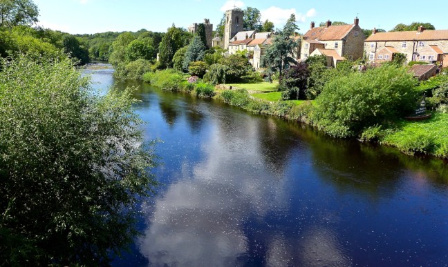
Post 175:  15 April 1998: Day 4 – Pendeen to Zennor – 9 miles

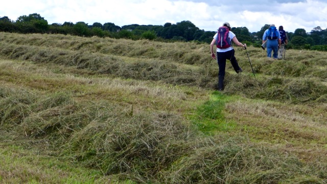
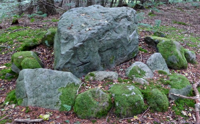
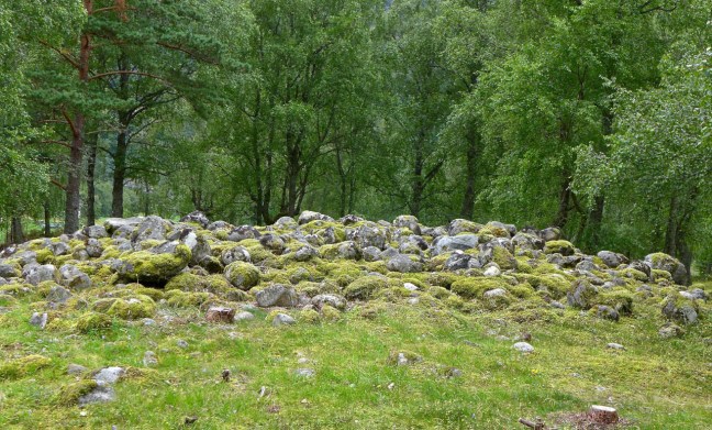
The weather was holding as I left the sleepy village of Pendeen to head inland and visit some of the antiquities that adorn this barren but beautiful part of Penwith. A couple of pleasant enclosed ways led to the heather clad Carnyorth Common. Perched on the top is an outcrop of rocks called Carn Kenidjack, shaped by the winds and rain over centuries. There are few better viewpoints than to sit here on a quiet summer’s day with a walking friend and put the world to rights. The path eventually picked up an enclosed way and after a left and then right I crossed the Pendeen to Penzance road. After ascending the wonderfully named Woon Gumpus Common, Chûn Quoit was reached, a good place for a break. This Stone Age chamber is the only one on the peninsula to retain its capstone in place. It is only missing the covering mound of earth and stones. Having rested I ascended gently to Chûn Castle, the remains of an Iron Age hill fort with stone ramparts in three concentric rings. After admiring the panoramic views across this bleaker and more remote part of the Penwith Peninsula I descended the permissive path through gorse bushes to Trehyllys Farm.

A quiet narrow lane led past Bosullow to the Madron-Morvah road at which point I turned right to the Mén-an-Tol Studios, well worth a visit if open. A clear and touristy track was then followed to the curiously named Mén-a-Tol, a bronze age holed stone large enough for a child to crawl through; it is said that rickets is cured on climbing through the hole nine times towards the setting sun. I then continued to the Four Parish Stone, which marks the boundaries of Zennor, Madron, Gulval and Madron parishes. Here I turned left to head to the sea again passing Carn Galver, a rocky outcrop. I stopped for lunch under the remains of Carn Galva mine before the winding path again led to the Atlantic and Bosrigan Castle, an Iron Age cliff castle.   Here I was walking through history in an area little changed for centuries; the gales and winds off the Atlantic making sure that ‘civilisation’ stays away. The coastal path then skirts prehistoric patterns of tiny fields at Bosigran, dated to the Iron Age some 1,500 to 2,000 years ago.

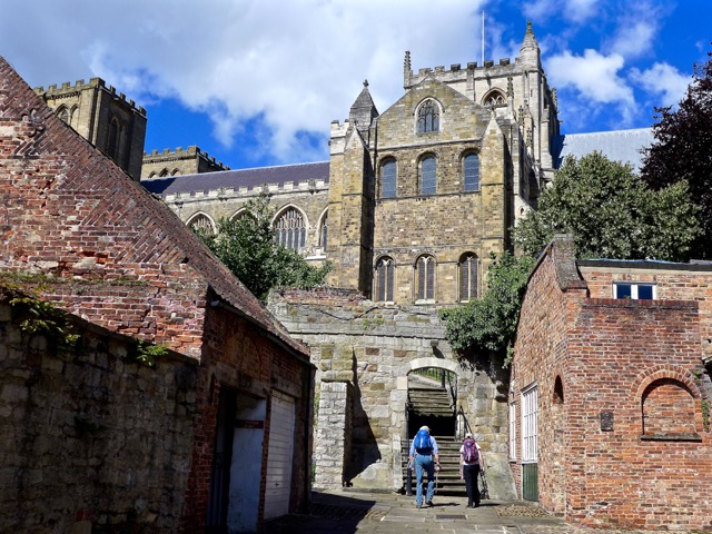
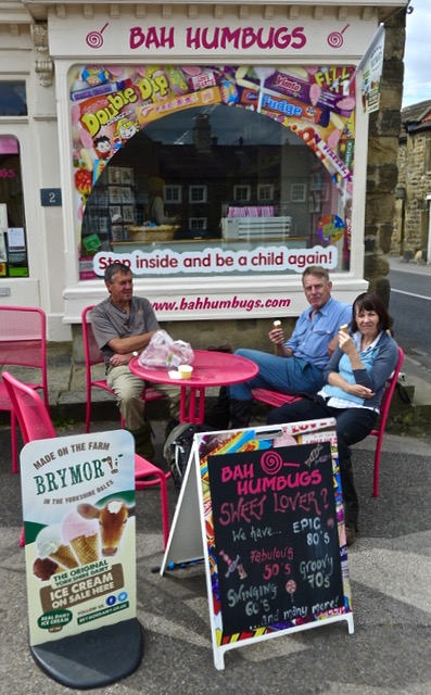
Shortly after passing the prominent Gurnard’s Head and some awesome coastal scenery I arrived at the Backpacker’s Hostel at Zennor

September 2008 064 
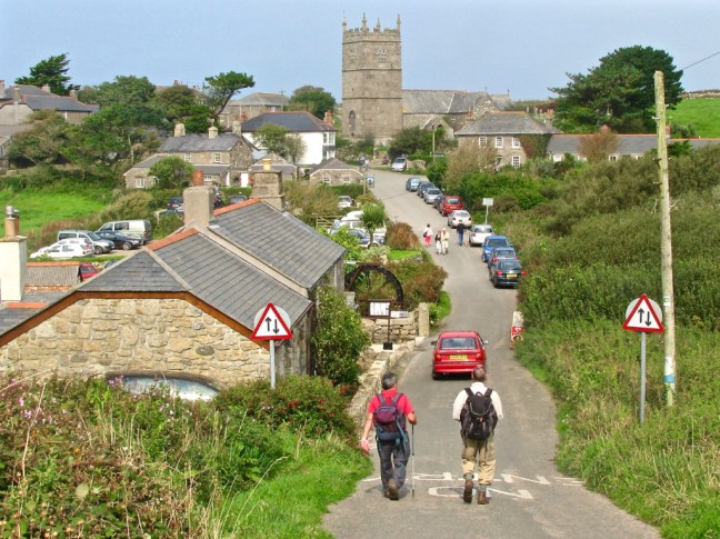
to be welcomed by Gabrielle Jackson, a former producer of Gary Rhodes (you know the chef with the spiky hair do).

It was fortunate that Gabrielle, also a skilled cook, was putting on a meal for fifteen to celebrate the hostel owner’s birthday. What more could one ask for as the wine flowed and the food was delicious.

Completion of my 52nd Long-distance Walk, Left or Right, Bale Escapes, The Missing Lake, Tour de Yorkshire, Tom Cruise, I am Out of Date, Military Encounter, Hung out to Dry.

Post 174: 17 August 2017, Ripon Rowel Circles 11 with an addition.

Arriving at Ripon for the final section of this long-distance walk, there was a sense of excitement and anticipation that a walk we had started on 25th May was nearly at an end. In addition, we had a meal booked at Gusto for the evening to celebrate Celia’s birthday, so a double celebration was in the offing.

I was somewhat surprised to see Carol had left and right socks and so did Sid the Yorkshireman. I had never seen these in over 60 years of walking. What is all that about?

Does Carol not know which her left and right feet are? Does she need a reminder so she can put her boots on the right foot (or left so as to speak).

After some questions on the 1,000 Mile Walking Challenge Facebook site, it seems there are loads of folks that use such socks!

So how come I have walked the equivalent of over 4 times around the World without them?

I reckon it is marketing ploy to get folks to pay more for their socks. Added value and all that.

Having lived in Yorkshire for some 31 years, I can see through these marketing ploys. All complaints please to Sid the Yorkshireman.

Now double lay socks (an inner sock within a sock) are a different matter and definitely stop one getting blisters. That’s where my money is going. In fact on the way to my Norwegian cruise I managed to pick up two pairs from the Port of Tyne for £7.99p. Now that’s a bargain!

IMG_1956

We now had to head to the bus stop to get a bus at 9.40am to North Stainley, the start of our walk, watching out for blind corners on the way. I had forgot my skateboard and bicycle on this occasion

P1070639

Alighting from the bus (free for Sid the Yorkshireman and myself but not for Carol – a benefit of old age) we knew we were in the countryside as we met our first deer.

P1070640

We then passed a large quarry.

P1070641

And a huge tree.

P1070643

There were even North Yorkshire conveniences (for the quarry men).

P1070644

Our path was redirected as they are enlarging the quarry.

Now who lives in a house like this?

This was a bale of hay trying to escape capture.

P1070647

Problems, problems.

After taking a turning onto a bridleway at Frizer Hill we suddenly found ourselves looking at a lake that wasn’t on my map (the one on the right below). Latter we found it on Sid’s map (on the left below).

How can you have a lake go missing on the map?

P1070648

Sid’s map was produced 2003, selective changes 2013. Mine was revised 2003 , selective changes 2005. I am out of date.

So the lake must have appeared between 2005 and 2013!

After some pontificating and using my compass, we decided we had gone wrong and backtracked to where the last bridleway sign was. The sign and guidebook instructions were confusing to say the least. We had followed a clear track and missed an overgrown path on our left. The guide made no mention of a path off left. Hmmm……….

We did eventually find the path off left and were back on route. Of course to add to our frustrations and overheating, the path was badly overgrown for some distance. It was going to be a long day.

P1070649

It was now 12.16pm and we hadn’t even had a banana and coffee break by the time we arrived at Mickley church. I decided to skip the coffee break and have lunch instead.

P1070650

Energies restored we reached the River Ure

P1070651

and the beautiful village of West Tanfield

P1070653

P1070654

This brought back memories of the Tour de Yorkshire and where I had watched and filmed events from the bridge.

P1030329P1030331

No bikes today and so it was back to the River Ure.

Carol got a little excited as she reckoned that Tom Cruise had just appeared from the weir in swimming trunks. There was certainly a chap from the nearby campsite who told me he had been for a swim and that the water was cold. But Tom Cruise? I didn’t notice and in any event Tom Cruise had just broken his ankle jumping from one building to another on film location. The heat was certainly getting to Carol.

P1070657

P1070658

We arrived at North Stainley at after 2pm.

P1070660

Sid and Carol were ready for their lunch and so we stopped at the cricket ground.

An all English scene if ever there was one.

P1070661

After lunch we soon had to enter a military zone but failed to encounter any tanks or such like.

P1070662

Afte some fast walking we arrived back at the historical area of Ripon near the Cathedral at 4pm – pretty tired.

And the end of the walk at Ripon Cathedral P1070664P1070666

As we had a meal booked we couldn’t hang around for the horn-blowing at 9pm.

P1070665

It was now time to wash my rucksack in the bath and hang it out to dry. I suspect the bath hole will be blocked now…………..

IMG_1957

Miles Walked 13.2

Calories 1510

Steps 26,530

Average Pace 18.03 Minutes per Mile

Fastest Split 17.46 Minutes per Mile

TOTAL MILEAGE ON THE RIPON ROWELL CIRCLES 126. (RIPON ROWEL ONLY IS 50 MILES). 

PS The Gusto meal was excellent especially with Celia’s Diner’s Membership giving 40%!


Historic Ripon, Alpacas, Finding Santuary, We will Remember Them

Post 173: 15 April 2017, Ripon Rowel Circles, The Sanctuary Way section.

Our walk on the Sanctuary Way began at Ripon Cathedral on a very pleasant morning.

P1070588

Version 2

Version 3

Just down from the Cathedral there are a lot of historical buildings.

P1070587

Including a hospital

P1070589P1070590

And a house where King James 1 slept in 1617.

After following the River Skell and River Ure to Bridge Hewick we encountered the first Sanctuary Post.

May your heart be strong in faith

Faith in your friend, faith in humanity, faith in God

P1070594

P1070593

We continued to Sharow village along the River Ure and across fields.

Here there are the remains of an original Sanctuary cross.

May your heart be strong in compassion with that forgiving love that offers sanctuary to refugees, asylum seekers and all victims of loveless regimes. 

We then came to North Bridge and crossed the River Ure to then follow the river on the other side in a northerly direction.

We were now on the look out for alpacas, Millie, Lucy and Mel!

P1070610

Another Sanctuary Post was reached.

May your heart be always shining with light 

Light for the lost, light for our leaders, light for the whole world. 

P1070611

Another Sanctuary post was reached at the cemetery.

May your heart be strong in hope

Hope in human goodness, hope in tomorrow, hope in life itself.

We stopped at the cemetery for lunch on a bench to find it looking onto the war graves of Canadian and British flying crew who died during the second world. Many died on the same day, which indicated they were in the same plane. Most were in their early 20s. We will remember them.

There were also some graves for Germans who died soon after the war. We will remember them too. 

Another Sanctuary post was reached at Hell Wath Cottages. .

May your heart be full of courage

Courage to begin again, courage to face the oppressors of freedom, courage to face ourselves. 

P1070624

At Quarry Moor another Sanctuary post was passed (never place noticeboards under trees) .

May your heart be surrounded by beauty, your own and that of others. May you never be seduced by false attractions. May you see beauty everywhere. 

P1070627

We then came across a flower bed with a large L in the middle. Having just missed a turning, we wondered if it stood for Lost!

P1070630

Back on track another Sanctuary post was reached at Gallows Hill!

May your heart be a healing heart, to heal those you listen to, look at, touch and share with the world. 

P1070632

There was just one spot where this view of Ripon Cathedral could be recorded.

P1070633

Followed by a final climb of the steps to the end of an interesting walk.

P1070634

P1070637

P1070636

P1070635

Miles Walked 12.3

Calories Burnt 1,400

Steps taken 24,600

Average Pace 18.03 Minutes per Mile

Fastest Split 6-8 Miles 17.31 Minutes per Mile


Turner was Here, Fishermen Everywhere, A Folly, Hens, Chickens, Ducks, Children, Cows, Crops, Sheep, Fields of Gold and Barley, Theakston’s, Bah Mumbugs

Post 172: 10 August 2017, Ripon Rowell Circles 10.

From the Masham Market Square we paid our 50p car parking in the honesty box and headed down to the River Ure. Fishermen were out in force.

P1070518

It was a beautiful morning

P1070520

The gate and sign were surrounded by vibrant vegetation and flowers.

P1070521

A ruined dove cote on the hill was passed.

P1070522

Fungi was evident.


We reached a viewpoint in Hackfall Woods, which was painted by Turner.

It was a moment in time which stood still, when elements came together all at the right time.

The fisherman was in the perfect spot, the light on the river in front of him was ‘just right’ and Masham church spire could just be seen. One step left or one step right and it would be misplaced. The trunk on the right would, under normal photography technique, be cropped out as a distraction. However, I decided to leave it as it seemed to have bent in its growth in order to capture the view.

P1070527

A little further on we found a perfect spot for our banana and coffee break. A sandy beach!

P1070528

I think the views and sun were starting to affect Alf as he started to fish with his trekking pole. Now I am not a fisherman, but I would have thought to catch anything he should have put a line on the pole? Some folks will do anything to get in my photographs.

He probably thought it was another Turner moment in time.

P1070530

The River Ure gained speed and made for delightful walking.

P1070532

We soon arrived at a folly, Fisher’s Hall. There is some debate as to whether it was named after William Aislabie’s head gardener William Fisher who would have undoubtably have been deeply involved in the construction of Hackfall or, because of its proximity to the river, it is a fisherman’s rest building. Above the door is carved W.A. 1700. It was built about 1750. The Penny Magazine 1835 makes a mention of the stone used to build it.


P1070539

One or two signs on the route were difficult to spot.

P1070540

Some crops were high.

P1070541

Others made the route like a race course.

P1070543

Cows tried to block our route.

P1070544

Not to mention ducks, sheep and children in Grewelthorpe.


We eventually reached the ‘Fields of Gold and Barley’. Sting and Theresa May would be jealous.

P1070549

We then encountered the ‘hens and chickens stones’!

P1070550

And golfers.

P1070551

You can make what you want of these strange structures, which stretched our imaginations.


This Jameson cow was one we didn’t mind encountering!

P1070555

But even better was arriving at Theakston’s in Masham


But, as it was a hot day, we settled for a Brymor ice-cream. Bah Humbugs!

P1070560

Miles Walked 12.

From Norway to Wreaks, Grewelthorpe and Foulgate.

Post 171: 7 August 2017, Ripon Rowel Circles 8. 

Having returned from the glories of Norwegian fjords, waterfalls and mountains on the 6 August, the names on the walk route on 7 August seemed less than enticing; Wreaks Lane, Grewelthorpe Moor and Foulgate Farm.

This was soon remedied when we hit lovely purple heather at the start of the walk, followed by a rainbow. Yorkshire was welcoming us back in a very colourful manner.

P1070494

P1070495P1070497P1070501P1070505

Even the cows with calves seemed to have calmed down since we last encountered them.

P1070506

It was soon time for our coffee and banana break with Sid the Yorkshireman and Carol showing off their new Norwegian flasks. Now Norway is expensive but sometimes you get what you pay for and these were certainly more decorative than my much cheaper flask.

P1070507

There is no doubt that Norway is more dramatic than Yorkshire with huge mountains, fjords, waterfalls and with dramatic skies and landscapes. Many of the walks demand very high levels of fitness (see previous blogs).  But Yorkshire has much lovely walking countryside that more ‘senior walkers’, like myself, can cope with much more easily.

P1070508

Around 70% of the world’s heather moorland is in the UK and the largest continuous expanse of moorland in England and Wales is on the North York Moors, and the Yorkshire Dales and surrounding areas have their share too. So there was a lot to be thankful for.

P1070509

We passed a former 1878 Wesleyan Chapel.

P1070510

And a newly painted bus stop at Manor Farm. We were not sure if any buses ever came.

P1070511

Passing grouse butts, we decided to use them as shelter for our lunch with spectacular views and skies towards the North York Moors in the far distance.

P1070512

We passed through Low Bramley Grange and and Foulgate Farm to return to Wreaks Lane and our car.

The end of a gentle resume of the Ripon Rowels Circles after our Norwegian Saga (as opposed to Saga holiday – we are not there yet! ).

Miles Walked 7. 

Calories Burnt 847

Steps Taken 12,200

Average Pace 18 Minutes per Mile. 


Eidfjord Wander, A Double Rainbow, Try Looking at the World in a Different Way, The Mightily Superfit, The End of the Nordic Saga.

Post 170: 4 August 2017, Eidfjord Wander.

Having completed the walk to the Viking burial grounds, I decided to have a wander around the village of Eidfjord. First stop was a delightful gallery. See slideshow:

This slideshow requires JavaScript.

Then after passing a lovely cafe

P1070453

I was treated to an exquisite double rainbow show, see slideshow:

This slideshow requires JavaScript.

I continued to the pretty church


P1070468

Then the old part of town.

P1070473P1070474P1070475

Before seeing things and my ship in a different way! This was without having had a drop of gin and tonic.

P1070476P1070477

Returning to the ship I was able to watch the triathlon in a new way from above. Watching the Norwegians swim across the fjord and cycle and run over the steep hills just confirmed they are mightily superfit! Time for a G&T to recover from my walking today.

P1070478P1070479P1070480P1070481P1070483P1070484P1070485P1070489

P1030611P1030615

At 8.30pm our ship left for the Port of Tyne. There was a superb Balmoral Crew Show to ease the pain of leaving Norway. This was then moderated by force 5 waves.

5 August 2017

Sunrise in Newcastle was at 5.34am and I just managed to catch it. See slideshow:

This slideshow requires JavaScript.

I hope you have enjoyed my travels to Norway as much as I have?

Miles walked today 2 + 3.5 earlier = 5.5

THE END OF THE NORDIC SAGA

Eidfjord Walk to the Haereid Viking Burial Grounds.

Post 169: 4 August 2017,  Eidfjord Circular

Leaving the ship after another sumptuous lunch, we headed off for my guided walk to the Haereid Viking burial grounds, Western Norway’s largest area of burial mounds from the Iron Age and Viking periods. It is home to almost 400 graves from 400-1000 AD, which are located on the Haereid plateau at 100 metres (328 feet) above sea level. Perhaps one of my relatives would be there as my DNA is 35% Viking!

P1070373

Here is the route.

P1070561

We passed canoeists in the fjord

P1030602

And ice carving in the car park!

P1030603 
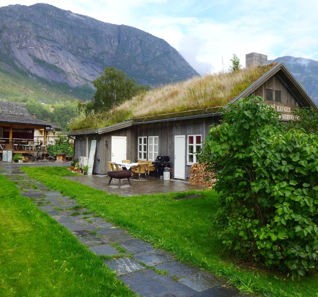
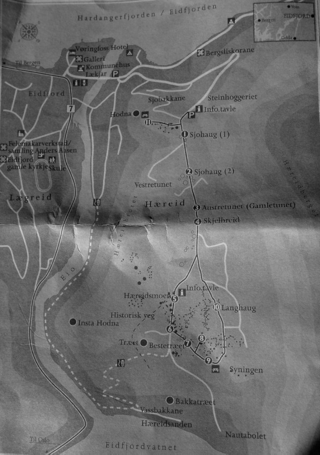
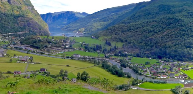
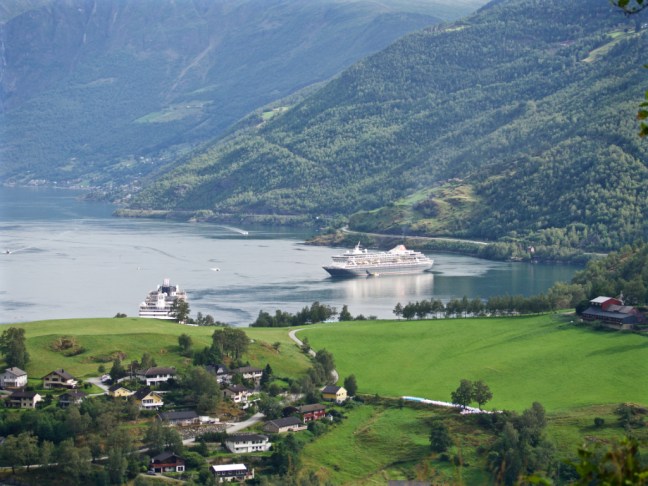
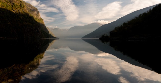
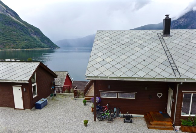
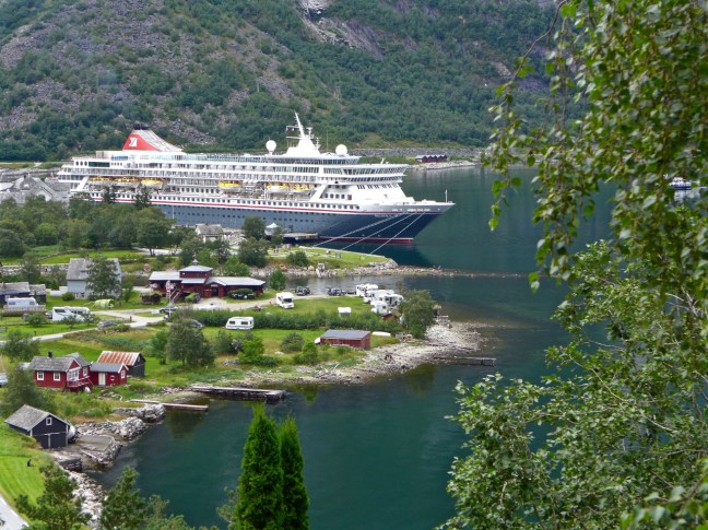
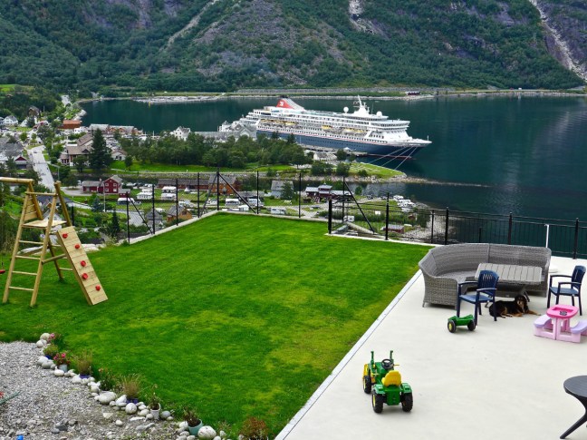
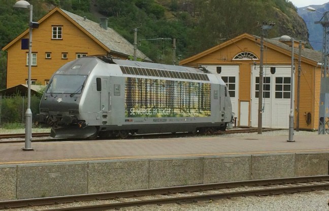
Then a caravan site by the fjord, to begin an ascent to a viewpoint at Hodna.

P1070374

We were intrigued by a house which had strengthened guttering for snow and a ladder for clearing snow off the roof.

P1070375

There were soon retrospective views of our ship

P1070376

What a back garden!

P1070377

A train came down the hill.

P1070378

Before we reached the viewpoint.

P1070380P1070383

P1070384

A sign warned of avalanches that had occurred in the area but our path was quite safe.

There was no time to let the grass grow under Carol, Sid the Yorkshireman and Alison’s feet so I urged them on. There was enough grass on the roofs.

I was delighted to find an old Volvo and Steve found a VW. Like us they had seen better times.

Someone coming the other way did say they had not seen any burial grounds and we pointed out they had passed them!

Further on we found the burial mounds.

P1070400

Many Viking and other artefacts have been found in the area, such as a gold ring, iron axe, arrowheads, a knife, a blade, a brass ball, coal, shards from clay vessels, charcoal, a shield buckle, rock crystals, three-leaf bronze clasp, an Irish 9th century circular buckle and an iron frying pan.

We then descended and many people coming up in the opposite direction asked us how much further it was to the graves.

We arrived at a delightful beach overlooking Eidjordvatnet. An opportunity for some photography and a rest.

This slideshow requires JavaScript.

The path became a track alongside the river and even included a smart toilet.

Some remnants of the salmon fishing traps (now banned) of the past were found

P1070419

Lovely flowers were in abundance. see slideshow.

This slideshow requires JavaScript.

Finished off with some interesting signs.

Had we not got a ship to return to we could have booked a bad room or two!

P1070434

The guide’s reward – some delicious Italian ice-cream

Miles Walked 3.5


Cruising Hardanger to Eidfjord.


Post 168: 3 August 2017, Cruising Hardanger to Eidfjord. 

We left Flam at about 5.30pm after a wonderful day there in good weather. Rumours were around that the UK was getting a lot of rain. As we sat in the Observatory at about 10.00pm to start the quiz, the sky change coloured. Fortunately, I had a small camera and was able to go out on top deck to capture the colours. See slideshow:

This slideshow requires JavaScript.

At 10.30pm it was off to see the comedian Andy Rudge who was very funny. I can’t remember if it was disco dancing after that!

4 August 2017

I was up and about not long after the sunrise at 5.16am. I had spotted interesting clouds through my porthole. See slideshow:

This slideshow requires JavaScript.

A couple of ships passed.

At about 8.00am we entered Hardangerfjord running from the Atlantic to the Hardangervidda Plateau. It is the fourth largest fjord in the World and the second largest fjord in Norway.

We then cruised past Furebergfoss Waterfall around breakfast time, a great view from the restaurant:


Sit back and enjoy the slideshow as passengers could:

This slideshow requires JavaScript.

Wonderful cloud effects lined our route. I remember a photographer saying that clouds make a photograph. I must agree.

Again relax and sail through the clouds in the slideshow:

This slideshow requires JavaScript.

There were occasional full breaks in the cloud.

But not many. See slideshow:

This slideshow requires JavaScript.

Until a fine bridge, fairly recently built, was passed under.

This slideshow requires JavaScript.

And the smiley face of one of our favourite members of staff signalled Eidfjord was close.

P1070368

The views from the ship looked promising. Time for another superb lunch before embarking on our planned walk.

P1070369P1030599P1030598P1070372

Miles Walked 0 apart from round the deck. 


Flamsbama, Train Up and Cycling Down, Waterfall Up, Follow the Blonde Lady to Find it!

Post 167: 3 August 2017, Flam and Brekkefossen

Arriving in Flam at about 7.00am, the plan this morning after breakfast was for Celia to catch the train to Myrdal ascending to 867 metres within just 50 minutes. The railway gradient is 1 in 18 over a distance of 20 kilometres (12.42 miles). She would then get the train back to Berekvam, which is half-way between Myrdal and Flam where a bicycle would be provided for her to cycle down. She would start at 343 metres above sea level and cycle for approximately 11 kilometres (6.8 miles) – nearly all downhill!

Having been on the train before, I fancied a walk to the Brekkefossen Waterfall. This was about 7 km (4.4 miles) and is situated at the top right of the map.

P1070516.jpgP1070329

Leaving the ship I passed through the station which can get extremely busy at times as it is a major World tourist attraction. Finished in 1944, the railway climbs almost 1,000 metres through magnificent scenery, in and out of mountains, past waterfalls and ravines, and pausing at the beautiful Kjosfossen Waterfall – where water crashes 225 metres down the side cliffs. It passes through 20 tunnels.The river at some point was diverted to go under the railway line!

P1070313

IMG_1875

P1070339

After some easy road walking (3 on the map) the waterfall soon came into view

P1030540
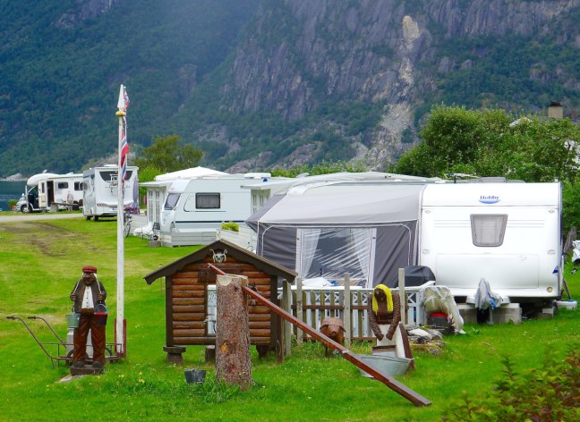
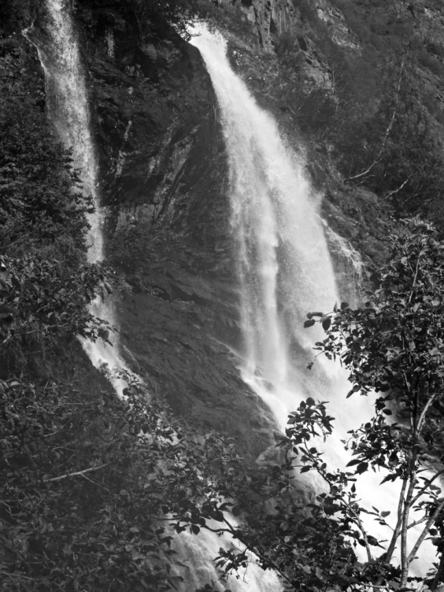
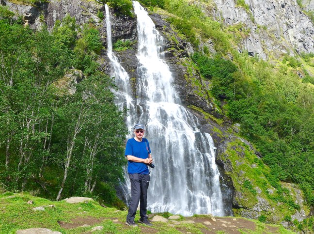
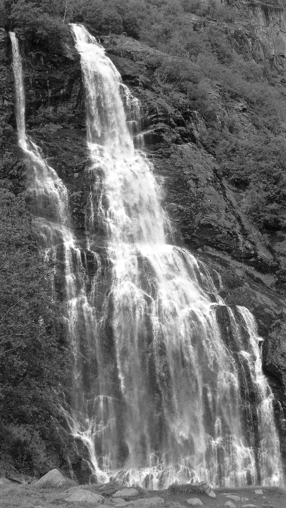
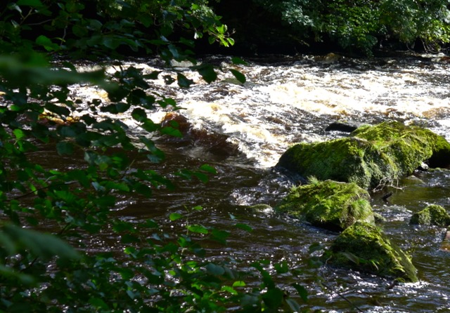
and at the Brekkefossen sign I left the road. The path was quite easy and even at first but became rough, muddy and steeper. I met a lady who had got so far up, but explained that she didn’t feel up to it having previously had ankle injuries. I got quite quite high up as shown in the photograph but views were restricted by the trees. Two young ladies were descending and confirmed that views from the top were no better and the path got even steeper.

P1030531

I decided to descend, somewhat disappointed. There were steep inclines at the side of the path and I didn’t want to end up in hospital or worse. It was also slippy. Fortunately, I had brought my trekking pole. Further down I met a family from California. who were descending.

A blonde lady from Holland (they are usually Norwegian) appeared at a sharp bend and headed off right descending to a grassy meadow area. She seemed to know where she was going so I followed her. A magnificent viewpoint emerged at the base of the waterfall. I had missed this on the ascent and there were no viewpoint signs. I wonder how many people miss this magnificent viewpoint?

P1070323P1070326

There were views back along Flamsdalen towards our ship.

P1070328

P1030532

And along the valley.

See slideshow. A train passed along. Can you spot it?


This slideshow requires JavaScript.

This made the hard climb all worthwhile. When Norwegians say it is a moderate walk, bank on a steep hill! However, a young Norwegian couple were clearly going to the very top of the mountain. Easy peasy for the superfit.

I met  a number of people coming up as I was descending and their question was ‘how much further?’. I tried to encourage them to keep going, but to watch out for the descending grassy viewpoint area.

On reaching the road I turned right towards  a bridge marked on the map only to find it under repair following damage by extensive floods in recent years. I continued further along to a Dutch family who were sat around their motorhomes. One motorhome was a  40 years old Dutch one and very unusual. They did not know if I could get to Flam village where there was another bridge.

I was off the map!

P1030538

Eventually I found a bridge and crossed over. It was now warm, but I had a water bottle.

I then followed the quiet road alongside the railway line back down the valley.

Soon I came across some raspberries, which were for sale at the end of someones drive. 30 krona (about £3) which was very reasonable for Norway (I had already eaten a few before the picture was taken). I also found a wool and gift shop selling homemade ice cream.

Both were absolutely delicious.

IMG_1867

The views were gorgeous in the sunlight.

P1070330

P1070331P1070332

I came across some unusual walkways, which were damaged last time I passed here in September 2014 on a Great Railway Journey holiday.

P1070335 


I saw Celia’s train heading out at midday and she saw me. My activities were coming to an end and hers were just beginning.

I passed the lovely hotel, The Fretheim, which was built by English salmon fishermen in the 19th Century and I stayed there in September 2014.

P1070341

I do not normally add my photographs of previous trips, but have  included two I took in 2014,  one of which adorns our lounge wall at home.

Such wonderful memories.

Dawn

Norway in a Nutshell_6108_edited-1

Nightime.

Norway in a Nutshell 2014_5941_edited-1

Miles Walked 6.2

PS Celia did return from her bike ride, but I didn’t see her as she must have been going too fast downhill!!


Kate and William attend British Night, Europe’s Highest Sea Cliff, Reflections.

Post 166: 2/3 August 2017, Cruising to Flam (pronounced Flom)

Leaving Olden for Flam along Invikkfjorden and then Nordfjord we passed Hornelen Europe’s highest sea cliff at 860 metres (2,820 feet). There was a build up of cliffs before then.


P1070237


P1070262

It was time to party on British night after an exhilarating day. It was good that we had some special guests on board. William and Kate and of course Sid the Yorkshireman and Carol in her union jack tights.

Get a glass of wine or a G&T and enjoy the slideshows and the Show!!!!

This slideshow requires JavaScript.

The Show

This slideshow requires JavaScript.

Early next day, after sunrise at 5.11am, we sailed through the broad Sognefjorden and into the much narrower and beautiful Aurlandsfjorden. Another late night and early morning!

This slideshow requires JavaScript.

This slideshow requires JavaScript.

This slideshow requires JavaScript.

This slideshow requires JavaScript.

As we got nearer Aurland and Flam the reflections got better.

This slideshow requires JavaScript.

Arrival in Flam and moved over again by a larger ship. Another tender landing.

This slideshow requires JavaScript.

Miles Walked 0 other than around deck