Post 244: 5 April 2018, The Inn Way – Yorkshire Dales, Buckden to Stalling Busk
After previous posts I was no longer Home Alone or Billy no-mates.
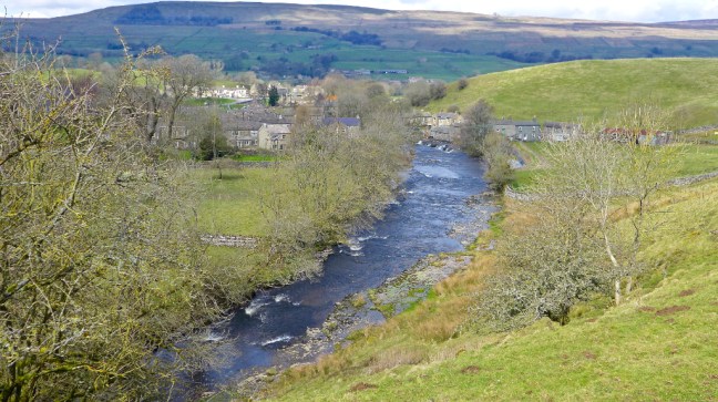
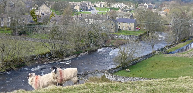
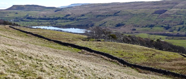
Leaving home at 7.30am, with Alf under protest that he had to get up so early on his holiday week, we arrived in the Yorkshire Dales to a glorious morning, here just passing Kettlewell.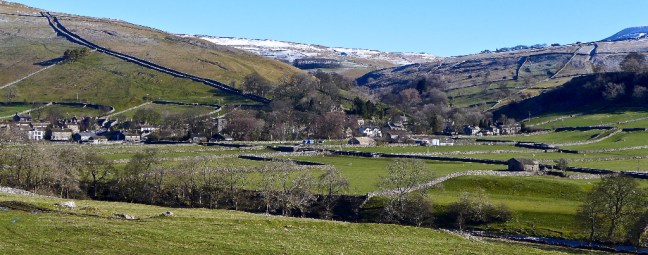 We arrived at Buckden car park at 9.30am and parked next to the Horseless Carriage Services! Sid the Yorskshireman was still not available for the walk so we were able to pay the car parking charges, without being made to feel guilty. It pays for the repair of bridges etc.
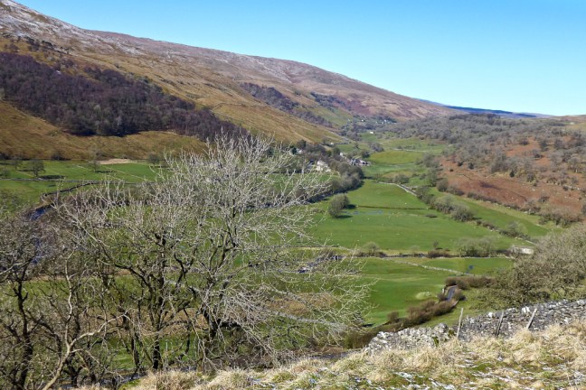
 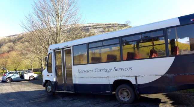 We climbed a wide track, called Buckden Rake, and had views towards Hubberholme further up Wharefedale. The track passed through Rakes Wood and skirted the lower flanks of Buckden Pike. It was once part of the Roman road between the forts at Ilkley and Bainbridge.
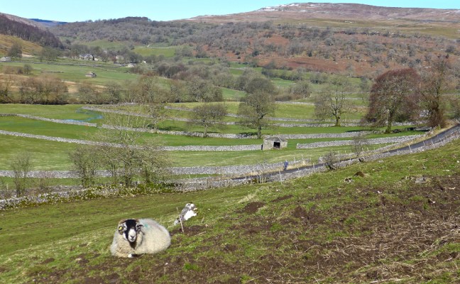
 Then Cray came into view below us, a small hamlet of old farmhouses, barns and the White Lion Inn. Cray is noted for a series of waterfalls along Cray Gill, which we would shortly walk alongside. The name of the hamlet relates back to ancient tribes of pre-Roman Britain, as Cray is a Celtic word which means fresh stream.
  The path ahead was muddy but clear.
 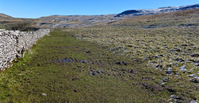 Our route ahead could be seen partly on the road ahead in the distance and over Stake Moss.
 The views back were superb.
  The White Lion Inn at Cray came into view far below. There was no time to divert to what is the highest inn in Wharfedale. This old drovers’ inn dates back to the 17th century.
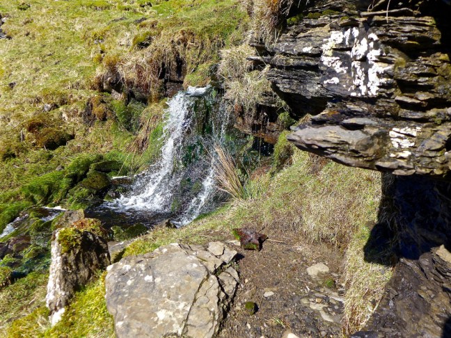
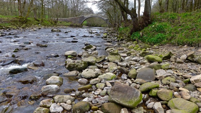
  Our first waterfall encounter was at Cow Close Gill. Some photographers were there early, but there was no obvious easy access to the falls other than climbing over a wall and so we carried on walking.
 We soon came across a couple of signs.
  The Pennine Journey sign had particular significance for me and I was pleased to see that the route is now being signed as I had been involved in the book coming to fruition and received an acknowledgement by the Editor David Pitt in his introduction to the book which was also supported by the Wainwright Society.
The route follows Alfred Wainwright’s 1938 walk described in his book A Pennine Journey, published in 1986. Wainwright’s editor was Jenny Dereham who was later to become my editor.
The 100-mile Lady Anne’s Way is not well known to me and runs from Skipton Castle into Cumbria and the Eden Valley. I think it is one to walk for the future.
We soon reached the B6160 from Buckden to Wensleydale and were able to look back at our route.
 We soon left the B6160 along a track and stopped for a sheltered banana and coffee break, near a small waterfall adjoining Hell Gap and looking back into the sun towards Buckden Pike. This is some of the finest open moorland walking in the area.
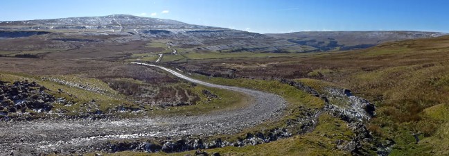
 We left the main track at a footpath and met a couple from Brighton who had started walking from Stalling Busk and were heading in the opposite direction to the pub at Hubberholme. They confirmed that, despite the recent heavy rain, the route was passable over the streams in the area.
  We then decided we had found the Yorkshire Dales last remaining glacier from the Ice Age.
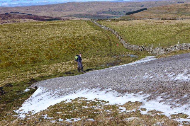 It even had a glacial snout and some terminal moraine and an outwash area. We also have vivid imaginations on our walks.
  After completely easy navigation we suddenly arrived at this gate (this photograph was taken on our return journey).
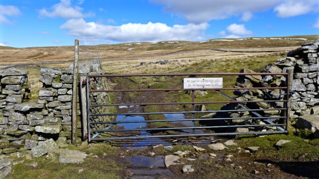 Alf, who was standing in front of the stile to the left, then read the sign saying:
No right of way through gate. Footpath through stile to left.
Now somehow, beyond all reason and comprehension, Alf missed the stile and said we needed to follow the wall further down the hill. I didn’t see the stile as Alf was standing in front of it. That’s my excuse and I am sticking to it.
It was a monumental cock-up the likes of which I had never experienced on a walk before. The Greatest Cock-up in the history of walking, which will be submitted to the Guiness Book of Records as such.
I have immediately asked for Alf’s wife to make him an appointment at Specsavers to get glasses that he wears all the time, like mine.There did seem to be tracks as we descended the hillside, but I started to question whether we had somehow missed the stile? Alf was adamant that we couldn’t have done and I also said I hadn’t seen one. We eventually arrived at a cracking waterfall where the two streams of Shaw Gate Gill and Silky Gill joined to lead to Cragdale Water. Every cloud has a silver lining as if we had kept to the correct route we would have missed the waterfalls.
We knew we had gone wrong and now had to cross the streams. We eventually found crossing points. 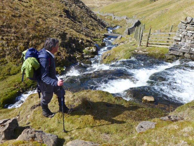
 We had lost a few hundred feet and had a steep climb back up to the High Lane (track), which we were supposed to be on.
To make matters worse sometime later at Stalling Busk I found that my automatic camera lens cap had gone missing and I believe it may have somehow got detached in this area. If you also get lost and find it there please let me know!
It is likely there will be a Public Enquiry into this monumental cock-up and heads will roll. Not mine of course as it is well known amongst my friends that I am never to blame for cock-ups.
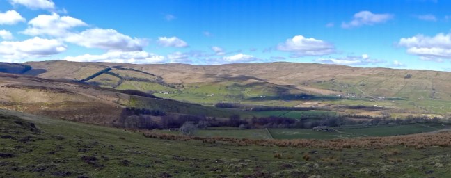
Back on the High Lane we could only admire the fantastic and expansive views before us.


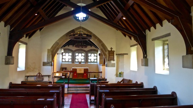
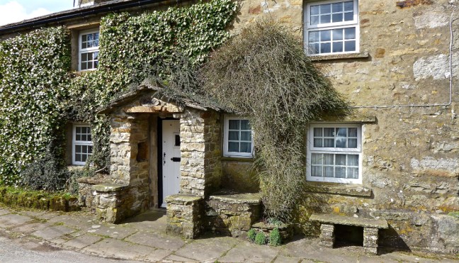
 We dropped down to Stalling Busk for lunch on a bench in the sun at the delightful Church of St Matthew. We watched a paraglider way above us in the blue sky keeping his height using the thermals. We hadn’t expected to see a commemoration plaque on a nearby cottage in such a remote venue.

 Stalling Busk, known locally as Busk, is 1,100 feet above sea level.
After some recuperation we then had to return back to Buckden along the same route as it is not possible to do a circular walk without extending the mileage considerably. We had already walked about 6.5 miles up to 1840 feet (561 metres). However, on this route it is not a problem returning on the same route as the views seemed very different, especially with some cloud emerging. Also we were able to determine where we had gone wrong at the now ‘infamous’ gate and stile.
We thought we saw in the distance the Yorkshire Wildlife Trust working on the moorland, filling in old drainage channels to reduce flooding lower down, to recover some of the open moorland due to its contribution to reducing C02 and to encourage other wildlife conservation work. Their website is: ywt.org.uk

 The earlier waterfall on Cow Close Gill was now in the afternoon sun.
  There was a pleasant descent back to the car to arrive at about 4.00pm.
The end of a fabulous walk, despite the almighty cock-up.
We decided to head back home by a different route driving over into Wensleydale which would be the focus of our next few walks on The Inn Way.
Miles Walked 13
Steps 30,000
Calories Burnt 3,900
PS: We hit bad holiday traffic on the way back near York and be warned we are thinking of bringing in a ban on visitors to Yorkshire on walk days as it is interfering with our walking schedule! However, interestingly, despite the busy roads, we only passed 5 walkers on our walk.


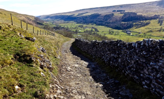
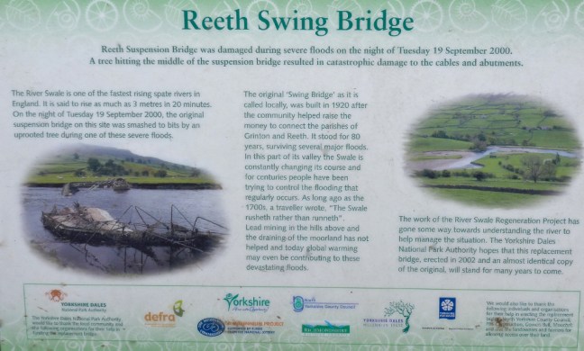
 We had to leave Reeth to head back up the valley to where we had left the Inn Way on the previous walk. It was to be a high level, circuitous, route as Sid the Yorkshireman (also known as Morley) wished to find Morley’s Folly as indicated on the OS map.
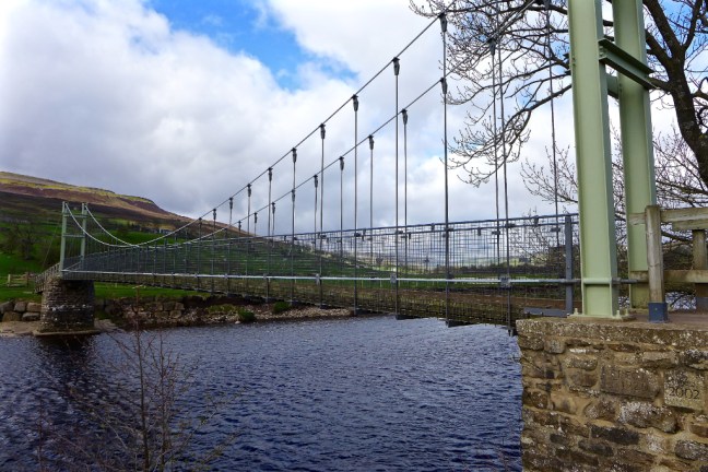
 We then climbed past Harkerside Farm to High Harker Hill.
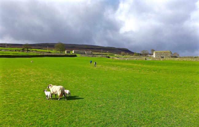 There were fine views along Swaledale towards Calver Hill.
 We then entered a lead mining area and had to watch out for holes. Mining started in Roman times. The area around Reeth prospered in the 17th and 18th centuries as a centre for lead mining and hand-knitting.
  It was quite windy higher up and so we stopped behind a shooting lodge for our coffee and banana break near Blue Hill. The tracks are well maintained by the shooting fraternity.
  There were some dramatic shades of light.
  This was not Sid the Yorkshireman’s folly.
  We spent a good half-an-hour looking for the folly, without success, amongst a desolate former mining area.
  Dropping off the high fells we came across Sunter’s Garage Shelter which was a fabulous shelter from the wind.
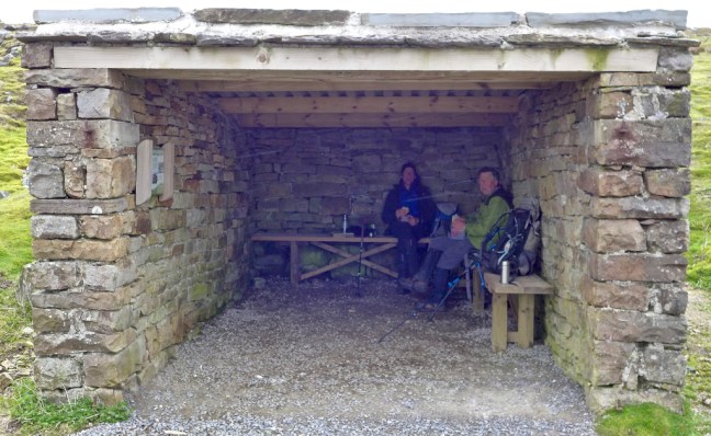
 What a lunch-time view.
  We descended past High Whitaside to the unnamed waterfall on Haverdale Beck to resume the route on the Inn Way.

 A gradual ascent to Birks End followed.
 After a little road walking a delightful bridleway and track were followed back to Reeth.


 No walkers had been passed all day until on the final path, when we made way for a large group of primary school children! They may have been heading to Maiden Castle, which we had passed. It is hidden away on Harkerside Moor. It was built during the Iron Age over 2,000 years ago by the Brigantes tribes. It is thought to have been a ceremonial or religious site.
 There was free parking in Gunnerside, near the Kings Head. This was a relief to Sid the Yorkshireman as we had been discussing an article in the Sunday Times, which said that parking costs the average UK driver £1815 per annum! In London owners spend £9,353 per annum. The average UK driver spends 35% more per mile than the average US motorist and 6% more than the average German. Sid the Yorkshireman brings the average down as he probably spends less than £20 per annum.
 However, we were not in search of Vikings. We were in search of the Swaledale Seal. It was last reported that having entered the Humber Estuary from the North Sea it passed through York to reach the River Swale near the A1!
  Leaving Gunnerside we had to climb to about 1500 feet at Oxnop Head to resume the Inn Way where we had last reached it in thick mist. We soon reached the River Swale which s England’s fastest flowing river. This suggested the seal would not get this far unless it had the skills of a salmon.
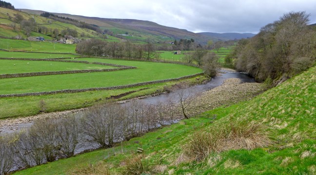 I was surprised to see this old limestone field barn with ‘door covers’. Each barn traditionally had an area for storing hay called a hay mew and a separate area of stables for wintering cows. They are less used in this way now as modern farm buildings house the cattle.
 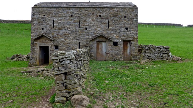 We continued along the River Swale towards the lovely shaped Ivelet Bridge
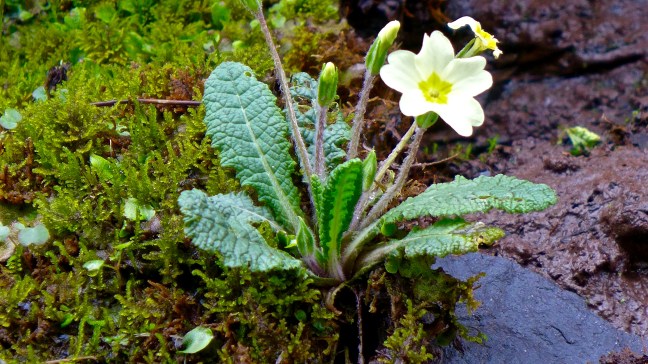
 At this point we stopped on a bench for our coffee and banana break. Sid the Yorkshireman was still upset about the 20p toilet charge (they tend to be free on the North York Moors) and, being overcome, we laid him to rest on one of the old ‘coffin’ stones expecting that he would soon be picked up by the undertaker and finally taken away.
 No such event happened and so he resumed the walk with us.
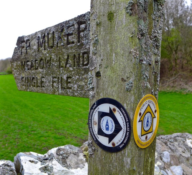 We crossed the River Swale and Oxnop Beck, noting the older bridge over Oxnop Beck was no longer in use.
 The climb to 1650 feet (503 metres) began with a vengeance and continued for over 2 miles. However, the views, particularly back, were fabulous.
 A trap for catching maybe stouts or weasels can be seen over the stream
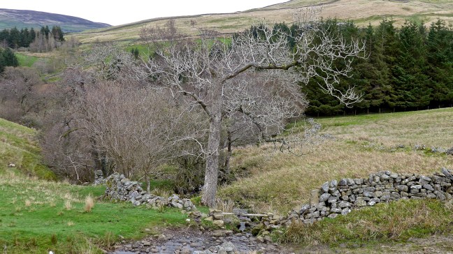
 Oxnup Gill
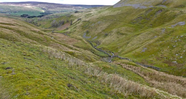 The quiet lane led up towards Oxnop Scar. It would once have been a busy, popular route for miners and passers by, sufficient to service a wayside inn called ‘Jenkin Crag’.
 The dramatic and sheer limestone cliffs of Oxnop Scar came into view.


 After passing Gill Head,
 we left the lane and descended back to Ivelet Bridge, the River Swale and Gunnerside for a lunch stop.
  Two cyclists were also having lunch and we discussed the prospects of the Tour de Yorkshire, which is being held between the 3 May and 6 May. Now a huge and successful annual cycling event it is one not to be missed. I and my wife, a keen cycling fan, will be attending 2 or 3 days and thousands of fans will turn out and Yorkshire can claim to be the cycling centre of the UK.
 Passing a limestone kiln
 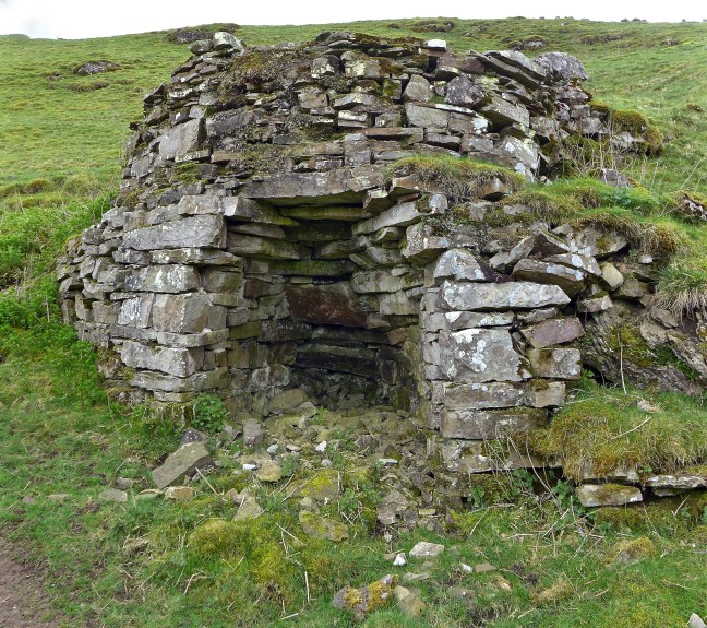 There were fine views ahead towards Reeth.
 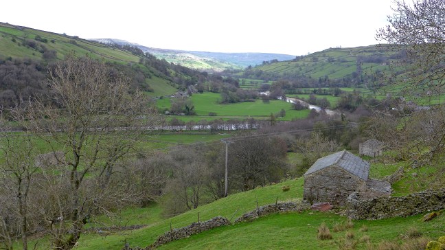 A tree that was soooooo… big it had to be hugged.
 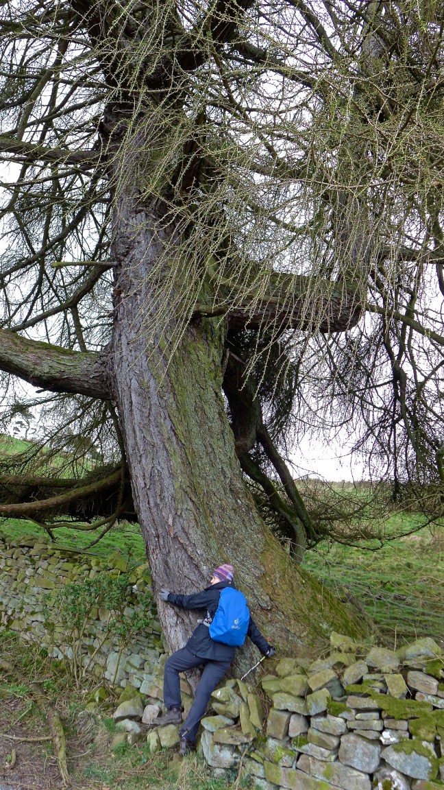 Followed by more expansive views.
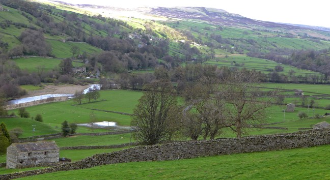 We then reached a delightful, unnamed waterfall (see video on Facebook) and then left the Inn Way,
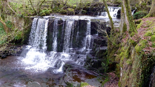 to descend to the River Swale and follow it back to Gunnerside.
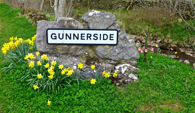
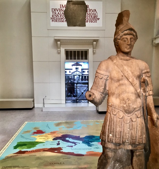
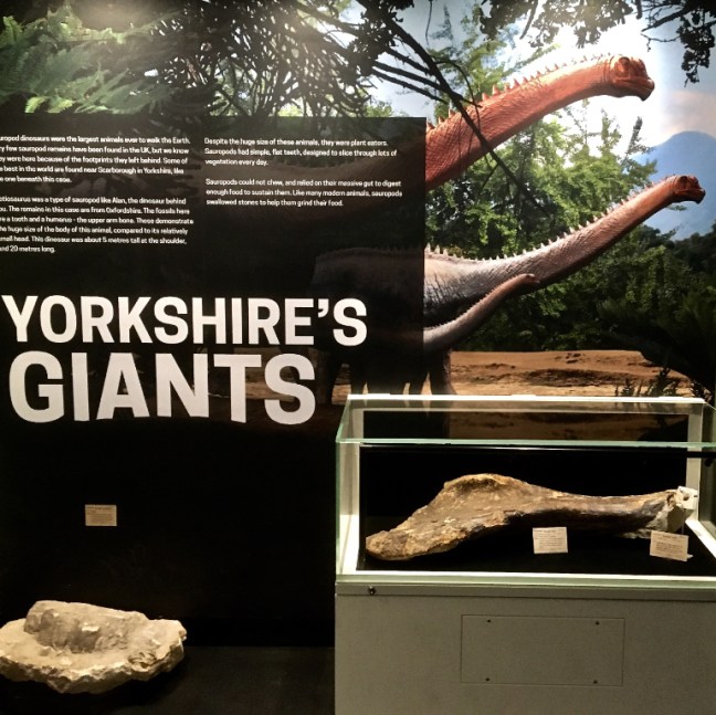
 I then went to Yorkshire’s Jurassic World area in the museum and was able to feed huge dinosaurs with tree branches that I picked with ‘special equipment’ and wearing ‘virtual reality googles’. It was too realistic for comfort and only those above 5 years old can partake. I just qualified by over 60 years!
  There are huge bones on display of actual dinosaurs.
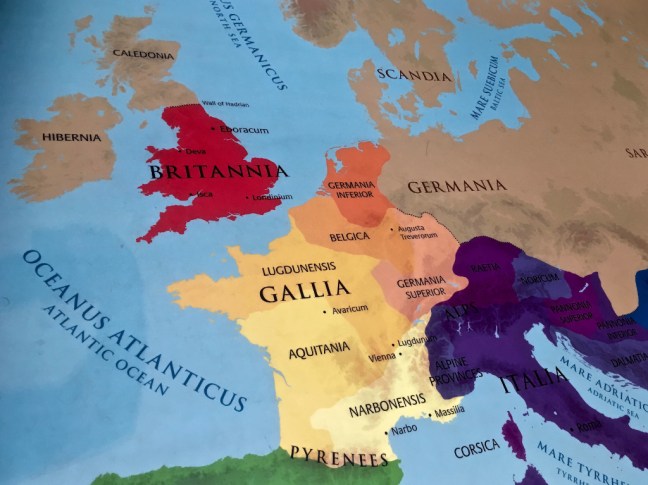
 There is an interesting geological map created in 1815 by William ‘Stata’ Smith, which represents the first complete geological map of this country. There is also a floor map as below made of pebbles.
 I then headed to the Viking area of the museum as York has been described as the Viking Capital of England. It is said that Viking men had long hair and elaborate engraved combs (see lower photograph) as it was more attractive to women. Despite having 32% Viking DNA, I don’t have much hair now!
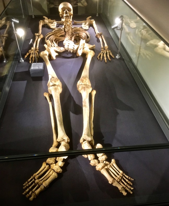
 I therefore moved onto the Medieval section and thought the skeleton had some likeness to me as he was also very tall. However, he had a sad and violent end so that didn’t cheer me up either.
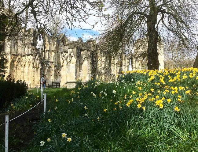
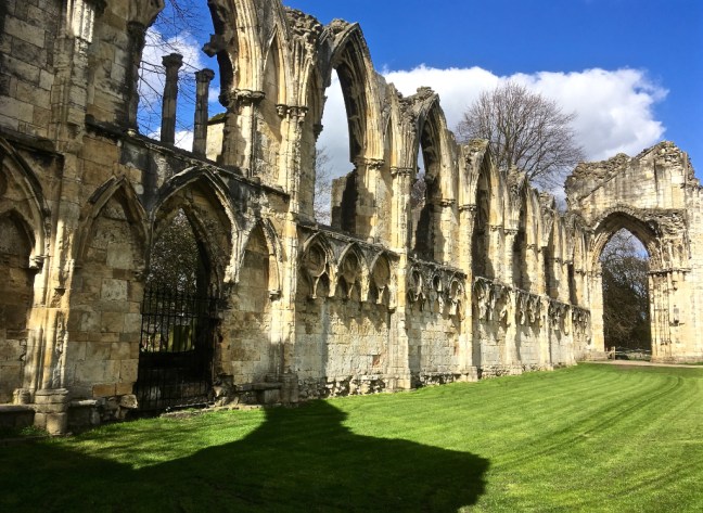
 Leaving the museum, St Mary’s Abbey looked splendid in the sunshine with vibrant daffodils around it. This was a Benedictine monastery founded by William II in 1088 and was one of the wealthiest in the country. In 1539 the Abbey was closed during Henry VIII’s dissolution of the monasteries.

 Nearby is the Hospitium, a timber-framed medieval building, once used as the guest house for St Mary’s Abbey. The ground floor was built in 1310, the first floor in 1420 and a new roof added in 1930.
 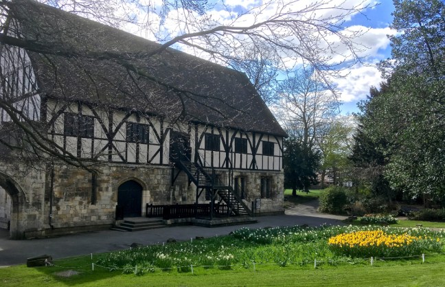 I then wandered through Museums Gardens to the excellent Kings’s Manor. This was originally the Abbott’s house, part of St Mary’s Abbey, its earliest remains dating from the 13th century. After the dissolution of the monasteries the Council of the North was held there until 1642. The coat of arms are of Charles I and also James I to mark his stay there on the way to England to be crowned in 1603. The buildings are now used by the University of York for the Departments of Archaeology, Eighteenth-Century Studies and Medieval Studies.
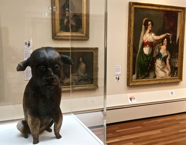
 I continued to the nearby York Art Gallery, which has an extensive ceramic collection
 There are other substantial art works and regular temporary exhibitions.
 This is a very old painting of Robin Hood’s Bay, which particularly attracted my attention
  At the back of the gallery are some fine gardens and walled quiet areas.
 I then wandered past York Minster, built between 1220 and 1472, which is the largest Gothic cathedral north of the Alps and the largest medieval cathedral in England. The Great East Window is the largest expanse of medieval stained glass in the world.


 It was a fine, enjoyable, unplanned walk using only my mobile phone for photographs and a reminder of how interesting and beautiful York is.
 We climbed up to Brough Scar, where even the lambs were sheltering from the cold.
 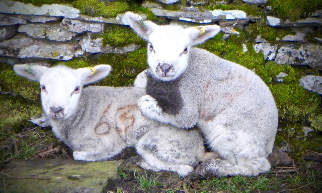 We soon reached a poor imitation of Stonehenge.
  We descended to Worton.
  The Victoria Inn there dates from 1698 and is the last remaining example in the Yorkshire Dales of a farm-cum-pub. Unfortunately, it was closed both in the morning and when we passed on it on the way home.

 Arriving at Nappa Mill we noticed that a car had seemed to have an argument with a lawn mower and come off worse.
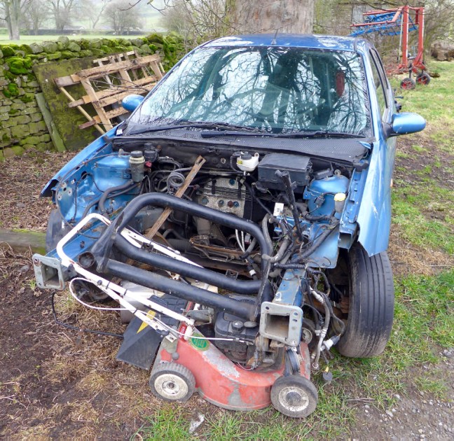
 A little further on sheep had taken over the old dismantled railway line that used to run to Hawes.
 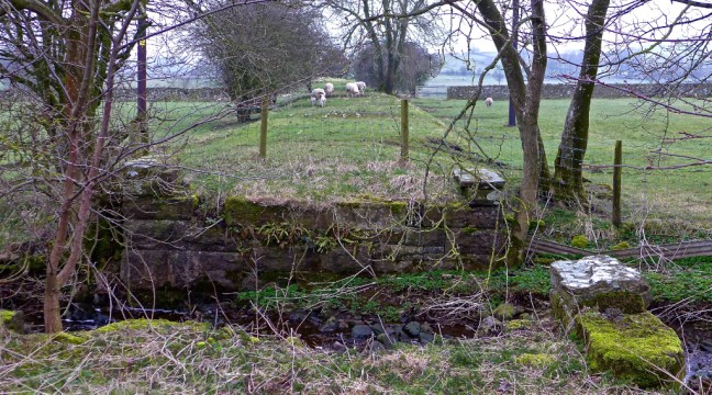 Nappa Hall, a fine fortified dwelling or ‘pele tower’ built in about 1450, was passed.
 Newbiggin Beck was then crossed as Sid the Yorkshireman tried unsuccessfully to repeat his Basil Fawlty silly walk.
  He then suggested we take the scenic route into Askrigg.
  We passed The White Rose Hotel, Lodge Yard and the King’s Arms.


 Opposite is Crinkly House, the ‘Skeldale House’ of the BBC television series ‘All Creatures Great and Small’.
 The church is the largest and most imposing in Wensleydale and its interior is worth a visit.
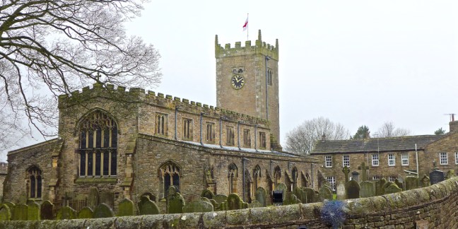

 We then left the village past the Crown Inn, heading north along the road into the mist towards Swaledale.
 The views were impressively bad in the increasing mist as we ascended steeply along the road for about 3 miles.

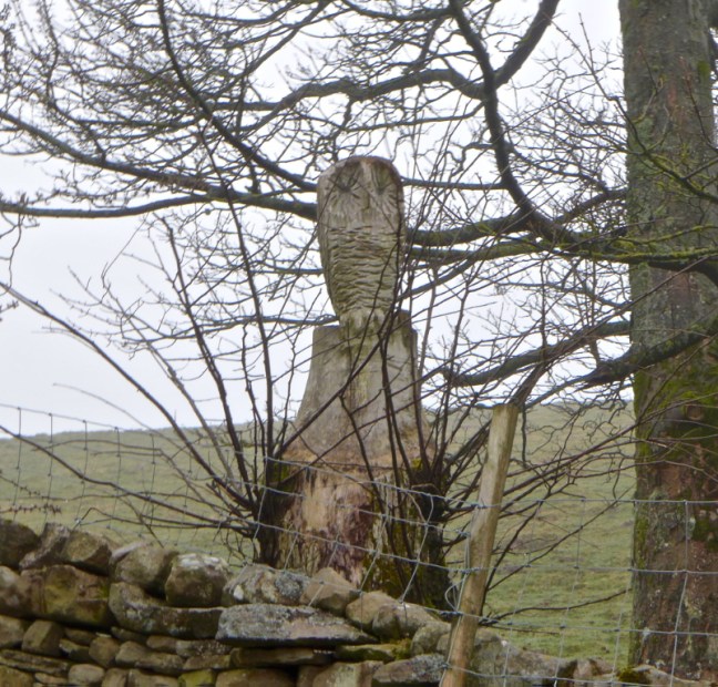
 It had been reported that on Carlton Bank on the North York Moors a rare and large Eagle Owl had been spotted.
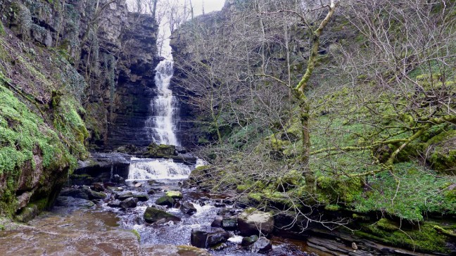
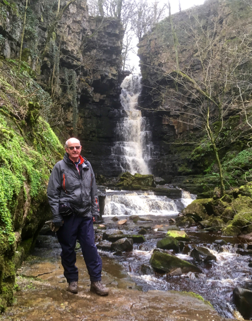
 We left the road along Low Straights Lane (Track) and reached Mill Gill and the waterfall for a fine lunch location. See video on Facebook.
 There used to be two comedians called Little and Large, but this is an optical illusion of Sid the Yorkshireman and Alf , caused by the differing rock levels. They also reported that the ground beneath their feet was vibrating.


 Arriving back in Bainbridge we noticed no expense had been spared on the bus signs.
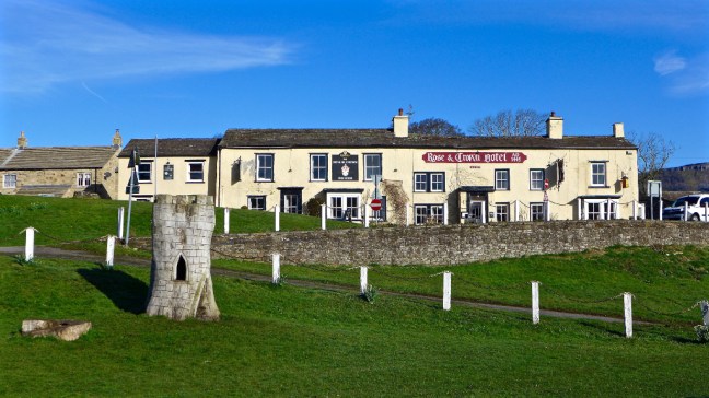
  The Rose and Crown was passed for the last time on this walk.
 Despite the weather, it was a fine walk and it could have been worse as it rained whilst driving back home.
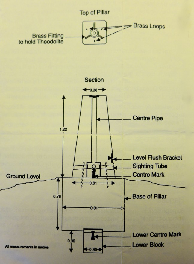
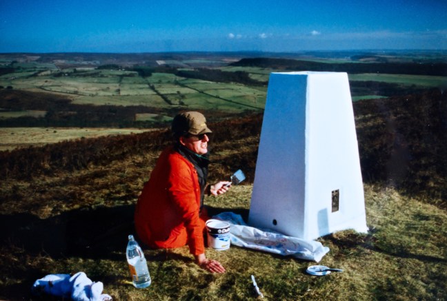
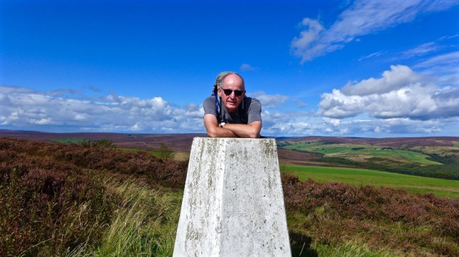 There has recently been a lot on the 1,000 Mile Country Walking Magazine Facegroup Group about trig pillars (also known as trig points and ordnance survey columns) and so I have decided to tell my story about my adopted trig point north east of Helmsley on the North York Moors. It is a story of what happens when you put one foot in front of the other and things turn out in a way that you could never imagine.
 After the farms the tarmacked lane became a track leading to Beadlam Rigg Plantation. From Middle Farm to the trig point it is about 2 miles.
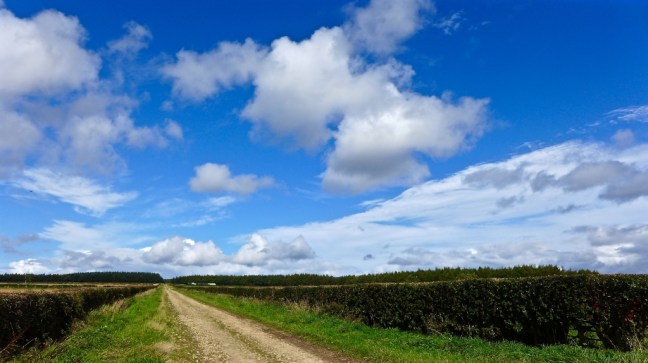
 I emerged from the woods to follow a heather lined, ascending track.
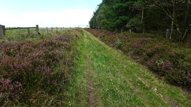
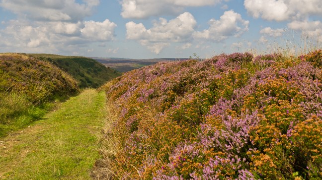
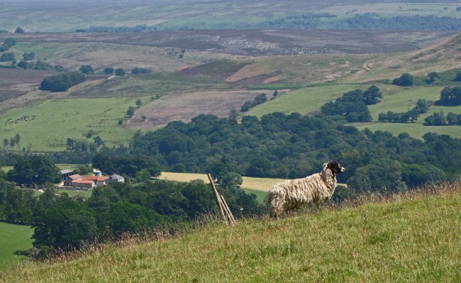
 On reaching a gate at the top I reached the escarpment of Rollgate Bank and a huge expansive view, as far as the eyes could see, of an open heather clad moorland – a ‘patchwork quilt’ that on a good sunny day will take your breath away.


 I then turned right along the track to find the trig pillar. I knew then my book would be completed and published.

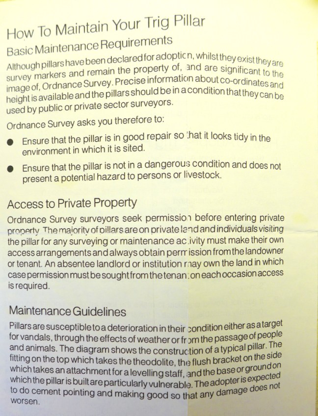
 They also issued guidance on how I ‘care’ for my new friend.

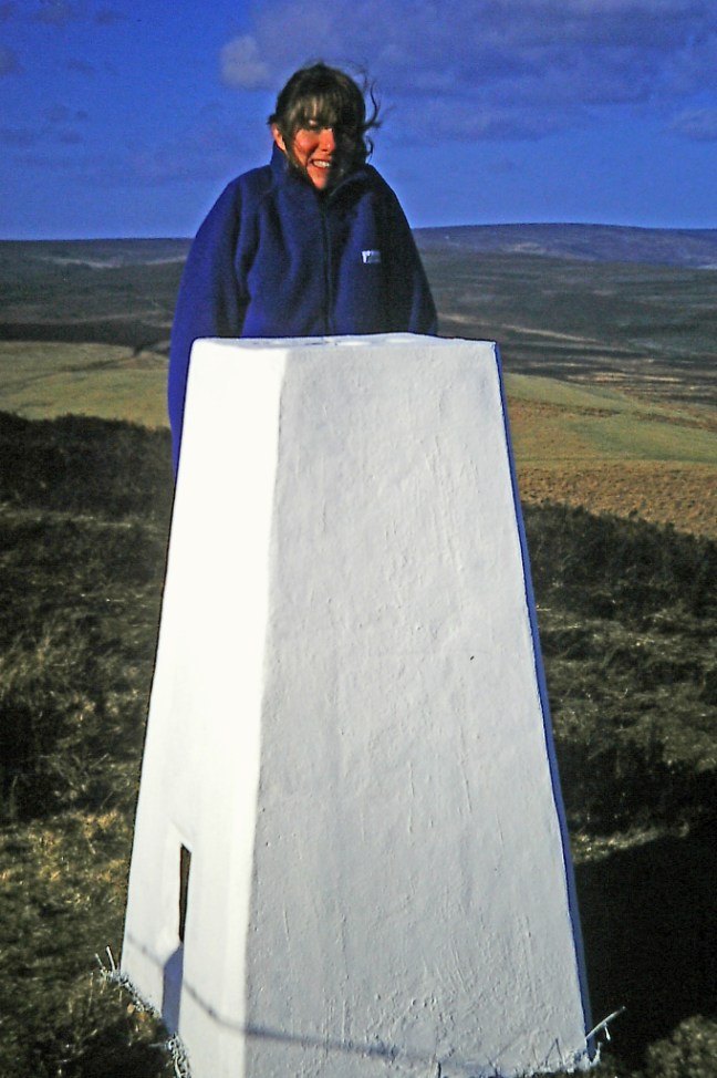 The place clearly left a great impression on Penny as some years later, when she became seriously and terminally ill in Canada and then Australia, she left instructions that this should be one of her final resting places. I had already indicated in the Conclusion of my book that this should also be my final resting place and so I will be in the company of another great lover of walking and the outdoors.


 There is even a bench just a little further on down from the trig pillar off Rollgate Bank. A fabulous place to listen to the silence, feel the breeze in your hair (if you have any) and admire the views.
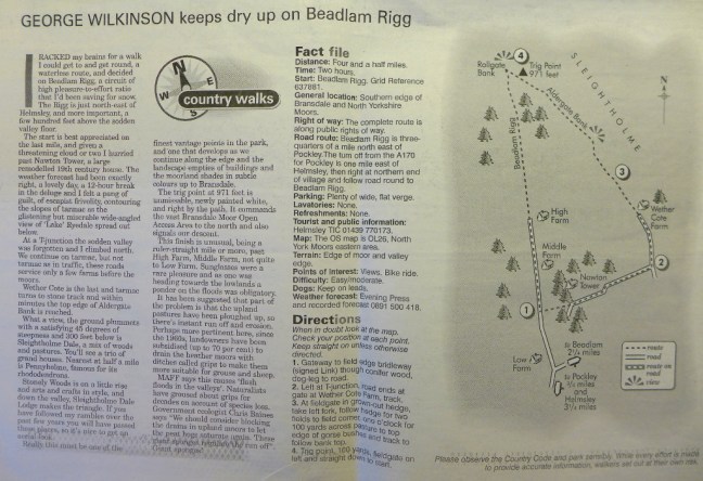


 However, things got worse for Sid the Yorkshireman when he discovered there was a charge of 20p for the toilets. Needless to say having paid my 20p he was waiting outside and got in free. Due to Sid the Yorksshireman’s grumbly mood, nothing was right, and due to his non payment of toilet fees, we decided to punish him by putting him in the stocks.
 Not having any tomatoes or such like to throw at him, we gave Carol a turn who was much more cheerful, having just retired.
 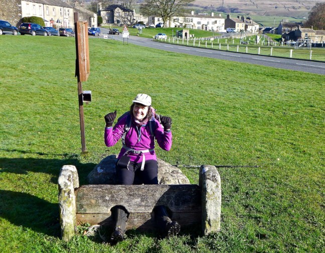 Sid the Yorkshireman then decided to apply his sheep ‘whispering powers’, which totally failed as the sheep bolted.
 It was time for an early bath.
 We were heading to the start of the next section of The Inn Way at Stalling Busk.


 The Cam High Road, a Roman road, is straight in the manner of Roman road construction and is at high level, before descending to the Roman Fort of Virosidvm in Bainbridge.
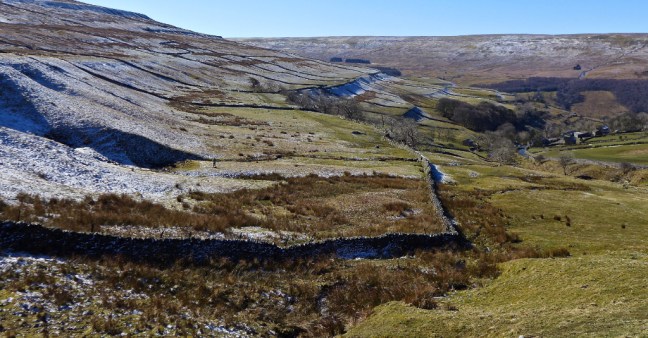
 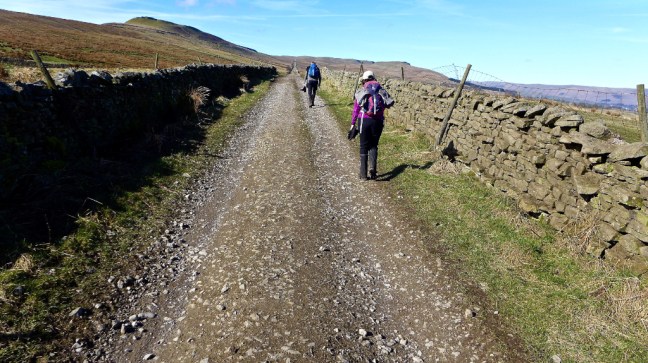 The views from the Cam High Road on such a day were stunning. Yorbrugh at 1686 feet (515 metres) can be seen ahead.
 Leaving the steady climb up the Cam High Road we followed a steeper, boggier path signed Marsett.
 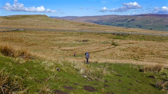 I got a little ahead and waited at the top as a skylarks sang and planes flew overhead. I am not sure whether they were classed as near misses.
  Soon afterwards we decided to stop for our coffee and banana break as it was now about 11.00am and sometime since we had eaten breakfast. See separate video on Facebook.
  Instead we enjoyed the sound of the Raydale valley skylark and took in the wonderful views in the warming sunshine. There could be no better place for a coffee break? The village of Marsett, our next destination, could just be seen lower down.
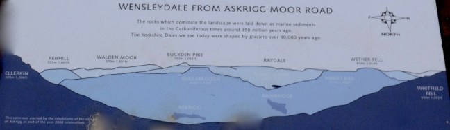
 Raydale once formed part of the hunting forest of the Lords of Middleham Castle and means valley of the roebuck. It is enclosed by the wonderfully named Yockenthwaite Moor at 2109 feet (643 metres), Fleet Moss at 1955 feet (596 metres) and Drumaldace at 2014 feet (614 metres). Raydale seen from our coffee location on some outcrops of rocks is probably one of the most breathtaking views in the Yorkshire Dales.
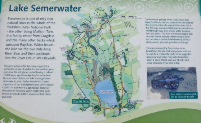
  Semer Water glistened, reflecting on itself itself far below. It is one of only three natural sheets of water in Yorkshire, the others being Malham Tarn and Hornsea.
  However, we couldn’t stay forever and eventually began our steepish descent, whilst watching out for the odd hole or two in the soft velvety grass that it would have been easy to turn an ankle on.
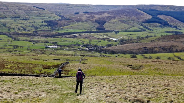
 After a dog gate, which Sid the Yorkshireman decided he wouldn’t fit through having just been on a cruise, he got a bit snap happy with my camera phone.
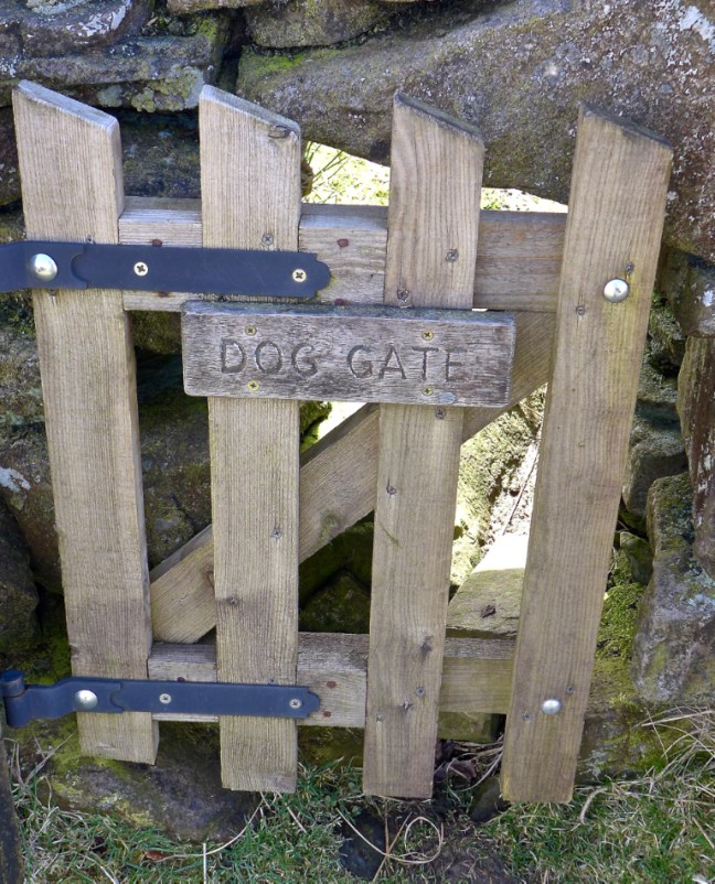
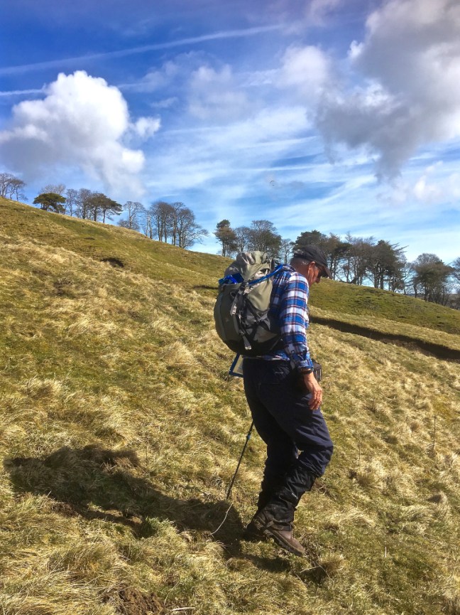


 If your wondering why I had a MS Midnatsol (meaning midnight sun) hat on, it was a prize for winning a winter Facebook Hurtiguten photographic competition. It was probably appropriate that, in order to get the winning photograph, I had to climb up and down 418 ice covered steps to the top of Mount Askla in Alesund Norway, which of course is good training for the ups and downs of the Yorkshire Dales and vice versa. Fortunately, I had spikes on but a Norwegian young lady didn’t and came down on her bottom! Quite a sight! It is as well to remember that descending is often harder than ascending as I found out later on this walk.
  By now we were in the midday sun and I think it had affected Sid the Yorkshireman. Given a choice between a ford and a bridge Sid the Yorkshireman will invariably opt for the ford with the premise that is will clean his boots. Note the Basil Fawlty silly-walk style as he crosses Crooks Beck. Very appropriate.
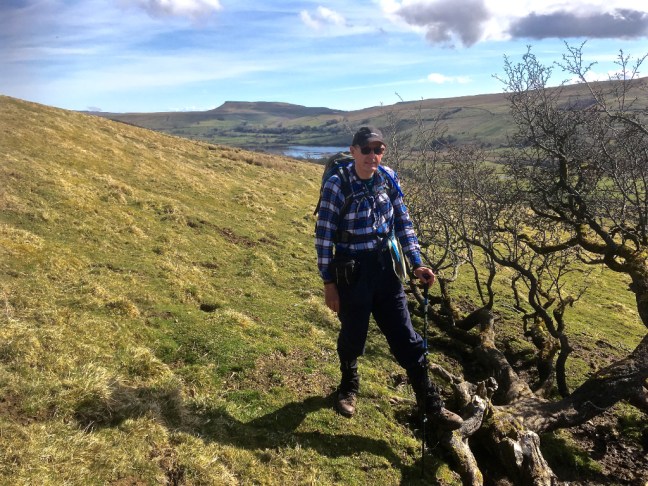
 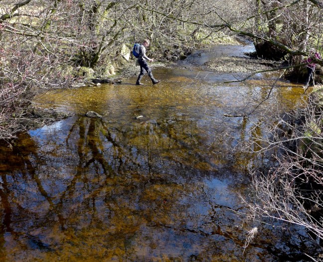 As we climbed to the village of Stalling Busk at 1,100 feet there were fine views back across the valley.
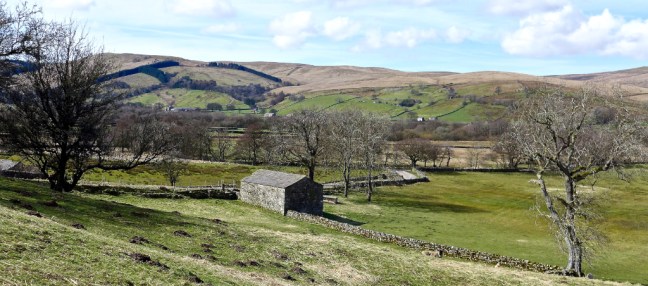 Arriving at the delightful church I could now resume The Inn Way.
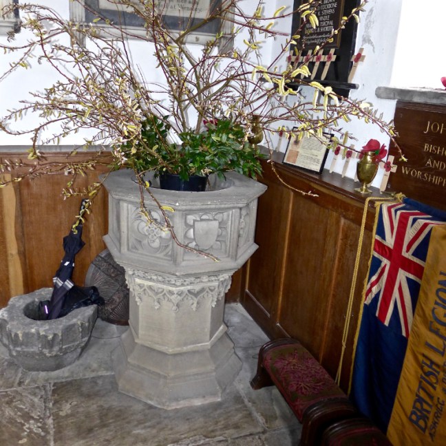
 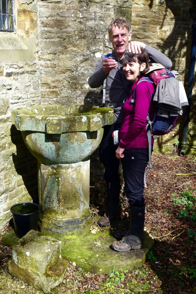 There is fine memorial outside the church. WE WILL REMEMBER THEM.
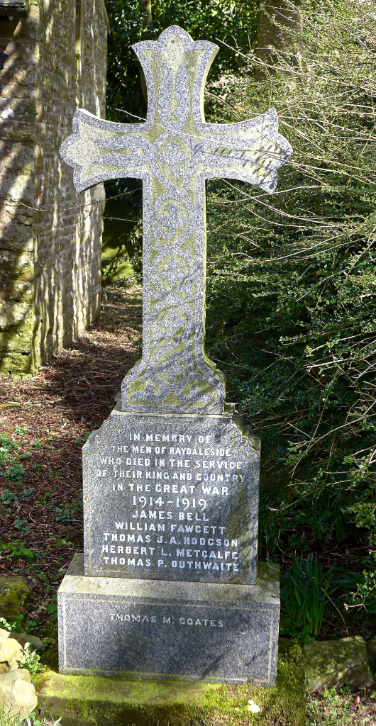

 Semer Water came into view again. It is a glacial lake, a last remnant of the Ice Age, when moraine debris was left to retain the glacial meltwater.
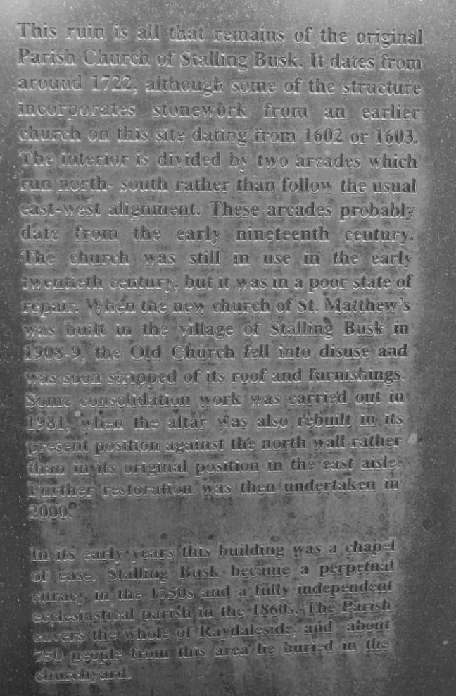
 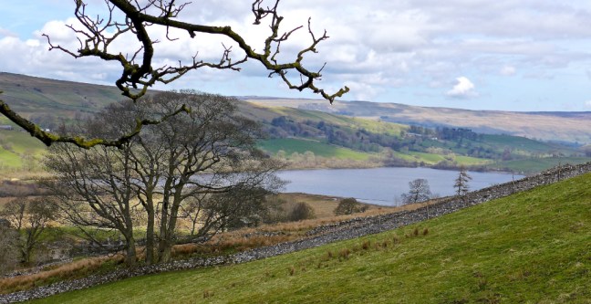 The remains of the original church was reached, dating from 1722.
 There were some interesting gravestones in the graveyard; WE WILL REMEMBER THEM. Thomas Hodgson was only 25 when he died for his country and our freedom.
 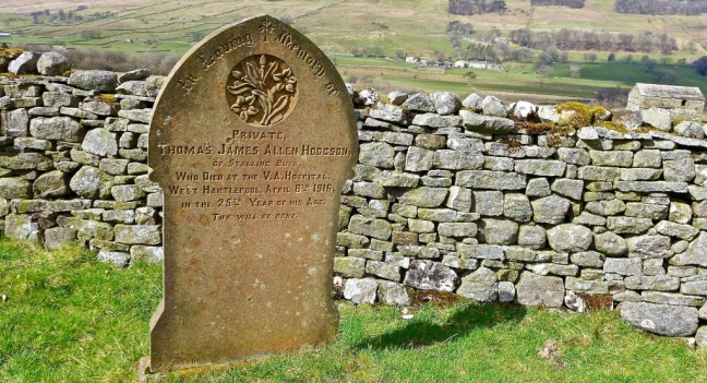 The hand on Ann Tate’s grave is very realistic.
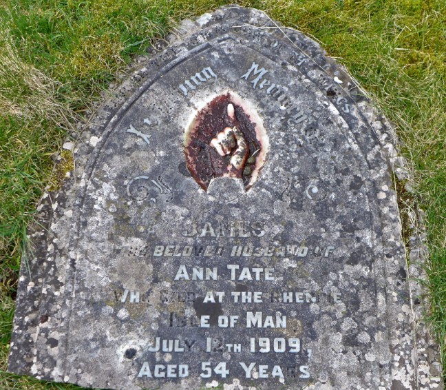 Agelika Davey from the 1,000 mile Facegroup has indicated that the text on the gravestone below is from Psalm 84:
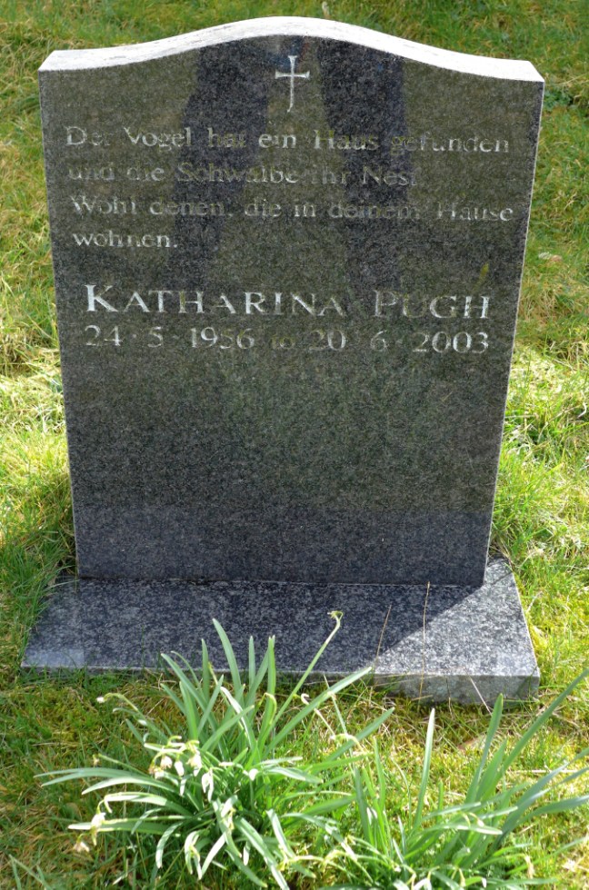 It was time to leave the graveyard and the views from it.
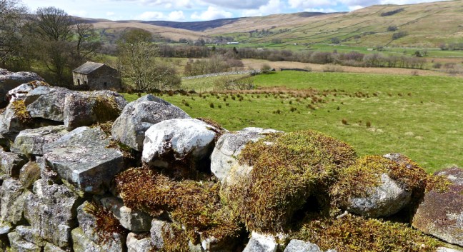 Semer Water is home to many species of migrating birds and there are rare plants in the surrounding marshland. It is an area of Special Scientific Interest and is managed by The Yorkshire Wildlife Trust, a charity.
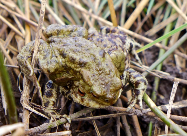
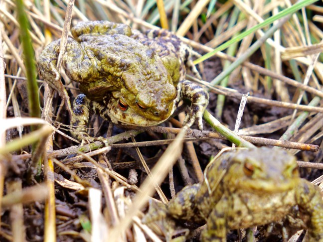
 As if to prove the point a frog came along to greet us on the path. It was clearly a ‘show off’ as it has some unusual face extras. Frogs will do anything to find a mate at this time of year as we discovered later. One of my reader’s reads the blogs over breakfast and, as a warning, some later photographs of frogs may put her off her breakfast. They are X-rated and only suitable for over 18s. I think she just qualifies!
 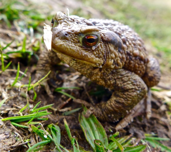 After squelching through a lot of mud we reached the end of Semer Water and the clouds were starting to appear and it felt a bit cooler.
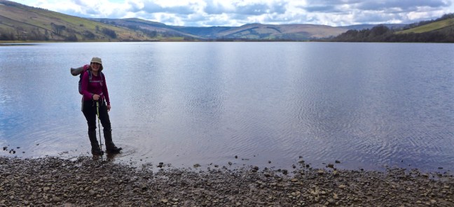 It is possible to walk on water in the Yorkshire Dales.
 Especially after writing these blogs with a beer and gin and tonic.
  It is also possible to become a modern day legend.
 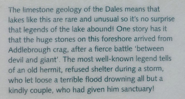 Clearly I am the old hermit in the story and Sid The Yorkshireman and Geordie Caz are the couple.


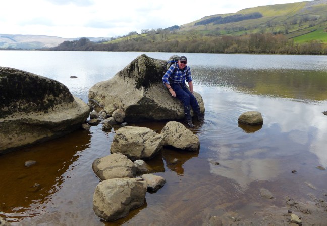
 Now you will remember that earlier I said it is easier to ascend than descend. This applies on slippy glacial erratic boulders too!
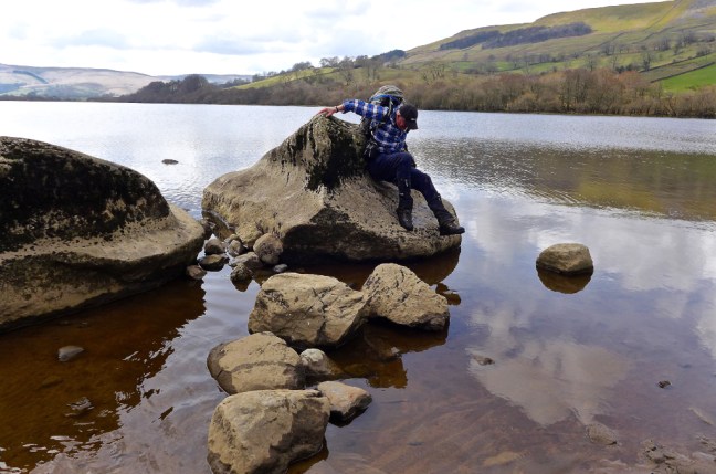
 Any breakfast readers (they know who they are) should now look away. If you try to count the number of frogs there are more than you think. Count the eyes which are the give away. Spring is here!
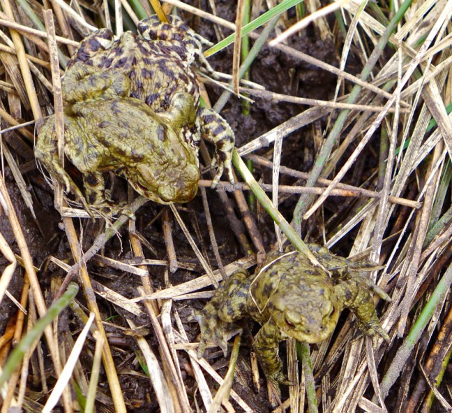
 The River Bain, which can just be seen here as we look back to Semer Water in the far distance, is England’s shortest river at 2 miles. It found a passage through the glacial moraine and finishes in Bainbridge where it joins the River Ure. A smaller river than this is often referred to as a stream, creek, brook, rivulet and rill.
  Over the two miles I collected a bag of rubbish – shocking. I wonder if I can get some of that extra high energy stuff as, being suitable for pregnant ewes, growing lambs and tups, it should give me just the sort of boost I need.
 Arriving at Bainbridge the River Bain certainly provided us with a fine finish to a fabulous walk. Note an Archimedes Screw can just be spotted at the end above the waterfalls.