The World Speed Record on Water, Passing your MOT, I Have a Headache.

Post 43: The route took us through fields and farmyards, then, at Higher Lath Farm, we went slightly wrong where the fold of my map was over some buildings, which I should have been looking for. This was the opportunity for Alf to give me some stick, which seems to be a favourite pastime of my walking companions. In their minds 200 yards off-route becomes 20 miles and I seem to get the full force of their frustration. However, it certainly leads to increased concentration in finding the correct route.

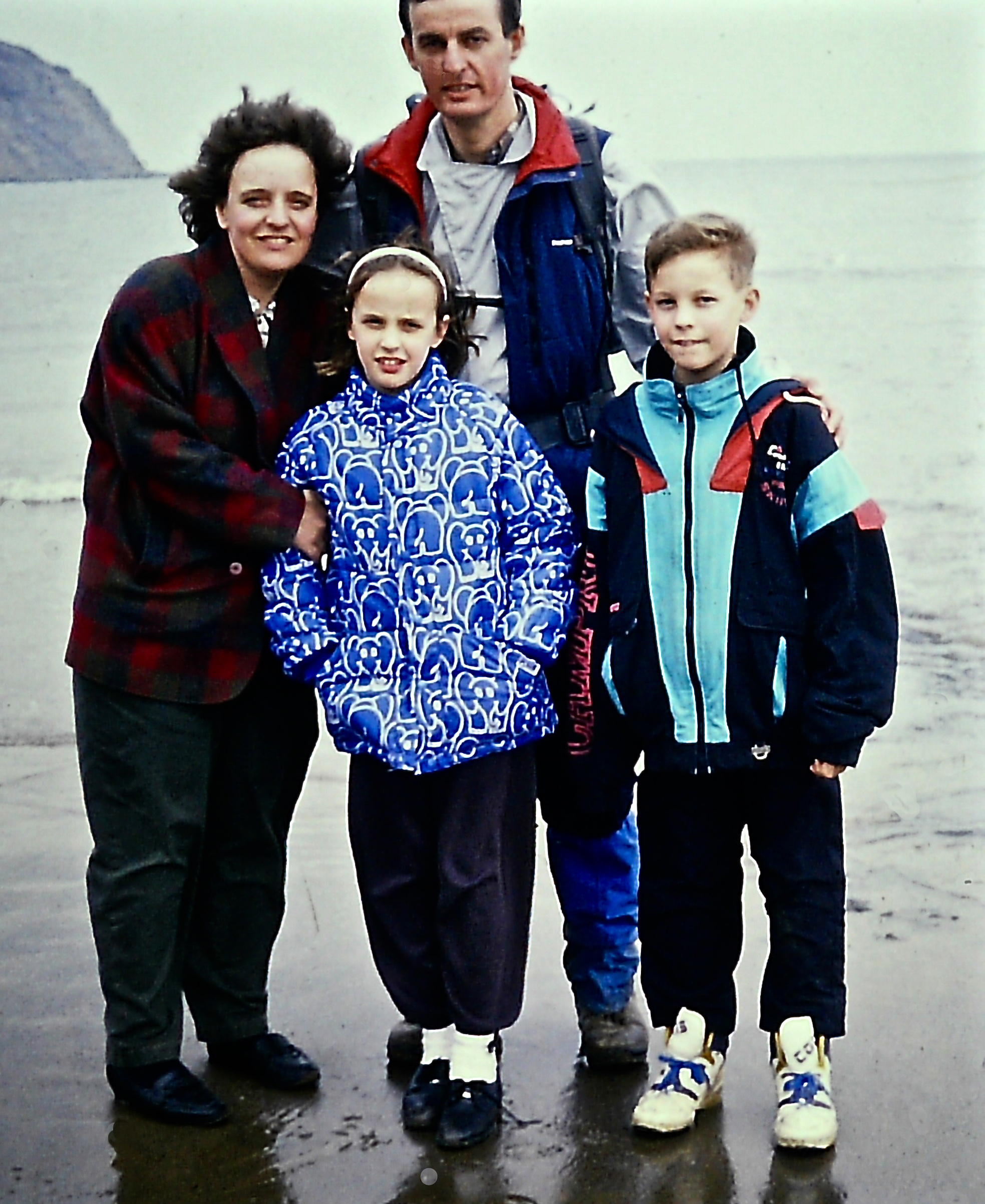
We arrived at Beacon Tarn, which provided an excuse for a refreshment stop. A family consisting of Grandad, Grandma, Mom, toddler son, and Dad were progressing towards us, up to their ankles in mud. Dad was the only one carrying a pack and it was huge. They stopped at the tarn and I couldn’t help but contemplate the difficulties when walking with toddlers. I was pleased that my children had passed this stage so that I could now stroll out independently and fast. However, I never regretted the short walks I had experienced in the past with my own children, but it is good to move onto another phase in life.

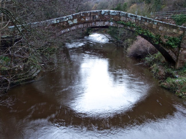
Our next stop was on the edge of Coniston Water, next to a dead sheep, which we only noticed when I started to take some photographs. The views along Coniston were impressive and it was possible to imagine (Sir) Malcolm Campbell setting the world record of 141.74 mph in his powerboat Bluebird, some 138 mph faster than we were walking. Between 1956-59 Donald Campbell broke the record five times (the last time reaching 276.33 mph). On 4 January 1967, however, he was killed on the lake when trying to raise the world record to 300 mph. His body was never recovered.

Despite our low speeds and the relatively flat terrain, Gary managed to slip over at least twice. On inspection, the soles of his boots had no tread on them and it was clear he would fail an MOT. I had warned him on numerous occasions of the dangers of not having decent treads on his boots but, as ever, he took no notice. He tried his hardest to break a leg at 3 mph, heaven knows what he would be like in a boat at 300 mph.

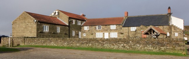
After some pleasant woodland walking, along the waters edge, we arrived at Coniston Hall, a late 16th-century manor house, which has several chimneys that are built so large the owner must have had a fixation on Father Christmas.

29 March 1992: Day 2 – Coniston Youth Hostel to LongthwaiteYouth Hostel – 19 miles       

On paper this was always going to be a tough day and one option, not accepted due to Gary’s tight schedule, would have been to split the day at Elterwater Youth Hostel.

We left Coniston Youth Hostel at 9.00am, just as the bright sunny morning turned to rain. For some reason, Gary and Alf had not brought their gaiters, which was a little surprising as they are designed for the type of muddy and wet terrain we were due to walk through that day. The climb to Tarn Hows was harder than anticipated, possibly because the rain had made everywhere slippy. In thick mist and heavy rain this tourist honeypot did not look quite as attractive as in the postcards and calendars. This is one of the great honeypots of British tourism, with an estimated 750,000 visitors a year.

Tarn Hows
Tarn Hows

This most perfect of Lakeland landscapes is man-made. Until the last century there was a collection of small pools here known as Monk Coniston tarns or the Tarns, and it wasn’t until a small dam was built across the outflow stream, Tom Gill, that this famous spectacle of water was created. The Ordnance Survey still call it ‘The Tarns’ on their maps.

Tarn Hows
Tarn Hows

Some time after leaving the tarns, we stopped for refreshments adjacent to the Coniston-Ambleside road, with the choice of sitting on a log in the pouring rain or on grass in the shelter of a tree. I was cheered up shortly afterwards when some orienteers came running through the woods, slipping about on the mud, soaked in fairly flimsy tee-shirts; I felt quite sane doing what I was doing compared to their activity. Defined as a competitive sport of finding one’s way across rough country with a map and compass, orienteering originates from Scandinavia where it was introduced in 1918 as a sport for young people. Like all crazy ideas it was exported to Britain such that veterans in their 60s run around looking for bits of paper displaying a clue to the next destination. I have enough trouble trying to get to real destinations without looking for bits of paper.

Arriving at Elterwater, I began to wish I had split the day, especially when I saw the Britannia pub was quite close to the hostel.  It was here a few years later that we met sexy Sarah at the hostel. However, on this occasion there was no Sarah; instead Alf who started to complain.

‘I’ve got a headache.’

‘A headache? Out here in all this fresh air?’ This caused me some concern as, at only 100 feet, I decided it couldn’t be altitude sickness. Fresh air is supposed to clear headaches and I had never heard of anyone having a headache when out walking, unless in the ‘death zone’ near the top of Everest.

The start of a new walk – The Cumbria Way

Post 42: March 1992 -The Cumbria Way – maturity, aged 40

After Wainwright’s Coast to Coast walk, I was keen to experience some more of the wonderful Lakeland scenery and the Cumbria Way seemed to fit the bill perfectly, starting as it does at Ulverston in Southern Lakeland and heading north through central mountainous Lakeland to finish at Carlisle. At some 70 miles, the walk could be done in five days, therefore not impinging too much on my busy work and home life. The walk is, for the most part, through lowland valleys and therefore would be less susceptible to bad weather. If the weather was good there would be opportunities to walk some high-level routes.

P1030833_6939_edited-1

The National Parks and Access to the Countryside Act of 1949 provided for the designation and subsequent completion of long-distance routes along which ‘the public should be enabled to make extensive journeys on foot or on horseback.’ In 1998, the Royal Opera House received the same annual subsidy as all the national parks of England and Wales put together. The opera house serves fewer than five hundred thousand people and received sixteen million pounds, as did the national parks, which were visited by seventy-five million people.

Individuals or other organisations other than the national parks have created long distance walks. The Cumbria Way was an ‘unofficial’ route created by the efforts of members of the Ramblers Association using existing rights of way.

To say members of the Ramblers Association were somewhat obsessed with rights of way is an understatement. Their magazine ‘Rambling Today’ had numerous details of cases against farmers, landowners and local authorities as well as enough legal information to satisfy the most ardent barrister or solicitor. Every other sentence was dominated by the word ‘access’, to the extent that you couldn’t help wonder if some of the members ever got time to go out just to enjoy a walk.(Update – this is no longer the case and their magazine is much more informative on general walking matters – maybe they have now achieved many of their access aims).  However, what was the biggest single participation event in the Ramblers calendar? Well, according to their magazine it was the raffle. In 1996 members bought, or sold, 126,850 tickets, contributing £53,354 to the Step Alive Fund. Now if that is not evidence that the Ramblers Association was really a front for Gamblers Anonymous then I don’t know what is! (I am only joking – please don’t get the solicitor’s onto me!) One of their best legacies is the Cumbria Way.

On a more serious note, they have lobbied very effectively in maintaining many rights of way which otherwise would have disappeared and the proposed legislation on freedom to roam in the late 1990s is very much due to the good work of the Ramblers Association. They have done a lot for Access including the creation of National Parks, creation of long-distance walks including the Pennine Way, open access, free walking in Scotland, the opening up of the England coast path, ensuring the future of woodland walking. So they are a charity well worth supporting. They also provide a wide variety of walking holidays.

They are also great for people who are more sociable than me and who like walking in bigger groups!

27 March 1992

I left York with Alf and Gary on the 1.37pm train. My pack weighed twenty-eight pounds as per Coast to Coast, although my own weight was twelve and a half stones, half a stone heavier than the previous year. One of the enduring features of middle-age is that one’s weight tends to steadily go up rather than down. The best advice is to increase the amount of exercise, but with family and work commitments this sometimes is just not possible. We changed trains at Leeds and Preston, where Gary nearly missed the train as he was learning some lines for his forthcoming appearance as Joseph in the York Mystery plays.

The start of the walk, Ulverston, is somewhat unusual as it is the home of the Laurel and Hardy museum, due to Stan being born in the town. The appearance of Gary and myself is not dissimilar to these famous comics, me being the taller thinner one and Gary being the shorter rounded one.

The evening was spent playing darts in one of the local pubs; Ulverston is hardly a Mecca for entertainment.

28 March 1992: Day 1 – Ulverston to Coniston Youth Hostel – 16 miles

The start of the Cumbria way is a bit disappointing, an uninspiring sign at the top of an open area called The Gill, north of the market place. I would have thought that Bardsea near to Ulverston Sands would have given a more definitive start, with views across Morecambe Bay. I was glad to be getting away from the trappings of civilisation for a few days, although Gary and Alf couldn’t resist reading newspapers before we left the bed and breakfast accommodation. After devouring a hearty breakfast, we left Ulverston at 9.00am. With no pubs or cafés on todays walk we stocked up with plenty of food and drink. The weather was warm and clammy so that I began to wonder why I had brought my cold weather gear; the reason became evident later on during the walk.

6D (old pence) for a Hearse, Becoming a Man, a Pint at Robin Hood’s Bay, the End

Post 41: 10 April 1991: Day 13 – Glaisdale to Robin Hood’s Bay – 19 miles

Woke up to sunshine piercing through the curtains. This was it, the last day of this epic journey having survived getting lost in the Lake District, overcome appalling weather and losing the company of Archie. However, I had met many new people and made a number of new friends, not least Wendy and Clint who would be walking with me on this last day. I felt six feet tall; actually I am six feet two and a half inches, but maybe a couple of inches had worn away after 171 miles of walking. One thing for sure, my feet were much larger and I was now down to wearing one pair of socks rather than two pairs as in St Bees. Top tip; always have boots that allow for foot expansion on these walks so that you start with two pairs of socks, a thin wickable inner sock and a thicker wool based outer sock. As the feet get bigger you can take the inner socks off. When you buy a pair of boots you should be able to get a finger down the back when the foot is pressed forward. My walking boots are normally a size larger than my normal shoes. My feet expanded about half a size on this walk.

By now, I looked like a weather-beaten beetroot, resulting from the effects of wind, sun and rain. Due to the need to keep my pack weight down, I only allowed myself a tiny tube of sunblock and a travel sized bottle of aftershave. Only Wendy, like any female, bothered to carry make up and smellies; it seems a woman must always be at her best, even on Coast to Coast. I decided not to do any more clothes washing as the washing machine at home was getting nearer and hand washing lost its attraction.

We had a huge heart attack breakfast, picked up a substantial packed lunch, then had a quick photo call in bright sunshine outside the pub; we were in good spirits and were excited to be starting on the last day.

We soon arrived at the early 17th-century Beggar’s Bridge, feeling not unlike beggars in our dusty, dirty and well-worn clothing.  The bridge was built by Thomas Ferris in 1619. Ferris was a poor man who hoped to wed the daughter of a wealthy local squire. In order to win her hand, he planned to set sail from Whitby to make his fortune. On the night that he left, the Esk was swollen with rainfall and he was unable to make a last visit to his intended. He eventually returned from his travels a rich man and, after marrying the squire’s daughter, built Beggar’s Bridge so that no other lovers would be separated as they were. Isn’t that romantic?

P1060764
Beggars Bridge.

We had a pleasant climb parallel with the River Esk through East Arncliffe Wood then, just after Egton Bridge, we arrived at an old toll booth sign:

P1060779

The only category we felt we could fit into was the hearse, as we felt half dead through tiredness.

We continued along a track to Grosmont, which is a main station on the North York Moors Railway and where many of the trains are ‘steamed up’ in the morning. The railway from Pickering to Whitby was created by George Stephenson and after being threatened by closure was kept open by the North York Moors Railway Society.

Grosmont
Grosmont
The Whitby Enterprise
Sir Nigel Gresley
GrosmontApril08 059
The Whitby Enterprise
The Flying Scotsman - iconic
The Flying Scotsman – iconic

After a steep climb out of Grosmont and the crossing of Sleights Moor, we arrived at the pretty valley of Littlebeck, which boasts a hermitage hewn out of rock, dated 1790 and initialled GC.

Wainright's Coast to Coast 1991

With the prospect of a return to work looming, I was inclined to take up residence and become a hermit. However, it is difficult to give up modern comforts and instead continued along Littlebeck to the lovely waterfall of Falling Foss, where we stopped in bright sunshine for our final packed lunch of the walk. I have a very good friend who lost her father at a much too young an age and he was laid to rest in this area, a beautiful, tranquil and peaceful resting place.

After a further seven miles, much of it over moorland, the sighting of the North Sea is a delight, but there are still three miles until the end of the walk at Robin Hood’s Bay.

Robin Hood's Bay. Wainwright's route finishes along the cliffs on the far side - a delightful 3 miles of walking and a fine and fitting end to a magic walk.
Robin Hood’s Bay. Wainwright’s route finishes along the cliffs on the far side – a delightful 3 miles of walking and a fine and fitting end to a magic walk.

We arrived at 5.00pm and met the Black Country Stompers. On the windy beach was my wife Celia, daughter Sophie and son Alastair.

The big 50_6696_edited-1

The traditional dip in the North Sea and a photo call was immediately followed by a celebratory pint in the Bay Hotel.

The big 50_6701_edited-1

PICT0003
A well earned and much needed Guinness

I was now a man according to Wainwright and no longer a boy!

P1020516
This is me on my knees as portrayed by my 10 year old son at the end of Coast to Coast.

P1020515

September 1991

I was walking in Littlebeck with my wife and family and we met a father and teenage son walking Coast to Coast for the third year in succession. I had thoroughly enjoyed Coast to Coast and thought I would like to do it again sometime in the future, but not three years in succession; that was crazy.

One evening, when I was mulling over Wainwright’s Coast to Coast Pictorial Guide, I read his Personal Notes in Conclusion at the end of the book. I had read them before, of course, but on this occasion my eyes stopped in the middle of page xiv: ‘… but I would feel I had succeeded better in arousing interest for the planning of private long-distance walks if the book induced some readers to follow instead their own star and find their own rainbow’s end.’

Wainwright succeeded in my case and there and then I decided to take up his challenge to plan my own alternative coast to coast walk, which I hoped would be as equally attractive as Wainwright’s and which would allow a relatively solitary walk across England, taking in three of the country’s finest National Parks – the Lake District, the Yorkshire Dales and the North York Moors. However, I was unable to walk my coast to coast route for another eighteen months and therefore decided to walk the Cumbria Way the following year to ‘fill in’ for 1992.

The Highest Point of the North York Moors, a Lion, Fat Betty and Explosives.

Post 40: 9 April 1991: Day 12 – Great Broughton to Glaisdale – 19 miles (from Clay Bank Top) 

In the morning we paid our pound to get a lift back to Hasty Bank and the Coast to Coast route. I had arranged to meet Clint and Wendy at the car park, but had in fact waited at a different end of the car park. After ten minutes we stumbled into each other. It was good to have some companions to walk with now that Archie had returned home.

We ascended to Urra Moor and the highest point of the North York Moors at Botton Head at 1491 feet.

White Rose Walk_3452_edited-1
Urra Moor. Cold Moor to the far left in the distance and the Wainstones after the dip.

Our spirits were high on this penultimate day, the weather was good with clear and bright skies. Arriving at Bloworth Crossing on the dismantled Rosedale Ironstone Railway, we decided to pretend we were trains, such was our delight at being on flat easy walking for 6 miles. We even started singing train songs, such is the effect a Coast to Coast walk can have. At this point, I decided to do what the Americans call ‘power striding’ where you stride out at great speed, in my case pretending to be an Inter-City 125. My ‘youthful energy’ was definitely returning as I sped along the dismantled railway line around the head of Farndale! Perhaps there was another motive? I soon arrived at my goal the Lion Blakey Inn, dating from 1553 and conveniently situated on the top of the moors at 1,325 feet.

P1060675
The Lion Blakey Inn

You have to leave your muddy boots outside, but unfortunately it has been known for boots to be stolen. I found it difficult to relax knowing that my Coast to Coast walk could finish if someone decided to take my boots.

Suddenly a Saga coach trip arrived full of elderly people; they had great difficulty walking the few yards from the coach to the pub. I really did feel super fit and young again! In an outdoors magazine survey in December 1997, the Lion Inn was included in the nationwide top ten pubs. It has a fine selection of beers including Theakston’s Old Peculiar and, if hungry, there is even an Old Peculiar casserole. There is also a welcoming fire, which makes leaving the pub one of the most difficult challenges on Coast to Coast.

Deciding we wanted to finish the walk, we left and soon ‘met’ Fat Betty. No, this is not a lady who comforts coast to coasters, but is in fact one of a number of crosses to be found on the North York Moors; many of these crosses were thought to have acted as markers or guides to monks, travellers and traders crossing the moors. There are often coins on top of the crosses, which are left for those who have run out of money.

P1000273_edited-1
Fat Betty

Wendy had her radio and headphones on as we walked briskly over Glaisdale Rigg. We did not stop again until we reached Glaisdale.

P1060717
Glaisdale and bottom right the powder house used for the local ironstone mining, which took place between 1862 and 1876. It lost its roof in about 2009.

The Arncliffe Arms at Glaisdale was our last overnight accommodation of the whole walk.

The big 50_6697_edited-1
The Arncliffe Arms

It was definitely a ‘male domain’, as a group of men listened to Country and Western tunes of a bygone era. There was also Neil Young singing ‘Heart of Gold’ and other seventies music, which I had listened to some twenty years earlier when I was an undergraduate student; like the North York Moors, the juke box was stuck in a time warp. The landlord of the pub said it was a pity it wasn’t karaoke night; I wasn’t so sure…………….he hadn’t heard me sing.