The Plot, Children Playing, Kittens Playing, Flying Dancers.

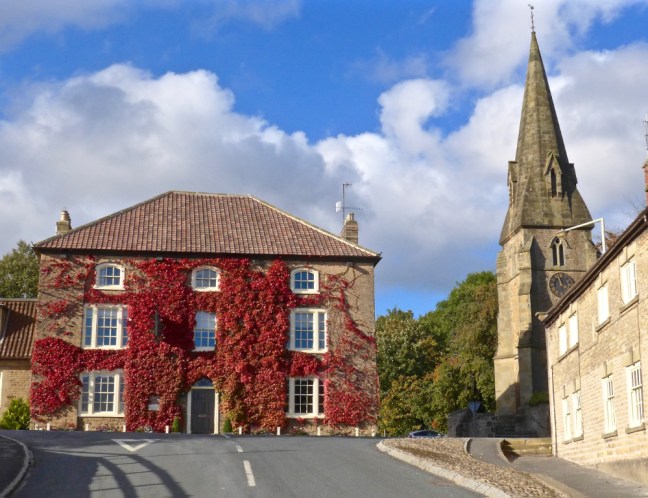
Post 76: 25 October 2016, Cleveland Circle 3.

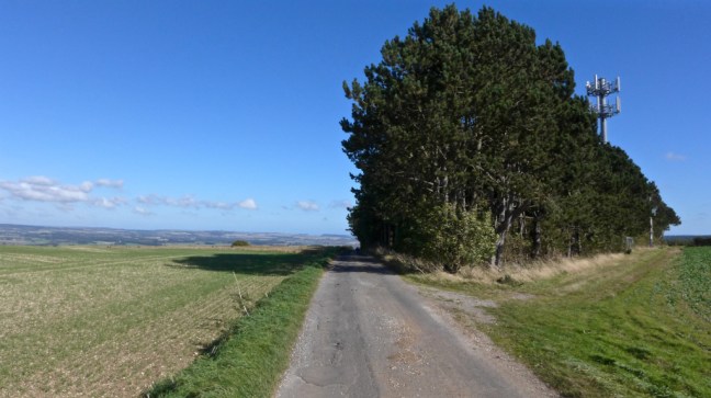
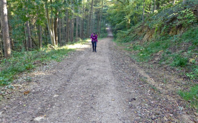
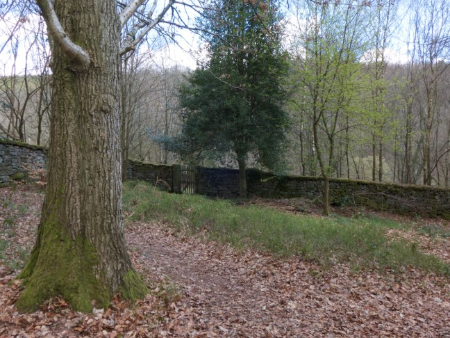
Arriving at Cold Kirby we soon came across the first frost I had seen this Autumn. There was certainly a chill in the air but we were to be surprised later on as to how the temperature increased as the day went on. Route finding for the first section to Sutton Bank was easy as it was the reverse of my North of England Way.


p1040866

There was suddenly a thundering roar and I nearly jumped out of my skin. Two horses came racing past. It was the first time that I had seen horses on the Hamilton House small training circuit.

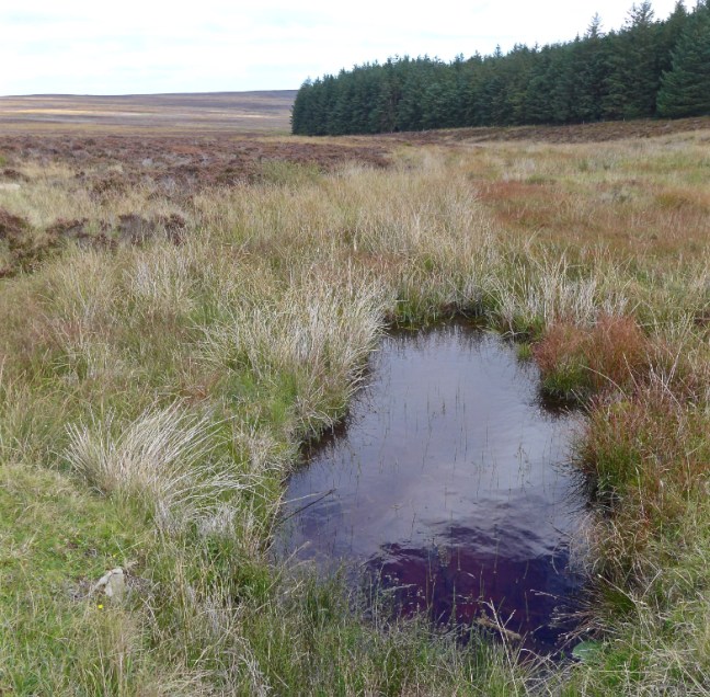
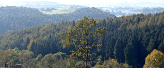
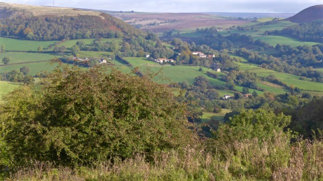
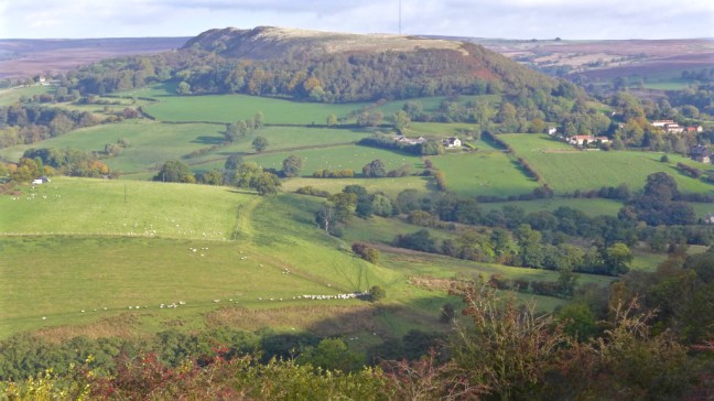
We carried on along Castern Dike, believed to be late Bronze Age or Iron Age, to reach the escarpment of Sutton Bank. It was a lovely view toward the Yorkshire Dales in the distance with low mist hiding the Dales. Even Thirsk below us was hidden.

p1040867

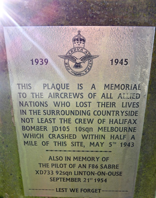
The light was still shining on some brave aircrewmen who sacrificed their lives for our freedom.

p1040870

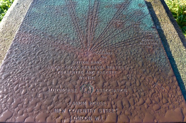
Overnight rain on the viewpoint marker gave an interesting effect.

p1040872

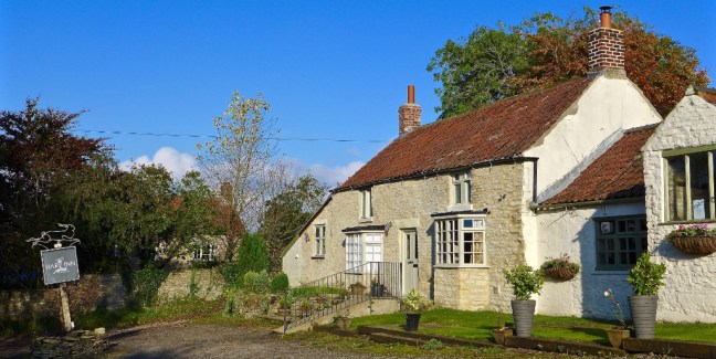
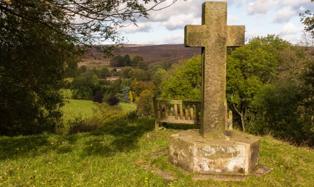
Leaving Sutton Bank Information Centre, we came across the remains of a cross not named or marked on my OS map. We then passed what used to be the Hamilton Inn on an old 17/18th Century Drovers’ Road from Scotland to England. Sadly the pub closed in recent years.

p1040874

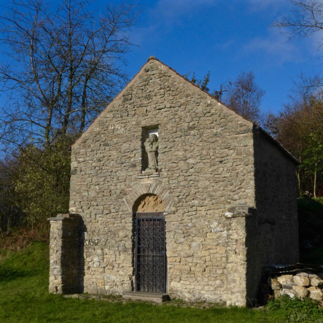
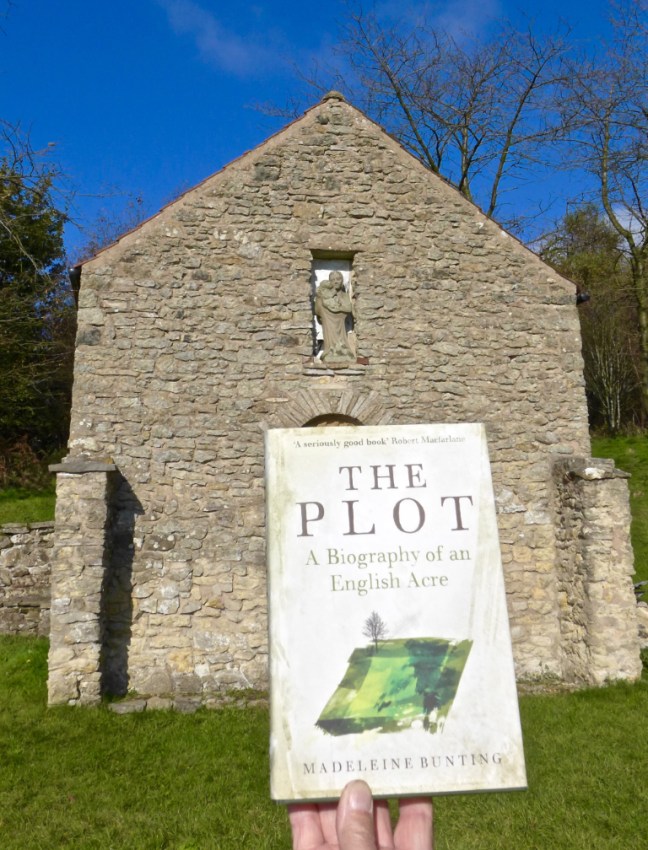
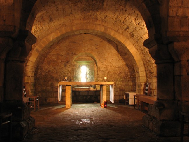
We then descended another old Drovers’ Road and now a BOAT (byway open to all traffic) to Scotch Corner. This is very different from Scotch Corner on the A1/M1 much further north. There used to be a pub here for the drovers’ rest and suitable refreshments but it fell into disuse. In the 1950s John Bunting created a chapel to commemorate former students from Ampleforth College who sadly had been killed in the Second World War. John had been a teacher there.

p1040876

p1040875

We decided to stop for a ‘banana break’ and coffee as on a very sunny day it was idyllic, sheltered and with a stunning view.

p1040880

There are some lovely carvings.

We were just about to leave when two gentlemen from Middlesborough joined us holding a book. It turns out that John Bunting’s daughter, Madeleine Bunting, had written about this piece of land and her brother’s development of this lovely chapel. On my return home I and my companions each ordered a copy of the book and look forward to reading it. One of the gentlemen had been a student at the University of York in the early 1960s and of course I had worked there from 1986.

p1040885

Scotch Corner has long been associated with the Battle of Byland in 1322 when Robert Bruce of Scotland heavily defeated Edward II’s English army in this area.

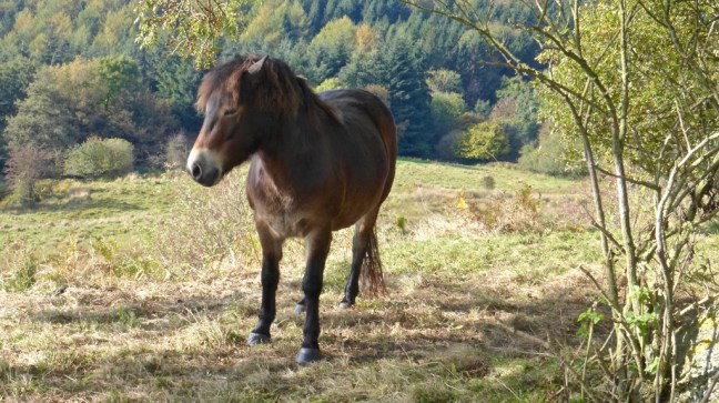
We eventually continued to descend the Drove Road towards Oldstead, passing some Exmoor ponies at Oldstead Bank. I am not really sure what they were doing in the remote parts of Yorkshire! They are evolved to survive harsh conditions and in Winter it will often be snowbound and very cold in this area.

p1040888

p1040889

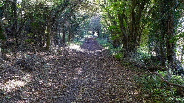
Walking along these Drovers’ Roads you can almost feel yourself going back in time to when horses, livestock and perhaps carts would have trundled along them.

p1040893

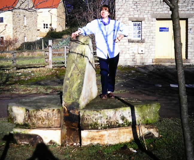
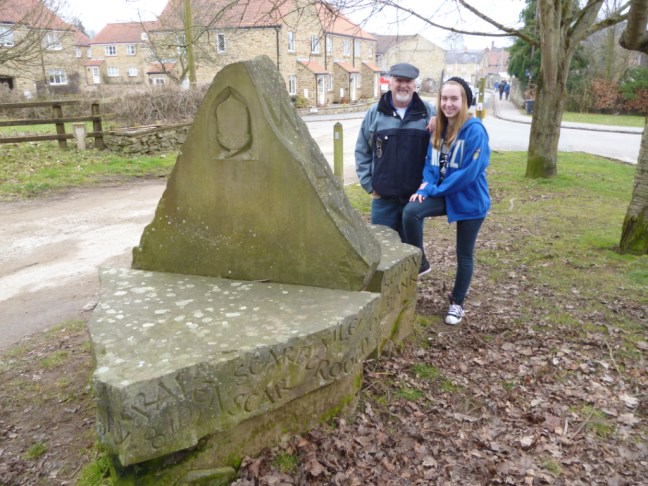
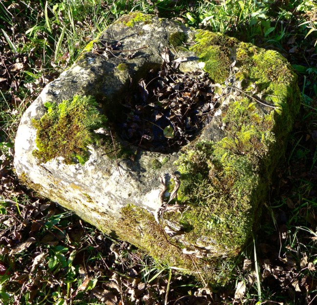
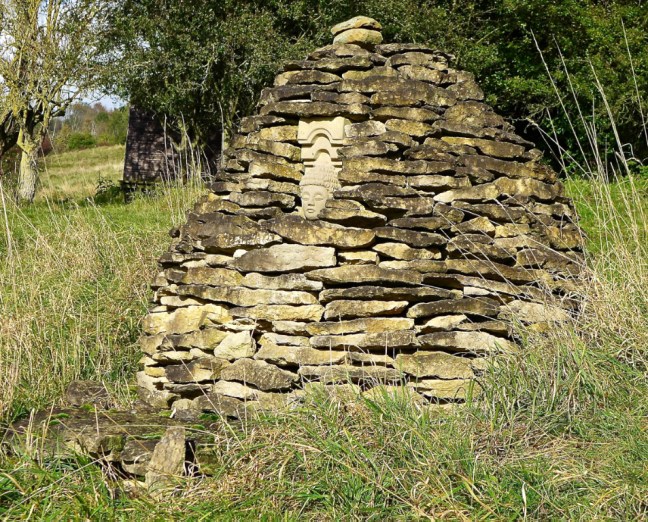
A rather unusual stone structure brought us to an inquisitive halt. We could not determine what this was for.

p1040896

We passed the Olstead pub and restaurant , The Black Swan.

p1040897

Autumn light and colours lit up the peaceful scene further on from the pub.

p1040898

Our peace was interrupted when we came across a sign “Children Playing”. See the slideshow:

This slideshow requires JavaScript.

Closely followed at Oldstead Grange by “Kittens at Play”

This slideshow requires JavaScript.

You can make your mind up which are the daftest and which are the cutest!

If that was not enough stimulation for one day we walked past a hedge covered in bright red berries.

p1040912

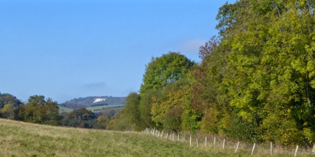
Then The White Horse in the distance.

p1040915

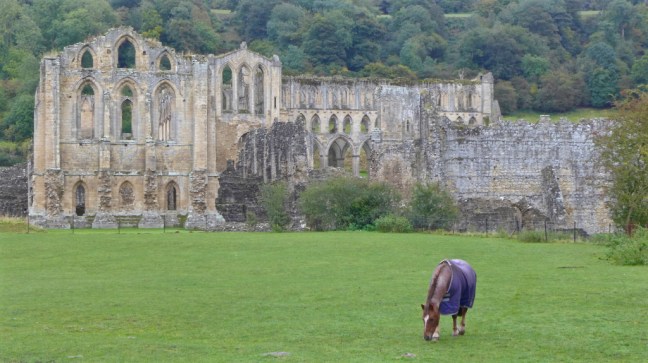
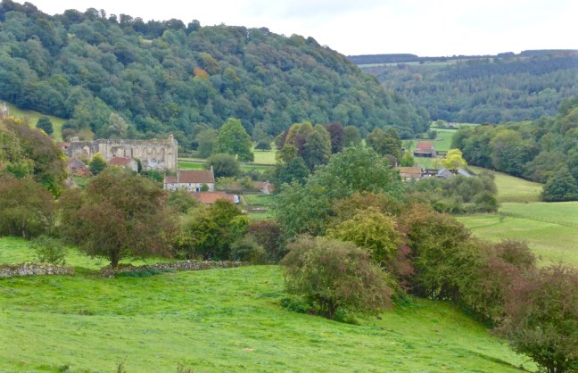
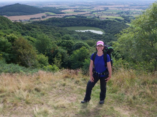
Lunch was on a bench overlooking Byland Abbey in sun with a falcon display in the background. It doesn’t get much better than this in the middle of October.

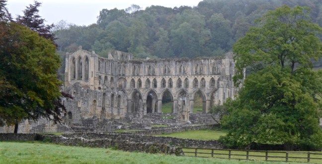
Byland Abbey was established in 1135 and disestablished in 1538. It was of the order Savigniac and then absorbed into Cistercian in 1148. After early disputes with other religious orders it became famed for sheep rearing and wool exports. The church was reputedly one of the finest 12th-century churches in Europe.

This slideshow requires JavaScript.

Abbey House was passed

p1040924

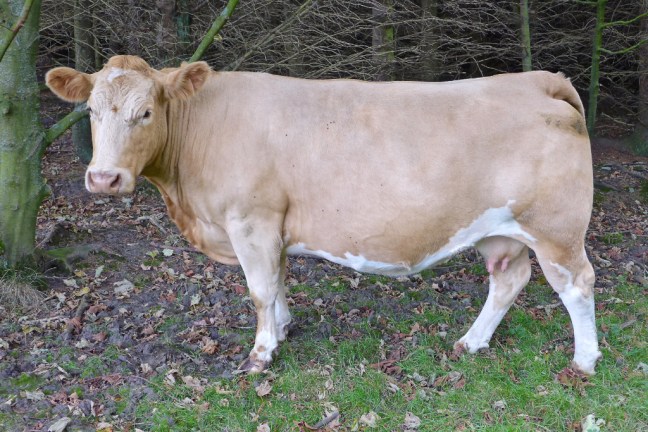
and yet more horses.

p1040926

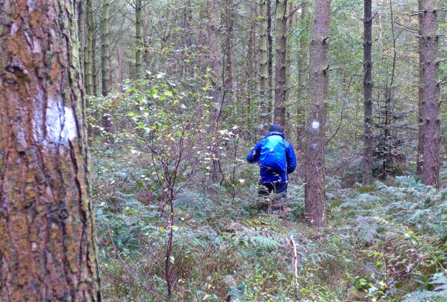
With relaxation, lunch and fun over, a steep long hill beckoned through Abbey Bank Wood

p1040927

To lead to some flying saucers,

p1040929

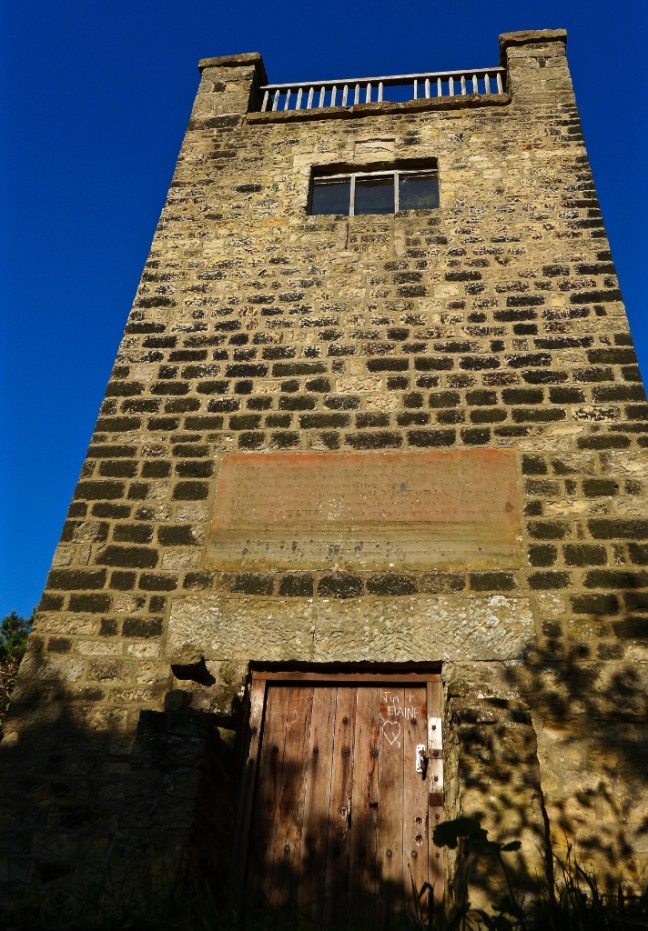
near Mount Snever Observatory. This was built in Queen Victoria’s reign by John Wormald of Oldstead Hall.

p1040931

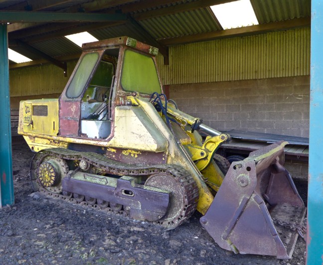
A more modern relic in need of attention was found at Cam Farm.

p1040932

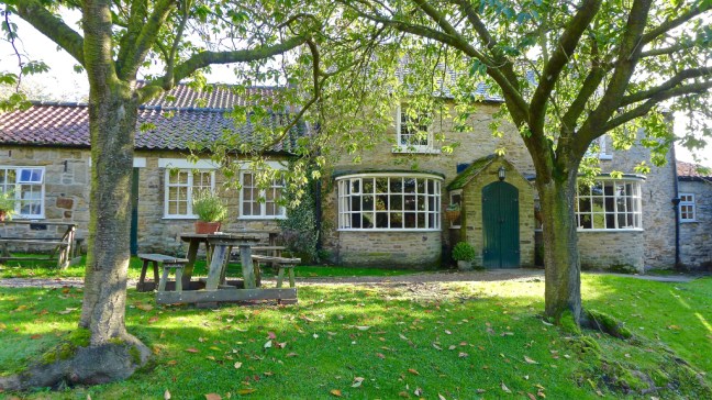
After crossing the main A170, we descended to the village of Scawton to pass another pub, the 13th Century old Hare Inn.

p1040933

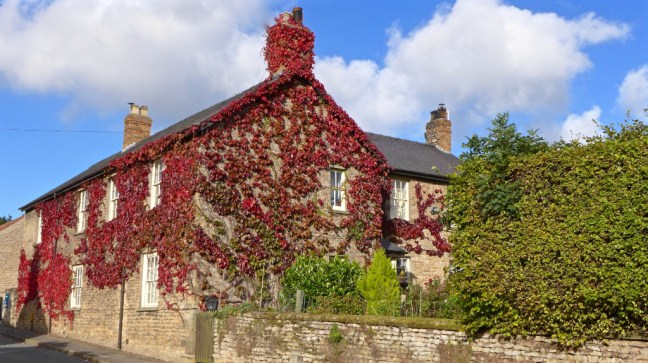
Yet more Autumn colours in Scawton,

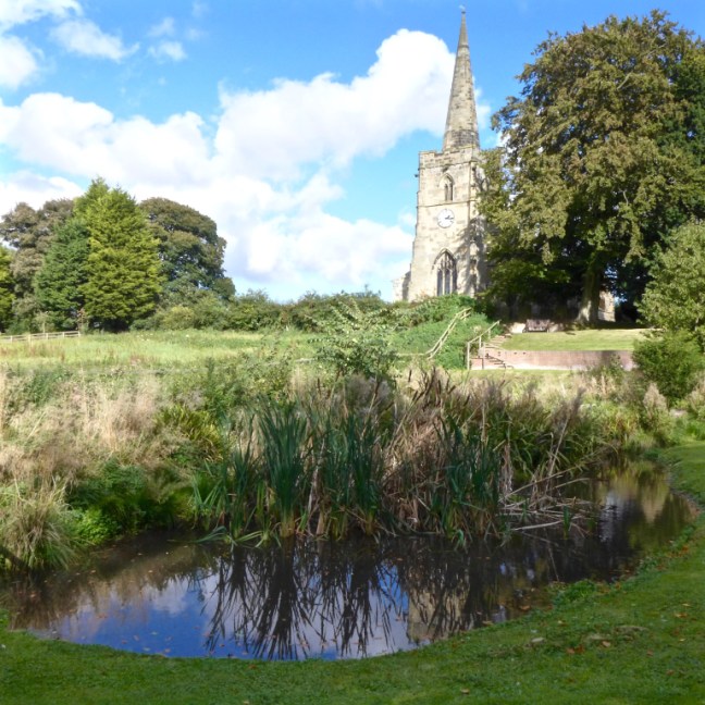
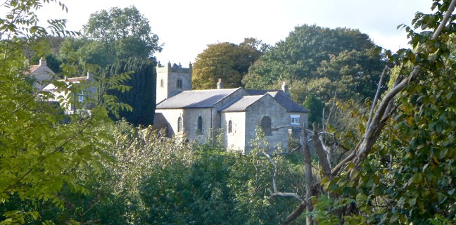
and memorials in Scawton Church.

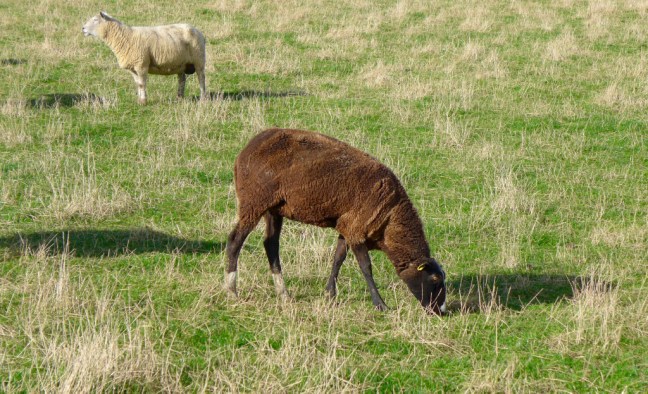
Leaving Scawton we came across some unusual sheep with white feet! p1040941

But more interesting were the vast numbers of cobwebs in fields and in the trees. Spiders stocking up for Winter?

p1040942

We arrived back at Cold Kirby tired but exhilarated by a varied and interesting walk. One of the best.

Mileage completed 13

Calories burnt 1,500

Average pace 19 minutes per mile. 

Steps taken 27,300

Fastest two mile split 18.36 minutes per mile at 2-4 miles stage. 

Photographs taken – Lots! 


En-route to my Final Resting Place.

Post 75: Day 12 – Helmsley Youth Hostel to Lastingham – 15½ miles      

We left the hostel at 9.30am in bright sunshine, which lifted our spirits considerably after the heavy rain of the previous day.

We stopped for coffee on a log near a clearing in the woods of Riccall Dale, frequently used by scouts for camping. Crossing the River Riccall near Hasty Bank Farm, we met a young lady who was digging out the track.

‘What are you doing?’ I asked, mystified by her actions.

‘During yesterday’s heavy rain the water ran straight down the track, then through the kitchen. I’m trying to divert the flow of the water.’

‘That’s rough,’ I said sympathetically, knowing how much rain had fallen on us the previous day.

We soon joined a tarmac lane leading past Low Farm, Middle farm and High Farm; needless to say we were ascending. Photograph of Canadian, Tara Corcoran, walking past High Farm in 2015 in high winds and heavy rain.

p1060173-1jpg

I was a little bit disappointed that we had not yet seen what I would regard as true North York Moors moorland. When we arrived at the Rollgate Bank Ordnance Survey column (also known as triangulation pillars or trig pillars), I was stunned by the three hundred and sixty degree view around me; the moors opened up their isolated and expansive beauty for the first time on the walk. We savoured the peace and fine open views. Unlike many trig points this one was surrounded by a fine carpet of grass and provided a perfect back-rest as we scanned the patchwork quilt of heather and fields before our eyes.

the-big-50_6780_edited-1

It was about this time that the Ordnance Survey announced that, due to the introduction of satellites, their 4,904 Ordnance Columns were redundant. Lengthy and passionate debates had raged as to what should happen to them. Should they be demolished and removed, be listed as of architectural interest, become memorials to the long-departed or just left as they are. To Alfred Wainwright and other enthusiastic hill-walkers trig pillars were more than concrete lumps on the tops of hills: they were visual poems, proud guardians of the landscape, which welcomed walkers and surveyors alike at the end of a gruelling climb. A wise Ordnance Survey employee decided that the trig pillars would be made available for adoption.

p1030232

Forget adopting children, adopt a trig pillar instead, far less noisy (no CD player continuously emitting sounds of Oasis or Verve), troublesome and expensive! All that is needed is a little bit of painting every few years with a fantastic view!

p1030233

Penny, also Canadian, who helped me paint the trig point on a cold February day and is now there forever and forever young.. sadly missed.

penny-painting-davids-trig

I had to adopt this particular trig pillar at Rollgate Bank and I decided there and then I will have my ashes scattered there. My application to the Ordnance Survey was successful, although I didn’t seem to get the character assessments, family inquisitions and screening that occurs with a child adoption. However, it was not until 21 January 1997, on my forty-fifth birthday, after paying £10 to the Land Registry to identify the landowner, that I finally received permission from the landowner to have access to maintain my adopted trig point. I now have to keep an eye on the pillar and paint it from time to time. I was very lucky to have been accepted for adoption as, due to excessive demand, waiting lists were closed quite quickly, the country being full of sentimental eccentrics like myself. The Ordnance Survey kindly issued detailed notes on the construction of my pillar and how to maintain it.

A gentle descent into Sleightholme Dale was soon followed by pleasant walking over Harland Moor, then a steep descent to Dale End Bridge and Lower Farndale, famous in spring for its daffodils.

p1020828

p1020923
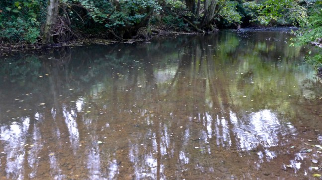
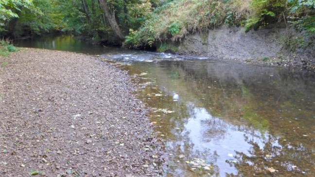
The River Dove was followed to pass by the peaceful Lowna Burial Ground, which forms the Quaker burial ground where 114 Friends were buried between 1675 and 1837.

p1020920

p1020919

p1020921

We continued past the many sheep to Lowna Bridge, renowned for being visited by the ghost of Sarkless Kitty. We spent at least fifteen minutes waiting for Kitty to appear, but with no success.

p1010010_edited-1

p1020918

After a climb, the picturesque village of Hutton-le-Hole was reached.

Here there was the most welcome Crown Inn, well-stocked ice-cream shops and a number of gift shops; all characteristic of a tourist honeypot. Dan insisted on holding up the queue as he tried to decide which flavours to have in his double cone ice-cream. He interrogated the poor girl behind the counter in great detail as to the content and flavour of the multitude of varieties on sale; she must have been glad to see the back of us.

Hutton-le-Hole appears as Hoton in the great Domesday survey of 1085/86, thereafter undergoing several name changes from Hege-Hoton, Hoton under Heg and Newton, to Hutton-in-the-Hole by the 17th century; the present form dates from only the 19th century.

Alongside the strong craft tradition in the area, in particular spinning and weaving, other industries such as tanning and milling, lime-burning, and coal mining have left their marks and two centuries ago the village would have seemed a very different place from the quiet and well-manicured spot admired by visitors today.

However, of most interest was the Ryedale Folk Museum ,which won the 1995 National Heritage Museum of the Year award. The museum, spread over 2½ acres of land, contains a reconstructed hamlet of workshops, thatched cottages and a thatched manor house. There are also barns, mills, a medieval glass kiln, an early photographer’s studio and wagon sheds. The museum has a number of special craft demonstration days each year. The Museum also runs an annual Merrills contest, this is an ancient, skilled board game that has been played regularly in the area and is now, in fact, increasing in popularity.

After a steep climb out of the village, we admired a super view back towards my adopted trig point

We reached Victoria Cross, which was erected in 1897 to commemorate Queen Victoria’s Jubilee and the opening of the road up Lidsty Hill on which the cross now stands.

the-crosses-walk_0082_edited-1

The view towards Lastingham is particularly stunning in late summer when the heather is out.

the-crosses-walk_0081

Lastingham was chosen as a site for a monastery by St Cedd in 654, but it was destroyed by the Danes about two hundred years later. In 1078 some monks from Whitby re-founded the abbey but after ten years moved on to York where they founded St Mary’s Abbey. The present church has a remarkable crypt, which is probably still as it was nearly 1,000 years ago. It is reached down a stairway inside the church and is unique in England in having a nave and side aisles. It is believed to have been used at one time for cockfighting. I particularly enjoyed sitting in the crypt on my own and listening to the silence and sense of history of such a place.

n-moors-august-2007-025

Dan was clearly feeling really hungry and, as a thank you for dragging him on this walk, offered to treat me to a meal in the restaurant. During the meal, we met a family from the Midlands, who had chosen Lastingham as their eventual retirement home. The evening turned into a very sociable and enjoyable occasion, not finishing until the early hours of the morning.

Wet, Wet, Wet,The White Horse, A Nuclear Explosion?

Post 74:  9 April 1993: Day 11 – Thirsk to Helmsley Youth Hostel – 19 miles

On this day the North York Moors were reached of which St. Aelred, the 12th-century abbot of Rievaulx Abbey, wrote: ‘Everywhere peace, everywhere serenity and a marvellous freedom from the tumult of the world.’

This is still the case as we hurtle towards the millennium and it is re-assuring that considerable efforts are being made to preserve the National Parks. The North York Moors National Park was formed in 1952, a good year as it is also the year I was born.

I was very excited at the propect of getting onto my ‘home’ heather moorland. 70% of the world’s heather moorland is here in the UK. A sheep can walk 25 miles without leaving the heather. Two-thirds of the National Park is not moors at all, but is forest, agricultural and dales. There are 1400 miles of rights of way to walk on. It is an incredibly expansive landscape.

Our Yorkshire landlady provided us with a huge cooked English breakfast, including black pudding. She then prepared an enormous packed lunch, but didn’t know what to charge. When we said other bed and breakfasts had charged £2.50 to £3.00 she wondered if this was too much. Yorkshire hospitality is difficult to beat.

We left the hostel at 9.30am in heavy rain (most of the photographs were taken later), which increased in intensity as the morning went on. Just beyond Grizzle Field House Farm, near Felixkirk I was delighted to find two brand new stiles, which had been erected following my request to the Footpaths Officer of the Local Authority. They were so clean it looked as though we were the first to put feet on them. I was over the moon to have persuaded the Local Authority to arrange for the erection of two stiles, without having to have call the heavy brigade in, the Rambler’s Association.

Arriving at the village of Felixkirk, we sheltered from the incessant rain in the porch of the Norman church of St Felix, as we drank a warming cup of coffee from our flasks.

After a steep ascent, the Cleveland Way was joined and followed, in reverse to its usual direction. Any Cleveland Way walkers met are on the first day of their walk, having started at Helmsley earlier in the day. Their walk, at 108 miles, is approximately half the distance of The North of England Way and takes a wide northerly sweep through the North York Moors, eventually finishing south of Scarborough at Filey. Each year, some three hundred and five thousand walkers use the Cleveland Way.

Continuing on our route, the magnificent viewpoints at Sutton Bank and near the White Horse of Kilburn are shortly reached. The late James Herriot in his book James Herriot’s Yorkshire said the view from Sutton Bank, ‘is the finest view in England.’

The pictures were taken at Sutton Bank in 2015 when Canadian, Tara Corcoran, completed my coast to coast solo. The weather was a bit kinder then. Gormire Lake is in the background.

p1060155

david-and-tara-jpg2

It might be the finest view in England in good weather, but with the rain was coming down in sheets and I couldn’t even see the end of my nose. We decided to head for the Sutton Bank Information Centre, which is well worth a visit since it provides information about the North York Moors, and, after the 700-ft ascent from Thirsk, has a café providing much needed refreshments. We succeeded in flooding it as water poured off our waterproofs onto the floor. Four years later, a new one replaced it, presumably because of wet rot. We spent all our time apologising to the waitress for the mess, but she didn’t seem to mind as we were the only customers; no one else was mad enough to be out in such appalling weather.

Leaving the information centre we continued along the escarpment past the gliding club to the White Horse. It was impossible to take photographs and these were taken at a later date in Winter:

mosaic-walk_0724

mosaic-walk_0723

The White Horse.

mosaic-walk_0710_edited-1

The horse was carved out of the hillside in 1857 by John Hodgson, the village schoolmaster, with some thirty helpers. It is 314ft x 228ft. The underlying rock of the White Horse of Uffington in the south of England is chalk, but here it is limestone and the horse requires regular maintenance to keep its white coat. On a clear day York Minster can be seen to the south. When I take my dog for a walk in the morning, I can often see the White Horse some forty miles away.

It is not surprising that the plateau was the scene of large bonfires in 1977 to celebrate the Silver Jubilee of The Queen’s accession to the throne, in 1988 to celebrate the 400th anniversary of the defeat of the Spanish Armada and in 1995 for the 40th anniversary of VE Day.

It was near here that the Battle of Byland was fought in 1322, when Edward II whilst resting after an abortive raid into Scotland was overtaken by the pursuing Scots. The English forces were defending the top of the escarpment but were eventually outflanked and had to retreat to York.

Shortly after leaving the escarpment, we followed the Cleveland Way through Cold Kirby to descend into delightful Nettle Dale. We then visited he magnificent ruins of Rievaulx Abbey.

rievaulx-abbey-1
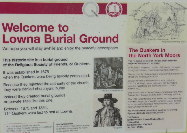
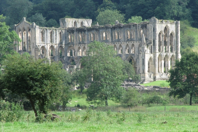
The Cistercian Abbey was founded by Walter L’Espec in 1132. Its importance can be judged by the fact that thirty-five years after it was founded there were 140 monks, 249 lay brothers and 260 hired laymen, a large community. The Abbey nestles in a tree-covered valley whose narrowness accounts for the fact that the church is aligned from north to south instead of from the usual east to west. The monks created great wealth, from sheep farming (at one time they owned 14,000 sheep), iron working, fishing and salt production on the coast. Canals were used for floating blocks of stone on rafts from the River Rye to the Abbey for carving. Around the time of the Dissolution, however, the abbey declined and fell into debt and by 1536 only twenty-two monks remained. After 400 years of life, the site was eventually stripped for building stone and, in due course passed to the Duncombe family. It was acquired by the state in 1918, and is now superbly looked after by English Heritage.

p1030236
At the Abbey with my children, Sophie and Alastair and dog Dovey in the 1980s. With hair

Leaving the Abbey, we passed through Blackdale Howl Wood, slipping and sliding on the muddy ground. Some mountain bikers skidded to a halt alongside us, covered from head to toe in mud, but clearly enjoying themselves. We were not the only mad fools out that day. Indeed, when we eventually arrived at the town of Helmsley there were hoards of bicycles parked outside the youth hostel. Bank Holidays are guaranteed to get the cyclists out.

Helmsley lies under the southern edge of the North York Moors and is a typical small market town, with a large market place surrounded by old inns and interesting shops. Its ruined castle stands high on a mound overlooking the town.

miscmarch-09-010_edited-1
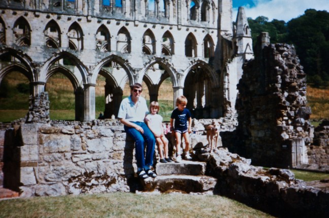
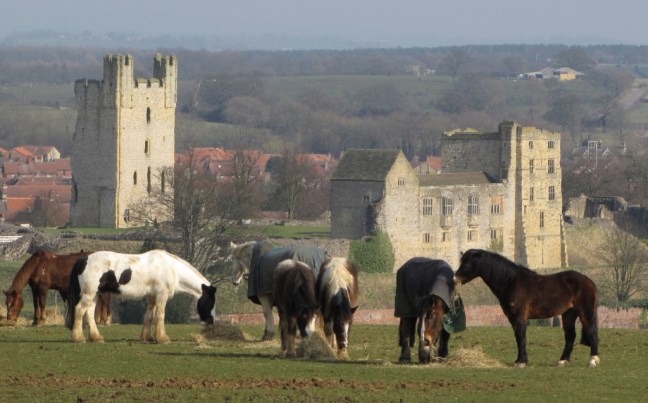
It was built in about 1200 and was later besieged by Parliamentary forces after the battle of Marston Moor and the fall of York during the Civil War. The castle was finally surrendered on 22 November 1644 after a three-month siege. Between 1646 and 1647 the castle was made unfit for war with parts of the keep and the walls being destroyed. It is now in the hands of English Heritage.

To emphasise why I prefer my holidays on the ‘trail’ in places such as Helmsley rather than a large town or city, a few statistics may prove useful. One can compare crime figures say in Helmsley, Colchester and Albuquerque, New Mexico. In 1997, Helmsley had three assaults, three indecent assaults, twenty-two burglaries of buildings which were not houses (a number of these were sheds and garages), one aggravated taking of a vehicle, two thefts from a dwelling, three stolen pedal cycles, seventeen thefts from parked cars, six recorded shoplifting incidents, six stolen cars, four cases of fraud, one case of handling stolen goods, and ten cases of criminal damage. The average crime per year in Colchester is one murder, eight stolen cars a week, more than one thousand two hundred thefts from vehicles, four hundred and thirty one bicycle thefts, thirteen rapes, five hundred and seventy assaults, one thousand six hundred and eighty-seven criminal damage offences and eight hundred and ninety nine shoplifting offences. In 1996, crime in Albuquerque was seventy-two murders, seven thousand one hundred and twenty stolen cars, one thousand five hundred and twenty reported rapes, three thousand one hundred and twenty eight assaults, twenty-three thousand six hundred and sixty eight thefts and robberies, one hundred and sixteen arson cases, three hundred and fifty eight kidnappings and one thousand seven hundred and thirty-two complaints of intimidation. It has been said that Helmsley is one of those towns that makes you feel you don’t want to be anywhere else in the world.

During our evening meal at the hostel, a group of youngsters on an outdoor course kindly waited on us, probably noticing that these two ‘old’ men were feeling a little tired after a full day’s walking in heavy rain. They then played us at chess, before the ‘old fogeys’ headed for the pubs of Helmsley for the daily dose of ‘medicinal’ Guinness. Returning from the pub we found that we were in a dormitory with a group of seventy-year old cyclists. The older people get the more they seem to snore and this group succeeded in performing a symphony of snoring. It is at times like this that you wish you were back home. One group of walkers once told me that you should click your fingers loudly to stop people snoring; it seems to work with all but seventy-year old cyclists, who were unlikely to wake up unless there was a nuclear explosion.

Who Influenced My Decision To Walk 50 Long-distance Walks

Post 73: 18th October 2016

As I have now started my 50th long-distance walk, it seems appropriate to reflect on who encouraged or influenced me in my decision to set myself the target of 50 long-distance walks by the time I was 85. This target was set around the millennium after having done 10 long-distance walks in 10 years. So projecting forward it seemed a reasonable target. I have since had more time to increase the annual walks such that I am likely, all being well, to finish 20 years ahead of schedule. I also went to the excellent Alfred Wainwright Exhibition in Keswick over the weekend and this led to thoughts about his influence on not just me but generations of walkers since.

My father was a great influence as he walked in the Lake District in the pre-Alfred Wainwright years. It also appears that he fished too but I don’t remember that.

pict0002

That is before Wainwright starting writing his magnificent pictorial guide books on 9 November 1952, 11 months after I was born. The series of pictorial guide books that followed, one every two years, opened up the Lake District and fells for many more people including myself.

p1040846

My father then started to acquire Wainwright’s guide books and  I have since been fortunate to be able to use them. Their detail and accuracy is second to none.

p1040768

However, it was Wainwright who with A Coast to CoasWalk captured my imagination for long-distance walking. Seeing the TV series with Eric Robson and this elderly gentleman with a pipe made me think if he could walk coast to coast then a much younger me certainly could.

p1040844

He didn’t of course walk it in one go with a pack on his back but that doesn’t detract from the genius of Wainwright who devised whole new systems of looking at the countryside, mapping it and recording it.

One of my most exciting moments was when I was able to include the view from Orrest Head in my own coast to coast guide book as it was where Wainwright’s life changed.

p1040765

Another interesting time was reading his book A Pennine Journey, which had laid in a drawer forgotten until 1986. A purely descriptive record of a walk he completed in 1938 I decided to work out his route and write a guide to it. The outcome will be described later in my diaries.

p1040847

p1040771

It is sufficient to say at this stage that I received an acknowledgement in a book A Pennine Journey, published by the Wainwright Society in 2010. I was its 40th member and now there are well over 1,000 members, a testament to Wainwright’s enduring influence.

p1040845

Further information is available at the Wainwright exhibition in Keswick Museum until January 2017. 

p1040766

The equipment he took with him on walks

p1040762

His early life.

p1040763

His interests and leisure pursuits. p1040764

The plates that were used to print his books.

p1040769

Like for many other walkers and followers, Alfred Wainwright influenced and changed my life for the better……………………….


Cleveland Circles walk 2, a Shoot, Brown Sheep and Ghosts.

Post 72: 17 October 2016

It was good to get back on the ‘home’ ground to continue my 50th long-distance walk, with a prospect of reasonable weather.

We parked at Cold Kirby at 8.50am and noticed a bit of a chill in the air. Cold Kirby doesn’t have the Cold included in its name for no reason.

After passing through Murton Grange Farm, expansive views emerged through the trees.

p1040821

Gowerdale House sat lonely in the valley below us.

p1040823

Whilst Hawnby Hill could be seen in the far distance.

p1040824p1040825

Soon after our ‘banana’ break a sign on a gate post had an uncanny resemblance to me! We were not sure what or really who it was meant to represent.

p1040827

We arrived at Old Byland and judging by the washing out it was Monday washday. After lunch in the village square, we dropped very deeply on a slippy muddy path to Low Gill where these delightful fungi struggled for light.

Our walk came to a halt as a pheasant shoot lay across our path. Deciding not to risk being shot we waited 20 minutes for the shoot to take place before they all packed up to go for lunch. The dogs below enjoyed retrieving the pheasants.  p1040834

We continued to Rievaulx Bridge.

p1040835

Before arriving at another locality used for shoots. It can cost about £900 to go on a shoot. It seems a lot of money and I couldn’t really see the attraction of it.

p1040840

We ascended towards Cold Kirby, passing unusual brown sheep.

p1040841

To arrive back at Cold Kirby at about 3.00pm. St Michael’s Church dates to about 1841 and replaced the original building of the 12th century. The font is 12th century and the bells date from the 13th century.

The ghost of a Byland monk and priest of the church, James Bankerly, caused such concern that his body was exhumed and carried to Gormire Lake, where it was thrown in with his coffin.

p1040843

Mileage completed 13.6 

Calories burnt 1,440

Average speed 18.33 minutes per mile

Best 2 mile split 18.28 minutes per mile. 


21 Miles to Walk, Crossing of the A1 and East Coast Railway line, James Herriot the World’s most Famous Vet, Our Editor, the Air Raid Shelter

Post 71: 8 April 1993: Day 10 – Ellingstring Youth Hostel to Thirsk – 21 miles

We left Ellingstring Youth Hostel at 9.15am. At first my knee was a little sore, but after a slow start it gradually eased. On a long-distance walk there is always one day you are not looking forward and this was it. I had desperately tried to find a satisfactory route across the Vale of York to Thirsk, a route which did not involve too much road walking but many of my efforts were thwarted. My aim was to combine safe crossing-places of the A1, the River Swale and the main east coast railway line with good footpaths, but the options are few.

‘Aren’t you being a bit wimpish?’ my Editor Jenny Dereham (I was in good company as she was also editor to Alfred Wainwright, James Herriot, Dick Francis and Gervaise Phinn) said. ‘Couldn’t you cross the A1 and East Coast railway line without bridges?’ Fortunately, she seemed to accept I couldn’t swim the River Swale with a 30lb pack on.

‘I wouldn’t sleep at night worrying about my readers being run over by cars or trains.’ I pleaded. ‘When originally checking the route it took me ten minutes to get to the central reservation of the A1 and ten minutes to get off it. It was terrifying; with a 30lb pack you can’t outrun cars and lorries travelling at 80-90mph.’

‘Well, what about crossing the railway line? Your revised route over the bridge involves a lot more road walking,’ she replied, not easily persuaded.

‘On originally checking the route, I did once cross the railway line on the public right of way. It was four tracks wide and I later found out that it is the fastest section of the East Coast line. Inter-City 125s hurtle along at over 100mph, you can hardly see them coming let alone outrun them.’

Eventually my Editor was persuaded I had done all I could, barring spilling blood; although my crossings have bridges to make the walk as safe as possible, inevitably this has added to the ‘tarmac’ mileage. It is best to use trainers to walk across the tarmac sections, much better than walking boots with stiff soles. Following my request, it is possible a bridleway bridge may be built over the A1 near Middleton Quernow, but due to the usual financial constraints it may be some way off yet. In the meantime, I took advantage of the many grass verges along the lanes and wore a pair of trainers; I found these eased the foot pounding.

To add to the days hardships I had to skip between Ordnance Survey maps almost continuously. Although the day was the unavoidable link between the Yorkshire Dales and North York Moors National Parks, there were some attractions on the way, not least the town of Masham, which is reached after pleasant walking along the River Ure.

This is a medieval market town and St Mary’s church dates from the mid-12th century. An important survival from the Anglo-Saxon period is the lower portion of a round-shafted cross of sandstone in the churchyard near the porch. It has been dated to the early 9th century. The bands contain figurative scenes and animal ornamentation. A series of Old Testament scenes has been identified in the highest complete band.

Masham is noted for Theakston ales, which have been brewed in the town for over 165 years. Walkers can refresh themselves at the visitor centre, and discover how a small brewery continues to produce traditional cask Yorkshire ale; there are displays of old tools, pub games and a brewery shop and tours of the brewery are available. For some coast to coasters their ‘Paradise’ may simply be the ‘Black Bull in Paradise’ at the Theakston Brewery visitors’ centre. In 1992 a new brewery was established, the Black Sheep Brewery, and a visitor centre opened; there are tours. It is likely that many coast to coasters never get beyond Masham and live there happily ever after.

As dedicated walkers we re-joined the tarmac lanes and the foot pounding continued until arrival at Thirsk, our feet so hot we could fry an egg on them. Our bed and breakfast happened to be in the oldest house in Thirsk, built in the 1820’s, with wattle walls (interlaced rods and twigs). The landlord was very informative on the life and times of James Herriot.

Thirsk is a market town, boasting one of the most popular racecourses in the north. The grandstand was opened in 1854 and it hosts eight to ten flat race meetings each year.

p1040695

p1040696

In the Market Place is what is known as the Bull Ring, which is marked out in cobbles (update – I recently tried to find this but in my limited time didn’t locate it) . This is where bulls were baited by dogs before going to slaughter, a nasty sport which took place even as late as 1750. The buses now stand there. The Three Tuns used to be a bustling coaching inn with extensive stabling at the rear, some of which remains.

p1040694
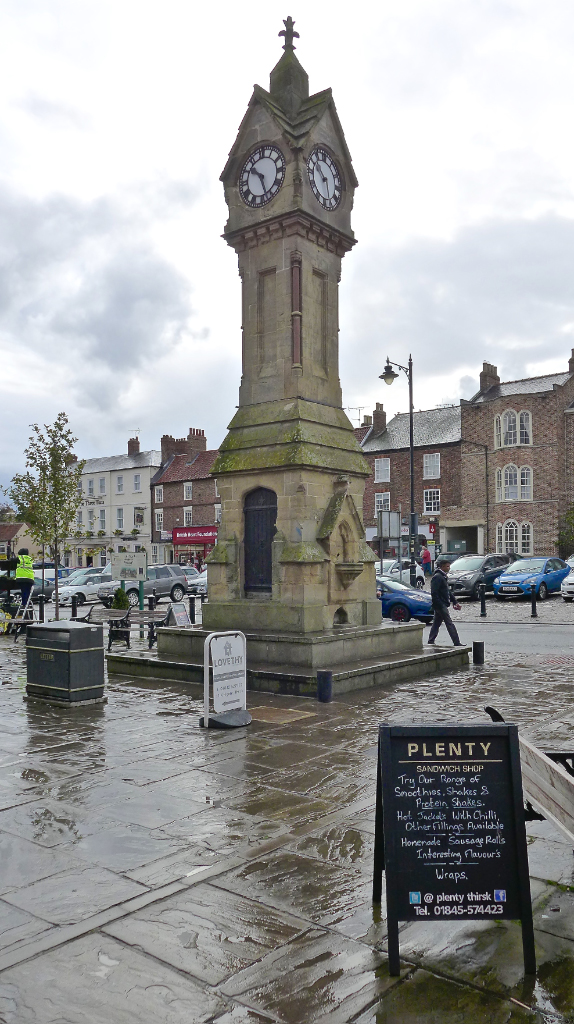
The stagecoach trade provided employment for large numbers of townsfolk until the coming of the railway. Now tourists provide a lot of employment.

p1040693

Pevsner reckoned that St Mary’s church, built in the Perpendicular style in the 15th century, is without question the most spectacular perpendicular church in North Yorkshire, so it is well worth a visit.

p1040728

The real James Herriot, James Alfred Wight, the World’s most famous vet practised in Thirsk

p1040700


p1040701

At the time of writing, plans are afoot for the building to become a museum (update – now open); the practice has moved elsewhere to more peaceful surroundings.

In the Visit England Awards for Excellence 2015 the museum was voted the ‘BEST IN ENGLAND’ small visitor attraction.

The web-site is at: http://www.worldofjamesherriot.com

These are my own recent pictures:

p1040697

The house is immaculately as it was in James Herriot’s lifetime.

p1040704

Including the Air Raid Shelter:

p1040706


For a tour of the other rooms see the slideshow:

This slideshow requires JavaScript.

For some other parts of the museum see the next slideshow:

This slideshow requires JavaScript.

There is also a farrier’s workshop, TV studio, statue of Alf Wight, restored vintage car of Alfs time, model Grand Central Station and other areas for children which I haven’t included.

James Herriot left £5 million in his will so certainly sold a lot of books.

You may recall that Gary was seriously ill after drinking water out of streams in the Yorkshire Dales. Well apparently James Herriot, when on his rounds, used to drink water out of streams at lunchtime to compliment his Wensleydale cheese and digestive biscuits. My theory, although I have no scientific evidence to prove it, is that the cheese acted as a water steriliser and purifier.

In the evening we went in search of food. In my case this usually means finding the first place that sells reasonably priced good food, be it fish and chips or a pub meal. For Dan this means a revue of every menu in town, inspecting the curtains of every pub, restaurant, and fish and chip shop, wiping your fingers on every window sill to quantify the amount of dirt, looking through every window to ascertain cleanliness, and checking for flacking paint on doors. On one occasion, Dan got so excited at the look of a pub he marched in with his muddy boots on, then across a carpet that looked as though it had never seen the sole of a shoe.

‘Oh we don’t usually have your sort in here,’ the owner said in a condescending accent that ensured we didn’t stay.

If the pub or restaurant passes every one of the various ‘Egon Ronay’ tests and the owner seems alright, Dan might then agree to go in and stay for a meal, or he might say, ‘Lets just look down this street. There might be a better one down here.’

After having already walked 21 miles, I was convinced that evening we walked another 10 miles, until we eventually settled for a meal in the Three Tuns Inn.

THE BIG 50!

Post 70: 11 October 2016

Around the beginning of the Millennium 2000, after I had completed 10 long-distance walks after 10 years of walking, I suddenly had the mad idea to set myself a target of 50 long distance walks by the time I was 85.

Having completed 1 long distance walk a year, it seemed a reasonable target. However, at that time, I was employed full time and had not anticipated the free time I would have later in life as the children departed to University and retirement came along.

So here I was today to embark on my 50th long-distance walk, 20 years ahead of schedule! This walk should take between 6 and 9 months to do.

In 2001, I completed the 108 mile National Trail the Cleveland Way, making up circular routes to complete it. In 2006 John Eckersley wrote a guide dividing the Cleveland Way into 30 separate, self contained but interlinked shorter day walks much in the mode in which I had completed the Cleveland Way. It is called Cleveland Circles. 

It is an admirable book and all profits go to Christian Aid and so I would urge you to buy a copy. His web-site is at:

Home

I thoroughly enjoyed walking the Cleveland Way in 1991 and the Cleveland Circles seem to offer a fitting finale to reach my big 50 target.

Some folks often say I seem to be walking round in circles in my life!

The Cleveland Way and Circles officially start in Helmsley Market Square at the Old Cross. Steve and myself at the Cross.

Here is Steve and myself at the first sign, a stone with an acorn sculpture on it, of the Cleveland Way with 319 miles of circles to look forward to………..

Life does come full circle as I remember a special Canadian lady, Penny,  who was also photographed at the sign of the the Cleveland Way some years back and sadly passed at a much too young an age. I have never met anyone else who had such a love of life and the Great Outdoors. She was an inspiration to whoever she met. Her last days were spent in Australia and it was she who insisted, from Australia, that I join Facebook so we could share photographs of the Great Outdoors. Without her I doubt my blog would now being read in nearly 100 countries. She was a true international person who travelled widely and lived life each day to the full. It is something I now try to do.

penny-at-helmsley

Her Australian husband Gordon and daughter Georgia came to the same spot after her passing.

helmsley-2

Leaving Hemsley we looked back to its castle.

p1040649

The magnificent Rievaulx Abbey soon came into view.

p1040650

We stopped at a very special place for Penny, myself and her family by the River Rye.

p1040660

As Alfred Wainwright said:

‘The fleeting hour of those who love the hills is quickly spent, but the hills are eternal. Always there will be the lonely ridge, the dancing beck, the silent forest; always there will be the exhilaration of the summits. These are for the seeking, and those who seek and find will be blessed both in mind and body’

Penny was so blessed….

She will never be forgotten.

p1040659

Rievaulx Abbey, which is on my North of England route and described in my book On Foot from Coast to Coast: The North of England Way (life coming full circle again), was founded by Walter l’Espec in 1132. Its importance is judged by the fact that thirty-five years after it was founded there were 140 monks, 249 lay brothers and 260 hired laymen, a large community.

p1040662

The Abbey nestles in a tree-covered valley whose narrowness accounts for the fact that the church is aligned from north to south instead of from the usual east to west.

p1040666

The monks created great wealth from sheep farming (at one time they owned 14,000 sheep), iron working, fishing and salt production on the coast. Canals were used for floating blocks of stone on rafts from the River Rye to the Abbey for carving. Around the time of the Dissolution, however, the abbey declined and fell into debt and by 1536 only twenty-two monks remained. After 400 years of life, the site was eventually stripped for building stone and, in due course, passed to the Duncombe family. It was acquired by the state in 1918, and is now superbly looked after by English Heritage.

Afte a ‘banana break’ near the Abbey we walked into the village and were confronted by a practice that has gone on for years; a person who shoes horses. This has little changed from the time of the monks, other than it is now a mobile farrier with a van.

p1040667p1040671

There were two magnificent horses to be shoed.

p1040668

There was plenty of steam and the farrier described it as a smelly job.

A roof in the village was little changed too, being traditional thatched.

p1040680

The church added to the feeling that this place and valley is timeless.

p1040681

We began ascending a track with great retrospective views of the valley and identified it as a spot to return in a couple of weeks for the autumn colours. This was a new route for me. p1040684

After a short road section, we arrived at Oscar Park Farm. Spot the black pig!

p1040688

Before heading east towards Collier Hag Wood. To put it mildly the path was difficult to follow at first but later the trees were marked with paint spots to aid navigation.

p1040689

Then heather and trees made the path fairly indistinct. It is amazing that such public rights of way exist and can still be followed.

p1040690

We descended into dark woodland.

p1040691

To reach a desolate enclosed valley.

p1040692

After a steep ascent out of the valley and encountering a shooting party, we followed a track along Beck Dale for a few miles to arrive back at Helmsley. A very varied and enjoyable walk with some special memories.

11 miles completed. Only 308 still to go. 

Average pace 18.26 minutes per mile

Calories burnt 12,000

Steps taken 22,400

Fastest 2 mile split 20.21 minutes per mile (approx 3 mph) 

49th Long-distance Walk Completed!

Post 69: 6th October 2016

This was intended to be a relatively straightforward 11 mile walk to complete the Derwent Way. True to form with this walk unexpected obstacles were encountered. Only 2 other people were encountered on the whole walk.

We parked near Low North Park/Camp which, we found out from a local who was walking his dog there, used to be a military camp until the 1960s. It was used to accommodate persons from the Spanish Civil War. It was also used for the work shy from work houses. They were used to plant trees. Little information seems available on the internet to verify what he said.

A sign points out the dangers of leaving the rights of way, although there were no motor cycles out at just after 9.00am on a weekday.

p1040483

There are signs of infrastructure from the past e.g. house foundations and roads.

p1040482

Stopping for a banana break it was decided I should walk the plank.

p1040490

and take a dive.

p1040492

It was not long before we encountered some unexpected obstacles

p1040495

p1040494

We eventually found a way round them after much clambering and came across a historic site – a tumulus. I couldn’t help but wonder who was buried here? Walkers who never escaped the forest?

p1040497

We were surprised to meet a cyclist who was on the Moor to Coast cycle route. We met no one else after this.

p1040498

At last we left the confines of the forest

p1040500

and reached the source of the River Derwent

p1040511

p1040502

It seems incredible that this river that has flooded towns and much land downstream, before entering the River Ouse, starts as almost  little pond.  Then a slightly bigger pond.

p1040513

p1040512

We carried onto Lilla Cross the end of the walk. Lilla is recorded by Bede as one of King Edwin of Northumbria’s officers of court. In AD 626 he saved the king from an assassin by taking the fatal blow himself. It is not known why Lilla’s body was carried miles to be buried in this bronze age barrow. In the 1920s some Anglian jewellery was found but dated some 300 years later than Lilla.

p1040514

After lunch and celebratory photographs at the cross it was time to move on as cloud decreased the temperature.

p1040522

It is rumoured that Yorkshire heather is more comfortable than Premier Inn beds.

the-river-derwent_5103

p1040515

Something I had never seen before are these new flood defences designed to slow up the flow of water to the lowlands. Basically bundles of twigs and heather – is this the Government’s high expenditure on flood defences?

p1040524

We finally descended off the moors to agricultural land

p1040527

and the local residents

p1040529

Time for celebration.

p1040530

p1040534

11 miles walked

966 calories burnt

23,154 steps

Would I recommend the Derwent Way as a walk to do?

Yes if you want to avoid other walkers. There are every few on much of the route and it is little walked.

Yes if you want to follow a river from its source to its end.

No if you don’t like walking through overgrown paths and paths that are not maintained e.g. fallen trees removed.

No as it is very prone to flooding for much of the year.

No as there is much rather tedious road walking – one section was 5 miles long.

I will not be doing this walk again!!!

There are so many better ones.

Bring on my 50th Long-distance Walk; either

The 319 mile Cleveland Circles

or

The Pembrokeshire Coast Path,  if  I walk a further 3 miles on it on my next trip there in September 2017.


Half-way, 100 miles completed, Mary Queen of Scots, The Plague, Hypothermia.

Post 68: 7 April 1993: Day 9 – Aysgarth Falls Youth Hostel to Ellingstring Youth Hostel- 16 miles

It was another late departure at 10.00am, caused by Dan having to apply ‘Compeed’ to his blisters. In addition, he had pulled a muscle, which was causing him a few problems. I felt great as, near Hollins House Farm, I passed the 100-mile half-way mark.

Our first stop of the day was at Bolton Castle, erected by the first Lord Scrope, Chancellor of England, in 1379, more as a fortified manor house with the needs of comfort predominating over those of defence. Designed with a huge four-storey tower some hundred feet high at each corner, four ranges of living quarters enclosing a courtyard and turrets in the middle of each of the two longer sides, it took eighteen years to complete. The antiquary Leland, writing in about 1546, asserted that it cost £12,000 to build, a sum equivalent to around £1.5 million today.

From July 1568 until January 1569 Mary, Queen of Scots was imprisoned at Bolton, apparently in some degree of comfort since about twenty servants were billeted in the village. The castle was garrisoned for the Royalists during the Civil War, besieged by the Parliamentary forces in 1645 and eventually surrendered. Two years later it was partially dismantled and in 1761 the northeast tower, weakened a century earlier, fell during a great storm. The other three towers survive almost to their original height. Owned by Lord Bolton, the castle has a museum of local history exhibits, and an excellent tearoom. It has been considerably restored in recent years, with grant aid from English Heritage. Dan decided torest in the tearoom, whilst I toured the castle, taking photographs, admiring the figurines of Mary Queen of Scots, monks and other characters of the past and the somewhat basic toilets of days gone by. The latter being holes in the floor dropping down to a void outside the castle walls. Any invaders would have received a nasty surprise if someone was on the toilet.

Near Redmire I had to jump across a stream and in doing so jarred my knee; I needed to be more careful. The pain eased off as we approached Wensley, where we rested for lunch on a circular seat rapped around a tree. Wensley is a small village of 19th-century estate houses set round a neat green. On the hillsides above the village cattle and sheep predominate, whilst below are the first arable fields in the dale. For a century after 1202, when it received its charter, Wensley had the only market in the dale and this continued to function until the 16th century, although on a decreasing scale as other markets were established.

As the parish register notes Plague struck Wensley in 1563: ‘This year nothing set down.’ Some surviving villagers fled to higher ground at Leyburn. The fortunes of Wensley were revived when Bolton Hall was built.

Wensley’s church of the Holy Trinity is one of the finest in the Dales. Much of it dates from around 1300, but the tower was rebuilt in 1719. The interior is rich in furnishings and of particular interest are the traces of an early 14th-century wall painting, the 17th-century box-pews, a reliquary, a poor box, a two-decker pulpit and stalls with poppy-heads. The Scrope family pew includes part of a fine wood screen, which probably came from Easby Abbey when it was dissolved in 1537, the abbey having been owned by the Scrope family. There is also a banner of the Loyal Dales Volunteers, which was raised against Napoleon. The church was the setting for the television marriage of James and Helen Herriot.

This was to be a day of visiting village and towns and we soon arrived at Middleham, an opportune moment to have an icecream. This is one of the norths great centres for racehorse training, a tradition going back two centuries. Beautiful horses on their way to the gallops outside the town are a common and delightful sight; it was tempting to ask if we could borrow one to rest our weary legs. The Swine Cross commemorates Richard’s 1479 ratification of the Market Charter given to the town a century earlier by Ralph Neville, Earl of Westmorland. A lane nearby leads to St Mary and St Alkelda’s church, dating mainly from the 13th and 14th centuries, and made a collegiate foundation by Richard in 1478. At some point during the last century, the writer Charles Kingsley was its canon. Kingsley House, the rectory next to the church, was built in 1752.

The first castle, its site marked by hawthorns, was built in the early Norman period. Its successor of 1170 passed into the hands of the Nevilles of Raby a century later but saw its great days during the War of the Roses. The castle remained Crown property until 1625, when it passed into private hands; it is now in the guardianship of English Heritage.

Descending from Middleham we reached and followed the River Cover to its confluence with the River Ure, the latter eventually leading to Jervaulx Abbey. This was a great Cistercian house, founded in 1156 and suppressed by Henry VIII in 1537. The abbey fell into ruins, but there is still sufficient remaining to remind the walker of the way of life of the Cistercian monks who built and occupied it. Little remains of the church, which is entered through the south-west door and was the focal point of the abbey. Other parts that can be seen include the cloister, the dining hall, two infirmaries and the abbot’s lodging. The dominant feature is an imposing wall of the dormitory, originally 180 feet long with a line of lancet windows. The abbey is set in lovely parkland with many trees and flowers, the daffodils and aubrietia being particularly attractive in spring.

However, with no roof the abbey was no place for us to stop for the night, therefore we continued on our route towards Ellingstring Youth Hostel. The last diversion of the day was to try one of the popular homemade Brymor icecreams from High Jervaulx Farm, just beyond Jervaulx Abbey. There are over forty different varieties made from the milk and cream of Guernsey cows and is a great refresher before the final ascent of the day to Ellingstring Youth Hostel.PICT0002

The hostel, with its log fires, homely lounge, and basic ‘drying room’ (consisting of a few clothes lines) captures the spirit of self-catered youth hostelling off the beaten track. It was very tempting to continue beyond the hostel to Masham, 5½ miles further on. This would have reduced the following day’s mileage of 21 miles and enabled us to take advantage of Masham’s range of fully catered accommodation – as well as the Theakston and Black Sheep Brewery visitor centres! However, our choice was to raid the hostel shop for food. I opted for tinned potatoes, tinned meat, tinned vegetables, followed by tinned rice pudding. Dan, maintaining the traditions of gourmet cooking, went for real potatoes and vegetables, which he spent ages peeling. He insisted I have some, despite my plate already being full; we nearly ended up having an argument. However, we spent a relaxing evening sitting in front of the log fire. On retiring to bed Dan, a fresh air fiend (what is wrong with my smelly socks?) opened the windows. At about 3.00am, I awoke shivering and suffering from hypothermia. Fortunately, no one else was in the dormitory, so I took duvets and blankets off the spare bunks, eventually getting warm and back to sleep under about five duvets and blankets.

Back to the Present, The Bus Walkers, the Jungle and the Penultimate 49th

Post 67: 4 October 2016 

Today was to be the penultimate walk of my 49th long-distance walk. I had started these long distance walks in 1990 and here 26 years later I was getting closer to my target of 50 walks by the time I was 85. I was well ahead of schedule!

This walk had the unusual attribute that we would use our bus passes to catch two buses to get to the start of todays walk where we had previously finished.

The car was left at Hutton Buscel and we then caught an East Yorkshire bus to The Seamer roundabout! p1040479

We then got the Coastliner bus from the roundabout to East Heslerton, not realising there were 3 bus stops along this small linear village. We got off at the first and had to walk an extra 1/4 mile to the start of our walk.

p1040453

All free with our bus passes.

We then walked in completely the opposite direction to where the car was. This seems a strange decision by the author of the Derwent Way. It was also peculiar as it took us away from the River Derwent, which we were supposed to be following. Even worse it meant climbing up steeply onto the Yorkshire Wolds. I think he tried to justify it for the views of and from the Wolds.

Looking back there was a fine view of East Heslerton Church.

p1040454

The car was parked near the horizon below the distant hills and we were going away from it!

p1040455

However, it did enable us to savour parts of the Wolds. Had it been a bad weather we would have been most unhappy.

We were now in David Hockney country, which is quite distinctive with rolling chalk hills, large skies, uninterrupted views, few trees apart from farms sheltered by woodlands,  and quiet lanes. Good cycling country.

p1040457

The weather and views were stunning.

p1040458

Sometimes paths cross in life and this was one such occasion. I had walked the 79 miles Wolds Way from Hull to Filey in 2002 and the 82 mile Centenary Way from York to Filey in 2004.

p1040459

We were now walking Eastwards, but not really getting much nearer to our destination.

p1040460

At about 1 o’clock we stopped for lunch on a log, with this view. A train could be viewed in the far distance heading to Scarborough.

p1040461

Once we started walking again the lovely views continued.

p1040463

Until we reached St Nicholas Church Garden of Reflections in the village of Ganton.

p1040466

A plaque commemorating Harry Vardon adorned a house. He was originally from Jersey and ended up living in Yorkshire as the Professional/Greenkeeper at Ganton Golf Club. He won the Open Championships a record six times and the 1900 U.S. Open. He was the first professional player to play in Knickerbockers. He died of pleurisy or possibly lung cancer at the age of 66.

p1040467

We were then able to cross the A64 and start heading in the direction of the car! We crossed the railway line to Scarborough.

p1040468

At long last we got back to the River Derwent, but it was looking a bit sad with lots of weeds blocking its flow.

p1040470

What followed was the hardest mile of walking Steve and myself had ever encountered through blocked paths. The path was non existent and completely overgrown with brambles, nettles , weeds and other vegetation. It was a jungle from which there was no escape as the farmers had barbed wire fencing either side. It was exhausting to walk through. Can you spot Wally?  – oops I meant Steve.

p1040471

When I at last saw a fence out of it onto the road I relaxed a touch and, getting caught up in the vegetation, took a tumble. No damage caused, other than to my pride.

Arriving at Wykeham there seemed to be some interesting walks, but we had no time left for them. However, we collected some conkers, the process of bending down for them stretching our now very stiff muscles.

p1040472

The ivy on buildings was resplendent

p1040473

p1040474

p1040475

After crossing the A170 there were some animals near a Caravan Park

p1040476

p1040477

At about 4.15pm we arrived back at Hutton Buscel, somewhat tired but delighted that we now only had one more walk towards completing my 49th long distance walk.

p1040481

Miles walked 14

Average Speed 18 minutes per mile. 

Calories Burnt 1,400

Steps 29,650