Scarbados,Winter Storms in April, the Route Blocked by Waves.

Post 140: 25 April 2017, Cleveland Circles 28

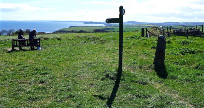
Due to various commitments we decided, at the last minute, in the morning to go to Scarbados (Scarborough) and walk what we thought would be an easy 9 miles around Scarborough (known also as Scarbados). So we left York at 11.00am instead of our usual 7.30am. We arrived at the car park near where the Holbeck Hall Hotel used to be until it fell into the sea. This should have been a hint of things to come as it was fairly breezy, it had just started raining and the sea was a bit rough. One of our destinations, Scarborough Castle, could just be seen in the distance.

P1060784

We donned waterproofs, including winter gear and over-trousers, and we were soon to find we were probably the only people adequately dressed for the conditions to come. Umbrellas were a no no in the wind.

P1060786

It wasn’t so bad walking inland through town and past Queen Victoria

P1060787

and past a memorial seat to soldiers.

P1060788

A steep climb then followed towards the church going past Butter Cross, a sole surviving medieval street stone.

P1060789

P1060790
St Mary’s Church

Near the church we found the gravestone of Anne Bronte who died at the very young age of 29 (not 28 as previously shown on the old gravestone).

P1060791P1060792

We passed Scarborough Castle to be hit be really strong winds, nearly getting blown over.

P1060793

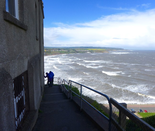
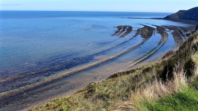
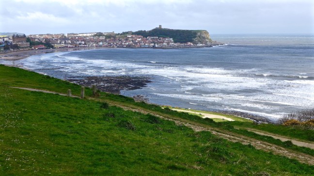
However, it was worth gaining height for the views towards North Bay.

P1060795

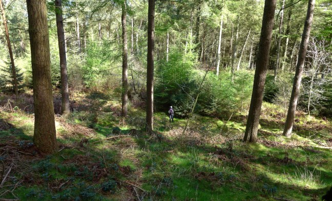
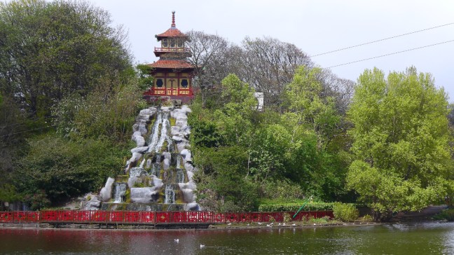
Some relief from wind was gained when we descended to Peasholme Park. This opened in 1912 and attractions include an atificial boating lake, mock naval battles and a putting green.

P1060797

A little further on towards the Sea-life Centre we passed the miniature railway line.

P1060804

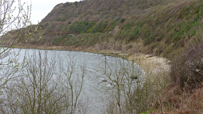
The headland is protected from the sea by gneiss rock from Norway. However, there was little to protect us from the heavy wintry showers, at times stinging hail, and high winds. We would soon pass below Scarborough Castle shown on the headland. William de Gross started to build the castle in 1140.

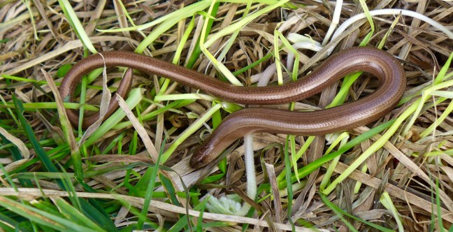
If you don’t keep moving you can end up like this poor chap.

IMG_1527

After heading around the headland we came to South Bay with its rather gawdy amusement arcades. We passed in front of the Spa which originated in 1626 when Mrs Tomyzin Farrer claimed that the local spring water had health giving properties. ‘Spaw House’ was built in 1698 by Dickie Dickinson.  It 1826 the ‘Spaw’ became the Spa. It has been improved and made more secure against the sea over the years.

Moving on quickly we suddenly realised our route back to the car park was blocked by the sea.

Sid the Yorkshireman said ‘we could run through between the waves’. I think he was joking!

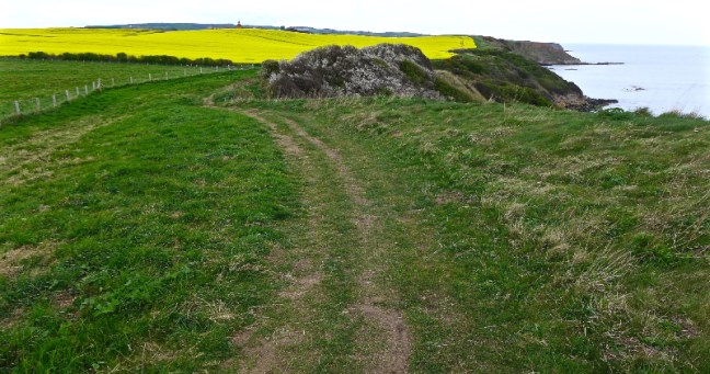
We retraced some steps and ascended further up the cliffs before rejoining the main Cleveland Way to lead us back to the car.

P1060826

Miles Completed 9 

Steps 20,682

Calories 790

Theresa May Goes West and We Went East.

Post 139: 20 April 2017, Cleveland Circles 27

So Theresa May goes walking to the west, Snowdonia in Wales,  and ends up calling a snap General Election. That is Power Walking.

We decided to go East and ended up making no decisions at all, other than whether we should have an ice-cream or not at the end of our walk.

Now would Theresa’s decision have been different if she had walked my North of England Way, which I know she has a copy of? It is of course top secret as to how she got it as these are Secret Diaries.

So heading out East to Scalby (pronounced Scorby according to a local) we started walking at 8.45am on Cleveland Circles and coincidently the North of England Way.  Our first stop was at Scalby Parish Church, dedicated to St Laurence.

There is a plaque in the churchyard dedicated to a very brave lady who died trying to save passengers of the Whiskey Echo.

P1060773

We continued inland to Prospect Farm where the prospect of entering a field with these long horned cattle put fear into Carol. Fortunately, we were able to avoid them.

P1060776

There were lovely views back to Scarborough Castle and a couple of deer suddenly startled us, one jumping the barbed wire fence.

P1060778

We eventually reached the coast and the Cleveland Way,

P1060780

P1060781

before passing Scalby Lodge Farm pond which was largely dried up, symptomatic of the dry weather we had been experiencing recently.

P1060782

Our final view of the coast was at lunch time just below Scalby Ness.

P1060783

Then it was mostly tarmac walking back to the car. It was then off to an ice-cream at Hackness (see previous blogs). Much more enjoyable than a General Election. Perhaps Theresa should have gone east?

Now I think in the election we are going to get a lot of rhubarb, rhubarb, rhubarb and more rhubarb from politicians, so I had Rhubarb and Ginger ice cream, imported into Yorkshire from Suffolk. It is midway between sorbet and ice cream but very refreshing after a long walk.

IMG_1522

Miles Walked 11.14

Calories Burnt 1,300

Steps 21,900

Average Pace 18.12 Minutes Per Mile 

Fastest Split 17.41 Minutes Per Mile between 8-10 Miles 


Low Expectations, Batteries Low, Where are the Walkers, Walking Backwards, Getting Away from it all on a Bank Holiday, then Disaster .

Post 138: 17 April 2017, Cleveland Circles 26

We left York with low expectations at 7.30am on a Bank Holiday Monday as the forecast was for cloud and some rain. The roads were completely empty of traffic at this time and on this day, which meant we had a good journey along the A64 to Burniston, north of Scarborough, the start of our walk. The skies were blue and the sun was out.

After walking along the dismantled railway line to Cloughton we walked through some pleasant largely unexplored countryside for several miles. No other walkers were seen.

We stopped in a quiet pleasant woodland for coffee and homemade Mary Berry Simnel cake. A real energy boost!

P1060740

The first notable location of interest were some standing stones at Rigg Farm. Our guide book said this was the property of Anne Tiffany who had given permission for Cleveland Circles walkers to cross her farmland in order to view this ancient monument. This small stone circle is believed to have dated from the Late Neolithic to the Bronze Age (about 2400-1000BC). It is believed that it was a focus for burial rites.

P1060742

There were originally 24 earth fast stones, but now there are only 15.

P1060748

As we walked near the farm, the farmer Chris Chapman came out to greet us. His wife Anne Tiffany (she kept her own name) had passed away a number of years ago and didn’t want to be buried at the stones. Instead she was laid to rest alongside the drive from the farmhouse in a modest grave, which was her wish. He was more than happy to allow walkers to continue visiting the site of the stones.

P1060749

Leaving the A171 we entered some tricky woods to descend to Cloughton Moor House.

P1060750

P1060751

Following a track, great views towards the sea appeared. Still no other walkers

P1060753

We were surprised to come across a lonesome post box, nowhere near any particular village.

P1060754

We eventually reached the coast near Hayburn Wyke for stunning views, many of them looking back. It was around here that my batteries on my mobile phone expired and my Map My Walk app stopped working. Maybe I hadn’t fully charged it the night before.

P1060756

Views forward were stunning too, including Scarborough Castle in the distance. Other walkers were seen on this section of The Cleveland Way.

P1060758

Then we came across a long awaited bench for lunch with a fabulous panoramic view in the sun. It doesn’t get much better than this, especially when we had expected rain. Clouds were forming over land, but not where we were on the coast.

P1060759

Thank you for the life of Ann Hazell and for the bench.

P1060760

We continued to Cloughton Wyke.

P1060762

With explosions of colour.

P1060765

And again great views back. I sometimes think I should walk backwards.

We passed the Long Nab Coastguard Station now a bird-watching hide.P1060770

Scarborough Castle was getting nearer.

P1060771

We arrived at Crook Ness where there is a fine information board. Sid the Yorkshireman points out that it was partly paid for by EU money. Or is that our money we give to the EU who then hand it back to us?

P1060772

On that note it was a short walk back to the car and the end of a fine walk. We had hardly seen any traffic or walkers and had truly ‘got away from it all on a Bank Holiday‘.

Taking the ‘country route’ back to York, disaster then struck as the ice-cream and cider shop (see previous blog) at Hackness was closed. We had to settle for buying our eggs from a farm.

Miles Walked 12


The Mad Hatters, The Health Resort that Never Was, Dinosuars, You Need Radar to Find Them, a Cider/Icecream Oasis.

Post 137: 4 April 2017, Cleveland Circles 25

You will recall from previous blogs that Sid the Yorkshireman has a propensity to lose hats and occasionally find them again. At the last count is was about 30 hats, or maybe I exaggerate slightly – perhaps 3 hats. Having lost his Lawrence of Arabia sun hat he turned up at the start of our walk at the Falcon Inn, just off the A171, at 9.00am with the replacement summer hat. Trouble was he had forgot to take the label off or was he deliberately keeping it on so that if he didn’t like it he could take it back?

P1060701

The next problem was that near the coast it was colder than York so he reverted back to his winter hat.

P1060702

Now Sid is not the only walker to have hat problems. Due to the fact I have so many zips in my outdoor gear it is not unusual for a hat to disappear for a while into a zipped pocket only to re-appear again in a month or two. In the meantime I may have purchased another hat. At the last count I had 6 Spring/Summer/ Autumn hats, including a decorating hat (rarely used as walking is much more fun than decorating), and about 5 winter/other hats!

We frequently come across hats and gloves that have been lost by other walkers on walks.  I think the hat saga could run and run…..

It is not only hats that go missing. We soon arrived at the location of the Three lords’ Stones. However, we could only find two. Now it is understandable for a hat to go missing, but surely not a stone which must weigh a ton?

We were soon heading towards Ravenscar to have our first stop and a coffee break outside the National Trust shop. P1060705

The rather splendid building in the distance on the left was built in 1744 by Captain William Child. It was opened by a development company in 1895 as a hotel. To the right of the hotel is the ‘Peak’, known since 1897 as Ravenscar. This was the town that never was.

Some of the bricks in the paths have RAVENSCAR embedded in them. The Whitaker Brick Company started making Ravenscar bricks in 1900 to be used for the construction of a proposed  new seaside holiday resort.  However, when potential investors for the resort arrived by train they were not impressed with a resort miles from any sandy beach and with 630 foot cliffs below it. The development company Ravenscar Estate went into bankruptcy in 1913 and the resort was not built.

We left the town that never was to follow The Cleveland Way.  

Many dinosaur footprints have been found in the cliffs hereabout.

P1060707

We soon came across the remains of a radar station, which has built in 1940 to detect German planes and ships. There was no mention of it detecting lost hats.


Fine views soon opened up towards Scarborough Castle, which can just be seen in the far distance.

P1060716

We had a steep descent to Hayburn Wyke, which made a good sheltered lunch stop, even if a little noisy from the waterfall.

P1060720

P1060721

Climbing up steeply from the beach we came across knarled and twisted trees.

P1060729

Until the Hayburn Wyke Hotel was reached

P1060730

With its horseshoe arch.

P1060731

After some confusing route finding near the dismantled railway track (not our fault) and between Claughton Moor House and Prior Wath, we emerged from some very boggy ground to find an old limekiln.

P1060732

Near the end of the walk we saw two deer.

P1060737

Driving back we came across a delightful oasis of food, home produce, organic vegetables and whole foods as well as various drinks including real cider. This was near the junction at Suffield near where The North of England Way passes. The cider and farm shop has particularly tasty ice-cream and its own Tabular Hill cider.  Well worth a stop if in the area.Their website with opening times is: WWW.TREETOPPRESS.CO.UK

Tel 01723 363 731.

P1060738


Miles Walked 11.73

Calories burnt 1,300

Steps 24,900

Average Pace 19.47 Minutes per Mile

Fastest Split between 6-8 miles 18.24 Minutes per Mile. 


The Anvil Collector, A Knight in Armour – The Old Alehouse Crusader, A Slow Worm

Post 136: 2 April 2017, Cleveland Circles 24

With a great forecast for the day we were surprised to encounter drizzle as we headed across the moors to Ravenscar to arrive at about 9.00am. It was a bit cloudy and cold when we started putting our boots on. As we ascended the first hill we could just see Robin Hood’s Bay in the distance.

P1060668

After some moorland walking we arrived at Cook House to find a fairly unique collection of anvils.

P1060669

Also a clever adaptation of a telephone box for storing of wood.

P1060670

And a knight in armour.

P1060671

P1060672

The mottled lambs hereabouts were very cute.

P1060673

We then entered a delightful woodland area and a deer ran across our path. It was too quick to capture on camera.

P1060674

P1060675

We then arrived at Ramsdale Mill Farm. It is believed that there has been a mill at this site since 11th century. The present mill was commissioned in 2003 and is intended to provide hydro-electric power.

P1060676P1060677

The views towards the coast from the track leading away from the mill are superb. Ravenscar where we started can be seen on the farthest hill.

P1060678

We were heading towards Boggle Hole for lunch on the beach. Before that we passed Fylingthorpe Public School and soon after the path enters the garden of someones house at Sunnyside. There is a dog that barks and if you are lucky the owner of the property comes out and is more than happy to have a chat and explain about the history of the area. She has lived there since 1948 and her Aunt formed the school. She will tell you about the history of the school and about how the water supply to her house has been somewhat intermittent in the past and not always pristine pure having come from springs higher up. There is also a barn which had its roof raised from the original thatch and she will take you inside to show you where the roof was originally.

We descended down to the Cleveland Way path.

P1060685

At Boggle Hole there is a Youth Hostel, which used to be a former corn mill and it is possible to obtain refreshments there. In the past it was a haven for smugglers.

After a steep climb out of the valley we resumed our walk along the Cleveland Way. It was essential to keep looking back towards great views in the direction of Robin Hood’s Bay.

However, the views forward are superb too, showing a wave cut platform. It is the remains of a huge dome structure centred on the bay. The sea has eroded the structure to reveal the layered rock. This area is of international importance for fossil records with more than 250 species of fossils being identified from 600 beds.

P1060695

We arrived at the remains of the Alum Works. Quarrying started in 1650 and continued until 1850. In its peak in 1768 over one hundred thousand tons of rock a year were dug out by pick axe and moved in wheelbarrows along the manufacturing line!

P1060697

Here we found a slow worm.

P1060696

The final section of the walk is a fairly unrelenting climb. Just before we got back to the car we passed a tunnel, which which was built to divert trains away from the nearby hotel. The tunnel diversion cost £500. The railway from Robin Hood’s Bay was opened in 1885.

P1060699

Miles Walked 11.22

Calories Burnt 1300

Steps 23,600

Average Pace 19.26 Minutes per Mile. 

Fatest Split at 8-10 Miles, 18.58 Minutes per Mile.