Sub 8 hours on The Three Peaks of Yorkshire, Cramp, Carried off Ingleborough on a Stretcher with Oxygen, an MBE. 5,200 Feet of Ascent (1585 Metres).

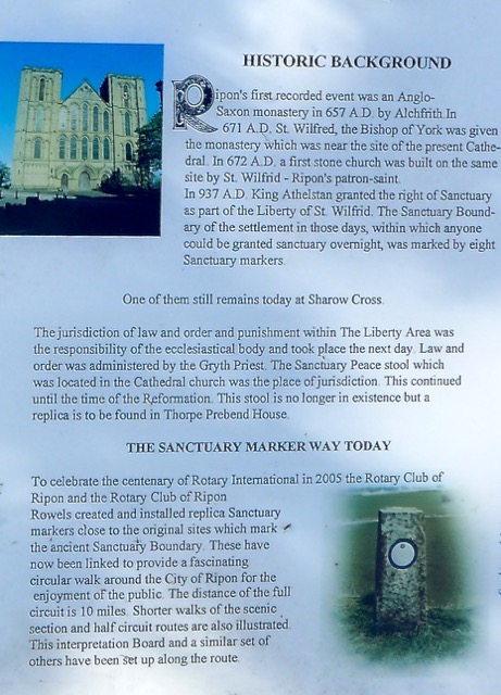
Post 178: 21 June 1998: Sub 8 on the ‘Three Peaks of Yorkshire’

The day of the Imperial Cancer Research Fund/RAF Leeming ‘Three Peaks’ challenge walk arrived and we were put into groups of 6 or 7.

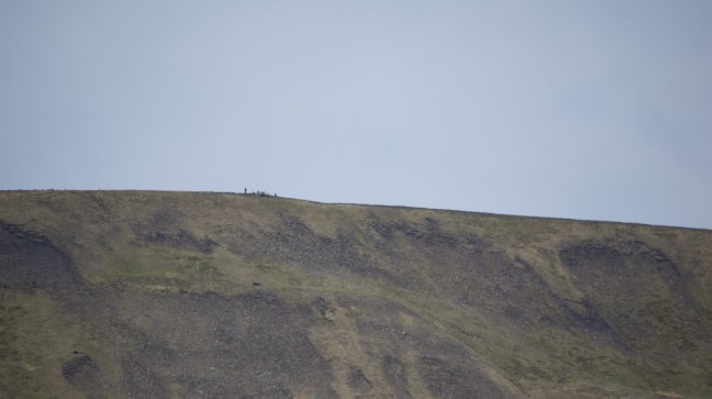
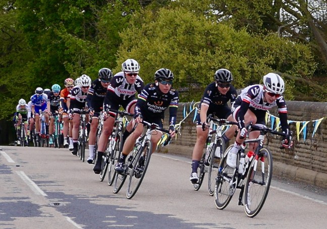
This is our group and unlike the others, not being a member of Her Majesty’s Armed Forces, I am the one with spindly legs! Too much sitting at a desk in my job as a University Administrator.

Various_0671_edited-2
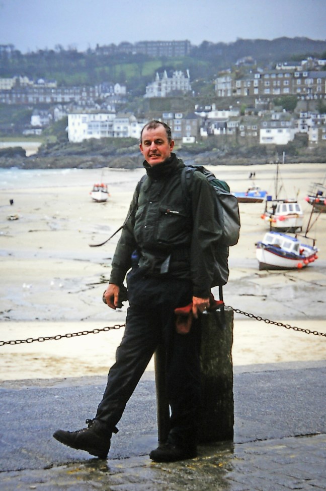
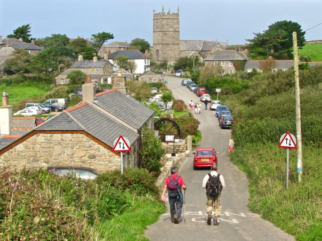
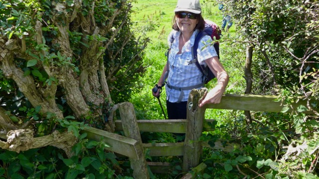
After covering ourselves in factor 30, our team of six ‘white’ apparitions (we were white at the start of the walk) left Horton-in-Ribblesdale just after 8.00am, in bright sunshine, to head for the summit of Pen-y-ghent. I soon started to get worried when I found out my team included a member of the parachute regiment, a former Harrier jump-jet pilot and a member of the RAF mountain rescue team.

Had they put me in the wrong group? I must have filled the pre-walk form in wrong by admitting I had done coast to coast three times – a big mistake! I didn’t have time to find out if it was the wrong group as we were soon on the summit of Pen-y-ghent.

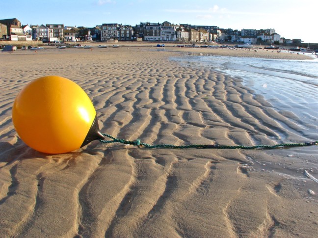
A quick drink and snack and I headed off to the peat bogs where a female member of another team was soon to find herself up to her waist in peat and water (up-date the route has now been changed to avoid these) .

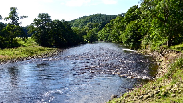
A longer break of five minutes at the Ribblehead Viaduct,

enabled me to have a sandwich and drinks before heading on all fours (‘the direct route’) to the summit of Whernside (pictures taken later as no time on the walk!).3 Peaks_8204_edited-13 Peaks_8195

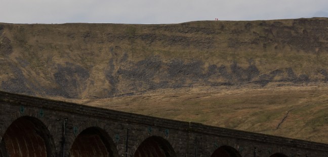
A glut of caterpillars on the ground made the ascent more interesting. One member of the group started to develop cramp, but that’s no excuse for not finishing.However, all the group reached the summit. There were fine views towards one of my favourite valleys Dentdale,

Dentdale

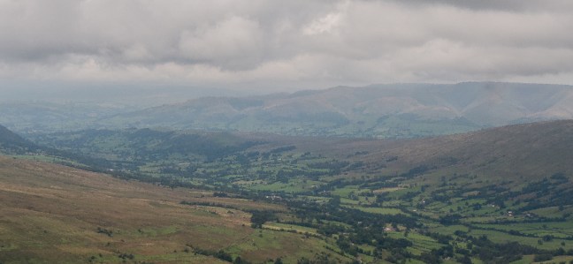
and ahead to Ingleborough, our next destination.

Ingleborough

After a rapid descent of Whernside, we had an eight minute break. I was also starting to develop cramp and to get some salt into my aching body I ate a packet of crisps so quick you would have thought my life depended on it. It probably did.

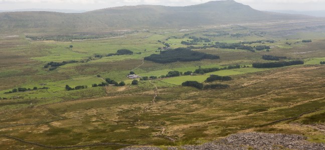
As we ascended the final peak of Ingleborough, the sun scorched our tired bodies and morale did not improve when a distressed walker was carried down on a stretcher in the opposite direction, whilst receiving oxygen. However, by counting ten steps at a time then resting, the steep section was conquered and our leader encouraged us at the top by saying we were nearly there. If you believe that you will believe anything. We still had 7 miles to go.

Our leader then said he thought we could finish in less than 8 hours, which would be a remarkable time. So, after a quick gulp of water, it was fast walking and trotting down from Ingleborough summit, every step hurting as I had developed a lovely blister on the bottom of my heel.

3 peaks_8268_edited-1On reaching a sign saying it was 1½ miles to Horton-in-Ribblesdale, I remembered that it is more like 3 miles. As I entered the village,

3 peaks_8261_edited-1

I had 8 minutes to reach the Pen-y-ghent café, the end of the walk. I tried to jog but cramp set in and so it was fast walking to the end. I finished with four minutes spare to join the ‘sub 8 hours club’. Ours was the only team to finish in less than 8 hours, the remaining teams finishing in 9 to 11 hours, still well within the 12-hour challenge time.

One person who had just been included in the Queen’s Birthday Honours list in recognition of his achievements, especially in raising money for cancer research, was the leader of the mountain rescue team from RAF Leeming, which supported the walk, Sergeant Al Sylvester. As we headed for the evening pub celebrations, he was required to wear a paper plate around his neck with ‘MBE’ inscribed on it. If he had dared to take it off he would have had to buy a round for 35!

I would like to make a special thanks to Gary for his support in the ‘training’ programme leading up to the walk. Although he didn’t quite do enough to be included in the Queen’s Birthday Honours List, he has nevertheless been awarded an honorary HMMMM. For those that haven’t heard of this unique and rarely given qualification it stands for ‘How many more miles Maughan?’

Thanks also go to the staff, including Frances and Helen, from the Imperial Cancer Research Fund who made us feel so welcome, gave encouragement when needed and fed and watered us so well. Also to the RAF mountain rescue team who supplied the tents, selected the route and offered support and advice on the walk. Fortunately, only one walker had to receive medical attention and was unable to complete the walk.

For two days after the walk I spent most of my time doing stretching exercises and having baths to stop my body seizing up. I also repaired blisters and sore feet. However, it was all worth it as I raised over £950 for cancer research towards a total contribution on the day of £10,500 from over 30 walkers. I also had the satisfaction of pushing myself beyond what I thought I could do, sub 8 hours.

What better way can you spend a weekend?

£450,000 is being spent on path restoration on the 3-Peaks, much of it caused by erosion caused by its popularity for charity walks. However, I wonder if anyone has quantified the reduced NHS bill and reduced work absenteeism as a result of improved fitness through walking? However, a voluntary code whereby the numbers are limited would not be unreasonable. I have heard of over 130 being on some walks.

THE THREE PEAKS CHALLENGE HAS TO BE COMPLETED IN 12 HOURS AND IS 24 MILES LONG AND INCLUDES PEN-Y-GHENT (694 METRES, 2,277 FEET), WHERNSIDE (736 METRES, 2415 FEET) AND INGLEBOROUGH (723 METRES 2372 FEET). 

GOOD LUCK! 

From an encounter with a Real Mermaid to a Pilgrimage, Virgin Hill, the Last Day.

Post 177:  17 April 1998 Day 6 – St Ives to Penzance – 14 miles

Having survived the previous days encounter with the Real Mermaid of Zennor (see post 176), I started out with a skip in my step as I headed along the coast towards Carbis Bay on this my last day. Here I joined part of the Santiago de Compostela – a network of pilgrim routes, which lead to one of the three most important places of Christian pilgrimage in the world – the Cathedral of St James in Santiago de Compostela, North West Spain. No wonder I was excited. Since the ninth century, people have trekked across Europe to make their pilgrimage to the shrine of St James the Great, the brother of St John. In 1987 the Council of Europe decided to promote the Santiago de Compostela Pilgrim Way ‘as a highly symbolic and significant European cultural route’.

The St Michael’s Way is one of the Santiago de Compostela routes, which crosses Cornwall and was particularly used by pilgrims from Ireland and Wales who wished to reach Europe, without sailing around Land’s End. The route has been signposted by a shell sign based on the Council of Europe’s sign for pilgrim routes.

After leaving Carbis Bay with its gorgeous beaches and palm trees,

Cornwall Summer 2008 019 there is a steady climb until Knill’s Monument is reached. From here there are magnificent views of Carbis Bay and the north coast. John Knill was the Collector of Customs at St Ives in 1762 and Mayor five years later. He built this monument and left money for celebrations every five years, which have continued ever since. They are held on the Feast Day of St James the Apostle, 25th July, thus creating a link with the earlier pilgrims.

I left the fine views behind to quiet enclosed ways and country lanes. I soon passed a monolithic, longstone, or menhir. After passing through undulating fields I reached a huge granite boulder, The Bowl Rock supposedly bowled here by a giant during a game. Trencrom Hill a little further on was believed to be the centre for giants. It was in fact an Iron Age hill-fort and is now in the hands of the National Trust. From the top there were superb views from coast to coast, including Mounts Bay, and I was pleased to stop here for a lunch with a view.

Descending from the hill I passed the quaint Ninnesbridge Chapel now converted into a house.

Cornwall Summer 2008 037After more undulating fields I descended a steep hill to Red River Ford, another place for a break but I had to watch out for the occasional car splashing me as it went through the stream.

Another ascent led past Ludgvan Church, noted for being where the famous antiquary and naturist, William Borlaze, was rector between 1722 and 1772. After walking along quite lanes I climbed Virgin Hill (I am not sure how or why it got its name but I can guess!) from where I enjoyed a tremendous view of St Michael’s Mount, a fairy tale scene. An island rises magnificently from Mounts Bay and perched on the top is a ‘12th-century castle’.

St Michael's Mount
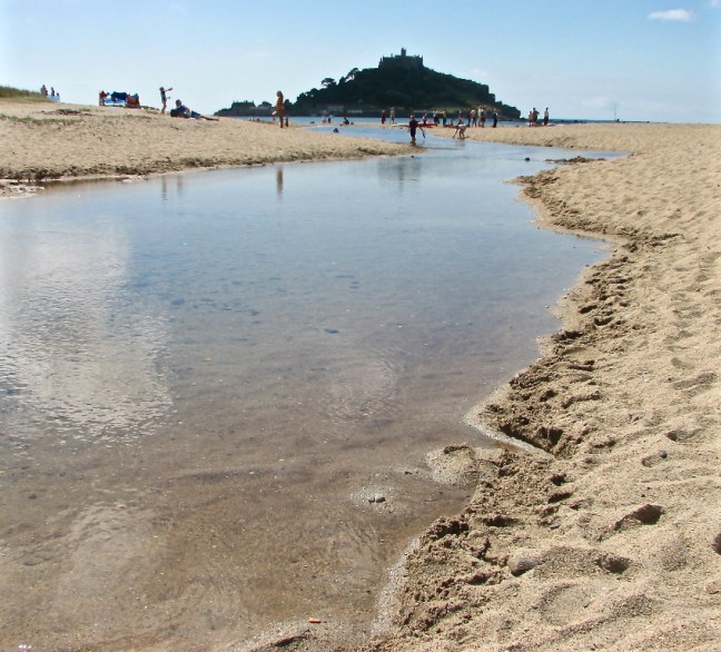
It was given to the monks from Mont St Michel in Normandy in 1070, and a Benedictine priory built on the summit in 1135 became an important place of pilgrimage in the Middle Ages. The priory, rebuilt in the 14th century, became the home of the St. Aubyn family in 1659 and the family still live there, although it is now owned by the National Trust. Fortunately the tide was out and I was able to gain access to the gardens and buildings by walking along the causeway. When the tide is in it is possible to be ferried in a boat.

As I left the Mount and followed the path above the broad beach along Mounts Bay my journey was coming to an end. Admiring Penzance church standing out above the houses it was time to reflect on a beauty and variety of this interesting walk.

I was soon on the Inter-City train heading away from this lovely peninsula back to the trappings of a busy commercial world. However, I knew I would come back……………


An Encounter with the Real Mermaid of Zennor, A Force 8 Storm, Paradise in St Ives.

Post 176: 16 April 1998: Day 5 – Zennor to St Ives (via Zennor Quoit) – 8 miles

I awoke with a thick head, which was not helped by a claggy and wet morning. After a hearty cooked breakfast, I decided to visit Zennor’s Wayside museum, which has superb displays on the agricultural and historical background to the area. I then passed the traditional pub, the Tinner’s Arms, to the beautiful St Senera church of Zennor. It has been said that ‘When London was a collection of mud huts, Zennor was a church town.’ There has been a centre of worship here since the 6th century A.D.

The earliest record of a church dates from 1150, but little remains today of this church. Two of the old 16th century bench ends survived and they have been made into the ‘Mermaid Chair’. The carved figure of a mermaid is holding a glass in her right hand and a comb in her left hand.

It is said that a beautiful women in a long dress used to sit in this church listening to the wonderful singing of a local chorister, Matthew Trewhell. One day she lured him to the stream which runs through the village; she led him into the sea at Pendour Cove, now known as Mermaid’s Cove, where his voice can still be heard singing to his love. There are also two stone Cornish crosses in the churchyard.

Not finding a mermaid to lure me on this occasion, I carried on walking to try and find Zennor Quoit in thick mist. The Quoit took some finding but in an eerie cloud I came across the 4,500-year-old Neolithic chamber tomb with a main chamber of five upright stones and an antechamber of three others. I was captivated by the sense of timelessness and loneliness.

I returned to the coastal path and found the wind and rain starting to increase. It turned out that a force 8 storm was on its way. The path is very rocky, arduous and undulating, but provides dramatic coastline walking.

September 2008 014_edited-1

At two islets, the Carracks, there were seals sheltering on the rock.

Some years later I was sitting in warm sun at peace with the world watching the seals, when a walker from Holland came along. She was bronzed and had been walking the coastal path. I lent her my binoculars to see the seals and with that she carried on walking with me to St Ives. She was on the last day of her walk around the Land’s End peninsula. We chatted about the many long distance walks we had done and we were ‘kindred spirits’ both having a love of walking. I was very impressed as she had walked across the whole of Spain coast to coast and was now walking the Land’s End peninsula solo. How do you get fit to walk the steep ups and downs of this rugged coastline when you live in Holland which is flat? Turns out she roller-skated to work and cycled a lot.

As it got to late morning and lunch was on my mind, she asked me if I wanted to go somewhere quiet. Now I thought this was a bit odd as the path was already quiet, having not seen any other walkers, but I thought it might be a language thing (despite her English being very good) and she wanted somewhere quiet to have lunch. I suggested a couple of places aside the coastal path with very good views, but on both occasions she said she had something else in mind. I wasn’t really sure what she meant but thought there might be a better spot further along the path. Eventually, we came across a bench with a good view. I was getting hungry and wanted my lunch so more or less insisted we stop. Strange thing was she had no lunch with her, so I shared some of mine with her being a Good Samaratan. It was only later when I told my wife about my encounter she said that she thought the lady had something other than lunch in mind! She was the Real Mermaid of Zennor.

Back to 1998 and the storm was in full spate and the rain was at lashing me. At times the wind was so strong I had to bend over to grab the grass verge, so as not to get blown over. There were no other walkers about.  I have seen the rescue helicopter in this area on sunny calm days!

Helicopter1

Arriving in St Ives an American couple asked where I had come from as I looked a bit wet. The water poured off my waterproofs onto the pavement.

The big 50_6716_edited-1

It was with relief that I eventually found myself sipping tea in the number 38 art shop on the quayside in St Ives (photograph taken on another day!).

The big 50_6711_edited-1

A friend runs the shop (update he is now retired) and I am always guaranteed a welcome cup of tea after the energetic walk from Zennor. One of my favourite walks of all time.

St Ives has everything, golden beaches, turquoise seas,

The big 50_6707_edited-1

September 2008 102St Ives Sept 07 011St Ives Sept 07 031St Ives Sept 07 092September 2008 098St Ives Sept 07 sunset3E

Sennen BeachFootsteps in the Sand

arts and crafts exhibitions, quaint cobbled streets, delicious fresh crab salads (from Stevensons), Cornish ice-cream,

PICT0002-2traditional pubs,

St Ives Sept 07 246restaurants, and cafes all centred around the harbour.

September Sun St Ives

However, because of this it does tend to get rather crowded in summer.

The prominent St Ives Tate Gallery is worth a visit for lovers of modern art. The famous sculpture Barbara Hepworth lived in St Ives and her studio, Trewyn, was left to the nation after she died in a fire in 1975 and displays superb examples of her work, which were inspired by the landscape of this area.

After a pub meal with my friend and a guided tour around Trewyn I retired to my bed breakfast.

A truly memorable day.

How to Cure Rickets, Gary Rhodes Producer.

Post 175:  15 April 1998: Day 4 – Pendeen to Zennor – 9 miles

The weather was holding as I left the sleepy village of Pendeen to head inland and visit some of the antiquities that adorn this barren but beautiful part of Penwith. A couple of pleasant enclosed ways led to the heather clad Carnyorth Common. Perched on the top is an outcrop of rocks called Carn Kenidjack, shaped by the winds and rain over centuries. There are few better viewpoints than to sit here on a quiet summer’s day with a walking friend and put the world to rights. The path eventually picked up an enclosed way and after a left and then right I crossed the Pendeen to Penzance road. After ascending the wonderfully named Woon Gumpus Common, Chûn Quoit was reached, a good place for a break. This Stone Age chamber is the only one on the peninsula to retain its capstone in place. It is only missing the covering mound of earth and stones. Having rested I ascended gently to Chûn Castle, the remains of an Iron Age hill fort with stone ramparts in three concentric rings. After admiring the panoramic views across this bleaker and more remote part of the Penwith Peninsula I descended the permissive path through gorse bushes to Trehyllys Farm.

A quiet narrow lane led past Bosullow to the Madron-Morvah road at which point I turned right to the Mén-an-Tol Studios, well worth a visit if open. A clear and touristy track was then followed to the curiously named Mén-a-Tol, a bronze age holed stone large enough for a child to crawl through; it is said that rickets is cured on climbing through the hole nine times towards the setting sun. I then continued to the Four Parish Stone, which marks the boundaries of Zennor, Madron, Gulval and Madron parishes. Here I turned left to head to the sea again passing Carn Galver, a rocky outcrop. I stopped for lunch under the remains of Carn Galva mine before the winding path again led to the Atlantic and Bosrigan Castle, an Iron Age cliff castle.   Here I was walking through history in an area little changed for centuries; the gales and winds off the Atlantic making sure that ‘civilisation’ stays away. The coastal path then skirts prehistoric patterns of tiny fields at Bosigran, dated to the Iron Age some 1,500 to 2,000 years ago.

Shortly after passing the prominent Gurnard’s Head and some awesome coastal scenery I arrived at the Backpacker’s Hostel at Zennor

September 2008 064 
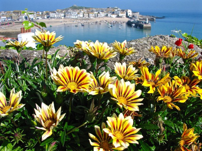
to be welcomed by Gabrielle Jackson, a former producer of Gary Rhodes (you know the chef with the spiky hair do).

It was fortunate that Gabrielle, also a skilled cook, was putting on a meal for fifteen to celebrate the hostel owner’s birthday. What more could one ask for as the wine flowed and the food was delicious.

Completion of my 52nd Long-distance Walk, Left or Right, Bale Escapes, The Missing Lake, Tour de Yorkshire, Tom Cruise, I am Out of Date, Military Encounter, Hung out to Dry.

Post 174: 17 August 2017, Ripon Rowel Circles 11 with an addition.

Arriving at Ripon for the final section of this long-distance walk, there was a sense of excitement and anticipation that a walk we had started on 25th May was nearly at an end. In addition, we had a meal booked at Gusto for the evening to celebrate Celia’s birthday, so a double celebration was in the offing.

I was somewhat surprised to see Carol had left and right socks and so did Sid the Yorkshireman. I had never seen these in over 60 years of walking. What is all that about?

Does Carol not know which her left and right feet are? Does she need a reminder so she can put her boots on the right foot (or left so as to speak).

After some questions on the 1,000 Mile Walking Challenge Facebook site, it seems there are loads of folks that use such socks!

So how come I have walked the equivalent of over 4 times around the World without them?

I reckon it is marketing ploy to get folks to pay more for their socks. Added value and all that.

Having lived in Yorkshire for some 31 years, I can see through these marketing ploys. All complaints please to Sid the Yorkshireman.

Now double lay socks (an inner sock within a sock) are a different matter and definitely stop one getting blisters. That’s where my money is going. In fact on the way to my Norwegian cruise I managed to pick up two pairs from the Port of Tyne for £7.99p. Now that’s a bargain!

IMG_1956

We now had to head to the bus stop to get a bus at 9.40am to North Stainley, the start of our walk, watching out for blind corners on the way. I had forgot my skateboard and bicycle on this occasion

P1070639

Alighting from the bus (free for Sid the Yorkshireman and myself but not for Carol – a benefit of old age) we knew we were in the countryside as we met our first deer.

P1070640

We then passed a large quarry.

P1070641

And a huge tree.

P1070643

There were even North Yorkshire conveniences (for the quarry men).

P1070644

Our path was redirected as they are enlarging the quarry.

Now who lives in a house like this?

This was a bale of hay trying to escape capture.

P1070647

Problems, problems.

After taking a turning onto a bridleway at Frizer Hill we suddenly found ourselves looking at a lake that wasn’t on my map (the one on the right below). Latter we found it on Sid’s map (on the left below).

How can you have a lake go missing on the map?

P1070648

Sid’s map was produced 2003, selective changes 2013. Mine was revised 2003 , selective changes 2005. I am out of date.

So the lake must have appeared between 2005 and 2013!

After some pontificating and using my compass, we decided we had gone wrong and backtracked to where the last bridleway sign was. The sign and guidebook instructions were confusing to say the least. We had followed a clear track and missed an overgrown path on our left. The guide made no mention of a path off left. Hmmm……….

We did eventually find the path off left and were back on route. Of course to add to our frustrations and overheating, the path was badly overgrown for some distance. It was going to be a long day.

P1070649

It was now 12.16pm and we hadn’t even had a banana and coffee break by the time we arrived at Mickley church. I decided to skip the coffee break and have lunch instead.

P1070650

Energies restored we reached the River Ure

P1070651

and the beautiful village of West Tanfield

P1070653

P1070654

This brought back memories of the Tour de Yorkshire and where I had watched and filmed events from the bridge.

P1030329P1030331

No bikes today and so it was back to the River Ure.

Carol got a little excited as she reckoned that Tom Cruise had just appeared from the weir in swimming trunks. There was certainly a chap from the nearby campsite who told me he had been for a swim and that the water was cold. But Tom Cruise? I didn’t notice and in any event Tom Cruise had just broken his ankle jumping from one building to another on film location. The heat was certainly getting to Carol.

P1070657

P1070658

We arrived at North Stainley at after 2pm.

P1070660

Sid and Carol were ready for their lunch and so we stopped at the cricket ground.

An all English scene if ever there was one.

P1070661

After lunch we soon had to enter a military zone but failed to encounter any tanks or such like.

P1070662

Afte some fast walking we arrived back at the historical area of Ripon near the Cathedral at 4pm – pretty tired.

And the end of the walk at Ripon Cathedral P1070664P1070666

As we had a meal booked we couldn’t hang around for the horn-blowing at 9pm.

P1070665

It was now time to wash my rucksack in the bath and hang it out to dry. I suspect the bath hole will be blocked now…………..

IMG_1957

Miles Walked 13.2

Calories 1510

Steps 26,530

Average Pace 18.03 Minutes per Mile

Fastest Split 17.46 Minutes per Mile

TOTAL MILEAGE ON THE RIPON ROWELL CIRCLES 126. (RIPON ROWEL ONLY IS 50 MILES). 

PS The Gusto meal was excellent especially with Celia’s Diner’s Membership giving 40%!


Historic Ripon, Alpacas, Finding Santuary, We will Remember Them

Post 173: 15 April 2017, Ripon Rowel Circles, The Sanctuary Way section.

Our walk on the Sanctuary Way began at Ripon Cathedral on a very pleasant morning.

P1070588

Version 2

Version 3

Just down from the Cathedral there are a lot of historical buildings.

P1070587

Including a hospital

P1070589P1070590

And a house where King James 1 slept in 1617.

After following the River Skell and River Ure to Bridge Hewick we encountered the first Sanctuary Post.

May your heart be strong in faith

Faith in your friend, faith in humanity, faith in God

P1070594

P1070593

We continued to Sharow village along the River Ure and across fields.

Here there are the remains of an original Sanctuary cross.

May your heart be strong in compassion with that forgiving love that offers sanctuary to refugees, asylum seekers and all victims of loveless regimes. 

We then came to North Bridge and crossed the River Ure to then follow the river on the other side in a northerly direction.

We were now on the look out for alpacas, Millie, Lucy and Mel!

P1070610

Another Sanctuary Post was reached.

May your heart be always shining with light 

Light for the lost, light for our leaders, light for the whole world. 

P1070611

Another Sanctuary post was reached at the cemetery.

May your heart be strong in hope

Hope in human goodness, hope in tomorrow, hope in life itself.

We stopped at the cemetery for lunch on a bench to find it looking onto the war graves of Canadian and British flying crew who died during the second world. Many died on the same day, which indicated they were in the same plane. Most were in their early 20s. We will remember them.

There were also some graves for Germans who died soon after the war. We will remember them too. 

Another Sanctuary post was reached at Hell Wath Cottages. .

May your heart be full of courage

Courage to begin again, courage to face the oppressors of freedom, courage to face ourselves. 

P1070624

At Quarry Moor another Sanctuary post was passed (never place noticeboards under trees) .

May your heart be surrounded by beauty, your own and that of others. May you never be seduced by false attractions. May you see beauty everywhere. 

P1070627

We then came across a flower bed with a large L in the middle. Having just missed a turning, we wondered if it stood for Lost!

P1070630

Back on track another Sanctuary post was reached at Gallows Hill!

May your heart be a healing heart, to heal those you listen to, look at, touch and share with the world. 

P1070632

There was just one spot where this view of Ripon Cathedral could be recorded.

P1070633

Followed by a final climb of the steps to the end of an interesting walk.

P1070634

P1070637

P1070636

P1070635

Miles Walked 12.3

Calories Burnt 1,400

Steps taken 24,600

Average Pace 18.03 Minutes per Mile

Fastest Split 6-8 Miles 17.31 Minutes per Mile


Turner was Here, Fishermen Everywhere, A Folly, Hens, Chickens, Ducks, Children, Cows, Crops, Sheep, Fields of Gold and Barley, Theakston’s, Bah Mumbugs

Post 172: 10 August 2017, Ripon Rowell Circles 10.

From the Masham Market Square we paid our 50p car parking in the honesty box and headed down to the River Ure. Fishermen were out in force.

P1070518

It was a beautiful morning

P1070520

The gate and sign were surrounded by vibrant vegetation and flowers.

P1070521

A ruined dove cote on the hill was passed.

P1070522

Fungi was evident.


We reached a viewpoint in Hackfall Woods, which was painted by Turner.

It was a moment in time which stood still, when elements came together all at the right time.

The fisherman was in the perfect spot, the light on the river in front of him was ‘just right’ and Masham church spire could just be seen. One step left or one step right and it would be misplaced. The trunk on the right would, under normal photography technique, be cropped out as a distraction. However, I decided to leave it as it seemed to have bent in its growth in order to capture the view.

P1070527

A little further on we found a perfect spot for our banana and coffee break. A sandy beach!

P1070528

I think the views and sun were starting to affect Alf as he started to fish with his trekking pole. Now I am not a fisherman, but I would have thought to catch anything he should have put a line on the pole? Some folks will do anything to get in my photographs.

He probably thought it was another Turner moment in time.

P1070530

The River Ure gained speed and made for delightful walking.

P1070532

We soon arrived at a folly, Fisher’s Hall. There is some debate as to whether it was named after William Aislabie’s head gardener William Fisher who would have undoubtably have been deeply involved in the construction of Hackfall or, because of its proximity to the river, it is a fisherman’s rest building. Above the door is carved W.A. 1700. It was built about 1750. The Penny Magazine 1835 makes a mention of the stone used to build it.


P1070539

One or two signs on the route were difficult to spot.

P1070540

Some crops were high.

P1070541

Others made the route like a race course.

P1070543

Cows tried to block our route.

P1070544

Not to mention ducks, sheep and children in Grewelthorpe.


We eventually reached the ‘Fields of Gold and Barley’. Sting and Theresa May would be jealous.

P1070549

We then encountered the ‘hens and chickens stones’!

P1070550

And golfers.

P1070551

You can make what you want of these strange structures, which stretched our imaginations.


This Jameson cow was one we didn’t mind encountering!

P1070555

But even better was arriving at Theakston’s in Masham


But, as it was a hot day, we settled for a Brymor ice-cream. Bah Humbugs!

P1070560

Miles Walked 12.

From Norway to Wreaks, Grewelthorpe and Foulgate.

Post 171: 7 August 2017, Ripon Rowel Circles 8. 

Having returned from the glories of Norwegian fjords, waterfalls and mountains on the 6 August, the names on the walk route on 7 August seemed less than enticing; Wreaks Lane, Grewelthorpe Moor and Foulgate Farm.

This was soon remedied when we hit lovely purple heather at the start of the walk, followed by a rainbow. Yorkshire was welcoming us back in a very colourful manner.

P1070494

P1070495P1070497P1070501P1070505

Even the cows with calves seemed to have calmed down since we last encountered them.

P1070506

It was soon time for our coffee and banana break with Sid the Yorkshireman and Carol showing off their new Norwegian flasks. Now Norway is expensive but sometimes you get what you pay for and these were certainly more decorative than my much cheaper flask.

P1070507

There is no doubt that Norway is more dramatic than Yorkshire with huge mountains, fjords, waterfalls and with dramatic skies and landscapes. Many of the walks demand very high levels of fitness (see previous blogs).  But Yorkshire has much lovely walking countryside that more ‘senior walkers’, like myself, can cope with much more easily.

P1070508

Around 70% of the world’s heather moorland is in the UK and the largest continuous expanse of moorland in England and Wales is on the North York Moors, and the Yorkshire Dales and surrounding areas have their share too. So there was a lot to be thankful for.

P1070509

We passed a former 1878 Wesleyan Chapel.

P1070510

And a newly painted bus stop at Manor Farm. We were not sure if any buses ever came.

P1070511

Passing grouse butts, we decided to use them as shelter for our lunch with spectacular views and skies towards the North York Moors in the far distance.

P1070512

We passed through Low Bramley Grange and and Foulgate Farm to return to Wreaks Lane and our car.

The end of a gentle resume of the Ripon Rowels Circles after our Norwegian Saga (as opposed to Saga holiday – we are not there yet! ).

Miles Walked 7. 

Calories Burnt 847

Steps Taken 12,200

Average Pace 18 Minutes per Mile. 


Eidfjord Wander, A Double Rainbow, Try Looking at the World in a Different Way, The Mightily Superfit, The End of the Nordic Saga.

Post 170: 4 August 2017, Eidfjord Wander.

Having completed the walk to the Viking burial grounds, I decided to have a wander around the village of Eidfjord. First stop was a delightful gallery. See slideshow:

This slideshow requires JavaScript.

Then after passing a lovely cafe

P1070453

I was treated to an exquisite double rainbow show, see slideshow:

This slideshow requires JavaScript.

I continued to the pretty church


P1070468

Then the old part of town.

P1070473P1070474P1070475

Before seeing things and my ship in a different way! This was without having had a drop of gin and tonic.

P1070476P1070477

Returning to the ship I was able to watch the triathlon in a new way from above. Watching the Norwegians swim across the fjord and cycle and run over the steep hills just confirmed they are mightily superfit! Time for a G&T to recover from my walking today.

P1070478P1070479P1070480P1070481P1070483P1070484P1070485P1070489

P1030611P1030615

At 8.30pm our ship left for the Port of Tyne. There was a superb Balmoral Crew Show to ease the pain of leaving Norway. This was then moderated by force 5 waves.

5 August 2017

Sunrise in Newcastle was at 5.34am and I just managed to catch it. See slideshow:

This slideshow requires JavaScript.

I hope you have enjoyed my travels to Norway as much as I have?

Miles walked today 2 + 3.5 earlier = 5.5

THE END OF THE NORDIC SAGA

Eidfjord Walk to the Haereid Viking Burial Grounds.

Post 169: 4 August 2017,  Eidfjord Circular

Leaving the ship after another sumptuous lunch, we headed off for my guided walk to the Haereid Viking burial grounds, Western Norway’s largest area of burial mounds from the Iron Age and Viking periods. It is home to almost 400 graves from 400-1000 AD, which are located on the Haereid plateau at 100 metres (328 feet) above sea level. Perhaps one of my relatives would be there as my DNA is 35% Viking!

P1070373

Here is the route.

P1070561

We passed canoeists in the fjord

P1030602

And ice carving in the car park!

P1030603 
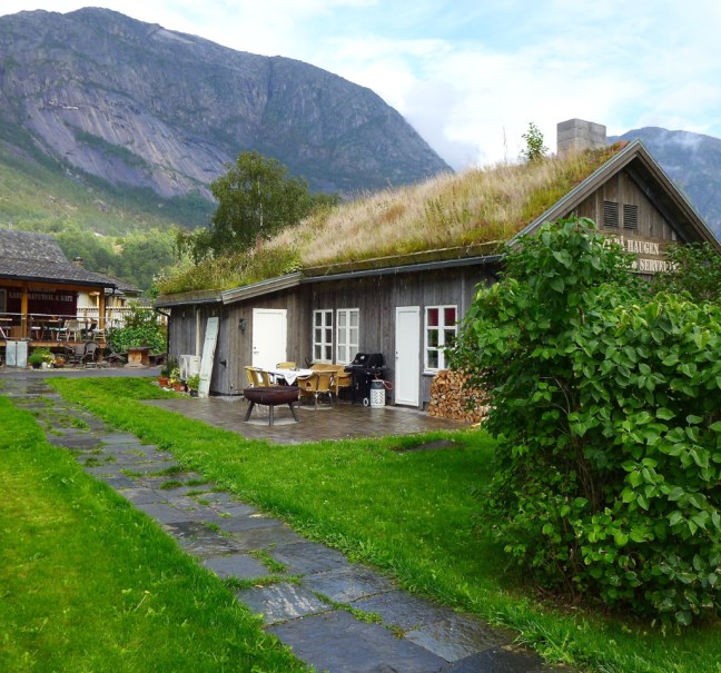
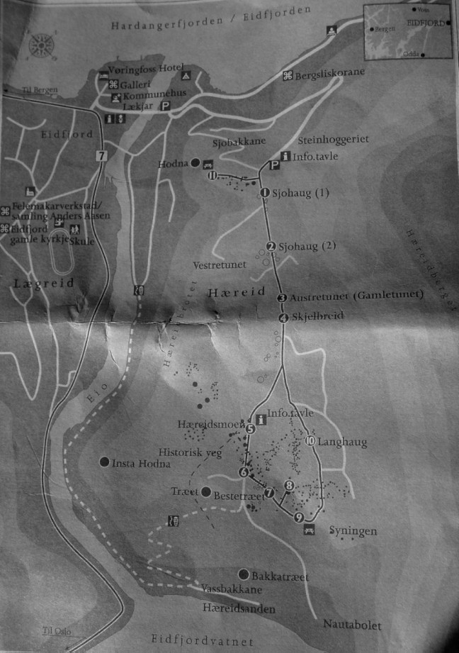
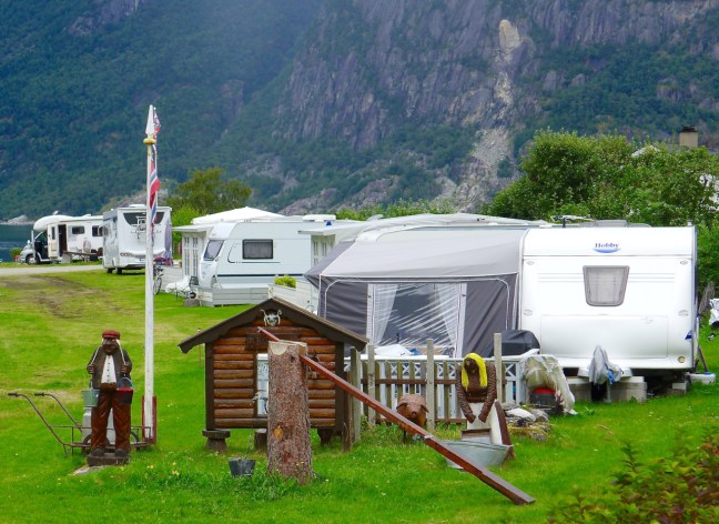
Then a caravan site by the fjord, to begin an ascent to a viewpoint at Hodna.

P1070374

We were intrigued by a house which had strengthened guttering for snow and a ladder for clearing snow off the roof.

P1070375

There were soon retrospective views of our ship

P1070376

What a back garden!

P1070377

A train came down the hill.

P1070378

Before we reached the viewpoint.

P1070380P1070383

P1070384

A sign warned of avalanches that had occurred in the area but our path was quite safe.

There was no time to let the grass grow under Carol, Sid the Yorkshireman and Alison’s feet so I urged them on. There was enough grass on the roofs.

I was delighted to find an old Volvo and Steve found a VW. Like us they had seen better times.

Someone coming the other way did say they had not seen any burial grounds and we pointed out they had passed them!

Further on we found the burial mounds.

P1070400

Many Viking and other artefacts have been found in the area, such as a gold ring, iron axe, arrowheads, a knife, a blade, a brass ball, coal, shards from clay vessels, charcoal, a shield buckle, rock crystals, three-leaf bronze clasp, an Irish 9th century circular buckle and an iron frying pan.

We then descended and many people coming up in the opposite direction asked us how much further it was to the graves.

We arrived at a delightful beach overlooking Eidjordvatnet. An opportunity for some photography and a rest.

This slideshow requires JavaScript.

The path became a track alongside the river and even included a smart toilet.

Some remnants of the salmon fishing traps (now banned) of the past were found

P1070419

Lovely flowers were in abundance. see slideshow.

This slideshow requires JavaScript.

Finished off with some interesting signs.

Had we not got a ship to return to we could have booked a bad room or two!

P1070434

The guide’s reward – some delicious Italian ice-cream

Miles Walked 3.5