One of my Favourite Places, England’s Westernmost town, St George and the Dragon, Heinz Beans and the Cape, Perfection, the Drowning of 19 Tin Miners in Poldark Country, Arsenic, Life Expectancy 35 Years, A Fogou.

Post 161: 14 April 1998: Day 3 – St Just to Pendeen – 7 miles

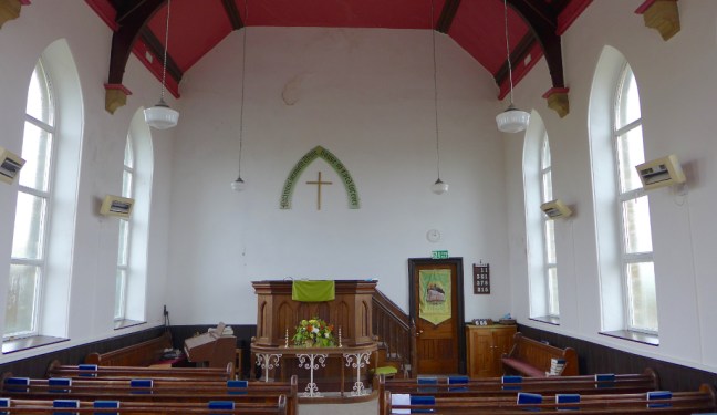
Leaving the hostel next morning I soon arrived back in St Just, this time venturing to explore something other than the pubs. Sturdy windswept granite houses surround the market square, which in summer can get very busy. I headed for the quite large parish church named after a 6th century Christian missionary Justus. Just inside the entrance gate is the old Market Cross, from which the sexton would read the notices after the Sunday services. Outside the church doorway are the remains of a wayside cross, which were placed along funeral routes where rest, prayers and hymns took place. Over the entrance to the church is an 18th century sundial. The hollow stone in the porch is believed to be the font from the ancient oratory at Cape Cornwall where I would soon be heading. Of particular interest on the interior north wall are two medieval wall paintings, one of which represents the wounded Christ surrounded by tools of the period, entitled ‘A warning to Sabbath breakers’, and the other which represents St George and the Dragon. From the church I walked opposite the town clock along North Row to the last cottage, which was an original meeting place of the Methodist Society where John Wesley preached. I then proceeded to Chapel Street where stands the old Literary Institute which was founded in 1842 as a library and lecture hall and later became the Lafrowda social club; it has a neo-classical facade. Further along was the Wesleyan Methodist Church built in 1833 to accommodation a congregation as high as 2,000. Returning to the clock I passed it to the grass-covered amphitheatre known as the Plen an Gwary, which means ‘playing place’. Until the early 17th century the site was used for performing medieval miracle plays. The large block of granite show the marks made during hand-drilling competitions organised by miners in more recent years.

Cornwall Summer 2008 165
Sunset over St Just 

From the Plen an Gwary I followed the road towards Cape Cornwall but turned off at the Great Atlantic Map Works which frequently exhibits local art work including the much acclaimed paintings of Kurt Jackson who stunningly captures the special light and atmosphere of the area. As I proceeded along Bosorne Road looking back over Cot Valley I could see the Youth Hostel amongst windswept trees. Ahead were the twin rock islands of the Brisons. The lane soon became a track passing between restored ventilation shafts and mine stacks until the remains of a Late Neolithic to Middle Bronze Age (2500-1500 BC) burial chamber, Ballowal Barrow, came into view. Continuing to the summit of Carn Gloose there were outstanding views back towards Land’s End.

PICT00011
Celia and Ross above Bollowall Barrow in the early 1970s. 

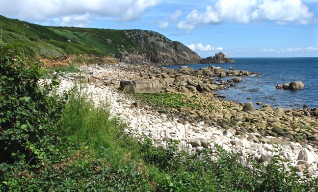
A little further around the headland the path started to descend steeply and the distinctive Cape Cornwall appeared in front of me rising to a summit with a mine stack perched on the top.

P1070061

CapecornwallsunsetIMG_0452

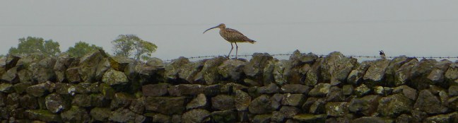
It was not unusual to get birds blown onto the Cape in storms. This pied wagtail was one of the local residents.

Pied Wagtail

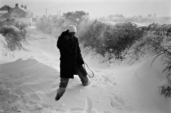
Celia near Cape Cornwall in Winter. it was very rare to get snow and it quickly thawed.

PICT0004

The view from the back of our house.

PICT0002


Reaching the base of the Cape a sign indicated that it was bought for the nation by H J Heinz Ltd in 1987 and was then presented to the National Trust to mark the company’s centenary. I climbed the steep path to the mine stack which was part of the 19th-century Cape Cornwall mine. Below me to the south, the beach of Priests Cove was littered with pebbles and boulders with small fishing boats tied to the slipway. Each summer there is a swimming race from the Brisons to the Cove – some three-quarters of a mile and a test of considerable fitness and stamina.

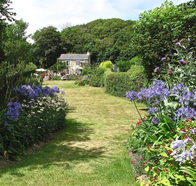
I descended the Cape to a small building, St Helen’s Oratory, partly restored by the National Trust its walls are believed to incorporate masonry from an original early Christian building. There are also two gravestones in the field, one of which has a number of toys surrounding it and sadly is the grave of a child, the other being the grave of a local golfer who played at the Cape Cornwall Golf Club across the lane. Above the golf course is a huge barn that has been converted into holiday flats, in which we have stayed for our annual summer holiday for many years.

PICT0002-1

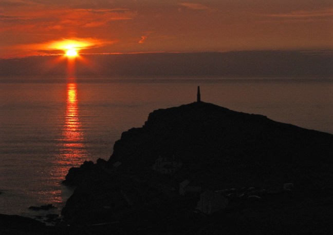
The view from the flats is breathtaking especially during sunsets over the Cape, resulting in me writing the following poem:

A view from the window

Sun piercing glazed sea and woolly sky

A quilt of fields entombs golfers as they try.

The house martins dance and weave in delight

While the redpoll hops from green to green.


Cars snake along twisted lanes

As walkers ascend the chimney trail.

Cape Cornwall stands proud and erect

While Atlantic waves crash against darkened granite,

Perfect.

September 2008 109-1

I left the field to pass the car park and then turned left to follow the coastal path to Kenidjack Valley.

Cornwall Summer 2008 126

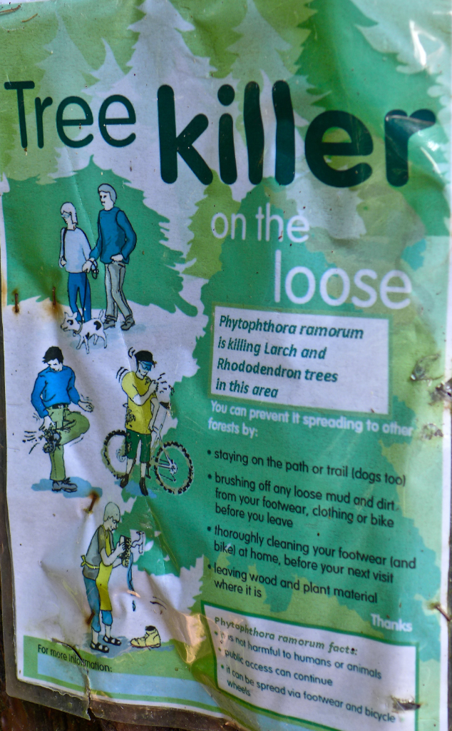
There are numerous mining remains within the valley including a huge wheel pit and an ancient calciner for extracting arsenic from tin ore, to both purify the ore and to collect the arsenic powder for sale as pesticide. Water power was used extensively here for mining purposes. The National Trust has carried out much restorative work including reinstating a typical reservoir, which would have supplied the tin mines with water. The southern slopes of the valley are traversed by the dried up courses of leats – narrow channels, which carried the water.

After crossing Tregeseal River and passing some isolated cottages, I took a path off right, which ascended the other side of the valley.

PICT0004-1

The path straight on leads to the sea and some twenty years previous was a favourite walk of my wife’s and mine during our four years residence in St Just. On one occasion, despite coastguard warning flares being set off I saw a German tanker pass between Cape Cornwall and the Brisons, missing rocks and disaster by only four feet.

At the top of the path I turned left to view the remains of what used to be travellers huts, perched on the cliffs at the mercy of Atlantic storms until the local council forced them to move on. It is incredible that they managed to live in such a harsh setting.

I returned to the main coastal path and ascended to the promontory of Kenidjack Head with its well-defined Iron Age bank-and-ditch defences. Inland are the remains of shooting butts, dating from the mid-nineteenth century but in use until the end of the last war.

I now headed northeast on more level ground towards the engine houses of Wheal Edward and West Wheal Owles.

Botallack
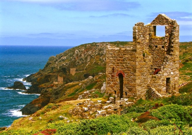
At the latter in 1893 miners broke through into abandoned, flooded workings of Wheal Drea and 19 men and a boy were drowned. Continuing through the industrial wasteland I passed the Botallack Arsenic Labrynth, which is part of a 19th century tin mine. To the left was one of the most dramatic viewpoints in England where the Crowns engine houses sit perched on cliffs above ferocious seas. It is said that when miners went to the underground passages under the Atlantic they could hear the waves crashing above. The Crowns are part of Botallack mine, which was worked before 1721 and closed in 1914. The lower pumping house was built in the 1930’s and the upper working house in 1858. Both were preserved in 1984 by the Carn Brea Mines Society with the help of many individuals and authorities as a tribute to the past generations of Cornish miners.

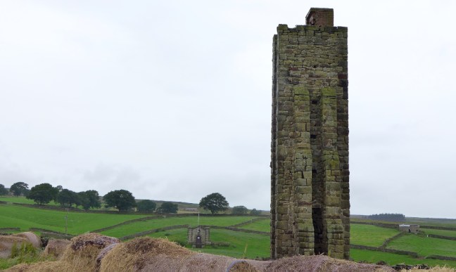
I continued on the coastal path to the Levant Engine House with its steam engine restored for the National Trust by the Trevithick Society.

Cornwall Summer 2008 058This is the oldest beam engine in Cornwall and after 60 idle years is steaming again. It was built in 1840 and the 27 inch engine hoisted ore from the Levant Mine. Miners used to climb down small stepladders to over 2,000 feet underground. Life expectancy in the early days of the mines was only 35 years until improvements in conditions took place including the provision of ventilation. It produced copper and tin ore until its closed in 1919 after 31 miners were killed.

I then headed inland towards Geevor tin mine. This was the last mine to remain in production late on into the 20th century. Geevor closed in 1990 despite considerable efforts by the local community to keep it open. It is now an outstanding Mine Heritage Centre and I couldn’t resist an informative underground and surface tour of the workings. The old mine workings are scattered throughout the area and give a sense of the drama, history and mystery of mining that is endemic here.


I then returned to the coastal path as far as dramatic Pendeen Lighthouse situated on the slate promontory of Pendeen Watch. The lighthouse came into service in 1900. There have been many wrecks in this area and in January 1939 seven of the eight-man St Ives lifeboat crew were killed as well as all the crew of the collier Wilson, which sank in Wicca Pool.

Just along from the lighthouse and, after viewing Portheras Cove,

IMG_0647

I climbed steeply away from the dramatic and dangerous coastline to Pendeen Manor Farm, a 16th-century building of great character. In the yard is a good example of an Iron Age (1st century BC) underground chamber called a ‘fogou’. The name derives from the Cornish word ‘vau’ meaning cave. Such structures may have been used as storehouses for food and artefacts. The Pendeen fogou suggests that Manor Farm lies on the site of an Iron Age village.

My bed and breakfast for the night was in the exposed village of Pendeen. However, there were two pubs and in the first one, the Radjel I met the local story teller Hartley Hancocks who claimed on 17 January 1952 he saw the Liberty wrecked off the coast of Pendeen. There was also a man from Leeds who had walked from St Ives to Pendeen and was now feeling the effects. I was pleased I was only walking to Zennor next day. At another pub I met a pleasant, adventurous, young lady who was walking the South West Coastal path on her own. She had a deep suntan or was it a wind tan and her hair was sun bleached? We chatted about long-distance walks and then retired to our respective bed and breakfasts, the following day to head in opposite directions like passing ships in the night.

Into the Jungle Again, The Most Dangerous Large Animal in the UK, Druids, The Tour de France

Post 160: 20 July 2017, Ripon Rowel Circles 9

Once again, as a few days ago, the forecast had been promising but, driving out to Masham for the start of today’s walk, the reality was different; quite heavy rain. So we donned waterproof trousers and jackets from the start.

Masham is a medieval market town and is noted for Theakston ales and the Black Sheep brewery.

We left the central parking area to descend to the River Ure and followed it for a fairly short distance before leaving it to follow the River Burn.

IMG_1767

After some confusing navigating we eventually reached The Jungle alongside Sole Beck, as described in the previous blog. This time we were walking it in the opposite direction towards Lobley Hall. The main difference was that contrary to when walking it the previous two days this time it was very wet with two days further growth.

IMG_1768

We passed through a field of cows and calves, which were much more docile than some of our earlier encounters on the walk. This was a relief as in recent days I had discovered that, according to the HSE, there have been 74 people killed by cattle since 2000. 70% of these have been killed by cows with calfs or bulls. Apparently, this makes cattle the most dangerous large animal in the UK.

After reaching High Knowle farm we encountered a very unusual tractor.

IMG_1772

We then arrived at the Druid’s Temple at about lunch time. We tried to find a suitable sacrifice for lunch but had to settle for my usual jam sandwiches and Mary Berry fruit cake.

IMG_1773

This folly was completed in 1820. It was commissioned by William Danby who lived at nearby Swinton Park, which is now a hotel. It is said that it was an effort to alleviate unemployment among labourers in the area who were paid shilling a day to build the folly.

IMG_1774

There is a ‘glamping’ holiday accommodation site nearby, Bivouac at Druid’s Temple.

We left the Temple to return to the Ripon Rowel route back to Masham. Leighton Reservoir could just be seen in the distance.

IMG_1776

Arriving at Masham we passed the Theakston Brewery.

IMG_1779

And a monument recording the Tour de France, which passed through here in 2014!

IMG_1783

IMG_1784

The rain had stopped by the time we got back to the car. St Mary’s Church dating from the mid 12th Century can be viewed from the market square.

IMG_1785

Miles Walked 12.6

Calories Burnt 1,400

Steps 25,500

Average Pace 18.16 Minutes per Mile

Fastest Pace at 10-12 miles 17.43 


The Jungle, Lake Superior, Himalaya and a Killer on the Loose.

Post 159: 18 July 2017, Ripon Rowel Circles 7

Carol was recovering from flu and so we decided to walk just 7.5 miles (according to the guide book) instead of the 14.5 we had originally planned. A nice leisurely day in the sun or so we thought. Funny how you get a surprise on walks. It started fairly gently from Wreaks Lane and there were fine views over to the moors of the Nidderdale AONB.

P1070095

We dropped down to the tine hamlet of Ilton where a worthy cause was underway. Mobile phone reception was poor in this area.

P1070096

We arrived at Lobley Hall, which is a ruined 17th Century farmhouse. It is a Grade II Listed Building. The guide did not say which side of the building the path went and as there was a clear one to the right we followed it. This led us in the wrong direction according to the maps and so we retraced our steps to try and find another one, more in line with the maps.

P1070098

We succeeded and found The Jungle! Hardly any path, much of it overgrown and very hot and humid with some steep slippery slopes. Not the easy walk we had anticipated.

P1070099

P1070100

After leaving the jungle we came across this wonderful, huge, very old specimen. No not Carol – The Sycamore Tree! I could be in trouble here!

P1070101

A little further on we passed Lake Superior and thought we must have taken a wrong turning. However, due to the very high walls of Swinton Park we were unable to see Lake Superior, which we thought was in Canada.

P1070114

We didn’t see another walker all day on this walk and there is some delightful countryside. It is a real backwater off the beaten track.

P1070102

However, all is not rosy as there was a killer on the loose.

P1070104

We then came across many unusual trees and plants and had indeed came across a huge Himalayan Garden. We walked through parts of it on the right of way, despite it being closed.

P1070105

Carol was still suffering from the after effects of flu or the effects of the sun as she got to the top of a stile and said “which way now?”. She hadn’t noticed the arrow at the bottom of the stile.

P1070107

The walked turned out to be 9.7 miles, somewhat longer than the guide book said!

Miles Walked 9.7

Calories Burnt 1,100

Average Pace 20 Minutes per Mile

Fastest Split at 1-2 miles 17.45 Minutes per Mile 


My Favourite Beach, Porthcurno, The Minack Theatre, Sennen Cove and Towards Land’s End

Post 158:  13 April 1998 Day 2 – Treen to St Just – 11½ miles

It was a beautiful sunny morning as I bade farewell to Rosemary and the tiny hamlet of Treen. Soon the sea came into view, glistening bright blue with white specks.

CornwallMay07 072

I dropped down to the sandy beach of Porthcurno, for once almost empty of tourists. My favourite beach.

It was still only 10.00am. and a group of overseas teenagers were the only other people on the beach; they kindly agreed to take my photo with a backdrop of golden sand, blue sea and a dramatic headland.

The big 50_6703_edited-1

Had I not remembered that I had a full day’s walk ahead I could have stayed in this idyllic setting. But a day of great promise lay ahead, including Land’s End.

Just up from the beach beyond the car park was the Museum of Submarine Telegraphy – a unique centre for the study of early international communications. The museum is underground, in tunnels built into the granite cliffs during the Second World War, to protect the telegraph station. To my great surprise I discovered that this quiet secluded spot was the home of the world’s largest submarine telegraph station. This all began as far back as 1870 when Porthcurno became the landing site for an all-undersea telegraph cable link between England and Bombay, India. In 1872 the three companies that had each laid a portion of the Porthcurno to Bombay cable merged to form the Eastern Telegraph Company and the system itself had been extended to Australia. The Eastern Telegraph Company and associated companies went on to develop a worldwide submarine cable network. Porthcurno was the gateway to the network and in time became the world’s largest cable station with fourteen cables in operation.

In June 1900 Marconi installed an experimental wireless station on the Lizard and succeeded in communicating with another Marconi station on the Isle of Wight, proving beyond doubt and against the opinion of ‘experts’ that his newly developed ‘wireless’ waves could travel beyond the horizon. Marconi was soon to transmit across the Atlantic without having to lay expensive cable. The cable station at Porthcurno closed in 1970 by which time the Eastern Telegraph Company had become Cable and Wireless, and Porthcurno was also a telecommunications training college.

Leaving Porthcurno I re-joined the coastal path as it climbed steeply to another unique attraction, the auditorium of the Minack Theatre carved from the golden cliffs.

P1070067

From 1931 until she died in 1983 the open air Minack Theatre was planned, built and financed by one remarkable women; Rowena Cade. An exhibition centre records her life and achievements through models, photographs and audio-visual display. Each summer from May to September, actors, singers, musicians, comedians and dancers perform at this magnificent location, which can seat an audience of 750. To attend a performance here is a unique and memorable occasion, but on a cool evening don’t forget the blanket and dram of whisky.

From the top of the next promontory there were fine views ahead and a fine descent to above the sandy beach of Porth Chapel.

CornwallMay07 079
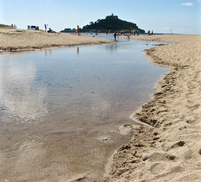
With care it is possible to descend to the beach; on a hot summers day it can get quite busy. Just beyond the beach there were the remains of a small two-roomed 8th-century chapel largely overgrown now with vegetation. One room was believed to provide accommodation and the other would have been the chapel.

Just a few steps up from the chapel, also to the right of the path, was the Porth Chapel Holy Well, a small roofless three-sided granite structure built on a large natural stone covering the spring. Where the path forks I turned right to follow a path for just under a ¼ mile to visit the lovely church of St Levan. I entered the churchyard by a well-preserved coffin stile with stone in the middle on which to rest a coffin and seats for bearers to rest. The present church dates from the 13th century with 15th century additions. There is a splendid Celtic cross within the churchyard.

Returning to the main coastal path I reached the tiny hamlet of Porthgwarra with a cave leading to a sandy beach with a few small boats.

The cave was blasted through by miners so that boats could be pulled to a higher level. Ascending to the next headland of Gwennap Head I could see large black and red landmarks (a bit like clowns’ hats), warning shipping away from the dangerous rocks in the area.

The coastal path became better defined but more exposed as I drew nearer to Land’s End. The scenery and walking was a delight as I marched enthusiastically through rocky outcrops, grass and heather towards my goal, the end of England. There was a pleasant descent to Millbay, also known as Nanjizel, where some twenty years earlier was a relatively accessible sandy beach where I frequently sunbathed. However, nature has demonstrated its power by throwing huge boulders onto the sand and making sunbathing difficult. However, as I crossed the footbridge over the small stream it was a pleasant place to stop, sheltered from the wind, which blows strongly across the headland.

Continuing along the headland the dramatic Armed Knight granite outcrop came into view; an opportune time to take out the camera.

P1070063Dolphins and seals are frequently seen in this area but you need a good zoom to record them on film (this was pre-digital!). The power and grandeur of this southwest tip of England was evident as waves pushed on by running swells and tides crashed against the huge granite outcrops forming 200-foot cliffs and crags. Out to sea the Longships Lighthouse could be seen 1½ miles offshore and the Wolf Rock Lighthouse further out to sea. I was very fortunate to see the Scilly Isles as low humps on the horizon, some 28 miles south west in the Atlantic. The Scillies are Britain sunniest spot and some of it was shining on me.

After this wild beauty there was a shock as the white Land’s End theme park came into view. In the summer, when seen from a distance, visitors mill around like ants. They may have driven hundreds of miles or even journeyed from abroad to taste the Land’s End experience, but by walking there you truly experience the Land’s End peninsula. I had felt the hard granite and soft golden sands under my feet, tasted the salty sea air, felt the warmth of the sun, been dazzled by the bright sunlight reflecting off the sea, pushed by powerful winds, drenched from the driving rains and damp sea mist, seen the bright yellow of wild daffodils and gorse and purple haze of heather and felt the undulating contours of this remarkable landscape. Arriving in their cocooned cars they enter the cocooned buildings to the cocooned Land’s End experience. However, I didn’t deny myself all the ‘tourist honey-pot’ pleasures on offer and had a well-earned icecream and pint of beer. Tourists were queuing to have their photograph taken next to the Land’s End sign indicating how far they were away from home. On some summer evenings there are firework displays, which become very ‘surreal’ if the sea mist descends.

I descended to the ‘First and Last House’ near Dr Syntax Head, the mostly westerly point of the United Kingdom. I did not linger too long as there was the dramatic northern section of the Land’s End peninsula awaiting me.

Just off the coastal path, Maen Castle Fort was soon passed, a stone cliff castle dating back to 300BC.

There have been many shipwrecks in this area.

Cornwall Summer 2008 077Lands End Shipwreck

Then the former coast-guard look-out was reached giving wide ranging views towards Whitesand Bay and the golden sands of Sennen beach.

Cornwall Summer 2008 079The path dropped steeply down to Sennen Cove, a former fishing village but now a retirement and resort centre. I soon reached the round house, an old circular capstan house, which offered the opportunity to view paintings and drawings of the area. After passing the lifeboat station there are a number of cafés where icecreams, Cornish pasties, fish and chips and tea could be purchased. In summer the area gets very busy. Where the road bears steeply uphill a car park leads down to beach and on a sunny day it would be tempting to have an hour or two enjoying the golden sands. For those preferring a quieter beach it is best to continue round the next headland to Gwenver beach. Both beaches are popular with surfers although the latter beach is more popular with topless sunbathers. However, as it was early spring there were no such distractions and I scurried on with a few miles of energetic and dramatic coastal walking still to do.

At the headland of Nanven I descended to a path above the stream and followed it inland through bracken to the Lands End Youth Hostel (St Just).

Celia-24
Celia, myself and Ross – Cot Valley in the early 1970s.

This large white building stands prominently overlooking the secluded Cot Valley and in exceptionally strong winds in the late 1970’s nearly lost its roof. There can be a funnelling effect as the winds roar straight from the Atlantic up the valley. In the more sheltered spots surrounding the hostel lush plants and trees grow profusely, warmed by the air straight off the Gulf Stream. The Australian warden grows many of her own vegetables and fruits and uses the ingredients to make sumptuous ‘home produced’ meals. There were few guests at the hotel, three elderly ladies who were regular customers, a New Zealand lady called Gillian who was having six months off having left her job in a solicitors office and a couple of climbers from Leeds who didn’t seem very convincing as to why they were climbing.

In the evening I decided to visit some former neighbours when I had lived in St Just between 1975and 1979. This inevitably resulted in a visit to a number of the five St Just pubs and we threw the British Legion bar in for good measure – if you want to meet true St Just locals go to the British Legion. With a torch and unsure step I just about managed to find my way back along winding lanes to the hostel. I was relieved that I had a relatively easy days walking planned for the next day including a potter around England’s westernmost town, St Just.


The Potato House, Who was the 15th of 19 Children, Aggressive Midges, Flies and Cows

Post 157: 10 July 2017. Ripon Rowel Circles 5 and 6. 

The forecast was for light, very occasional, showers so it was a surprise when we parked the car on a grass verge near Kirkby Malzeard Moor as rain descended. We decided to put on our waterproof trousers and jackets from the start. They were not to come off until well near the end of the walk. Some shower! The donkeys were not impressed at Kendall Bank Farm.

P1070069

We soon passed a couple of mosaics, which signalled we were back on the Crackpots Trail (see blog 155 for further details)

P1070070

The old potato house.

P1070071

Arriving at the tiny hamlet of Greygarth, we were surprised to come across a delightful Gothic style Wensleyan Chapel, built in 1885. They must have been very religious in this remote area to build such a grand chapel in such a small remote hamlet.

John Wesley lived from 1703 to 1791 and was the 15th of 19 children born to Samuel Wesley, Rector of Epwoth. His ‘Field Preaching’ was a feature of Methodism and there were plenty of fields to choose from around here. He discouraged people from drinking and gambling.

In 1774 Mary Barritt, a travelling preacher from Colne, came to preach in this area at Dallowgill. The first chapel measured 9 yards by 6.5 yards. In 1841 there were 8 households in Greygarth. The land for the 1885 new Chapel was bought for £3. In the 1920’s a preacher Mrs J. Rayner would walk from Ripon about 8 miles away to preach and then walk back.

P1070072

A tribute to Dallowgill Chapel printed in the Ripon Gazette in 1985, to celebrate the 100 years since opening, seemed appropriate today:

Four square to all the winds that blow,

And all the rain which falls,

Oh, Greygarth Chapel standing high

How sweet those hallowed walls

Westward the windows still look out

On heather covered slopes,

While to the east, a vista fair,

Of farmyard joys and hopes………


P1070073

The rain was coming down quite heavily by now and even the curlews looked fed up. Note the small bird to the right of the wall – two birds for the price of one.

P1070080

After passing Dallowgill Church and Dallowgill Outdoor Centre, both in some neglect, we entered a wood which needed careful navigation in order to find the route to Dallow Hall.

P1070081

Before passing a beer and wellington mosaic.

P1070082

We then reached the same narrow lane which the previous week the tiny frogs had been migrating over. They were still hopping over the lane!

P1070085

After returning to the car after seven miles of walking on walk 5, we then started walk 6 to pass a series of mosaics. One had a cow which was to prove prophetic.

After passing a sighting tower

P1070091

We stopped for a midge accompanied lunch by Ellershaw Gill before crossing Stock Beck.  It was the first time this year we had been surrounded by midges and flies. Not pleasant. It was good to get walking and onto open land again to get away from them.

P1070092

However, it was entering a huge field with a ‘Bulls’ sign that came as a bit of a shock. As we walked on the right of way, a large number of heifers and a bull came towards us to try and cut our route off. The quicker we walked the quicker they walked. In over 60 years of walking I have never known such intimidating and aggressive cows. However, we managed to get through to the next field thinking we had escaped. But no, these cows had other ideas. They followed us into the next large field. Our route was away from the fence diagonally across the second field to a gate. The cows started to head towards the gate and surround us so there would be no escape.

P1070093

Somehow we managed to get through the gate to safety.

Having not seen any other walkers all day, we did wonder whether the cows were not used to walkers.

Miles Walked 12. 


Floods, A Dolphin Playing, Nelson, The Brontes, The Egyptian House, Shorts in Snow,Crabs, Dolly at 102, Daffodils, Merry Maidens, Logan’s Rock, Lightfoot.

Post 156: 11 April 1998 (note – many of the photographs and drawings were taken/drawn later and some even EARLIER than this walk!) ) 

I had my traditional weigh in (update – by chance I am exactly the same weight today as I was then!). I Arrived at York station at 11.15am and I was delighted to find my 11.43am train already at the station. There was no one on the train and it was very pleasant to be able to pick my seat instead of having to fight for one as is the more usual occurrence. Due to incredibly heavy rainfall there was some doubt as to whether the train would go right through to Penzance. The previous day it stopped at Birmingham and buses ferried passengers to Bristol to circumvent the floods. However, fortunately the line was clear and the train sped down and through Bristol and onto the attractive coastal section beyond Exeter. Between York and Exeter the train had filled up with passengers but beyond Exeter it began to empty again so that by the time I reached Penzance at 8.27pm my carriage was empty.

CornwallMay07 024
Trengwainton, Penzance

My first stop in Penzance was at the fish and chip shop. Why is it that fish and chips always taste so much better with a sea breeze? I walked past the harbour to see the Scillonian in dock. The Trinity House National Lighthouse Centre situated in the former Trinity House buoy store was closed and would be saved for another day. On reaching the art-deco style open-air Jubilee Bathing Pool I briefly admired the Penzance promenade lights reflecting in the sea, the promenade being the only one in Cornwall. I began to ascend Chapel Street where, some twenty-two years earlier, I had been employed by Penwith District Council in an office with a direct view over the harbour. One of my starkest memories of those years was of watching a dolphin playing with a small rowing boat, pushing it from left to right in the harbour.

Chapel Street contains some fine examples of Regency and Early Georgian houses and the imposing 19th-century Church of St Mary. Notable features of the church include the alms box of 1612 from the old St Mary’s Chapel, the huge East Window installed after a fire in 1985 showing amongst other things the Scillonian, the font of serpentine dating from 1874, and the Gallery running around three sides of the church. Within the grounds are the remains of a cross from an early Chapel that stood around here in 1425.

The road is full of sea-faring history with the Turks Head pub, the Admiral Benbow, and the Maritime Museum. The Union Hotel is reputed to be the first place in England that news of Lord Nelson’s death and his victory at Trafalgar was announced by the Lord Mayor at a ball. One of the houses in the street, identified by a plaque, was the home of the mother of the Brontë sisters. Marie Branwell, then twenty-nine, moved from Penzance to Yorkshire in 1837. For me, this is not the only link between Yorkshire and the Land’s End Peninsula as both landscapes have an affinity with wildness and the elements of nature. The rather unusual ornate Egyptian House was passed; now accommodating a National Trust shop. At the top of Chapel Street, near the Market House, is the statue of Sir Humphry Davy holding a miner’s safety lamp, which he invented. Penzance was his birth-place.

P1070059

As I turned left along Alverton Street the pubs were beginning to fill with youngsters, eager to have a good Saturday night out. My priority was to find the hostel and I walked swiftly on. Just before the Pirate Inn I turned right along a narrow dark lane signed Castle Horneck Youth Hostel. The trees and shadows waved eerily in the breeze but, after crossing the Penzance by-pass, some lights could be seen ahead through more trees. I soon reached the youth hostel, an early Georgian manor house, to enter the reception and dining room adorned with flags from around the world. There was also a huge menu board advertising their speciality of freshly baked pizzas; I vowed there and then to have one when I returned the following week after my walk.

My dormitory was occupied by four middle-aged men who had that day walked from Penzance to St Just, a distance I intended to do in two days. Even allowing for the fact I would be carrying a pack they had grossly underestimated the effort required and one of the group had nearly collapsed on his return to the hostel. I doubt whether any of them had enjoyed the day’s walk but their consolation was in the distance they had covered. However, walking in Cornwall should never be a foot-march; it is too varied and beautiful for that.

12 April : Penzance to Treen. 9 Miles.

My wife had been in Penzance the week before visiting friends and when I had asked whether I needed to bring shorts or a body warmer she had said shorts. She confidently informed me of this from her mobile telephone as she walked back from St Michael’s Mount and could see men in shorts. She must have been enjoying the sight as she did not notice the tide was coming in until water was lapping around her shoes! In the end I decided to take both.

St Michael's Mount

I had an early night and woke as dawn broke in anticipation of the day ahead. Looking through the steamed up window I could see trees blowing in a strong wind and horizontal rain; not very encouraging. After a full English breakfast I left the hostel just as snow started to fall. This was to say the least somewhat unexpected for the Land’s End peninisula.

By the time I reached Newlyn Art Gallery the snow had turned to sleet. Situated on Newlyn Green overlooking St Michael’s Mount the Gallery provides a programme of contemporary art and related events throughout the year. It centres on artists and exhibitions of regional, national and international importance. In Edwardian times the area was famous for the work of artists of The Newlyn School – Stanhope Forbes, Frank Bramley, Lamorna Birch and others who brought this rocky coast and its fisherman to the walls of the Royal Academy. At the time Newlyn was of greater artistic significance than St Ives. Unfortunately, on this occasion, I arrived too early to gain access.


After crossing a bridge leading to the harbour, ‘The Pilchard Works’ came into view off a road to the right. This is Britain’s only working salt pilchard factory. Cornish pilchards have been sold to Italy since 1905 though exports from Cornwall started as early as 1555. Shoals of up to thirteen million fish were caught in one haul. Wandering around the works the packing pressing of pilchards into wooden boxes and barrels can be seen in the 1926 Press Room as well as the salting of the fish using the traditional Cornish ‘cure’ that has been used since Elizabethan times. It is possible to walk over some of the original concrete tanks, each of which used to hold sixteen to twenty tons of fish, ‘roused’ (mixed) with salt and layered up to nine feet deep. Boards were placed every three feet to prevent the tank man disappearing below the brine when the fish were taken out. There are seventy-year old screw presses that are still in use and which ensure most of the fresh water is extracted giving Pilchards a shelf life of over a year if kept chilled. The sample tasting is an unforgetable experience!


IMG_07192
Crabs at the harbour of Newlyn

Other images from Newlyn Harbour

June 2008 005

Cornwall Summer 2008 scallopCornwall Summer 2008 127

Following the harbour road, a memorial dedicated to Louisa A M McGrigor was soon reached. She died on British Red Cross service March 31, 1917.

It was time to leave the coast and ascend along quiet lanes to the village of Paul. The lanes are briefly left to cross a field from where there are superb views towards Mounts Bay with St Michael’s Mount rising prominently from the blue sea. The tower of the church of St Pol-de-Leon comes into view, this at eighty-six feet being one of the tallest in Cornwall and a landmark for sailors. The church dates from rebuilding at the end of the 16th century, the previous church having been set on fire and largely destroyed by a Spanish raiding party.

In the wall of the churchyard is a monument to Dolly Pentreath, a Mousehole fish-wife who died in 1777 at the reputed age of 102. Dolly was believed to be the last person to converse solely in the ancient Cornish language as her native tongue. In the church there is granite boulder memorial weighing a ton, brought from Lamorna Cove. On it is inscription commemorating the eight men of the Penlee lifeboat, the Solomon Browne, from Mousehole who gave their lives attempting to save other seamen on the night of 19th December 1981. On top, the ship’s lantern was made by unemployed youngsters from Cornwall.      

After leaving Paul, a steep descent led into Mousehole (pronounce Mouz’l) where I rested by the picturesque granite-walled harbour for an icecream, I was accosted by a National Trust volunteer actively recruiting new members. The name Mousehole is believed to originate from the mouth of a cave in the cliff to the South of the village. I wandered through the narrow streets adorned with craft shops and galleries before ascending a narrow lane, Ragginnis Hill, to pass the Mousehole Wild Bird Hospital and Sanctuary. Founded in 1928 by Misses Dorothy and Phyllis Yglesias, the Sanctuary has become famous especially after the Torrey Canyon disaster when over 8,000 oiled birds passed through the Hospital. The RSPCA took over the hospital in 1953 but at the end of February 1975 withdrew financial support. On 28th July 1976 the Santuary became a charity in its own right funded by voluntary contributions. In July 1978 the Mobil Oil Company presented a cheque for £10,000 to put the sanctuary on a firmer financial footing.

I soon left the lane along a rough track leading to the pleasant coastal path and the Kemyel Crease Nature Reserve (Cornwall trust for Nature Conservation), a lovely wooded area adorned with wild flowers.

After rounding the headland of Carn-du the picturesque but popular Lamorna Cove came into view. I stopped in sun-shine at the harbour to have lunch whilst watching the divers come and go on small boats. One of the delights of this walk is the descents to little coves which are all different, each having its own character. In Victorian times, since 1849, Lamorna Cove has been a centre for for quarrying high quality granite. A timber jetty was first used to load the granite on to ships but this was replaced with stone pier in 1854. Heavy seas often delayed loading of stone and put moored vessels at risk. The price of Lamorna granite became prohibitive and transport by sea was abondoned in favour of overland transport to Penzance. The quarries ceased productions in 1911. Although there is still some evidence of quarrying nature has restored the beauty of the cove so that it has become popular with artists and tourists. My lunch in these pleasant surroundings was cut short by dark clouds and a hail storm.

However, back on the coastal path the sun came out again to lift my spirits. I soon arrived at Dominack, the former home of the late author Derek Tangye, whose books became best-sellers.

P1070062

Derek and his wife gave up successful jobs in the rat race of London to live at this isolated farm. They struggled to live growing daffodils and other local plants in the face of Atlantic storms and in writing enthusiastically about their animals, including cats and a donkey, they acquired many fans.

PICT00022
Celia and our dog Ross.

At this point I decided to leave the coast and head back in almost the same direction as I had come. To me walking is not about getting from A to B. It is about finding the best and most interesting route and I wanted to visit the ‘Merry Maidens’ stone circle, apparently the best preserved of its type in the County of Cornwall.

I soon found myself back in the wooded valley of Lamorna near the village hall. I followed the narrow lane until reaching a pleasant bridleway off left, leading past Menwinnion Country House for the elderly and retired. I then followed the quiet country lane, leaving it shortly after passing the converted Borah Chapel to cross a field to the B3315. Crossing the road carefully the Pipers standing stones can be seen in the fields beyond.


P1070064

Although on private land gates do give access. The two huge granite standing stones are the largest menhirs (Cornish word for standing stones put up in the prehistoric period) to remain in Cornwall, being fifteen and thirteen feet. They are aligned north-east to south-west which is thought to represent the twin aspects of a male deity.

PICT0004-2

I then followed the B3315 which was shortly left by a stile to cross two fields, the second of which contained the ‘Merry Maidens’.


P1070066
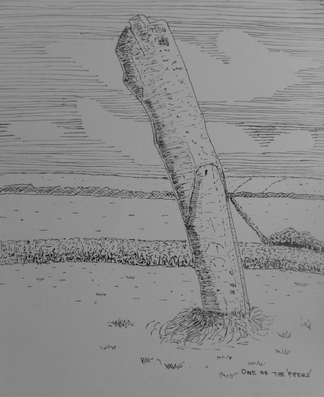
This is a precise circle of 19 evenly spaced erect stones (as I and Cotton in 1826 only drew 18, I suspect one went missing), dating from 2400-800BC, with the tallest stones to the south-west and the shorter ones to the north. It is thought that they reflect the phases of the moon, sun and life. The circle is also known as Rosemodress, the Boleigh Circle and as Dawns Men, Cornish for ‘the stone dance’. The popular term ‘Merry Maidens’ is a folk name relating to numerous fanciful stories of young girls turned to stone for dancing on Sundays. The true purpose of the stone cicles is unclear but may have had cultural or religious significance.

A little further along the B3315 is Tregiffian Barrow.

P1070065This is an excavated entrance of a megalothic chambered tomb built during the third millennium BC in the Neolothic period. The northern half of the tomb is obliterated by the road. In the 1960’s the eastern flanking stone to the entrance was found to have a random design of thirteen circular and twelve oval ‘cup marks’. This stone has been replaced by a cast replica by English Heritage.

Continuing along B3315 Boskenna Cross was reached opposite a lane to St Buryan. For many years the cross was buried below the Cornish hedge until it was ‘discovered’ again in 1869. The front of the cross has a figure wearing a tunic with the feet turned outwards. The Saxon King Athelstan granted a charter of extended sanctuary to St Buryan enabling wrongdoers to remain in safety within a mile or so of the church, rather than within the normal sanctuary of the immediate confines of the church. There are a lot of ancient crosses around St Buryan that may have been sanctuary markers.

It was now time to return to the scenic coastal path and so I headed across fields to Boskenna and St Loy, the latter valley being lush with trees, flowers and other vegetation, it being almost sub-tropical.

St Loy beachSt LoyBee on ThistleSeptember 2008 106-1

Demoiselle Agrion Dragonfly

A climb out of the valley leads to undulating coastline which tests tired legs but a rest can be had at the tiny hamlet and cove of Penberth where a number of the fisherman’s cottages are owned by the National Trust.

One further climb and Logan’s Rock comes into view an eighty-ton once rockable stone which in 1824 was dislodged by Lieutenant Hugh Goldsmith and a dozen sailors from his cutter. Such was the outrage of locals that he had to pay a princely sum to have it re-instated. The headland, ‘Treryn Dinas’, on which it is situated was once an Iron Age fortress settlement; four lines of ditch and rampart were constructed between third and first centuries BC and remnants still remain.

Opposite the headland I took the pleasant path through fields to the village of Treen, my overnight stop. After passing the small Post Office and shop my bed and breakfast was located and I was delighted to be able to have a soothing shower.

An American lawyer, Rosemary, was in the adjacent room and we decided to try out the local hostelry, the Logan Rock Inn, together. She was not feeling well and declined the food on offer. I was ravenous and devoured my meal quickly. She seemed to be suffering from a mixture of jet lag, over exposure to South Westerlies and exhaustion from walking the cliff paths. It is very difficult to ‘do’ the Penwith peninsula in a week from the States as she had planned. She had even arranged for a one man company called ‘Lightfoot’ to transport her belongings between her accommodation. Having carried my 28lb pack up and down the cliff paths I was quite envious and decided that in a few years time it might be an option to consider. However, I would hate losing the sense of independence of carrying all my needs on my back, not true backpacking with a tent of course as I was staying in hostels or bed and breakfast. ‘Lightfoot’ turned up at the pub to ask how my American acquaintance was getting on. I was impressed by this personal service and was not surprised to find he was doing a roaring trade.


Instead of the Wilderbeast Migration we encountered the Frog Migration, also the Crackpots Trail.There is definitely one at the End.

Post 155: 2 July 2017, Ripon Rowel Circles 4

At last a better forecast and we were able to resume the Ripon Rowel Circles walk at High Grantley, west of Ripon. This house looked like it was held up by plants.

P1070035

We soon reached the edge of Skelding Moor, where there were numerous sounds and sights of lapwings. curlews, skylarks and oyster catchers.

P1070036

Shortly after we came across a mosaic of a curlew

P1070037

And plants

P1070038

Even more surprising on a quiet lane there were numerous baby frogs the size of a 5 penny piece. They were all migrating somewhere? Apologies for the poor quality of the photograph but they were tiny and kept moving.

P1070045

Stopping at a bridge over the River Laver for a coffee break there was another mosaic, this time a brown trout. As with the previous ones this was part of the Crackpots Mosaic Trail. There are 22 mosaics on the trail, which were made in 1997. They are centred around Dallowgill, near Kirby Malzeard.

P1070047

Continuing to Laverton we stopped for a very early lunch and admired the local signage.

After lunch we met very fashionable sheep

P1070050

And some disciplined and

P1070052

Curious cows. P1070056

Finally, ‘Sid the Yorkshire’ went into raptures when we came across some rusty old ‘hedge finds’ and

P1070057

a 1959 Fordson Major Tractor. It takes all sorts! You could tell  we had been on part of the Crackpot Trail…….

P1070058

Miles Walked 8.6

Calories Burnt 985

Steps 18,000

Average Pace 18 Minutes per Mile

Fastest Split 5-6 miles 17.52 Minutes per Mile

Elevation Gain 491 Feet. 

Min elevation 442

Max Elevation 700