Post 270: 16 June 2018
I sat quietly reading the Rescue 2018 booklet of Incidents Attended during 2017 in the area of the The Three Peaks of Yorkshire. The peaks are Pen-y-ghent (694 m or 2,277 fit), Whernside (736 m or 2,415 ft) and Ingleborough (723 m or 2,372 ft). The challenge is to walk to the summits of each of the peaks in less than 12 hours. The walk covers a distance of 23.3 (37.5km) to 26.1 Miles (42 km), depending on the route taken.
Here are some of the reports:
Male Age 68 – Walker was reported to have passed out and then regained consciousness…Cave Rescue Organisation (CRO) carried him by stretcher to a waiting air ambulance.
Male Age 79 – A walker was reported to be in difficulty near the summit of Whernside. It appeared he had tripped and fallen. He was assisted to an air ambulance.
Male Age 78 – suffered a lower leg injury and was unable to progress to the top of Whernside. He was carried on a stretcher back to team vehicles and driven to a road ambulance.
Male walker aged 82 – requested help due to feeling faint when trying to walk. He was reported to have fallen earlier. He was brought down in a private vehicle.
Male aged 70 – was reported to have collapsed on the path. The helicopter flew him to hospital.
Male aged 68 – felt unwell, approaching the summit of Pen-y-ghent but continued to the top. Very soon after beginning the descent, he collapsed and lost consciousness. Despite CPR he did not recover.
Female aged 66 – slipped, while descending the stone-pitched path from Ingleborough falling and rolling 30m to sustain head, hand and leg injuries. She was flown to hospital.
Male aged 68 collapsed with chest pains… he was carried by stretcher to a road ambulance.
Female aged 73 had fallen and injured her ankle. She was extracted by vehicle.
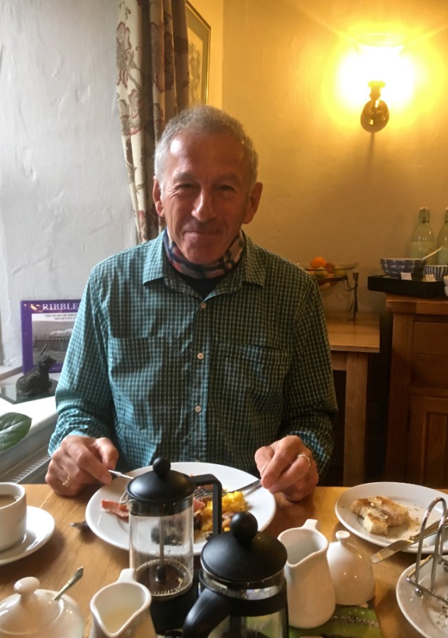
Dan, the next poor young and innocent ‘victim’, sat opposite me at breakfast quite unaware of the contents of the Rescue book. Actually he wasn’t even that young, being of ‘bus pass age’.
 I say ‘victim’ because I felt a little bit responsible for encouraging him to attempt the Three Peaks. For many years I had cajoled him into attempting this great Yorkshire Challenge, without success. He had lived in the ‘flatlands’ or ‘lowlands’ of Suffolk and Norwich, where the best thing to recently come out of the area, as far I can tell, is Ed Sheeran.
I can only think that he was a late developer when it came to walking and now he was making up for lost time. Males tend to have a lot of competitive ‘banter’ when walking, unlike when walking with females where I find there isn’t the competitive element. It is interesting that there are far fewer females who appear in the Rescue Reports.
After two previous successful Three Peak walks, I last completed the Three Peaks on 20 June 1998 in 7 hours 56 minutes, at the young age of 46. I felt I would never better that time and so retired from the activity! That’s my excuse.
However, in Dan’s favour he had a pretty impressive walking CV:
Trek to Everest Base Camp
Near summiting of Mont Blanc, only missing the summit because his walking partner, who he was roped to, was taken ill.
High route from Chamonix to Zermatt trek.
The second half of my ‘On Foot from Coast to Coast: The North of England Way’
Circuit of Mont Blanc.
Climbed Kilminjaro
Critically, three weeks ago, he had completed Alfred Wainwright’s Coast to Coast (192-200 miles depending on the route taken).
I pointed out to him in our ‘competitive banter’ that he couldn’t really be considered to be a ‘proper serious walker’, unless he completed The Three Peaks of Yorkshire. After completing coast to coast he was probably as fit as he would ever be and the Three Peaks were as dry as they had ever been and therefore this was his best and possibly only ever chance. The forecast was reasonable too – low cloud, if a little breezy. At least it wouldn’t be too hot!
At the last minute he booked his bed and breakfast at Middle Studford Farm (about a mile from the start Horton-in-Ribblesdale). This was an inspired choice as when I later joined him I thought it was one of, if not the best, bed and breakfast I had stayed in, especially for walkers (more of that later). .
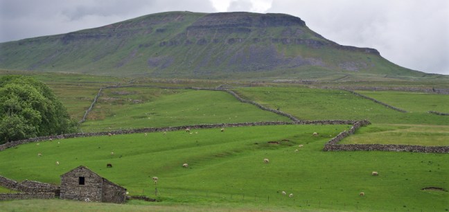
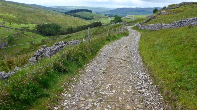
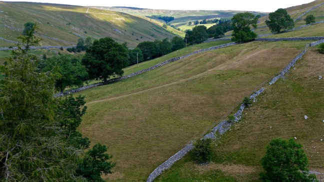
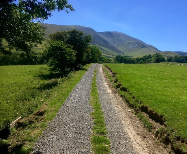
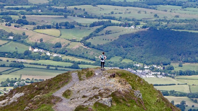
We parked near the church with the first peak Pen- y- ghent looming in the background.  Then Dan clocked in at the Pen-ghent Cafe at 8.30am.
 As we ascended a couple of youngsters had not got their dog on a lead and it ran off, uncontrolled, to chase sheep. We were very concerned about that. They did recover the dog so hopefully no damage was done to the sheep. Some people do need to take more control of their dogs.
 Standing below the increasingly steep path with rain starting I think Dan had some thoughts. Such as ‘What the heck am I doing here?”
  However, with a bit of ‘winding up’ he soon started to smile again.
  Soon after I donned full waterproofs as the wind and rain increased, Dan confessed to having left his waterproof trousers at home. Several points deducted there and jokes and banter about living in the flat lowlands he wouldn’t be aware of the vagaries of the weather in the northern hills and how tough it is ‘Up North’.
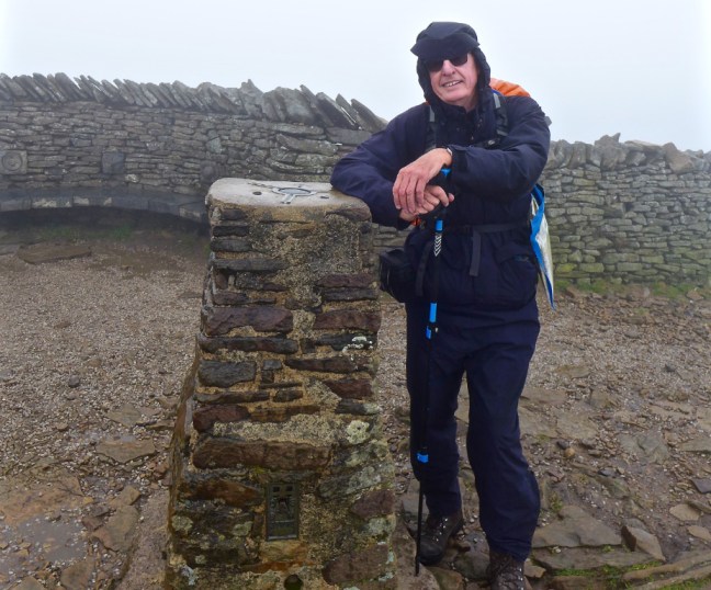
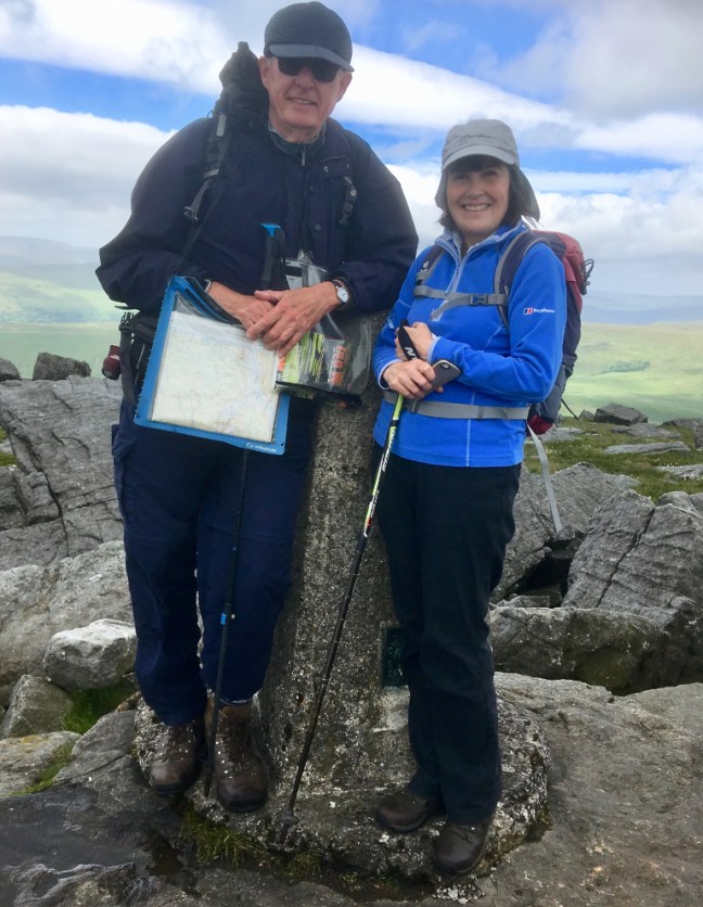
There is then a steepish rock scramble where care is needed when it is wet. With the wind now making us both look like ‘Michelin Men’, we managed a quick photoshoot at the summit. 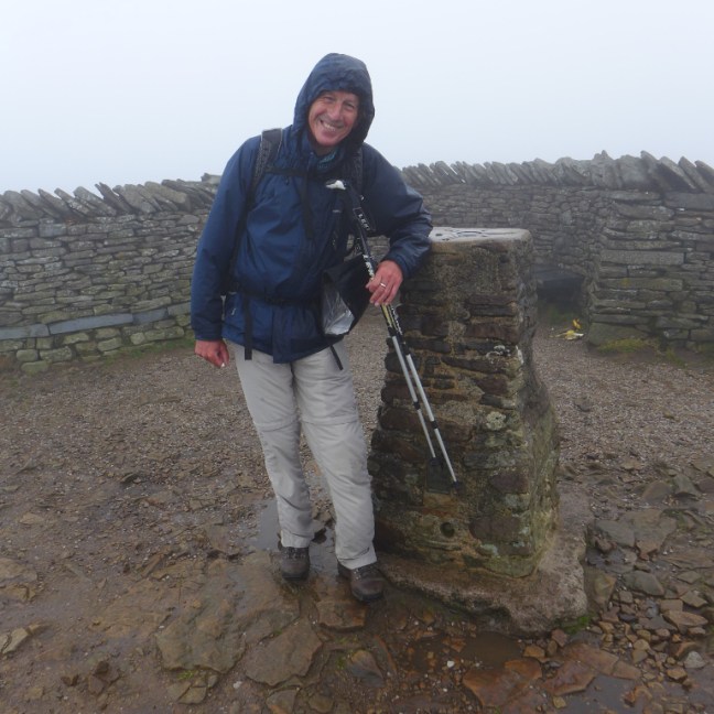
 Before descending amongst the mist and rain. Not what we had anticipated given the forecasts.
  At the bottom I departed for my bacon butties in the Pen-y-ghent Cafe and Dan carried on towards Whernside. This was my second breakfast as I had got up at 4.45am and had a early breakfast to drive 2 hours to the bed and breakfast on time. The sun came out and all was well with the world again!
 Except that a youngster was hobbling down the track a couple of inches every 5 minutes with two trekking poles either side. I asked if he was okay and had he taken pain killers, which he had. I asked if he was still in pain and he said, presumably referring to his girlfriend, she was the pain!
He said he had sprained his ankle, a reminder that 3 Peaks walks are a serious challenge even for the young, perhaps more so because of their inexperience. Even though he had good boots on, I thought he had broken his ankle as his foot was at a very extreme ankle. He then said a land-rover was coming to pick him up and I suggested he stop and wait for it to arrive. I passed the land-rover about 10 minutes later on the way down and advised them where I had last seen him.
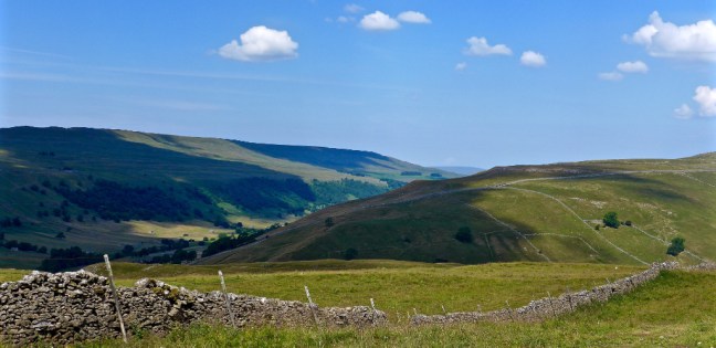
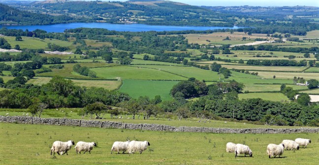
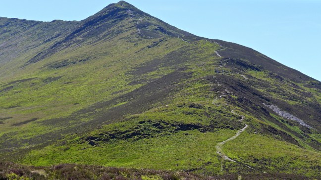
I met up with Dan in a lay-by after Nether Lodge and Hunter Hill, which looks up towards the second peak, Whernside. It is sometimes described as a beached whale and who would ever want to climb a beached whale?  Dan was going well and would go even better after he had some of my home-made Mary Berry fruit cake. It has miraculous properties (brandy) and would guarantee he got to the end. It is even rumoured it got me a free holiday in Bavaria, but that is another story….
  I was then able to track him on his ascent of Whernside using my big zoom camera lens.
  That’s Dan with the bright orange rucksack cover and white trousers (well they were white when he started).
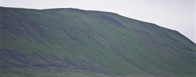
 I did photograph some walkers on the summit ridge at 14.05. This reminded me of the last sightings of Mallory going to the top of Everest, to perish there.
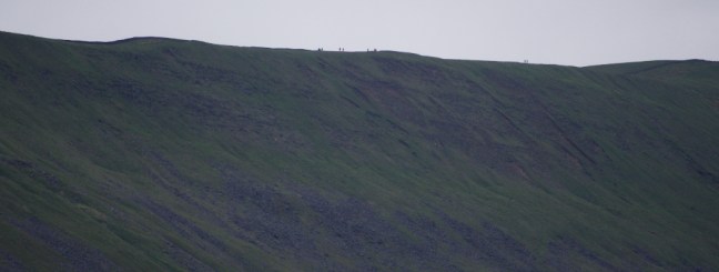
 Dan indicated he summited with this photograph at 14.35. Crucial evidence if he was to satisfy the Ethic’s Committee of his completion of the 3 peaks.
 It was to be several hours before I was to see him again. I waited in the car (catching up on sleep) just after the pub, north-east of Chapel le Dale.
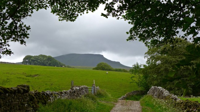
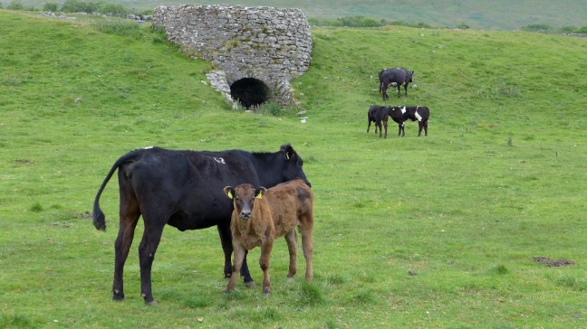
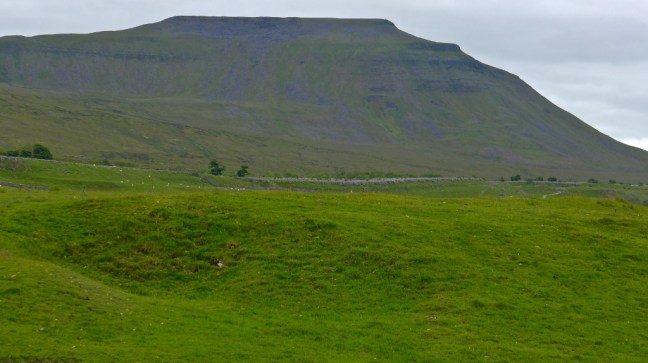
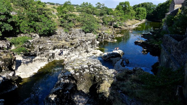
I wandered over to look at the local bull and cows, a lime kiln and the last peak, Ingleborough.

 However, Dan took the lower route directly opposite Chapel le Dale. I had no telephone signal and so at 16.40 I decided to head to the next rendezvous point after his descent from Ingleborough.
Dan later confirmed he summited Ingleborough at 17.20pm. I need to give him some photography training for, when under pressure and tired, his photograph is a bit out of focus. 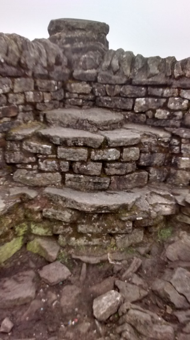 His final summit time came in just after I had started a sweepstake amongst walking friends as to what time he would finish. Huge stakes of £1 per bet. Bets of finishing time ranged from mine of 10 hours 30 minutes (too optimistic as the weather closed in) up to 11 hours 45 minutes. No one bet on him not finishing!
However, given the weather conditions as seen from my car (and no doubt much worse at higher altitude) I starting working on a contingency plan – Plan B. After 10 hours 30 mins I had lost my sweepstake and so put my mind to less urgent matters.
What happens if he slips on the wet rock or grass or gets lost in the poor visibility? I decided I would make a decision after 12 hours, that is 20.30. If the conditions were still bad and he hadn’t turned up I would contact Mountain Rescue. He could be appearing in next years Rescue booklet! Fame at last.  But Then, like a mole appearing from the ground, a little head appeared!
 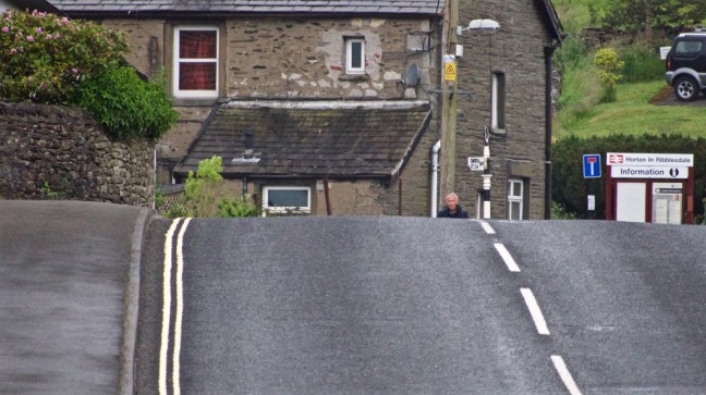 Then a very determined person.
 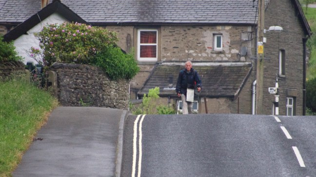 Then on spotting my Volvo a tired smile (I keep telling him to swop his VW for a Volvo).
 All that remained now was to walk another 10 minutes to the Pen-y-ghent Cafe to book in at the end, whilst I drove there!
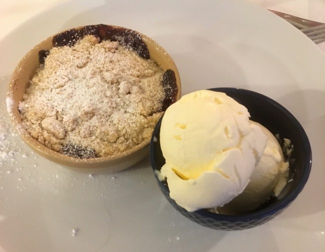
Every picture tells a story and what a story this was. He finished at 19.28. Total time of a very respectable 10 hours 58 minutes given the poor conditions at the start and finish. At least one much younger group gave up after Whernside because of the weather conditions.  The evening was finished off with a fabulous meal at the bed and breakfast cooked to order by the excellent chef owner. Even fruit crumble and ice-cream one of my favourites, not forgetting our first courses of delicious sweet potato soup and mushrooms garlic and tomato, all washed down with a well earned bottle of wine. I had been up since 4.45am!
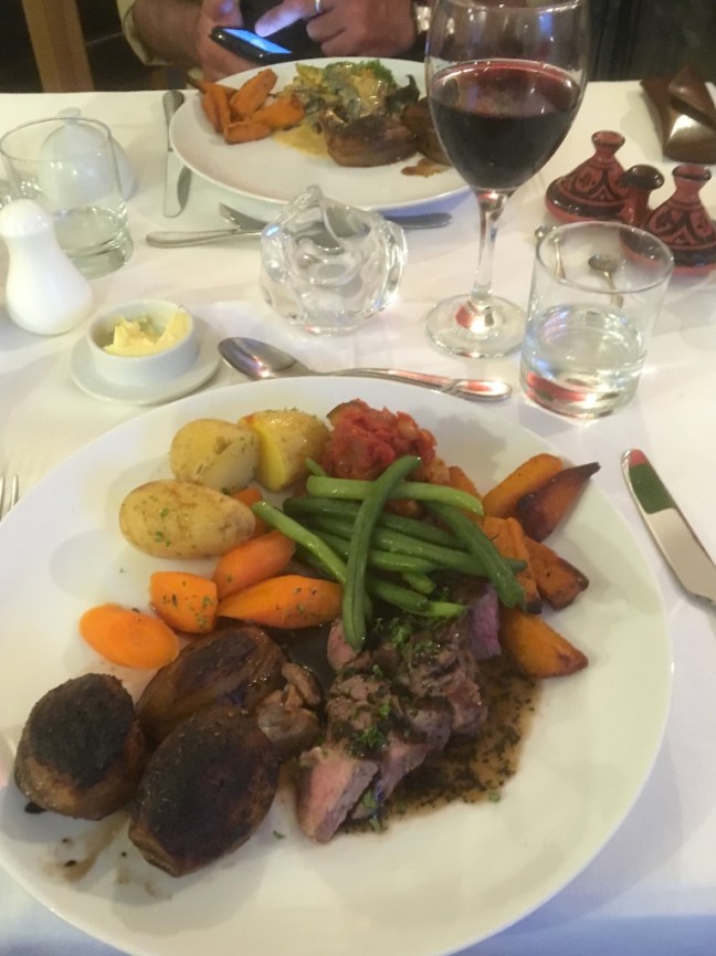
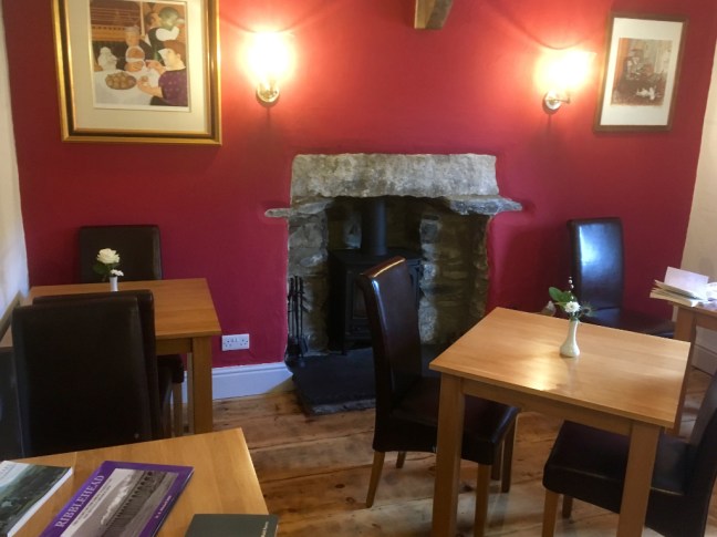 As I said one of the best bed and breakfasts I have stayed in.
Did I think Dan would complete the walk in 12 hours? I put my prediction in his birthday card which he will open on Saturday. Another year gone past the ‘bus pass age’.
Miles Walked:
Dan 23 to 26
Me 10
I was saving myself for Great Whernside on the Inn Way next day with Carol Caz and Sid the Yorkshireman – blog to follow.
PS I have suggested that Dan HAS to now to climb Great Whernside and Little Whernside (the boggy one). No doubt he will accept the challenge before he is 70, by which time we might have him trained as a serious walker.


 We were booked on an excursion in the morning to the Ring of Brodgar and Skara Brae. A short walk from the coach brought us to the Ring of Brodgar, which is an impressive stone circle constructed some 4,500 years ago. 27 of the original 60 stones remain.


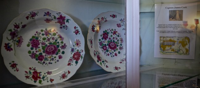
 I then headed to Skaill House where some of Captain James Cook’s crockery is kept.

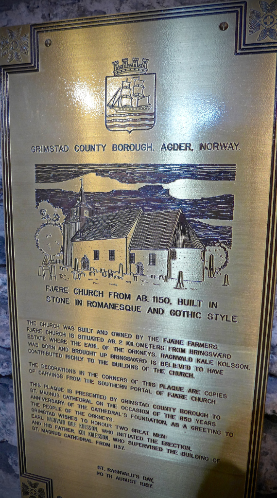
 After lunch on the ship I walked around Kirkwall in the area of St Magnus Church.


 Finally, there was a sunset viewable from the ship. A fitting end to a fascinating day.
 My wife Celia came dashing out of the shower naked and dripping wet. It was the nearest I would get to the ‘Titanic moment’ when Leonardo DiCaprio drew Kate Winslet completely nude, except for a necklace. Celia didn’t even have a necklace on.
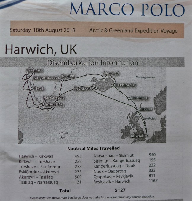 For those who know little about Greenland, it is the largest island in the World ( although larger Australia and Antartica are continents). Over 80% of Greenland is covered in permanent icecap (see bottom right below). Iceland, which we would also go to, is the smaller island bottom right.
 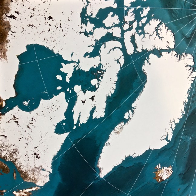 North Greenland is not that far from the North Pole! We went to South Greenland. We also went so far West we had to alter our watches and cameras three times going there and three times coming back.
  Our ship Marco Polo, shown below in Akureyri, Iceland, was quite small and over 50 years old. With 800 passengers it is the one behind the MSC Meriviglia, the latter which has about 4500 passengers and shouldn’t be allowed in small ports. The passengers swamp small communities and I even met a passenger from the MSC ship who said it was just too big. They are not of a human scale.
 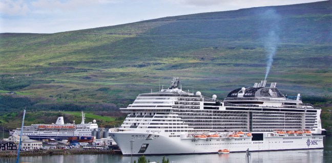 Marco Polo was built in East Germany for the Russians to a military specification and fortunately it is ice strengthened. It still has the original engines of over 50 years! It entered service in 1966 when England won the World Cup! It is quite iconic with sleek lines and the feel of being a real ship, not like the modern giant cruise ships which look like blocks of flats and seem top heavy.
 Our cabin 227 was on the Baltic Deck which was to prove excellent for seeing icebergs.
 An excellent book on the history of the Marco Polo is available for £7.99 from Cruise and Maritime (normal rrp £15.99).
  Greenland, with only an estimated population of 55,877 (1 January 2018), has many unusual attractions not least huge icebergs, glaciers, whales, dolphins, porpoises, seals, walrus, sea eagles, muskox, reindeer and even polar bears.
 It was such attractions and a 2 for 1 deal from Cruise and Maritime that led us to book this trip over a year ago. Greenland is not the easiest place to travel around with only 62 miles of roads in its capital Nuuk, few airports, the largest one being somewhat isolated in Kangerlussaq. There are no roads between towns and villages. Getting around is generally on a sledge with a few huskies to tow you along or by boat. Travelling by ship seemed the best way to visit it.
  Greenland’s capital Nuuk only has a population of only 17,316 (1 January 2016)
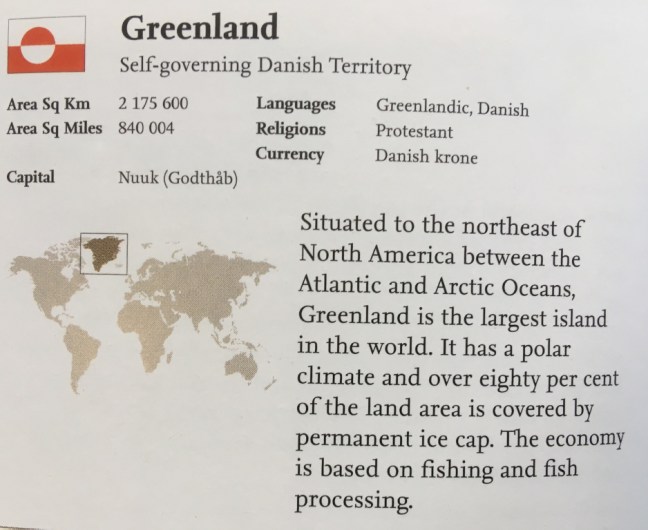 I hoped to find some walks when we docked in ports and indeed did find some. However, there are mosquitoes and black flies (that can give ulcers and cysts from bites) and so some protection is advised as with my head net below. One passenger was hospitalised on a previous trip due to black fly bites.
 So you are welcome to join me on this memorable journey, through my blogs (on Facebook or Word Press) which I will write over the next few weeks………..
 We continued to the New River Bridge.
 From where there are fine views towards Castle Howard,
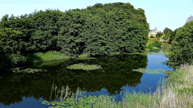
 And on the other side towards the Mausoleum.
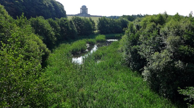 The Earls of Carlisle and their families are buried in the crypt. A little further on the Pyramid came into view. This contains a large bust of Lord William Howard (1563-1640) from whom the Castle Howard branch of the Howard family originates.
 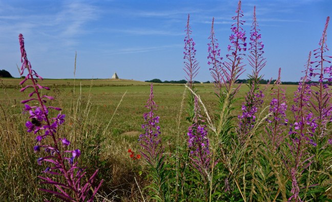 We then entered Pretty Wood to reach the folly of Four Faces.
 We were on the route of of the previous walk and again passed King Oak. This time Geordie Caz was with us so the tree got a hug.
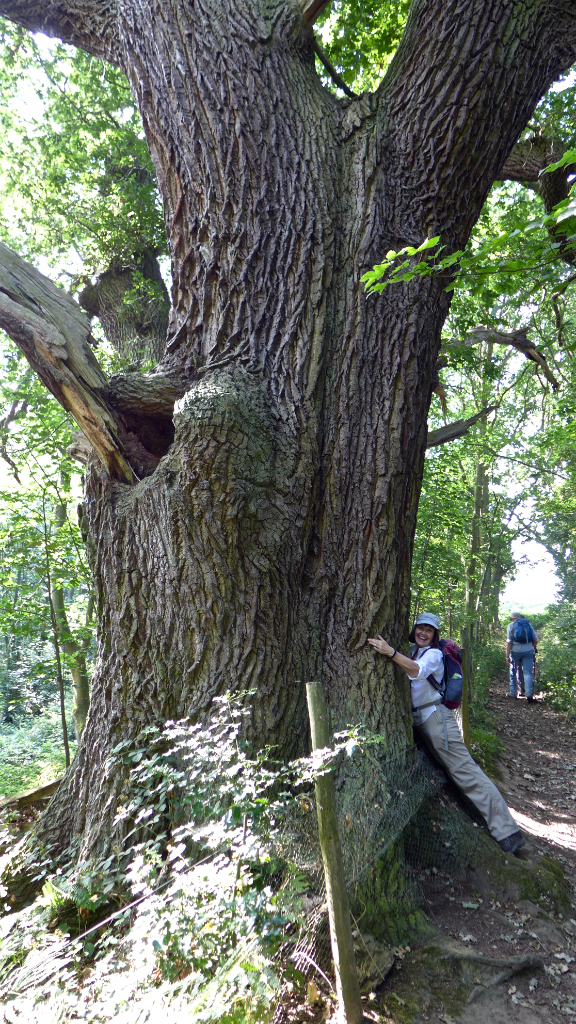 We then went through an overgrown area which for me in shorts was a bit tricky as nettles encroached on the path. At Hutton Hill Farm we reached arable land, which was much easier to walk through.
  In effect we were circling the mausoleum.
  A bit further on Alf looked as though he had gone to the toilet. We were in fact looking for a lunch spot. He had found a bench on which only he could sit. For some reason he looked so pleased. Only trouble was that it was in the sun and so we moved on……
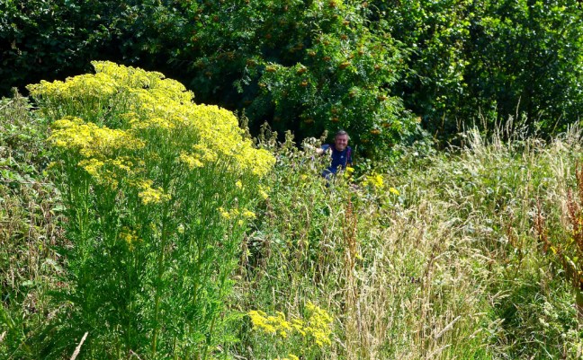 After lunch on a log in the woods on the Ridge of Entrenchments, where flies were a bit annoying, we headed back to the car and a temporary water pipe indicated that we were indeed in a drought. It was after midday and certainly very hot – over 25 degrees.
 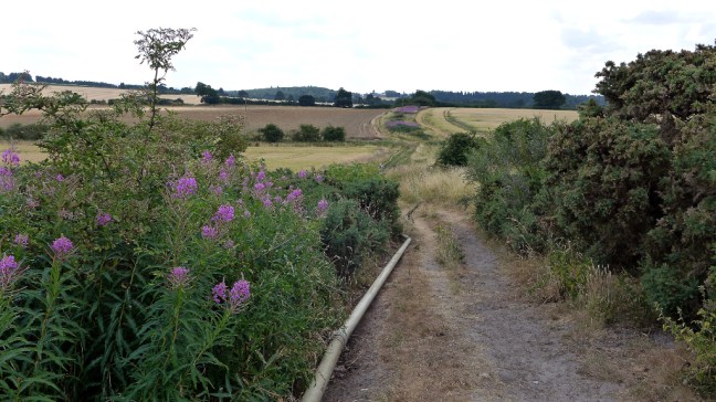 We finally arrived home and look what I found in my garden alongside the drive! My trekking pole had gone for an early walk and jumped out of my boot bag. As I said earlier when you get to a certain age inanimate objects find a way of moving about on their own.

 The previous day Alf had been on a walking navigation course and so we put him through the ‘Spanish Inquisition’ to see if there was anything we could learn. One thing that cropped up was how should you descend these large stiles. Facing frontwards or backwards. His course leader said facing frontwards as on turning round at the top he had seen walkers catch their rucksacks and fall off. We disagreed and thought backwards as shown by Sid the Yorkshireman below. We then discussed whether if we followed the course leaders advice and had an accident, could we sue him. However, it was decided this might not work so we decided not to sacrifice Sid the Yorkshireman.
 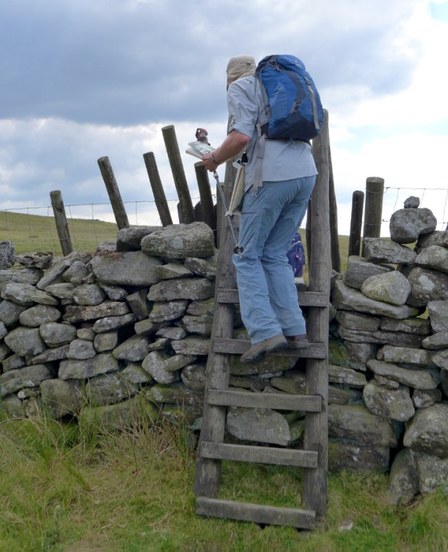 The question then arose as to when you should have ‘elevenses’, that is the coffee and banana break, given that we had started late. By 11am I was ready as having had breakfast at about 7.00am, over 4 hours earlier I was in need of a break and food, especially given the hot weather. The others wanted to carry on and complete more mileage before having a break. With missed one good viewpoint with nice soft grass but come 11.30am I went on ‘strike’ and just halted and got my banana and coffee out and said I would catch them up. I think the clue is in the title ‘elevenses’. The others reluctantly parked up and ‘Sid the Yorkshireman’ was duly punished by having thistles stuck in his foam mat. It is a brave walker who do not comply with the Chair of the Ethics Committee wishes.
 We descended to a fine limestone pavement.
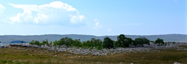 We briefly joined the Dales Way and recognised we had come this way on the first day of the Inn Way back on 19 March 2018, when we had started the walk.
  It was a bit different then when we had become Snow Angels!


 We then started ascending to Bale House.
 Where at about 2pm, at the nearby High Barn, we stopped for lunch.


 We then descended to Hebden Beck and followed it to Hebden.
  At Hebden Sid the Yorksman got his Chardonnay bottle out, swearing it was water. But when he mentioned he had gone a bit faint I did wonder.
  We descended further to the fine suspension bridge over the River Wharfe, where people were cooling off by swimming in the river.


 What water was left was being made good use of by the locals to cool off.
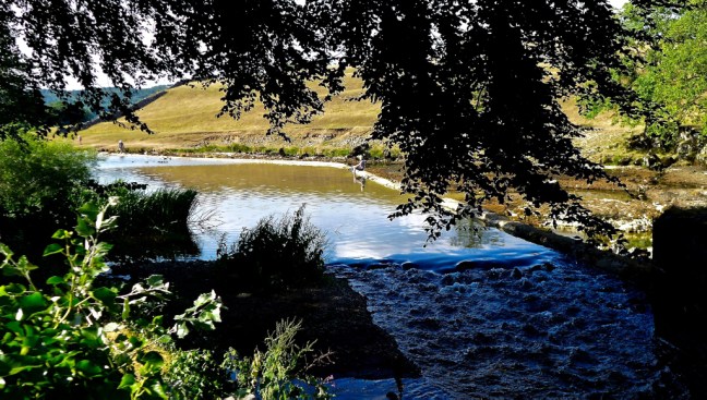
 We then ascended with Brockle Beck on our left to take a right turn to Rakefoot. We continued to ascend on open ground with fine views over Derwentwater to Cat Bells
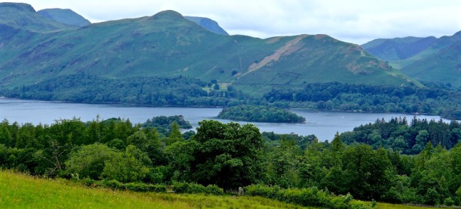 We passed some Duke of Edinburgh participants who were administering blister pads to their feet. A fairly common sight at this time of year. A few blisters and suffering on the fells is character building so I am told! I just think it is painful and should be avoided at all costs – the blisters that is.
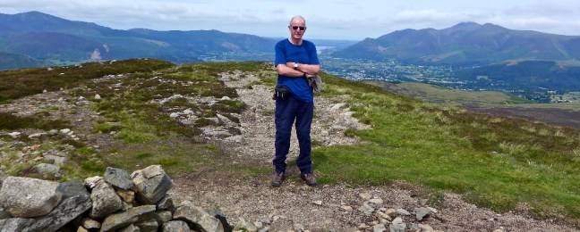
 Walla Crag’s height is easy to remember at 1234 feet and comprises a rocky, heather clad and forested area.
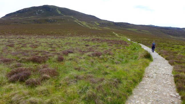 We soon reached the summit cairn where, at just after midday, it was time for a late coffee and banana break, with excellent views all round. The only problem was that I had forgot to bring my coffee.
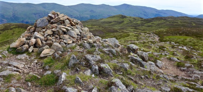
 There are extensive 360 degree views from here, including of Great Cable (top middle in the photograph).
 We were soon on our way to our main objective of the day High Seat. According to Wainwright the route is all swampy and is recommended only as a penance for sins. Fortunately, I had been a good boy and so the swamps weren’t that bad. Alternatively, the recent dry weather had made it acceptable. However, I could imagine with a little rain it would be a nightmare. We reached it at just before 1pm and by this time I had been ‘converted’. Not to a new religion for my sins, but to shorts as it was getting warmer.
 The summit is at 1995 feet but with my extra 6 feet I think that means at least my head had climbed a mountain, which is generally regarded as being over 2,000 feet.
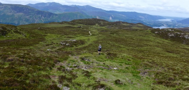 One final look back to the summit
 We descended to Ashness Gill
 It was steep and long and the two days of walking were catching up with me.
 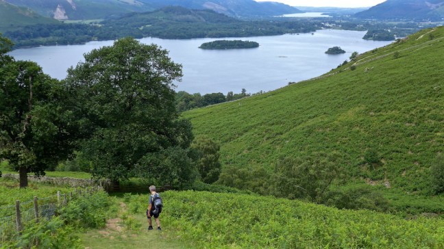 At neatly 2pm we reached Ashness Bridge, one of the most photographed scenes in Lakeland.
 It was a quick dash down to the Borrowdale Road (at this point I could have used my bus pass for the last mile or so but there was no bus) and then left past the Borrowdale Youth Hostel to Mary Mount and late lunch.
 We were slightly late for our ‘meet’, but not by much. We looked for the shopping bags of the wives and counted the cost. It was much cheaper on the fells.
 Parking at Bassenthwaite I was soon going through pastures with cows and calves, a little tense, particularly when walking solo. However, the already hot weather seemed to have tired them. What would it do to me?! I couldn’t use my bus pass here.
 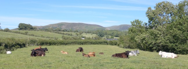 I passed through Barthwaite, Hole House, Barkbeth Farm and around Barkbeth Hill through pleasant pastures. The views looked good towards Great Cockup in the west and Skiddaw to the south-east.
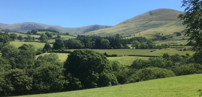

 Then the ascent began and Scotland, across the Solway Firth, in the far distance and Bassenthwaite Lake came into view.
 An unusual but natural out crop of rocks called the Watches was reached and the first good sightings of Ullock Pike (right) and Skiddaw (left) seen.
 I had a gradual climb towards the summit of Ullock Pike with changing views, including of the new £300 million water supply line being laid by United Utilities from Thirlmere to West Cumbria. This is to stop water being taken from Ennerdale Water, which is now a protected wildlife habitat. It is due to be completed in 2022. if this heatwave continues I wonder if they will need water from Ennerdale and Thirlmere?! £300 million for a glass of water seems a bit steep to me. Time for a coffee break – much cheaper.


 A few more puffs and fabulous views and I was at the summit of Ullock Pike.


 Another Woolfest husband had escaped to here. What now? With this weather there was only one thing to do – carry on up to the summit of Skiddaw (3053 feet), which was 823 feet above me. The fourth highest peak in Lakeland, but only a little lower than the highest peak Scafell Pike (3208 feet) . There was a somewhat steep path to get there!
 Even the sheep were feeling the heat at Carlside Tarn, especially with that wool coat! Just remember what the sheep (and husbands) have to put up with all you ladies at the Woolfest!
 Views ahead, and back where I had climbed, distracted from the heavy breathing as I climbed steeply. I passed two young men descending, one of whom was hobbling on his trekking poles with a knee bandage on. Not the most encouraging sight.


 A quick photoshoot on the summit and it was time for lunch. It was now 1.42pm and I had started walking at about 10.30am.
  Of course I had booked the best table in the restaurant on my previous visit here two weeks ago, but a young couple had taken it over!
  However, they let me join them at the table, out of the cooling breeze. Of course they only had T shirts on, but by the time I sat down I had 4 top layers of clothing on. There is no way I will get cold over lunch.
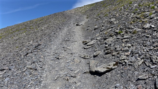
 I passed the two ladies I had passed earlier still ascending and encouraged them to carry on. I hope they made the summit? One was having asthma issues, which was affecting her breathing.
 It was a long descent back over Ullock Pike, but in continuing good weather the views were stunning.

 I dropped off the ridge to find an alternative path back to the car using a section of the Allerdale Ramble. At the junction I stopped for a rest and a nice couple asked if I wanted my photograph taken as I was solo, a nice thought.
 So I took a photograph of them too.
 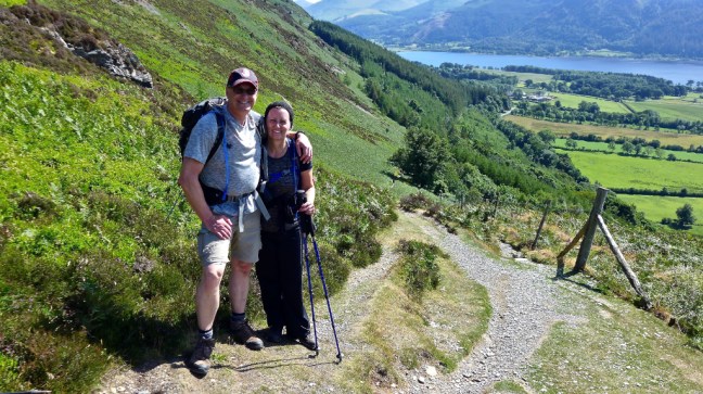 By now the sun was dropping and creating lovely reflections on Bassenthaite Lake
  It was about 5.30pm by the time I got back to the car. Celia phoned me to ask where I was!
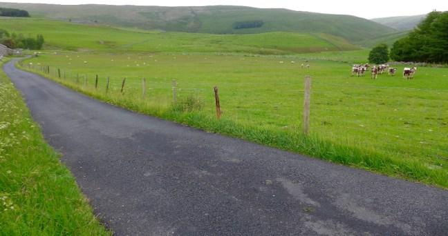 I arrived at Kettlewell exactly at 9.30am but Sid the Yorkshireman and Geordie Caz had been delayed due to traffic. However, we soon passed three inns on The Inn Way, The King’s Head (21st on the walk), the Blue Bell Inn (22nd) and the Racehorses Hotel (24th).
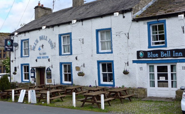

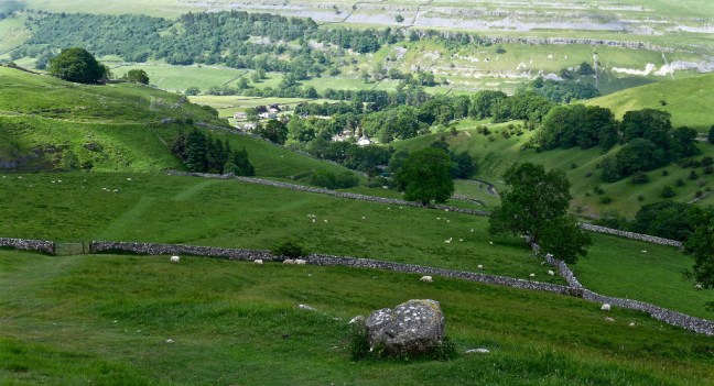
 Kettlewell is the Spaghetti Junction of Wharfedale with two streams and numerous paths radiating from it. After some debate as to which side of the stream we should follow (either is possible) and which path, we eventually found a sign to Great Whernside and then the navigating is straightforward – head straight up!
  It is important to keep looking back to capture the views back to Kettlewell and Wharefdale and even me! With high winds forecast, I had deliberately worn my Rohan ‘anti- wind hat’, which would only blow off if my head blew off as well.
 Eventually after much climbing we reached Hag Dyke Hostel which, at 1533 feet, has the highest chapel in England. The hostel is one of the highest in England. However, the highest hostel accolade goes to Skiddaw House in the Lake District at 1550 feet (which I have stayed in).

 After our coffee and banana break on a sheltered bench next to the chapel, we continued our ascent with increasing winds.
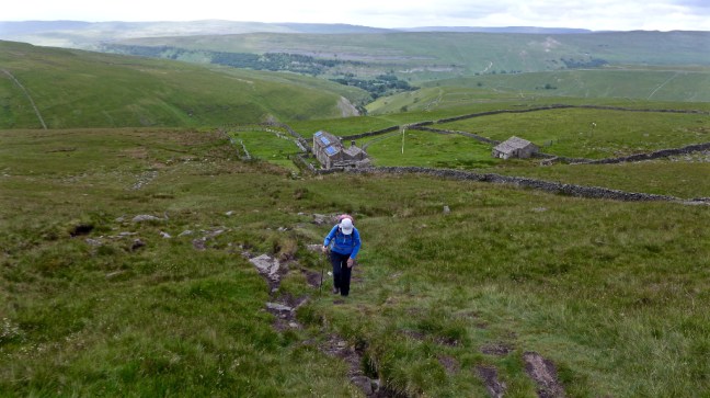 We arrived at the summit at 11.42am for a customary, but windy, photoshoot. Its summit is the highest point of the Eastern flank of Wharfedale at 2,310 feet (704 metres) which might explain the high winds. It was ‘blowing a hoolie’.


 Continuing along the summit ridge we left it on a descending signed path just before a pile of stones.
  The wind was whistling up the valley and it was quite difficult to stand at times. It was certainly strength sapping.
 We then had a lovely descent down the Top Mere Raod to Kettlewell.
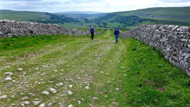
 However, the stony track is a bit hard on the feet. But nature finds a way of surviving even on stony tracks.
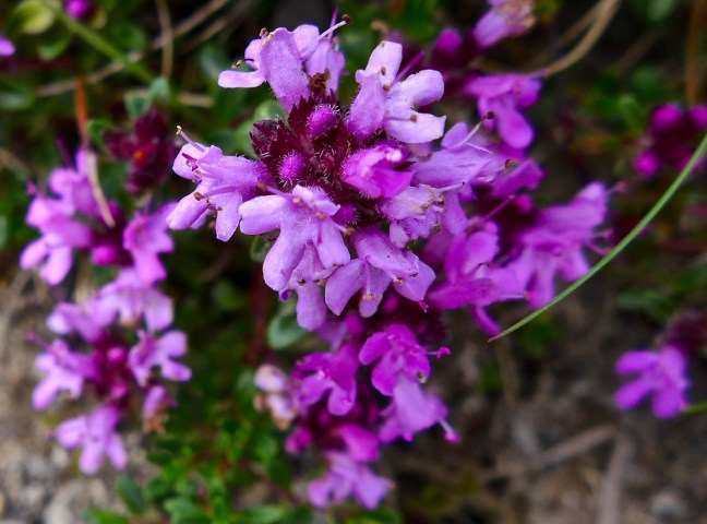 A really good circular walk. We now only had about 12 miles to walk to the end of the Inn Way at Grassington. We might even use our bus passes one way to do that section next time.
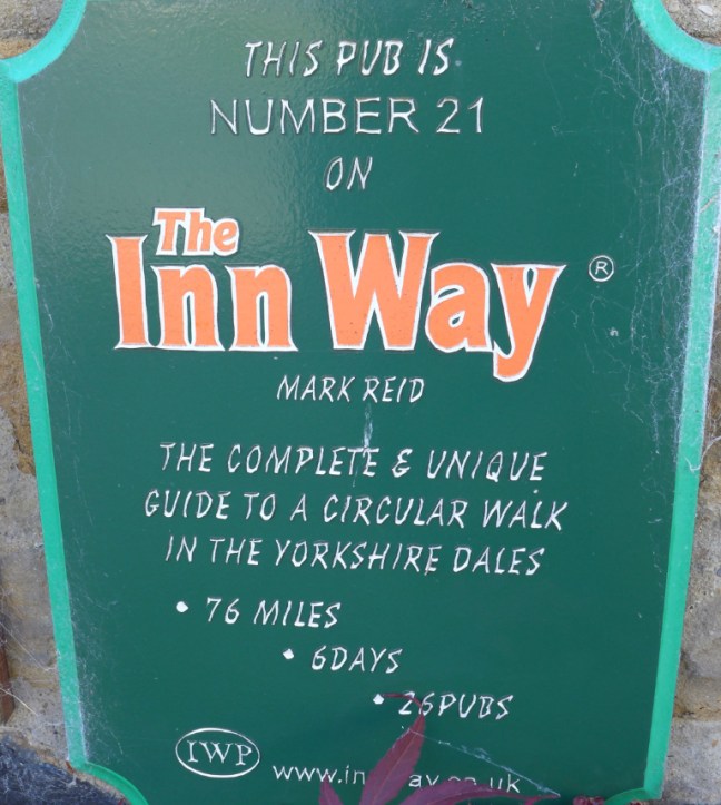 We then passed an old Wesleyan Chapel that had been converted to 3 bedroomed accommodation and was on the market for £389,950.
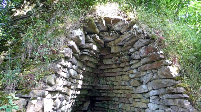
 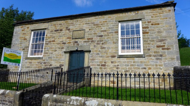 A lime kiln, built before 1850, was in excellent condition. Lime burning required a temperature of 800-900 degrees centigrade. Lime was mostly spread on the land (usually moorland) for creating new pasture or for improving existing pasture.
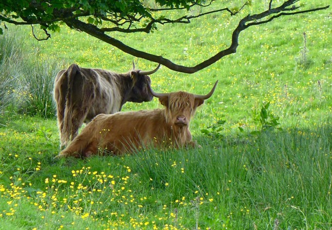
 Ponies and highland cattle are grazed at Arkleside.
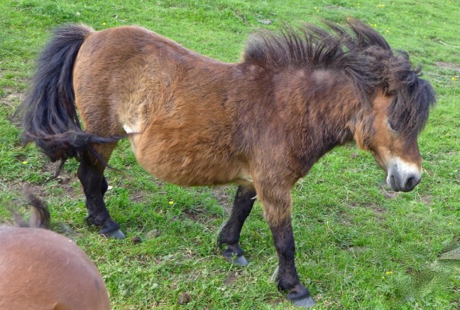
 As we headed up the valley we crossed the River Cover a couple of times.


 Some sheep had taken up residence in a barn.

 Delaying our departure until it had passed we continued along past Woodale Farm to join the quiet lane.
 It was time to find some entertainment as road walking can be hard on the feet and distractions take the mind off it. Also it is one way of stopping intermarrying.
  We noticed there were no potholes and the road was perfect.
 Then we remembered the Tour de Yorkshire came through here recently and I had come over from the ‘t’other’ side of the hill ahead at Park Rash. I was there!
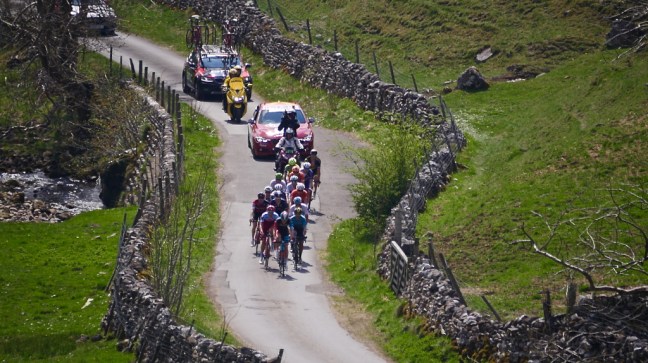
 The roads are re-tarmaced for the cycling. So if you have potholes just need to get the Tour to go through your roads.


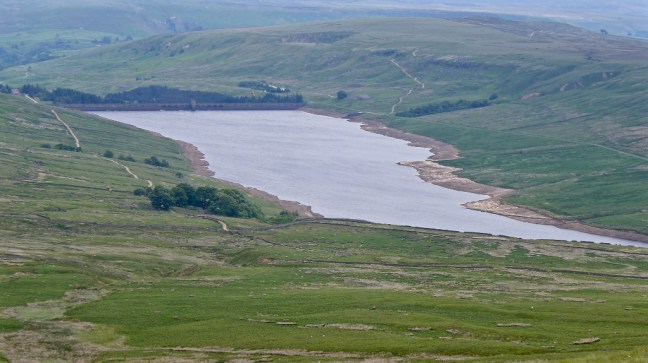
 The views to Scar House Reservoir made it worth it. The height of the water in the reservoir reflects the dry weather we have had recently.
 By the time I got to Deadman’s Hill I was ‘dead on my feet’.
 Little Whernside looks quite flat topped when your dead.
 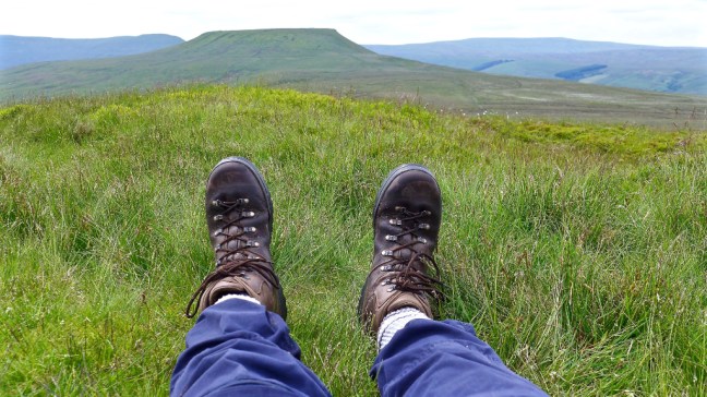 At least Sid the Yorkshireman didn’t chop my head off as happened to these poor folks. He realised I don’t carry much money on walks.
 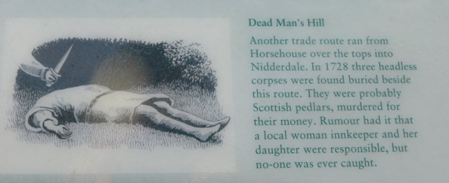 All that remained was a descent to Horsehouse and a visit to the church.


