Post 271: 17th June 2018, Little Hunters Sleets to Kettlewell via Great Whernside
Having seen Dan successfully complete the Three Peaks of Yorkshire at ‘bus pass age’ the previous day, I had an early start next morning with breakfast at the excellent bed and breakfast at Middle Stud Farm near Horton-in-Ribblesdale. I wonder how it got its name? Were there Higher and Lower Stud Farms?
In any event I had to get to Kettlewell by 9.30am to meet up with Sid the Yorkshireman and Geordie Caz.
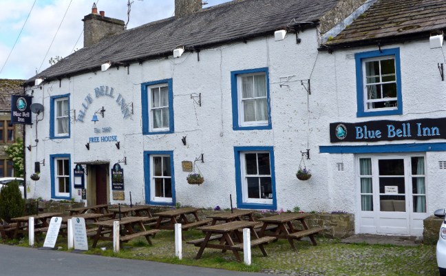
I set the sat nav and off I drove to Langcliffe which, after passing through, joined a single track road with passing places. It went on for miles, through gates, hairpin bends, fabulous views of the Three Peaks, complete remoteness and steep drops to the side, eventually dropping down to Arncliffe. However, the tarmac was of a very high standard, presumably because the Tour de Yorkshire cycling must have passed through there. 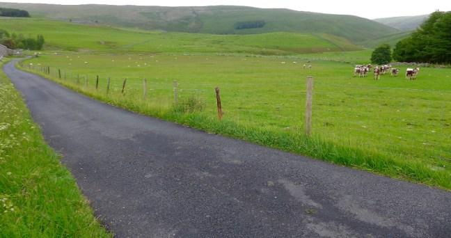 I arrived at Kettlewell exactly at 9.30am but Sid the Yorkshireman and Geordie Caz had been delayed due to traffic. However, we soon passed three inns on The Inn Way, The King’s Head (21st on the walk), the Blue Bell Inn (22nd) and the Racehorses Hotel (24th).

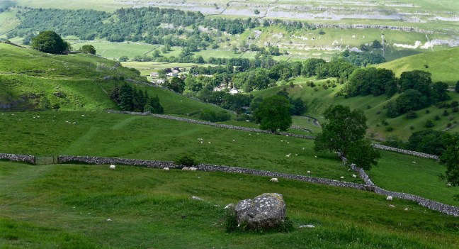
 Kettlewell is the Spaghetti Junction of Wharfedale with two streams and numerous paths radiating from it. After some debate as to which side of the stream we should follow (either is possible) and which path, we eventually found a sign to Great Whernside and then the navigating is straightforward – head straight up!
  It is important to keep looking back to capture the views back to Kettlewell and Wharefdale and even me! With high winds forecast, I had deliberately worn my Rohan ‘anti- wind hat’, which would only blow off if my head blew off as well.
 Eventually after much climbing we reached Hag Dyke Hostel which, at 1533 feet, has the highest chapel in England. The hostel is one of the highest in England. However, the highest hostel accolade goes to Skiddaw House in the Lake District at 1550 feet (which I have stayed in).

 After our coffee and banana break on a sheltered bench next to the chapel, we continued our ascent with increasing winds.
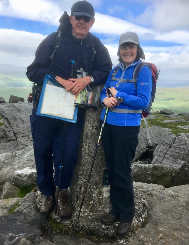
Again the views were better looking back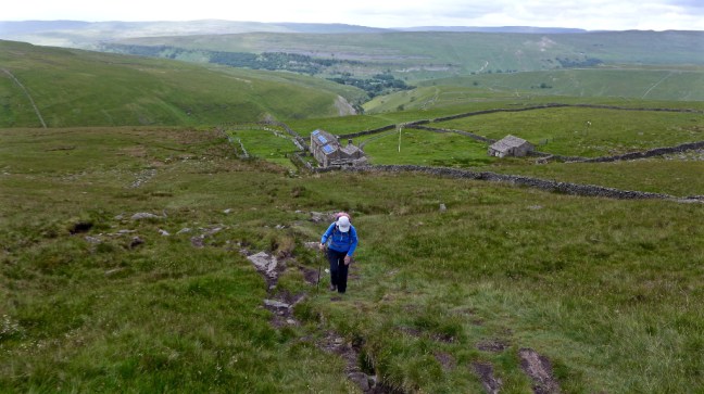 We arrived at the summit at 11.42am for a customary, but windy, photoshoot. Its summit is the highest point of the Eastern flank of Wharfedale at 2,310 feet (704 metres) which might explain the high winds. It was ‘blowing a hoolie’.


 Continuing along the summit ridge we left it on a descending signed path just before a pile of stones.
  The wind was whistling up the valley and it was quite difficult to stand at times. It was certainly strength sapping.
We eventually descended to where we had got to on the last Inn Way walk and stopped for lunch in shelter from the wind. After lunch we resumed the Inn Way route above towards the Starbottom Road (track) and Cam Head. The views along Wharfedale were stunning.  We then had a lovely descent down the Top Mere Raod to Kettlewell.
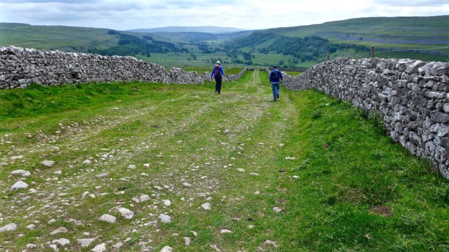
 However, the stony track is a bit hard on the feet. But nature finds a way of surviving even on stony tracks.
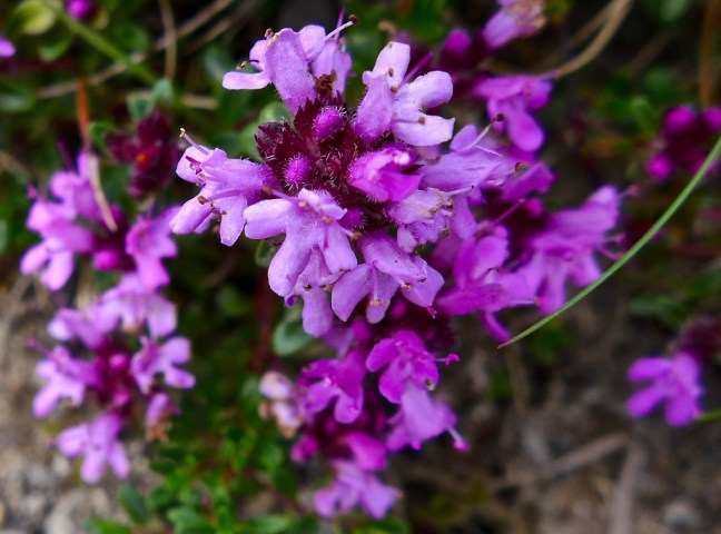 A really good circular walk. We now only had about 12 miles to walk to the end of the Inn Way at Grassington. We might even use our bus passes one way to do that section next time.
Of course I had an extra spring in my step on this walk as, after having been told I had skin cancer (sun related as walkers are in the high risk group) a few weeks ago and had minor surgery, I had since, after further post surgery tests, been told that in fact I hadn’t in fact had or got cancer. My good looks (what goods looks I hear you say?) might even return after a little healing in the winds of Yorkshire. I will of course continue to wear one of my 14 hats and apply sun cream liberally. And so should you in the sun.
Miles Walked 10
Calories Burnt 3320
Steps 21,679
