The First Cruise Ship of 2017 to Cross the Arctic Circle in Norway.

Post 106: 25th January 2017, 1000 Mile Walk Challenge 

On the previous day we were the first cruise ship of 2017 to cross the Arctic Circle in Norway. Many more will eventually follow in the spring and summer months.

The Captain had made the correct decision to head for the shelter of Ofotfjorden, in order to avoid the force 10/11 storm and a dangerous narrow passage to Harstad.

I awoke at just before 8am to look out of my cabin to see a ski slope lit up and apparently suspended in mid air in the distance. Was I dreaming?

p1020591

There was also a huge bridge all lit up.

p1020597

A very surreal start to the day!

There were the bright lights of Narvik too and the mountain, so it wasn’t a dream.

p1020598

I got up fairly quickly to do some early morning photography, before the sunrise which was due at 9.25am. Given that sunset was due at 2.19pm it was going to be a short day!

At 2.08pm I took this picture

p1020603

At 2.13pm this one.

p1020610

At 2.19pm it went dark again!

Despite strong winds and roughish seas still, between sunrise at 9.54 and sunset at 2.19, I somehow managed to walk 3 miles around the deck.

Miles Walked 3

Weather: Partly Cloudy Skies

Air Temp: 4 degrees C/39 degrees F

Sea Temp: 5 degrees C/ 41 degrees F

Wind: Force 5


Sea Serpents, Sea Eagles and Crossing the Arctic Circle

Post 105: 24 January 2017, 1,000 Mile Walk Challenge

Today was a sea day, when we would cross the Arctic Circle.

There was time to walk a couple of miles around the deck before breakfast. With all the delicious and tempting food available on a cruise ship its essential to get some walking in on the deck. The promenade deck on MS Balmoral is timber and so trainers are ideal – 4 times around the deck equals one mile. There is always plenty to see when in the islands area of Norway. There are literally thousands of islands. The Norwegians are great bridge and tunnel builders and fortunately, due to their lucrative oil, timber and fishing industries, can afford to build magnificent bridges and tunnels to islands with a tiny population. It is always a good idea to carry a camera when walking around deck as you never know what you will pass or see.

p1050746

We passed Rorvik at 8.52am. This is the capital of a large island group called Vikna, which consists of almost 6,000 islets, skerries and islands and is home to many birds. There are about 3,700 inhabitants living on seven islands. There is much fishing, fish farming and farming in this area.

The last sighting of a sea serpent was made in 1926 by two boys fishing for mackerel on the northern side of Vikna. It was 200 metres long  and had 60 humps. Unfortunately, the boys did not have a camera. I wasn’t going to make that mistake!

p1060024

Soon after leaving Rorvik, Leka a large island featured in the Norwegian Sagas, was passed to our left.

In 1932 a 3-year old girl called Svanhild was carried away by an eagle and taken to its nest on a mountain, 300 metres above the ground. She was later rescued and continued to live in Rorvik. She kept the dress she was wearing when she was taken. I did not get any pictures of white tailed sea eagles on this trip, but here is one I took on  a trip on MS Polarlys (Hurtigruten) in 2012.

With an 8 foot wing span it could lift a 3 year old. Magnificent birds.

Hope my grandsons takes note if they go to Norway and stay close!

norway-2012_6220

After breakfast a small coaster passed us going south.

p1020548

We then passed Torghatten (Hat Mountain), the mountain with the hole in it.

After lunch a Hurtigruten ship, MS Kong Harald, passed us going southbound at 1.57pm. Time for a quick wave.

p1020555p1020558

The Seven Sisters Mountains were passed (see separate video on Facebook/You Tube).

With sunrise at 9.25 and sunset at 4.54, light seem to be already fading when we passed under this bridge at 2.30pm.

p1020562

So that by 4pm the light really was going.

p1020563

So how could we find the Arctic Circle, which we were due to pass at about 4.20pm?

Fortunately, the ship had its high intensity beamed light to seek it out.


I have a much better picture I took in July 2014, which is in my lounge at home

towards-the-north-pole_2724_edited-3

It was shortly after this that a force 11 storm was forecast and instead of carrying on in danger through narrow channels to Harstad, we diverted to Ofotfjorden, to ‘sit out’ the storm near Narvik.

Miles Walked 2

Weather: Cloudy Skies With Drizzle

Air Temp: 4 degrees C/39 degrees F

Sea Temp: 7 degrees C/45 degrees F

Wind: Force 5


Sea Days and Train Days

Post 104: Winter Norway, 22 January 2017, 1,000 mile walk challenge 2017

Today was a sea day so the only walking I could do was around the deck.

p1050633

4 laps around the deck is 1 mile.

Miles Walked 4 

Cloudy Skies

Air Temperature 6 degrees C/43 degrees F

Sea Temperature 9 degrees C/54 degrees F

Wind Force 3


23 January 2017, Alesund Norway.

We arrived early at the wonderful town of Alesund, with its art nouveau architecture. Walking would be limited as we had an excursion booked to go on the Rauma Railway and see the Trollstigen Mountains.


Arriving by coach at the Trollstigen Mountains looming over 1,555 metres into the mist, we searched for the Trollveggen, which at 1,000 metres is Europe’s tallest vertical overhanging rock face.


We then headed for lunch at the lovely Bjorli winter resort.

After lunch we were able walk a little around the hotel.  Microspikes were essential.

Finally, it was time to board the Rauma Railway to go through the beautiful and dramatic Romsdalen Valley to Andalnes.

p1020493

The views from the train are spectacular.

p1050664

p1020502

We arrived at Andalsnes after a breathtaking journey. Note the coach is a chapel.

There was an interesting coach drive back to Alesund with many dramatic bridges and tunnels to go over and through.


Sunset was at 4.09pm and so arriving back at the ship it was now time to do some night time photography, which I love doing. From a berthed ship, with various lenses and with a tripod it is possible to get some good results.

p1050731

p1020547
Mount Aksla and the 414 steps to the top.


There was just time now before dinner to continue with the 1,000 mile walk challenge, 2 miles around the deck!!!

Phew what an amazing day!

Miles Walked 2

Weather Cloudy Skies with drizzle

Air Temperature 6 degrees C/43 degrees F

Sea temperature 7 degrees C/45 degrees F

Wind Force 5


Conquering the Peeping Roseberry, Iridescence, What Posers, and the Fall.

Post 103: 6 Febrauary 2017  Cleveland Circles 14

Having returned from Norway late on Saturday (about midnight) and returning to a pile of washing, mail, emails, birthday cards, etc etc, when Sid the Yorkshireman suggested that as the forecast for today was good we should do a strenuous 11 mile walk around Captain Cook’s Monument, I was somewhat reserved. However, as it had been established I was part Viking I had no choice but to accept as they are not meant to be wimps.

The irony of a walk involving Captain Cook hit me as I had been through 4 storms at sea, including at two force 10/11 (12 is hurricane), had been up many nights (see previous blogs) hoping to see and photograph the northern lights, had more than exceeded my gin and tonic and cocktails ‘allowance’ and was probably still over the limit for driving (fortunately Steve offered to take his car). I was also still suffering from Arctic Cough.

Steve made it worse by saying we had to leave at 7.00am and Carol had to get back for an appointment.

After going through fog and mist (as per many previous weeks) we arrived at Great Ayton Station just after sunrise and with bright clear skies.

Leaving the station we soon had a view of Roseberry Topping, which on previous walks had been peeping tantalising at us from a distance. This time it was much closer and it was on the agenda to be conquered. p1060188

The views to the Cleveland Hills were awesome with frost making the fields below glisten.

p1060189

The climbing soon started and Sid’s pose says it all.

p1060190

Are those buds on the tree? Spring looms?

p1060191

We soon reached Captain Cook’s Monument after much huffing and puffing up the first of four steep ascents on this walk.

p1060195

Captain James Cook was born in 1728 in Marton a little village fairly close to here. In 1736 his family moved to Aireyholme Farm on the outskirts of Great Ayton below us. At 17 he moved to a grocers shop in Staithes. He soon moved to Whitby where he became apprenticed to the shipowner John Walker. He was to become famous for his voyages to New Zealand and eastern Australia (1769-70) and then to the South Seas (1772). It was on his next voyage searching for the North-west passage round Canada that he was forced to rest in Hawaii where he was killed trying to settle a dispute between his men and the local people.

The monument was erected in 1827 and is 15 metres high.

Descending from the monument and passing some poo bags it was clear that some folks either can’t read or just don’t care.

p1060196

A mysterious inscribed border stone was passed?

p1060199

The first of a number of poses were made in front of Roseberry Topping, the Yorkshire Matterhorn.

p1060201

The views were superb.

p1060210

It was then that we started to get iridescence skies, something I had witnessed in Norway the week before. Yorkshire was competing with Norway!

p1060214

Rather oddly I converted this to black and white, but I think it works?

p1060217

We then came across two stones on the path from Holy Trinity School. Does anyone have more information about the school or how the inscribed stones came to be on the path?

We soon started to descend towards Guisborough,

p1060222

And watched a logging operation for a while. A video will be put separately on Facebook and You Tube. 

p1060225

Another steep ascent began towards the Hanging Stone and this pose again says it all.

p1060227

Our lunch stop ahead!

p1060228

p1060229

More posing.


But this is real posing. See slideshow. 

This slideshow requires JavaScript.

Ascending Roseberry Topping we discovered we were 46 miles from Helmsley and 64 miles from Filey on the Cleveland Way.

p1060243

Finally, we conquered Roseberry Topping for some ultimate posing.

And pictures of the conquered.

We had reminder that much hard work went on these areas in the past extracting ironstone.

p1060257p1060258

But Roseberry Topping was not conquered and gave Sid a kick up the backside and sent him flying on some slippy mud just towards the end of the walk.

With no broken leg and just damaged pride, Carol and myself laughed so much my ribs are still hurting or is it still the Arctic Cough?

A sign of spring finished a great walk.

p1060262

Miles Walked 11.25

Elevation Gain 1680 feet

Minimum Elevation 61.3 feet

Maximum Elevation 1044 feet

Steps 23,400

Calories Burnt 1,300

Average Pace 18.54 Minutes Per mile. 


Sunset and Sunrise from Southampton

Post 102: Friday 20th January 2017. 

I was about to start my 2 week cruise to Norway, with some associated walks.

My ‘Norwegian Walk’ began with a 1 mile walk  around the deck at around 7.07pm whilst still birthed at Southampton, as the sun began to set. The start of our holiday. p1020476

Miles Walked 1

Partly Cloudy Skies

Air Temperature 3 degrees C/37 degrees F 

Wind Force 4 Slight Moderate


Saturday 21st January 2017

I awoke on my 65th birthday at just after 7am to a lovely sunrise somewhere in the North Sea. See slideshow:

This slideshow requires JavaScript.

I completed 3 miles around the deck before birthday celebrations got into full swing in the evening.

p1050615

Sunrises and sunsets are one of my favourite photographic subjects and this one exceeded my expectations. There was hardly anyone else on deck at just after 7.00am! What a treat you can miss by staying in bed.

p1020482

It is always a delight to see another ship pass by, this one at 7.49.

p1050628

This next two weeks of my 1,000 mile walk challenge were going to be something very different from my normal walks.

As per my previous blog I discovered I was part Viking and it only seemed appropriate that I was heading for Norway with my dearest Celia.We had a lovely meal and celebrations in the evening on formal night with friends Annabelle, Christine and John on the MS Balmoral. I thought it best not to turn out in my outdoor gear!

p1060266

Miles Walked 3

Partly Cloudy Skies

Air Temperature 3 degrees C/37 degrees F

Sea Temperature 8 degrees C/46 degrees F

Wind Force 4 Slight Moderate 


I am now part Viking – But which parts? She didn’t recognise me with my clothes off. Northern Lights and my 50th long-distance walk completed.

Post 101 : 5 February 2017. 1,000 Mile Walk Challenge

Yes it’s official I am part Viking. My recent DNA tests, the results of which were given to me on my big birthday on the cruise ship, Fred Olsen’s MS Balmoral , revealed the following.

Great Britain  38%

Scandanavian (Viking) 32%

Irish  25%

Europe West 4% 

Europe Jewish 1%

Iberian Peninsula 1%

Italy/Greece 1%

So it was only appropriate that with these results I was on my way to Norway, to hopefully see the Northern Lights again.

In order to carry on my 1,000 mile walk challenge I decided that despite five storms at sea including two force 10/11 violent storms (force 12 is hurricane), (videos to be added on Facebook and You Tube later), 

p1060187

See Slideshow

This slideshow requires JavaScript.

paths on land that were sheet ice and significant  rain on lower ground and snow on higher ground I must keep walking on the trip, sometimes around the deck of the ship and sometimes on land.

See slideshow:

This slideshow requires JavaScript.

Plenty of snow. Marks in the snow left by early morning skiers are evident.

p1050989

Sheet ice.

p1050991

Deep snow

p1050648

As well seeing the Northern Lights I also wanted to photograph them.

I succeeded in walking 34 miles over two weeks, which just passed the criteria to be classed as a long-distance walk. This was my 50th completed, which was my target I set to do in the 1990s by the time I was 85. I had reached my target 20 years earlier than planned.

In order to complete the various tasks, particularly seeing the Northern Lights, I had to dress accordingly for the cold and to spend hours on the deck of the ship waiting for the Northern Lights to appear. The clothing included thermals, a Rohan goose down jacket, winter lined trousers, a Norwegian Dale woollen jumper, two hats, two pairs of gloves, Yaktrax hand and foot warmers, two pairs of socks, a neck warmer and over-trousers. This turned out to be a mild two weeks in Norway!

In addition, when walking on land, micro-spikes were essential. I saw three other passengers from the ship slip on the ice.

When on the way to dinner one night, dressed in more smart casual attire, a lady who I had previously met whilst photographing the Northern Lights, replied when I said hello to her, that “she hadn’t recognised me with my clothes off”!

I think she meant to say she didn’t recognise me with my outdoor clothes off!

p1060027

Sometimes I was on deck until midnight, 1am, 2am and between 3am and 7am and some rest outside in the cold was necessary.

p1060034

However, despite a number of disappointments due mainly to cloudy skies, I did get to photograph the Northern Lights from the deck as below:

p1020869

p1020871

p1020881

p1020883

p1030002

p1030004

Well worth all the effort!


A Century of Posts, Viking or Not? The Last Blog? Does Kildale Exist? Two Missing Aeroplanes, Walk like a Mountain Goat.

Post 100: 17 January 2017. Cleveland Circles 13. 

It is with some surprise that this is my 100th blog in The  Secret Diaries of a Long-distance Walker. When I started blogging in August 2015 I hadn’t a clue where it would lead; a bit like a long-distance walk. It is heartening to know that I am currently getting over 1,000 views of the blog each week.

I would like to particularly thank those whose showed encouragement in the early days and I think they know who they are. Secret Diaries will now take a rest for two to three weeks but will return in early February. By the time I return I will know after my big birthday on the 21st whether I am Viking, Anglo-Saxon, Irish or whatever, having had a DNA test.

img_0186_edited-1

My walking companion ‘Sid the Yorkshireman’ thinks the test may show that I am a criminal and may be put away. If he is correct then it could well be my last blog. Having said that, it might be possible to blog from prison, but I might get short of walking material. There is nothing like good friends to keep you grounded.

However, lets live in hope that I am not a criminal and in two to three weeks I will be back on the North York Moors and blogging again.

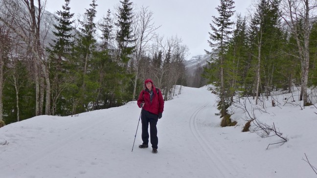
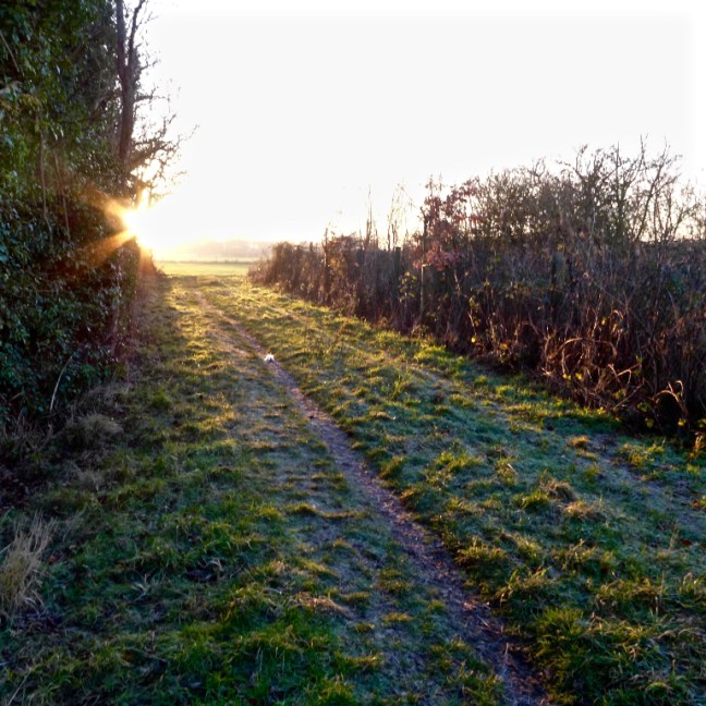
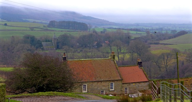
So leaving home at the ridiculous time of 7.30am in fairly thick mist and fog we headed out after trying to put Kildale, our destination, into my new Sat Nav. Now according to my Sat Nav it didn’t show up and therefore presumably doesn’t exist. I then remembered that I had been there a couple of times before, not least on The Samaratan Way.

So abandoning all this high tech support we decided to use our memories to find our way to Kildale, not helped by thick fog. However, as our motto is Adventure not Dementia we eventually arrived at Kildale just before 9.00am.

Starting walking at 9.15am we took a detour to the Church of St Cuthberts and St Gregory, Gregory being the Pope in Rome who sent in the first missionaries to England in 597 AD.

When the Vikings invaded in 793, Lindisfarne Monastery was sacked and again in 875 when it was abandoned. The surviving monks carried the coffin of Cuthbert to Yorkshire and wherever they stayed they erected a small chapel, including  one at Kildale. Eventually St Cuthbert was interned in a vault beneath the newly built Durham Cathedral.

p1050568

We were greeted by a couple of strange characters above the porch.

And then by some strange tombstones. When the church was being rebuilt in 1867-8 the floor was lifted to reveal a number of Danish (Viking) Burial artefacts, including a Viking sword, axe, and weighing scales. This pagan burial on a Christian site was very unusual.

An enthralling television series I have been following is The Last Kingdom, based on Bernard Cornwell’s book of the same name. It follows the Viking invasion of what is now the United Kingdom and the battles with King Alfred of Wessex.

img_2235

Fortunately, the great stone grave slabs survived and commemorate the Percy family with the Percy Arms. They are now in the porch. The one with an inscribed cross and sword suggests it is a Crusader’s tomb.

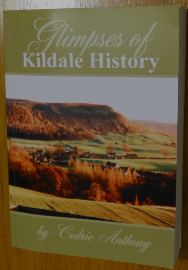
A book was on display in the church giving more information, and copies can be obtained from Mary Cook, 1 Station Road on the left just up from the church. When buying a copy of the book (buying good and interesting books is an incurable addiction of mine) I forgot to ask the lady whether she was a relative of Captain Cook!

p1050613

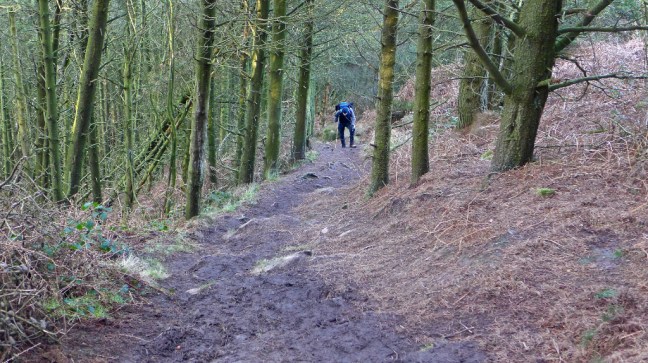
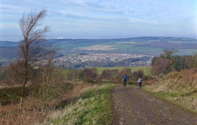
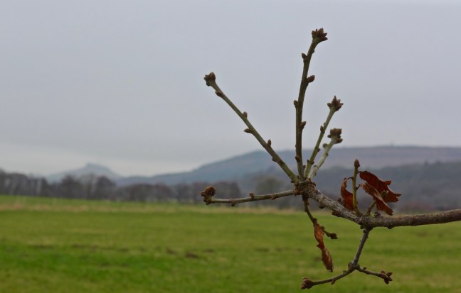
After dropping the book back at the car, the serious walking began with a climb past Bankside Farm with fine views.

p1050577

p1050580

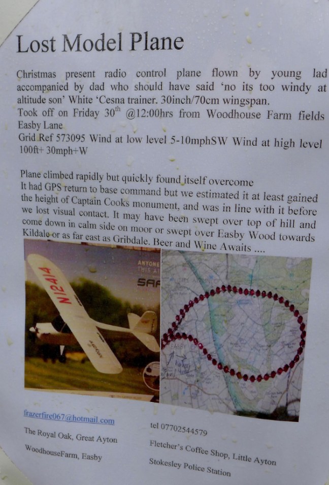
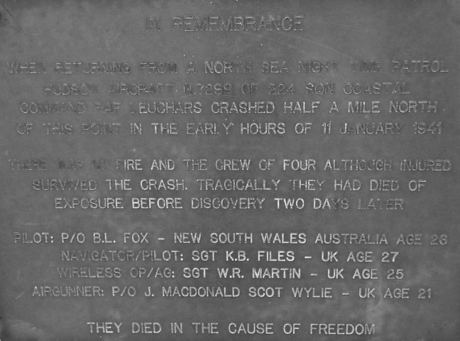
Then we came across a poster indicating the first lost aeroplane.

p1050582

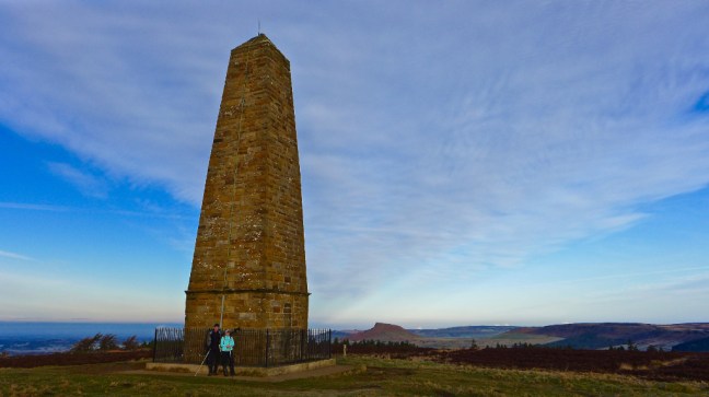
After a climb to Captain Cook’s Monument (to be described in the next blog) we stopped for our banana break and coffee in thick mist.

Descending towards Borough Green Farm we passed a gatepost dated 1668 (formerly a boundary stone), inscribed at the time when Charles II was King!

Then we came across the strangest mushroom I have ever seen. p1050585

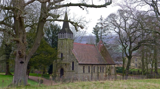
Followed by Easeby Hall and Church

p1050586

p1050588

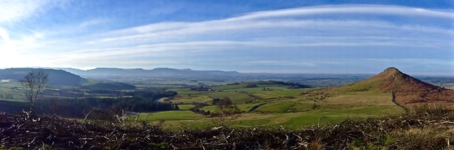
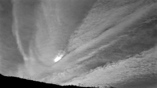
A lovely cloud effect then appeared over the edge of the Moors.

p1050589

And Captain Cook’s Monument appeared in the distance.

p1050595

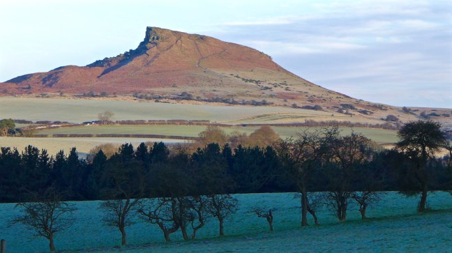
And Roseberry Topping continued to peep at us in the distance.

p1050599

We were pleased to arrive at Battersby Junction Station for lunch with its water tower of 1907 still proudly standing.

After crossing a charming bridge, which looked like something from the land of Hobbits and which led into Battersby,

p1050605

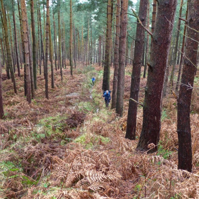
the serious hill climbing started and instead of advising Carol and Sid to walk like Penguins, as per on ice and mud in previous weeks, they were advised to climb like mountain goats.

p1050606

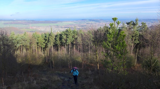
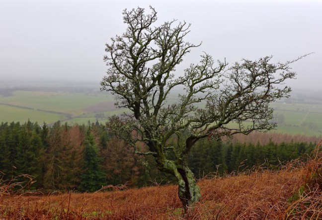
The views from the top could have been better as the mist was starting to descend again and eventually turned to rain.

p1050607p1050608

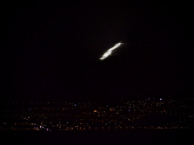
Back on the Cleveland Way we came across our second missing plane. How sad and what a terrible passing of young lives. We will remember them.

p1050610

Miles Walked 12.53

Calories Burnt 1,400

Steps 27,508

Average Pace 18.53 Minutes Per Mile

Fatest Pace 17.09 Minute Per Mile between 10-12 Miles

Walk Like A Penguin, But Don’t Stub your Toe.

Post 99: 15 January 2017 1,000 Mile Walk Challenge

After a week away it was back to my ‘bread and butter’ walk through the village with one or two extras, including collecting The Sunday Times, which would take me a week to read! The Yorkshire Wolds could not be seen in the mist.

img_1286
Enter a caption

I soon discovered  that the paths were covered in water from light rain, but underneath there was black ice. I had not put spikes on or taken my trekking pole. So the only solution was to walk like a Penguin. This advice I only heard recently, which shows that after 60 years of walking there are still new things you can learn. You basically take smaller steps and sort of waddle a little, keeping your arms fairly close to your side. It does actually work and reduce the risk of a fall. Penguins have evolved over millions of years and are experts on ice and thats how they get about. Occasionally they slide on their front, but I wouldn’t recommend that.

norway-2012_7750_edited-1

Another thing I learned is that if you stop and chat to people it increases the mileage measured by the app Mapmywalk. Presumably you don’t stand completely still and so it adds miles.

Miles Walked 4.02

Calories 457

8,200 Steps

Average Pace 18.37 Minutes Per Mile

Elevation Gain 51.5 feet

Minimum Elevation 36.4

Maximum Elevation 84.5

Now to go back to how I am getting on with walking the Cumberland Way in 1994. This was before mapmywalk apps were invented.

31 March 1994: The Cumberland Way, Day 5 – Dockray to Eamont Bridge – 16 miles                

After a huge breakfast, we set off in drizzle to the impressive Aira Force, formed as a result of Aira Beck being confined to a narrow gorge. The path then skirted Gowbarrow Fell giving fine views of the head of Ullswater far below, with the Helvellyn range of mountains forming a backdrop. Here there are fine views of Ullswater.

However, you will have to make do with a photograph taken from a boat on Ullswater, which I took more recently.

p1060349

and a slideshow:

This slideshow requires JavaScript.

The remainder of the day was spent in gentle descent, to eventually follow the River Eamont to the small village of Eamont Bridge. Here Alan left us, reputably to return to work, or was it just a coincidence we had now left the mountainous region?

Eamont Bridge has two prehistoric henge monuments, Arthur’s Round Table and the Mayburgh monument. The former was used for religious purposes and was probably of the early Bronze Age period, about 1800BC. The latter was of late Neolithic period, about 2000BC, again having religious origins.

Having walked 62 miles, unscathed, through some of England’s most mountainous area, Dan then proceeded to stub his toe on a step leading to his bedroom. I burst out laughing as he let out an almighty yelp and hopped around on one foot. It was not funny as he lost a toe nail and gangrene could have set in? Then of course leg amputation which would have spoilt the walk.

What was worse, there was some doubt that evening as to whether he could walk to the pub. Grimacing, he overcame the agony, hobbling to the village until we eventually found an inn with the following sign:

In this Hive we are all Alive

Good Liquor makes us Funny

If you be dry step in and try

The Virtue of our Honey

With such an invitation how could we resist?

The End of Week Two with the Biggest BANG in the UK!

Post 98, 14 January 2017, 1,000 Mike Walk Challenge 2017, week two. 

After a week of attending a birthday celebration for my 94 year old mother and baby sitting for my 3 year old and 11 month old grandsons I decided to have a final walk (it could have been literarily my final ever walk)  in the Midlands to return to Yorkshire with a big bang. I had managed a few short walks in the week and they were posted directly to my Facebook Page: The Secret Diaries of a Long-distance Walker. 

Arriving at the Staffordshire County Council Car park just below the village of Hanbury, I ascended the edge of what looked like the rim of a volcano. My walk to the Fauld Crater began proper at the Cock Inn. We have had some very good ‘home cooked’ meals there.

img_1275

I thought this would be a fairly easy walk and only had approach shoes on. It was quite a muddy, tricky and steep descent into the bottom of a big hole on a Public Right of Way. Given that this is the site of the largest explosion ever in the UK I couldn’t help but wonder if there are still one or two unexploded bombs under my feet? There are signs advising of DANGER UNEXPLODED BOMBS, STRICTLY NO ADMITTANCE, WARNING SUDDEN DROP but I assumed these were not where I was walking! However, one or two public footpath direction pointers were missing off a sign in the bottom of the crater I was in!

img_1276

The RAF Fauld Explosion was a military accident which occurred at 11.11am on Monday, 27 November 1944 at the RAF Fauld underground munitions storage depot. It was one of the largest non-nuclear exposions in history and the largest on UK soil. One fifth of the force of Hiroshima. 

3500 to 4500 tonnes of ordnance exploded including 500 million rounds of rifle ammunition. The crater formed is 100 feet deep and 250 yards wide.

A nearby reservoir containing 450,000 cubic metres ( 6 million gallons) of water was destroyed along with buildings and a farm.

It is believed that about 70 people died and 18 bodies were never recovered. 200 cattle were killed by the explosion.

It is believed that use of a brass rather than a wooden chisel to remove a detonator from a live bomb may have caused the explosion.

More details and recent pictures of the underground storage facilities can be seen at:

http://www.dailymail.co.uk/news/article-3699468/Forbidden-remains-Britain-s-biggest-explosion.html

I was relieved to get back to the nearby Hanbury road.

img_1270

Without an explosion blowing me to smithereens! This explosive picture WAS taken today!

img_1282

Miles Walked 2

Steps 4,400, non of which were on an unexploded bomb

Calories Burnt 239

Average Pace 20 minutes per mile (I said it was tricky!)

Elevation Gain 116.9 feet

Min Elevation 314.4 feet

Max elevation 486.3 feet (unless you step on an unexploded bomb in which case it will be much higher).

 CUMULATIVE Mileage After Two Weeks 51.25


Morning or Afternoon walking? Bread and Butter Walking, Decomposed Brains.

Post 97:  5 January 2017,  1,000 Mile Challenge

As I had a few jobs this morning, not least trying to get my car hooked up to the internet (cars are getting very high tech), I left walking until late afternoon. The car already has a DVD so I can watch my favourite singer Katherine Jenkins, when the car is stopped or listen to it only when the car is moving. No distractions when driving!!!!

This walk is meant to be one of my ‘bread and butter’ walks from home, which are useful for the 1,000 mile challenge. It is not always possible to go off in the car to the Yorkshire Moors, Dales or Wolds. I soon came across this fine lone tree.

p1050525 

The last time I photographed this tree was on the 6 February 2012, when it looked somewhat different.

dunnington_4845

One thing I came across, which always distresses me, was dog poo left in a plastic bag as per the photograph. It will never decompose. The people that do this have decomposed brains.

p1050528

Walking further on and calming down a little, the sun peeped out as it dropped in the sky.

p1050530

I suddenly thought that I must get to high ground, despite the fact there isn’t really high ground in the village. Eventually getting to 93.1 feet above sea level, the views I had hoped for developed.

p1050537

p1050540

p1050543

A good end to the day…..

Miles Walked 2.7

Calories Burnt 306

Steps taken 5,500

Average Pace 1.15 minutes per mile

Fastest mile split at 2 miles 17.27 minutes per mile

Elevation gain 51.5 feet.

Minimum Elevation 36.1 feet

Maximum Elevation 93.1 feet.