Post 239: The Inn Way, 13 March 2018, Rievaulx Bridge to Helmsley
“The cars broken down” Celia, my wife, said on the telephone on Saturday when we were in the Midlands visiting our two 95 year old mothers for mother’s day. “The clutch is not working”.
“Well telephone Volvo Assistance”, I said from some two miles away at my mothers.
“What’s the number?”, she said. “I am in an awkward position at the Co-op.”
“Well put the hazard warners on if its dangerous.”
“There is a card with the number under the CD box and one in the glove box (for belt and braces). I will get a taxi and come to meet you. ”
By the time I got to Celia and the mother-in-law, the car (not the mother in law) was about to go on the lorry loader to be taken to the nearest Volvo garage in Wolverhampton.
We then got a taxi to the mother-in-laws a couple of miles where we were staying.
It was the first time in about 17 years that a Volvo had let me down. The last time was after dropping my daughter off at Northumbria University when my old Volvo 440 ground to a halt under the Angel of the North, due to an alternator problem. The AA had no problem finding us and took us home with the car on his lorry loader.
This was somewhat different as my car was only 15 months old and not meant to break down and I had planned to finish the Inn Way in Yorkshire on Tuesday. We had already postponed once due to the Beast from the East. This was an EMERGENCY.
I got onto Volvo Assistance and on Monday they had a courtesy car at the door. BMW 2 series automatic sport. Not a Volvo V40, but I could make do.

We travelled back to Yorkshire in pouring rain all the way, but I knew the forecast was good for Tuesday and the Inn Way. I also knew by now that a new clutch was required for my car and parts had to be ordered by the garage. I had not needed a new clutch since an old Volvo 340 had needed one about 30 years ago!
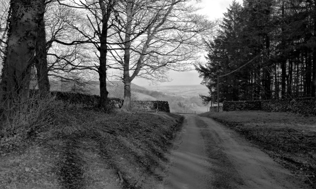
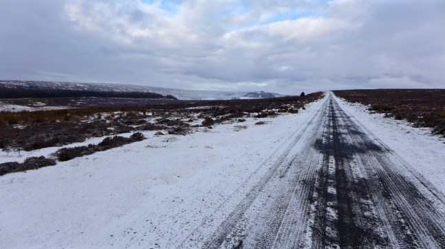
So we arrived at Helmsley at about 9.30am to start the last walk on The Inn Way.
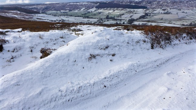
This walk, which we had started on the 23rd November last year had been one of the most challenging I had done as we had walked throughout the winter over and through the North York Moors. I had fallen in two bogs, having only fallen in one other bog in the rest of my life. We had encountered deep snow, ice, cold winds, overflowing streams to cross, hills, fog, mist, paths that weren’t there, Carol and Sid the Yorkshireman had both had falls, we had found new routes and paths we hadn’t done before in order to get back to the cars, deep puddles blocking paths, mud and more mud. It had tested our outdoor gear (e.g. waterproofs, insulation, my 4 hats on once occasion, and spikes), knowledge, energy levels, map reading and experience to the maximum. During this time nature has revealed itself with great beauty and power with Supermoons and Super Snow and Cold.
I had loved it!
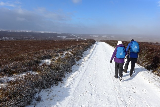
Today was to be, as in the Tour de France’s last day, our celebration. We knew we would finish the walk and this was a day to really enjoy ourselves.
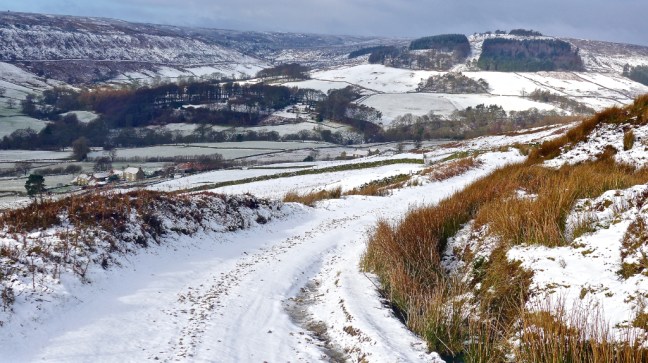
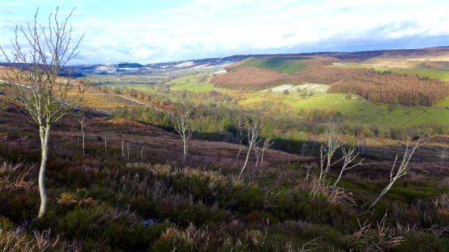
The forecast was good and much warmer and sunnier than previous walks. Spring had arrived although perhaps briefly. We soon passed Helmsley Castle just after the entrance to Duncombe Park.
 Sir Charles Duncombe, a wealthy London banker and Lord Mayor of London, bought Helmsley Castle and its estate in 1689 on the death of the Duke of Buckingham.

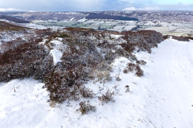
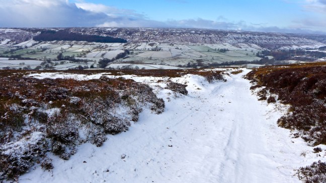
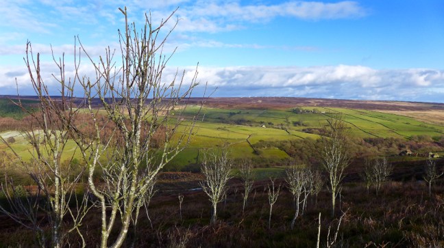
 We passed the Ionic Temple.
 Ascending there were good views back towards Helmsley and the walled gardens of the castle, which are well worth a visit.
 Carol had her first tree hug of the day.
We reached Duncombe House, which was built in 1713 by Thomas Browne who later adopted the Duncombe name. The house is occupied by Lord Feversham and is open to members of the public.
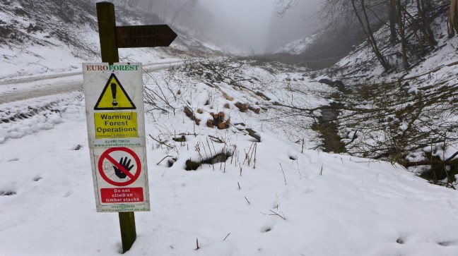
 After passing a tree felling area we reached Griff Lodge and The Cleveland Way and The North of England Way.
  A helicopter flew over us just as in the Tour de France! Were they filming us?!
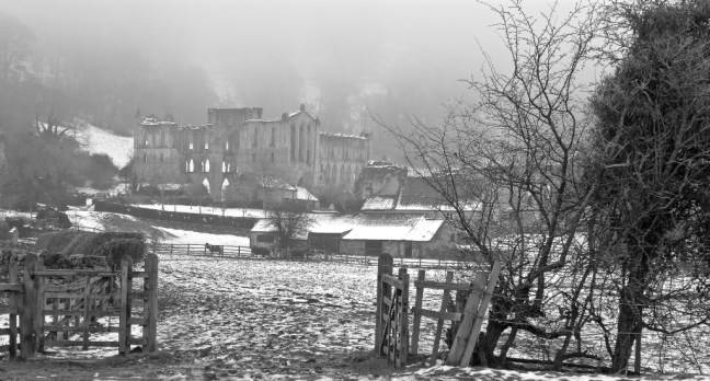
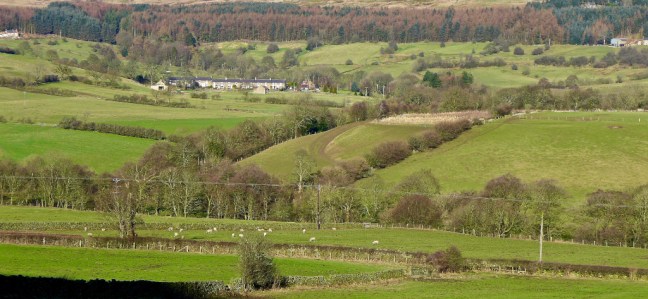
  Rievualx Abbey could then be seen in its magnificent valley sitting. The monks were not stupid in picking this sheltered, picturesque location.
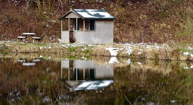
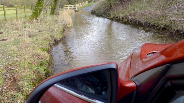
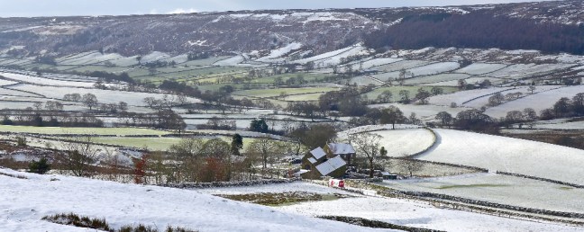
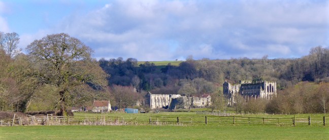 We then reached Rievaulx Bridge, which was where we needed to resume The Inn Way. Repairs were being carried out to presumably where cars and lorries had skidded into it during the bad weather.
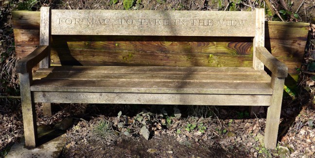
 We carried on past Ashberry Farm to have our coffee and banana break at a bench with wonderful views in energising spring like weather.


 All that remained was to walk back three miles along The Cleveland Way and The North of England Way to Helmsley for our celebratory lunch at Mannions.
 Carol and Sid the Yorkshireman were very happy with the delicious food.
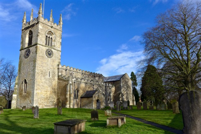
 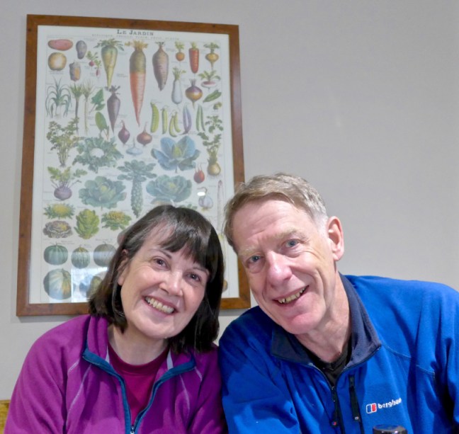 Helmsley is a delightful market town to visit out of season, but in the summer can suffer from its popularity with many people visiting.
 All that remained was to have a final photo call in the market place to finish a fine challenging walk.
Now where did I put my 1991 hat?
We couldn’t find it anywhere so we drove back along parts of the route, but with no luck.
However, when we got home I found it deep in one of the many Rohan pockets I have. “Age shall not weary them”.
Any typos or other mistakes are not due to gin!!!!
Miles Walked 8.1
Steps 18,000
Calories Burned 3,300
Daily Mileage
Day 1 – 12.8
Day 2 – 13.4
Day 3 – 14
Day 4 – 14.5
Day 5 – 14
Day 6 – 13.2
Day 7 – 11.8
Day 8 – 10.2
Day 9 – 11.2
Day 10 – 12.9
Day 11 – 12.6
Day 12 – 12.1
Day 13 – 13.1
Day 14 – 10.5
Day 15 – 10.2
Day 16 – 9.4
Day 17 – 8.1
Total Miles Walked 211
It is possible to walk The Inn Way as a linear walk and reduce the total mileage to an 89 mile walk.
Who Reads the Secret Diaries?
65% of readers are women
34% of readers are men
1% are ?
The biggest age group reading are aged 45-54 – 19% women.

 We arrived at Cold Kirby to have an impromptu ‘Kia Meet’
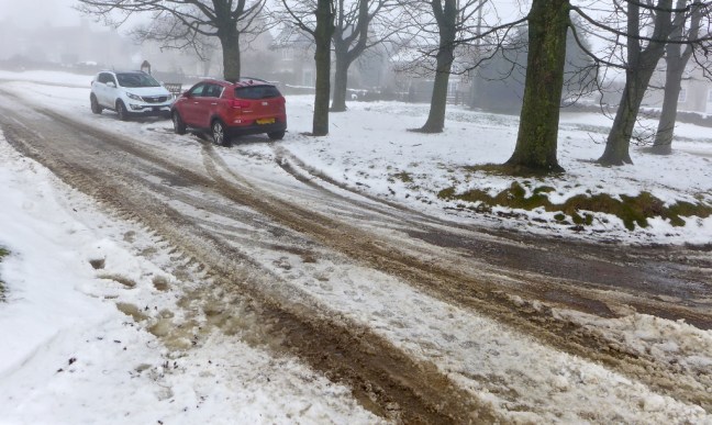 After slipping and sliding a few weeks ago on the Moors, Sid the Yorkshireman had decided to splash out on winter tyres and wheels to add to his 4 wheel drive Kia. He did this just before The Beast from the East arrived and so there is no doubt that he is to blame for the bad weather.

 We had an interesting start to our walk and thought that if the next 9 miles were going to be like this it could be a really tough day!

 We then had a tricky steep descent into Flassen Dale at which point Carol decided to put her spikes on. I already had mine on and Sid the Yorkshireman didn’t.
 Here we encountered some forest workers who, incredibly, informed us they had worked through all the bad weather the previous week!!! Snow Heroes.

 We ascended the other side of the valley. Much of the tree clearing was related to pheasant shooting, which is widespread in this area and brings a lot of income to it.
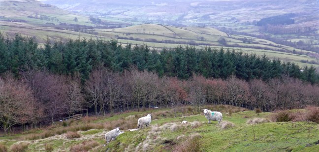
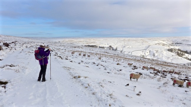
 We arrived at Pond Farm, Scawton where the sheep were very ‘friendly’ or more likely very hungry.
  After a coffee and banana break we visited the unique Norman Church of St Mary which is little changed since it was built by the monks of Byland Abbey in 1146.
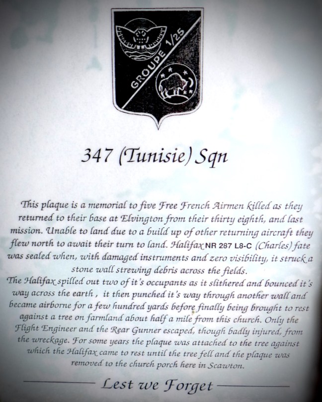
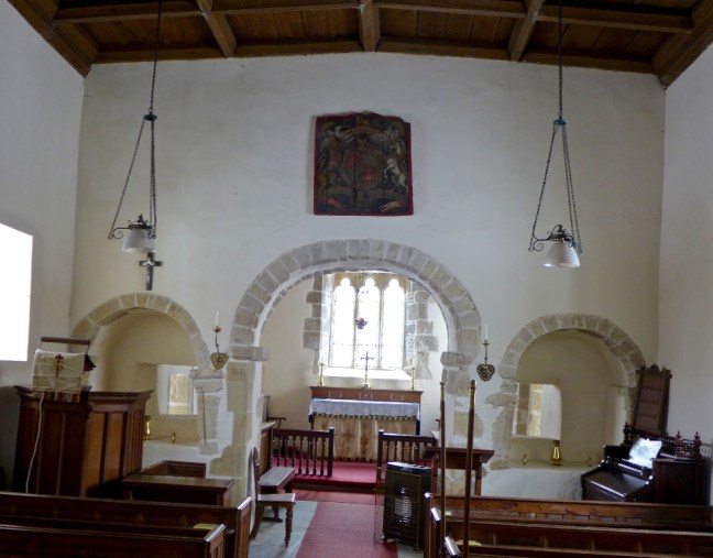 In the porch there is a memorial to five crew members of a Halifax bomber that crashed nearby in 1945.
 There are also the remains of a carving.
 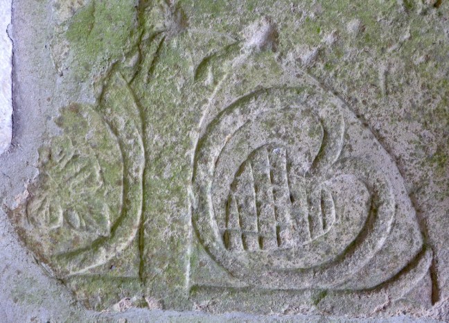 The font cover is unusual.
  We descended to Nettle Dale where The Cleveland Way crossed our path. It is the spaghetti junction of a number of paths.


 There are some rare ducks.
 And delightful trees
 Shortly afterwards we reached Reins Farm where there were free range children
 We descended to Bow Bridge over the River Rye, which leads to Rievaulx Abbey.
 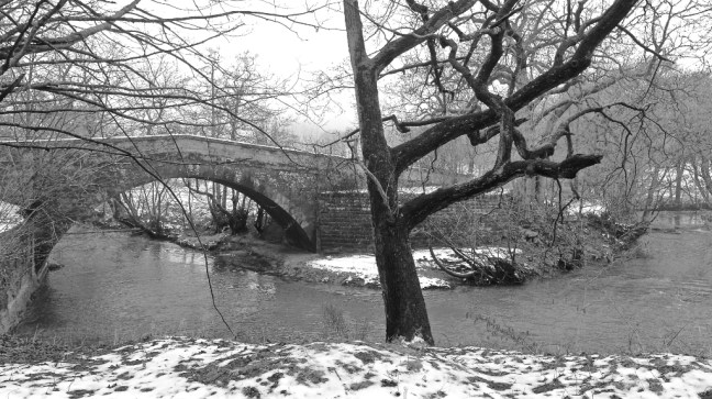 In the mist it was very atmospheric as we walked towards the Abbey for a lunch stop.
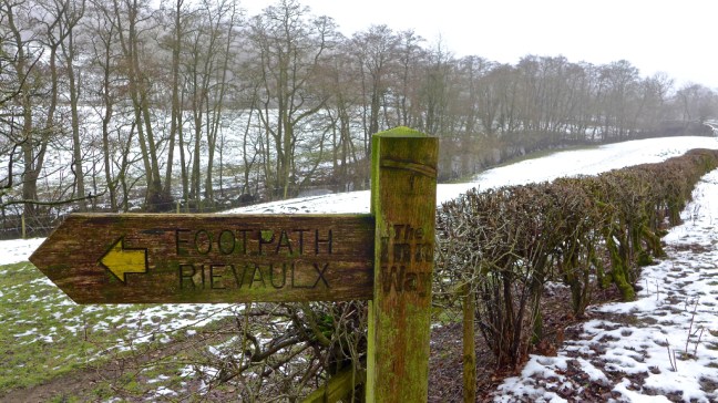


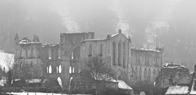
 This imposing Cistercian abbey was established in 1132 by twelve French monks and named after the valley Rievaulx, meaning valley of the Rye. St Aelred, the third Abbot, developed the abbey into being largest monastic establishment in England, with over 500 lay brothers and 140 choir boys.


 At Rievaulx Bridge we left The Inn Way to follow The Cleveland Way and The North of England Way back towards the car. The nearby house was built in 1885.
 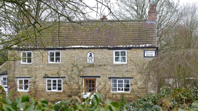 We then entered Nettle Dale again as, at long last, the sun appeared.

 We then had a long and gradual, but tiring ascent along the secluded and snowy Blind Side and Tanker Dales, with springs appearing.


 The snow created some delightful effects.
 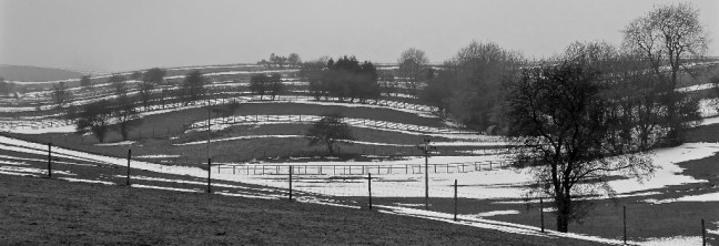 Arriving at Cold Kirby there some unusual sights. Whatever is a Penny Farthing doing there? Also the cow is not real.

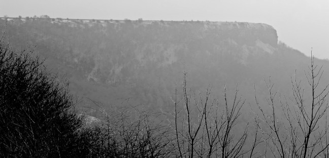
 Finally, after the walk, I couldn’t resist stopping off at Sutton Bank to admire the views.

 A fine end to the day.
 We arrived at Cold Kirby at about 9.00am and it was a balmy 1 degrees. Cold Kirby is often much colder, hence the name, due its exposed location.
 After passing Murton Heights fine views emerged
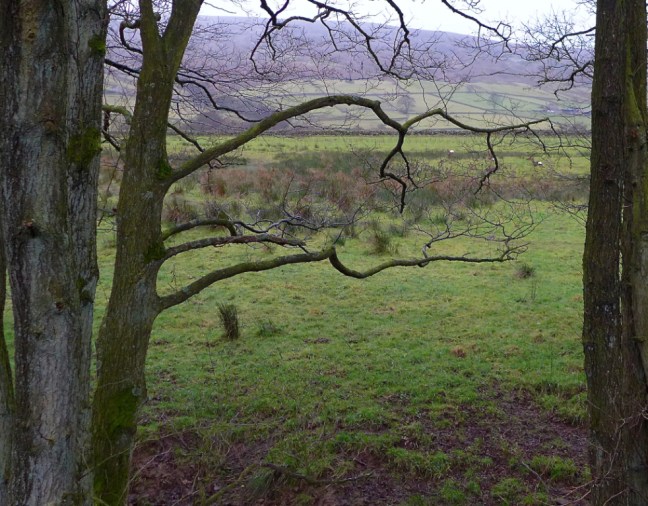
 The Easterside Hills near Hawnby and beyond, from where we had walked in previous weeks, could be seen.
 After a coffee and banana break below Noodle East we ascended to what remains of it, with great views back.


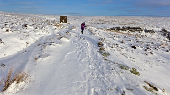
 We reached the Hamilton Drove Road to rejoin The Inn Way. We then joined the Cleveland Way to follow it to High Paradise Farm (see previous blog for opening times for refreshments etc). We were now on the Mosaic Walk where one of the many mosaics along the 36 miles route was in evidence. This is a circular route from Sutton Bank.
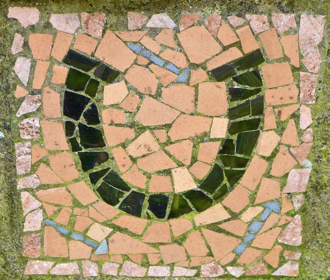 Just beyond a special gate Sid the Yorkshireman and Alf posed where James Herriot was photographed for the front of his biography. With no dog, Alf just made dog noises.
 Near High Barn lunch was beckoning, but due to a cold easterly which was being sucked over and down the ridge we carried onto the nearby quarry for some shelter.
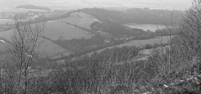
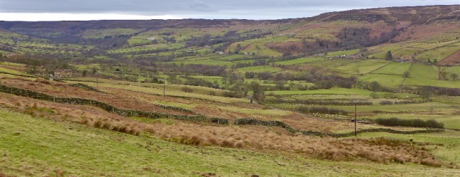
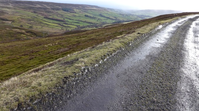
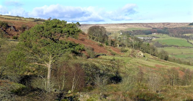
 Rejoining the Cleveland Way along the escarpment the expansive views were stunning.
 It was a bit further along from here at Sutton Bank where Alf Wight (James Herriot) said ‘The Finest View in England’ was. On a foggy day you have to make do with me as a German walking friend once found out. Not quite the same!
 We reached Whitestone Cliff and with rays of light the views were pretty impressive.
 Gormire Lake was far below us.
 Alf below was rightly proud to announce that he, with a colleague, had carried the oak bench from Sutton Bank (nearly a mile) and fixed it in position (as below) above Garbutt Wood. We decided to give Alf an honorary hero award.
 There is a tiny memorial plaque on the bench.
  It is said that from here, when steam trains were in use, you could follow a train all the way from York to Darlington.
  The Inn Way leaves the escarpment at this point to head towards Dialstone Farm. Sid the Yorkshireman got quite pedantic as to which gate we should go through even though they were only about 100 yards apart. By the time he had finished pontificating on the matter we were ready to throw him off Whitestone Cliff, just where a knight on horseback was reputedly lured over the cliff on his white horse, by the Devil dressed as the Abbott of Rievaulx.


 Apart from the last mile it was a fine walk. Somewhat flatter and easier than many of our previous winter walks on The Inn Way
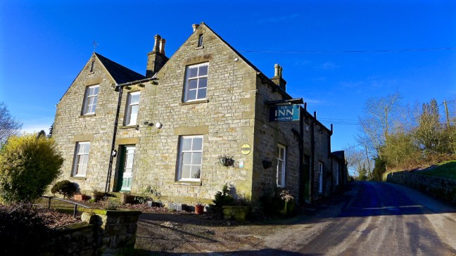


 There was much woodland clearing taking place.


 At this point I came across what would make a fine emblem for the North York Moors Winter Olympics. You can see the ‘Yorkshire Olympian’ if you look closely. The ‘sport’ would be Winter Cross Country Walking.
 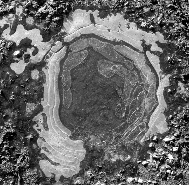 Our winter walking on The Inn Way has at times felt like a Winter Olympics and we had encountered much ice, snow, mud and winds on our walks. Indeed J.S Fletcher in his book The Enchanting North 1908 said about this area:
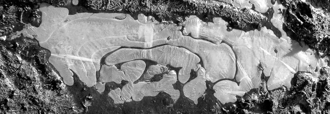 Back to reality we had some lane walking back to Hawnby.
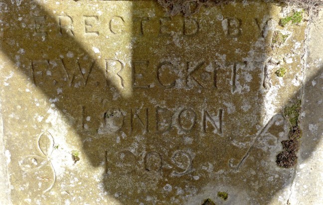
 Where we stopped in what was probably the best coffee and banana stop of the whole Inn Way walk. Built in 1909, presumably as a horse stop, it was very sheltered, warm and sunny.
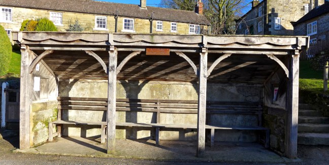
 Leaving the village we soon crossed Hawnby Bridge over the River Rye.
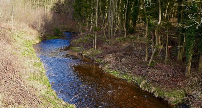 We then climbed around Coombe Hill with fabulous retrospective views.
 Before descending towards Arden Hall, situated in the beautiful Thorodale wooded valley. The building dates from the 17th century although it sits on a Benedictine nunnery which dates from the 12th century. Some remnants remain in the hall including a medieval fireplace. A pond known as Nun’s Well can sometimes be spotted through the trees.

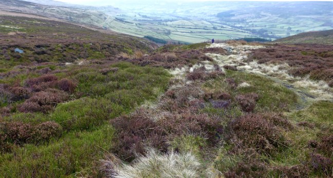
 A steep long ascent followed to join the Dale Town Common bridleway, with superb views back towards Hawnby and the moors beyond.
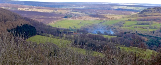 A little snow remained
 It was cooler and breezier on the tops and the sheep huddled together near their food. We started looking for a sheltered lunch spot.
  After nearly missing our bridleway at a fork we reached the Hamilton Drove Road and as Paradise was closed we settled for lunch in the shelter of a wall.
 We saw a few casual walkers without rucksacks who had just walked from the nearby car park for a breath of fresh air.
 At least the adders would be hibernating.
 The Bilsdale mast could be seen in the far distance and the views were 360 degrees.
  We descended to Sunny Bank Farm where our destination Hawnby could be seen in the distance, below Hawnby Hill and Easterside Hill.
 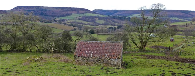 A little further on there was a fine view of Hawnby Bridge and its surrounds. It was designed by the famous architect John Carr.
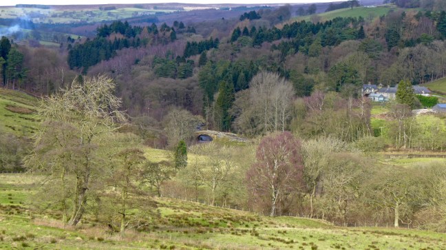 We crossed over the River Rye again at Dalicar Bridge where, whilst I was taking this photograph, Sid the Yorkshireman saw a kingfisher.
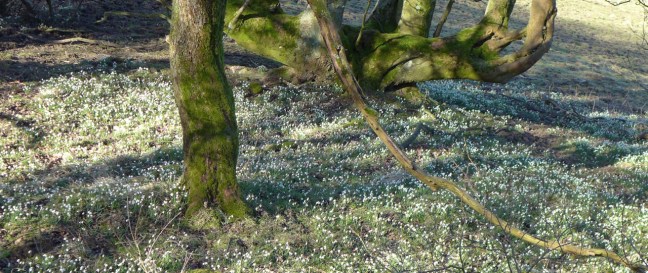
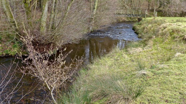 We made a small diversion to the 12th Century All Saints Church decorated all around with snowdrops.


 The present Sun Inn next door was opened in 1914.
 To the right of the pub is the gravestone of Bobbie Dowson, a famous local huntsman as well as cricketer of the Scout House team, who died in 1902. The local vicar refused to have the headstone in the graveyard because of the hunting motifs carved into it.
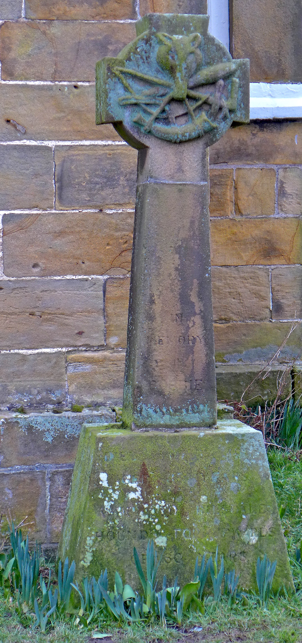
 We soon started following a route to grouse butt 3 and 7, which is where we finished on The Inn Way on Sunday. We passed by Hollin Bower Farm and above Low Crosset Farm, it getting cooler and more misty as we ascended.
  An ascent onto the open moorland followed where the route finding got very tricky to say the least. The bridleway we were following soon disappeared and Sid the Yorkshireman headed off across the heather after leaving a track which was not on my older map.
 Confusing or what?
 We headed along the line of the grouse butts and found 3 and 7 and the faint path nearby on which Carol had fallen (see previous post 234). It was time to regroup for the second time in this butt and have a banana and coffee break.
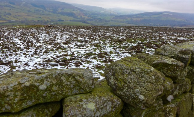
 After a long muddy descent and ascent and lunch, we reached Low Ewe Cote farm which, instead of ewes, had a herd of cows in the yard.

 We continued to High Banniscue Farm where we turned off The Inn Way to find a route back to my car. We passed Easterside Hill.
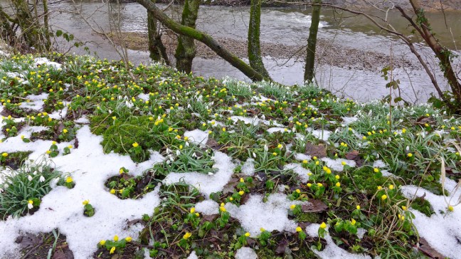
 Eventually we reached Crow Nest surrounded by snowdrops.
 Then a descent and ascent along a B.O.A.T, with Bumper Castle below us, led to a grouse deciding which route to follow at the junction of the B.O.A.T and bridleway!
  The B.O.A.T descended to Malkin Bower.
 With fine views along Bilsdale
 We then entered Hambleton, which is a place to grow! Being over 6 foot 2 inches do I really want to grow any more?
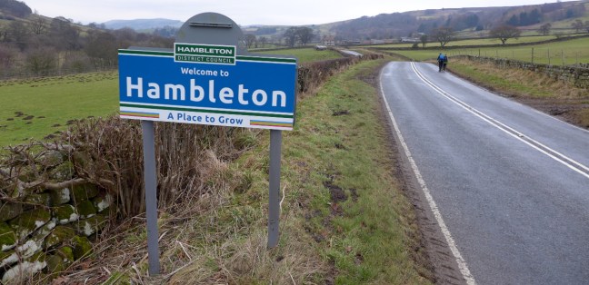 Does the sun shine in Bilsdale – well there are two Sun Inns. But no the sun didn’t shine today. It was claggy all day.
  Just as we were about to get our gear on a snow storm arrived.
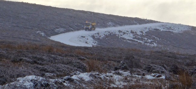
  It was so bad and went on so long we thought we would have to abandon the walk and take a few photographs and go for a coffee somewhere. There are not many cafes in this wilderness! The roads deteriorated quickly but we decided to leave the car park.

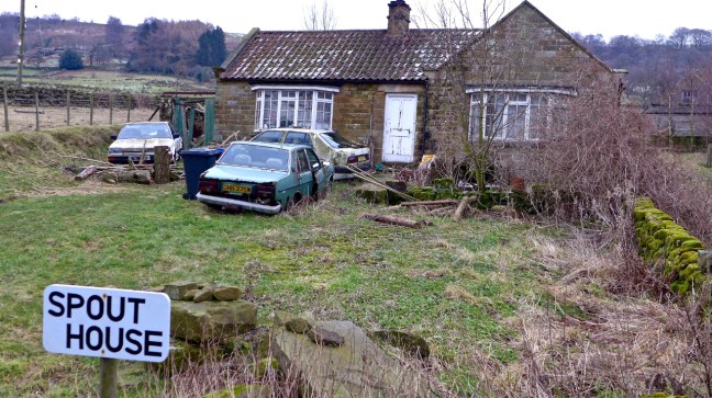
 When we reached a hill Sid the Yorkshireman drove very slowly and we thought with 4 wheel drive we would be okay. That was until the car started slipping and sliding down the hill towards Spout House. We were about to be spouted into a wall! I grabbed a car handle and braced myself for a crash as the car’s speed increased out of control and I could see some pretty hard stone walls directly ahead.
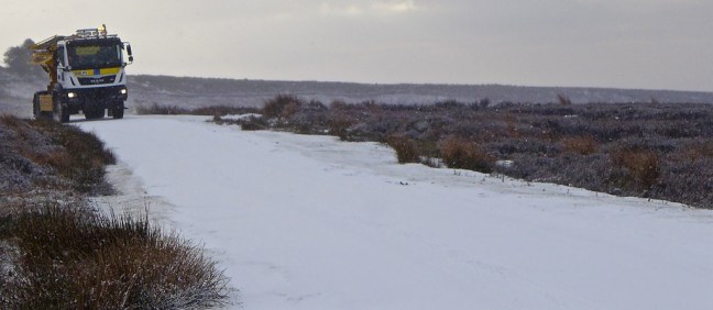 Some locals then appeared in their cars so they must know what time the gritter comes round the North York Moors remotest valley on a Sunday!
 Normal business resumed and we headed off walking along improving roads. Spikes were compulsory even for Sid the Yorkshireman.
 We soon turned off the road to begin climbing to Rudland Rigg where we would rejoin The Inn Way from earlier in the week. There were fine views towards Bransdale

 We then walked into low mist and all became grey again as we arrived at Rudland Rigg


 Bransdale Mill came into view. This and much of the land hereabouts is owned and managed by the National Trust.
  This was to be an early lunch stop at just after 11.30am as there was a bench and shelter from the slight wind. The old water wheel and other artefacts are still there. The mill is one of the oldest in the North York Moors dating back to the 13th century. It was used to ground corn and oatmeal. William Strickland restored the mill in 1842. Whilst sitting having our lunch we could imagine the activities that must have gone on there. It is like stepping back in time and full of interest.


 Bransdale was named after the Viking settler Brand and is the most remote valley on the North York Moors. Perhaps some of my relatives lived here?! With narrow lanes and few car parks and tourist attractions, such as cafes and information centres, it has a uniqueness and remoteness of its own. On the whole of the walk we only saw one other person on foot, and that was a runner from a remote farm. My sort of place!
 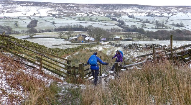 There was now a long undulating ascent towards our next destination Black Holes. The name is enough to put you off!


 There was suddenly a scream and I looked back and Carol had taken a tumble. Not the best place as if she was seriously injured it would have been a helicopter air ambulance job!
 At nearby Black Holes it was now important to find our bridleway/track back towards the car.


 We then continued to the ruins of Stork House with expansive views of Bransdale.


 It was with some sadness that we viewed the ruins. There is an inscription on a stone nearby dated 1815!


 Sid the Yorkshireman felt in need of a boot and spikes clean.
 And I felt in a need of a pheasant.
 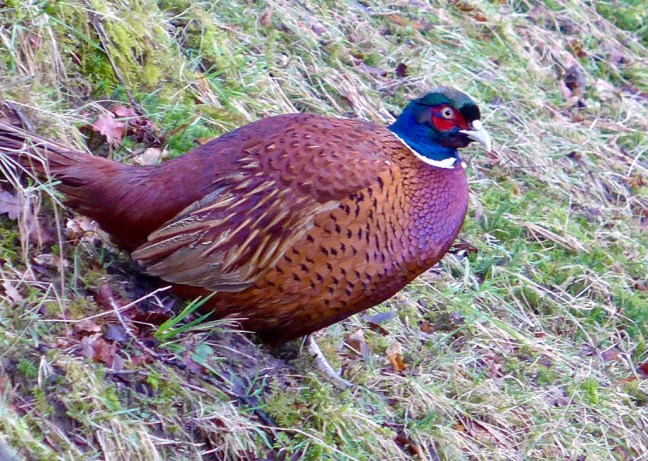 We just needed to find the transport home now. This seemed suitable.
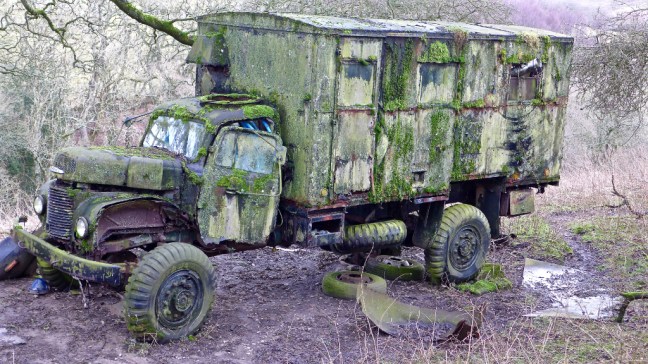


 After some tricky route finding through overgrown heather, we resumed descending into Farndale with fine views.
 Then light snow started and we thought that wasn’t forecast by Paul Hudson our weatherman. We hurried onto Church Houses for our coffee and banana break, alongside the closed Feversham Arms.
 We ascended steeply towards Rudland Rigg, with fine retrospective views back to Farndale.

 It was a bleak area in low cloud, not the bright sunshine forecast.
 We then left the Rigg and The Inn Way on a quickly disappearing path to descend back towards Farndale.
 It was very tiring through overgrown heather. Eventually we picked up a path and stopped for lunch in a sheltered spot out of the wind. There were great views along Farndale. Until………


 We kept saying that this wasn’t forecast. It was only when I watched Look North News that Paul Hudson admitted that things didn’t go according to plan and it was the first time since 2003! Not sure we would agree with that.
 We then had to cross the River Dove, which fortunately had a new bridge.

 At Esk House we came across a lovely Shire Horse, looking miserable with the poor weather.
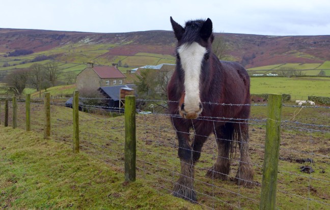 We then climbed the final hill of the day only for Sid the Yorkshireman to realise that he had dropped a glove about half a mile back. You can just see him (blue spot!) heading back down the hill to retrieve it!
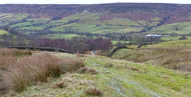
 After some delay we arrived at the dismantled railway, which is a section of Wainwright’s Coast to Coast Walk. The Rosedale Ironstone Railway was constructed in 1861, a considerable engineering achievement.


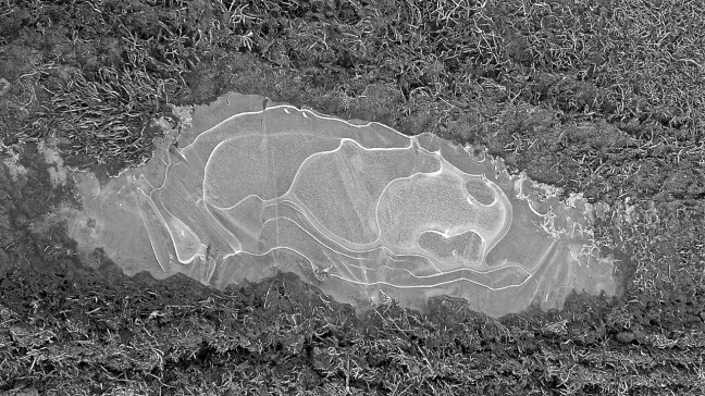
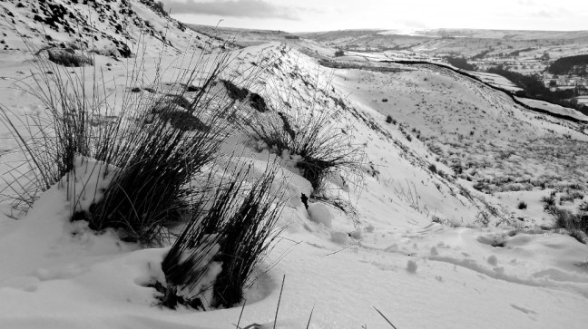
 I then started looking at the ice patches and the varying patterns they formed. Nature up here can be so creative.


 We soon dropped down to the Rosedale valley bottom as we had to pick up The Inn Way route again from where we last left off.
 What was noticeable this week was the increased sound of birds, clearly enjoying the spring like weather with temperatures much higher at 8-12 degrees. What a difference a week makes with last weeks snow all gone!!!
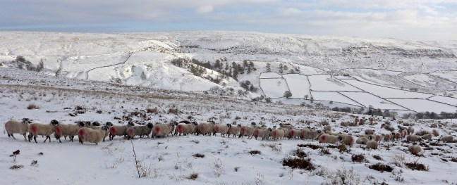
 We passed the Rosdal (Rosedale) and Whitby signpost to reach the lane at the top of The George Causeway Gap to then rejoin The Inn Way and head back down to Rosedale (known as an out and back in the trade!). It had started to rain and so we donned our waterproofs.


 We came across a recently cleaned out culvert, which had probably been there since the railway (now dismantled) had been built.

 There is now a £3.8 million Land of Iron Project fund by the Heritage Lottery Fund, David Ross Foundation and many other partners. It has a vision:
 The rain was getting heavier and this little oasis emerged. There is even cosy overnight accommodation.


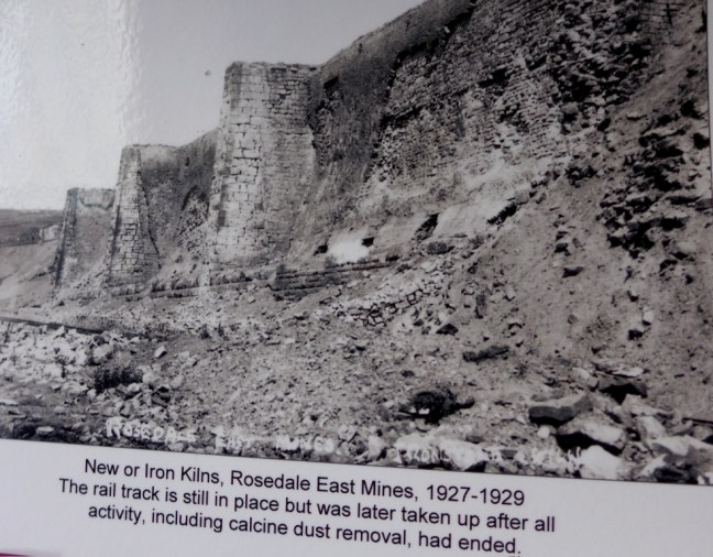
 On the opposite side of the valley were the old ironstone kilns.
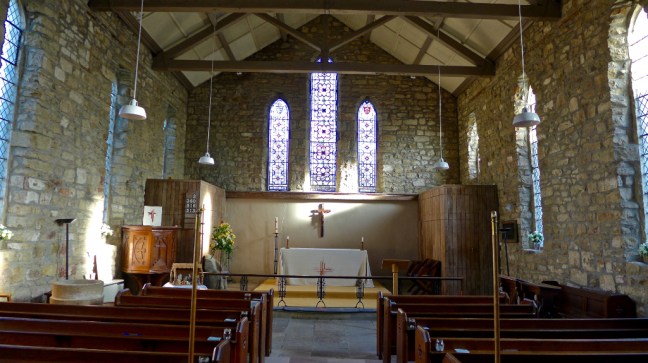
 We arrived at the church of St Mary and St Lawrence in Rosedale Abbey. The only remains of the priory is the staircase below right.


 The sun was out and it was time for lunch on a bench in the churchyard.
 We could ponder on the artwork of children in the church, relating their memories of the Tour de Yorkshire. Bicycles still adorn buildings in the village.
 We then had to climb out of Rosedale Abbey towards Thorgill Bank with ever changing images of Rosedale, one of my favourite valleys, brought alive by afternoon winter sun.

 Some farms on higher ground have fallen into disuse.
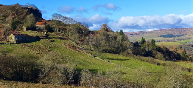
 The path became boggy and for the second time this winter (third time ever), due to lack of concentration and tiredness, I ended up going into a bog up to one knee. Fortunately the other leg was on firm ground.
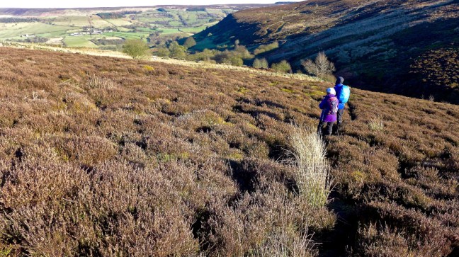 We arrived at the remains of Sheriff’s Pit, where the pithead operated from near the mine managers house and pit shaft.

 The shaft was excavated in 1857 to provide a quick and easy way of transporting ironstone from the West Mines up to the railway line on the side of Blakey Ridge. It descends 270 feet to link up with a 1500 foot long level that was cut into the West Mines to the north of Thorgill.
  All that remained now was to walk a couple of miles back to the car along the dismantled railway line and enjoy the fabulous mid afternoon views as the sun dropped low in the sky to give great photographic conditions. Relax – sit back and enjoy the slideshow.


 With the The North York Moors under melting snow we decided to postpone The Inn Way and head to the drier chalk lands of the Yorkshire Wolds. However, having already completed The Wolds Way, we decided on an alternative project, 38 mostly circular walks which collectively total 353 miles from the book Walking in the Wolds, published in 1993. It would be my 55th long distance walk. No doubt after 25 years there would be a few changes to the route!

 We soon entered typical rolling, green Wolds country.
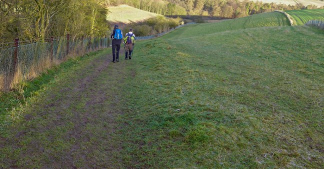 With some delightful copses.
  We passed boundary stones for Hunsley.

 High Hunsley Beacon was passed by us and also by an aeroplane way above in the sky (see white streak left of wire beacon).
  Trees provided some interesting shadow patterns on the fields, with a wind farm in the distance. It reminded me of David Hockney’s paintings.
 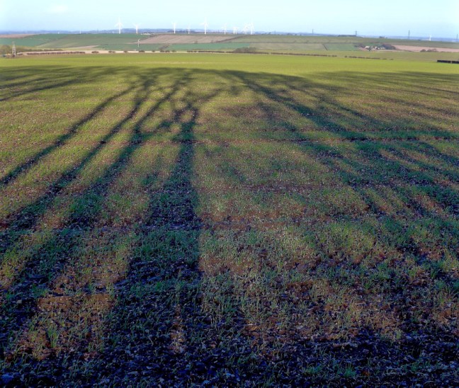 A descent into Swin Dale followed, which is a classic dry Wolds valley.
 We arrived at North Newbald which is one of two Danish settlements, the other being South Newbald. We had an early lunch break on a bench in the warming sun.
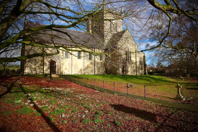 My first 2018 siting of snowdrops were in the church grounds.
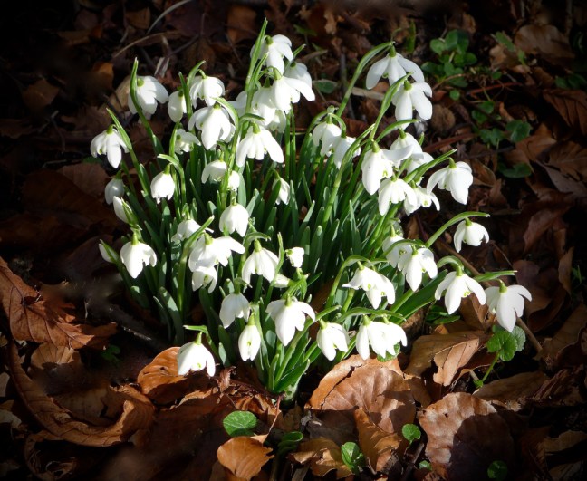 After passing through South Newbald we arrived at Hotham Church which has a distinctive tower. A plaque on a wall outside the church was placed there to celebrate 900 years of Norman heritage. Many of the village buildings are of local limestone.
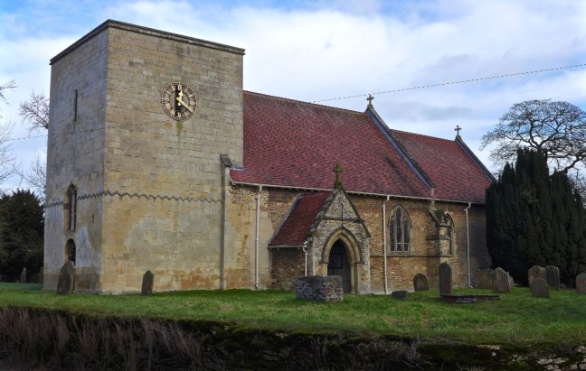 The pub, the Hotham Arms is quite unique in appearance.
 Further along is what we believe was an ice store.
 It may have belonged to nearby Hotham Hall
 Its lodge has a powerful sign – a reminder of the sacrifices so many paid for our freedom.

 Continuing to Everthorpe we wondered what the significance of the village sign was? We think it is related to the two prisons, HMP Everthorpe and HMP Wolds.
 Even the kissing gates are much larger than the norm!
 At South Cave outside the entrance to Cave Castle is a war memorial which says:
 Eight centuries ago a castle stood where a hotel and restaurant is now located.


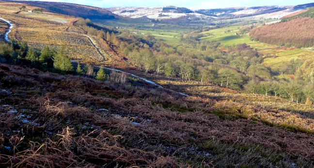
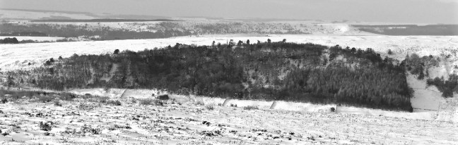
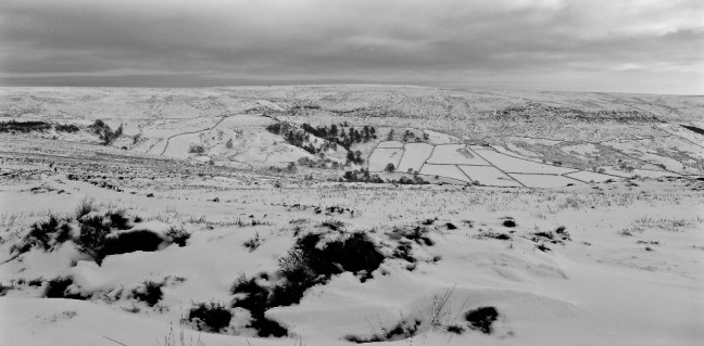
 We continued on the main road to pass Farndale, which confirmed there was still a lot of snow about. The views were gorgeous.
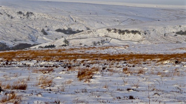

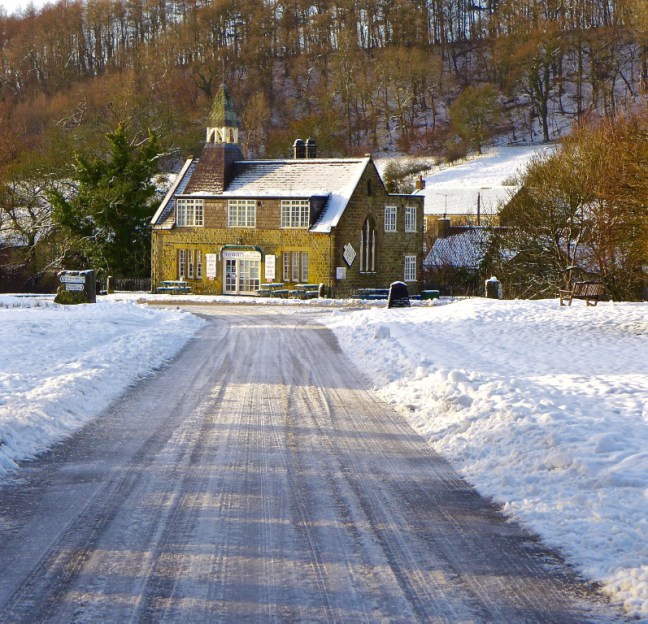
 We arrived at our starting point for the revised walk at the car park at the Lion Inn, Blakey, which was a little snowed under.
 I decided to put sun tan on as, even in winter, protection against the sun is advised (e.g. NHS Direct). There weren’t many coast to coast campers, despite this being on Wainwright’s Coast to Coast route! There was no accommodation at the pub when his book was first published in 1972, but coast to coasters have since contributed to the success of the pub in more recent years.
 We dropped steeply down to the dismantled railway in quite deep snow.
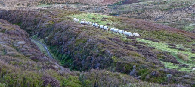
 The sheep thought us a little eccentric, but then they just followed each other like sheep.
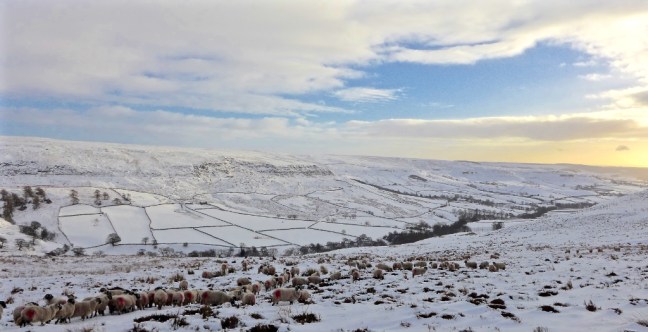

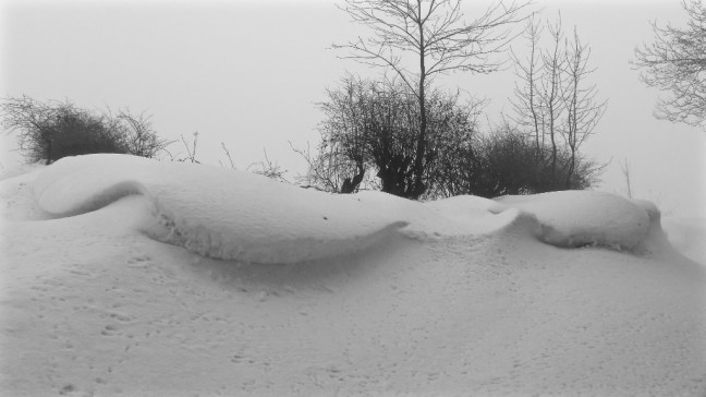
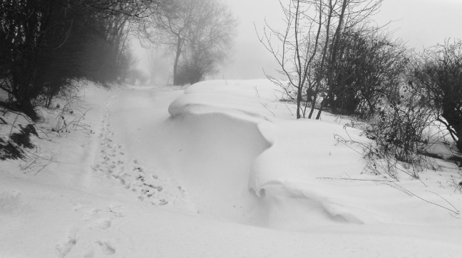
 The wind had created some wonderful snow effects.


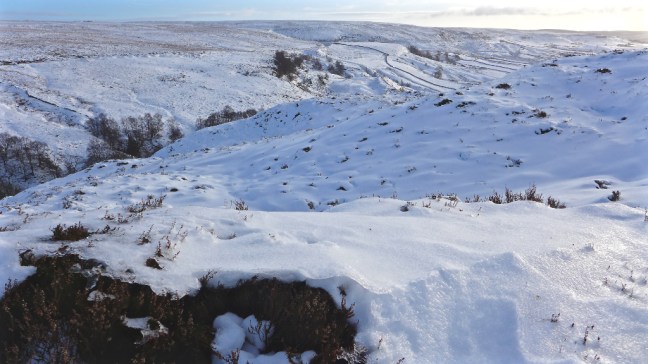 It was like entering a Winter Wonderland.


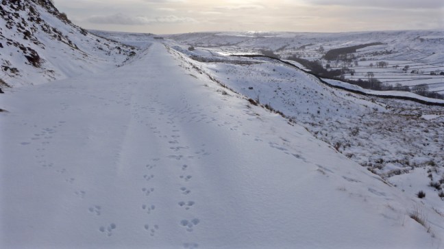
 The bonus for me was that I could use their footprints in the snow to lessen my efforts.
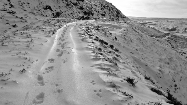 The sun was out and with our efforts we didn’t feel cold.
 We started to think about a banana and coffee break.
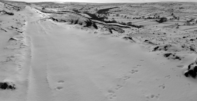
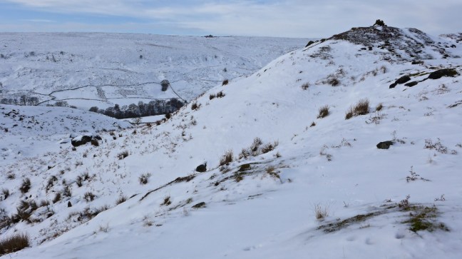
 At last we found a coffee break location with a fantastic view along the valley.
 Clouds were starting to appear and we were finding ‘Snow Miles’ were about twice as tiring as walking ‘Ordinary Miles’. We decided to return the way we had come back to the pub as it meant we could use our tracks to ease our efforts. It would have been dangerous and almost impossible to try and find paths to descend and ascend the valley back to the pub. They were covered in snow.

 We had brought our packed lunch and so as to admire the fantastic views further we stopped again at the only building on the route. It clouded over further, the wind got up and there was a definite change and chill in the air. We did not linger having had the best of the day.