Post 244: 29th March 2018, The Inn Way – Yorkshire Dales, Arncliffe to Buckden.
The alarm clock went off at 3.45am! My gear was already packed in the boot of the car, apart from my rucksack with food and flasks still to be done. The forecast was for good weather and I planned to resume The Inn Way again for the second time without Sid the Yorkshireman, Carol and Alf, all of whom were still unavailable.
But first my wife Celia was off on an adventure, going on a Mystery Cruise, and so I was dropping her off at Leeds Coach Station for a 6.30am depart to Dover. I would be ‘Home Alone’ over Easter.
Celia had been invited to join me on a walking holiday in the Bavarian Alps later in the year with a German walking friend but, not being a walker, preferred to cruise. I have been surprised by how many people when told she is going on a Mystery Cruise have asked me where is she sailing to?! That’s the point you don’t know. Today I have heard that she docked in Ghent but, because you don’t know which port until you dock, she lost an hours sleep as the time zone is different! We are cruising together to Greenland and Russia (Baltic) later in the year!
The ‘drop off’ in Leeds went well but I had a bit of trouble getting out of Leeds, despite the sat nav. Give me driving in the countryside every time over cities.
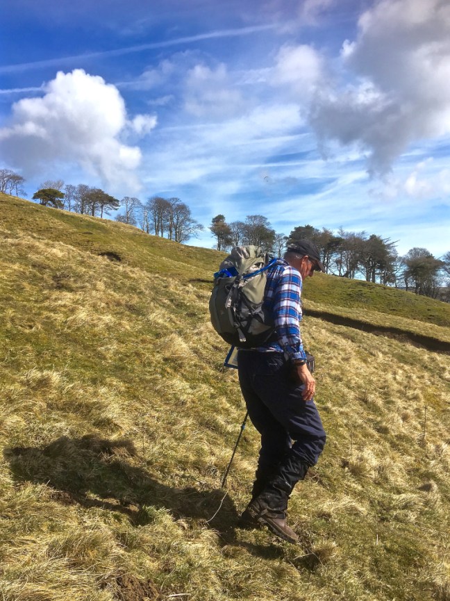
As I got towards Grassington the fog came down for the second time this week, but I still prefer that to driving in cities. It cleared and I parked in Arncliffe near the Falcon Inn.
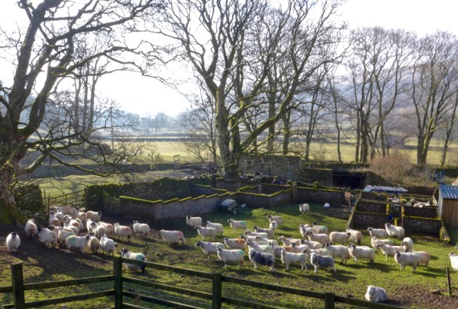
At about 9.00am I left the village along a road that was closed – at least it said it was until a landrover came hurtling along and I briskly stepped out of the way. It screetched to a halt and this bubbly, cheerful, young lady jumped out and headed for the lambs and starting feeding them. She then asked me if I wanted to hold them. Having never held a lamb in my life, how could I say no? They are surprisingly light, not surprisingly – very warm and certainly not nearly as cuddly as I am! However, they are a lot cuter than me.
I explained to the lady, who was a keen walker and local to the area, I was walking
The Inn Way and
‘going over the top’ twice! She said I ‘
should’ be alright. Now the ‘
should’, should have been a would to increase my confidence so I asked her to guess my age. She said 55. Now this is over a 16% discount on my real age and as a bus pass holder I was delighted.
I said goodbye to the welcoming lady (my friends later said asked whether she had been to Specsavers recently as they were worried about her eyesight) and headed off the road to the not too promising path. There had been heavy overnight rain and I hoped the paths weren’t flooded like this all the way.
 My fears were soon allayed as the final mist lifted and wonderful green velvety grass paths welcomed me.
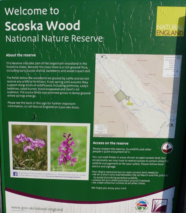
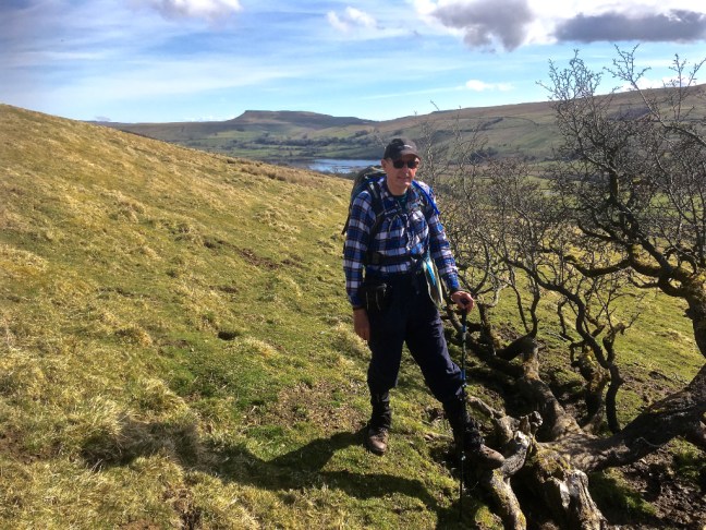
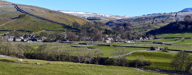
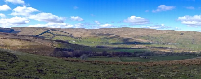
  I had entered ‘Arcadia’ (as opposed to arcades in Leeds) with wonderful soft paths, stone barns and the ancient Skoska Wood, which is the largest ash and rowan wood left in the Yorkshire Dales, now protected as a nature reserve. The valley of Littondale was carved by glaciers and the meltwater thousands of years ago with its Yoredale rocks lining both sides of the flat valley floor. It has changed little since then and it felt like I stepping back in time to a less hurried world where nature predominated.

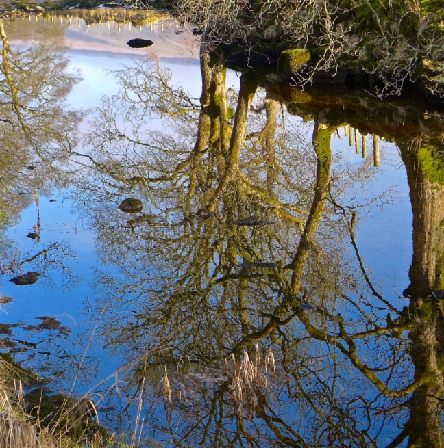
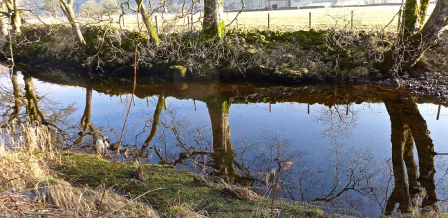
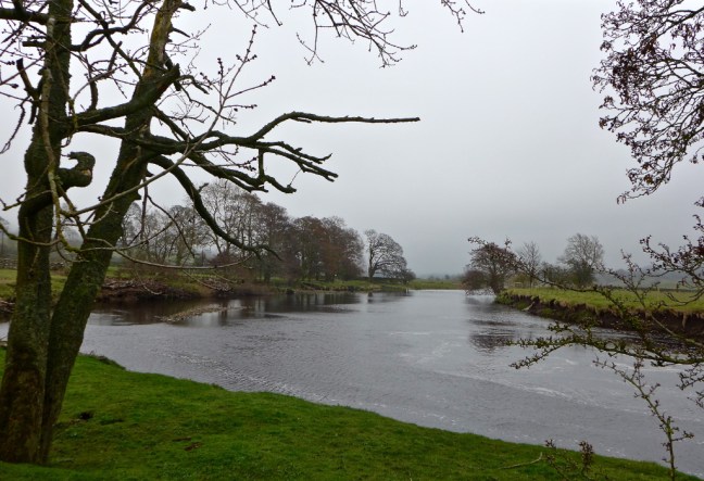
 The water in the River Skirfare was crystal clear and the low sun was casting ethereal reflections of the trees onto the river.
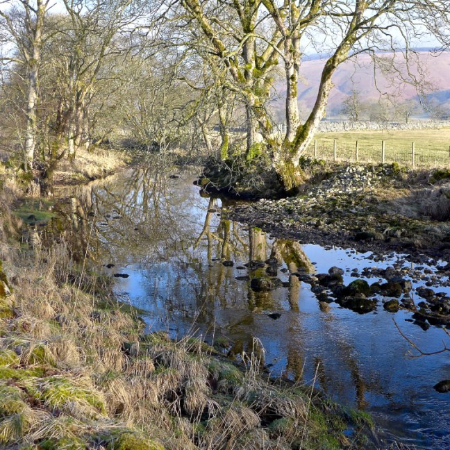

 The sudden contrast from Leeds or for that matter any city was stark.
Despite the rain overnight, the river had largely dried up in parts through the permeable limestone, only to emerge further downstream where there were less permeable rocks. A very strange phenomena.

 Certainly the sheep and lambs were enjoying the warming sun, peace and tranquility of the day as they sunbathed. No other walkers were about. Many birds were singing their hearts out.
Litton soon came into view and
The Queens Arms. It was time for a coffee and banana break on a small bench in the sun, just beyond the pub
(Arncliffe please note and get the Parish Council to cough up for one. Even 55 year olds would appreciate it, not to mention those like me with a bus pass.). Rumour has it that
Arncliffe won’t provide a bench as people might sit on it! I would be happy to come to the ‘opening ceremony’ and try it out when built.
It is believed that the inn probably provided refreshments as far back as the 17th Century. It is a classic example of an old drover’s inn with flagstone floors, low beams open fires and wood burners, and is the home of
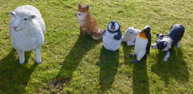
Litton Ale Brewery. The inn uses local ingredients and provides homemade food and great ale. I was surprised to see penguins in the area and that was without a drink!
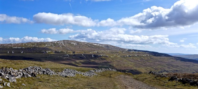
I then began the ascent of
Birks Fell to
Buckden in
Wharfedale. This is now a designated mountain (a hill above two thousand feet at 610 metres or 2,001 feet). On old imperial maps the highest point was shown as 2001-feet, but this was revised to 608 metres (the trig pillar is currently shown at 607 metres on maps) upon metric conversion. In 2006 the Ordnance Survey agreed with walkers that it was indeed over 2,000 feet just north-west of
Birks Tarn.
In Alfred’s Wainwright’s book ‘A Pennine Journey – The Story of a Long Walk in 1938’ he says:
“There is only one way to know a hill, and that is to put your feet on it and walk. Wander about leisurely if you wish, but better still, make the summit your objective and struggle up it. Plunge into the bracken and heather, and wrestle with the thousands of tentacles that would hold you back; splash through the streams that silver the hillside; scramble up the rocks and know the thrill that enslaves the mountaineer; sweat and pant, slip and tumble, and curse if you are so minded, and rest often. But get to the top………..
Either you will never want to see a hill again, in which case you may safely assume that the rot has settled in your soul so deeply that nothing will remove it; or you will hunger for the next opportunity, do it again and again and keep young forever.”
He also mentions about running down on the descent, but this is unwise for a so called 55 year old + 16% like myself as I am likely to trip up and be stuck on the fell. Given my wife was away I could be there for a while until someone found me ‘dead or alive’. I only met one other person on the climb I was about to start.
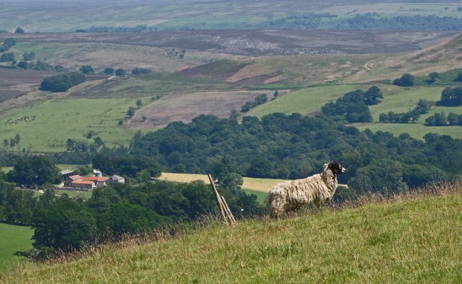
I soon passed an unnamed farm (on the map) and clearly the sheep were desperate to join me on the mountain.
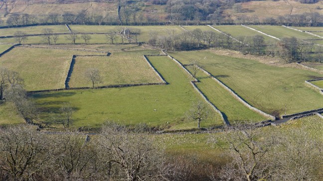
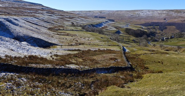
 As I ascended I kept looking back to the stupendous views. Who decided the shape of each field with its drystone walls and what was the rationale behind the shapes and sizes of the fields?
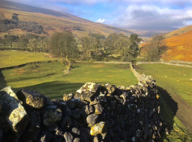


 The ascent looked long!
  And looking back was long.
 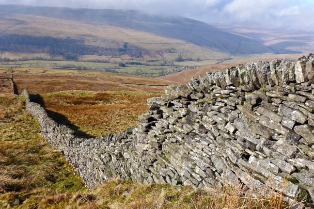 Nearing the top a little snow was clinging on.
 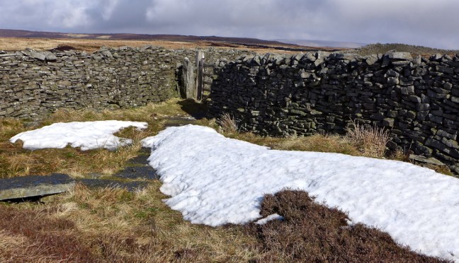 After the gate the trig pillar came into view and the descent, sometimes slippy and boggy, began.

 I was surprised to see frog spawn on the path.
 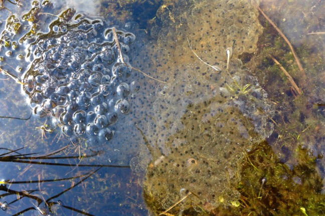 I passed a young man who was walking the route from Starbottom in reverse to me.
After a long tiring descent I reached Bucken to find both the Buck Inn and cafe closed. I had hoped to get a Dales ice-cream having missed out on one on my previous walk. This contrasted with when I did the Dales Way in 1990 and On Foot from Settle to Hadrian’s Wall in 1997 (see earlier blogs) when the cafe and pub were thriving. However, the cafe is for sale and it is planned that the inn will re-open.
Fortunately, I was carrying my own provisions and was able to have lunch on a huge bench
(Arncliffe please note).
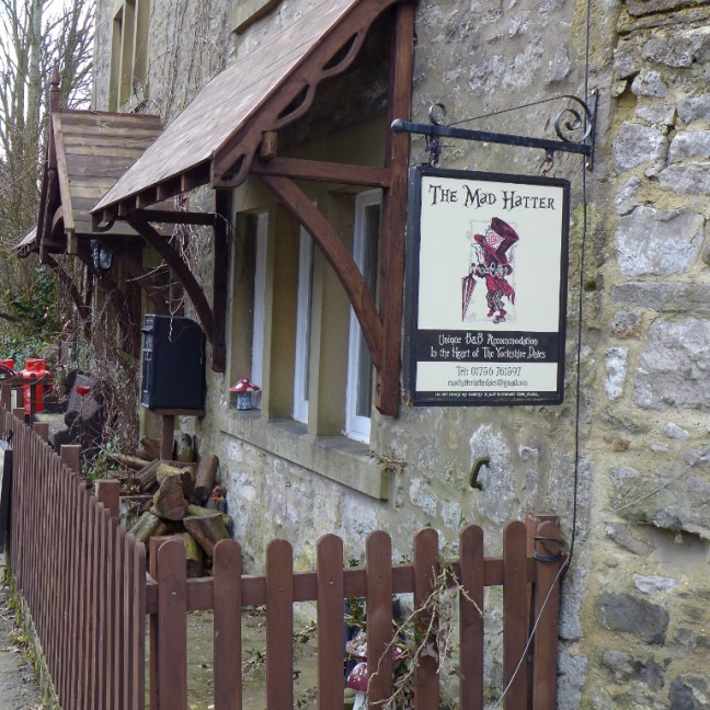
There was a bed and breakfast for ‘Mad Hatters’.
 It was time to leave The Inn Way and find a route back to the car at Arncliffe.
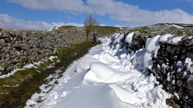
I then joined The Dales Way towards Starbottom and it’s velvety level grass paths were a delight to the feet and the mind, as the sun came out again in the sheltered valley.
I would strongly recommend
The Dales Way for anyone wishing to walk their first long-distance walk. But do it in 6-7 days in order to savour it
(see 1990 blog), not in 4 as I had been encouraged to do by my walking companion at the time.
I was somewhat surprised to see a propeller aeroplane come hurtling low down the valley.  There are some delightful colourful enclosed ways on The Dales Way, which offer shelter from any breeze.
  Opposite the bridleway to Starbottom I took the ascending bridleway in the opposite direction, leading towards Old Cote Moor. This climb was particularly noticeable coming at the end of the day’s walk and there seemed to be many false summits where I got to what I thought was the top, only to find there was another one ahead. However, the views below of the meandering River Skirfare, slowly finding it’s route like a large snake, made the effort well worthwhile. Also, given my car was over the hill, there was no choice – I had to keep going. My bus pass was no use.
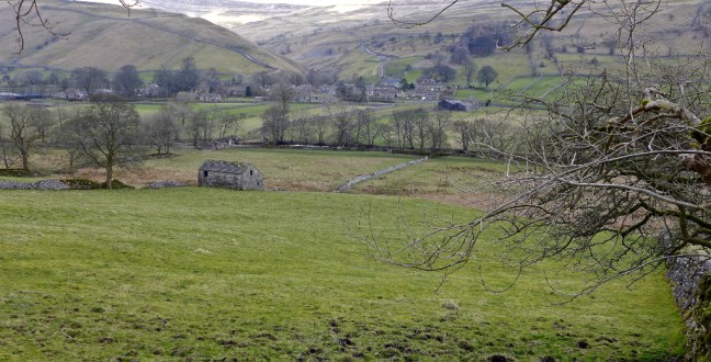


 Before the top and the heather line, I passed the young lad again. It was about 2pm and he said the Falcon Inn was due to close at 3pm. I hoped to make it for a cup of tea and icecream or cake as all my provisions had now gone.
 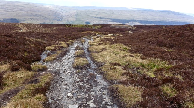 The descent followed with some relief. This is when most accidents happen and so it was important to keep concentrating on where I was putting my feet. It was clouding over, getting cooler and felt as though rain would arrive soon.

 Just before the village it was only appropriate the walk would end with lambs just as it had started.
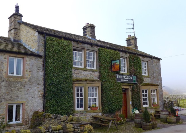
 I arrived at the Falcon Inn at 2.40pm and fortunately the landlord was welcoming and provided a pot of tea and a warm delicious scone by a warming fire. A proper Dales Inn. A great end to a great and challenging walk


Miles Walked 13.2
Steps 30,000
Calories Burnt 3,200
PS: When I came out of the Inn it was raining!
On the way home I found a delightful cafe at the bottom of the main street of Pateley Bridge, which had loads of varieties of Dales home-made ice-creams, pancakes and cakes, all reasonably priced. A well earned reward.
It could become a regular stopping point. There is 50p parking for an hour just off the road a little further up on the right.  I hit bad holiday and works traffic just after Knaresborough and so had a 30 minutes sleep in the car until it died down.
It had been a long day for a 55 year old!
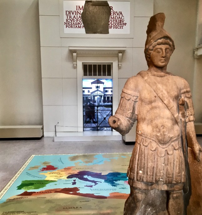
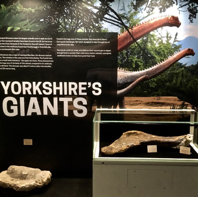
 I then went to Yorkshire’s Jurassic World area in the museum and was able to feed huge dinosaurs with tree branches that I picked with ‘special equipment’ and wearing ‘virtual reality googles’. It was too realistic for comfort and only those above 5 years old can partake. I just qualified by over 60 years!
  There are huge bones on display of actual dinosaurs.
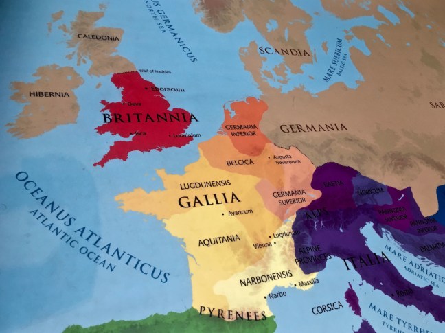
 There is an interesting geological map created in 1815 by William ‘Stata’ Smith, which represents the first complete geological map of this country. There is also a floor map as below made of pebbles.
 I then headed to the Viking area of the museum as York has been described as the Viking Capital of England. It is said that Viking men had long hair and elaborate engraved combs (see lower photograph) as it was more attractive to women. Despite having 32% Viking DNA, I don’t have much hair now!
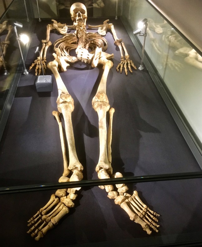
 I therefore moved onto the Medieval section and thought the skeleton had some likeness to me as he was also very tall. However, he had a sad and violent end so that didn’t cheer me up either.
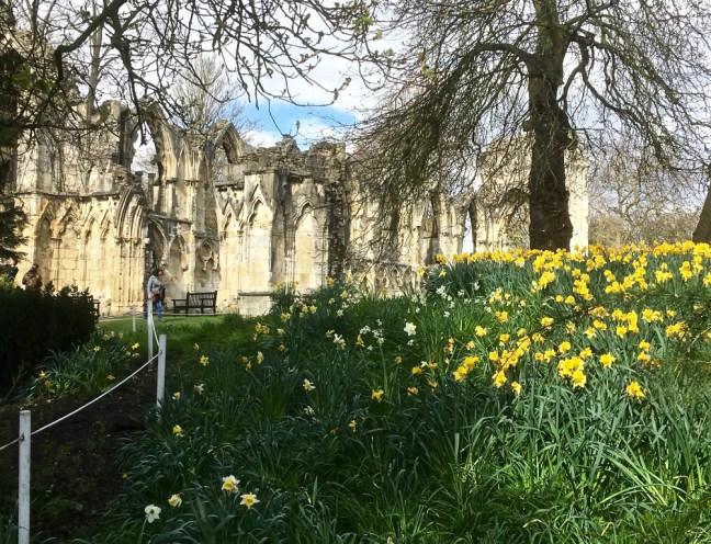
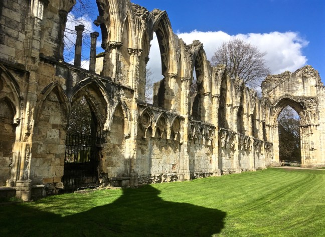
 Leaving the museum, St Mary’s Abbey looked splendid in the sunshine with vibrant daffodils around it. This was a Benedictine monastery founded by William II in 1088 and was one of the wealthiest in the country. In 1539 the Abbey was closed during Henry VIII’s dissolution of the monasteries.

 Nearby is the Hospitium, a timber-framed medieval building, once used as the guest house for St Mary’s Abbey. The ground floor was built in 1310, the first floor in 1420 and a new roof added in 1930.
 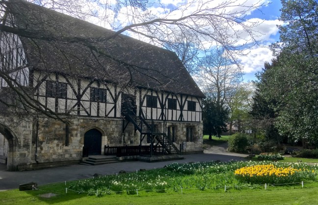 I then wandered through Museums Gardens to the excellent Kings’s Manor. This was originally the Abbott’s house, part of St Mary’s Abbey, its earliest remains dating from the 13th century. After the dissolution of the monasteries the Council of the North was held there until 1642. The coat of arms are of Charles I and also James I to mark his stay there on the way to England to be crowned in 1603. The buildings are now used by the University of York for the Departments of Archaeology, Eighteenth-Century Studies and Medieval Studies.
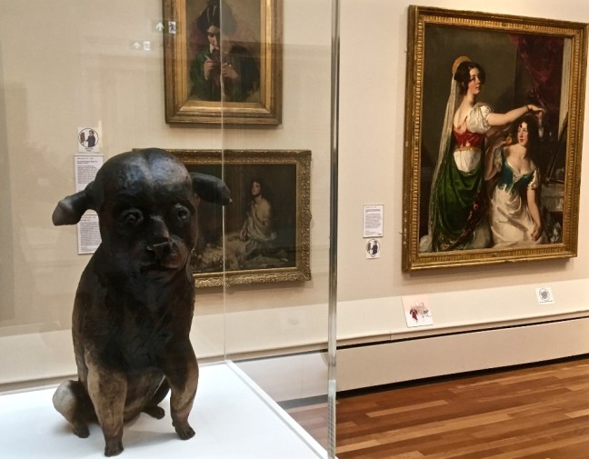
 I continued to the nearby York Art Gallery, which has an extensive ceramic collection
 There are other substantial art works and regular temporary exhibitions.
 This is a very old painting of Robin Hood’s Bay, which particularly attracted my attention
  At the back of the gallery are some fine gardens and walled quiet areas.
 I then wandered past York Minster, built between 1220 and 1472, which is the largest Gothic cathedral north of the Alps and the largest medieval cathedral in England. The Great East Window is the largest expanse of medieval stained glass in the world.


 It was a fine, enjoyable, unplanned walk using only my mobile phone for photographs and a reminder of how interesting and beautiful York is.
 We climbed up to Brough Scar, where even the lambs were sheltering from the cold.
 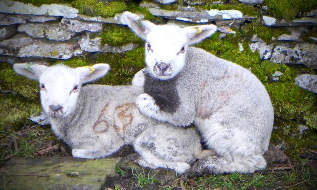 We soon reached a poor imitation of Stonehenge.
  We descended to Worton.
  The Victoria Inn there dates from 1698 and is the last remaining example in the Yorkshire Dales of a farm-cum-pub. Unfortunately, it was closed both in the morning and when we passed on it on the way home.

 Arriving at Nappa Mill we noticed that a car had seemed to have an argument with a lawn mower and come off worse.
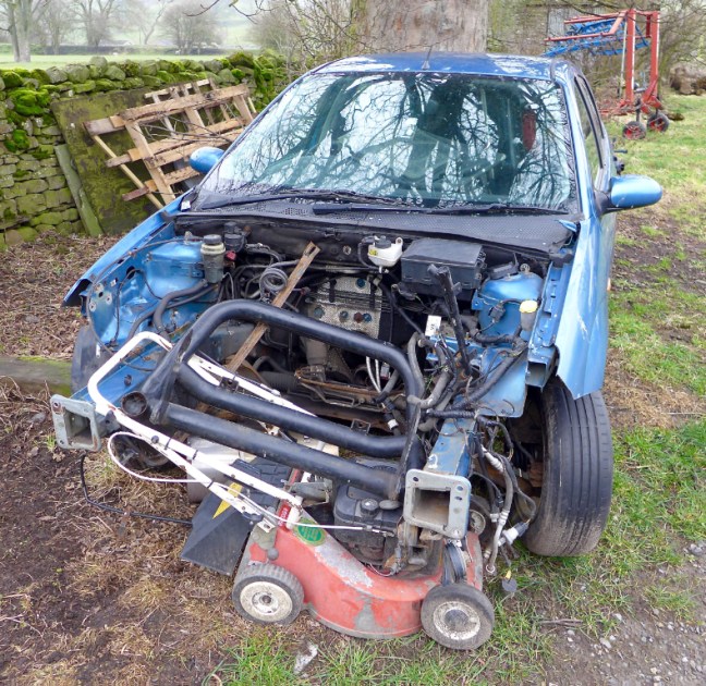
 A little further on sheep had taken over the old dismantled railway line that used to run to Hawes.
  Nappa Hall, a fine fortified dwelling or ‘pele tower’ built in about 1450, was passed.
 Newbiggin Beck was then crossed as Sid the Yorkshireman tried unsuccessfully to repeat his Basil Fawlty silly walk.
  He then suggested we take the scenic route into Askrigg.
  We passed The White Rose Hotel, Lodge Yard and the King’s Arms.


 Opposite is Crinkly House, the ‘Skeldale House’ of the BBC television series ‘All Creatures Great and Small’.
 The church is the largest and most imposing in Wensleydale and its interior is worth a visit.
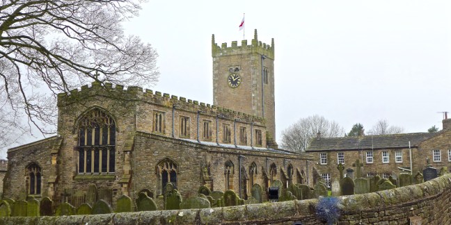

 We then left the village past the Crown Inn, heading north along the road into the mist towards Swaledale.
 The views were impressively bad in the increasing mist as we ascended steeply along the road for about 3 miles.

 It had been reported that on Carlton Bank on the North York Moors a rare and large Eagle Owl had been spotted.
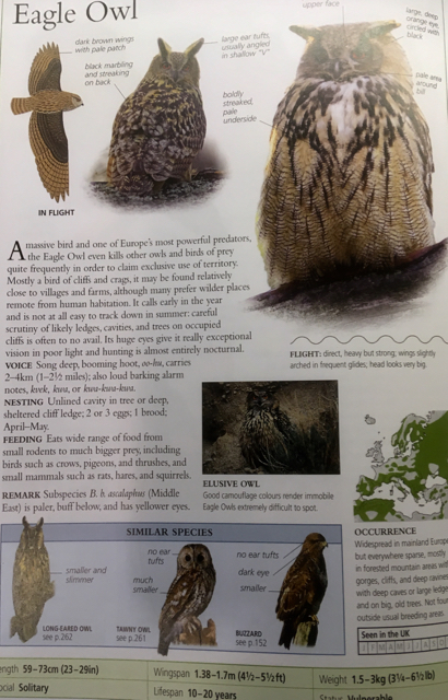
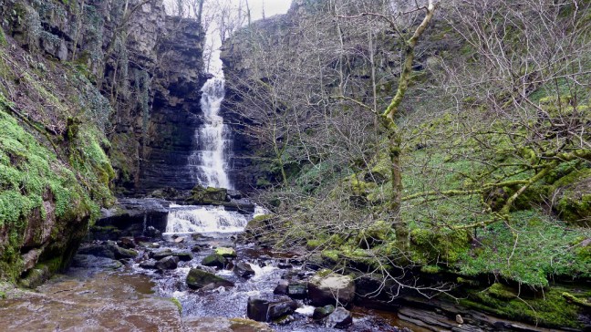
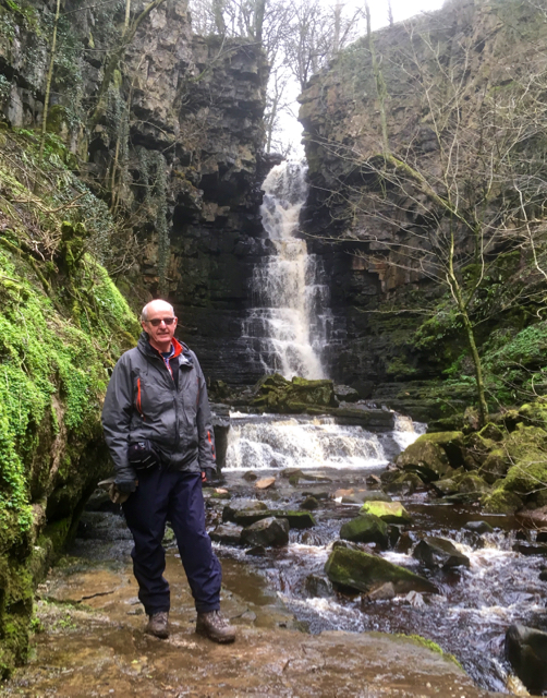
 We left the road along Low Straights Lane (Track) and reached Mill Gill and the waterfall for a fine lunch location. See video on Facebook.
 There used to be two comedians called Little and Large, but this is an optical illusion of Sid the Yorkshireman and Alf , caused by the differing rock levels. They also reported that the ground beneath their feet was vibrating.


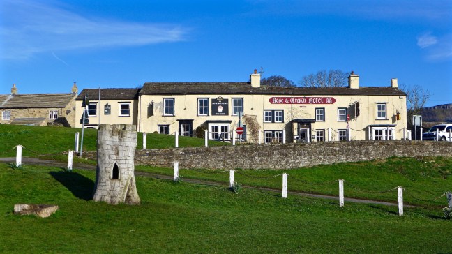
 Arriving back in Bainbridge we noticed no expense had been spared on the bus signs.
  The Rose and Crown was passed for the last time on this walk.
 Despite the weather, it was a fine walk and it could have been worse as it rained whilst driving back home.
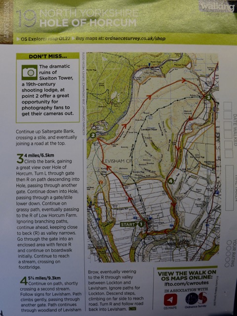
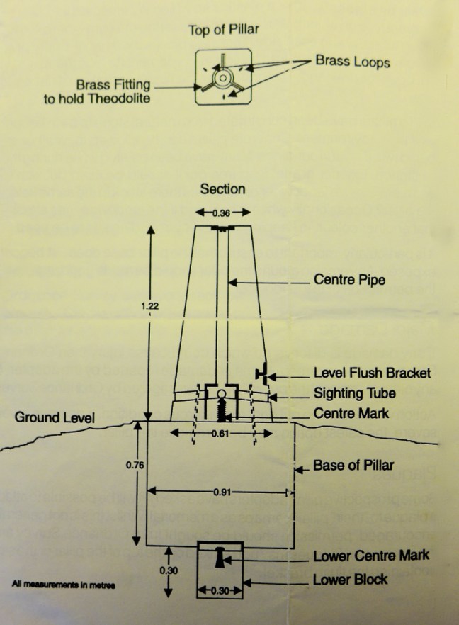
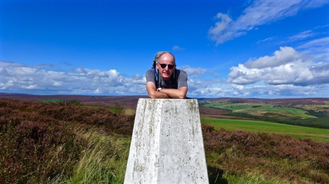 There has recently been a lot on the 1,000 Mile Country Walking Magazine Facegroup Group about trig pillars (also known as trig points and ordnance survey columns) and so I have decided to tell my story about my adopted trig point north east of Helmsley on the North York Moors. It is a story of what happens when you put one foot in front of the other and things turn out in a way that you could never imagine.
 After the farms the tarmacked lane became a track leading to Beadlam Rigg Plantation. From Middle Farm to the trig point it is about 2 miles.
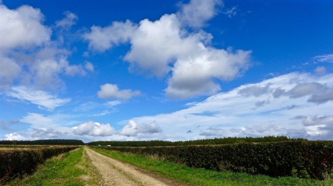
 I emerged from the woods to follow a heather lined, ascending track.
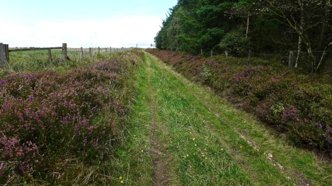
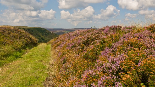
 On reaching a gate at the top I reached the escarpment of Rollgate Bank and a huge expansive view, as far as the eyes could see, of an open heather clad moorland – a ‘patchwork quilt’ that on a good sunny day will take your breath away.


 I then turned right along the track to find the trig pillar. I knew then my book would be completed and published.

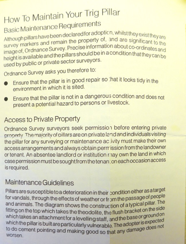
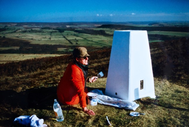
 They also issued guidance on how I ‘care’ for my new friend.

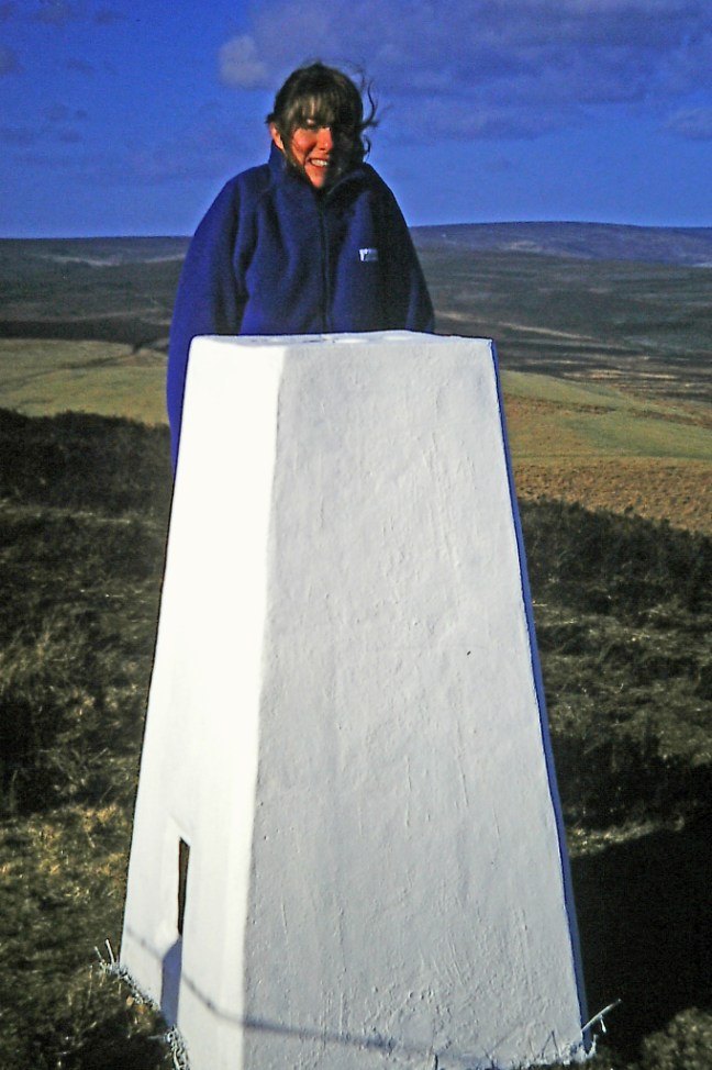 The place clearly left a great impression on Penny as some years later, when she became seriously and terminally ill in Canada and then Australia, she left instructions that this should be one of her final resting places. I had already indicated in the Conclusion of my book that this should also be my final resting place and so I will be in the company of another great lover of walking and the outdoors.


 There is even a bench just a little further on down from the trig pillar off Rollgate Bank. A fabulous place to listen to the silence, feel the breeze in your hair (if you have any) and admire the views.
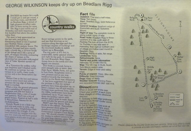


 However, things got worse for Sid the Yorkshireman when he discovered there was a charge of 20p for the toilets. Needless to say having paid my 20p he was waiting outside and got in free. Due to Sid the Yorksshireman’s grumbly mood, nothing was right, and due to his non payment of toilet fees, we decided to punish him by putting him in the stocks.
 Not having any tomatoes or such like to throw at him, we gave Carol a turn who was much more cheerful, having just retired.
 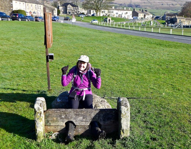 Sid the Yorkshireman then decided to apply his sheep ‘whispering powers’, which totally failed as the sheep bolted.
 It was time for an early bath.
 We were heading to the start of the next section of The Inn Way at Stalling Busk.


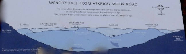
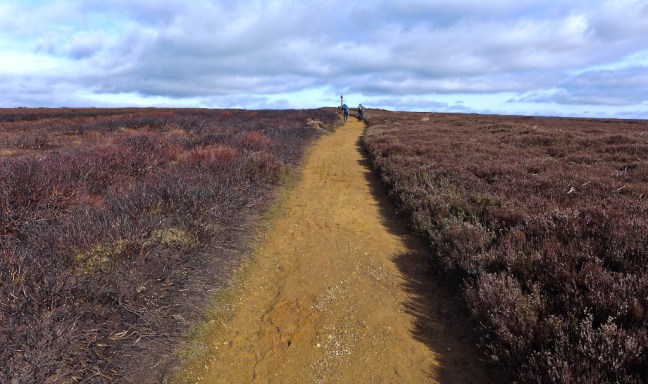
 The Cam High Road, a Roman road, is straight in the manner of Roman road construction and is at high level, before descending to the Roman Fort of Virosidvm in Bainbridge.
  The views from the Cam High Road on such a day were stunning. Yorbrugh at 1686 feet (515 metres) can be seen ahead.
 Leaving the steady climb up the Cam High Road we followed a steeper, boggier path signed Marsett.
 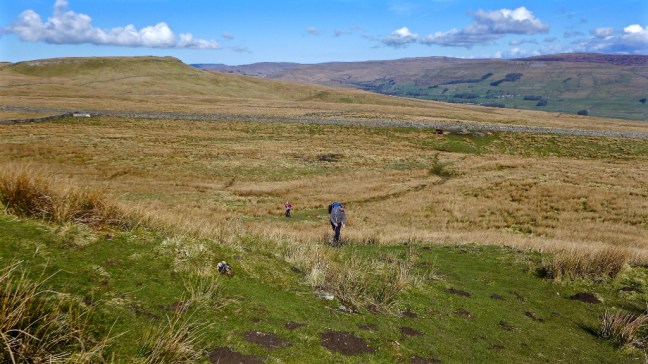 I got a little ahead and waited at the top as a skylarks sang and planes flew overhead. I am not sure whether they were classed as near misses.
  Soon afterwards we decided to stop for our coffee and banana break as it was now about 11.00am and sometime since we had eaten breakfast. See separate video on Facebook.
  Instead we enjoyed the sound of the Raydale valley skylark and took in the wonderful views in the warming sunshine. There could be no better place for a coffee break? The village of Marsett, our next destination, could just be seen lower down.
 Raydale once formed part of the hunting forest of the Lords of Middleham Castle and means valley of the roebuck. It is enclosed by the wonderfully named Yockenthwaite Moor at 2109 feet (643 metres), Fleet Moss at 1955 feet (596 metres) and Drumaldace at 2014 feet (614 metres). Raydale seen from our coffee location on some outcrops of rocks is probably one of the most breathtaking views in the Yorkshire Dales.
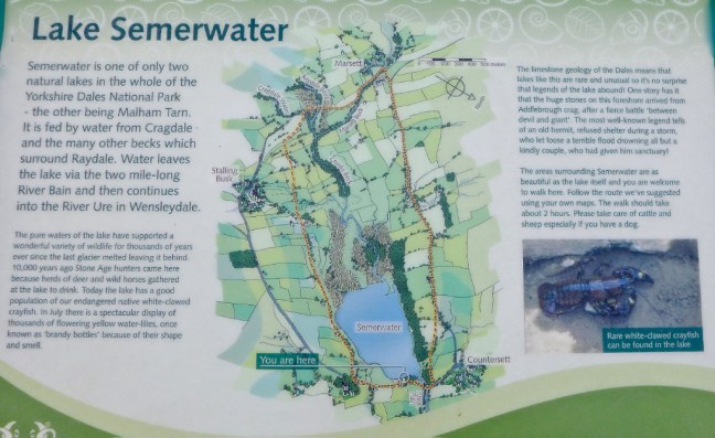
  Semer Water glistened, reflecting on itself itself far below. It is one of only three natural sheets of water in Yorkshire, the others being Malham Tarn and Hornsea.
  However, we couldn’t stay forever and eventually began our steepish descent, whilst watching out for the odd hole or two in the soft velvety grass that it would have been easy to turn an ankle on.
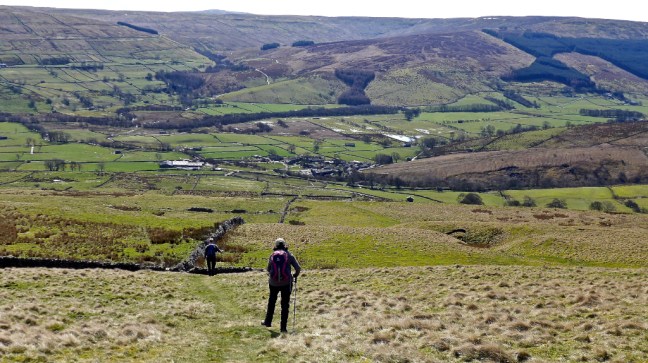
 After a dog gate, which Sid the Yorkshireman decided he wouldn’t fit through having just been on a cruise, he got a bit snap happy with my camera phone.
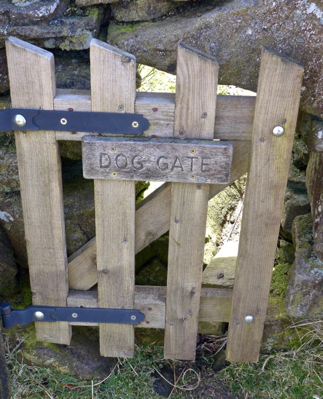


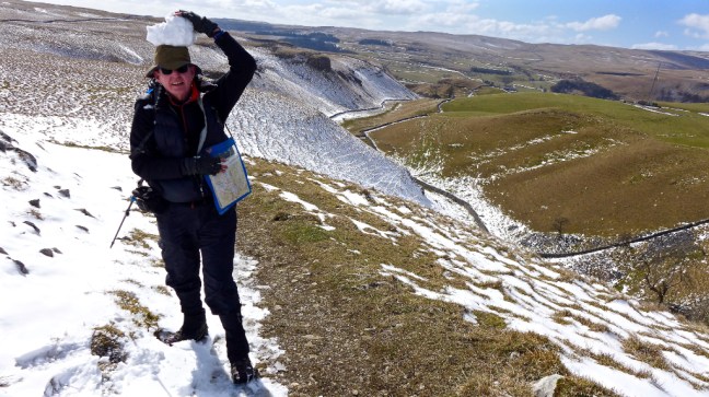
 If your wondering why I had a MS Midnatsol (meaning midnight sun) hat on, it was a prize for winning a winter Facebook Hurtiguten photographic competition. It was probably appropriate that, in order to get the winning photograph, I had to climb up and down 418 ice covered steps to the top of Mount Askla in Alesund Norway, which of course is good training for the ups and downs of the Yorkshire Dales and vice versa. Fortunately, I had spikes on but a Norwegian young lady didn’t and came down on her bottom! Quite a sight! It is as well to remember that descending is often harder than ascending as I found out later on this walk.
  By now we were in the midday sun and I think it had affected Sid the Yorkshireman. Given a choice between a ford and a bridge Sid the Yorkshireman will invariably opt for the ford with the premise that is will clean his boots. Note the Basil Fawlty silly-walk style as he crosses Crooks Beck. Very appropriate.
 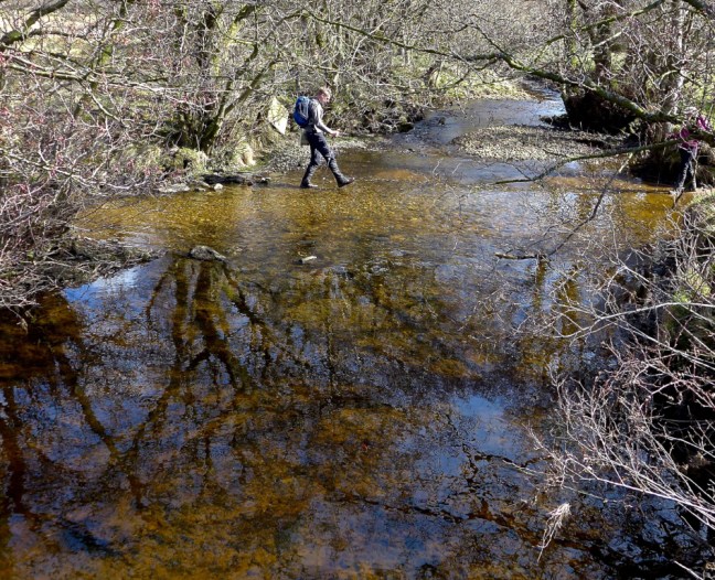 As we climbed to the village of Stalling Busk at 1,100 feet there were fine views back across the valley.
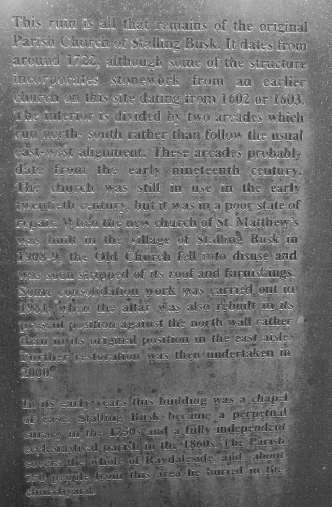
 Arriving at the delightful church I could now resume The Inn Way.
 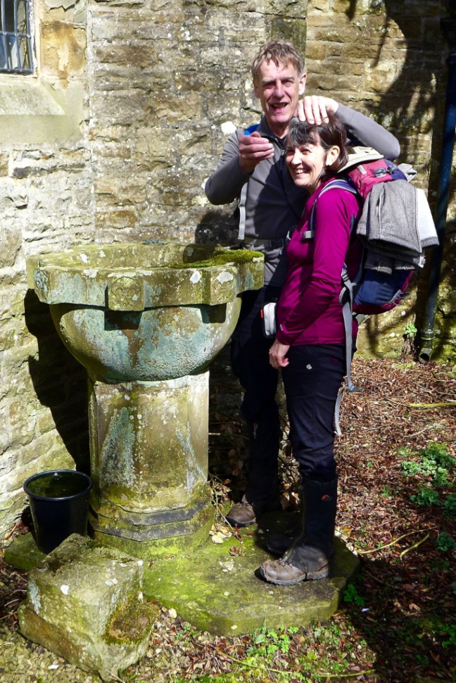 There is fine memorial outside the church. WE WILL REMEMBER THEM.
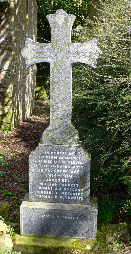

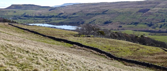
 Semer Water came into view again. It is a glacial lake, a last remnant of the Ice Age, when moraine debris was left to retain the glacial meltwater.
 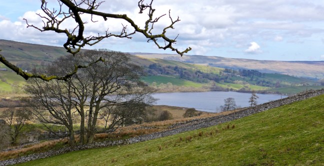 The remains of the original church was reached, dating from 1722.
 There were some interesting gravestones in the graveyard; WE WILL REMEMBER THEM. Thomas Hodgson was only 25 when he died for his country and our freedom.
 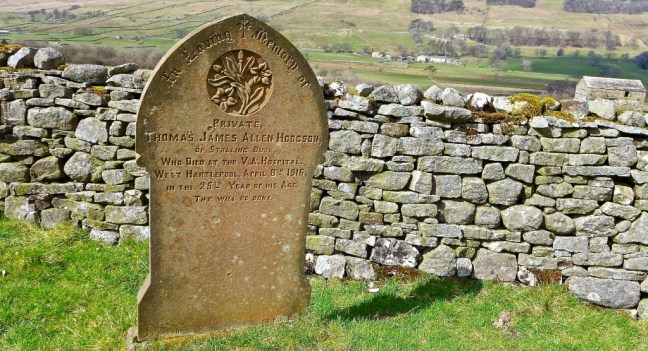 The hand on Ann Tate’s grave is very realistic.
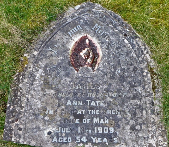 Agelika Davey from the 1,000 mile Facegroup has indicated that the text on the gravestone below is from Psalm 84:
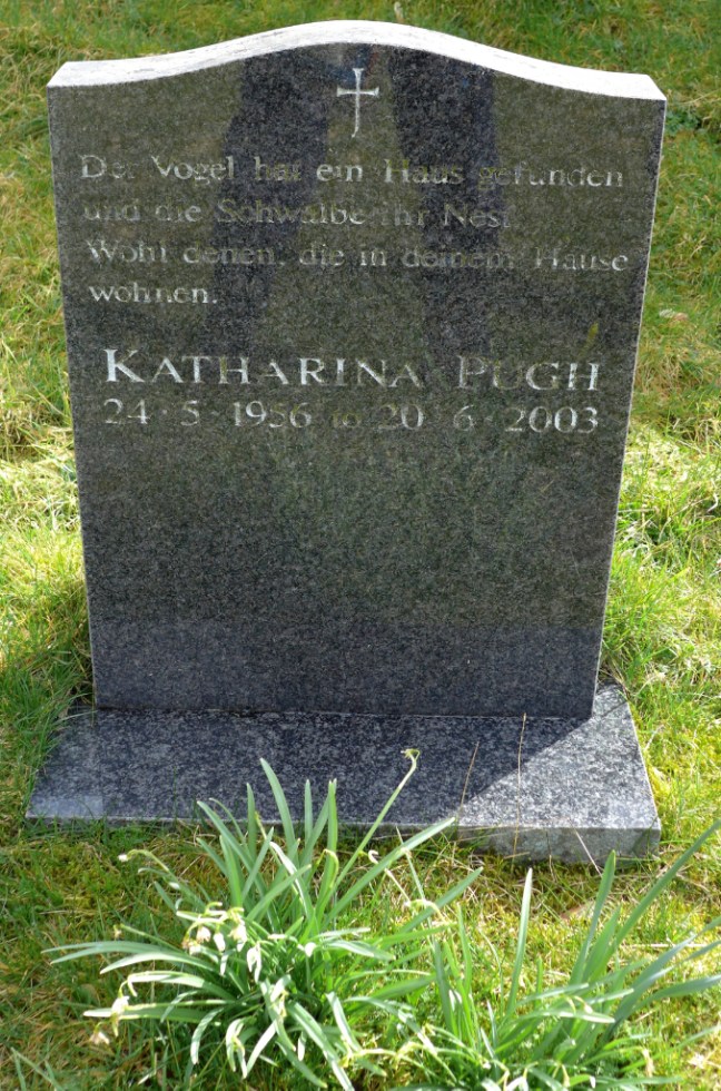 It was time to leave the graveyard and the views from it.
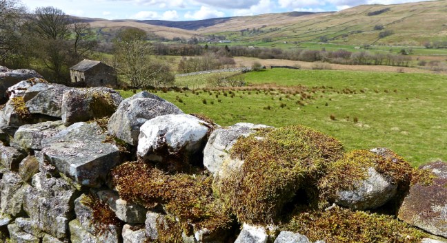 Semer Water is home to many species of migrating birds and there are rare plants in the surrounding marshland. It is an area of Special Scientific Interest and is managed by The Yorkshire Wildlife Trust, a charity.
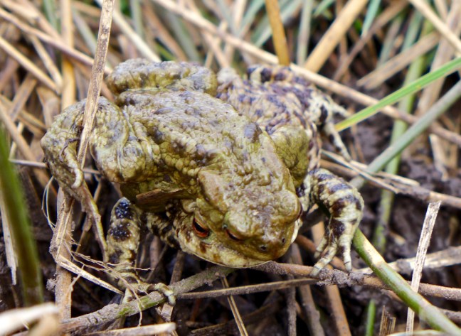
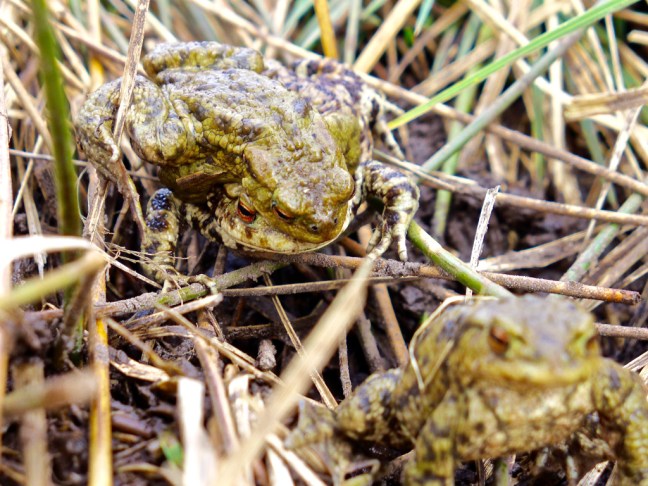
 As if to prove the point a frog came along to greet us on the path. It was clearly a ‘show off’ as it has some unusual face extras. Frogs will do anything to find a mate at this time of year as we discovered later. One of my reader’s reads the blogs over breakfast and, as a warning, some later photographs of frogs may put her off her breakfast. They are X-rated and only suitable for over 18s. I think she just qualifies!
 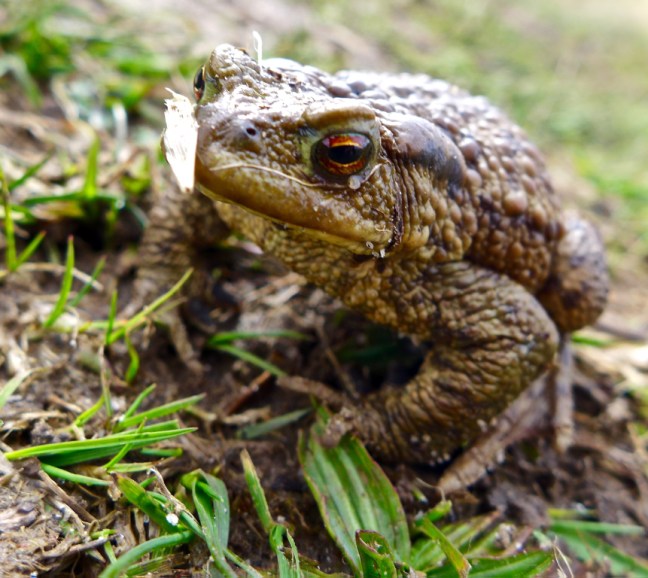 After squelching through a lot of mud we reached the end of Semer Water and the clouds were starting to appear and it felt a bit cooler.
 It is possible to walk on water in the Yorkshire Dales.
 Especially after writing these blogs with a beer and gin and tonic.
  It is also possible to become a modern day legend.
 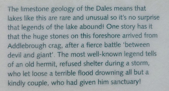 Clearly I am the old hermit in the story and Sid The Yorkshireman and Geordie Caz are the couple.


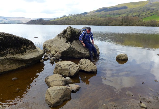
 Now you will remember that earlier I said it is easier to ascend than descend. This applies on slippy glacial erratic boulders too!
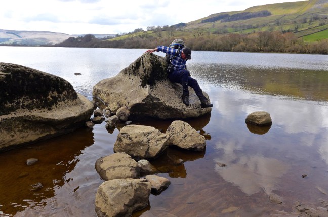
 Any breakfast readers (they know who they are) should now look away. If you try to count the number of frogs there are more than you think. Count the eyes which are the give away. Spring is here!
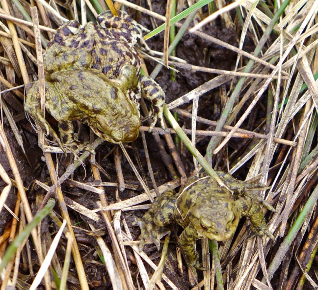
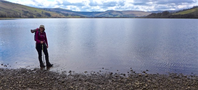
 The River Bain, which can just be seen here as we look back to Semer Water in the far distance, is England’s shortest river at 2 miles. It found a passage through the glacial moraine and finishes in Bainbridge where it joins the River Ure. A smaller river than this is often referred to as a stream, creek, brook, rivulet and rill.
  Over the two miles I collected a bag of rubbish – shocking. I wonder if I can get some of that extra high energy stuff as, being suitable for pregnant ewes, growing lambs and tups, it should give me just the sort of boost I need.
 Arriving at Bainbridge the River Bain certainly provided us with a fine finish to a fabulous walk. Note an Archimedes Screw can just be spotted at the end above the waterfalls.
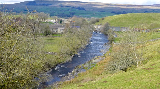

 We arrived at Buckden car park at 9.30am and parked next to the Horseless Carriage Services! Sid the Yorskshireman was still not available for the walk so we were able to pay the car parking charges, without being made to feel guilty. It pays for the repair of bridges etc.
 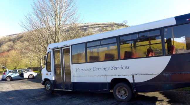 We climbed a wide track, called Buckden Rake, and had views towards Hubberholme further up Wharefedale. The track passed through Rakes Wood and skirted the lower flanks of Buckden Pike. It was once part of the Roman road between the forts at Ilkley and Bainbridge.
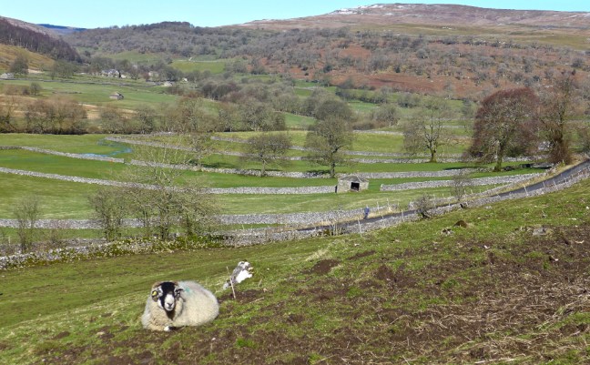
 Then Cray came into view below us, a small hamlet of old farmhouses, barns and the White Lion Inn. Cray is noted for a series of waterfalls along Cray Gill, which we would shortly walk alongside. The name of the hamlet relates back to ancient tribes of pre-Roman Britain, as Cray is a Celtic word which means fresh stream.
  The path ahead was muddy but clear.
 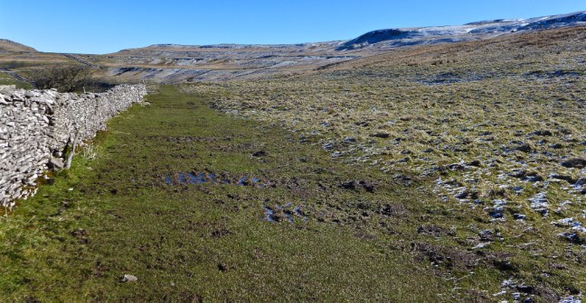 Our route ahead could be seen partly on the road ahead in the distance and over Stake Moss.
 The views back were superb.
  The White Lion Inn at Cray came into view far below. There was no time to divert to what is the highest inn in Wharfedale. This old drovers’ inn dates back to the 17th century.
  Our first waterfall encounter was at Cow Close Gill. Some photographers were there early, but there was no obvious easy access to the falls other than climbing over a wall and so we carried on walking.
 We soon came across a couple of signs.
  The Pennine Journey sign had particular significance for me and I was pleased to see that the route is now being signed as I had been involved in the book coming to fruition and received an acknowledgement by the Editor David Pitt in his introduction to the book which was also supported by the Wainwright Society.


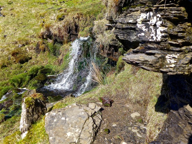
 We soon left the B6160 along a track and stopped for a sheltered banana and coffee break, near a small waterfall adjoining Hell Gap and looking back into the sun towards Buckden Pike. This is some of the finest open moorland walking in the area.
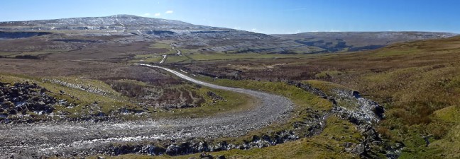
 We left the main track at a footpath and met a couple from Brighton who had started walking from Stalling Busk and were heading in the opposite direction to the pub at Hubberholme. They confirmed that, despite the recent heavy rain, the route was passable over the streams in the area.
  We then decided we had found the Yorkshire Dales last remaining glacier from the Ice Age.
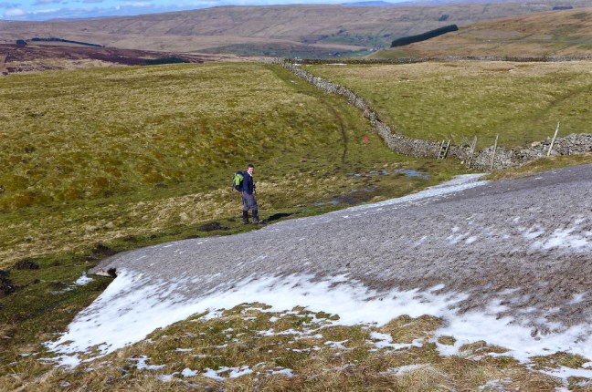 It even had a glacial snout and some terminal moraine and an outwash area. We also have vivid imaginations on our walks.
  After completely easy navigation we suddenly arrived at this gate (this photograph was taken on our return journey).
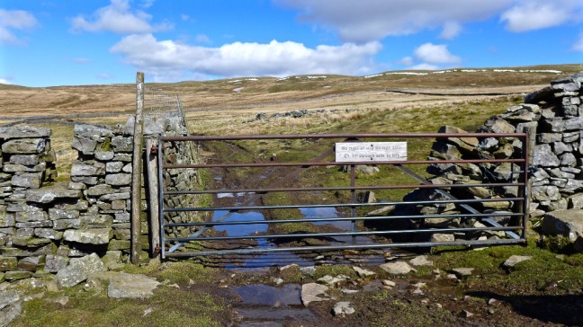 Alf, who was standing in front of the stile to the left, then read the sign saying:
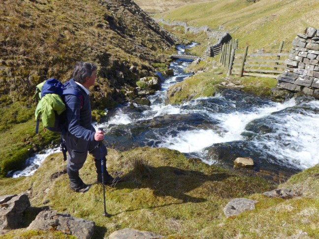
 We had lost a few hundred feet and had a steep climb back up to the High Lane (track), which we were supposed to be on.

 We dropped down to Stalling Busk for lunch on a bench in the sun at the delightful Church of St Matthew. We watched a paraglider way above us in the blue sky keeping his height using the thermals. We hadn’t expected to see a commemoration plaque on a nearby cottage in such a remote venue.

 Stalling Busk, known locally as Busk, is 1,100 feet above sea level.
 The earlier waterfall on Cow Close Gill was now in the afternoon sun.
  There was a pleasant descent back to the car to arrive at about 4.00pm.
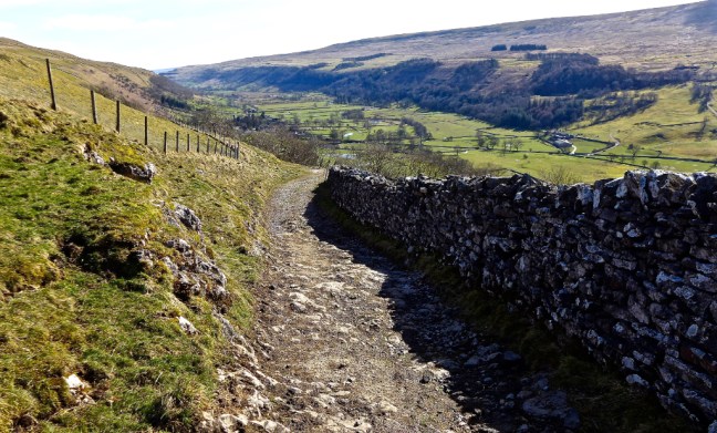


 Leaving Pateley Bridge on the B6265 there were few cars, but some lovely views.
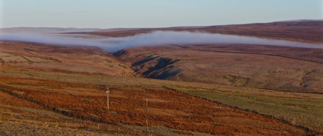
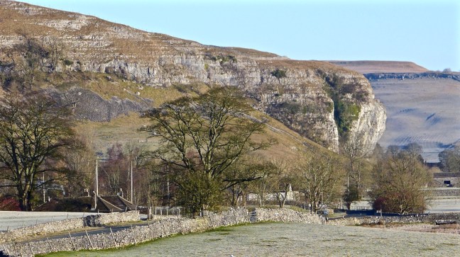
 However, approaching Grassington the views turned to thick fog, which lasted until I arrived at Conistone. Very strange as I didn’t remember fog being forecast. There was more of a hard frost in the Conistone area than fog. I started walking at just after 8.30am with clear blue skies. Conistone is a good example of an Anglian settlement that goes back to the 8th century with ploughing terraces on the hillside. The first thing that strikes you is how quiet it is.
 Following the road and then a field path, Kilnsey Crag came into view.
 The River Wharfe was passed.
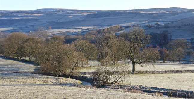
 I crossed the frosty fields towards the Crag and The Tennant Arms pub.
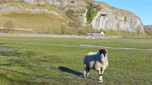 Kilnsey Crag was formed when water from Vauclusian Springs had worn subterranean ramifications, to finally emerge from the limestone near its base. Here the series of springs burst out where the basement of Silurian slates is not far below. Glacial meltwater would have supplied the springs. Close up to the limestone crag is an impressive site and it is a favourite haunt of rock climbers. It is 170-feet high with an overhang of 40-feet.


 A couple of accommodation units for groups were passed.


 The frost created interesting patterns.
  Whilst mist was still lurking behind me back towards Grassington.
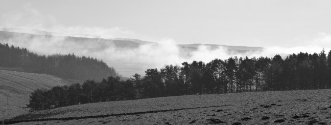
 I arrived at Hawkswick Bridge and the route crosses the bridge to the hamlet of Hawkswick, only to cross back shortly afterwards. Hawkswick was named after the birds of prey that once flew in the area.
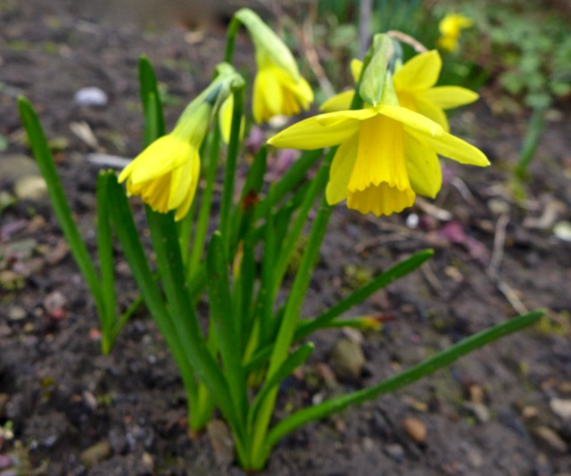
 There were lapwings ‘dancing’ in pairs. I could also hear curlew. The countryside was coming alive after our long and cold winter. Later I saw a dipper and heard skylarks and a woodpecker.
  There were some vibrant colours in the walls.
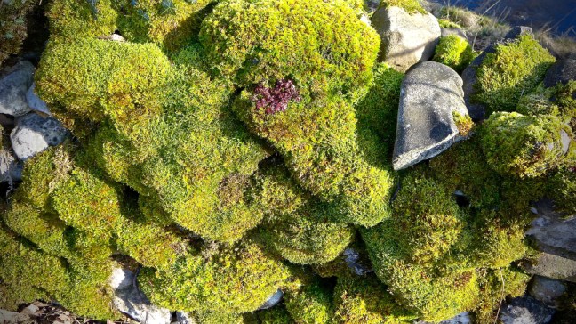
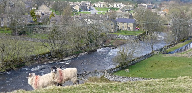
 A farmer then pulled up with his buggy and trailer and took new born lambs out of the trailer. Marvellous to see as the lambs had found a new exciting world to explore.
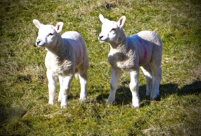
 ‘Mom’ was keeping a close eye on them.


 Suddenly and rather strangely the mist came ‘enveloping’ up the valley. It went much cooler and I felt very disappointed fearing this could be in for the day.
  Arriving at the Anglian settlement of Arncliffe, meaning ‘eagle cliff’, there was still some colour to be found.
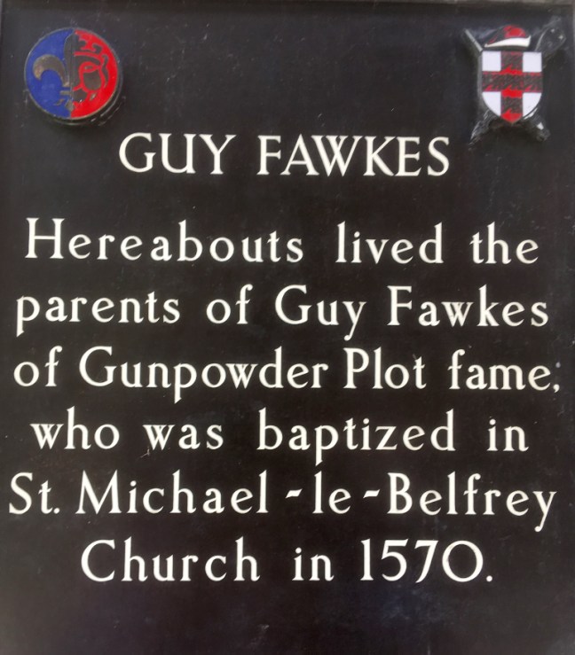
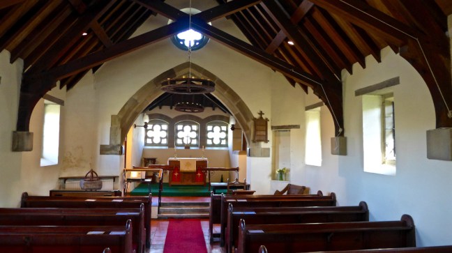
 The present church, dedicated to St Oswald, dates mainly from 1796 and 1841. The church tower dates back to the late 15th century and there is a memorial to the local men who died at the Battle of Floden in 1513, when the Scots and English were still fighting each other. The bell is from 1350 and one of the oldest in the country and is believed to have come from Fountains Abbey.
 Trouble makers in the area were put in stocks.
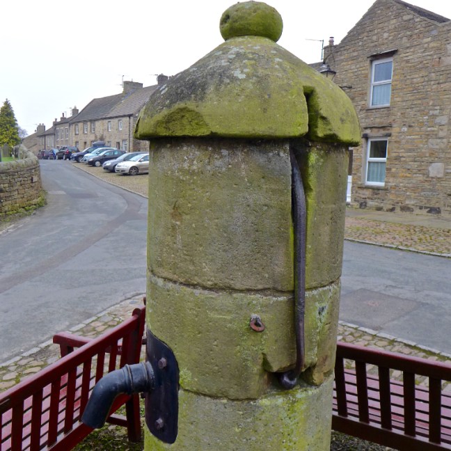
  It was coffee and banana break time but surprisingly, despite its spacious Anglian village green, there are no benches. I think this gives the wrong message for the village. The only benches are for the use of patrons of the Falcon pub. I had no choice but to perch on an ancient drinking monument.
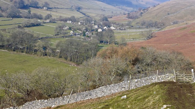
 It was now time to leave The Inn Way and find a route back to my car. This was to be a circuitous route over Middlesmoor Pasture to Kettlewell and then back along the Dales Way. I was still disappointed with the mist as I climbed the steep path through Park Scar Wood, whilst trying to avoid trees falling on my ‘crop of hair’.
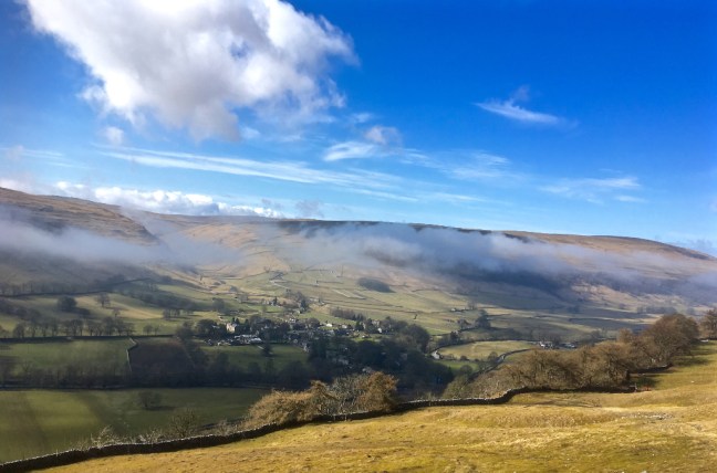
 At the top of the pasture and with perfect timing the mist started to move further along the valley and at the same time disperse. I sat and watched it, quite mesmerised. I had gone to ‘heaven’ as I hadn’t seen the like of it in over 30 years of walking in the Dales. See separate video on Facebook. Here are the later stages of the mist rising, along with the emerging views below of Littondale and Arncliffe and with the sun now radiating a comforting warmth.

 A couple passed me in the opposite direction and I watched as for some strange reason they veered right and missed the gate to descend to the wood I had just come up. They walked and pondered as to where to go for a long time and in the end seemed to find an alternative but incorrect way down.
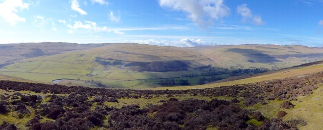
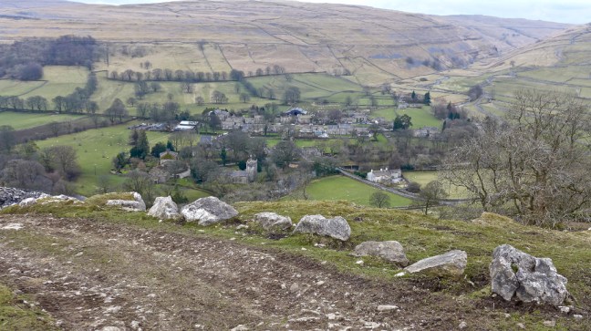
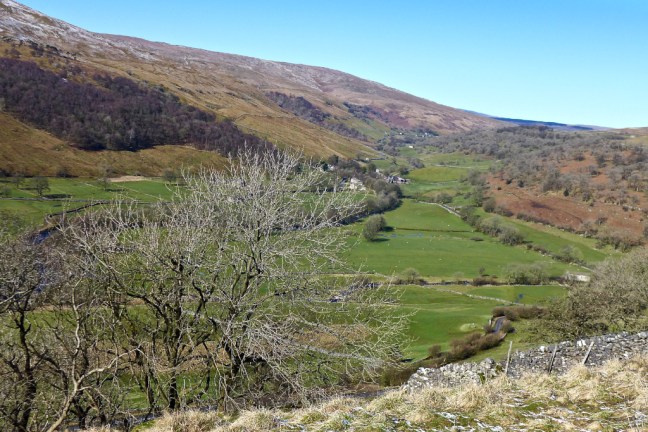
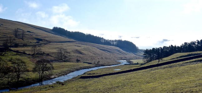
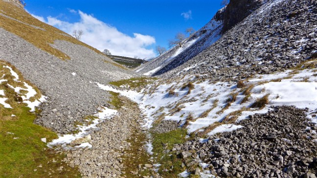
 Littondale disappeared from view and I then started to descend into Wharfedale towards Kettlewell.
 Buckden Pike could be viewed to the left.
  The villages of Starbottom and Buckden were in view nestled below Buckden Pike, all in warming sunshine. It was time to apply some more suncream.
  If I was going to finish the walk I had to get going again, but could have quite happily have sun-bathed for an hour or two. There were breathtaking views as I descended to Kettlewell and an intended Dales icecream – my first of the year. I had earned it.


 I found a couple of pubs but, despite trying two cafes (one was closed and the other sold the wrong sort of ice-cream) and a shop there was nowhere to buy a Dales ice-cream. The ice-cream parlour had the supply tied up but I was too early in season or had arrived on the wrong day.

 There was also the youth hostel (now also a Post Office) which I had stayed in on my 1990 Dales Way walk – my first long-distance walk. Hard to forecast then that I would now be on my 55th!
 I left Kettlewell with a sad heart having been denied an ice-cream, but was pleased to be back on the Dales Way 28 years later than when first on it.
  It soon brought back the need to go through and over many stiles on the Dales Way, some which have springs on the gates that can make you airborne if you are not careful.
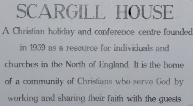
  I soon passed Scargill House in its wonderful peaceful setting.
 I then passed a lady walking the Dales Way solo. Only the fifth walker I had seen all day!
  Kilnsey Crag came into view on the other side of the valley and Conistone Pie on my side of the valley. I climbed to the top of the Pie but found out that I am not good at taking photographs of myself and gave up. I am not of the ‘selfie’ generation.


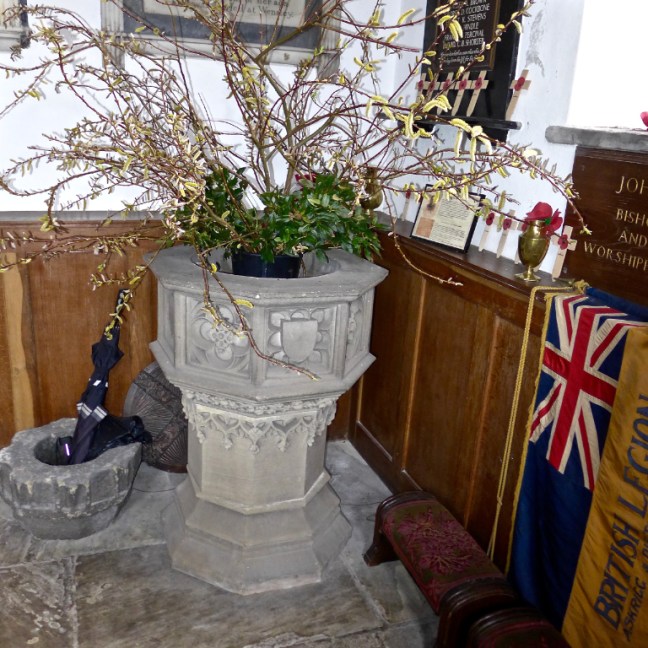
 A visit to the 8th century St Mary’s Church finished the day perfectly. It is the oldest church in the Southern Dales. It has a poor box and Norman font. In the graveyard is a sad memorial to a group of six young men who were killed by rising floodwater whilst they were exploring nearby Mossdale Caverns on 24th June 1967, in what was England’s worst caving accident.
 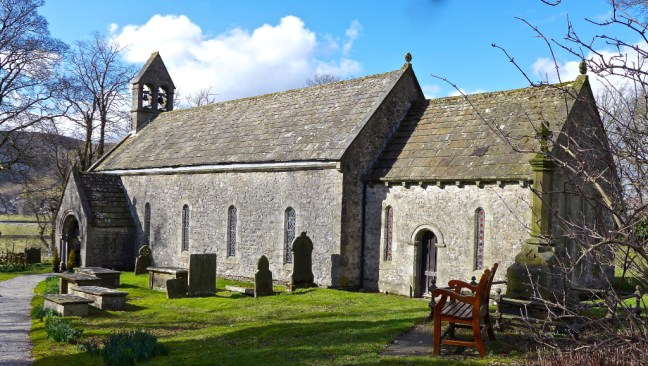 There are some beautiful Dales craft works – such detail!
 On the way home I called in for an ice-cream at Birchfield Farm ice cream parlour just after Pateley Bridge – but that was closed too!! Some things in life are not meant to be.
 This is an impressive cross standing some 10 feet high.
 We decided it was too windy for our coffee break and continued to a bench at the top of Rosedale Chimney. Sid the Yorkshireman and Alf decided it was still too windy on the bench so dropped down off the ridge, so I had the bench to myself.


 There was no one else about apart from the three of us – almost perfect solitude.
 Arriving at Hutton-le-hole we had the luxury of a bench each for lunch. This would be much busier in summer and even this coming Easter school holidays.
 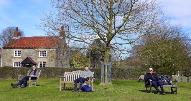 There were just a few sheep to keep us company.
 Carol, who often walks with us, was at work for her last week before retirement. Clearly when she retires she will be joining us for walks a lot more, judging by the cake she was given by her colleagues.
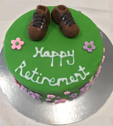


 Passing through the quiet village of Spaunton, where little seems to happen, we noticed the recycling bins for alcoholic bottles and cans were well stocked with empties!
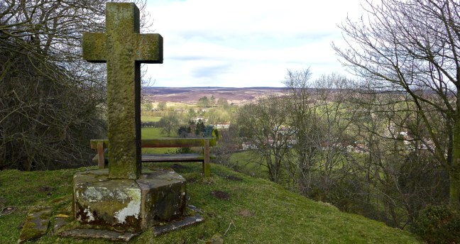
 A final descent with views of the church took us back to Lastingham


 By this time I needed a comfort break and we followed a sign for toilets to I think Dacre Banks. It took a while to find the toilets as they were not very well signed – more delays.
  They served my purpose, but Carol and Steve thought they were some of the worst toilets they had come across. However, they looked okay from the outside once you had found them!


 Fortunately, I had my infamous ‘1991’ hat on which will go down well when the Americans come to rescue us. This has been lost and found more times than I have had hot dinners, such is life when you are of bus pass age.
 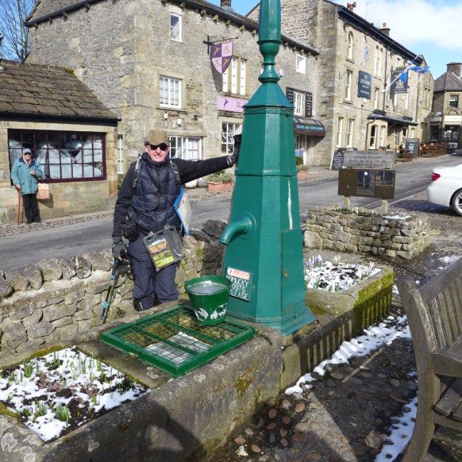 The great thing about walking in winter in the Dales is that it is very quiet. In summer the main street would be packed.
 The buds on the trees were still being held back by first The Beast from the East and then the Mini Beast. Now it is not for me to put forward conspiracy theories, but I have read that it is possible to control climates and is it a coincidence that the bad weather comes from the East? Now Russia just happens to also be in the East. Hmm….
 Near Town End Farm there was some confusion as, since the guide book has been published, the farm has expanded and the path redirected. However, our route was quite picturesque being snow lined.

 We joined the correct path along the edge of Grass Wood.


 Before being confined again as we joined The Dales Way


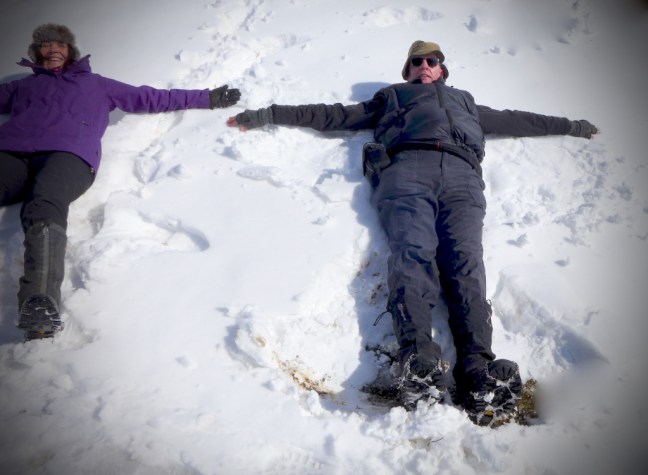
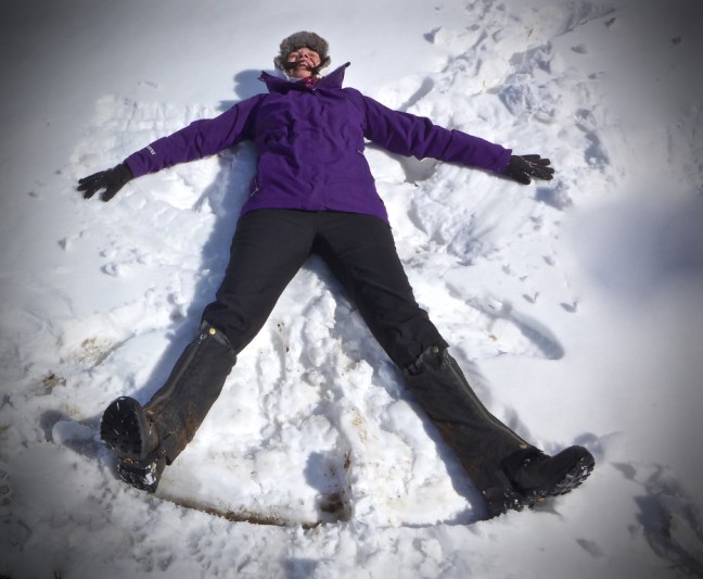
 This was proved when we went into ‘snow play’ and became snow angels.


 The RAF had received reports of strange folks in the area and buzzed us.
 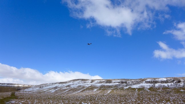 Some of the stiles were interesting.
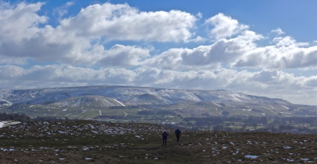
  And there were some stunning expansive views.
 We arrived back in Grassington, which even if you are not religious had a poignant message in God’s own County of Yorkshire.


 It took only an hour and 15 minutes to get back home and Sid the Yorkshireman was a lot happier and you never know, on this walk, he may come to love the Dales as I do, not just the North York Moors?
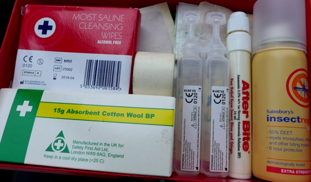
 What was worrying is that the wire in the boot was in case the exhaust came even more loose than it was already. The rubbish (milk bottle and Sainsbury’s bag) in the back were what we collected at the end of the walk. The ‘other bits’ are another story.
 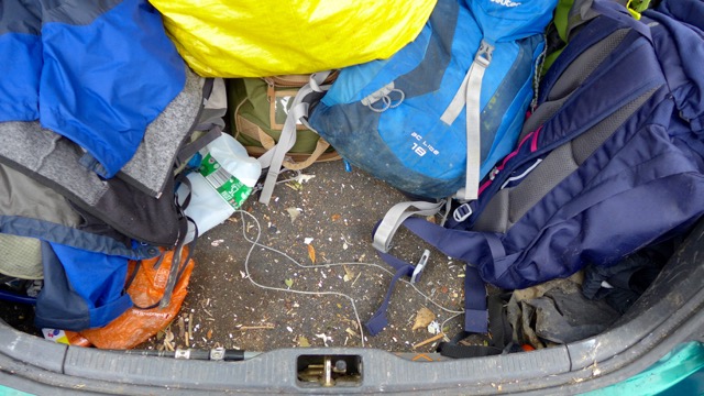 However, we had nothing to worry about as there was a decent first aid kit, especially if there were lots of insects about.