Post 245: 9 April 2018, The Inn Way, Yorkshire Dales, Stalling busk to Bainbridge.
Carol and Sid the Yorkshireman had returned from their holidays and were now able to join me on the next stage of The Inn Way. As Sid the Yorkshireman is allergic to traffic we decided to leave home at 7.00am. This worked very well until we hit fog! This put Sid the Yorkshireman in a very bad mood which, combined with the longer journey to the Dales instead of the Moors, persisted most of the day.
After we left the A1 and headed into the Dales the fog miraculously lifted, the sun came out and all was well with the world. We parked with the Rose and Crown Inn in sight.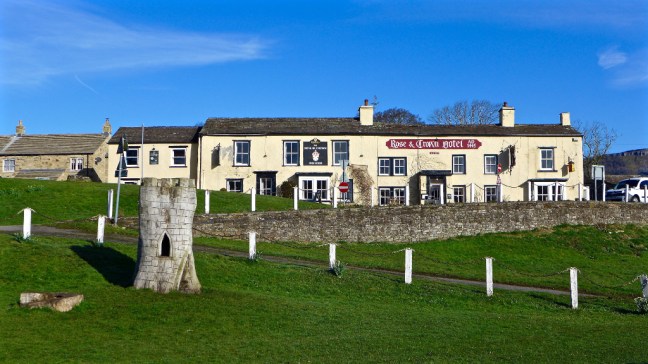 However, things got worse for Sid the Yorkshireman when he discovered there was a charge of 20p for the toilets. Needless to say having paid my 20p he was waiting outside and got in free. Due to Sid the Yorksshireman’s grumbly mood, nothing was right, and due to his non payment of toilet fees, we decided to punish him by putting him in the stocks.
 Not having any tomatoes or such like to throw at him, we gave Carol a turn who was much more cheerful, having just retired.
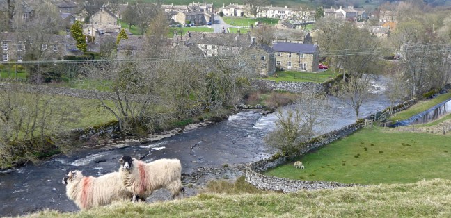
 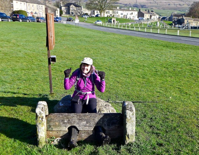 Sid the Yorkshireman then decided to apply his sheep ‘whispering powers’, which totally failed as the sheep bolted.
 It was time for an early bath.
 We were heading to the start of the next section of The Inn Way at Stalling Busk.
We had an ascent towards Greensley Bank Farm where there had been a slight route change compared to our map, now going through the farm to the right of it before turning back 45 degrees towards a big tree and the Cam High Road. The farmer kindly pointed this out to us. The scenery was delightful.


 The Cam High Road, a Roman road, is straight in the manner of Roman road construction and is at high level, before descending to the Roman Fort of Virosidvm in Bainbridge.
 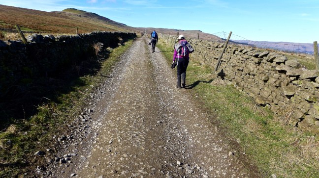 The views from the Cam High Road on such a day were stunning. Yorbrugh at 1686 feet (515 metres) can be seen ahead.
 Leaving the steady climb up the Cam High Road we followed a steeper, boggier path signed Marsett.
 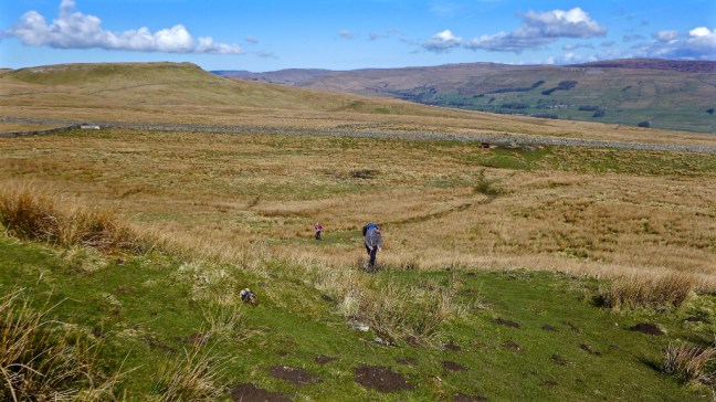 I got a little ahead and waited at the top as a skylarks sang and planes flew overhead. I am not sure whether they were classed as near misses.
  Soon afterwards we decided to stop for our coffee and banana break as it was now about 11.00am and sometime since we had eaten breakfast. See separate video on Facebook.
The view back towards the plain of York was superb as the fog we had driven through was still there and appeared as a bank or wall of mist at the end of the valley. I was tempted to walk a couple of miles to the next hill to view and photograph it more closely but Carol and Sid the Yorkshireman were not keen.  Instead we enjoyed the sound of the Raydale valley skylark and took in the wonderful views in the warming sunshine. There could be no better place for a coffee break? The village of Marsett, our next destination, could just be seen lower down.
 Raydale once formed part of the hunting forest of the Lords of Middleham Castle and means valley of the roebuck. It is enclosed by the wonderfully named Yockenthwaite Moor at 2109 feet (643 metres), Fleet Moss at 1955 feet (596 metres) and Drumaldace at 2014 feet (614 metres). Raydale seen from our coffee location on some outcrops of rocks is probably one of the most breathtaking views in the Yorkshire Dales.
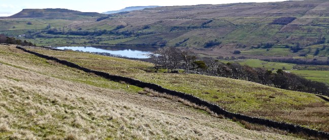
  Semer Water glistened, reflecting on itself itself far below. It is one of only three natural sheets of water in Yorkshire, the others being Malham Tarn and Hornsea.
  However, we couldn’t stay forever and eventually began our steepish descent, whilst watching out for the odd hole or two in the soft velvety grass that it would have been easy to turn an ankle on.
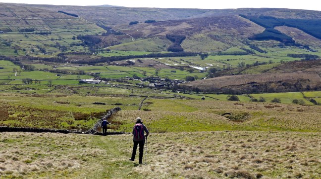
 After a dog gate, which Sid the Yorkshireman decided he wouldn’t fit through having just been on a cruise, he got a bit snap happy with my camera phone.
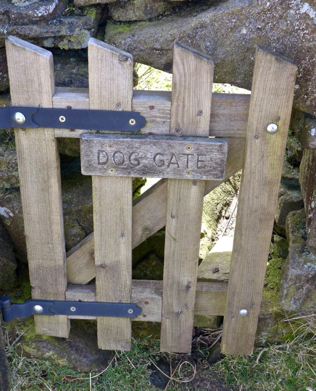
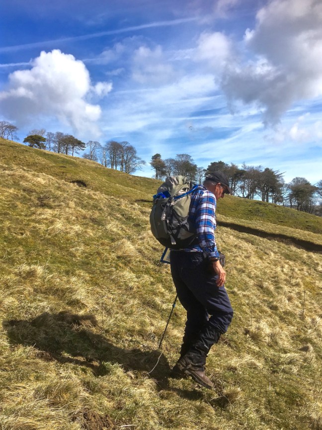


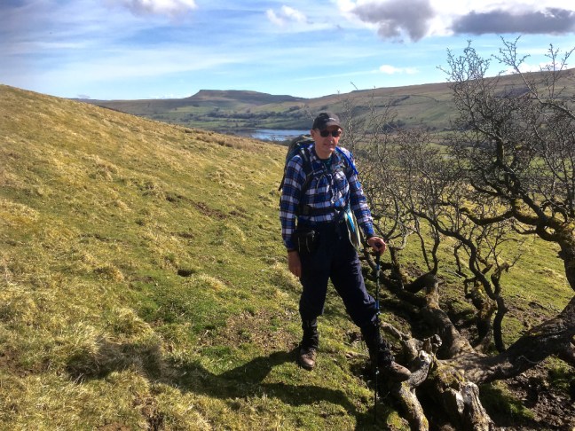 If your wondering why I had a MS Midnatsol (meaning midnight sun) hat on, it was a prize for winning a winter Facebook Hurtiguten photographic competition. It was probably appropriate that, in order to get the winning photograph, I had to climb up and down 418 ice covered steps to the top of Mount Askla in Alesund Norway, which of course is good training for the ups and downs of the Yorkshire Dales and vice versa. Fortunately, I had spikes on but a Norwegian young lady didn’t and came down on her bottom! Quite a sight! It is as well to remember that descending is often harder than ascending as I found out later on this walk.
  By now we were in the midday sun and I think it had affected Sid the Yorkshireman. Given a choice between a ford and a bridge Sid the Yorkshireman will invariably opt for the ford with the premise that is will clean his boots. Note the Basil Fawlty silly-walk style as he crosses Crooks Beck. Very appropriate.
 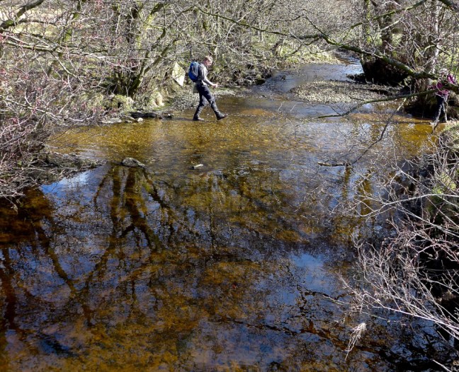 As we climbed to the village of Stalling Busk at 1,100 feet there were fine views back across the valley.
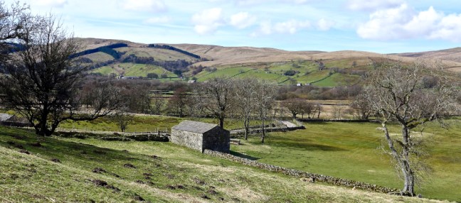 Arriving at the delightful church I could now resume The Inn Way.
Given that Carol had just retired from work and that she would now be able to walk more often with us we decided that she should be given an official blog/trail name. Poor girl. After a celebratory lunch on the bench, without champagne, we decided to have an official naming ceremony and there just happened to be an outside font. She was named Geordie Caz after her original Geordie roots (Newcastle area) and Caz being short for Carol (they do speak funny up there). At least that means that I probably can’t be sued now for defamation of character. 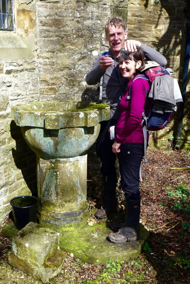 There is fine memorial outside the church. WE WILL REMEMBER THEM.
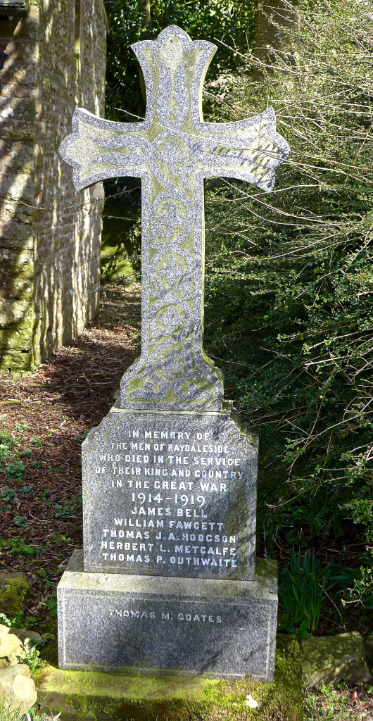
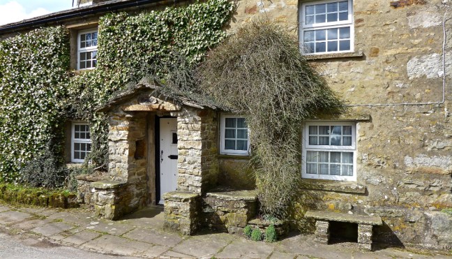
Leaving the village on The Inn Way we came across a fine house for sale at relatively low cost. For someone who wants to get away from the hustle and bustle of urban life it would be a great opportunity. 
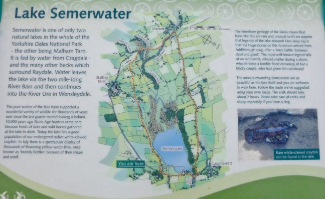
 Semer Water came into view again. It is a glacial lake, a last remnant of the Ice Age, when moraine debris was left to retain the glacial meltwater.
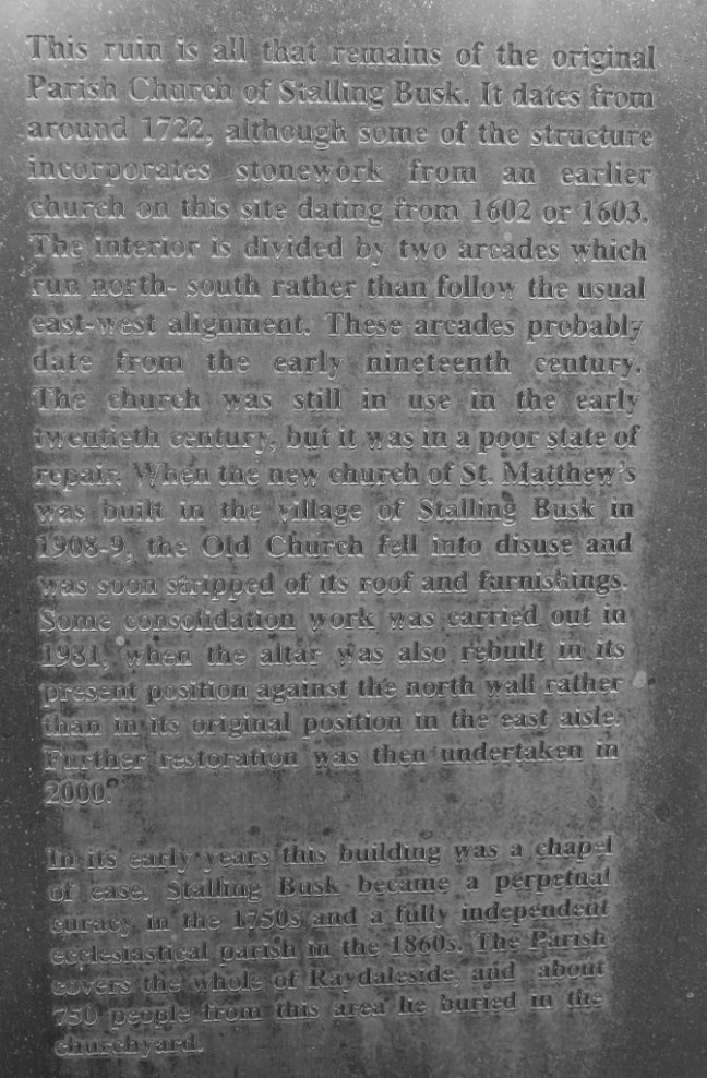
 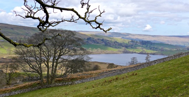 The remains of the original church was reached, dating from 1722.
 There were some interesting gravestones in the graveyard; WE WILL REMEMBER THEM. Thomas Hodgson was only 25 when he died for his country and our freedom.
 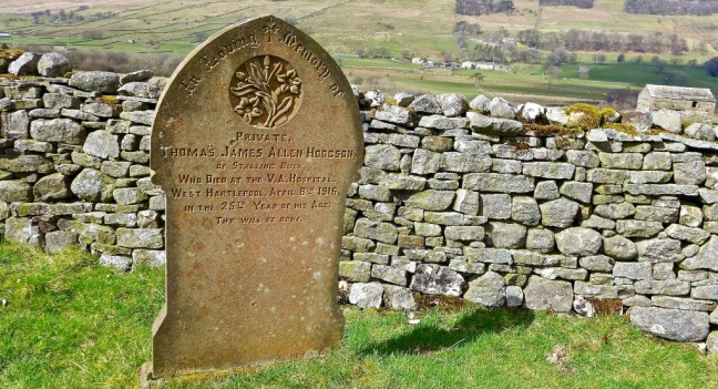 The hand on Ann Tate’s grave is very realistic.
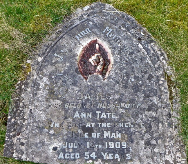 Agelika Davey from the 1,000 mile Facegroup has indicated that the text on the gravestone below is from Psalm 84:
“The bird has found a house, And the swallow her nest. Blessed are those who dwell in your house.”
We think her father’s gravestone was nearby. She was only 47.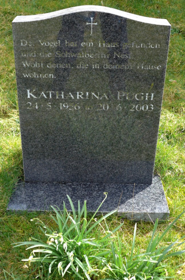 It was time to leave the graveyard and the views from it.
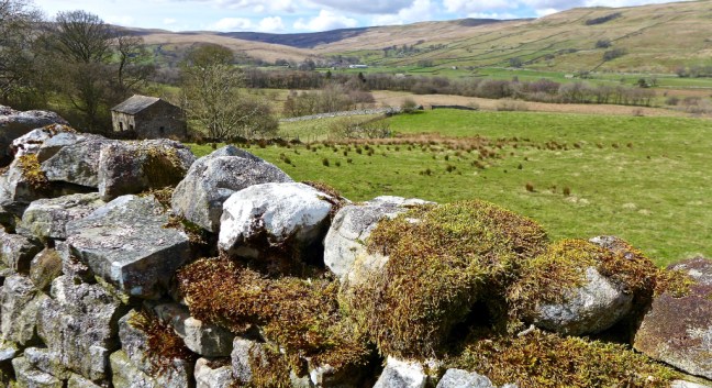 Semer Water is home to many species of migrating birds and there are rare plants in the surrounding marshland. It is an area of Special Scientific Interest and is managed by The Yorkshire Wildlife Trust, a charity.

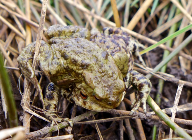
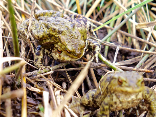
 As if to prove the point a frog came along to greet us on the path. It was clearly a ‘show off’ as it has some unusual face extras. Frogs will do anything to find a mate at this time of year as we discovered later. One of my reader’s reads the blogs over breakfast and, as a warning, some later photographs of frogs may put her off her breakfast. They are X-rated and only suitable for over 18s. I think she just qualifies!
 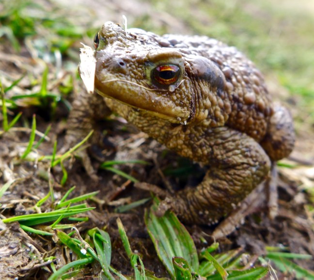 After squelching through a lot of mud we reached the end of Semer Water and the clouds were starting to appear and it felt a bit cooler.
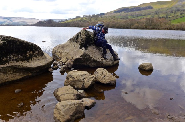
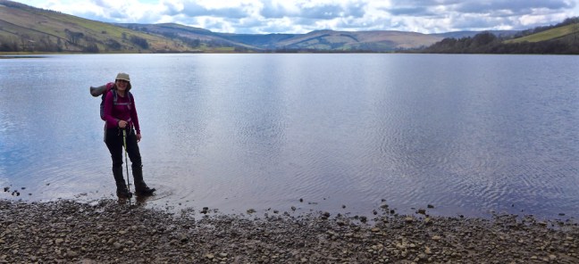 It is possible to walk on water in the Yorkshire Dales.
 Especially after writing these blogs with a beer and gin and tonic.
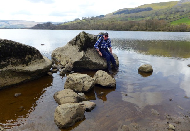
  It is also possible to become a modern day legend.
 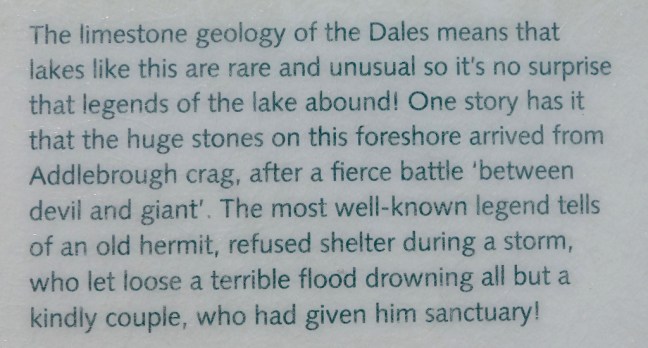 Clearly I am the old hermit in the story and Sid The Yorkshireman and Geordie Caz are the couple.


 Now you will remember that earlier I said it is easier to ascend than descend. This applies on slippy glacial erratic boulders too!
 Any breakfast readers (they know who they are) should now look away. If you try to count the number of frogs there are more than you think. Count the eyes which are the give away. Spring is here!
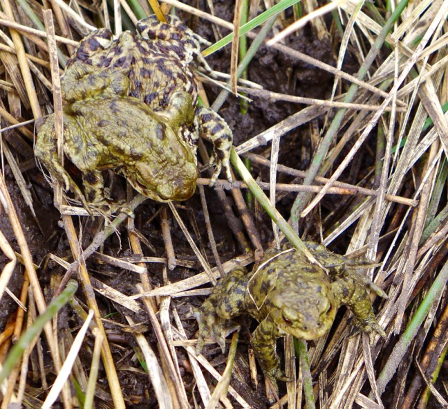
 The River Bain, which can just be seen here as we look back to Semer Water in the far distance, is England’s shortest river at 2 miles. It found a passage through the glacial moraine and finishes in Bainbridge where it joins the River Ure. A smaller river than this is often referred to as a stream, creek, brook, rivulet and rill.
  Over the two miles I collected a bag of rubbish – shocking. I wonder if I can get some of that extra high energy stuff as, being suitable for pregnant ewes, growing lambs and tups, it should give me just the sort of boost I need.
 Arriving at Bainbridge the River Bain certainly provided us with a fine finish to a fabulous walk. Note an Archimedes Screw can just be spotted at the end above the waterfalls.
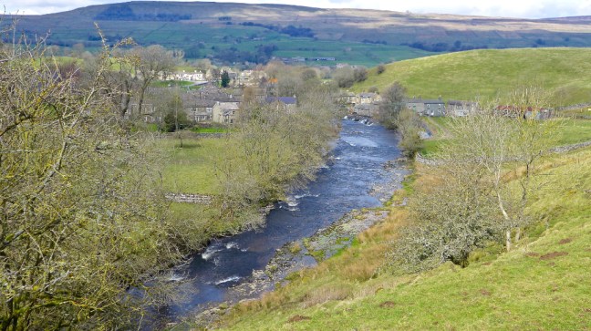

Miles Walked 10.8
Steps 23,000
Calories Burnt 3,900
