Post 244: 5 April 2018, The Inn Way – Yorkshire Dales, Buckden to Stalling Busk
After previous posts I was no longer Home Alone or Billy no-mates.
Leaving home at 7.30am, with Alf under protest that he had to get up so early on his holiday week, we arrived in the Yorkshire Dales to a glorious morning, here just passing Kettlewell.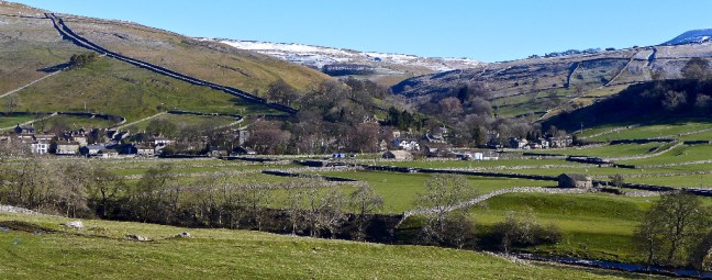 We arrived at Buckden car park at 9.30am and parked next to the Horseless Carriage Services! Sid the Yorskshireman was still not available for the walk so we were able to pay the car parking charges, without being made to feel guilty. It pays for the repair of bridges etc.
 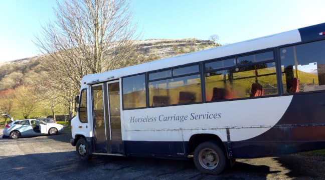 We climbed a wide track, called Buckden Rake, and had views towards Hubberholme further up Wharefedale. The track passed through Rakes Wood and skirted the lower flanks of Buckden Pike. It was once part of the Roman road between the forts at Ilkley and Bainbridge.
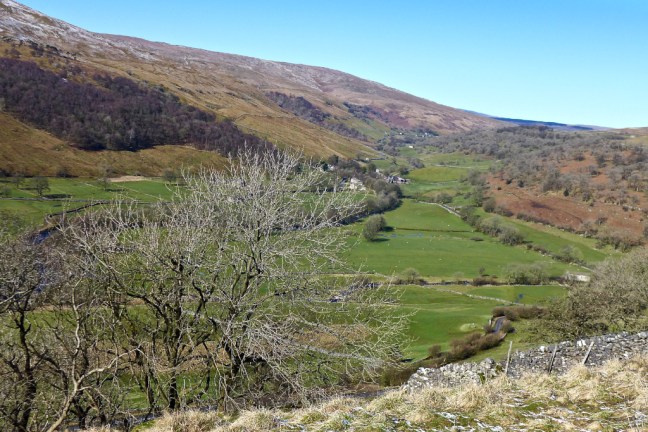 Then Cray came into view below us, a small hamlet of old farmhouses, barns and the White Lion Inn. Cray is noted for a series of waterfalls along Cray Gill, which we would shortly walk alongside. The name of the hamlet relates back to ancient tribes of pre-Roman Britain, as Cray is a Celtic word which means fresh stream.
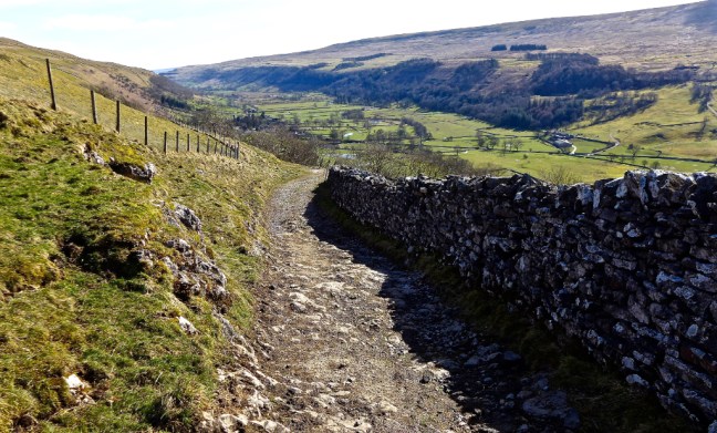
  The path ahead was muddy but clear.
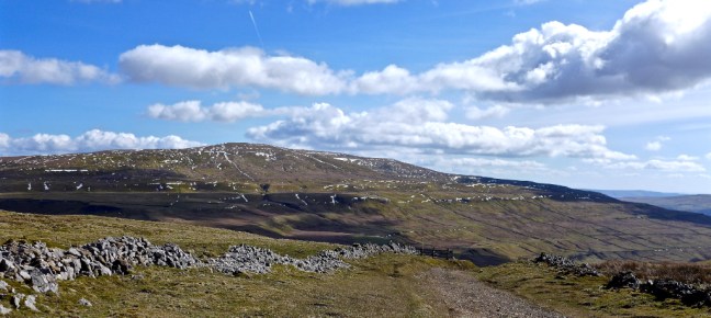
 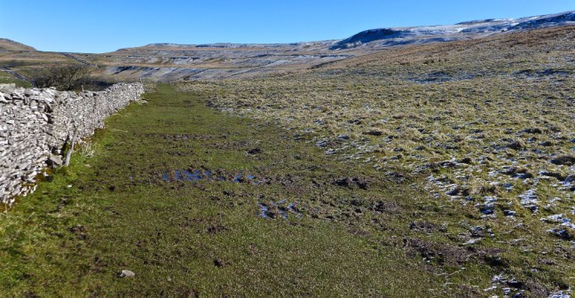 Our route ahead could be seen partly on the road ahead in the distance and over Stake Moss.
 The views back were superb.
  The White Lion Inn at Cray came into view far below. There was no time to divert to what is the highest inn in Wharfedale. This old drovers’ inn dates back to the 17th century.
  Our first waterfall encounter was at Cow Close Gill. Some photographers were there early, but there was no obvious easy access to the falls other than climbing over a wall and so we carried on walking.
 We soon came across a couple of signs.
  The Pennine Journey sign had particular significance for me and I was pleased to see that the route is now being signed as I had been involved in the book coming to fruition and received an acknowledgement by the Editor David Pitt in his introduction to the book which was also supported by the Wainwright Society.


The route follows Alfred Wainwright’s 1938 walk described in his book A Pennine Journey, published in 1986. Wainwright’s editor was Jenny Dereham who was later to become my editor.
The 100-mile Lady Anne’s Way is not well known to me and runs from Skipton Castle into Cumbria and the Eden Valley. I think it is one to walk for the future.
We soon reached the B6160 from Buckden to Wensleydale and were able to look back at our route.
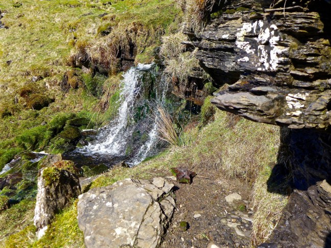
 We soon left the B6160 along a track and stopped for a sheltered banana and coffee break, near a small waterfall adjoining Hell Gap and looking back into the sun towards Buckden Pike. This is some of the finest open moorland walking in the area.
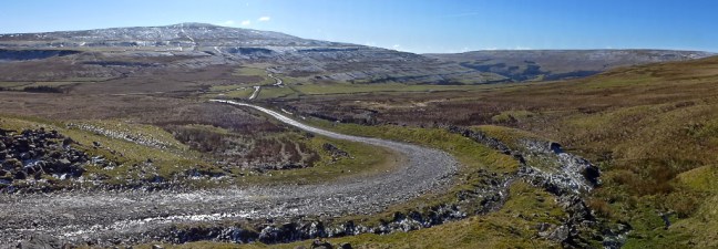
 We left the main track at a footpath and met a couple from Brighton who had started walking from Stalling Busk and were heading in the opposite direction to the pub at Hubberholme. They confirmed that, despite the recent heavy rain, the route was passable over the streams in the area.
  We then decided we had found the Yorkshire Dales last remaining glacier from the Ice Age.
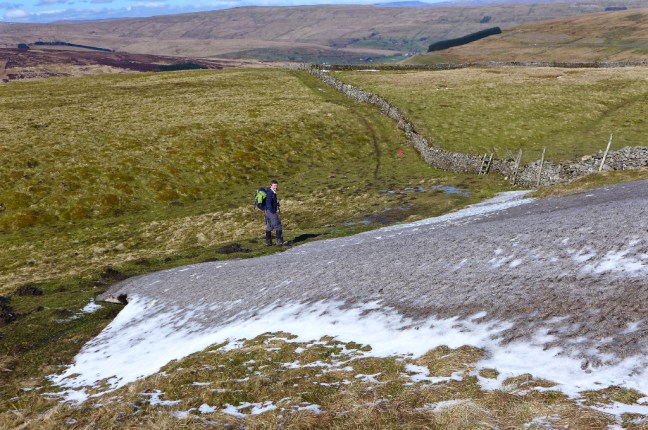 It even had a glacial snout and some terminal moraine and an outwash area. We also have vivid imaginations on our walks.
  After completely easy navigation we suddenly arrived at this gate (this photograph was taken on our return journey).
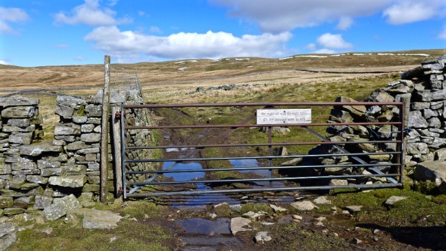 Alf, who was standing in front of the stile to the left, then read the sign saying:
No right of way through gate. Footpath through stile to left.
Now somehow, beyond all reason and comprehension, Alf missed the stile and said we needed to follow the wall further down the hill. I didn’t see the stile as Alf was standing in front of it. That’s my excuse and I am sticking to it.
It was a monumental cock-up the likes of which I had never experienced on a walk before. The Greatest Cock-up in the history of walking, which will be submitted to the Guiness Book of Records as such.
I have immediately asked for Alf’s wife to make him an appointment at Specsavers to get glasses that he wears all the time, like mine.There did seem to be tracks as we descended the hillside, but I started to question whether we had somehow missed the stile? Alf was adamant that we couldn’t have done and I also said I hadn’t seen one. We eventually arrived at a cracking waterfall where the two streams of Shaw Gate Gill and Silky Gill joined to lead to Cragdale Water. Every cloud has a silver lining as if we had kept to the correct route we would have missed the waterfalls.
We knew we had gone wrong and now had to cross the streams. We eventually found crossing points. 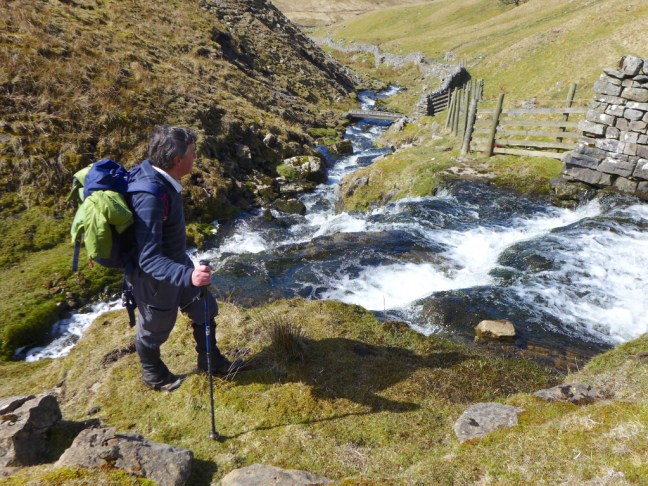
 We had lost a few hundred feet and had a steep climb back up to the High Lane (track), which we were supposed to be on.
To make matters worse sometime later at Stalling Busk I found that my automatic camera lens cap had gone missing and I believe it may have somehow got detached in this area. If you also get lost and find it there please let me know!
It is likely there will be a Public Enquiry into this monumental cock-up and heads will roll. Not mine of course as it is well known amongst my friends that I am never to blame for cock-ups.
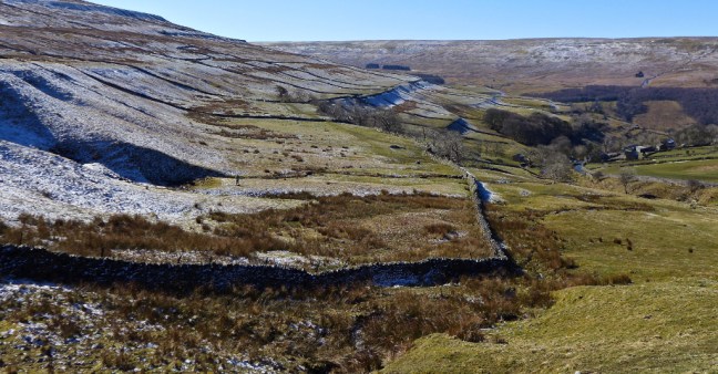
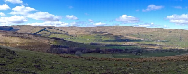
Back on the High Lane we could only admire the fantastic and expansive views before us.


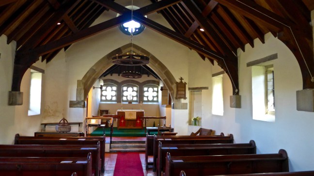
 We dropped down to Stalling Busk for lunch on a bench in the sun at the delightful Church of St Matthew. We watched a paraglider way above us in the blue sky keeping his height using the thermals. We hadn’t expected to see a commemoration plaque on a nearby cottage in such a remote venue.

 Stalling Busk, known locally as Busk, is 1,100 feet above sea level.
After some recuperation we then had to return back to Buckden along the same route as it is not possible to do a circular walk without extending the mileage considerably. We had already walked about 6.5 miles up to 1840 feet (561 metres). However, on this route it is not a problem returning on the same route as the views seemed very different, especially with some cloud emerging. Also we were able to determine where we had gone wrong at the now ‘infamous’ gate and stile.
We thought we saw in the distance the Yorkshire Wildlife Trust working on the moorland, filling in old drainage channels to reduce flooding lower down, to recover some of the open moorland due to its contribution to reducing C02 and to encourage other wildlife conservation work. Their website is: ywt.org.uk

 The earlier waterfall on Cow Close Gill was now in the afternoon sun.
  There was a pleasant descent back to the car to arrive at about 4.00pm.
The end of a fabulous walk, despite the almighty cock-up.
We decided to head back home by a different route driving over into Wensleydale which would be the focus of our next few walks on The Inn Way.
Miles Walked 13
Steps 30,000
Calories Burnt 3,900
PS: We hit bad holiday traffic on the way back near York and be warned we are thinking of bringing in a ban on visitors to Yorkshire on walk days as it is interfering with our walking schedule! However, interestingly, despite the busy roads, we only passed 5 walkers on our walk.
