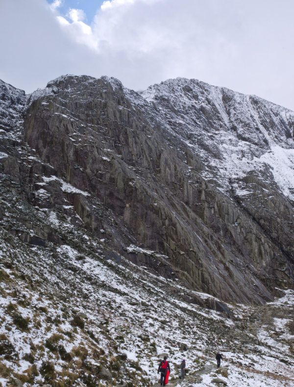
I was hanging on the end of a rope at the age of 17 on Idwal Slabs (Cwm Idwal) near Snowdon in Wales. My legs started to shake. I looked down and thought this was an early death that I had not intended. How had I got in this ridiculous and dangerous situation?
Some of the names on the climbing routes were enough to put fear into me; Suicide Wall Route 1, Hope, Game Set and Match, Y Grug, Heather Weakness, East Wall Girdle, Suspended Sentence, Last Rites, Penal Servitude, Death Row, Solitary Confinement, Teenage Menopause, Faith West Finish, Last Exit, White Hope and Clang Clang. The latter was presumably the sound I would make when I fell off.
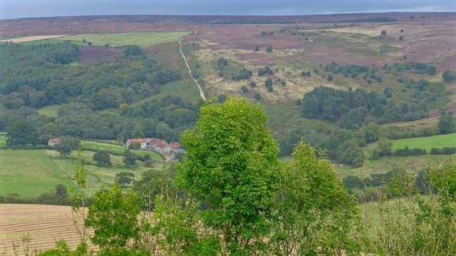
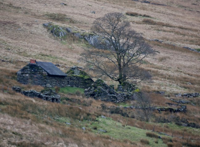
Idwal SlabsThe Cottage under Snowdon and near the Pen-y-Gwryd Hotel where merry nights were spent. The walk back across the bogs and streams in the dark was fun
It all started when I was busy studying intensely for my A-levels. My brother who was a member of the Midlands based 99 Climbing Club said I ought to take a break and go to their climbers cottage (The Cottage as it was known) near the Pen-y-Gwryd Hotel.
This seemed a good idea until I found out that the only person going to the Cottage that weekend had a reputation as a somewhat daredevil, risk taking, some would say foolish driver and climber. He had a tendency to write off cars and take climbing risks and drink a lot of alcohol. The complete opposite of me at 17 or for that matter any age.
However, arrangements were in place and I couldn’t back out.
So a little restful walk in the countryside for him was not on the cards and he suggested we go and climb Idwal Slabs. I tried to make excuses such as I had no proper climbing boots and no proper clothes. In those days this was not uncommon. As far as he was concerned I had a pair of tennis shoes and they would give good grip on rock. Neither did he accept that I had, not so long ago torn a crucial ligament, playing tennis and therefore was not that fit.
Now you may ask why I am bringing this up some 48 years later. I had in fact erased most of the terror from my memory.
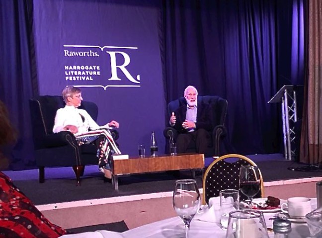
It was brought back when I went to the ‘Yorkshire Post literary Lunch with Sir Chris Bonington’, in my view probably one of the best UK climbers and expedition leaders ever and certainly one of the most famous.
I enjoyed his talk immensely as now in his 80s he looked back over his incredible life, having climbed some of the hardest and most dangerous ascents in the world such as the North Face of the Eiger, the Central Pillar of Freney (first ascent), the Old Man of Hoy (first ascent), the South West face of Everest and even climbed the Old Man of Hoy again at 80.
Why do climbers take such risks and accept sometimes very poor odds on the most dangerous mountains? I have been fascinated by the dangerous situations they put themselves into; sometimes losing their climbing partners and friends to the mountains. They can suffer frostbite, broken limbs, economic uncertainty, long periods in unimaginable cold, narrow and lucky escapes from death, long periods away from loved ones as well as competitive and difficult disputes within the climbing teams.
I think it is the wrong question to ask. The question is that given their enthusiasm and love of climbing, how can they not climb? Also given that many are driven and ambitious individuals it is inevitable they will live on the edge and push themselves to take risks.
Even after many years of climbing Sir Chris Bonington says in his new autobiography ‘I can offer no justification for the risks’.
At the lunch I was of course delighted to meet Chris, whose climbing career I have followed for years, and purchase a signed copy of his new book Ascent. I noticed there was another older book of his on sale, I Chose to Climb.
A bit like Touching the Void by Joe Simpson (in some ways the best book I have ever read) I knew Ascentwould be a book I would find difficult to put down.
I was somewhat surprised on page 34 to read that in the New Year of 1952, the year I was born and when Chris must have been about 17 and a novice climber (he was born 6 August 1934), he set out to the shores of Lyn Idwal where he stopped to examine the Idwal Slabs. He felt is was a relatively easy-angled sweep of rocks that was obviously climbed as there were lines of scratched footholds snaking up the cliff, made by boot-nails. He scrambled/climbed up solo hardly noticing the drop below him, until he reached a ledge stretching across the top of the slab.
He says ‘he felt a moment of elation and then wondered how the hell he was going to get down.’
There was no obvious way off up or down. That was exactly how I felt but at least I had an experienced climber above me who I was attached to by a rope.
The re-assuring thing I find after 48 years is that, like me, Chris experienced fear.
In the end he decided to retreat down the way he had come up and was much more aware of the drop below. When he reached the bottom he said ‘I felt the weight of fear lift with a huge sense of relief.’
However, that did not deter him from climbing back up with an experienced climber the same day to link three routes Faith, Hope and Charity. His climbing career had truly begun and the rest is history as they say.
Meanwhile, I was still stuck on a little ledge and felt I couldn’t move. My legs were shaking and I was getting more and more tired. My climbing companion above me was shouting instructions to lift one of my legs up high to a foothold. I think I eventually shouted ‘climbing’ after deciding I couldn’t stay there forever and there was a tug on the rope and I think I was pulled up rather than climbed up. Either way we reached the top and the escape route from the face. So I could argue that I had conquered a route that Chris Bonington hadn’t but, given there are a lot of different routes, this was not the case.
In any event this was the first and last time I was to climb with a rope and the nearest I got to real danger in the many years since of fell walking and long-distance walking. My highest risk was going over Striding Edge with a large pack after snow and after someone had died up there the previous week.
So as with Chris Bonington, for me the rest is history but either way Idwal Slabs was to have a profound effect on both of our lives and the directions we went in. ‘I Chose not to Climb’ and you can read what I did instead in these Secret Diaries of a Long-distance Walker.
When I said to Chris that I was pleased to hear that he had taken up and was enjoying walking, he did say that climbers do walk. I agreed but said that many walkers, including myself, don’t climb. However, I remain fascinated as to the challenges climbers undertake and the risks they are prepared to accept.
Post 204: 17 October 2017, the COT COMBO WALK Levisham to the Bridestones.
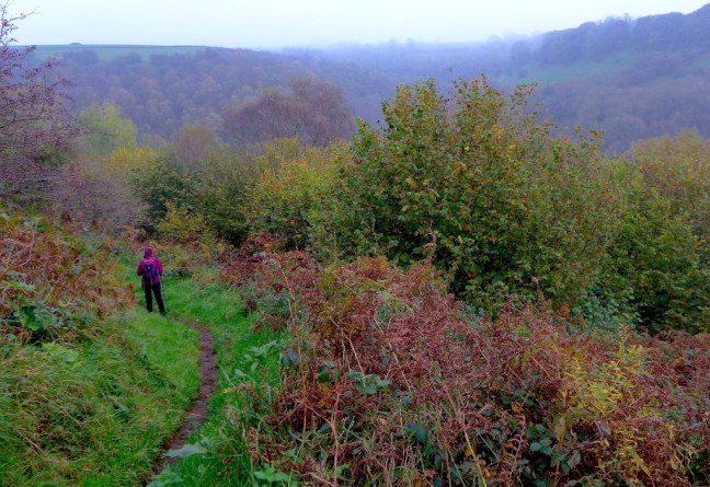
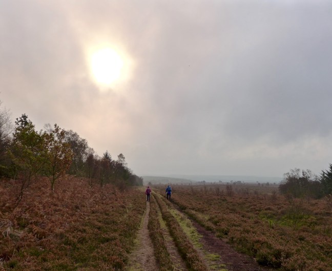
We started walking from Levisham at about 8.15am against a forecast of strong gales in Ireland and the west caused by the hurricane Ophelia. What would happen if the gales changed their course and came east? It was somewhat strange to walk towards the Hole of Horcum in completely calm weather.
The weather was a bit eerie in the bottom of the hole and quite humid and warm. Presumably it was the warm front of the low pressure on its way. By coincidence, back in 1997 in my book, On Foot from Coast to Coast: the North of England Way, I then described the hole as dramatic and atmospheric and that in autumn mist can make it grey and eerie. It was a deja vu moment.
The moor falls away 400 feet into a huge hollow. According to legend, the hollow was created by a giant who scooped up a handful of moor and threw it at his wife: he missed and the handful of moor formed Blakey Topping. However, the real reason for the formation of the hollow is that springs between the lower calcareous grit and the Oxford clay eroded away the hillside. The Oxford clay eroded more quickly and undermined the layers of rock which collapsed and enlarged the hollow to its present size. All the soil and clay from the valley has been washed down by the small stream.
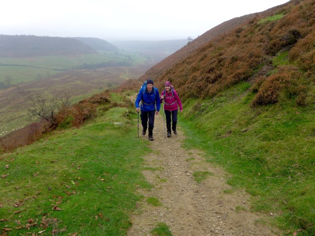
Climbing down into the hole and up out at the end saps the energy and so we had our banana and coffee break at the top.
We passed a strange stone just off the A169 with 1975 on it, but we do not know its history.
We then turned left along the Old Wife’s Way. As it is a bridleway I decided this would make a good cycling route in the spring but do behave as you could be on camera.
We shortly turned off the Old Wife’s Way towards the Bridestones.
Again there was some eerie light.
The Bridestones.
We decided to stop for lunch at the Pepperpot Bridestone but Sid the Yorkshire Man and Carol were a little nervous about my chosen location under the overhang and came up with stories about rocks collapsing on people. I explained that I had once had lunch there with my friend Penny many years ago and we had survived. She had even brought me a piece of fruit cake and and no doubt they had done the same? No!
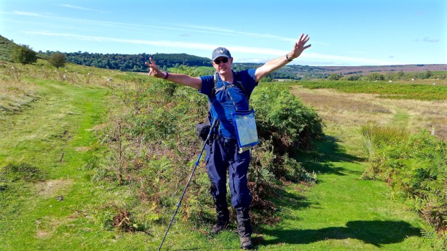
To prove my point I posed to show my immense strength, should it collapse. Nothing like tempting fate! Oooh I didn’t notice that big crack!
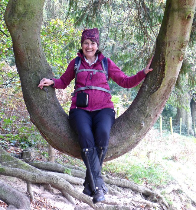
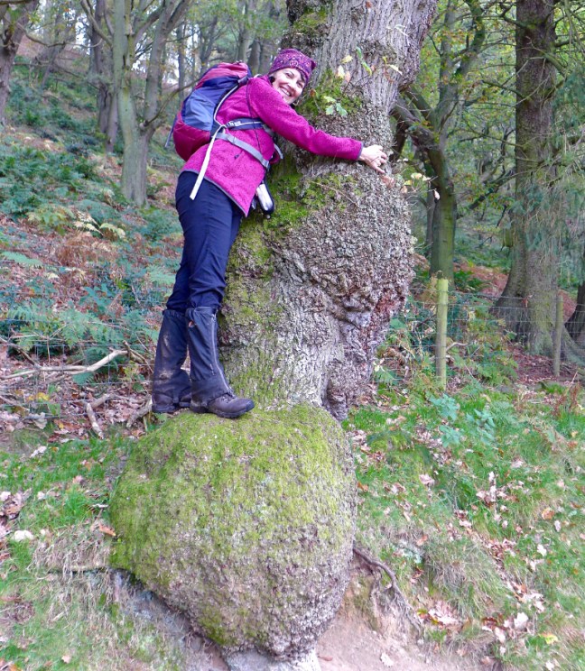
After a delightful lunch with some sun, we descended to Stain Dale where Carol had quite a few tree moments.
It was a delightful walk along the valley bottom and again humid and warm, with no wind.
Carol had another tree moment when we climbed out of the valley, just after Staindale Lodge. Fortunately, the tree hadn’t fallen on her head.
After passing the Fox and Rabbit pub and steeply dropping down Cross Dale, we followed the Sleights Track and then the very steep road back to the car at Levisham and the Horseshoe Inn.
Bizarrely, for the middle of October, people were having lunch outside the pub in warmth and calm, whilst in Ireland, Cornwall and the West people were being killed or seriously affected and property damaged by the gales.
What a strange world we lived in.
Miles Walked 12.7
Steps 26,600
Calories Burnt 1,500
Average pace 19.16 Minutes per Mile
Maximum Pace 14.42 Minutes per Mile
Elevation Gain 1,530 Feet (now I know why I was so tired at the end)
Post 203: An Undercover Operation and Walk to find the MK2 Spitfire.
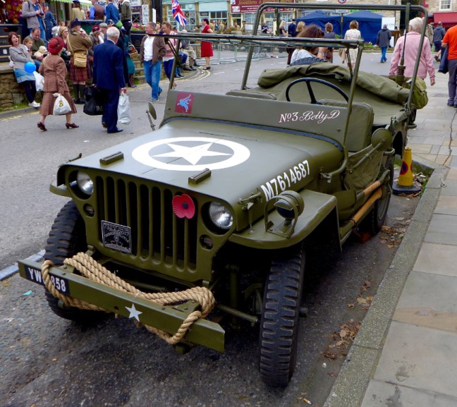
I had been tasked with trying to find a Mk2 Spitfire, which the resistance on the North York Moors had reported may have landed in the area of the North York Moors Railway.
Leaving York just after dawn with Sid the Yorkshireman and Carol the plan was that they would parachute me into Pickering Station from their Kia Sportage (they have a high frame) before anyone was properly awake. They would then go and do a walk around Lastingham as a decoy and then pick me up at the end of the day after the operation. It was felt that a sole agent would stand a better chance of getting through enemy lines, particularly around the occupied French village of Le Visham.
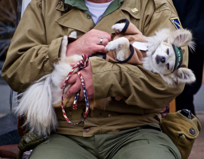
Waiting for the train there were one or two distractions. This is a common tactic used by the enemy and wouldn’t work on me.
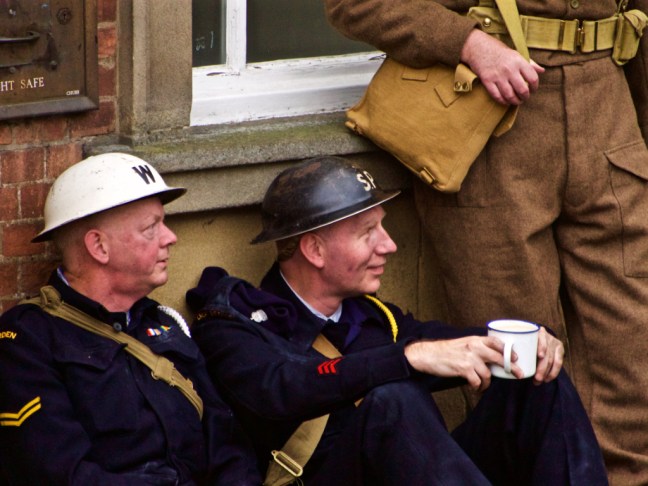
There were also an increasing number of soldiers appearing.
I had no trouble getting my ticket for the train and no identity papers were asked for, but I did have trouble catching the first train missing it by 2 seconds. As I bought the ticket the whistle to leave went. All top agents, even James Bond have mishaps and so, although a set back, it wasn’t a disaster.
It gave me chance to check out some of the vehicles in the area. There were many.
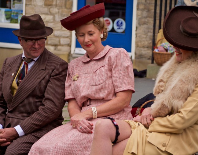
It was definitely the 1940s.
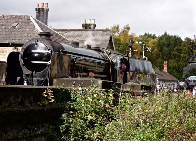
Eventually my steam train left, although soldiers were everywhere. It was so full I couldn’t get a seat so stood up looking out of the window.
There were special sniffer dogs that even sniffed out of the window of the train!
However, I had showered in the morning and so wasn’t caught by them.
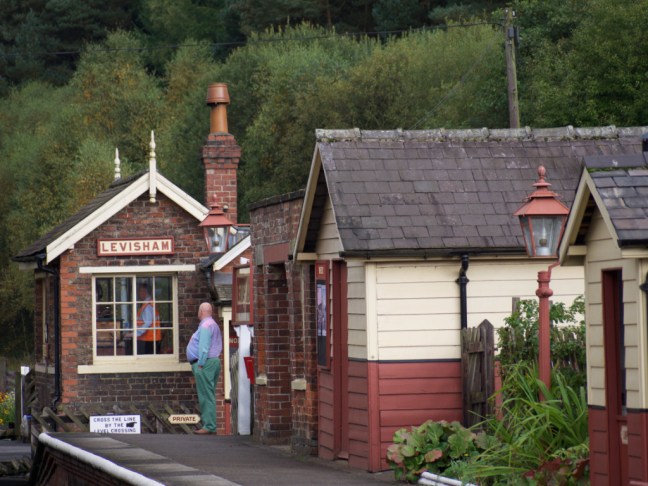
I successfully passed through the enemy occupied territory of Le Visham,
without being stopped, although some passengers had to produce identity papers.
It was getting a bit hot (summer in October), so I decided to get off the train at Goathland and walk the few miles through the North York Moors to Grosmont where the Spitfire was last reported. This would decrease the chance of being identified as an agent.
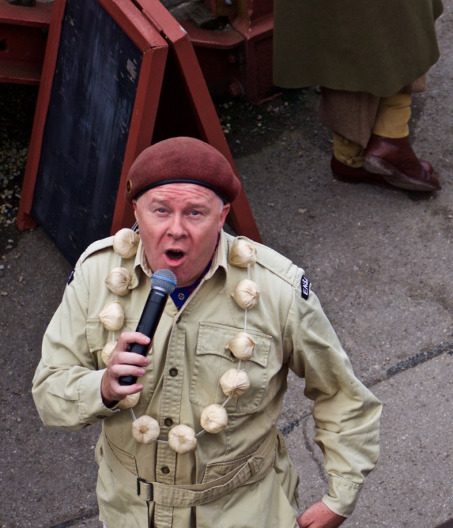
However, I felt the entertainer may have been a spy as he had his eyes on me.
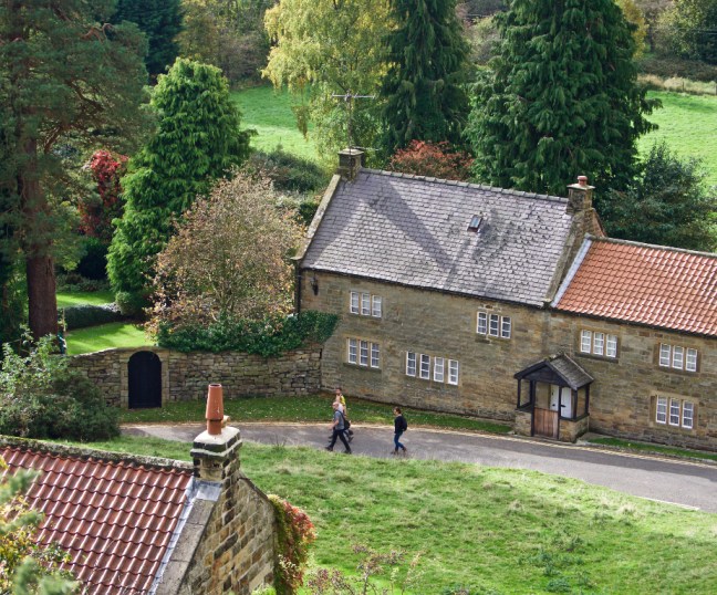
Goathland seemed to be friendly territory. There were even one or two Russians about who were now on our side and the lady with the mangle would put fear into anybody.
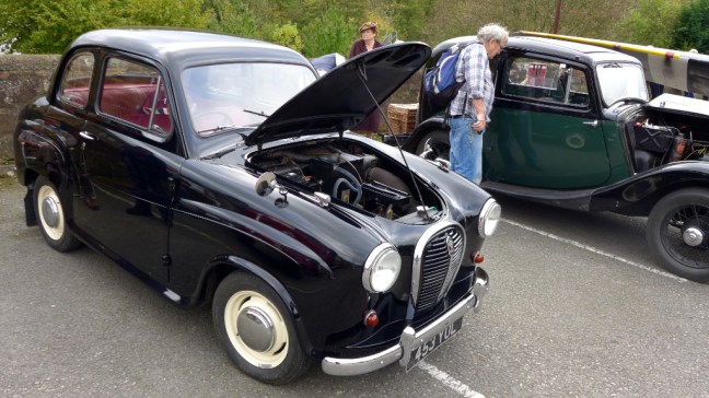
I began to relax when I found the Home Guard were around. We all know how Dad’s Army would win any battle for us. Also a car the same as the only car my Grandad ever had was in the garage – it must be friendly territory!
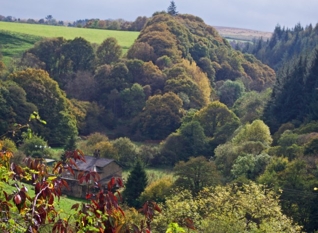
I followed the old railway incline to Beck Hole and took a path up to the current railway line to have lunch, in what is normally a secluded and quiet spot. However, for some reason a few walkers and a Ranger looking for Thomason Waterfall came along. The Ranger in particular wanted me to encourage people to go to the Whitby Museum as it is struggling financially. So do go or it will close!
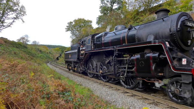
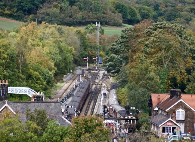
I watched some trains pass.
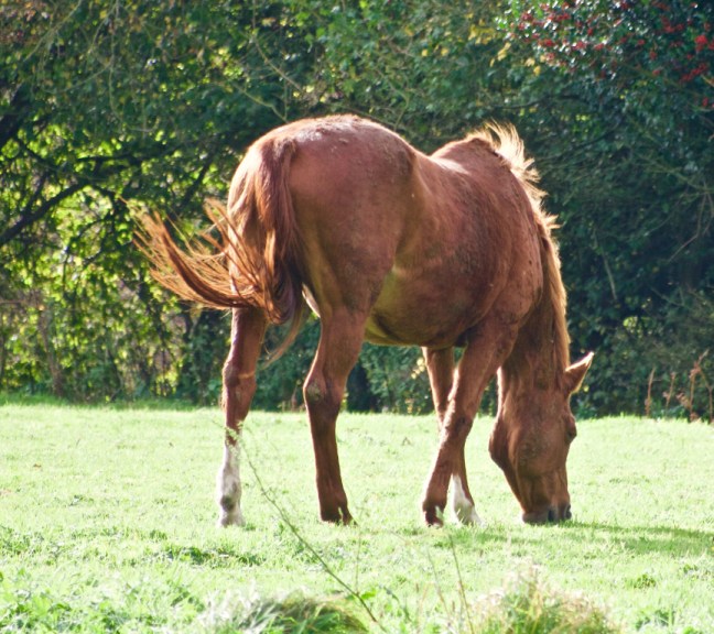
The scenery hereabouts was stunning and there were plenty of trees I could hide in should I be detected. There was even a horse for quick getaway. Not that I have ever ridden one.
After passing the goods yard, with trains awaiting renovation, I descended to Grosmont after helping some ladies out who were lost.
The were many, many people about, but there were rumours that a Spitfire was in the car park. I wandered over and sure enough one was there in excellent condition. Mission accomplished. Had my mobile had reception, I could have phoned Sid the Yorkshireman and my task would have been completed.
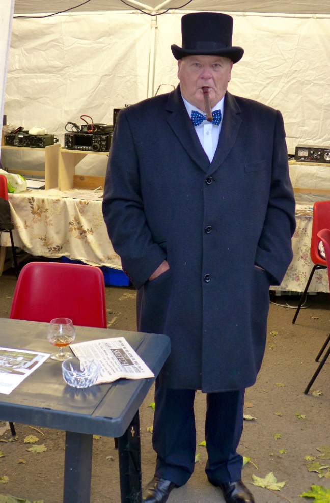
No doubt I would then be given an award for bravery by Winston Churchill
The only alternative now was to return to the pre-arranged pick up point of Pickering where they would make contact when they had finished their walk – the emergency rendezvous.
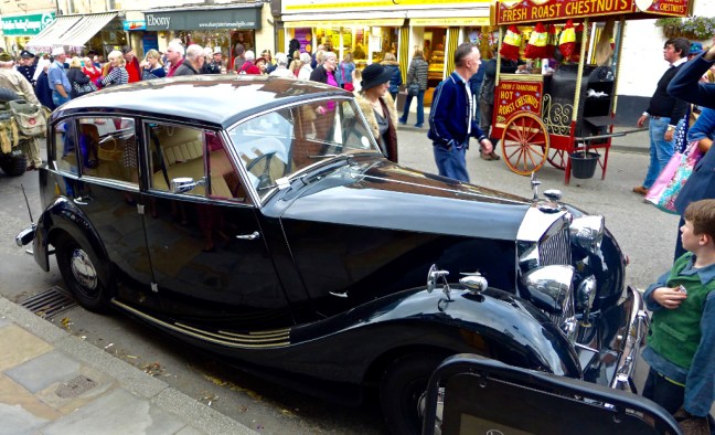
Before leaving I couldn’t help but admire another car like the only car my Grandad ever had – we called it a Stuffy Duffy.
I managed to get a seat on the train, which was absolutely packed.
Pickering was also packed and there were so many distractions with music and dancing (see videos posted separately!) that I didn’t hear Carol phone to say they were near Pickering. By the time I picked up a message from them they were in Malton.
Even one of the sniffer dogs found it all too much.
Folks were waiting for the night safe to be blown.
Or just relaxed.
Or acted suspiciously.
Carol had already told me what a delicious meal they had eaten in Lastingham, but it was rations for me now. A pasty and a cake.
I came across a car that I think was the bigger version of my Dad’s car when I was a child. His was a Triumph Mayflower. Like my Dad’s car, the gear change was on the steering wheel.
There were still military vehicles about, so I was still not safe.
How to get home? There was only one way – the Coastliner.
I got a seat but was then tortured, presumably by the enemy, to try and get some information as to what I had been up to. A lady on the bus talked with a high shrill voice non stop for nearly two hours!
Only when I got to York and caught my second bus with 2 minutes to spare did I escape the torture.
I now know what it must be like for soldiers who arrive home after, torture, danger, rationing and distractions to find there is no welcome home and the wife is not due back until the next day. It’s tough being an agent.
Post 202: 10 October 2017, THE COT COMBO WALK continued, Snape to Levisham.
We arrived at Snape village hall and parked up at about 9.00am. We were following my North of England Way to Lockton and then would largely follow the Tabular Hills Walk back to Snape.
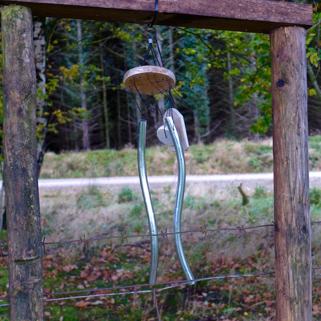
We soon passed a wind chime bell and wondered what it was doing in such a remote place.
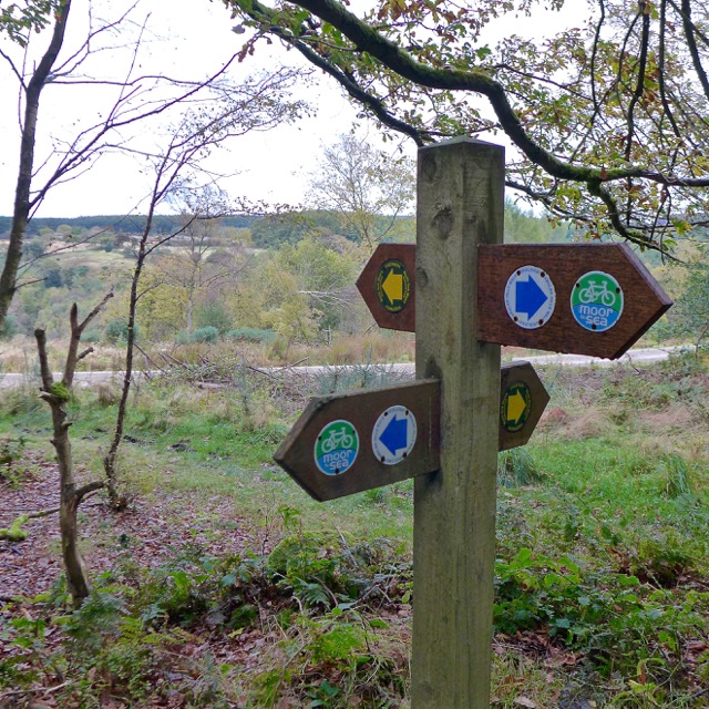
It was soon clear that there had been a lot of rain in the past few days and it was very wet underfoot, making it quite slippy and muddy. However, we had our ‘winter treads’ on. The path to and past Middle Farm was meant to be on the Moor to Sea cycle route but you would need to be a pretty good and fit mountain biker to follow it! It was hard enough walking over it.
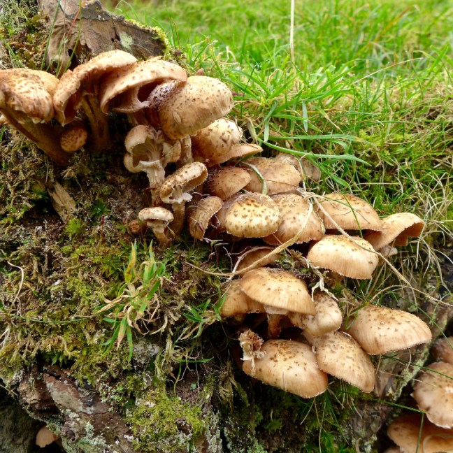
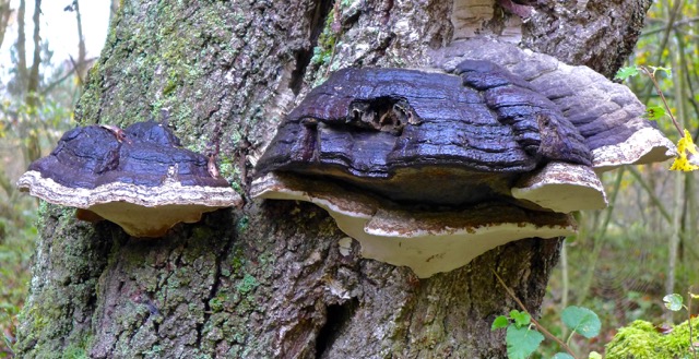
We came across tinder fungi. They were some of the largest I had ever seen.
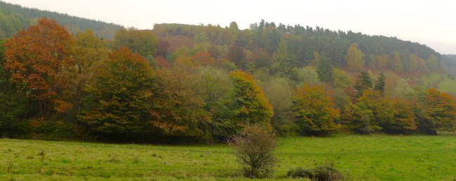
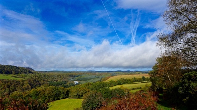
We crossed over the stream of Raygate Slack and eventually emerged above Newtondale. The Newtondale Gorge was was created by a glacier draining fromthe Esk Valley some 10,000 years ago.
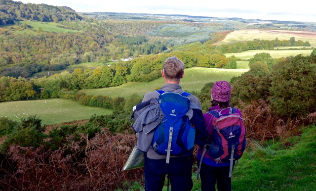
There were fine views all around.
We descended to Levisham Railway Station and stopped for a rest, banana and coffee break, whilst videoing a steam train coming into the station. On the 13/14/15 October this will become Le Visham a French station for the North York Moors War Weekend, when many people dress up in 1939-40s outfits and drive vehicles of the period. Celia is away with the car, so I have 2/3 buses to catch and then a steam train in order to attend, so it will be a bit like the 1940s for me.
A steep ascent followed and a close encounter with a herd of Highland Cattle, which were coming in the opposite direction on the lane and then our right of way path. Can’t they read? However, being friendly Yorkshire and, despite their big horns, they were quite friendly.
There was a mountain rescue sign and we did wonder about calling them!
As we ascended the narrow grassy path, avoiding the cattle wherever possible, there were fine views back. Note the comment in one of the videos by Sid the Yorkshireman that he didn’t fancy driving the bull past Carol and myself. I was left to film the big bull with huge horns and calves, whilst it tried to stare me out (see videos on Facebook Page comments). I may yet get a bravery award from the Queen for dedication to walk filming.
The steam from a train can just be seen amongst the green and brown tree mosaic.
We continued to Levisham Village, which is over a mile from the station and passed the Horseshoe Inn, which does good food!
And popped into the church
There was then a very steep descent and ascent to Lockton, past the Mill
There were fine views in the direction of the Hole of Horcum as we ascended the steep lane
We found an ornate bench opposite an information board and had lunch.
A fox, the youth hostel and the church were then passed to where we again descended a steep and muddy hill.
As we crossed Levisham Beck and ascended the hill on the other side of the valley, we came across Byrony and Rory Hancock from Guilford, who were on holiday. Their walk guide was a bit confusing and had led them to descend the valley too early, whereas to get to the Hole of Horcum, where they were walking to, they needed to stay high for another mile or so. It so happened that we had finished my North of England Way section and so I was able to give them my book with very detailed guidance so they could complete their walk. By an even stranger coincidence the Hole of Horcum is featured on the front of the book! What a small world. Hope they enjoyed the rest of their walk.
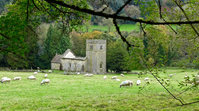
Our route took us in the opposite direction to pick up the Tabular Hills route and go past the old and redundant church.
Again this was muddy, slippy and tiring but beautiful.
Arriving at Farwath we crossed the railway line and did some more train filming – 2 for the price of one – a steam and a diesel train (see Facebook Page Comments for videos)
After another steep ascent we passed some a Free range area for children.
]]
Just before Newton-upon-Rawcliffe we came across a memorial bench carved presumably by the descendants of Robert Thompson. He was the famous mouseman of Kilburn (born 7 May 1876- died 8 December 1955) and carved a featured mouse on almost all the furniture he made. It is claimed that the mouse motif came about accidentally in 1919 following a conversation about “being as poor as a mouse”, which took place between Thompson and one of his colleagues during making of the cornice for a screen.
From the bench we watched and filmed two more trains!
After that there was some fairly routine track and lane walking back to the car.
Miles Walked 12.70
Steps 27,100
Calories Burnt 1500
Average Pace 19.54 (quite slow due to the conditions!)
I started training for the walk at the Opening Ceremony of the Dome on Millennium Eve as I dodged the trays decked with champagne glasses that came at me from all directions. However, I had limited success and by the end of the evening my legs were like jelly – was it the numerous glasses of champagne or was I totally unfit? Clearly there was a lot to do if I was to walk 200 miles at Easter.
At the Dome 31 December 1999-1 January 2000. I was flying!
My first setback occurred when my personal trainer (a 14 year old dog) decided he no longer wanted to go for a 3-mile walk in the morning. In the end I decided to go out on my own first at 6.30am with a 30lb pack (the maximum weight I would have to carry) and take the dog for a shorter walk later on. Then walking companions decided to start moving house or on occasions claiming injury (any excuse to avoid getting up at 7.00am on a Sunday morning – no medical notes were produced). In order to catch up on training it was necessary to take drastic action including purchasing an exercise bike and joining my local gym, B-Fit. I soon found out that there were muscles I had never used since childhood, triceps, biceps, quadriceps, abdominals to name a few. However, Christmas and Millennium celebration excesses were soon purged and progress was evident when, walking with the pack, I surprised a jogger by passing her!
As part of the training at weekends I had been walking sections of the Centenary Way, an 82 mile walk from York to Filey, and was delighted to finish it in February – my tenth long distance walk completed in 10 years. It can be a bit addictive! Other highlights of training included two glorious sunny March circuits of the head of Farndale on the North York Moors, close encounters with deer on the Yorkshire Wolds, listening to a skylark most mornings and at dawn seeing a meteor burning up in the sky over my local village Dunnington (no I hadn’t touched the Guinness).
Potential disaster – two weeks before the start of my C. to C. suspected ‘march fractures’ developed, an inflammation of the bones in the foot, so called because new soldiers often develop it when marching. I also developed ‘sore big toe joint’, what doctors describe as a traumatic arthritis. A Swedish speed skater and walker once said to me that you learn about your body through walking – mine was starting to protest. The balance between sufficient training and overtraining is fine one – I had overstepped the mark on road walking. A Canadian walking friend saw the funny side, ‘Of course you have march fractures; it is after all March. Wait until April Fools’.
April arrived and my feet were still sore. However, forever an optimist, I began to load my rucksack – even including a pair of shorts. The next day was the coldest April day on record and the Pennines, which I would cross, were covered in snow. Winters last fling? Two days to go and I still had a severe pain in the foot. The only possible solution was to wear my stiff walking boots in the house all weekend to stop the bending of the big toe – Celia (my wife) said, ‘you can’t do that as you are always telling Alastair (our son) to take his trainers off in the house’. She was correct but this was an emergency – and it worked!
11-14 April 2000: Lake District Section – Days 1 to 4 Ravenglass to Burneside 46 miles.
As Alf and myself set off (he joined me for the first 100 miles) I was well prepared as at Christmas I had been given the latest walking gadget, a trekking pole (thanks to mom and dad), which hopefully would prevent a recurrence of 1993 when, after slipping in torrential rain, I became the first person to aquaplane on my stomach along a section of The North of England Way/Pennine Way leading into Hawes. Note – walking companion Gary only walked the Pennine Way, much easier. Alternatively, should I succumb to the Guinness, the pole would come in useful to steady me on the return journeys from the pub.
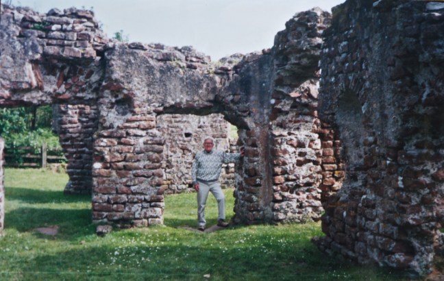
I dipped a toe in the Irish Sea carefully watching my boots in case they disintegrated in front of my eyes due to the Sellafield nuclear waste discharged a few miles along the coast. Muncaster Castle and Fell (described by Ruskin as the entrance to Paradise) were soon reached to give dramatic panoramic views of the snow covered Scafell mountain range (England’s highest). The first day took us into a different world – to a Roman bath house,
The Bath House and an 84 year old walker from Ireland who completed my coast to coast in 2002, solo! . Incredible – your never too old.
a 13th century corn-mill, a 15-inch narrow gauge steam railway, and a narrow gorge and waterfall. In the evening it soon became evident that there was a lot of time on our hands – it took some adjustment to get used to this slower pace of life. It is a good idea to take a small book as there is plenty of time to relax in the evenings.
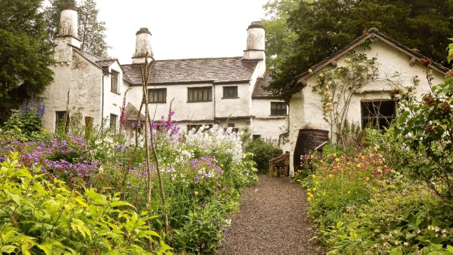
The second day involved two steep climbs and near the top of the second, on the Walna Scar Road rising from near sea level to 2,000′ towards Coniston, I said to myself ‘never again’ (I have since changed my mind). The afternoon of the third day was wet but we soon dried out at Townend – a National Trust yeamon farmer’s house with original furnishings, wood carvings etc.
Arriving at Burneside on the fourth day I was relieved to hear that the fourth best tattooist in the country had moved to Ambleside (see my 1993 walk!).
15-19 April 2000: Yorkshire Dales Section – Days 5 to 9 Burneside to Ellingstring – 69 miles
The Dales Way was followed in reverse for much of this section, with delightful riverside walking. Soon after leaving Burneside we saw deer. The description of me in an article in the Yorkshire Evening Press as ‘Mountain Man’ (my new trail name) had gone before me as an old lady in Sedbergh asked if my trekking pole was an ice-axe. Another stranger we met there said he had supper with a women from Stillington, near York, and stayed with her for 11 months – Alf replied that it must have been a good supper. A third stranger we met was a young German vet who was moving from Wick in Scotland to Hampshire – what a change. We directed her to Hampshire via Dentdale in order that she could see some of the best of the Dales countryside! At the Sun Inn, Dent, by chance Alf met some school friends he had not seen for many years – a small world. At Cowgill Chapel we were kindly invited for tea and biscuits and soon after a lady from the Quaker House ran out with a donation to Hospice 2000. Near our bed and breakfast at Scow Cottage we saw a ring ouzel, which rarely nests below 1,000 feet. In the morning I awoke to the sound of a woodpecker tapping away on a nearby tree. On leaving we thought we saw an otter but it was so quick we couldn’t be sure.
My Rohan white sun hat with ventilation holes (to reduce perspiration) seemed to be an attraction for birds and on leaving Askrigg a bird dropping landed on my head to Alf’s great amusement. Rohan will have to redesign the hat to make it bird proof. Despite carrying a huge bird book Alf still couldn’t identify the responsible bird. At Aysgarth Falls, Alf departed to return to work.
In the evening I met a couple who had just completed the Herriot Way for the third year in succession – the walks obviously went well as they were getting married in July.
Next morning Aysgarth Falls were magnificent after heavy overnight rain.
With Alf’s departure the weather improved greatly and at last I was able to wear shorts.
As I reached the 100 mile point curlews danced in delight as though in celebration – halfway to Scarborough! However, paths were streams and streams had turned to rivers and some wading near Redmire resulted in wet feet. After leaving the delightful church at Wensley (where the television wedding of James Herriot took place) I followed the swollen River Ure, majestically winding its way like a huge snake along Wensleydale. At Cover Bridge I couldn’t resist a Guinness in the 15th-century inn, followed a few miles later by 3 huge scoops of the Brymor ice cream (3 of the over 40 varieties made from the milk and cream of Guernsey cows) from High Jervaulx Farm.
20-24 April 2000: April North York Moors Section – Days 10 to 14 Ellingstring to Scarborough – 85 miles
In Ellingstring I was woken by a cockerel at the crack of dawn and got up at 7.00am to have an early start on the longest days walking – 21 miles across the Vale of York. Near Masham there were rabbits everywhere and near Thornborough I saw a stoat running along the lane ahead of me. Despite trainers to ease the road walking, on reaching Thirsk my feet were on fire; however, the site of the North York Moors lifted my spirits.
The next day involved a steep climb to Sutton Bank and there was water, mud and more mud everywhere. I had never seen the Moors so muddy in fourteen years. Despite it being one of the wettest Aprils on record, I only experienced 1½ days of rain on the whole walk.
At Helmsley my wife and son Alastair visited for the evening. Alastair was invited to join me for the last three days. He declined the invitation.
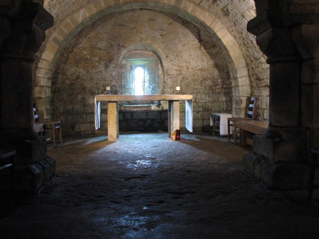
On arriving at Lastingham there was an unexpected surprise as Alastair had changed his mind and decided to join me for the last two days of walking (30 miles). He was wearing some of my worn out oversize old boots that he had found in the garage at home. At our overnight accommodation, the Blacksmith’s Arms, I looked out of the bathroom window in our room and noticed the cross on the roof of the nearby church. I suggested that in the morning Alastair visit the 1,000-year underground crypt in the church. In the middle of the night he had the most awful nightmare (the prospect of walking?). After breakfast Alastair went to the crypt whilst I packed the rucksacks. The crypt is a timeless. He came back to the pub and we began our journey together.
For a 19-year student, ‘hiking’ is not the trendiest thing to do but with good weather and plenty of fresh air Alastair’s enjoyed talking to some young walkers from London and Sheffield who were on the ‘Cleveland Way Missing Link’ long distance walk – one of them was a film producer and had been involved in producing videos for Oasis and Britney Spears.
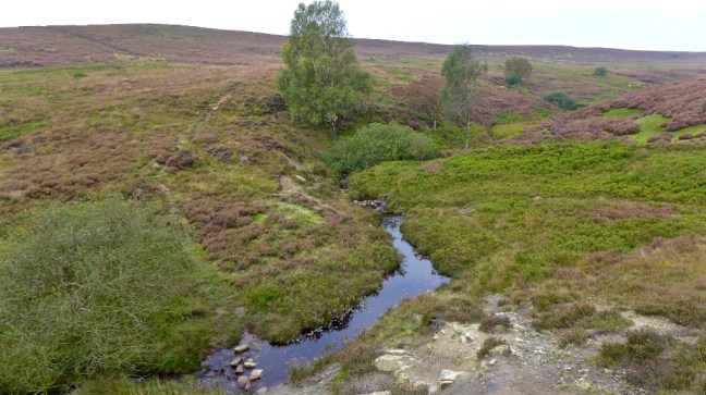
My route out of Lastingham was now well marked and cairned whereas some seven years previously there was no distinct path through the heather and even in bright sunshine compass bearings were necessary. At Levisham Station we took ‘time out’ to take a steam train to Grosmont and back but, being a bank holiday, it was so busy we couldn’t get a seat on the outward journey!
At last Scarborough North Bay came into view, 200 miles were completed, and my feet, ½ size larger than at the start of the walk, were dipped in the North Sea.
Did I enjoy the walk? In the words of Diana of Prague, the first recorded female to complete the North of England Way in 1993, ‘it was marvellous’. Was the walk better than the Opening Ceremony of the Dome? Well the Dome was one amazing night, but the North of England Way for Hospice 2000 was an amazing and memorable two weeks.
Dreams
A person without dreams is a person without a soul. In life it is important to have something to inspire – dreams inspire. Men and women only got to the top of Everest because they dreamt about getting there. So if you have an idea or dream have faith in it and yourself and, despite setback after setback, keep pursuing it and it may eventually be realised. There will be many unforeseen benefits from your pursuit, even if the dream is not realised.
I had a dream to devise a long-distance walk and despite many hurdles it came to fruition and was published. It required much energy and effort but led me to many beautiful and memorable places and resulted in many new friendships. The best things in life do not come easy. It also led to some unexpected outcomes. I have seen many places, met many people, have acquired many memories and not regretted one step of the journey in my life.
I did a a few appearances on local radio when my book was published in 1997. Radio Merseyside nearly floored me as they wanted me to describe my route backwards heading west rather than east.
The other stations were Jersey, Stoke, York, Cumbria. There were also some newspaper interviews by phone and the book was widely circulated in outdoor related publications. I then gave a talk for the Youth Hostels’ Association on Planning a Long-distance Walk at the first ever Outdoors Show at the NEC in 2002. The Show has been huge success since, but I think recently moved to London (like most things).
Top talkers were Alan Hinkes, Chris Bonnington, David Bellamy, Doug Scott, Ray Mears, Simon Yates. I think I was there to make up the numbers!
My biggest surprise was walking into York one day just after my book was published and there was a display in its own window of my book with boots and other walking gear!
In 2007 I took early retirement from work and continued with weekly day walks. I set myself a target of completing 50 long-distance walks by the time I reached 85. That is in 30 years.
Since then, at the age of 65, I have increased my total of long-distance walks completed to 52 and so have passed my target early.
It was towards the end of 2011 that I was diagnosed with early arthritis in my hip. It became apparent just before walking parts of the Peddar’s Way and Norfolk coast path when I started to get some pain in my hip. The walk was a way of celebrating a friend’s 60th birthday. However, after taking painkillers and anti – inflammatories for 3 days, I walked 11 miles on day 1, 19 miles on day 2, 23 miles on day 3 and 19 miles on day 4. The hip pain went, but I did get bad blisters!
It was not long before the pain returned and, after X-rays, I was diagnosed with early arthritis. Now it could be that my arthritis was caused by too much walking, but then that doesn’t explain how I also have arthritis in my hands. Also 1 in 4 people over 60 get arthritis. A lot of advice for arthritis is that you have to keep the joints mobile through walking, swimming and stretching exercises. In other words I need to try and carry on as before!
So at 65 the journey continues, perhaps a little slower, but the enthusiasm and love of the countryside doesn’t fade. It all started by just putting one foot in front of the other………………………………
However, after the Millennium I had what can only be called a Forrest Gump moment – I suddenly stopped.
No not walking, but writing diaries.
I resumed writing them in 2015, which is why your reading this now. May the walking and, according to one or two notable readers, the diaries long continue.
As Wainwright said:
The Fleeting hour of life of those who love the hills is quickly spent, but the hills are eternal. Always there will be the lonely ridge, the dancing beck, the silent forest: always there will be the exhilaration of the summits. These are for seeking, and those who seek and find while there is still time will be blessed in mind and body.
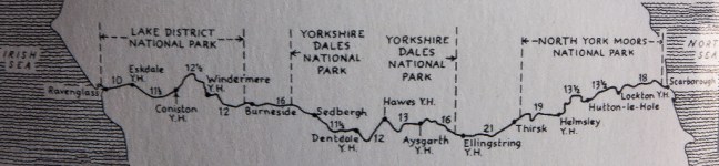
On Foot from Coast to Coast: the North of England Way – a walk for the Millennium and for others.
To celebrate the Millennium I planned to walk from Ravenglass on the Irish Sea to Scarborough on the North Sea, following the route again as outlined in my book On Foot from Coast to Coast: The North of England Way.
The theme of the walk was:
‘In the year 2000, walk 200 miles, view 20 churches, see 20 mountains, follow 20 rivers, visit 20 inns, drink 20 pints of Guinness (purely medicinal), burn 20,000 calories, and raise over £2000 for Hospice 2000.’
People could sponsor me for any of the above e.g. miles walked, churches viewed, pints drunk.
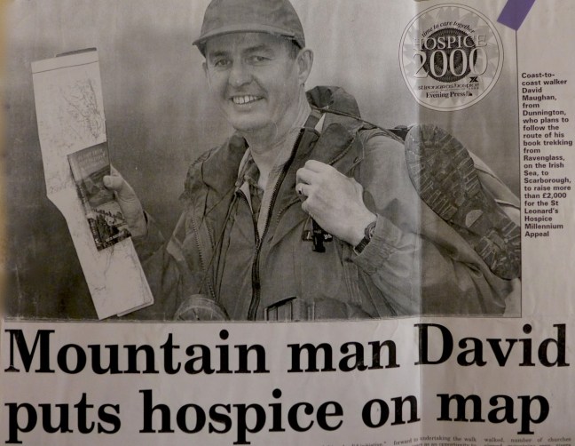
I had been looking forward to undertaking the walk for two years as an opportunity to celebrate the best of the English countryside in the new Millennium, whilst raising funds for a good cause, my local St Leonard’s Hospice.
Phil Lader, the US Ambassador to Britain and a keen walker said, ‘Not only is it a fitting means to celebrate the Millennium but it will provide support to a very worthwhile cause.’ The Ambassador had just completed a walk (with bodyguards!) from Land’s End to John O’Groats and said ‘Walking through the countryside has taught me far more than I ever dreamed about the people, history and culture of this wonderful island.’ The Archbishop of York said ‘And what support could be more active than the 200 mile Coast to Coast Walk across the north of England. I am especially pleased to commend this splendid initiative.’
I would not be walking with bodyguards, but I was thoroughly looking forward to a new journey in a new Millennium, although clearly I was not getting any younger. In the conclusion to my book on the walk I said that after completing the 200 miles in 1993 I felt twenty-one again despite being twice that age. It would be interesting to see if I felt the same again seven years on!
My summary of the walk was as follows:
I viewed over 20 churches: (1) St Michael’s Muncaster, (2) St Catherine’s Boot, (3) Holy Trinity Seathwaite, (4) St Andrew’s Coniston, (5) St Mary’s Ambleside, (6) St Mary’s Staveley, (7) St Oswald’s Burneside, (8) St Andrew’s Sedbergh, (9) St Andrew’s Dent, (10) St John the Evangelist Cowgill Chapel, (11) St Margaret’s Hawes, (12) St Oswald’s Askrigg, (13) Aysgarth Methodist Church, (14) St Andrew’s Aysgarth Falls, (15) St Oswald’s Castle Bolton, (16) St Mary’s Redmire, (17) Holy Trinity Wensley, (18) St Mary’s and St Alkeda’s Middleham, (20) Jervaulx Abbey, (21) High Ellington Chapel, (22) St Mary’s Masham, (23) St Michael Well, (24) St John Skipton-on-Swale, (25) St Laurance’s Carlton Miniott, (26) St Mary’s Thirsk, (27) St Felix with Holy Trinity Felixkirk, (28) York Minster (over 30 miles away from the White Horse of Kilburn viewpoint), (29) St Michael’s Cold Kirby, (30) Rievaulx Abbey, (31) All Saints Helmsley, (32) St Mary’s Lastingham, (33) St John the Baptist Levisham, (34) Lockton Church, (35) St Peter’s Langdale End, (36) St Peter’s Hackness, (37) St Laurance’s Scalby. Total 37.
I saw over 20 mountains: (1) Seatoller 2266′, (2) Scafell 3162′, (3) Scafell Pike 3210′, (4) Broad Crag 3054′, (5) Ill Crag 3040′, (6) Great End 2964′, (7) Esk Pike 2903′, (8) Bowfell 2960’, (9) Harter Fell 2340′, (10) Grey Friar 2537′, (11) Brown Pike 2289′, (12) Dow Crag 2556′, (13) Walna Scar 2033′, (14) Old Man of Coniston 2683′, (15) Brim Fell 2611′, (16) Weatherlam 2592′, (17) Pike O’Stickle 2323′, (18) Harrison Stickle 2401′, (20) Pike O’Blisco, (21) Crinkle Crags 2233, (22) Heron Pike 2001′, (23) High Pike 2155′, (24) Red Screes 2541′, (25)Yoke 2309′, (26) Ill Bell 2477′, (27) Froswick 2359′, (28) Great Coum 2254′, (29) Great Knoutberry 2204′, (30) Whernside 2419′, (31) Ingleborough 2373′, (32) Pen-y-ghent 2273′, (33) Wild Boar Fell 2324′, (34) Great Shunner Fell 2349′, (35) Cragdale Moor 2080′, (36) Buckden Pike 2303′, (37) Dodd Fell 2191′, (38) Sails 2185′, (39) Drumaldace 2015′, (40) Lovely Seat 2214′. Total 40.
I visited over 20 inns (cumulative pints of Guinness drank in brackets. M = Murphy’s B = Beamish.): 1 Holly House Hotel (½B), 2 Ratty Arms (1½) Ravenglass, 3 King George IV Eskdale (2½), 4 Woolpack Inn Eskdale (4), 5 Newfield Inn Seathwaite (5), 6 Sun Hotel Coniston (7B), 7 Eagle and Child Staveley (8), 8 Jolly Angler’s Burneside (9½), 9 Dalesman Sedbergh (11½), 10 Sun Inn Dent (12½), 11 The Board Hotel (13), 12 The Crown (13½), 13 The White Hart (14), 14 The Fountain Hawes (14½), 15 King’s Arms Askrigg (15), 16 Palmer Flatt Hotal Aysgarth Falls (18), 17 Cover Bridge Inn (19), 18 Black Horse Inn Ainderby Quernow (20), 19 Golden FleeceThirsk (21), 20 Royal Oak Helmsley (22), 21 Blacksmith’s Arms Lastingham (24), 22 Horseshoe Inn Levisham (25), 23 Moorcock Inn Langdale End (25½M). Total inns visited 23.
I drank over 20 pints of Guinness. See inns visited above (in brackets). Total pints of Guinness drank = 22½. Total pints of Beamish drank = 2½. Total pints of Murphy’s drank = ½. Total pints drank (purely medicinal for blisters and aching muscles!) 25½. As an occasional drinker of alcohol this was a tough target!
I burnt over 20,000 calories at an average of 100 per mile. I lost about 4lbs on the walk but consumed large quantities of food.
And with sponsorship I raised over £2300 for Hospice 2000
Miles Walked 200
A summary of the walk will be in the next blog………………….
If anyone is thinking they might like to walk the North of England Way to raise funds for their chosen charity, then I have copies available for £6 inclusive of p&p in the UK. RRP is £9.99. Please send an email to celiamaughan@btinternet.com.
Post 199: 28 September 2017 Lastingham to Cropton.
We started walking on the North of England Way from Lastingham at 8.45am after being in a procession on the A64 from York in quite heavy traffic – where does it all come from?!
We soon came across one of the various wells in the village.
Ascending out of the village towards the moors we passed the Grange Country House Hotel.
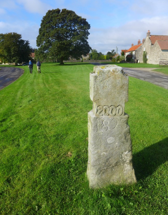
Just as the moors opened up the Millennium Cross appeared before us.
We walked to the right before getting onto open moorland.
Before descending and crossing Tranmire Beck.
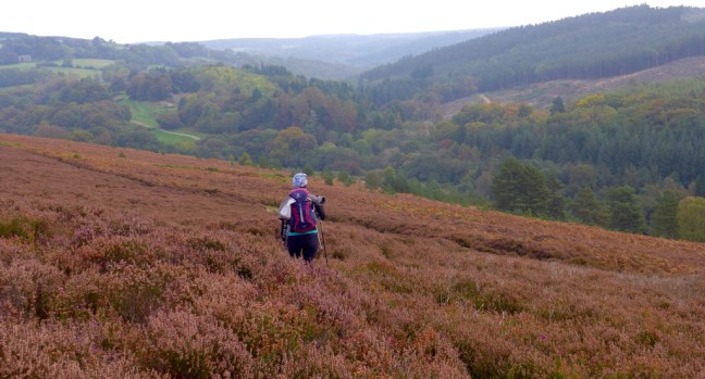
It was good to see that paths were much clearer and better signed than when I devised the route in the 1990s. Believe or not there is definite path through the heather.
We soon came to an area where glass making used to take place.
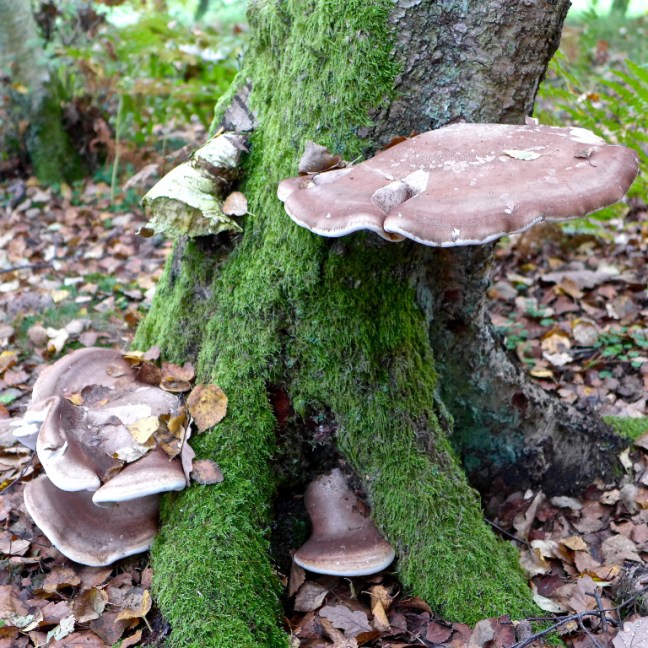
Passung through a wood towards the Blacksmiths at Hartoft, there were some fine fungi.
And an odd fawn sheep.
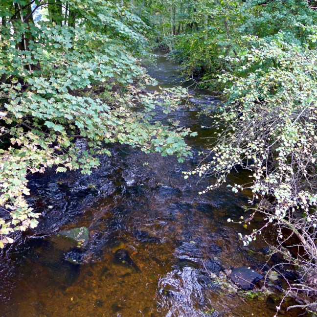
We crossed the River Seven over a bridge.
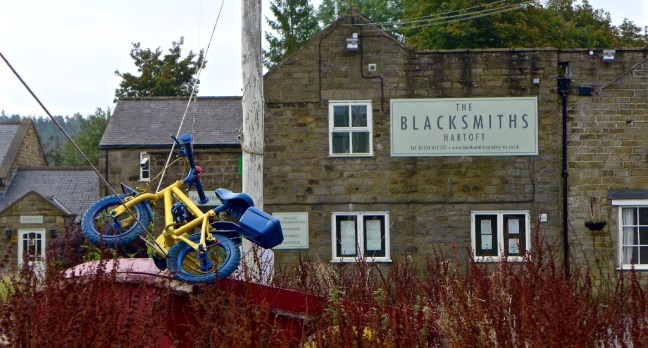
To reach the Blacksmiths now closed and available to let, where we had a banana and coffee break at 10.00am
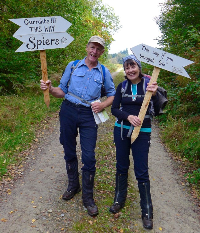
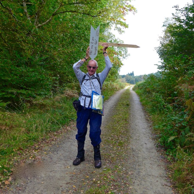
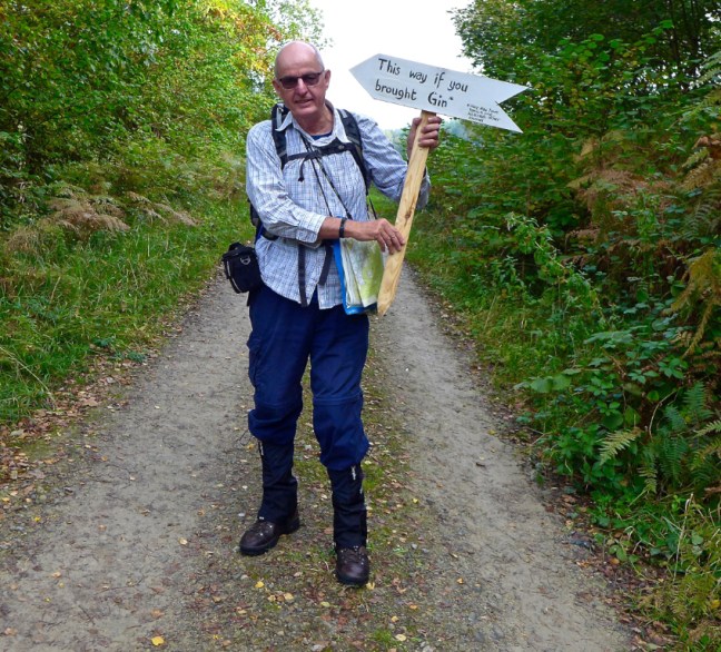
We crossed Hartoft Beck and took a left into the woods on a track. There was an information sign saying there was Track Rod event on today. There was no sign of cars, but plenty of signs to play with! Where was the gin?
Getting no gin we carried on,
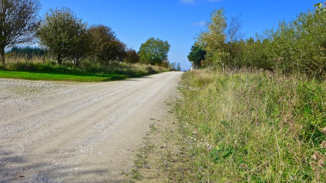
until we ascended a steep path on the right towards High Muffles Farm.
We then took a difficult, muddy, wet boat towards Stape passing the Ken Ather Outdoor Centre, which was for sale – is this a sign of the changing times? Are youngsters too glued to their computers, phones and other IT equipment to be bothered with the outdoors?
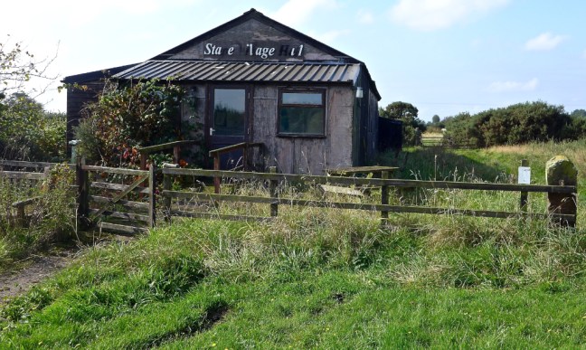
We stopped at what is left of the village hall for lunch. The villagers had recently decided not to replace it with a new village hall. Another sign of changing times?
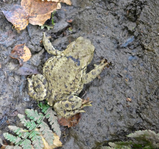
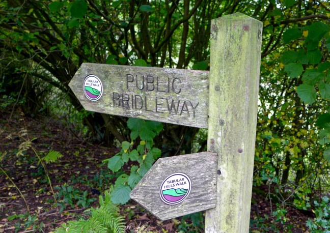
We left the North of England Way to join the Tabular Hills Walk and soon passed quite a large frog.
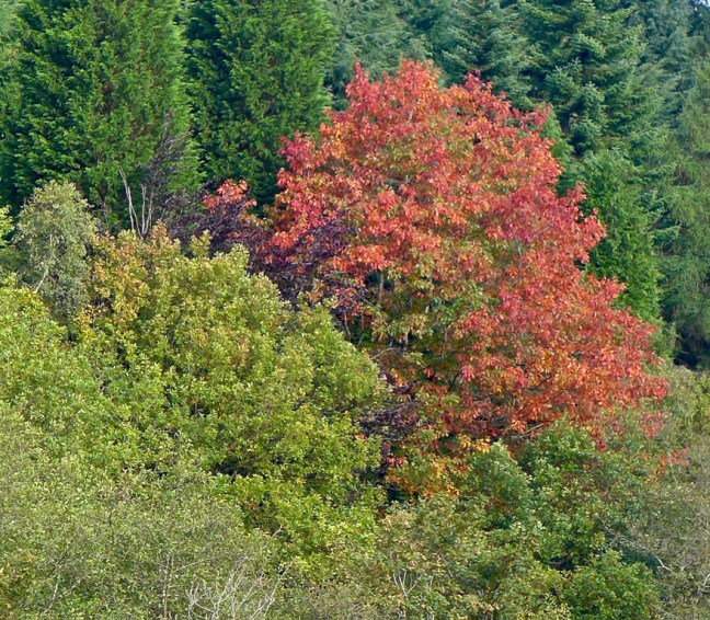
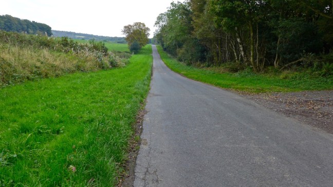
To eventually follow a fine woodland walk.
The pheasants are starting to look worried and confused as the shoots get busy soon.
The Sat Navs are also confused.
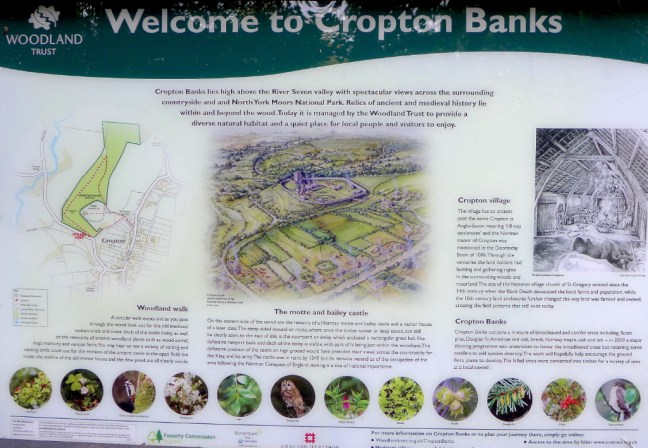
Afte a long tarmac walk we arrived at Cropton,
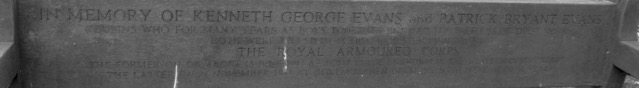
where there a number of well maintained benches in memory of the fallen.
St Gregory Church was passed.
In the churchyard are the base and shaft of a cross, which used to hold a cup of water for thirsty travellers giving rise to the rhyme:
On Cropton Cross there is a cup
and in that cup there is sup;
Take that cup and drink that sup,
and set that cup on Cropton Cross top.
It was strange that near here Carol was getting tired until I suggested she needed more water.
Behind the church is the site of a 12th century Norman castle which would have commanded views to the south to Pickering and north to Rosedale.
The walk is well signed.
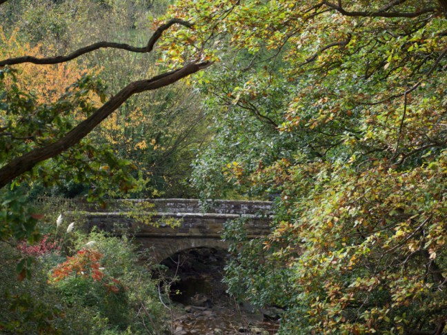
At Appleton Mill Farm we crossed the River Seven on a fine bridge designed for horses.
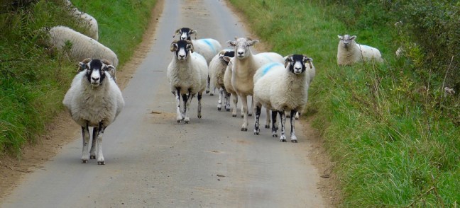
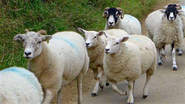
We then had a ‘High Noon’ moment with the locals.
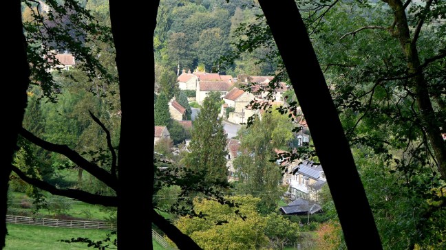
We then followed the old road and path down to Lastingham, with fine ‘tree framed’ views.
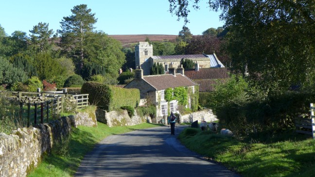
We entered Lastingham
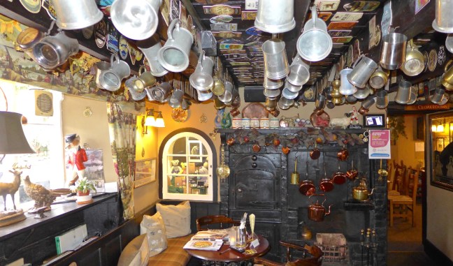
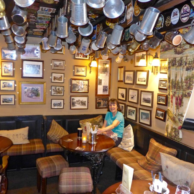
We eventually ended up in what we regard as the ‘best pub in Yorkshire’, The Blacksmith’s Arms for a well earned Yorkshire Hotpot followed by ice-cream!
A great walk.
Miles Walked 15.7
Steps 35,000
Average Pace 1623 Minutes per mile
Calories Burnt 1,900
After effects! When Carol got out of the car at home she got cramp. I got cramp in bed at just before 2.00am!
Post 198: 19 September 2017, Lowna Bridge Car Park to Appleton-le-Moors.
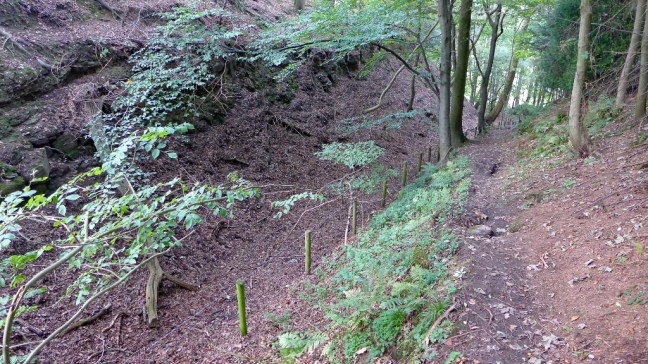
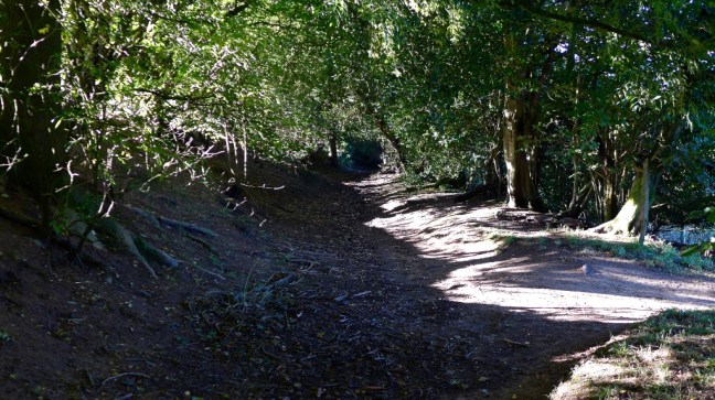
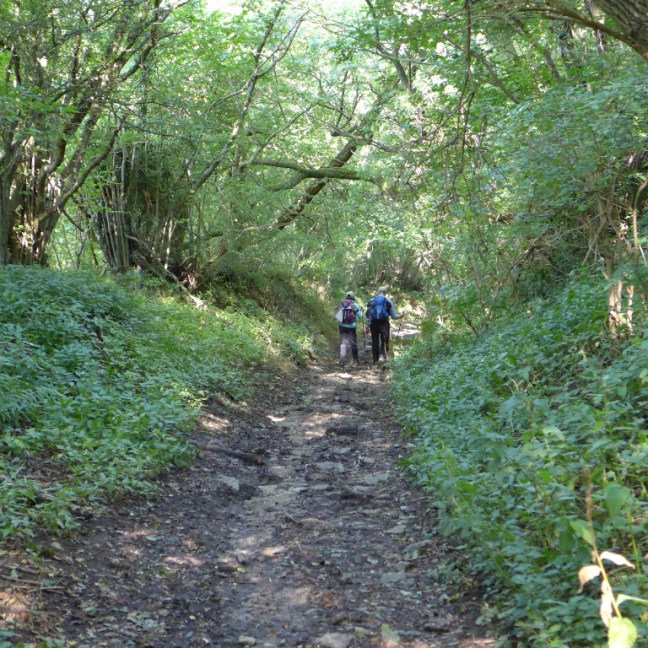
Still on the North of England Way, we ascended a step path out of Hutton-le-Hole to join a pleasant, probably ancient, enclosed way.
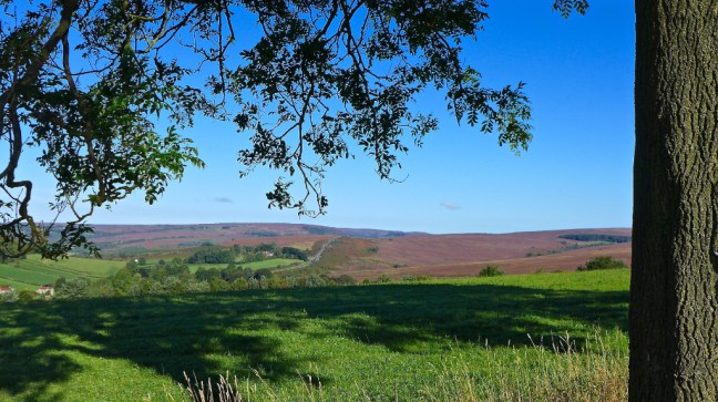
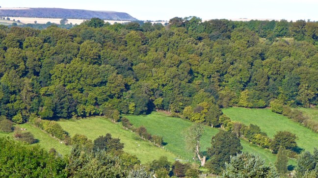
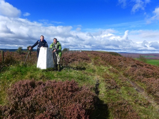
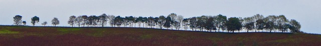
To reach a fine viewpont. On the last of the four photographs it is possible to see Rollgate Bank in the far distance where my trig point is located.
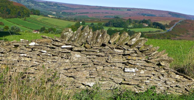
We then reached the small hamlet of Spaunton with its Pinfold, which would have been used to hold stray animals.
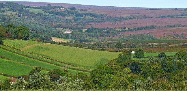
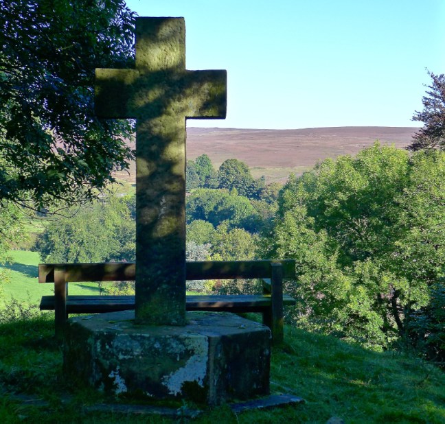
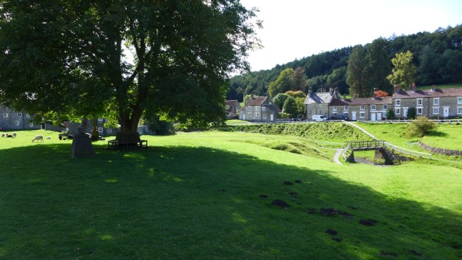
Just before descending to the beautifully located village of Lastingham at the next junction we diverted to Victoria Cross, just off the road . The Cross was erected in 1897 to commemorate Queen Victoria’s Jubilee and the opening up Lidsty Hill on which the cross now stands. Lastingham can be just seen nestled in the hollow below.
Lastingham was chosen as a site for a monastery by St Cedd in 654, but it was destroyed by the Danes about two hundred years later. In 1078 some monks from Whitby re-founded the abbey but after ten years moved on to York where they founded St Mary’s Abbey. The present church of St Mary Lastingham has a remarkable crypt, which is probably still as it was nearly 1,000 years ago. It is reached down a stairway inside the church and is unique in England in having a nave and side aisles. It is believed to have been used at one time for cockfighting. I particularly enjoy sitting in the crypt on my own and listening to the silence and feeling the sense of history of such a place. There are a number of interesting artefacts including of the Viking period.
The most interesting and remarkable artefact ever found at the church by Sid the Yorkshireman was my North Face hat, which I had lost some 10 days before on my visit to the area with Victoria. Someone had kindly left the hat on the reception desk. I was delighted.
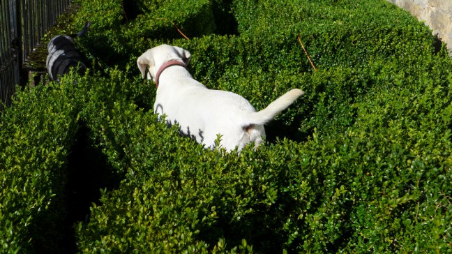
We had thought about bringing the village sniffer dogs in to locate it.
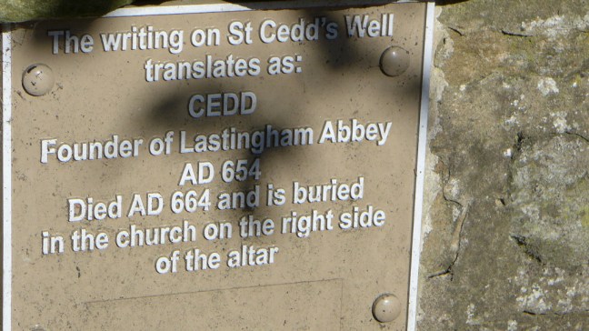
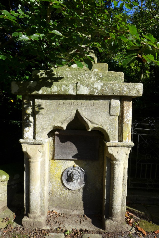
After a coffee and banana break we passed St Cedd’s Well.
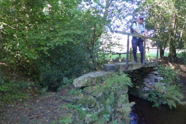
Before crossing a delightful bridge over Ings Beck.
We eventually reached Appleton-le-Moors, where we joined the Tabular Hills Walk for our return journey to Lowna.
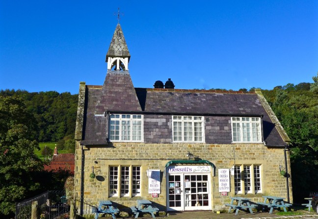
We followed very clear tracks back to Hutton-le-Hole, where we had lunch in the sun outside the small church.
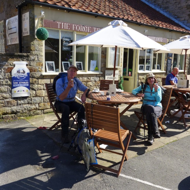
As we were nearing the end of the day’s walk we celebrated a great days walking with a Ryeburn ice-cream. It was also an early celebration as I was about to pass 800 miles ‘boots only’ miles of the Country Walking Magazine 1,000 miles challenge 2017.
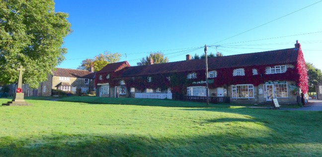
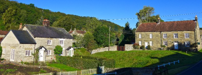
All that remained was to admire yet more fine views of Hutton-le-Hole in afternoon light.
Before the actual 800 mile walked celebration took place – where’s the champagne? In the fridge for the 1,000 miles?
We finished off with some delightful walking to the car park near Lowna Bridge.
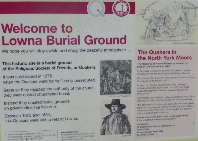
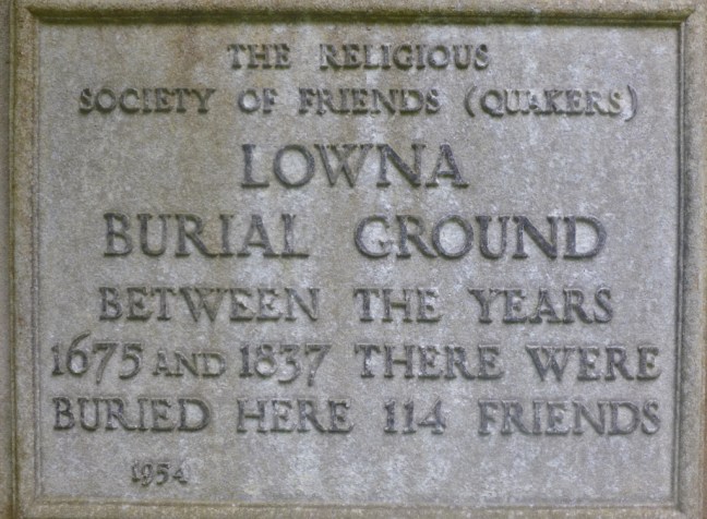
It was at Lowna in 1786 that Kitty Garthwaite coming home from a mop fair at Kirbymoorside, met Willie Dixon from Hutton-le Hole who took a splinter out of her hand. Her gratitude led, it seems, to her pregnancy, and she was keen to marry Willy. He kept putting off the wedding, though he continued to meet Kitty – but he also courted the daughter of a wealthy farmer. On Whit Sunday 1787, the pair quarrelled and Willie rode off. Next morning, Kitty’s body, clad only in her shift or sark, was seen floating in the river. But Willie had ridden to York for a marriage licence. Upon his return he heard of Kitty’s death and went in search of the body. The following day his body was found in the same dark pool. Three weeks later, local children saw Kitty’s naked apparition sitting in a tree, waving her sark. Over the next 20 years she lured16 young men to a watery grave. She is buried at the nearby Quaker BurialGround. The hauntings and deaths at Lowna did not stop until 1908, when a clergyman laid her spirit by bell, book and candle at the ford.
There are some days that get etched in the walking memory – this was one of those.
Post 197: 19 September 2017, Lowna Bridge Car Park to Appleton-le-Moors.
We arrived at Lowna Bridge car park at about 8pm and already the sun was out and a fine day was in prospect. We went through our normal start procedure, set our MapMyWalks apps, did a time check, ran through what we might have forgotten (this is an age thing) and had a mint. We the headed along a narrow quiet country lane usely occupied by sheep to our first village en route, Hutton-le-Hole. We were following my North of England Way.
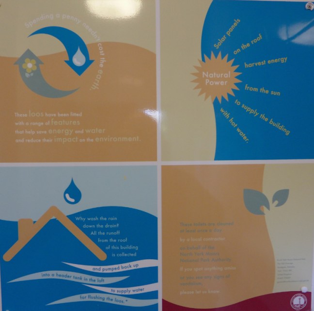
I have always felt you can tell a place by its toilets and Hutton-le-Hole, a well manicured and well kept village highlights this. The toilets are spotlessly clean and exceptionally eco friendly as shown by the various notices inside!
Its great to know you are peeing into a waterless urinal! No splashback!
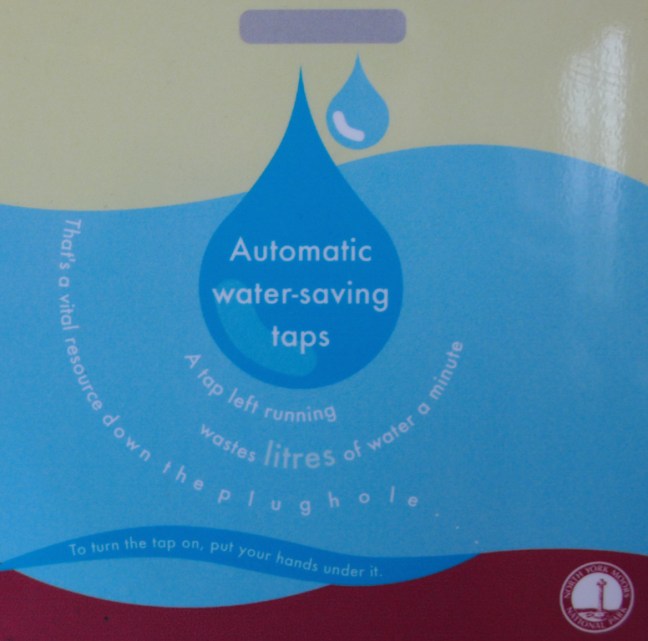
That there are automatic water-saving taps.
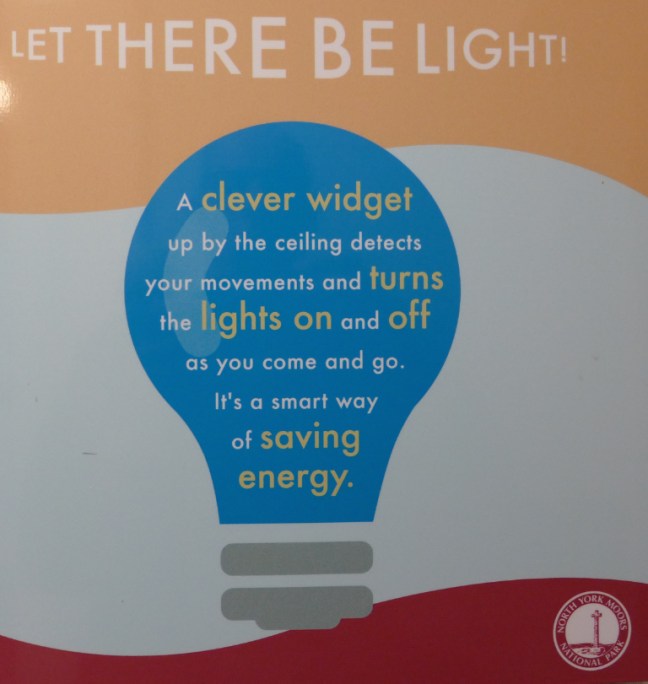
It’s interesting to note that the movement of your private parts are being monitored by a widget.
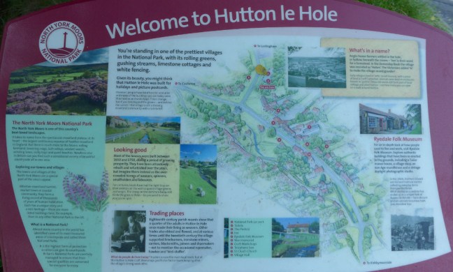
Welcome to Hutton-le-Hole!
Hutton-le-Hole appears as Hoton in the great Domesday survey of 1085/86, thereafter undergoing several name changes from Hege-Hoton, Hoton under Heg and Newton, to Hutton-in-the-Hole by the 17th century; the present form dates from only the 19th century.
Alongside the strong craft tradition in the area, in particular spinning and weaving, other industries such as tanning and milling, lime-burning, and coal mining have left their marks and two centuries ago the village would have seemed a very different place from the quiet and well-manicured spot admired by visitors today.
However, of most interest is the Ryedale Folk Museum ,which won the 1995 National Heritage Museum of the Year award. The museum, spread over 2½ acres of land, contains a reconstructed hamlet of workshops, thatched cottages and a thatched manor house. There are also barns, mills, a medieval glass kiln, an early photographer’s studio and wagon sheds. The museum has a number of special craft demonstration days each year. The Museum also runs an annual Merrills contest, this is an ancient, skilled board game that has been played regularly in the area and is now, in fact, increasing in popularity.
The village evens explains why it charges for car parking as a form of apology.
As you walk through it on such a fine morning, you are struck by its great beauty.
It was a shame to leave, but we had over 11 miles to walk.
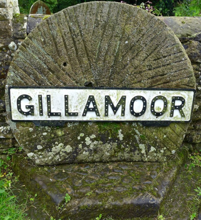
Post 196: 14 September 2017, Gillamoor to Rollgate Bank Trig Point.
We started walking from Gillamoor at just after 9.00am with some prospect of rain as Alf was with us. The only day he could get off work. We were following the well signed Tabular Hills Walk.
A rainbow soon appeared, which did not bode well.
We reached Green Lane.
Before Nawton Tower we came across a sad memorial and departed from the Tabular Hills Walk to head to Wether Cote.
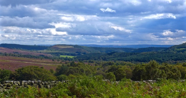
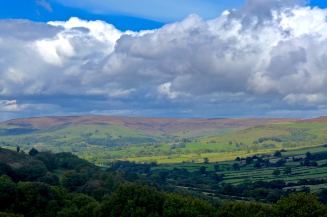
Expansive views opened up as we ascended to my adopted trig point on Pockley Bank
Maybe this is why it is called Rollgate Bank?!
We stopped at the memorial bench to DEE for a coffee and banana break.
Before picking up the North of England Way at my trig point.
We descended to Otterhill Common.
With some ominous clouds here abouts.
At this point the signage was very poor, almost non-existent and confusing. I need to write to the National Park again.
We eventually found our way to Pennyholme.
We then headed uphill towards Stonely Woods encountering a huge herd of lively cows, which has a bit disconcerting. We kept ‘calm’ and they did move out of our way.
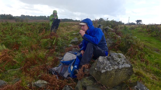
Just before reaching Harland Moor we stopped for lunch in the sun.
But this was soon interrupted by rain.
Alf had developed a headache at this point and took the direct route along the road back to my car. Sid and myself started to drop down into the valley of Farndale.
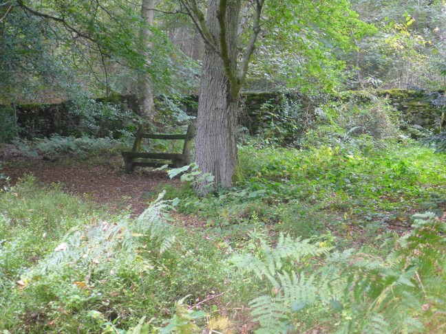
We soon came upon the Lowna Burial Ground
Before ascending to Gillamoor and the end of the walk


 Goathland seemed to be friendly territory. There were even one or two Russians about who were now on our side and the lady with the mangle would put fear into anybody.


 ]]
]]


 With Alf’s departure the weather improved greatly and at last I was able to wear shorts.
 As I reached the 100 mile point curlews danced in delight as though in celebration – halfway to Scarborough! However, paths were streams and streams had turned to rivers and some wading near Redmire resulted in wet feet. After leaving the delightful church at Wensley (where the television wedding of James Herriot took place) I followed the swollen River Ure, majestically winding its way like a huge snake along Wensleydale. At Cover Bridge I couldn’t resist a Guinness in the 15th-century inn, followed a few miles later by 3 huge scoops of the Brymor ice cream (3 of the over 40 varieties made from the milk and cream of Guernsey cows) from High Jervaulx Farm.


 Did I enjoy the walk? In the words of Diana of Prague, the first recorded female to complete the North of England Way in 1993, ‘it was marvellous’. Was the walk better than the Opening Ceremony of the Dome? Well the Dome was one amazing night, but the North of England Way for Hospice 2000 was an amazing and memorable two weeks.