Post 249: 23 April 2018, The Inn Way, Yorkshire Dales, Oxnop Head above Swaledale to unnamed waterfalls below Crackpot.
We left home at 7.00am and arrived in Gunnerside at just before 9.00am. This is Viking Country.………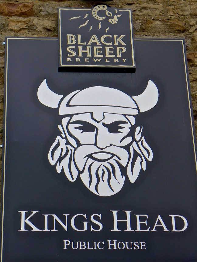 There was free parking in Gunnerside, near the Kings Head. This was a relief to Sid the Yorkshireman as we had been discussing an article in the Sunday Times, which said that parking costs the average UK driver £1815 per annum! In London owners spend £9,353 per annum. The average UK driver spends 35% more per mile than the average US motorist and 6% more than the average German. Sid the Yorkshireman brings the average down as he probably spends less than £20 per annum.
However, although relieved at the parking charges, he didn’t get ‘relief’ when he went to the toilets when he discovered they cost 20p. Unlike Geordie Caz and myself he decided to wait for a hedge or wall later on in the walk rather than spend 20p! Well he is Yorkshire born and bred! I can’t ever see him going to Iceland, where the toilets cost me £1 a time.
Whilst I always feel at home in the Dales (must be my Viking DNA) Sid the Yorkshireman always feels a little out of his comfort zone. The names in the area are decidely Viking, Gunnerside, Muker, Keld, Thwaite and it is said that up until the 16th century Norse speech continued in these remoter parts of Upper Swaledale and Wensleydale.
Gunnerside had a Viking chieftain called Gunnar who first settled here in the 10th century. The Vikings introduced the system of farming that still exists in the area today. In the 18th century the lead mining industry developed until about 6,000 tons of lead were produced annually. The Old Working Smithy still exists from 1795! Things change slowly in these parts, which accounts for much of its charm in a fast changing world. Swaledale lead was exported as far away as to the roofs of cathedrals in Rome and castles in Germany.
 However, we were not in search of Vikings. We were in search of the Swaledale Seal. It was last reported that having entered the Humber Estuary from the North Sea it passed through York to reach the River Swale near the A1!
  Leaving Gunnerside we had to climb to about 1500 feet at Oxnop Head to resume the Inn Way where we had last reached it in thick mist. We soon reached the River Swale which s England’s fastest flowing river. This suggested the seal would not get this far unless it had the skills of a salmon.
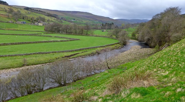 I was surprised to see this old limestone field barn with ‘door covers’. Each barn traditionally had an area for storing hay called a hay mew and a separate area of stables for wintering cows. They are less used in this way now as modern farm buildings house the cattle.
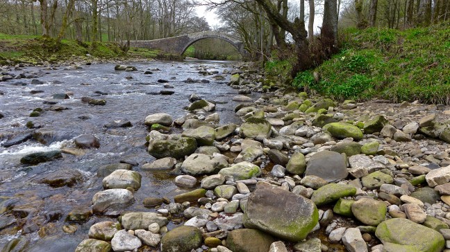
 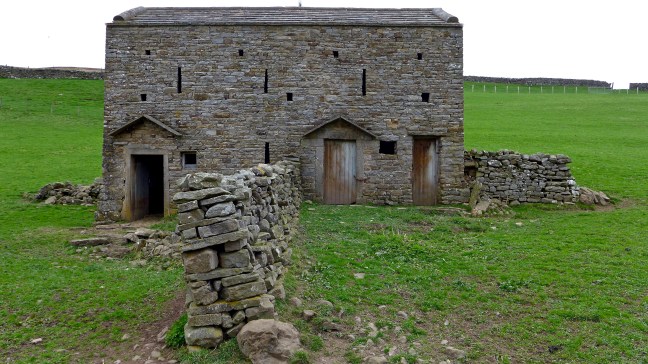 We continued along the River Swale towards the lovely shaped Ivelet Bridge
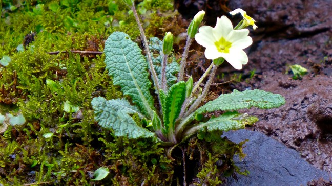
 At this point we stopped on a bench for our coffee and banana break. Sid the Yorkshireman was still upset about the 20p toilet charge (they tend to be free on the North York Moors) and, being overcome, we laid him to rest on one of the old ‘coffin’ stones expecting that he would soon be picked up by the undertaker and finally taken away.
 No such event happened and so he resumed the walk with us.
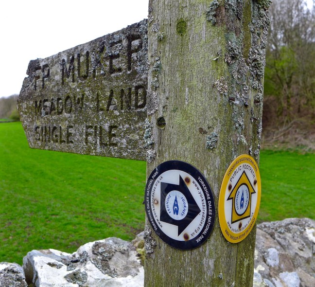
In the meantime, we noted the ‘A Pennine Journey’ signs, a book I had helped to produce and I think my subscription of £2.47 a year to the Pennine Journey Supporters Club contributed to the production and erection of these signs. Further details can be found at:
http://www.penninejourney.org.uk
There are wonderful hay meadows around June in the Muker area. Alfred Wainwright in his earlier book A Pennine Journey – The Story of a Long Walk in 1938, said of Swaledale:
“Swaledale was in front now, unfolding a little more of its beauty with every step I took….I could see copse and woodland, rich meadow and pleasant pasture wonderfully blended in shades of soaring hill and ragged peak, and my heart warmed to the sight.”
It has changed little since 1938.
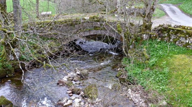
 We crossed the River Swale and Oxnop Beck, noting the older bridge over Oxnop Beck was no longer in use.
 The climb to 1650 feet (503 metres) began with a vengeance and continued for over 2 miles. However, the views, particularly back, were fabulous.
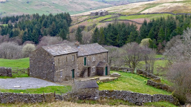
Low Oxnop Farm was passed, which was built in the traditional way with a building attached to the main house for the livestock, presumably not used as such now that more modern outbuildings had been built. 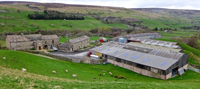
 A trap for catching maybe stouts or weasels can be seen over the stream
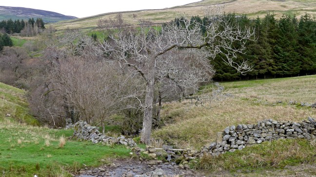
 Oxnup Gill
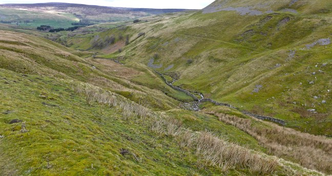 The quiet lane led up towards Oxnop Scar. It would once have been a busy, popular route for miners and passers by, sufficient to service a wayside inn called ‘Jenkin Crag’.
 The dramatic and sheer limestone cliffs of Oxnop Scar came into view.


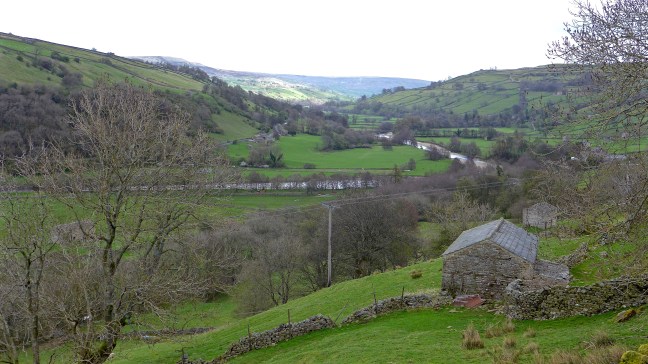
Soon after, we reached the route of the Inn Way and were able to begin our descent. The wind gathered a little, but the views to Upper Swaledale were far reaching.  After passing Gill Head,
 we left the lane and descended back to Ivelet Bridge, the River Swale and Gunnerside for a lunch stop.
  Two cyclists were also having lunch and we discussed the prospects of the Tour de Yorkshire, which is being held between the 3 May and 6 May. Now a huge and successful annual cycling event it is one not to be missed. I and my wife, a keen cycling fan, will be attending 2 or 3 days and thousands of fans will turn out and Yorkshire can claim to be the cycling centre of the UK.
From Gunnerside, we crossed the River Swale again and headed towards Banks Head.  Passing a limestone kiln
 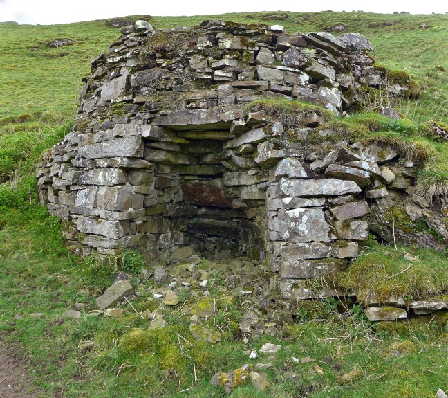 There were fine views ahead towards Reeth.
 A tree that was soooooo… big it had to be hugged.
 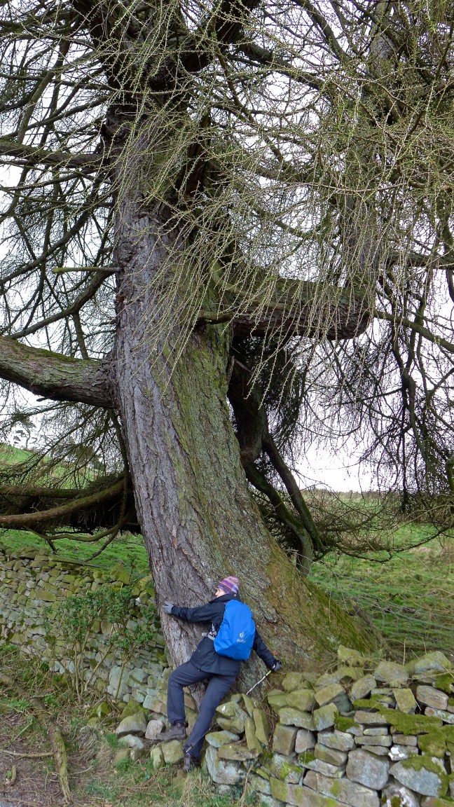 Followed by more expansive views.
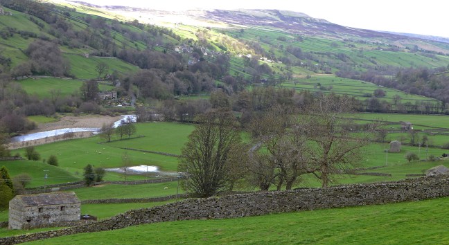 We then reached a delightful, unnamed waterfall (see video on Facebook) and then left the Inn Way,
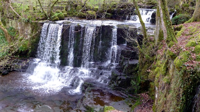 to descend to the River Swale and follow it back to Gunnerside.
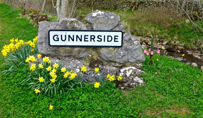
No Swaledale Seal was seen but, like the Lochness Monster, who knows where it is now?
Miles Walked 13
Steps 28,000
Calories Burnt 3,700
