Post 229: 16 Janary 2017, The Inn Way, Hart’s Leap to the Top of George Gap Causeway.
This section of The Inn Way was one of the trickiest to plan as it was on some of the remotest, exposed and boggiest sections of the North York Moors and the forecast was was for ice, high winds and snow later on. Some weather warnings had been issued for later on.
We decided that the snow was unlikely to arrive until after 2pm and with an early start we had a 10-11 mile route planned, which should enable us to get round before the worst of the weather arrived. We would make a final decision as to whether to walk depending on how we found the weather on arrival
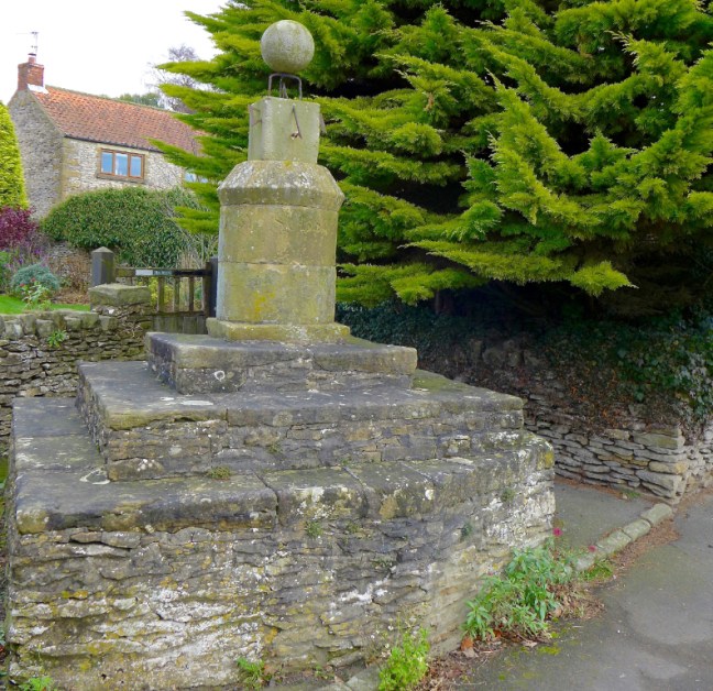
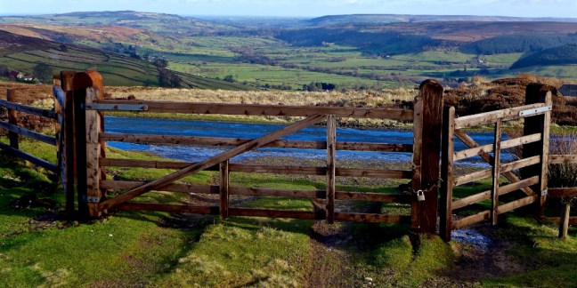
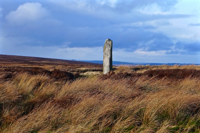
After passing the Lion Inn, Blakey we turned right along an icy road to the car park with the Millennium Stone, which is shown on later ordnance survey maps.
It was sunny but very cold when we arrived at the car park. However, there were no snow clouds in sight. So the walk was on.
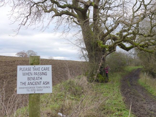
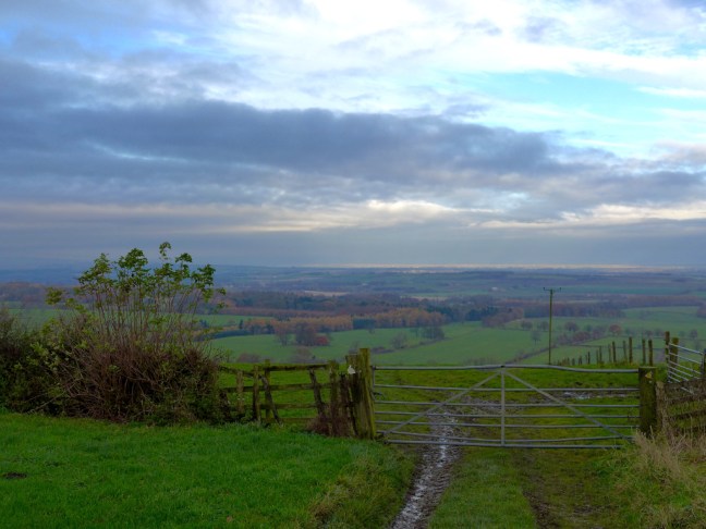
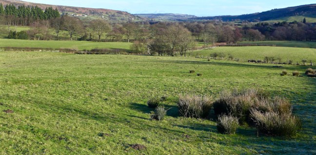
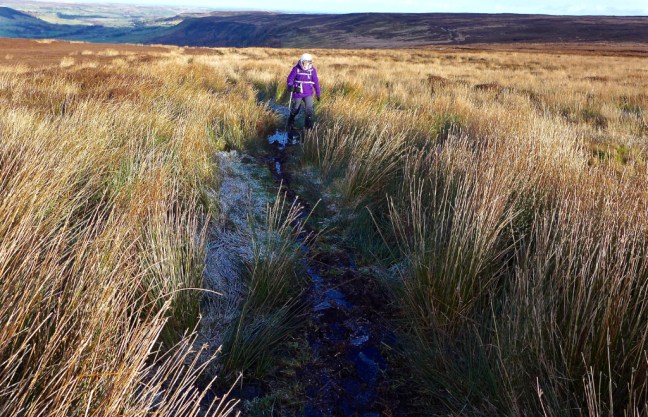
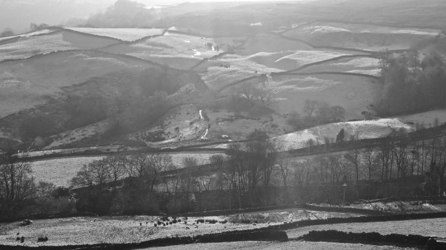
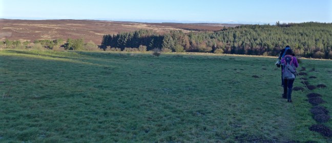
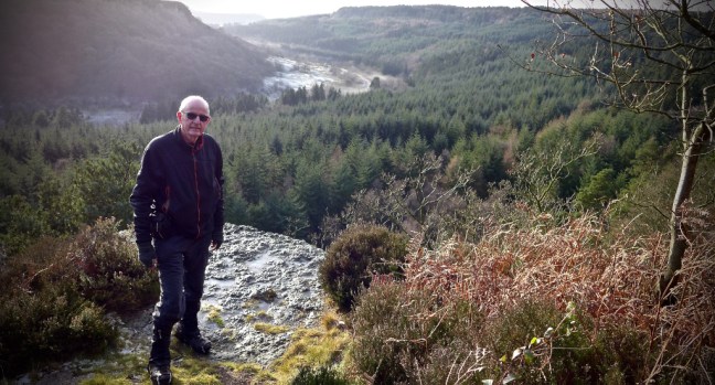
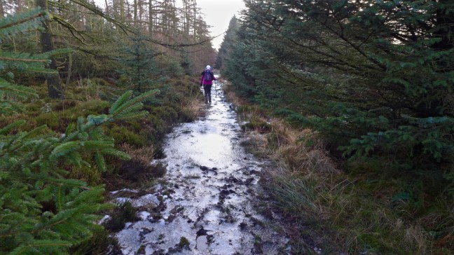
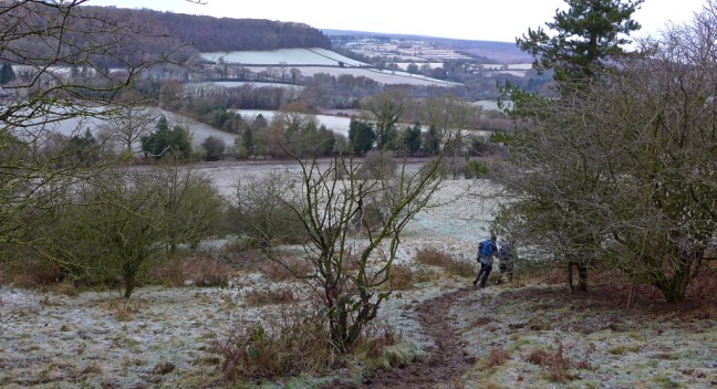
Our first section was on part of the Lyke Wake Walk, which can be difficult and tiring walking even in summer. In winter it not recommend and should only be taken by experienced walkers who know the area and challenges ahead. In this photograph it seems to prove the planet is round as the circumference of the planet seems apparent in the distance, or is it the shape of the Moors? We could have been on a different planet compared to when we left home. 

In his book Some Reminiscences and Folk Lore of Danby Parish and District (first published in 1953 and again in 1990) Joseph Ford says:
In travelling over our moorlands, one must keep in mind the danger of walking unsuspectedly into one of the many bogs, for, like quicksands, once a traveller gets too far in there is no retracing, and if there is no one to reach out a rescuing hand he is likely to share the fate of many poor sheep and other animals that have been submerged in the bog and never seen or heard of again. The horror of the thought is sufficiently strong in the minds of our Dalesfolk to cause them to give these bogs a wide birth.
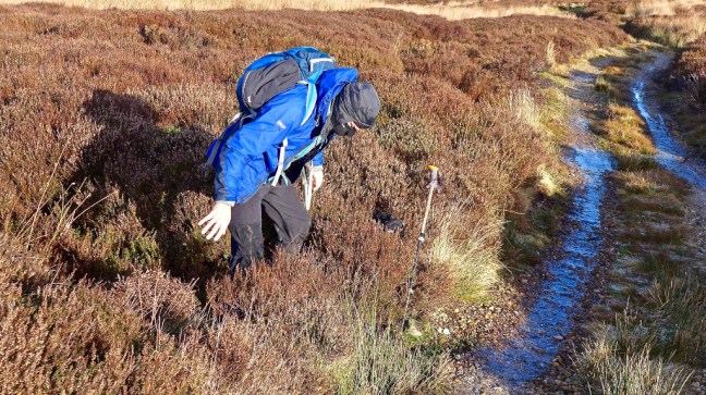
Many of the boggy areas were iced over, but of course I found the one bog that cracked under my weight (despite having lost 10lbs since October in training for the Bavarian Alps!). My front leg immediately sunk into an abyss up to my knee. However, experience told me to immediately and without hesitation to sit down to even out the weight. This stopped the descent to oblivion and with the other leg still on firm ground I managed to pull my forward leg out, although with considerable suction resisting me.
Sid the Yorkshireman’s reaction was “…quick where’s the camera. And that is even with microspikes on”. I suspect the weight of microspikes would have quickened my descent into oblivion and a helping hand would have been more useful than a camera!
Somewhat distracted by this, my 1991 hat on top of my balaclava came off without me noticing. About a mile on I realised I had lost it then Sid the Yorkshireman revealed he had luckily found it and held onto it!
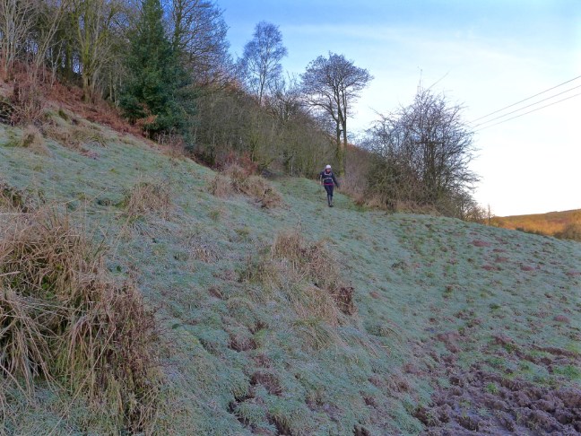
A tricky tiring 3 miles or so followed of dodging water, ice, bogs and overgrown heather. At times we could have been on a different planet.


 We eventually arrived at Shunner Howe, a likely tumulus, where we stopped for a banana and coffee break whilst trying to keep out of the keen, cold wind. We were smiling again!

 Reminder to myself: if Sid the Yorkshireman suggests again using the Lyke Wake Walk in winter for any walk, ignore him.
We eventually arrived at an the icy lane and what used to be the site of Hamer House, which use to be a pub
Joseph Ford recalls ‘how old people – natives of the dales- could relate how a neighbour’s sheepdog found, after a severe snowstorm, the decaying body of this or that old man, who had perished in the snow at Wintergill (where we were heading to!); or the finding of an old man’s bleached bones near to Bluewath Beck, not far from an ancient sheepfold, where sheep were washed in hot days in summer.
This old man used to travel these moors from one place to another to sell bottle corks, which he disposed of to the farmer’s wives, and his chief customers, the wayside innkeepers. Often he would call at Hamer, where he was unusually sure of a small business transaction with Joseph’s mother, which is how Joseph came to know him. His skeleton body was identified by the scattered bottle corks lying nearby, and the basket in which he carried them, which was beginning to decay. It is just possible he was on his way to make this small transaction – as Hamer was not far away – when the snowstorm overtook him.
Then there is the story of a man in his prime, travelling from Glaisdale to Hamer who – soon after he left the precincts of the dale to cross the moor by way of Wintergill – was caught in a blinding snowstorm. He could not see his way before him, and very soon the moorland track was hidden beneath the snow. What could he do? Amid the seething, hissing whirlwind of blinding snow? He took his hazardous bearings from the fury of the wind beating upon his face and set a course and steered by it accordingly.
…all but defeated he reached the old Wayside Inn, HAMER…they had to melt the clogged icicles from the snow-mans’s face.
His children at the pub hadn’t recognised him!
Not wanting to risk waiting for the snow to arrive, we pressed on along the icy lane, passing a bridge that had clearly had a car slide into it on the ice.  Turning off the lane at Wintergill there was surreal moment as I answered a call of nature just as a jet buzzed over us, no doubt to record on some RAF camera my indisposed situation! I still managed a one handed photograph or two!

 Zeppelins were reported as flying over the Moors before 1917. In 1916 high explosive bombs were dropped by the Germans, resulting in 40 or so basin-shaped holes in the ridge dividing Fryup Dale from Danby Dale.
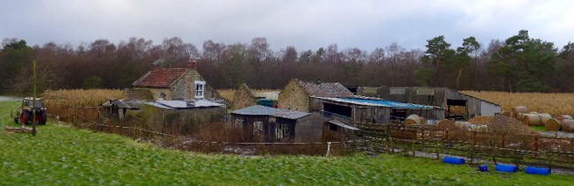
There are some signs of previous habitation at Wintergill.


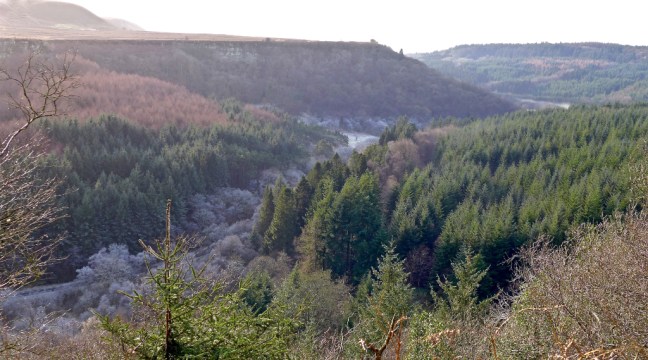
We soon began our descent into Glaisdale and what a fabulous descent with fabulous views it was, making all the hard work and encounter of the bogs of the Lyke Wake Walk worthwhile. The area reminds me very much of the Yorkshire Dales.


 We passed the door to nowhere!
 Then we stopped for an early lunch at about midday on a 2016 bench in excellent condition and location in the sun.
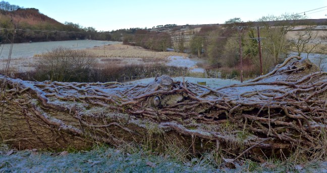
Starting our next ascent I noticed how even in winter there are lovely colours to be found and seen.

 And we found carvings on a rock from 1609!
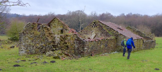
 Next stop were the remains of a building, which suggested folks were a bit shorter than me in the past.
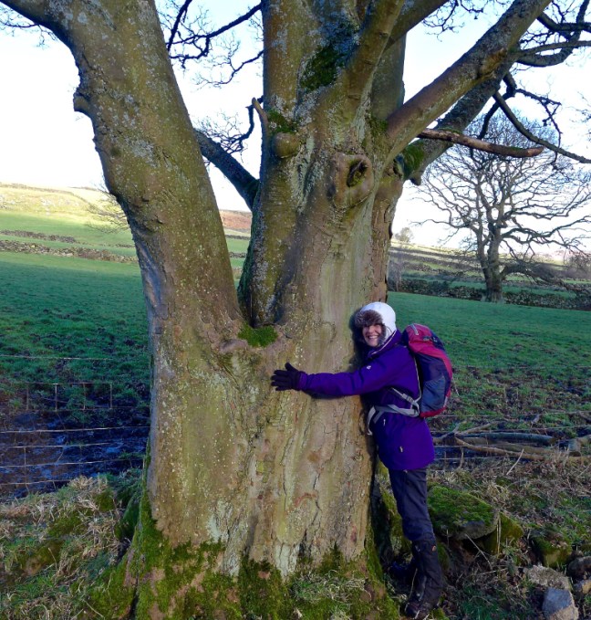
 Carol had to hug this lovely tree.
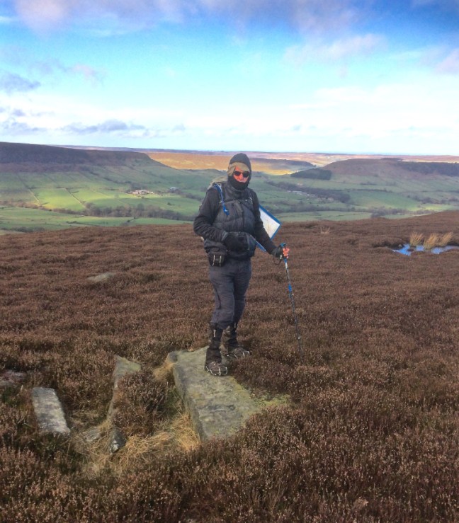
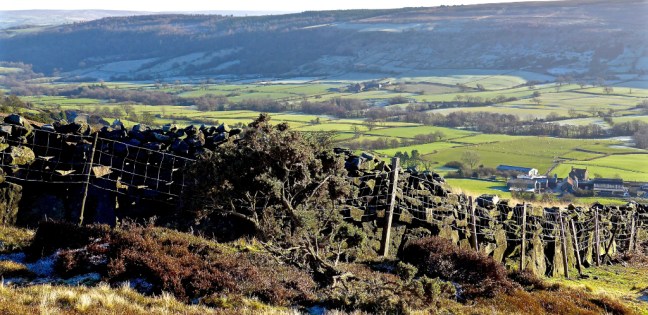
 There was the final big ascent of the day to Hart’s Leap, where we got to on our previous walk and where a stag was recorded as having leapt over 40 feet! (see previous blog)
  We were now on Glaisdale Rigg and a section of Wainwright’s Coast to Coast Walk.
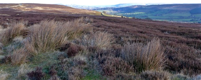
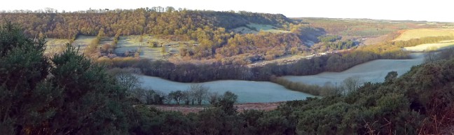
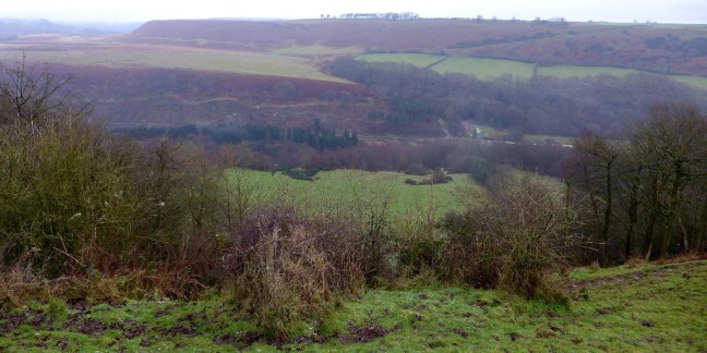
Great Fryup Dale was to our right. Note the clouds forming, which made us press on due to the risk of snow.
 To our left were fine views along Glaisdale to the sea.
 We left the tarmac lane continuing along the coast to coast route towards the George Gap Causeway.
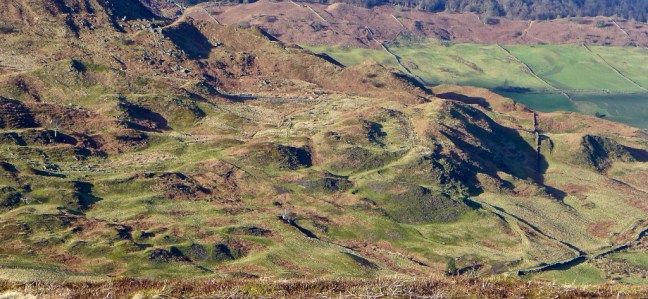
 At the head of Great Fryup Dale there were ‘lunar’ looking remains of what I think are glacial deposits known as Drumlins and some subsidence. Boulder-clay may have been deposited as swarms of rounded hummocks. Clay is found in the area as roof tiles on some of the houses were made of clay and there is more than one Red House in the area. One of my favourite books of all time is Principles of Physical Geography by F.J. Monkhouse. I selected it as an O-level prize ready for when I did A-level Geography. It worked as I got an A at A-level. I think I was a school swot but loved Geography and still use the book. There may also be evidence of ironstone mine workings that took place in this area many years ago.
 At this point Sid the Yorkshireman was powering on along the clear track, but suddenly ‘turned off’ it and seemed to fall quickly. He didn’t appear for some time and I assumed he had suffered a bad fall. Indeed he had!
He had turned off the track to go to the bog (sorry, slang for toilet) and had landed into a bog! I was just a little late in getting the camera out to capture him emerging with wet trousers. We are not sure whether he had aimed badly or whether his trousers were wet due to the bog!
A bog within a bog!
 Joseph says in his book: During recent years the late Lord Downe has done a great deal to lessen these dangers (of bogs) by cutting trenches to drain away the water which feeds the bogs, but there are some of such vast dimensions that they defy ordinary measures, and George Gap Spa is one of them.
It has been responsible for the death of innumerable sheep that have strayed too far over the edge, or been frightened and chased over the edge by stray dogs. Many a lost traveller on these lonely moorlands will have found his burial place in this bog, in company with other ill-fated men of the Stone and Bronze ages, whose bones have long mingled with the antler of the stag, the tusk of the wild boar and the bones of sheep and cattle, to lie rotting in the maw of of the great bog of Fryup.
The good news is that despite having my 3 hats somewhat misaligned, I didn’t end up in Sid’s bog. The moral of the story is that you should choose carefully where you go to the bog!
Great Fryup Dale
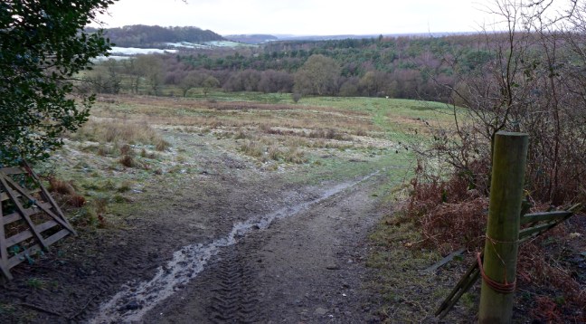
 All that remained now was to progress another mile or two over more boggy land and then follow the lane for a mile or so back to the car.
 Rosedale Topping can just be spotted in the far distance to the left of the Millennium Stone. The snow clouds were gathering and it was time to head off home
 A challenging, fabulous walk and possibly the hardest circular section of The Inn Way completed, although we had only actually walked about 3 miles of The Inn Way!
Miles Walked 11.2
Steps 25,000
Calories burnt 3500


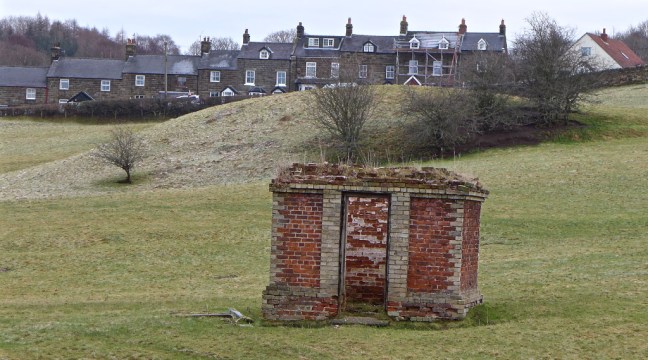
 With the sun coming up behind the hill, we passed the former Glaisdale ironstone mine powder store, which would have been in use from 1862 to 1876 when the mine was in operation.
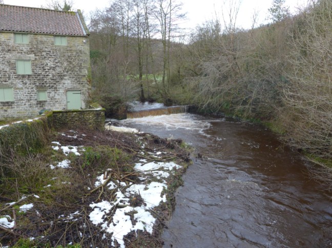
 Passing through Miller’s Wood we reached the old corn mill with its waterwheel.
 Following the River Esk we arrived at Rake Farm,
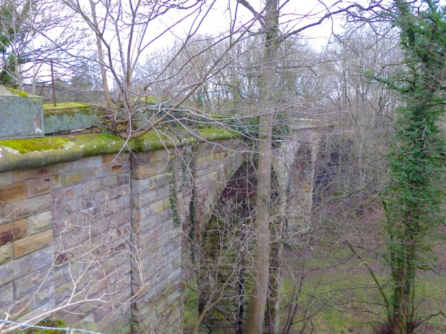
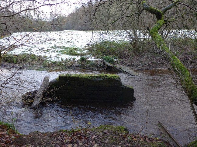
 and the Paddy Waddell Railway, the railway to nowhere. This was known as the Cleveland Mineral Extension Railway, which was intended to take a branch line from the Esk Valley Railway over the moors to connect with railway lines near Lingdale over ten miles to the north.
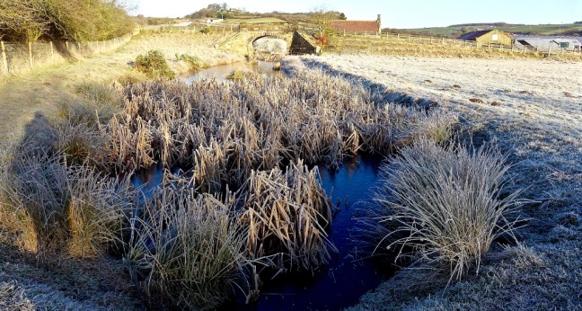 In 1872 John Waddell, a famous Victorian Engineer began work on the line.
 The project ceased in 1889 but a flooded cutting and bridge remain. John was nicknamed Paddy due the many Irish navvies he employed.
 After passing The Board Inn,
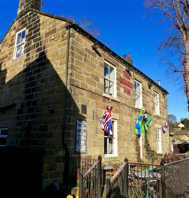 the real climbing on iced roads towards the open moors of Glaisdale Moor and Low Moor began.
 We followed The Inn Way sign, but there is no inn until Rosedale is reached many miles ahead.
  Having got someway behind my walking friends due to taking photographs, I had what I can only call a Sublime Moment, which climbers and walkers in remote areas experience as described in Robert McFarlane’s book Mountains of the Mind, which I have just finished reading. I think the moment was related to the sudden sense of changing nature, the icy sparse vegetation, the lone tree, the far distance views, the increased biting cold wind, all which overwhelmed my senses. It crossed my mind that if you had to spend a long time out here you would struggle to survive. It is essential to carry emergency bags and have good clothing. You go suddenly from a cosseted secure world to one of fragility.
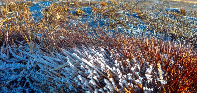

 Catching up with my friends at Glaisdale Rigg, I then did a small diversion to see wonderful vistas in the next valley of Glaisdale, where the frost lingered well into the day.

 There was no time for us to linger as we continued along the icy track towards Hart Leap.
 Great Fryup Dale looked remote and beautiful below us to the north-west.
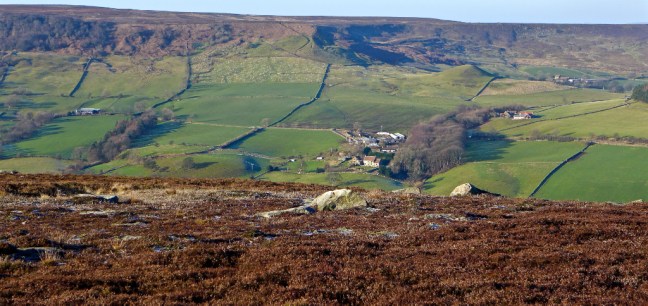 Finally, we arrived at Hart Leap where it is said that a large stag made its last leap in a vain attempt to escape the huntsman and their hounds; one stone marks where the stag took off and the other where it landed, the distance being 40ft 6 inches. The men’s world record long jump is 29 feet 4inches.
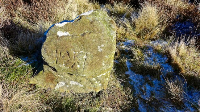
 This was our location to drop off the Rigg and leave The Inn Way to find a route back to the car and find a lunch spot out of the cold wind. There followed a few obstacles, a steep descent and a near fall for Sid the Yorkshireman (note without spikes!).

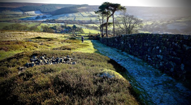


 We found a sheltered spot between walls with a view to savour. With homemade bread rolls, jam and fruit cake it was better than any restaurant lunch in York – well sort of!

 There was even a sculptured stone in the wall, which could be removed to let the sheep through! Not surprisingly it is known as a sheep hole.
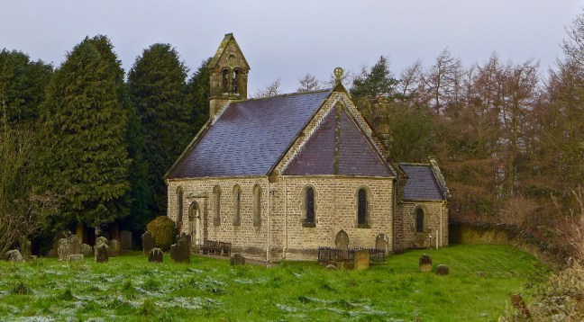
 After lunch we followed the road to Glaisdale Mehodist Chapel near Postgate Farm. Built in 1821 it is very small and intimate and the graveyard has far reaching views up the valley of Glaisdale. A fine place for a final resting place.


 We crossed over Eller Beck, which becomes Murk Esk at the confluence with West Beck. Are you confused already?

 With an interesting sign on the door and with a dog barking at us from inside the window to prove the point!
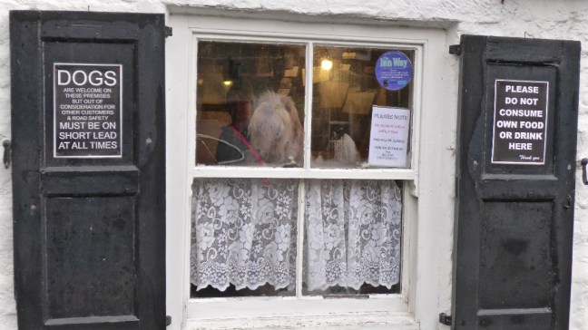
 After a diversion along a signed Grosmont Rail Trail, we then left the old line to ascend steeply from where there we fine and extensive views, including in the distance Egton Manor.
 Descending to Egton Bridge, Sid the Yorkshireman decided to do some community work (he does litter collection in his home village) encouraging branches blocking the path on their way. At this rate he will be expecting us to put him forward for an MBE. Not that we could use the path due to the flooded river!
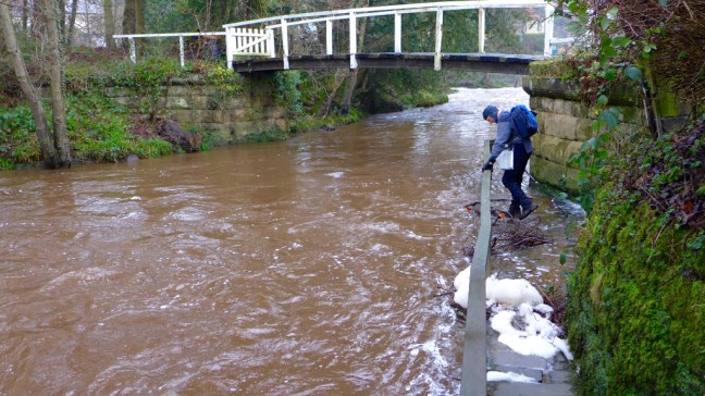 Always keen to cross rivers on stepping stones, Sid the Yorkshireman looked forlornly towards the stepping stones under water beyond the private bridge. .
 Another steep muddy ascent led to some rocks which made a a great coffee and banana break spot with extensive views. I remarked that it was much better than Costa or Starbucks or the multitude of other coffee shops in York. Although Alf wasn’t too pleased when he found his mat was not waterproof and he had a damp bottom!
 There was some tricky navigating on new paths for us. One of the reasons we like doing long distance walking projects is that we find paths we haven’t done before.
 We reached Arncliffe Woods, which is on the route of Alfred Wainwright’s Coast to Coast Walk. We then descended to the delightful River Esk.
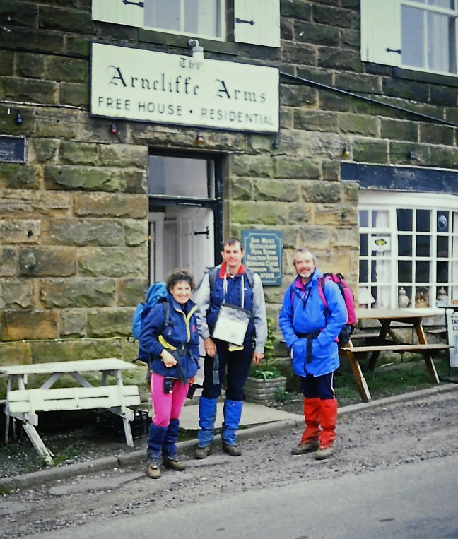
 After passing the Arncliff Arms , which I stopped at when completing AW’s Coast to Coast route in 1991, we descended to Glaisdale Railway Station, which had been salted for ice (hmm..?) and had an automatic announcement which advised repeatedly of the forthcoming rail strike.
 Wainwright’s route continues to attract walkers and indeed in May I will be picking some friends’ luggage up at Glaisdale and picking them up at Robin Hood’s Bay the end of the walk.
 Another tiring ascent followed, but there were lovely views back.
 A steep descent led to the old miner’s cottages at Esk Valley.
 Following the dismantled railway line back to Beck Hole we found some more signs! A day of signs.
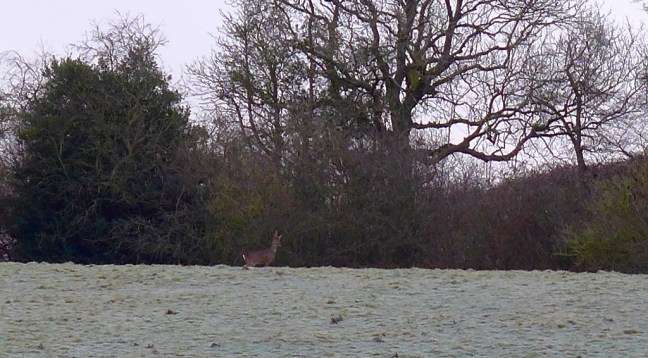
 There were fine clear views from the Moors, but with little wildlife other than the sheep and grouse.
 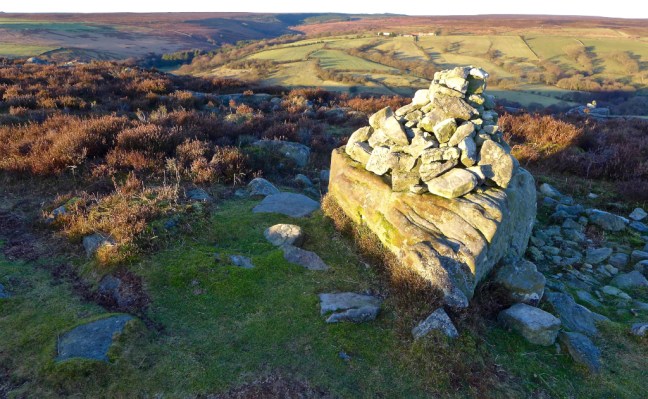 There was certainly a biting wind and we were pleased when the sun came up above the ridge. We descended to Hunt House
 Shortly afterwards we passed Wheeldale Lodge, which was formerly a shooting lodge and then in 1948 became a youth hostel. It sadly closed in 1999.
 Our path crossed the route of the Lyke Wake Walk, which marches 42 miles from Scarth Wood Moor, Osmotherley to Ravenscar on the East Coast. Since it was first walked on 1 October 1955 over 160,000 people have walked it. Anyone who completes the walk can purchase an official coffin badge. That’s assuming you don’t end up in a coffin trying to do the walk in less than 24 hours.
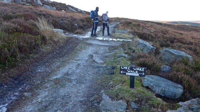 Now I always thought John O’Groats was in Scotland. However, it is here in Yorkshire and marked on the map as such. So all those people who say they have walked/cycled from Land’s End to John O’Groats in Scotland have got it wrong. They should have come to Yorkshire. To celebrate we stopped here for our banana and coffee break in the bright warming sunshine, sheltered from the wind. It was hard to get going again.
 Emerging from the forest at Wardle Green, we had to do a short out and back to rejoin The Inn Way at Wardle Rigg, from where we had left off on the previous walk.

 At Simon howe there was a good photograph opportunity.


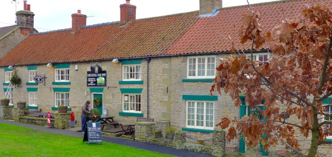
 We passed the Mallyn Spout Hotel, which was quite busy.
  Sid the Yorkshireman was stopped for speeding by PC Nick Rowan from Heartbeat. My first car was a Ford Anglia, which indicates I am no longer 21.
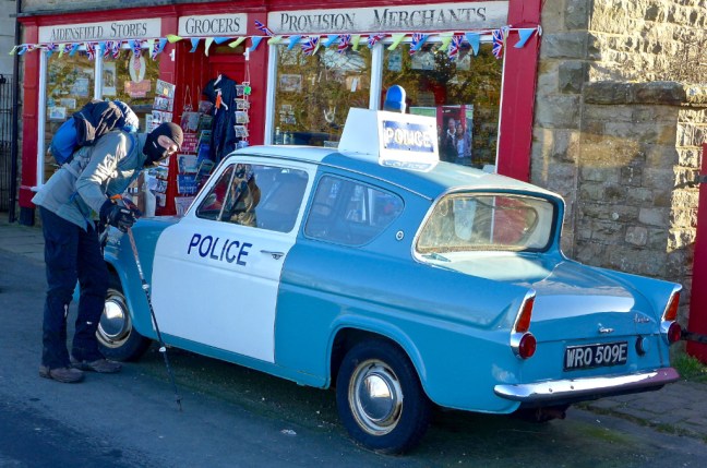 Being The Inn Way I took the obligatory photographs of the hotel/inns of Goathland or is it Aidensfield in the 1960s Heartbeat TV series. You can take your choice.

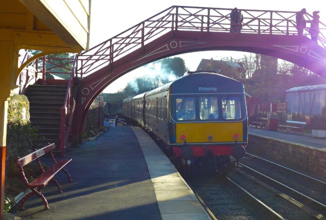 After lunch we carried on to Darnholme and then got a great video (see Facebook: The Secret Diaries of a Long-distance Walker) of a steam train in the valley far below us. The sound of the train resonated in the valley below as it worked so hard to ascend the incline. A living machine!
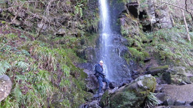
 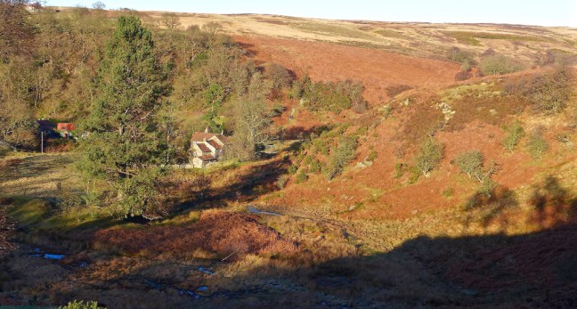 After Beck Hole we left The Inn Way to ascend and then descend, somewhat tired, to Mallyn Spout (Waterfall).
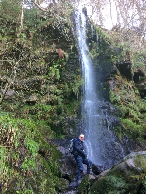
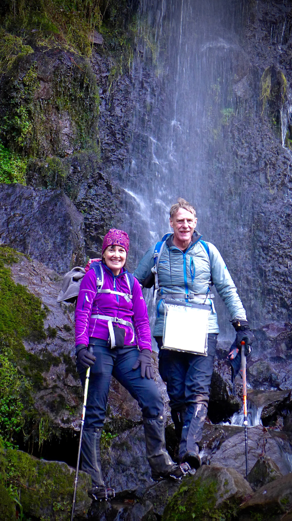
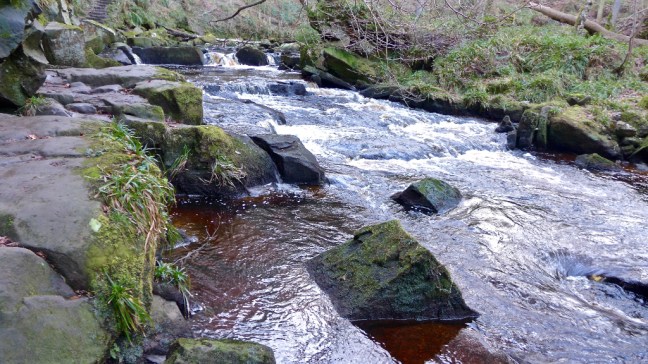 I have never seen it with quite so much water.
 A final ascent up the many steps to the hotel brought us back to the car and the end of another great days winter walking. We saw few other walkers all day, except around Goathland.
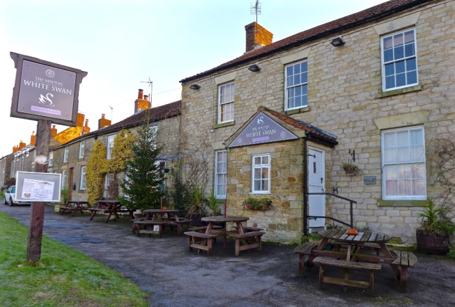 It soon became obvious that our route down to Levisham Station was both very steep and icy. The ground was solid. Sid the Yorkshireman had two falls.
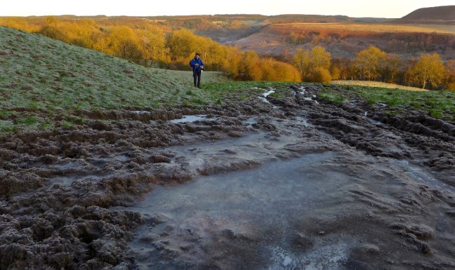
 After some awkward route finding we arrived at Levisham Station where Sid the Yorkshireman decided it would possibly be the ‘knockout’ if he fell again and decided to put his microspikes on. The road was an ice rink.
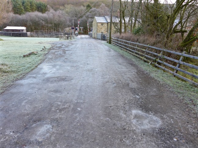 We had hoped a Santa special on the North York Moors Railway might come along but a Monday was the wrong day. Santa has a day off.
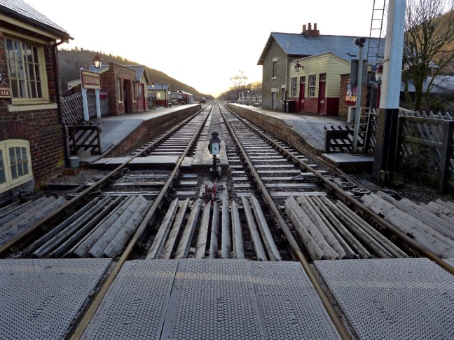 A climb up to Levisham followed with fine views back to where we had descended and ascended and Levisham Station. It must have been hell of a walk from the station with your luggage to the village!
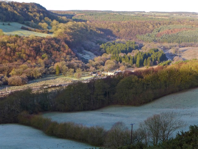
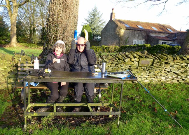
 At Levisham we found a table for our banana and coffee break and found a good use for our banana protectors. I reverted back to my Viking DNA with horns!
 The delightful Horseshoe Inn was passed.
 Sid the Yorkshireman suddenly got excited and insisted I get my camera out, just as my hands had warmed up again. It was some sort of loader on the road and he informed me it was rare to see one on the road – he is the ‘twitcher’ of tractors and agricultural equipment. Hmmm…..it takes all sorts.
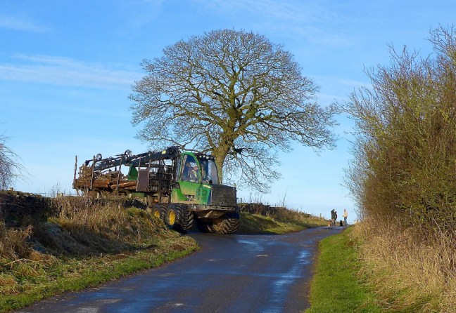 We emerged onto Levisham Moors, which is part of the Levisham Estate and stretches for several miles over 3,350 acres.
 There was packed ice again.
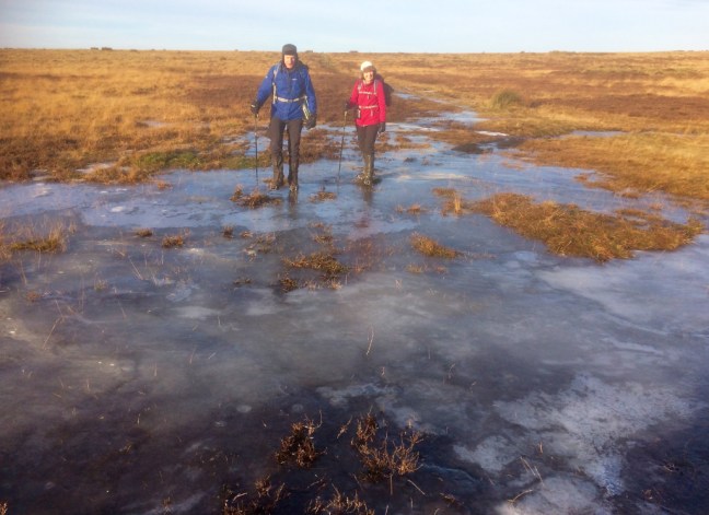 We had fabulous views in the now bright sunshine towards Skelton Tower
 Again the path was ice.
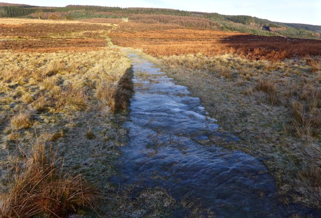 Skelton Tower was built in 1850 by the Reverend Robert Skelton, as a folly to free up his mind amongst its peace and tranquillity.


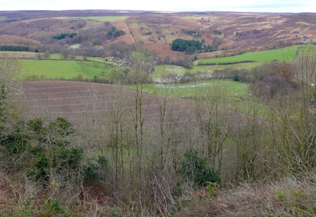
 We continued along the edge of the escarpment with views down to Kidstye Farm from Huggate’s Scar.
 The views back, below and ahead were delightful with mists and frozen trees giving it an ‘ethereal quality’. I was on photography overtime, at the same time trying to keep my hands warm; I have mittens without fingers to help plus, when the cameras away, another pair of gloves to go on top.

 The Fylingdales early warning system could be just seen on the horizon.
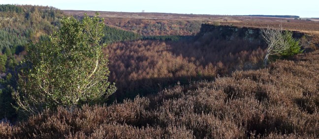
 Across the other side of the gorge was my named Pulpit Rock, our lunch-time destination but still some way to go.
 Just after Yewtree Scar and Pifelhead Wood we had to descend another tricky steep and icy path, high above a stream.
 Crossing the railway line again we then had a steep ascent to Needle Point. Half-way up Carol suddenly realised she had dropped her hat (easily done – I could run a second hand clothes shop with the hats and gloves we find on walks) and had to go back for it.


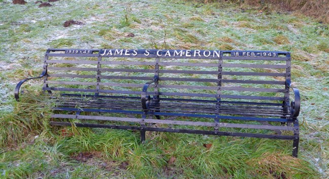
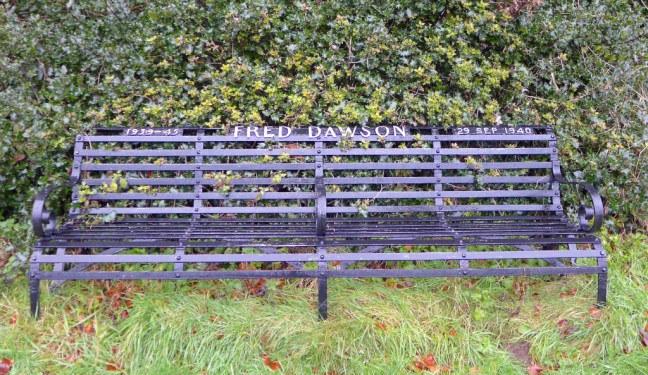
 The bench is a memorial to Professor Frederick Allin Goldsworthy, the father of the famous landscape sculptor, photographer and environmentalist, Andy Goldsworthy OBE. Andy now lives and works in Scotland.
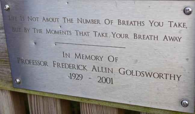
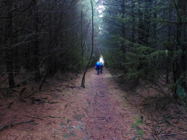
 Energies restored it was back to icy paths through the forests.
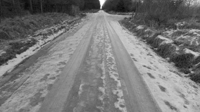
 We did see a fruit picker, but we didn’t see another walker (apart from the odd dog walker) all day!
 After leaving The Inn Way at Wardle Rigg, we descend back to the railway line and the Platelayers’ Cottage.
 Alongside is the former location of Raindale Mill, which was built in 1712 and has now been moved to alongside the River Foss in York near the Castle Museum!
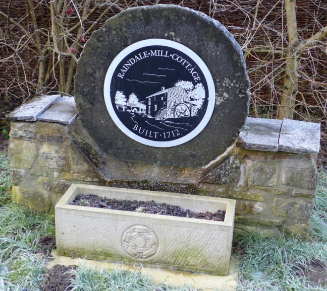 Arriving back at Newton-on-Rawcliffe at 3pm (we had started at 8.45am) I had to finish with a photograph of ice.
 Peat Road (Track), being a bit higher, had sections of sheet and broken ice and I was glad I had my microspikes on.


 We passed the Crown Inn, one of the pubs on The Inn Way.
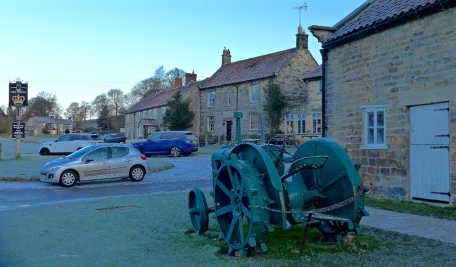
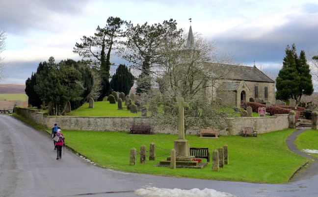
 There was not time to enter the St Mary’s Church noted for its 1,000 year old underground crypt, where cock fighting used to take place.
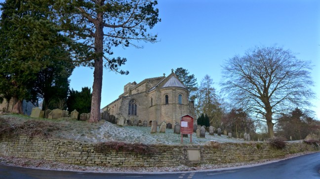 As well as three Holy Wells dedicated to St Cedd, St Chad and St Ovin, there is a plaque in the village to John Jackson RA who was born in the village and lived from 31 May 1778 to 1 June 1831. He became a notable portrait painter, even painting the Duke of Wellington and the explorer John Franklin.
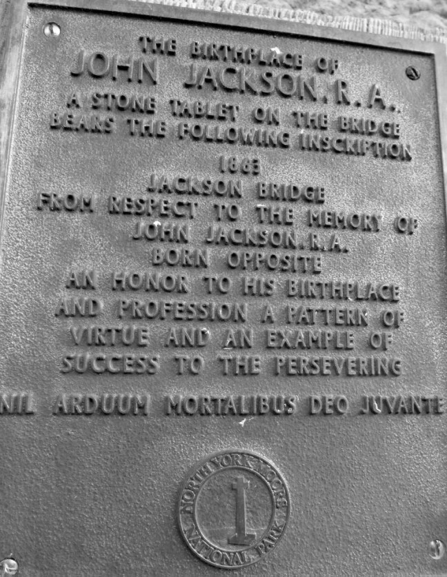 Here is Carol half expecting a famous painter to come along to paint her portrait. I took a photograph – what more could she expect in this cold!
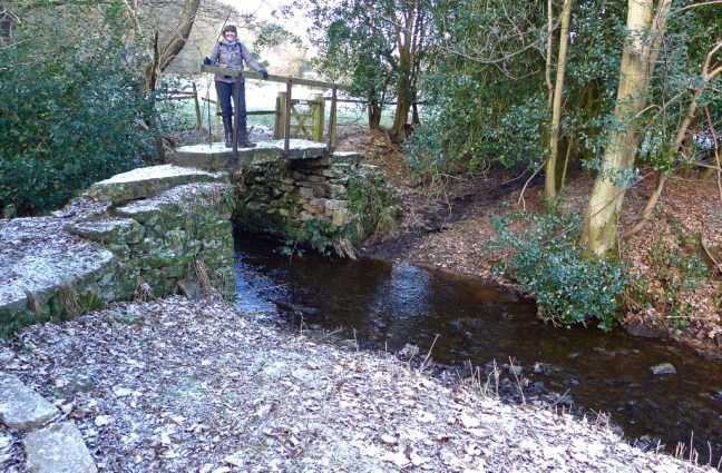
 At Appleton Mill Farm we crossed the bridge which is designed to take horses.
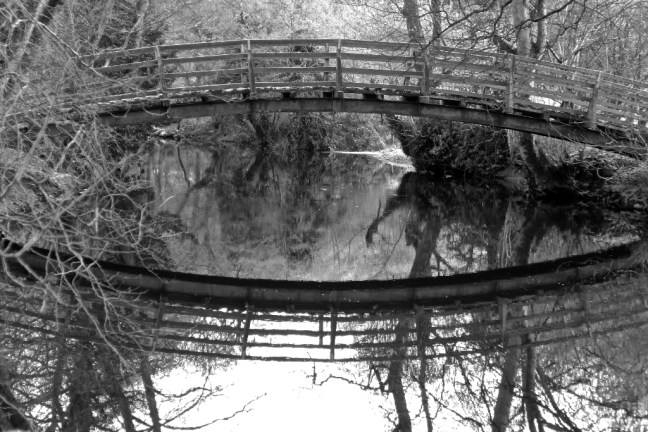 We now left The Inn Way on a circuitous route back to the car. Winter offers new opportunities for photography.
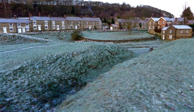
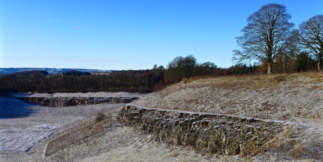
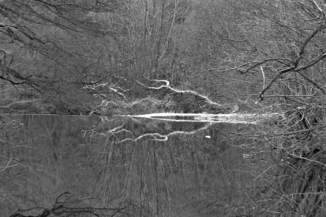 After Appleton-le-Moors we came across the large disused Spaunton Limestone Quarry, which may be developed as a holiday complex. It is certainly well situated, relatively hidden and would re-vitalise the nearby village.
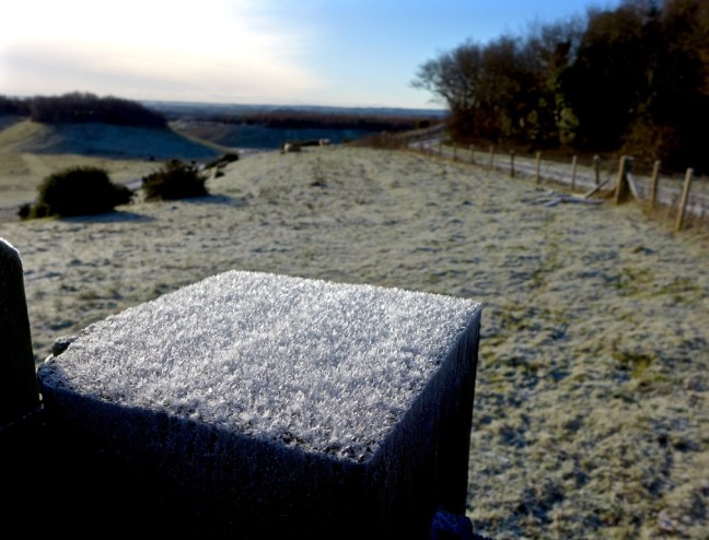
 We found an al-fresco lunch stop alongside an old barn, Lingmoor. It was in the sun and provided shelter from the wind. It was a bit like a storage heater as some warmth from the sun reflected back off the building. Carol and Steve chose the floor and I chose a stone trough to sit on. Such luxuries. A helper for the shoot, which seemed to be following us around, was surprised to walk to the back of the barn and see us there.
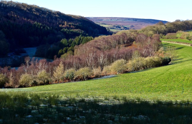
 A steep climb to Cockshot Plantation, Back of Parks Road , a B.O.A.T (Byway open to all traffic) and footpath led to Gillamoor, where we felt we had earned a 5 minute break on an icy bench. A bench, even if icy, is a real luxury on such walks. The view was splendid.
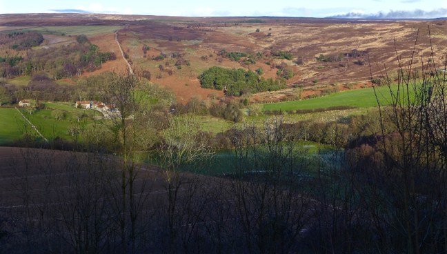
 Descending from Gillamoor we came across the only other walker ‘mad’ (as some people would think) enough to be out in the cold. Whereas we weren’t mad as our winter gear kept us as warm as toast and we had maps with us, he didn’t appear to have a map and seemed unsure of his route and whereabouts. Sid pointed him in the right direction back to Kirbymoorside, from whence he had walked.
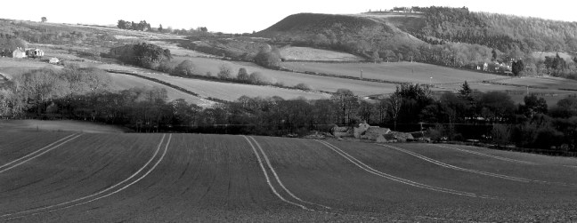 It was not a day not to know where you were going. A bit nippy.
 In the evening I went to the cinema with my my wife Celia to see a preview of the new documentary film Mountain. Simply breathtaking filming, journeys, scenery, adrenaline pumping activities, and hair raising adventures.