Post 223: 5 January 2018, The Inn Way, Beck Hole to Glaisdale Station.
A major panic arose just before writing this blog as I couldn’t find my map and guide book used on the walk. I telephoned my walking mates thinking I had left them in their car or one had taken them by mistake, but got a negative response. Disaster – had I left them back at the end of the walk?
I searched my rucksack and boot bag again, the study and in various other places around the house without success.
Then I noticed my wife’s coat on the stairs. Sure enough the maps were hidden under her coat. However, she said my coat was on the maps too. However, I pointed out that my body warmer still revealed the maps and I would have spotted them. The evidence is a here:


Had the need to find the map and guide been urgent for an imminent walk, it would have been grounds for divorce!
For the first time in 5 walks there was no need to debate whether to wear microspikes as heavy overnight rain meant that the ‘Ice Age’ on the North York Moors was over (for now).
After driving through rain and fog we arrived at the picturesque village of Beck Hole. We immediately saw a sign which meant we could be in for a confusing navigation day.
 We crossed over Eller Beck, which becomes Murk Esk at the confluence with West Beck. Are you confused already?


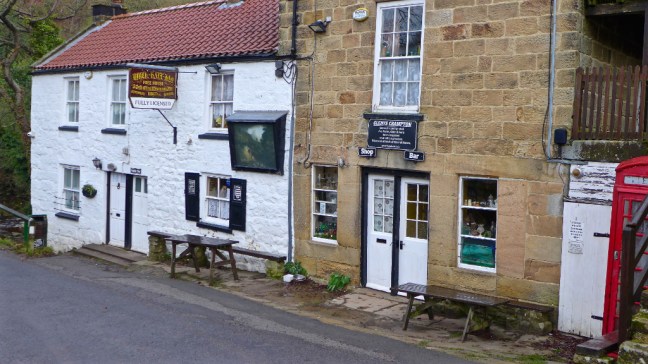
We then passed Birch Hall Inn
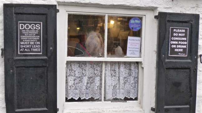
 With an interesting sign on the door and with a dog barking at us from inside the window to prove the point!
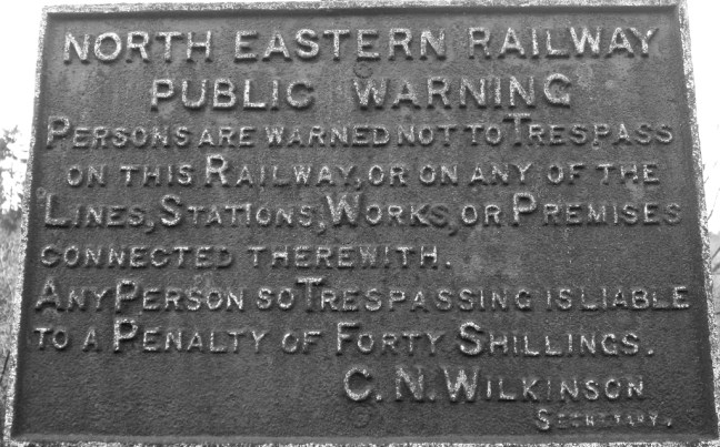
Leaving Beck Hole to join the dismantled railway line (the trackbed of the original Stephenson’s line) there was another interesting sign. There are indeed two waterfalls nearby at Thomason Foss and Mallyn Spout (see previous blog). To this day it is still a fine area for both short and long walks.
 After a diversion along a signed Grosmont Rail Trail, we then left the old line to ascend steeply from where there we fine and extensive views, including in the distance Egton Manor.

 Descending to Egton Bridge, Sid the Yorkshireman decided to do some community work (he does litter collection in his home village) encouraging branches blocking the path on their way. At this rate he will be expecting us to put him forward for an MBE. Not that we could use the path due to the flooded river!
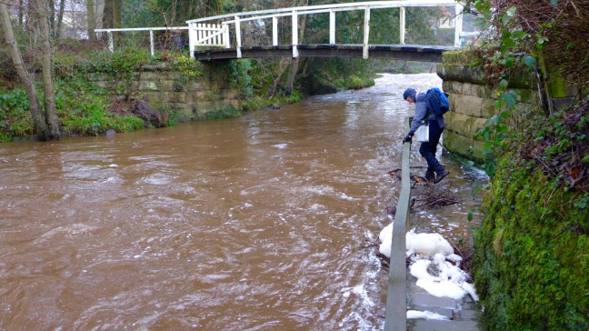 Always keen to cross rivers on stepping stones, Sid the Yorkshireman looked forlornly towards the stepping stones under water beyond the private bridge. .
 Another steep muddy ascent led to some rocks which made a a great coffee and banana break spot with extensive views. I remarked that it was much better than Costa or Starbucks or the multitude of other coffee shops in York. Although Alf wasn’t too pleased when he found his mat was not waterproof and he had a damp bottom!
 There was some tricky navigating on new paths for us. One of the reasons we like doing long distance walking projects is that we find paths we haven’t done before.
 We reached Arncliffe Woods, which is on the route of Alfred Wainwright’s Coast to Coast Walk. We then descended to the delightful River Esk.
 After passing the Arncliff Arms , which I stopped at when completing AW’s Coast to Coast route in 1991, we descended to Glaisdale Railway Station, which had been salted for ice (hmm..?) and had an automatic announcement which advised repeatedly of the forthcoming rail strike.

By the time we left we could have been suffering from deafness and migraines by the constant announcements. However, there was the delightful Beggar’s Bridge to sooth our irritations. Wainwright drew the bridge from almost the same spot prior to the publication of his book in 1973, some 45 years earlier. It is estimated that tens of thousands have walked it each year since, making it one of the most popular long distance walks. It has been rated the second best walk in the world. Wainwright said:
‘I want to encourage in others the ambition to devise with the aid of maps their pwn cross-country marathons and not be merely followers of other people’s routes: there is no end to the possibilities for originality and initiative’
He succeeded in my case and my own coast to coast, The North of England Way, was published in 1997.
Interestingly, the only other walkers we were to meet all day were in Arncliffe Woods on AW’s route.
 Wainwright’s route continues to attract walkers and indeed in May I will be picking some friends’ luggage up at Glaisdale and picking them up at Robin Hood’s Bay the end of the walk.
Here we left The Inn Way to make our own way back to Beck Hole and the car.
We came across something in hibernation at the bottom of a tree. We didn’t dare disturb it or them so will never know whether it was a fairy, hobbit, elf or something else……….
 Another tiring ascent followed, but there were lovely views back.

 A steep descent led to the old miner’s cottages at Esk Valley.
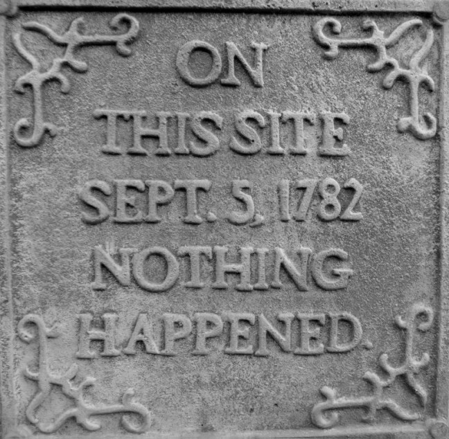
 Following the dismantled railway line back to Beck Hole we found some more signs! A day of signs.
Miles Walked 11.8
Steps 25,000
Calories Burnt 3,300
