Post 258: 14 May 2018 Bavarian Sculpture Garden, Walk around Elbach
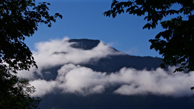
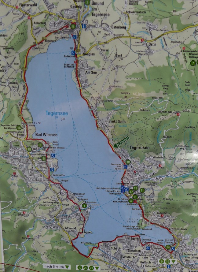
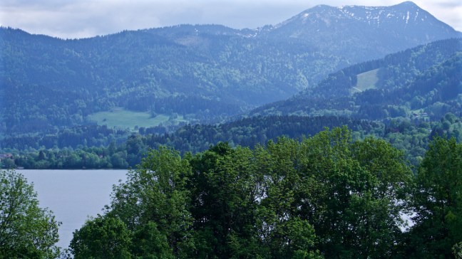
After the previous fantastic day visiting The Eagle’s Nest and Salzburg, I was on a high and woke fairly early before 6am. I was determined to make the best of the remaining time of my holiday and not miss any opportunities. I looked out of the bedroom window and I sensed it could be a good dawn and also I wanted to photograph some sculptures I had previously seen nearby. I headed to Lake Tegernsee which was within easy walking distance. The mist was up over the mountains and valleys hereabouts, which I love because each time it is seen, it is unique and transitory.


 I then reached the sculpture garden set against an awesome backdrop:


They are by:

Translated it reads:
Please do not touch any sculptures.
Parents are liable for their children!”
I wondered how long they would last in England without them being damaged?
I ws enthralled with them and continued to find new angles locations, backgrounds and positions in order to photograph them. It took about an hour and a half and I was starting to get cold!


Some sculptor!


My focus then returned to the lake and surrounding area. Beautiful.


 The town of Rottach-Egern could be seen below me. Painters, writers and composers used to flock here to be inspired by the vibrant, buzzing and cultural life of Rottach-Egern. I have written books and blogs, I paint and draw a little, but I fall down on the composing criteria!
Visitors from all over the world come to the promenade, Seestrasse, where they appreciate the lively and exclusive atmosphere around Malerwinkel, the hotspot of Rottach-Egern. It is even rumoured that some German national team footballers live in the area around the lake, former Russian leaders and other notable people and that Liverpool FC stay here.
I felt like I had won the lottery just to be able to spend 10 days in this area through the kindness of Victoria and her family. 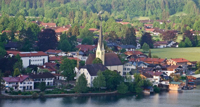 Now who could live in a house/castle like that?
  It was now time to return to my flat as I was on porridge duty and Victoria would be awakening soon. I would not be popular if I was late as she had a walk planned. Microwaves are ‘in short supply’ here and I would be using the traditional method of cooking in a saucepan with lots of stirring. Porridge with cinnamon and blueberries is essential for walks!
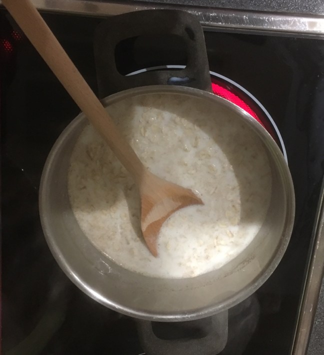
 We started the walk at the church in Elbach, which all I can say is somewhere in Bavaria!
 Victoria seemed to know where she was and where she was going (without a map – a cardinal sin in Yorkshire and a guarantee to get lost) but there are excellent signs indicating where to go and how far it would take. I got a bit worried when I saw Durham was on the sign and it had no indication how far or how long it would take to get there. I estimated that as I had come from York it would take about a day with flights and trains to get to Durham!
  It was a warm day and Victoria accosted my rucksack to put some of her belongings in as she hadn’t brought one. Wear the old ones out first I say! She knew she had been such a good guide that she could get away with anything now………
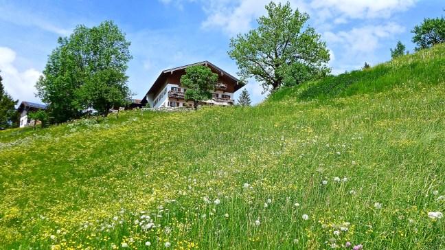
 We soon came across some lovely flowers and hay meadows.
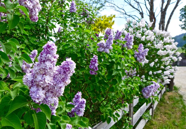
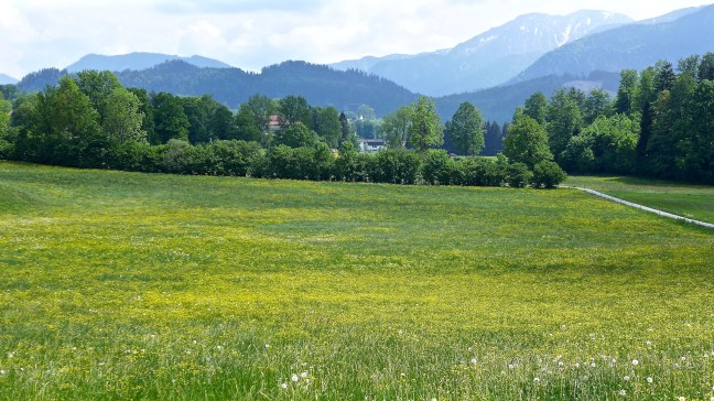
 It was lovely, peaceful, rolling countryside far from the madding crowds.
  The calmness was interrupted when we stopped for lunch and I discovered Victoria had packed, amongst other things, what seemed to paper for lunch! At least they provide plenty of benches to sit on and bins for rubbish.
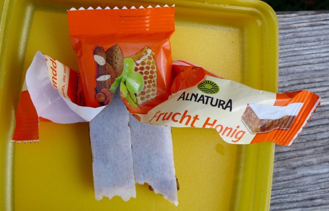
 We then came across a point to soak our feet, but we had passed it before Victoria explained its purpose. You don’t get that on the North York Moors – just bogs!
  There was suddenly an overpowering smell and I thought Victoria must have forgot to have a shower that morning. It turned out that the farmers had been putting manure on the fields.
 The scenery and clear paths were a delight.
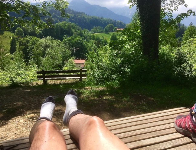
  Things got even better when we found the ultimate bench. Note the quick change into shorts as it got warmer. I could have stayed here forever. Again it beats a little mat on the North York Moors!
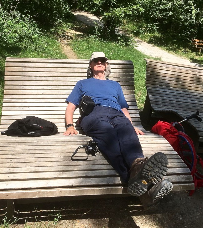
 But an ornate chapel and church, Wallfahrtskapelle Birkenstein at Fischbachau-Birkenstein, beckoned.
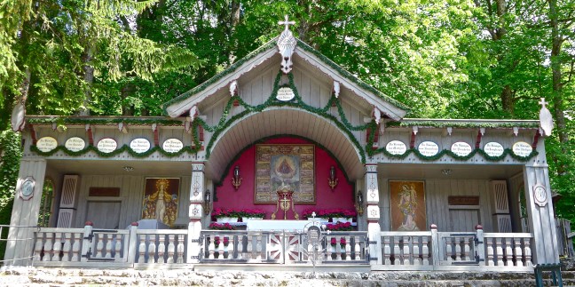
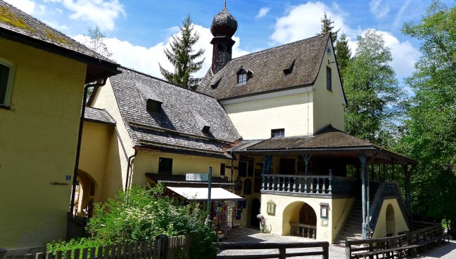
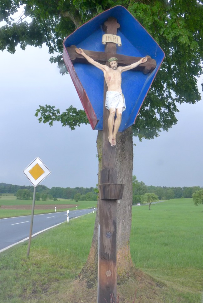
 It is off the tourist track and there is little information in English, in guide books or at the site. There is a Calvary scene with three crosses on the hill near the church. The church has an outdoors section and the main church is on the second story. No photographs are allowed. Downstairs there is a shop and another small chapel. Inside there are candles and a tomb with a statue of a male laid out on top.
A fascinating place off the beaten track.
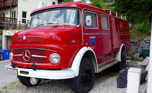
Leaving the church we somehow managed to pass a highly recommended cafe (too soon after lunch) and passed an old fire engine. 
 We were soon back in open peaceful countryside.

 Soon the church we started from came into view indicating the end of the walk with some maps on noticeboards!
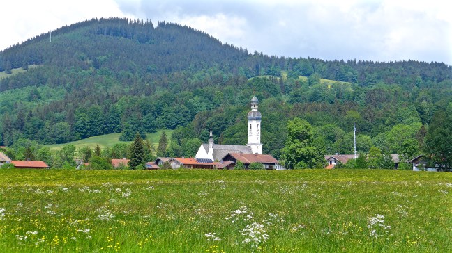


A delightful walk away from the busier areas of Bavaria. Another gem by my guide.
I got a little confused here but I think Pretzels and homemade egg liquor cake appeared on our return to the flat.


Miles Walked 9


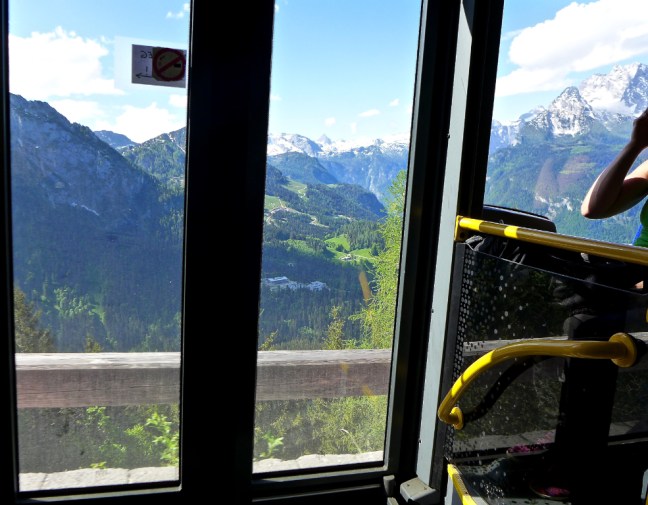


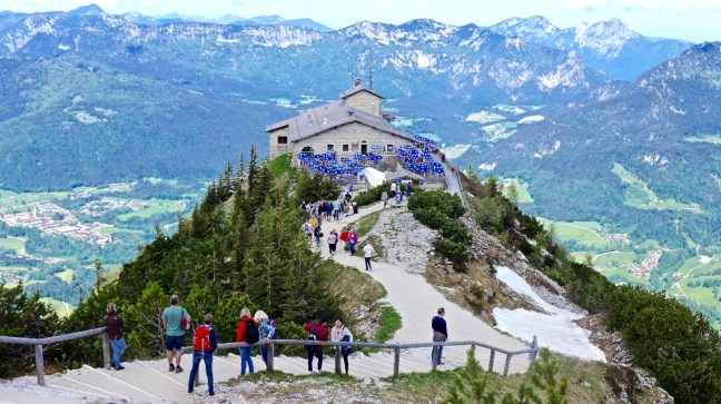
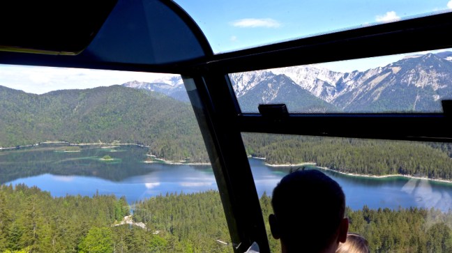
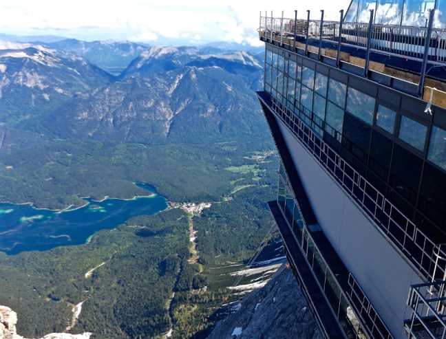
 We emerged onto the top with fabulous 360 degree views. Lake Konigssee can be seen below and just to its right Germany’s second highest mountain Wartzman at 8900 feet(2713 metres)


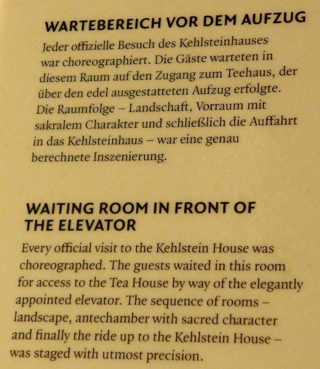
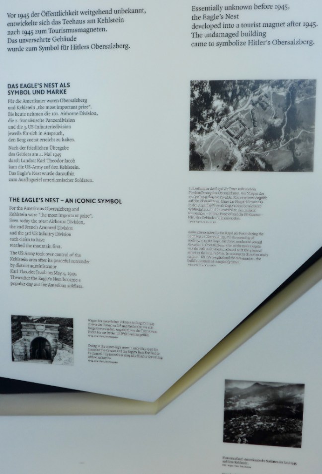
 There was then time in bright warm sunshine to explore The Eagle’s Nest with snow still about.


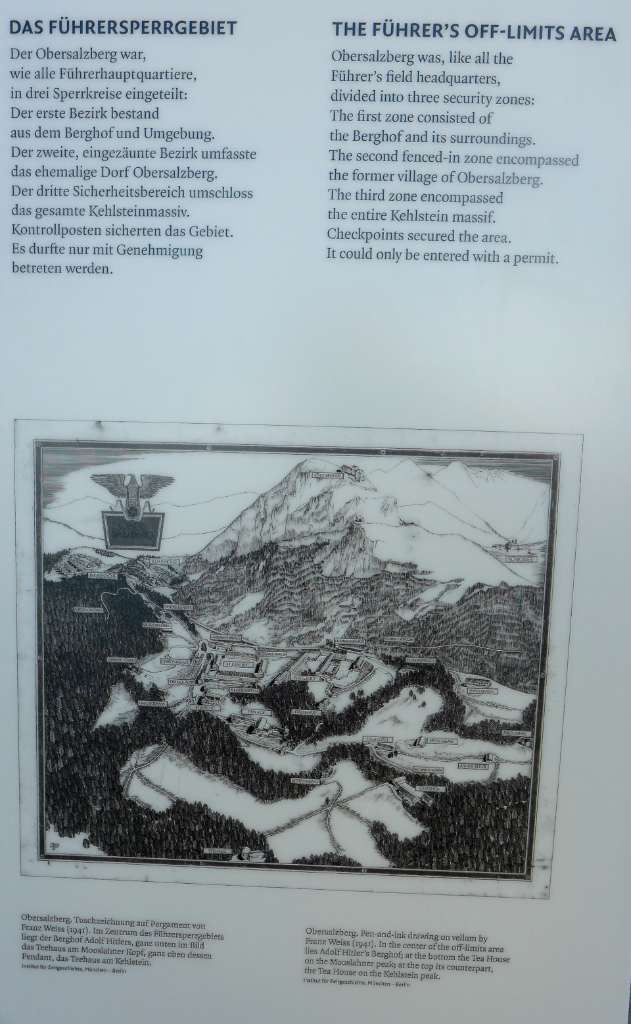
 There are some photographs and information about The Eagle’s Nest in the restaurant building.
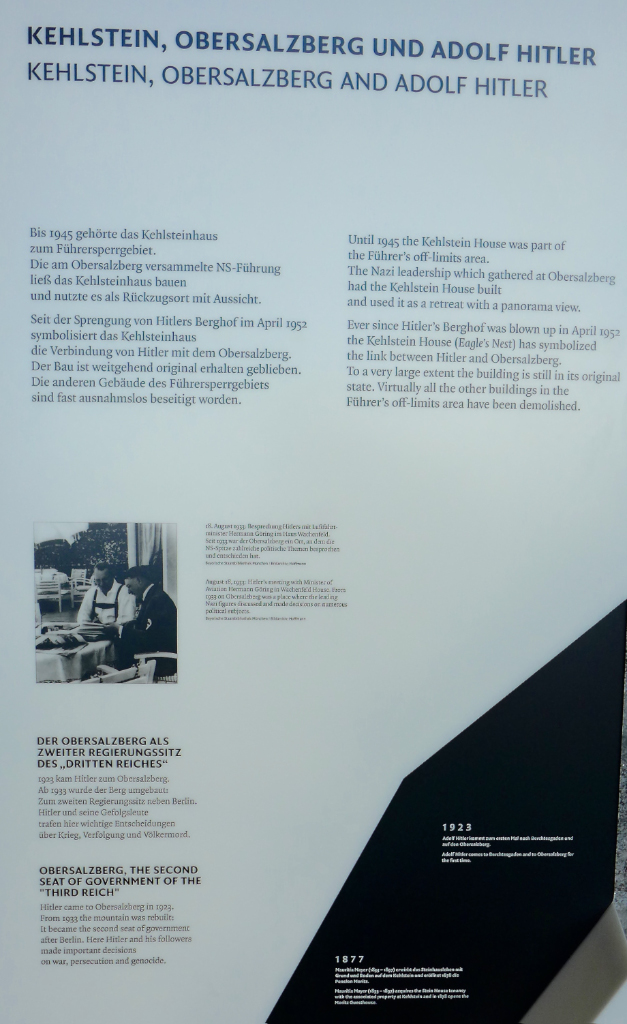


 As Hitler was no longer about I decided to have a cup of coffee and cake to celebrate (any excuse). It always comes with cream in Bavaria.
 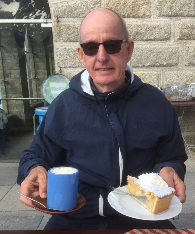 Shortly afterwards we had our packed lunch with this view!
 I was definitely feeling light headed through the altitude and we decided to descend on the bus with yet more fine views. My ambitions to climb Everest are on hold!


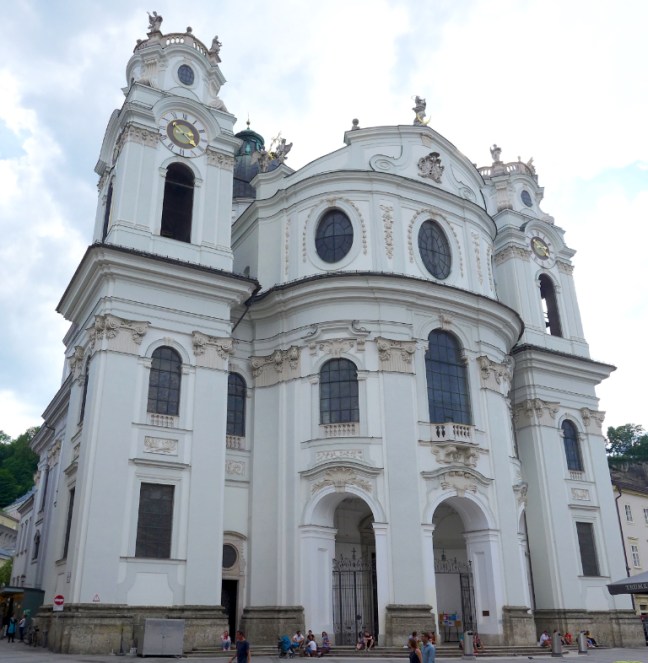
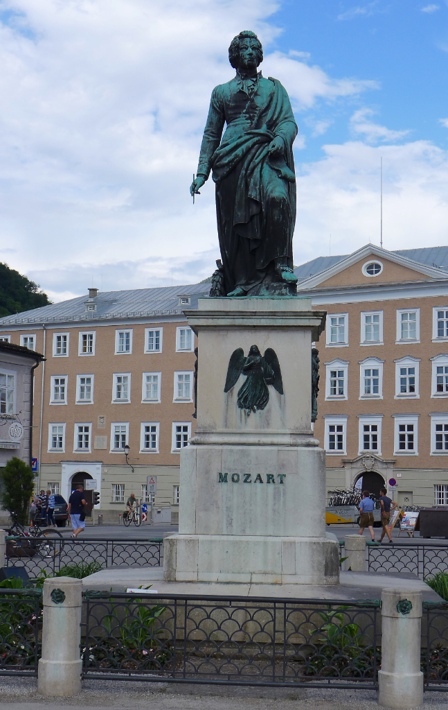
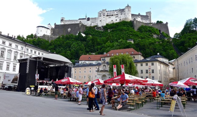
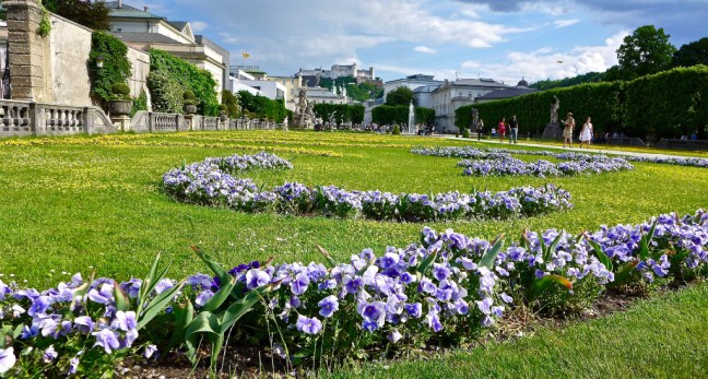
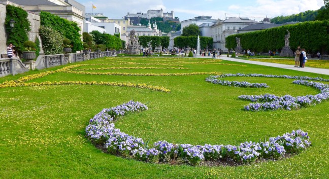
 Victoria then broke the news that we had time to head for Austria and Salzburg!!!! She had warned me to take my passport as there are occasional checks since the migration issues. The thought of ending up as an illegal entrant whilst on holiday concentrated the mind. We arrived in Salzburg at 4.15pm.
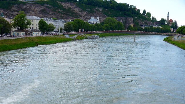

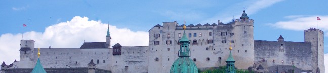

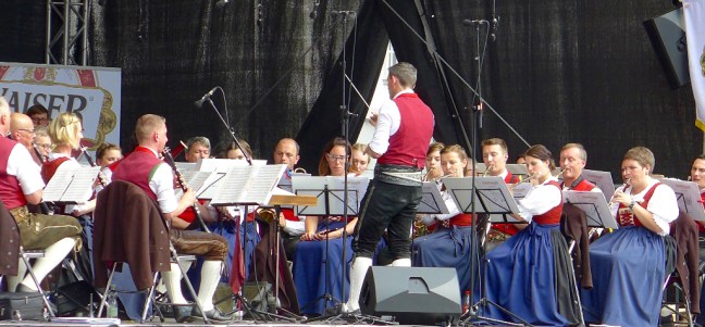
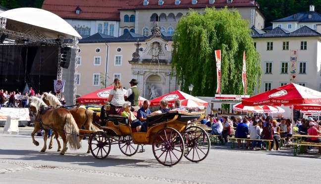
 In front of the castle we found a bench to listen to a concert in warming sun. It was very atmospheric with horses passing by. What a finish to the day!
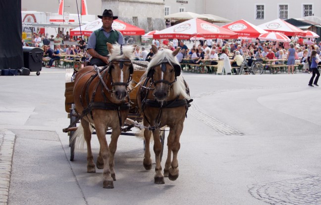
 I could have lingered there for hours but we had a long journey back to Tegernsee and I started to think of food. I asked Victoria if she knew of any restaurants she could recommend on the way back. Needless to say she came up with the goods! We found a picturesque walk back to the car.

 It was a fabulous choice of restaurant in the middle of nowhere and of course I had to have traditional soup, wiener schnitzel (breaded veal cutlet) followed by pancakes and ice-cream. Not forgetting the beer of course. Victoria is very cheap to run as unlike me she rarely has a pudding. It was she who said I am not allowed to diet in Bavaria! I would never be able to find the restaurant again.


 A fabulous end to a fabulous day.
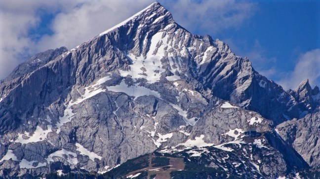
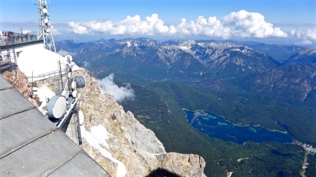
  The location where Victoria left the flowers had amazing views of the Alpspitze mountain at 2628 metres (8,622 feet).
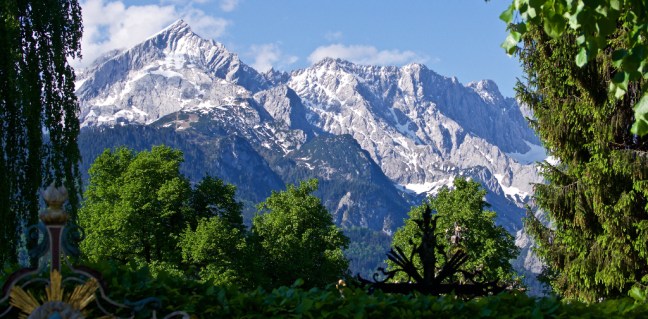

 We passed through Garmisch -Partenkirchen,
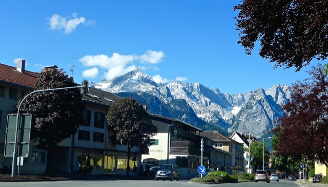 which became known around the world when the Winter Olympics were held there in 1936. There was still relatively little traffic at just before 10.00am on a Saturday.


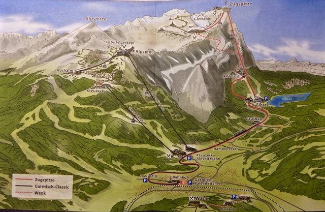

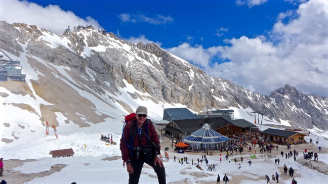
 Each car holds up to 150 people. Cosy!
 Having beaten the crowds that would later appear later we were soon off – only 10 minutes to the top.
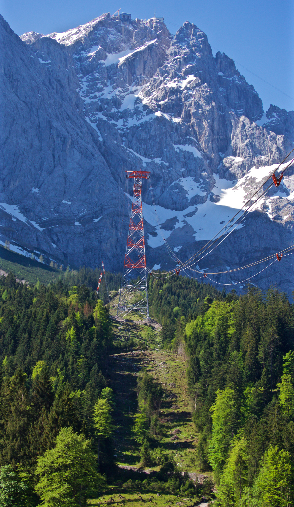
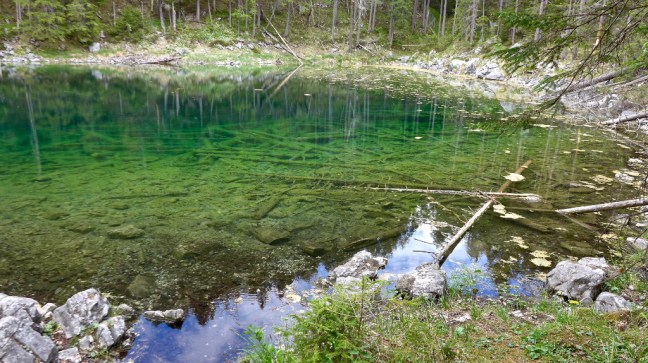
 The views of Lake Eibsee (the green lake) were stunning.
 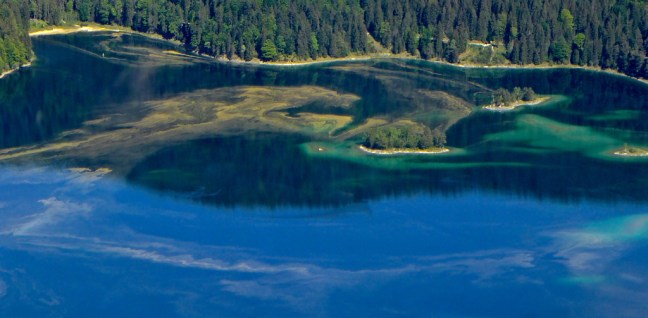 The views either side and up were also breathtaking. Going over the huge single tower caused some wobble and I had to grab onto a support.
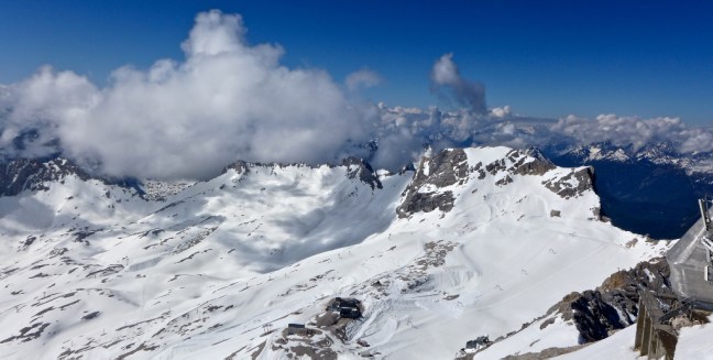


 At some point we went for a coffee in the cafe/restuarant. Children were playing in the snow and people were having photos taken on the summit, which was starting to get enveloped in mist.
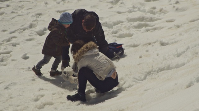


 I was glad to be descending as I was starting to feel light headed due to altitude sickness – the first time in my life. Or was it due to the beer and gin and tonic the night before?


 The day was not over and we headed to the village of Mittenwald, which used to have a trade route from Italy passing through it since Roman times. It is surrounded by the Karwendal range of mountains which is part of the northern, calcareous Alps. It consists of several chains of mountains characterised by precipitous, steeply soaring, bare rock walls and peaks most of which reach a height between 2,000 and 2,800 metres ( 6562 and 9183 feet).


 Every perspective seemed to be quite photogenic. It was an early start at just before 7.30am but worth it.


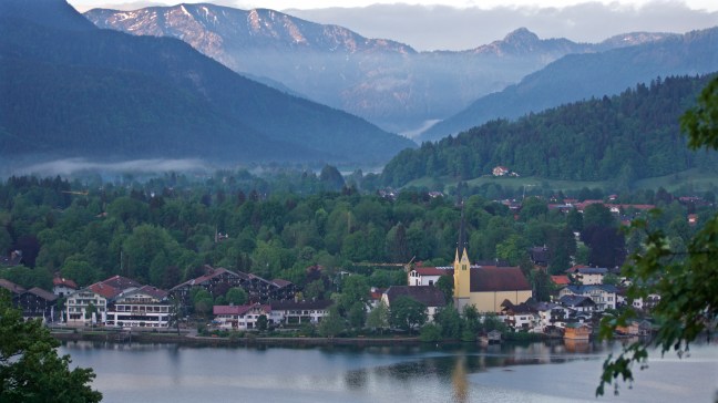
 I then went back to my flat to have breakfast before returning to walk to the town. The first settlement to be founded in the valley was a Benedictine monastery near Tegernsee , established in the 8th century.


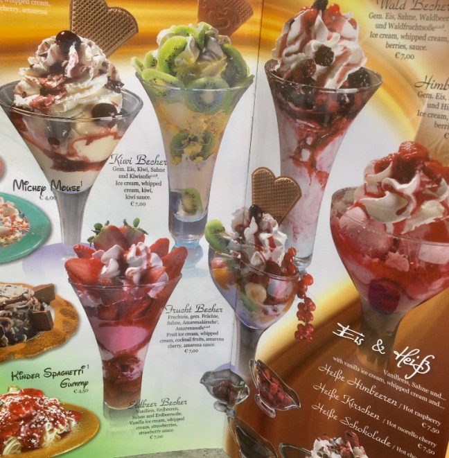
 Ice-cream is very tasty here too!


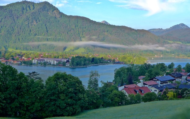
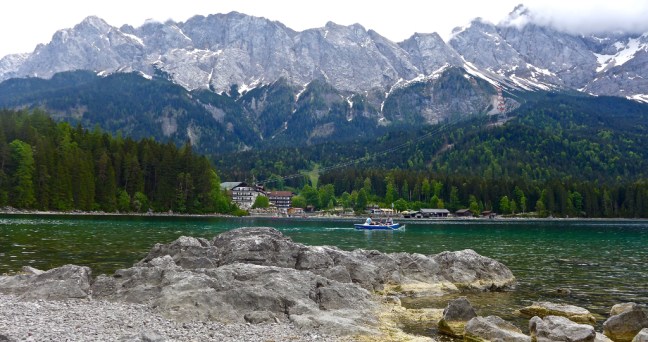
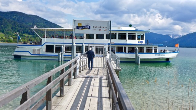
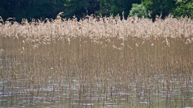
 There are boat trips on the lake.
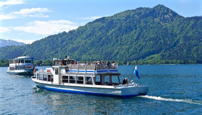 Birds and fish are in abundance in and around the lake


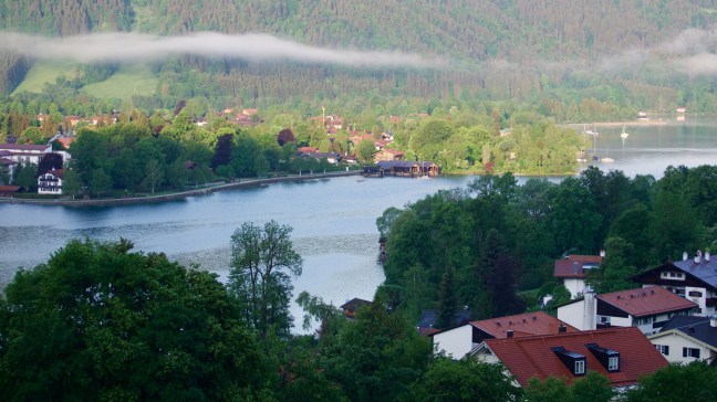
 There are also lots of benches. It was now warm enough for shorts.
 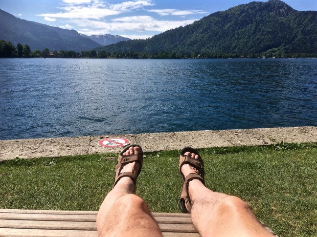 Tergensee reminds me of Keswick and Derwentwater, but on steroids!
 We then headed out to the nearby Krueth area, starting a walk at Wildbad Kreuth. It is not as bad as it sounds as bad means bath.
  We passed some buildings which used to be a bath house but is now used for occasional meetings of the Christian Social Union of Bavaria.
 We diverted to the memorial to King Max I. Joseph
 We then had a delightful walk to a waterfall, even though occasionally getting wet feet crossing a stream as I only had trainers on (whose idea was that?), not my waterproof boots.


 A delightful walk well guided by Victoria.
  But first I had to get there and on driving to York station my first problem arose – geese! They were blocking the road until a caring drunk came along and moved them on. It is not only Bavarians that can drink beer. This chap must have been drinking until 5 o’clock in the morning.
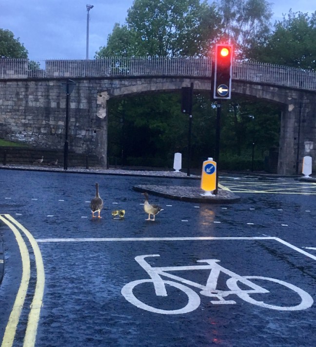 It was a good job I had allowed plenty of spare time to get to the station. At least my train arrived on time at 5.55am.
 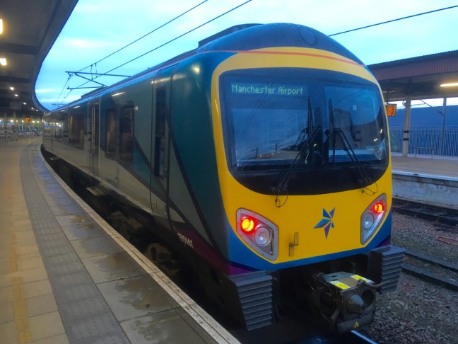 I arrived at Manchester Airport at 7.40am but my flight was not until 10.45am. Nothing like being early. I was determined not to miss my plane or holiday. I checked in my luggage and went through security and the security guard asked me to empty all the contents of my rucksack and take off everything but my ‘underpants’ (well that’s what it felt like). After filling 4 trays with the contents of my rucksack, 2 cameras, compeed, a first aid kit, a book or two, items of clothing (e.g. waterproof and body warmer) for the cold and wet of 6am in the morning, passport, money, travel documents, guidebook, watch, fit bit, spare glasses, mat for picnics in the countryside, etc etc. I said to him I thought I was travelling light. He smiled with one of those grins that say – right I will get this one and was not impressed. I had forgotten the golden rule of going through airport security – never joke with them.
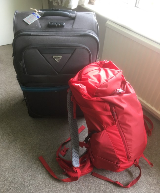 I had bought a new rucksack for the trip as I didn’t want to let the country down by taking my old rucksack, which I have used for over 28 years and was showing signs of wear and tear. I couldn’t turn up in an upper-class recreation region looking like I had just come from off the Moors.
 Eventually what looked like my plane arrived.
 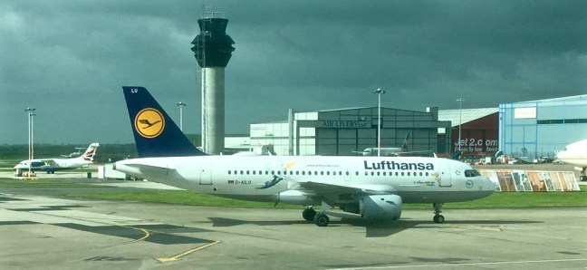 I had decided to go for extra leg room at extra cost. However, that meant I was the one that, in an emergency, had to open the emergency door and throw it out of the plane when asked! If they ask me in German I wouldn’t have clue as to what they are saying. Auf Wiedersehen Pet is my limit. ‘Goodbye Pet’ as my last words would however seem appropriate.
 I was soon up in the clouds having my neatly provided wrapped cheese sandwich and cup of tea. I now felt on holiday and about to embark on an adventure. My German walking friend and guide had already told me we could go to the top of the highest mountain in Germany when I had noticed she lived near it and I had asked if there was a cable car. I am not up to climbing up to over 9,00O feet.


 I seemed to walk miles to find my luggage (was this a new long-distance walk?). The airport cleaning bill must be massive as everywhere was spotless. I then arrived at what appeared to be a train station. Crikey I must have gone wrong somewhere? I asked a member of staff where the luggage claim place was and he said get on the train thinking another idiot has just landed!
 Next thing is which station do I get off at? Berlin, Hamburg or whatever? Fortunately there was only one station I think. When in doubt follow the crowd.
 Tegernsee was on the signs and maps. Not far now.
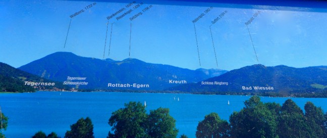
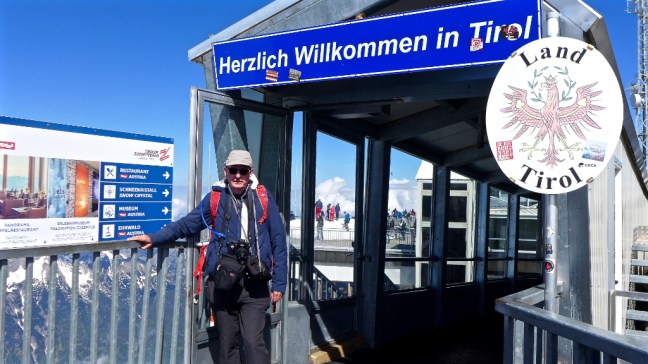
 The sun was out and the views magnificent and so it was time for some ‘holiday’ posing. I have to say that the Bavarian welcome at the airport in traditional Bavarian dress, beats me welcoming people in York in jeans or Rohan Outdoor Clothing! Perhaps I should purchase Lederhosen Breeches?
  [
[
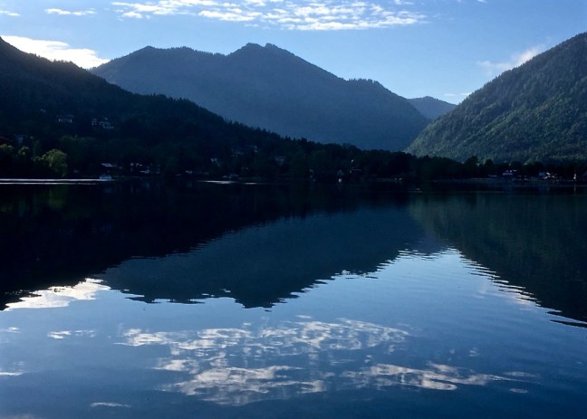
 Victoria also explained that she has her own mountain ‘Mount Fuji’ seen above and below, actually called Wallberg. She thought we could climb it during my 10 day stay. At 5650 feet (1722 metres) I smiled at her thinking ‘in your dreams’. The highest I have ever climbed is England’s highest mountain Scafell Pike at 3208 feet on the 21st October 1990. That had been tiring and I was now 28 years older. Of course I didn’t let her know of my doubts. British stiff upper lip and all that.
  There was just time to take a few more photographs as home-made strawberry cake was promised at ‘base’ in what appeared to be Arcadia. I had landed not just in Germany but on my feet in wonderland.
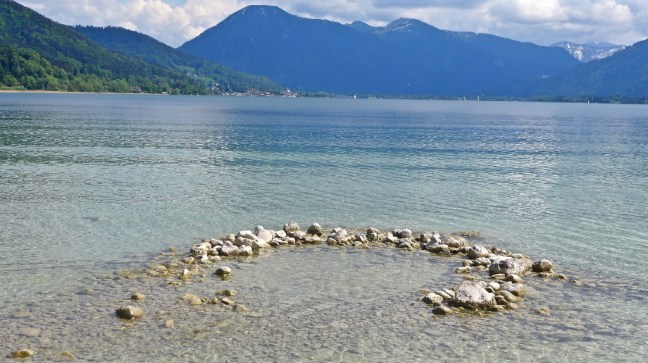
 Victoria had not finished showing me around yet and took me to see a church and the council offices in Tegernsee. When the council offices look like that you know you have arrived somewhere special.


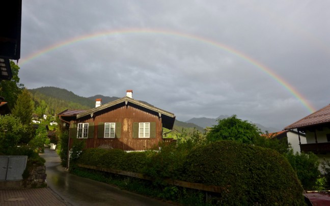
 The day came to an end with a spectacular double rainbow in front of ‘Mount Fuji”. I have only seen this phenomenon a handful of times in my life. I was in a different world and over the next days I was to find it got better and better…………………………..
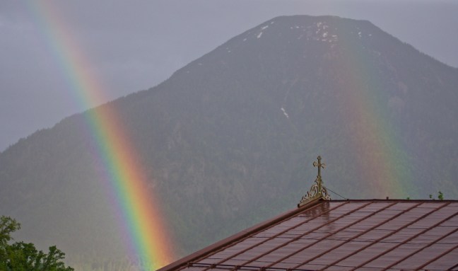
 And what does Victoria get for all this? A Yorkshire Passport and a Tour de Yorkshire hat and hand clappers.


 We hadn’t expected to meet wild boars at the start of the walk, but they were behind a fence.


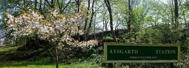
 Dragging Sid the Yorkshireman away from his ‘find’ we arrived at the former Aysgarth Station and the Freeholder’s Wood. This is a remnant of the ancient woodland that once covered Wensleydale and villagers of Carberby still have the right to gather wood; hence the name Freeholder’s Wood.
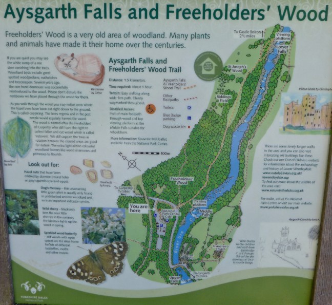

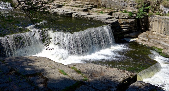
 Then it was on to the delightful world-renowned higher Aysgarth Falls on the River Ure for a superb location for our coffee and banana break next to the falls.


 Of great interest were three toilets for sale for offers in the region of £8,000. We later heard from a farmer that they they were sold for £14,000! The toilets include fishing rights. The mind boggles. Sid the Yorkshireman started to think that 20p for using toilets in the Dales was not such a bad price after all.


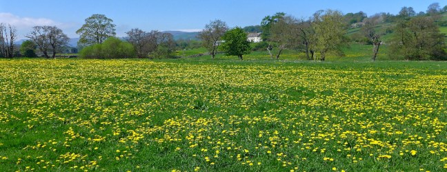 Then onto West Burton, which many say is the most beautiful in England. There are even carvings in the pavements!


 However, the best was yet to come and, as as we left the village, we came across West Burton Falls, also known as Cauldron Force, on the Walden Beck.
  This was our lunch spot and one of the best ever as we admired the fall accompanied by a grey wagtail.
  A young couple with a dog went in the water, one accidentally, and got soaked. They are just behind the trees. There are few more romantic locations and of course William Turner recognised this with his sketches.
 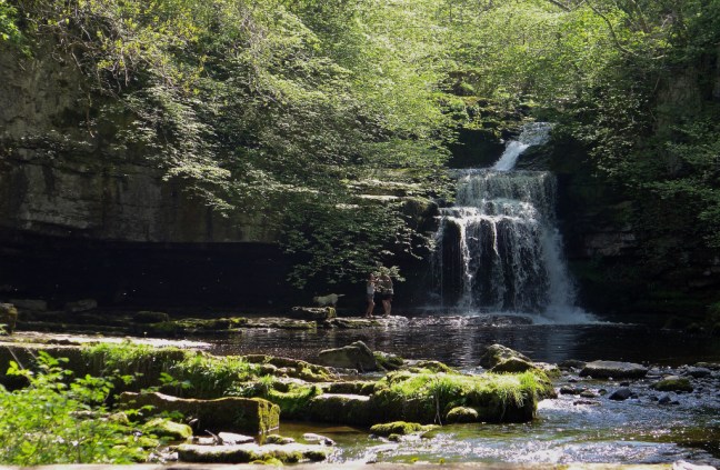 It was hard to leave such a place, leave the Inn way and find a route back to the car. The waterfalls appearance changed with the changing light, giving it a ‘chameleon’ effect.
  A family must have been so entranced by the place as they left some start-right shoes and trendy socks. Why don’t I get sock like those?! Much more fun than mine. If you know who they belong to they are still on a bench near the falls.
 In the autumn salmon swim up to the falls.


 The path brought us to Sorrelsykes Park. According to a former farmer owner we met, three folly’s on the limestone escarpment were built partly to gather up stone lying on the ground in the area. They are now listed.
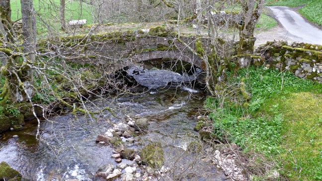
 Continuing to Egley we passed thorough more garlic adorned woods
 and crossed Hestholholme Bridge over Bishopdale Beck. Sid the Yorkshireman debated whether it was time for an early bath.
  We then came upon our third waterfalls, this time again on the River Ure.
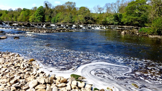
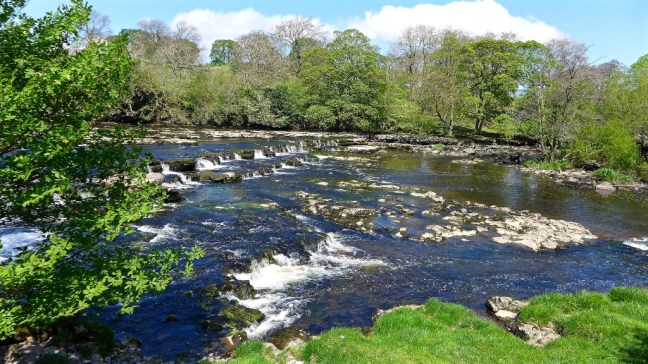 Our fourth falls were the Lower Falls.
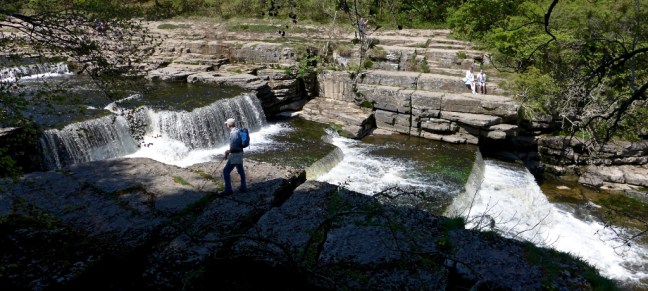
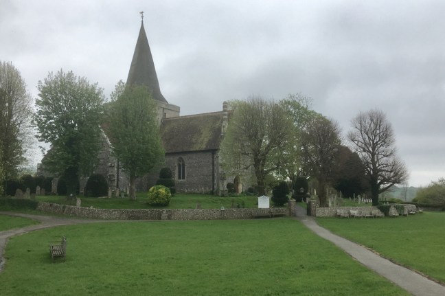
 We then went passed St Andrew’s Church again and passed the imposing Yore Mill. This mill was built in 1788 and is a fine example of an early water-power mill complex located as it is beside the strong running River Ure. The flour, cotton and woolmill was destroyed by fire and rebuilt in the 1850s. It ceased production in the 1950s.
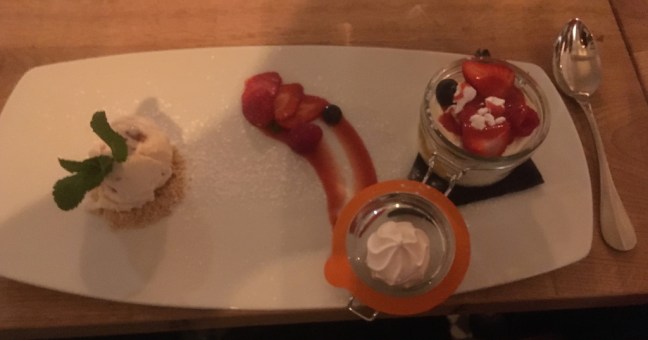
 I was looking forward to Sid the Yorkshireman’s birthday treat he had promised me from early April and instead of a pint decided to have a Yorkshire Dales ice-cream instead, until we found that the cafe had run out! He was delighted as he thought he had got away with no expense for another week.
 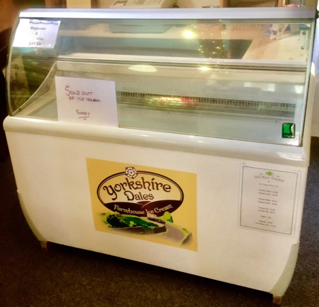 However, the Information Centre further on had some and I was not to be denied for yet another week.


 All that remained was a 3 mile walk past High Thoresby to Bolton Cattle.
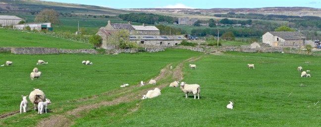
 The end of one of the best walks I have ever done.
 This is a must sought after award and includes a unique hat to be worn and hand clappers for when attending next years compelling Tour de Yorkshire cycle race.
  At the same time it was decided that Dan, who once persuaded Victoria and myself to venture into Lancashire, should not be awarded a Yorkshire Passport. It rained there on the same day it was sunny in Yorkshire, we got stuck in mud at an agricultural show and I had a fainting attack due to dehydration!

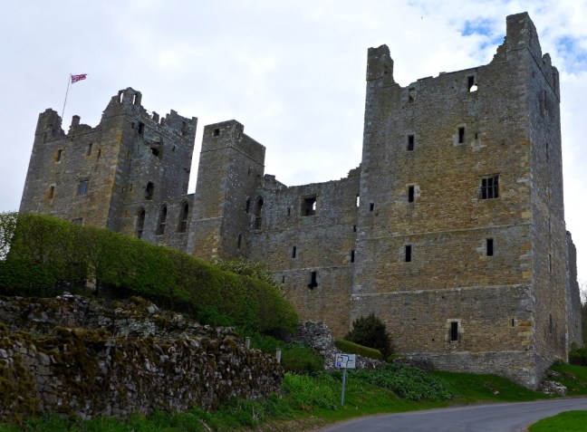
 Sid the Yorkshireman paid the £3 parking at Bolton Castle feeling quite pleased that the toilets there were free! I think he may have been ill.


 Before passing Dent’s Houses (as described on the OS map) to head off right along a path which quickly disappeared.
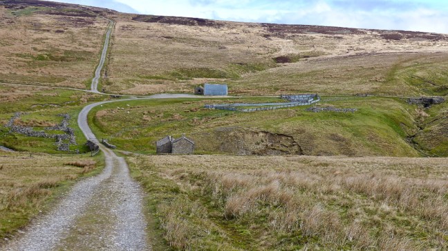 We eventually arrived at the road towards the youth hostel at Grinton Lodge.
 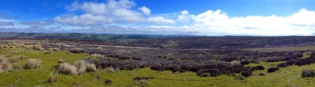 There were fine views towards our destination of Reeth.
 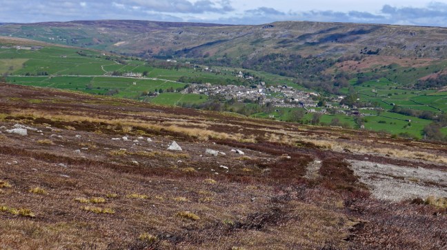 It was some years since I had stayed at Grinton Youth Hostel when snow was on the ground. On leaving the hostel, Gary’s car slid down the hill whilst I tried to get Radio 2 on his radio – he was not amused. I had warned him about going to the Dales in the middle of winter without winter tyres.


 We could have stayed there all day, but we had to get on towards Reeth (seen on the right in the distance).
 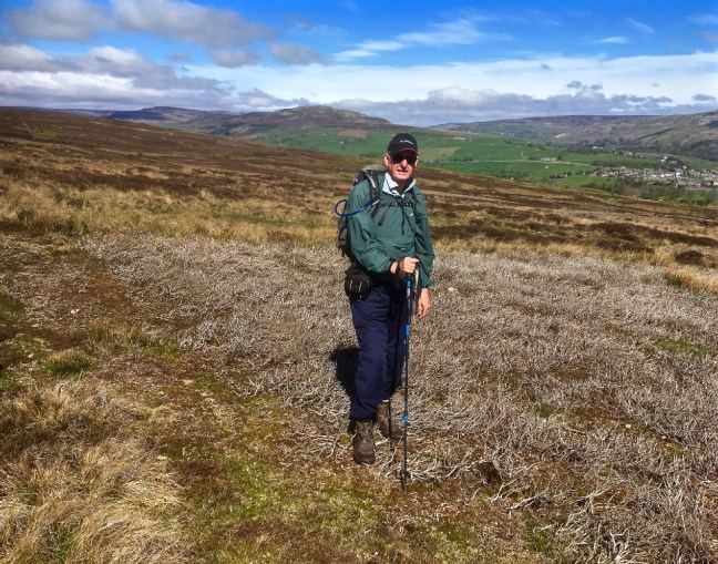 We descended to Grinton. No snow on the road this time, but the big tree is still there!
 We passed the Bridge Hotel and St Andrew’s Church

 Reeth expects residents and visitors to behave themselves!
  It was market day.


 We left the road to head across the ‘Green Land’. This photograph has not been altered in anyway! No wonder England is called ‘this green and pleasant land’ – except that in this case it is a bog!
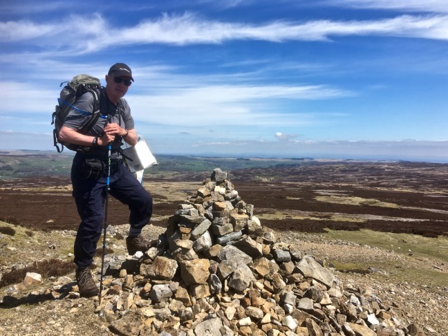
 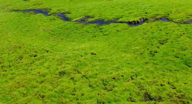 We finally reached the summit of Greet’s Hill, which forms the watershed between Swaledale and Wensleydale. We had climbed to 555 metres (1821 feet). No wonder we were tired and both propped ourselves up for the photoshoot by using our trekking poles.
 We started descending to yet more former mining areas.
  Where there was a strange looking beetle which changed colour.
 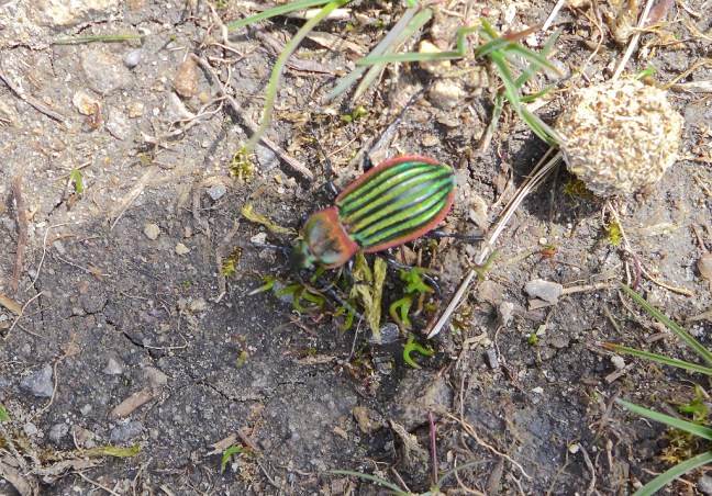 We arrived back at Dent Houses. A possible life saver in bad weather as it is left open for visitors. Sid the Yorkshireman took advantage of it in the ‘lounge’.


 I suddenly realised my spare small camera battery worth over £30 was missing from my camera bag. It must have slipped out somewhere. I walked on for about another quarter of a mile thinking it was lost and then suddenly spotted it on the grass ahead after 12 miles of walking! Miracles do happen!
 Finally, we found a dragon
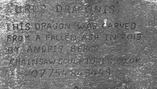 What had it got in it’s mouth? Yes someone who had dropped litter in Yorkshire!
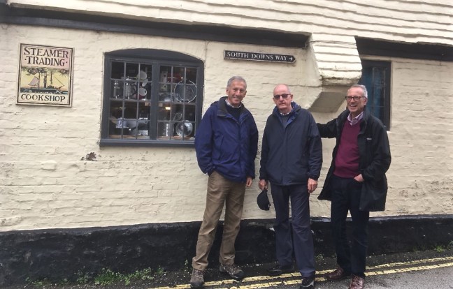
 Arriving at Vauxhall Station, I am sure MI5/6 were hoping to recruit me as the next James Bond. That’s before I had drunk some gin and tonic.
  We eventually arrived in Dorking to Alan’s super garden and, before dinner, the welcome gin and tonic.
  There were even wild parakeets and pheasants in the garden. It is normally warmer in the south compared to Yorkshire, but this weekend was to prove an exception to the rule. At times it was freezing at 5-6 degrees! I was so glad I had put a Rohan body warmer in my case.
  Saturday 28th April


 We then continued to what was Charterhouse Farm near Lewes in East Sussex.
 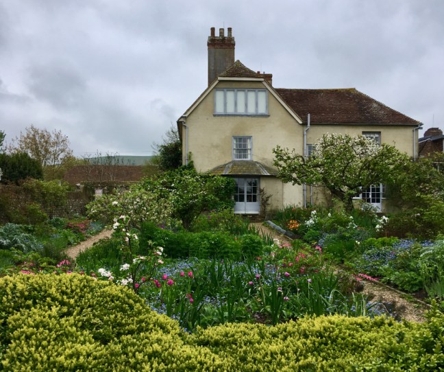 Alan had arranged a walking tour of the house, which was fascinating but no photographs were allowed. The Bloomsbury Group were associated with it and from 1916 it was the home of artists Vanessa Bell and Duncan Grant. Over the following half-century Charleston became the country meeting place of the Bloomsbury group of artists and intellectuals. Garnett, Clive Bell and Maynard Keynes lived at Charleston for considerable periods; Virginia and Leonard Woolf, E.M. Forster, Lytton Strachey and Roger Fry were frequent visitors.


 Dan nearly had a heart attack through laughter when we started talking about whether I would be wearing the Lederhosen, the German National Costume, in Bavaria. He has a vivid imagination.


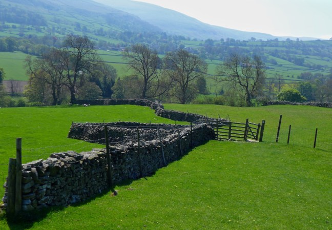
 We had to leave Reeth to head back up the valley to where we had left the Inn Way on the previous walk. It was to be a high level, circuitous, route as Sid the Yorkshireman (also known as Morley) wished to find Morley’s Folly as indicated on the OS map.
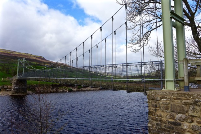
 We then climbed past Harkerside Farm to High Harker Hill.
 There were fine views along Swaledale towards Calver Hill.
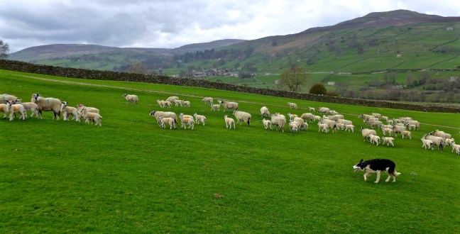
 We then entered a lead mining area and had to watch out for holes. Mining started in Roman times. The area around Reeth prospered in the 17th and 18th centuries as a centre for lead mining and hand-knitting.
  It was quite windy higher up and so we stopped behind a shooting lodge for our coffee and banana break near Blue Hill. The tracks are well maintained by the shooting fraternity.
 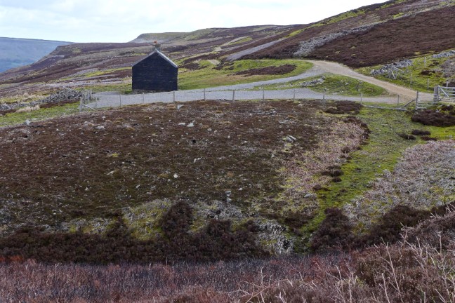 There were some dramatic shades of light.
  This was not Sid the Yorkshireman’s folly.
  We spent a good half-an-hour looking for the folly, without success, amongst a desolate former mining area.
  Dropping off the high fells we came across Sunter’s Garage Shelter which was a fabulous shelter from the wind.
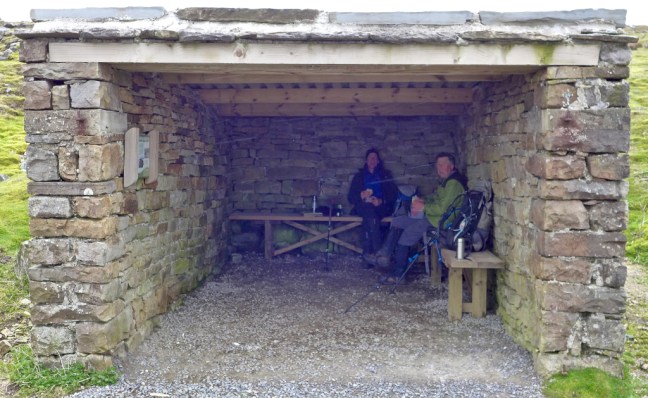
 What a lunch-time view.
  We descended past High Whitaside to the unnamed waterfall on Haverdale Beck to resume the route on the Inn Way.
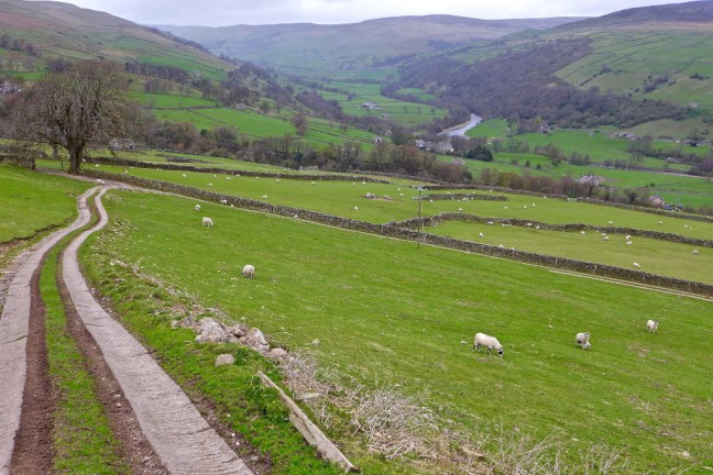

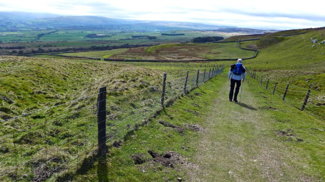
 A gradual ascent to Birks End followed.
 After a little road walking a delightful bridleway and track were followed back to Reeth.


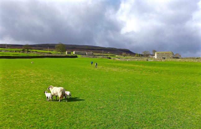
 No walkers had been passed all day until on the final path, when we made way for a large group of primary school children! They may have been heading to Maiden Castle, which we had passed. It is hidden away on Harkerside Moor. It was built during the Iron Age over 2,000 years ago by the Brigantes tribes. It is thought to have been a ceremonial or religious site.
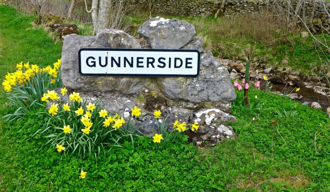
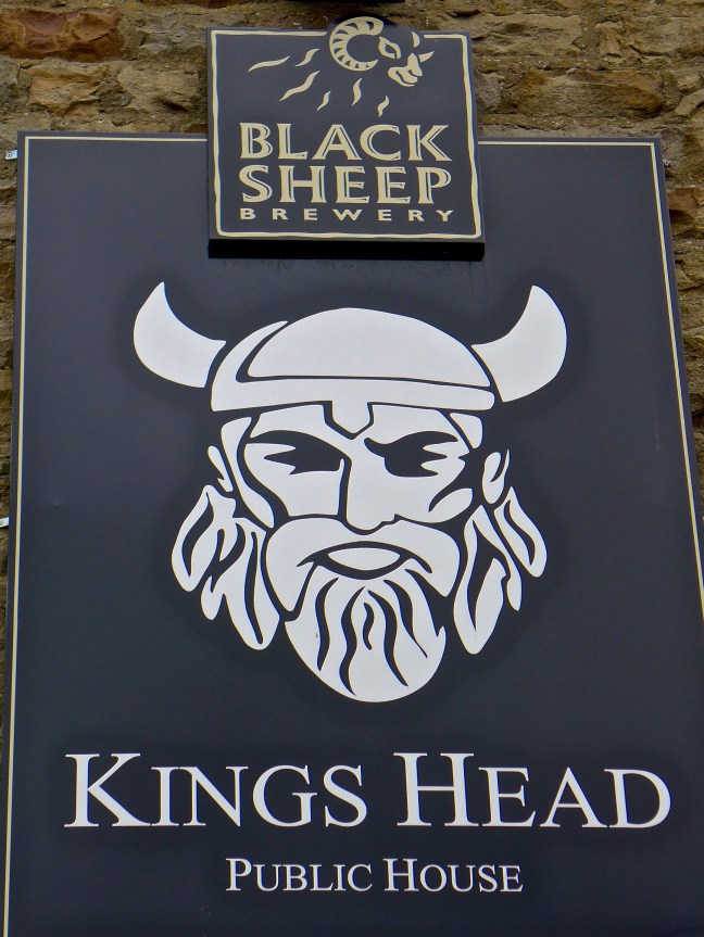 There was free parking in Gunnerside, near the Kings Head. This was a relief to Sid the Yorkshireman as we had been discussing an article in the Sunday Times, which said that parking costs the average UK driver £1815 per annum! In London owners spend £9,353 per annum. The average UK driver spends 35% more per mile than the average US motorist and 6% more than the average German. Sid the Yorkshireman brings the average down as he probably spends less than £20 per annum.
 However, we were not in search of Vikings. We were in search of the Swaledale Seal. It was last reported that having entered the Humber Estuary from the North Sea it passed through York to reach the River Swale near the A1!
  Leaving Gunnerside we had to climb to about 1500 feet at Oxnop Head to resume the Inn Way where we had last reached it in thick mist. We soon reached the River Swale which s England’s fastest flowing river. This suggested the seal would not get this far unless it had the skills of a salmon.
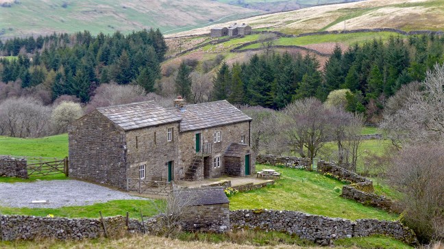
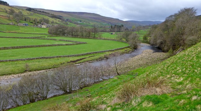 I was surprised to see this old limestone field barn with ‘door covers’. Each barn traditionally had an area for storing hay called a hay mew and a separate area of stables for wintering cows. They are less used in this way now as modern farm buildings house the cattle.
 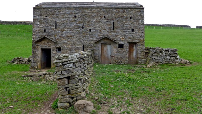 We continued along the River Swale towards the lovely shaped Ivelet Bridge
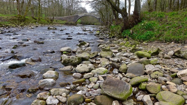
 At this point we stopped on a bench for our coffee and banana break. Sid the Yorkshireman was still upset about the 20p toilet charge (they tend to be free on the North York Moors) and, being overcome, we laid him to rest on one of the old ‘coffin’ stones expecting that he would soon be picked up by the undertaker and finally taken away.
 No such event happened and so he resumed the walk with us.
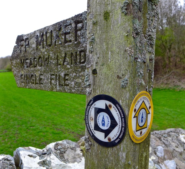 We crossed the River Swale and Oxnop Beck, noting the older bridge over Oxnop Beck was no longer in use.
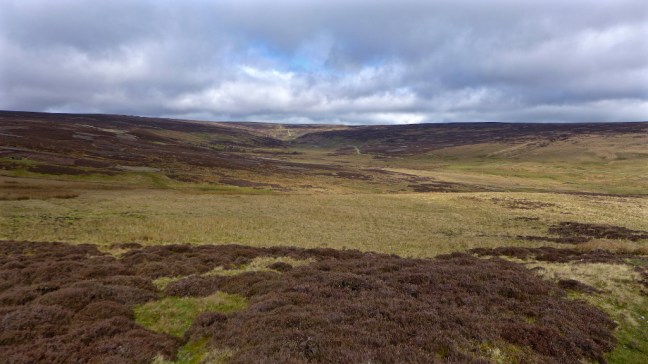
 The climb to 1650 feet (503 metres) began with a vengeance and continued for over 2 miles. However, the views, particularly back, were fabulous.
 A trap for catching maybe stouts or weasels can be seen over the stream
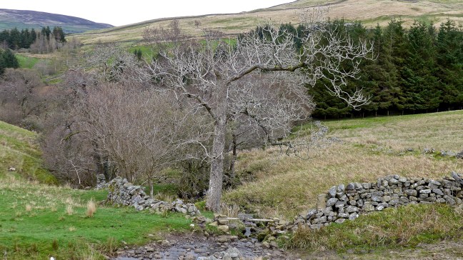
 Oxnup Gill
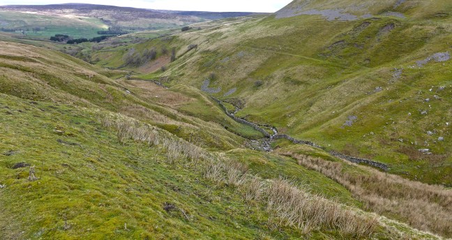 The quiet lane led up towards Oxnop Scar. It would once have been a busy, popular route for miners and passers by, sufficient to service a wayside inn called ‘Jenkin Crag’.
 The dramatic and sheer limestone cliffs of Oxnop Scar came into view.


 After passing Gill Head,
 we left the lane and descended back to Ivelet Bridge, the River Swale and Gunnerside for a lunch stop.
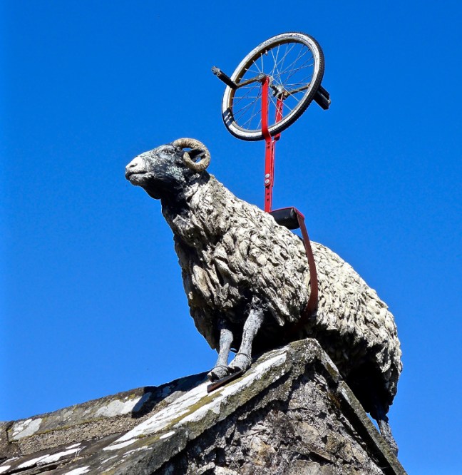
  Two cyclists were also having lunch and we discussed the prospects of the Tour de Yorkshire, which is being held between the 3 May and 6 May. Now a huge and successful annual cycling event it is one not to be missed. I and my wife, a keen cycling fan, will be attending 2 or 3 days and thousands of fans will turn out and Yorkshire can claim to be the cycling centre of the UK.
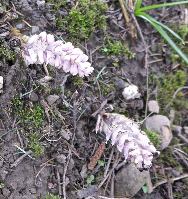 Passing a limestone kiln
 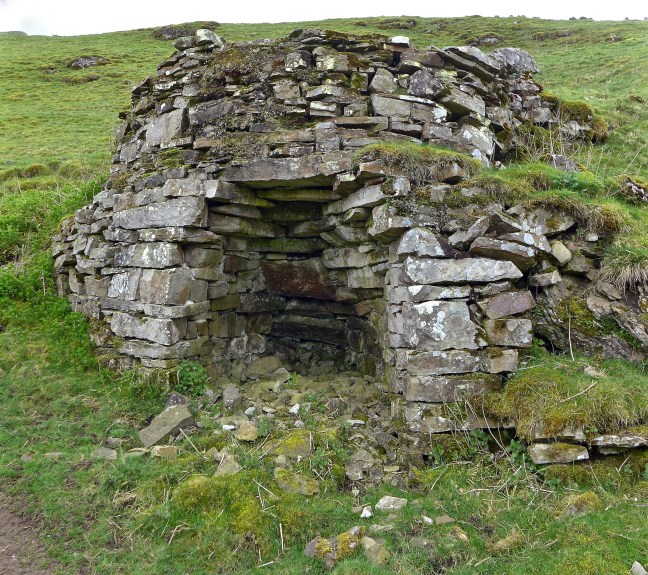 There were fine views ahead towards Reeth.
 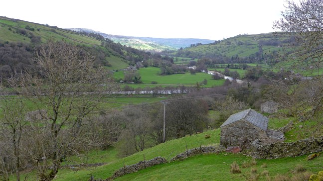 A tree that was soooooo… big it had to be hugged.
 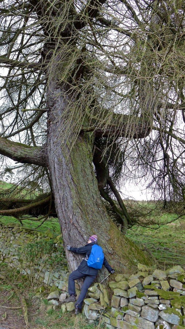 Followed by more expansive views.
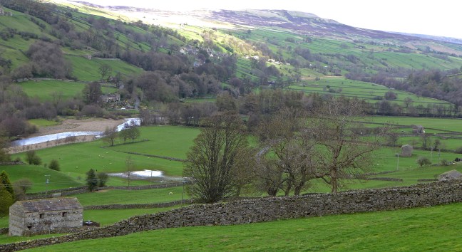 We then reached a delightful, unnamed waterfall (see video on Facebook) and then left the Inn Way,
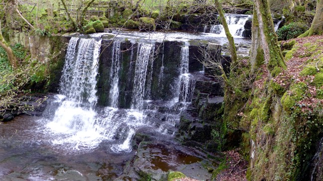 to descend to the River Swale and follow it back to Gunnerside.