Post 232: The Inn Way, 29 January 2018. The Top of The George Gap Cause (lane) to Sheriff’s Pit.
After last Mondays exhilarating but tiring walk in snowbound Rosedale we decided that we could resume The Inn Way on the North York Moors as we expected the worst of the melting snow to have gone. As an aside, I had in the meantime been reading, in the last few days, The Wainwright Letters. I was intrigued to discover that, whilst honeymooning in York in 1970 with his second wife Betty Wainwright, Alfred Wainwright went on the North York Moors for the first time.

Wainwright’s first marriage to Ruth ended with divorce on 24 June 1968. He was found guilty of mental cruelty and had to pay a lump sum of £4,000 and £500 a year to Ruth during his lifetime. It is not within the realm of this blog to go further into the reasons for the mental cruelty, but he did spend all his spare time going on the fells and writing his guide books. They did have a son.
Whilst on the North York Moors, Wainwright got the idea to devise his now famous Coast to Coast Walk and in 1973 this was published. By coincidence it was the year I got married and, despite my wife Celia having grounds for mental cruelty as I spend a fair amount of time on walks, planning walks, writing blogs and the occasional book and looking at maps, we have now been married for 44 years! I must be doing something right. In 1991 I walked Wainwright’s Coast to Coast Walk and am now on my 54th and 55th long distance walks!
We parked near the Farndale turning car park, just before the Lion Inn, Blakey. For night owls there is an opportunity to go interstellar.
 We soon dropped down to the Rosedale valley bottom as we had to pick up The Inn Way route again from where we last left off.
 What was noticeable this week was the increased sound of birds, clearly enjoying the spring like weather with temperatures much higher at 8-12 degrees. What a difference a week makes with last weeks snow all gone!!!
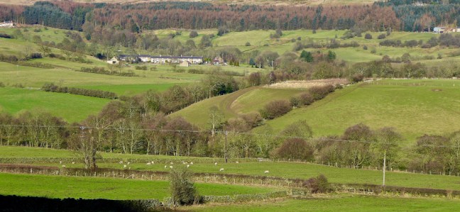
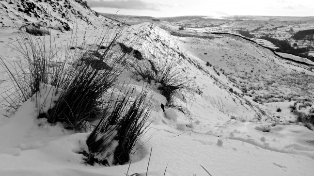
 We passed the Rosdal (Rosedale) and Whitby signpost to reach the lane at the top of The George Causeway Gap to then rejoin The Inn Way and head back down to Rosedale (known as an out and back in the trade!). It had started to rain and so we donned our waterproofs.


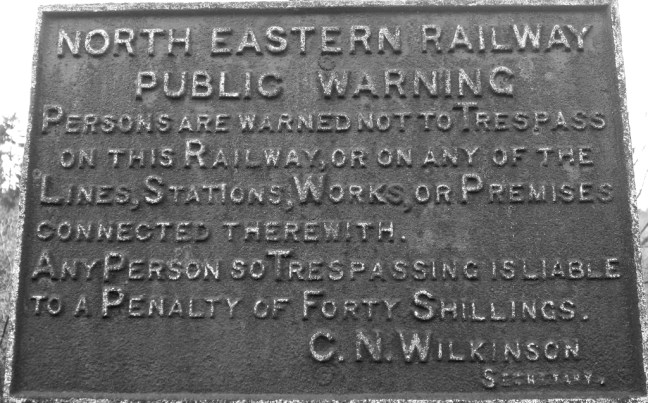
 We came across a recently cleaned out culvert, which had probably been there since the railway (now dismantled) had been built.


The place would have looked very different in the 1800s with trains crossing this embankment to service the Ironstone Industry.
 There is now a £3.8 million Land of Iron Project fund by the Heritage Lottery Fund, David Ross Foundation and many other partners. It has a vision:
History: Record, conserve and safeguard the legacy of our industrial past as it slowly melts back into the landscape.
Environment: Nurture and protect the natural world around us, helping it to flourish for many years to come.
People: Tell the stories of the people, industry and landscape that made the Land of Iron.
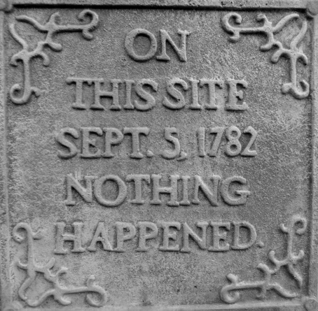
However, something else beckoned us.
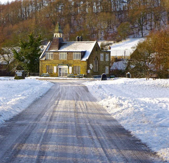
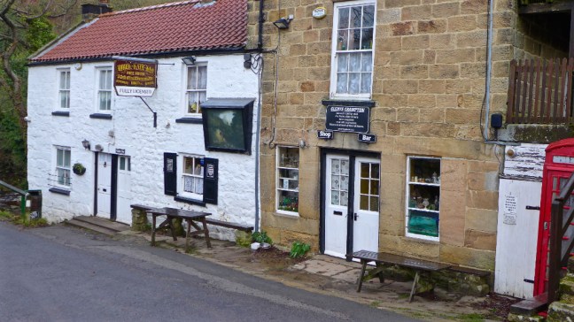
 The rain was getting heavier and this little oasis emerged. There is even cosy overnight accommodation.


We had homemade flapjacks and Yorkshire brack cake using the self service system. The rain got really heavy and we were delighted to be kept warm and dry. Just as we were leaving the owner came out and apologised for not providing milk. However, we had our own flasks. Well worth a visit and the rain now stopped!
We followed the Daleside Road to Thorgill and Rosedale Abbey.
Sid the Yorkshireman used to be a pig farmer and using his pig whispering skills was able to get this beauty into the perfect pose for a photograph.
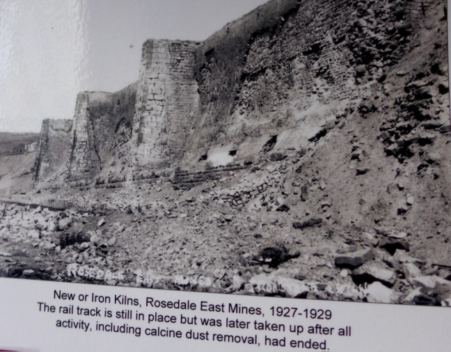
 On the opposite side of the valley were the old ironstone kilns.
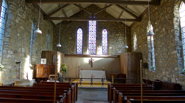
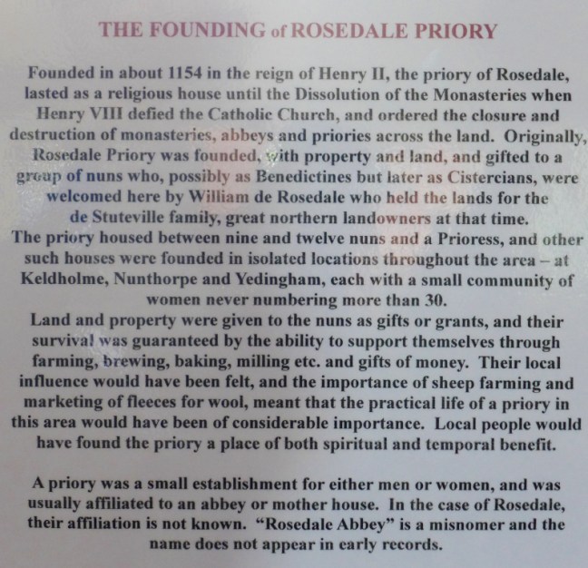
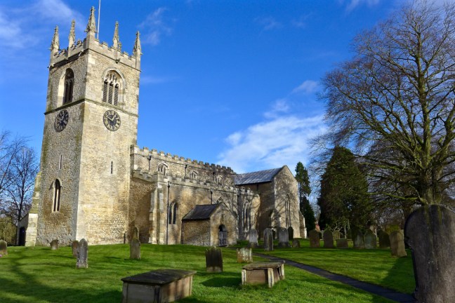
 We arrived at the church of St Mary and St Lawrence in Rosedale Abbey. The only remains of the priory is the staircase below right.


 The sun was out and it was time for lunch on a bench in the churchyard.
 We could ponder on the artwork of children in the church, relating their memories of the Tour de Yorkshire. Bicycles still adorn buildings in the village.
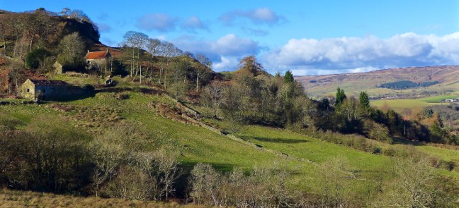
 We then had to climb out of Rosedale Abbey towards Thorgill Bank with ever changing images of Rosedale, one of my favourite valleys, brought alive by afternoon winter sun.


 Some farms on higher ground have fallen into disuse.
 The path became boggy and for the second time this winter (third time ever), due to lack of concentration and tiredness, I ended up going into a bog up to one knee. Fortunately the other leg was on firm ground.
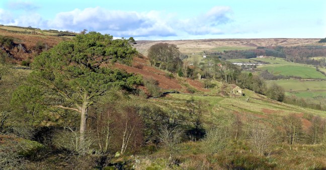
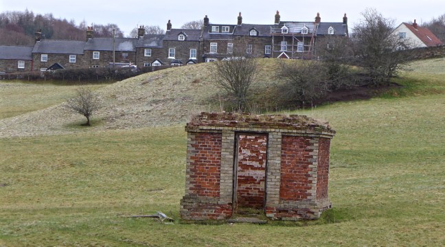
We were pleased to get on the higher drier heather. 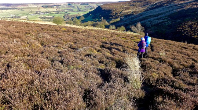 We arrived at the remains of Sheriff’s Pit, where the pithead operated from near the mine managers house and pit shaft.


 The shaft was excavated in 1857 to provide a quick and easy way of transporting ironstone from the West Mines up to the railway line on the side of Blakey Ridge. It descends 270 feet to link up with a 1500 foot long level that was cut into the West Mines to the north of Thorgill.
 All that remained now was to walk a couple of miles back to the car along the dismantled railway line and enjoy the fabulous mid afternoon views as the sun dropped low in the sky to give great photographic conditions. Relax – sit back and enjoy the slideshow.


Now where was that Dale Head Cafe when you are ready for a cup of tea? Oh damn its there on the other side of the valley below the trees!!!

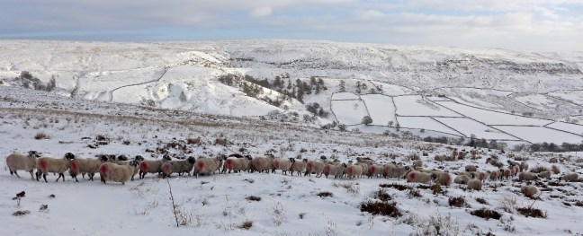
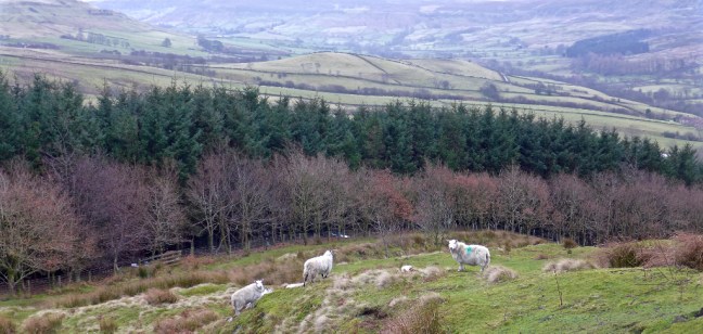
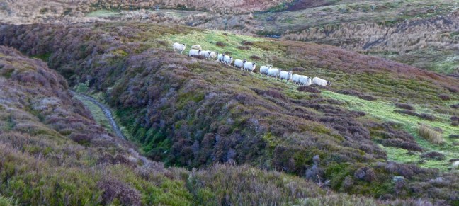
Finally, I imagine the conversation of the sheep below us went something like this:
“Hey Ewe, get in the queue!”
“That’s better”

Miles Walked 12.9
Steps 30,219
Calories Burnt 4193.
 With the The North York Moors under melting snow we decided to postpone The Inn Way and head to the drier chalk lands of the Yorkshire Wolds. However, having already completed The Wolds Way, we decided on an alternative project, 38 mostly circular walks which collectively total 353 miles from the book Walking in the Wolds, published in 1993. It would be my 55th long distance walk. No doubt after 25 years there would be a few changes to the route!

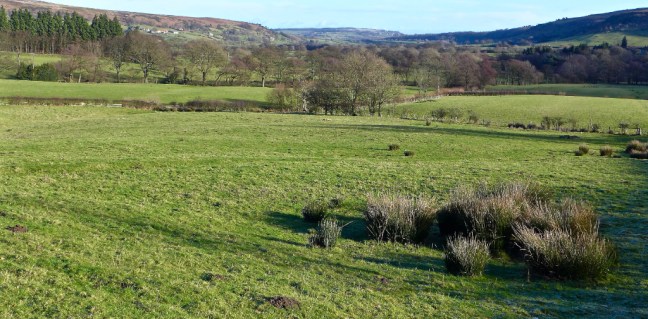
 We soon entered typical rolling, green Wolds country.
 With some delightful copses.
  We passed boundary stones for Hunsley.

 High Hunsley Beacon was passed by us and also by an aeroplane way above in the sky (see white streak left of wire beacon).
  Trees provided some interesting shadow patterns on the fields, with a wind farm in the distance. It reminded me of David Hockney’s paintings.
 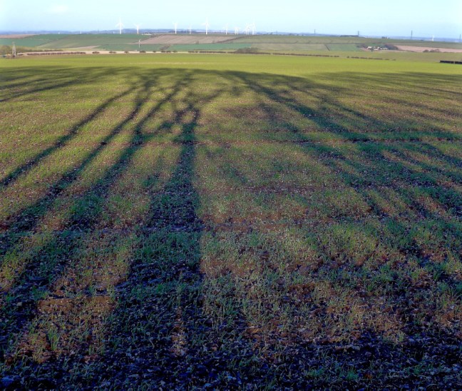 A descent into Swin Dale followed, which is a classic dry Wolds valley.
 We arrived at North Newbald which is one of two Danish settlements, the other being South Newbald. We had an early lunch break on a bench in the warming sun.
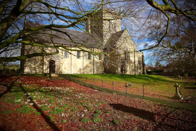 My first 2018 siting of snowdrops were in the church grounds.
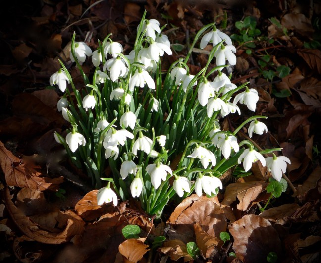 After passing through South Newbald we arrived at Hotham Church which has a distinctive tower. A plaque on a wall outside the church was placed there to celebrate 900 years of Norman heritage. Many of the village buildings are of local limestone.
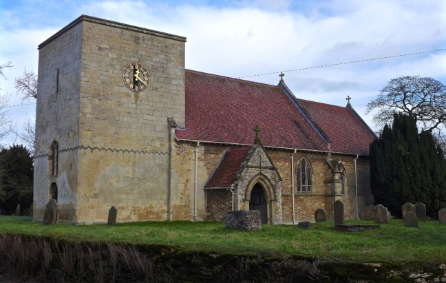 The pub, the Hotham Arms is quite unique in appearance.
 Further along is what we believe was an ice store.
 It may have belonged to nearby Hotham Hall
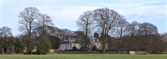 Its lodge has a powerful sign – a reminder of the sacrifices so many paid for our freedom.

 Continuing to Everthorpe we wondered what the significance of the village sign was? We think it is related to the two prisons, HMP Everthorpe and HMP Wolds.
 Even the kissing gates are much larger than the norm!
 At South Cave outside the entrance to Cave Castle is a war memorial which says:
 Eight centuries ago a castle stood where a hotel and restaurant is now located.


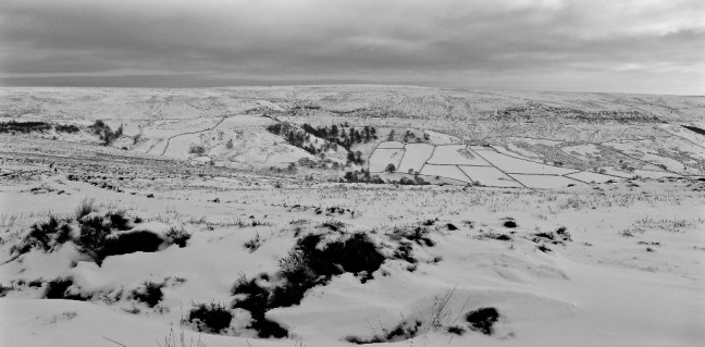
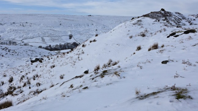
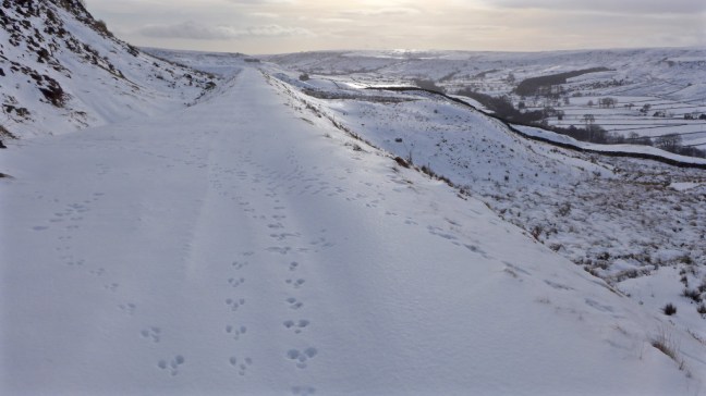
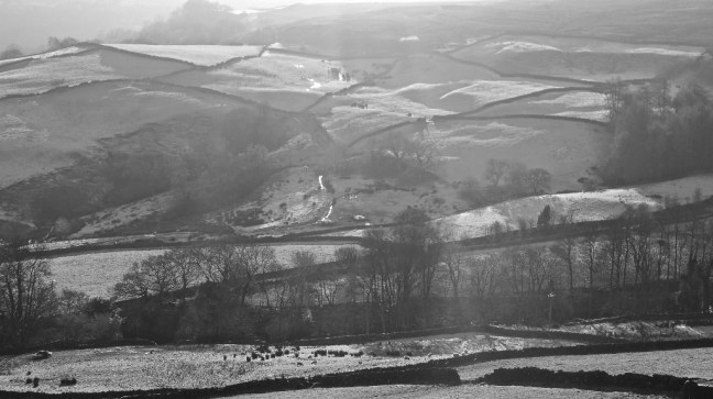
 We continued on the main road to pass Farndale, which confirmed there was still a lot of snow about. The views were gorgeous.
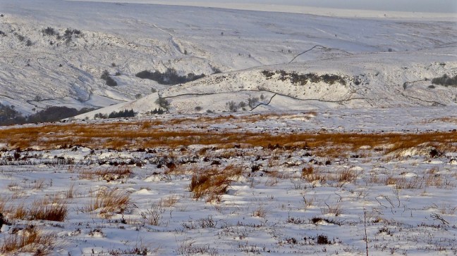

 We arrived at our starting point for the revised walk at the car park at the Lion Inn, Blakey, which was a little snowed under.
 I decided to put sun tan on as, even in winter, protection against the sun is advised (e.g. NHS Direct). There weren’t many coast to coast campers, despite this being on Wainwright’s Coast to Coast route! There was no accommodation at the pub when his book was first published in 1972, but coast to coasters have since contributed to the success of the pub in more recent years.
 We dropped steeply down to the dismantled railway in quite deep snow.
 The sheep thought us a little eccentric, but then they just followed each other like sheep.
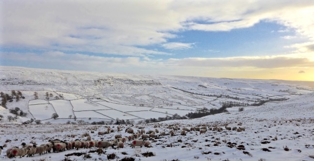

 The wind had created some wonderful snow effects.


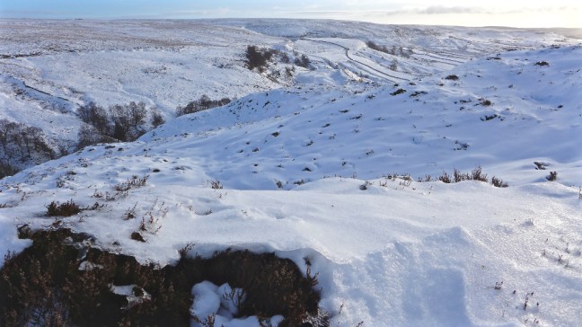 It was like entering a Winter Wonderland.


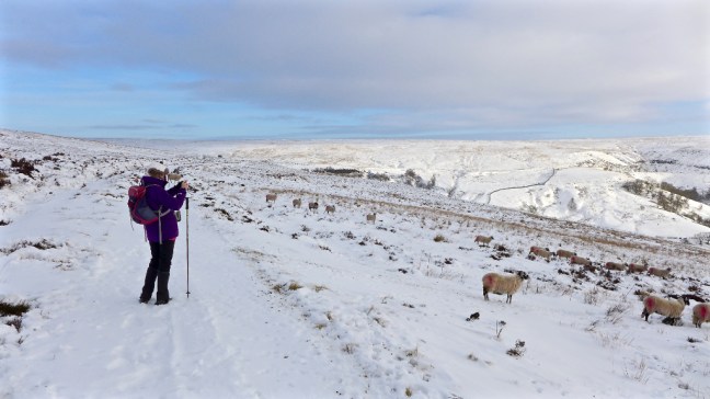
 The bonus for me was that I could use their footprints in the snow to lessen my efforts.
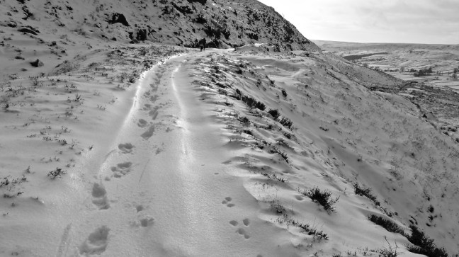 The sun was out and with our efforts we didn’t feel cold.
 We started to think about a banana and coffee break.
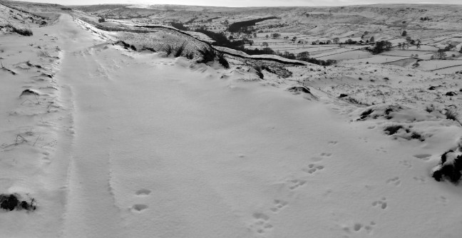
 At last we found a coffee break location with a fantastic view along the valley.
 Clouds were starting to appear and we were finding ‘Snow Miles’ were about twice as tiring as walking ‘Ordinary Miles’. We decided to return the way we had come back to the pub as it meant we could use our tracks to ease our efforts. It would have been dangerous and almost impossible to try and find paths to descend and ascend the valley back to the pub. They were covered in snow.

 We had brought our packed lunch and so as to admire the fantastic views further we stopped again at the only building on the route. It clouded over further, the wind got up and there was a definite change and chill in the air. We did not linger having had the best of the day.


 We eventually arrived at Shunner Howe, a likely tumulus, where we stopped for a banana and coffee break whilst trying to keep out of the keen, cold wind. We were smiling again!
 Reminder to myself: if Sid the Yorkshireman suggests again using the Lyke Wake Walk in winter for any walk, ignore him.
 Turning off the lane at Wintergill there was surreal moment as I answered a call of nature just as a jet buzzed over us, no doubt to record on some RAF camera my indisposed situation! I still managed a one handed photograph or two!
 Zeppelins were reported as flying over the Moors before 1917. In 1916 high explosive bombs were dropped by the Germans, resulting in 40 or so basin-shaped holes in the ridge dividing Fryup Dale from Danby Dale.


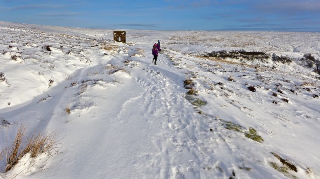
 We passed the door to nowhere!
 Then we stopped for an early lunch at about midday on a 2016 bench in excellent condition and location in the sun.
 And we found carvings on a rock from 1609!
 Next stop were the remains of a building, which suggested folks were a bit shorter than me in the past.
 Carol had to hug this lovely tree.
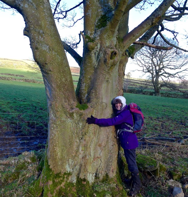 There was the final big ascent of the day to Hart’s Leap, where we got to on our previous walk and where a stag was recorded as having leapt over 40 feet! (see previous blog)
  We were now on Glaisdale Rigg and a section of Wainwright’s Coast to Coast Walk.
 To our left were fine views along Glaisdale to the sea.
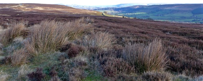
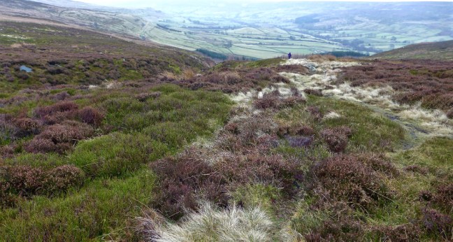
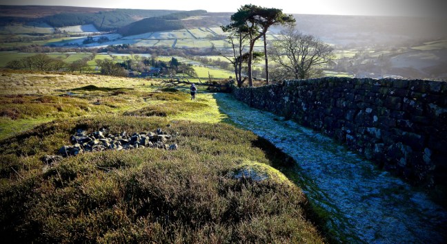
 We left the tarmac lane continuing along the coast to coast route towards the George Gap Causeway.
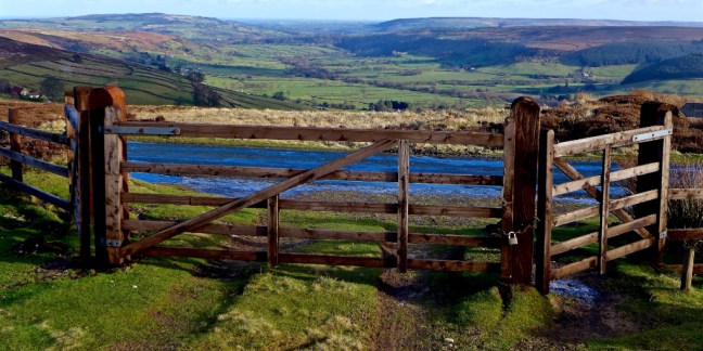
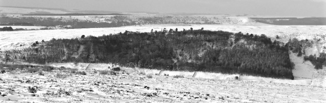
 At the head of Great Fryup Dale there were ‘lunar’ looking remains of what I think are glacial deposits known as Drumlins and some subsidence. Boulder-clay may have been deposited as swarms of rounded hummocks. Clay is found in the area as roof tiles on some of the houses were made of clay and there is more than one Red House in the area. One of my favourite books of all time is Principles of Physical Geography by F.J. Monkhouse. I selected it as an O-level prize ready for when I did A-level Geography. It worked as I got an A at A-level. I think I was a school swot but loved Geography and still use the book. There may also be evidence of ironstone mine workings that took place in this area many years ago.
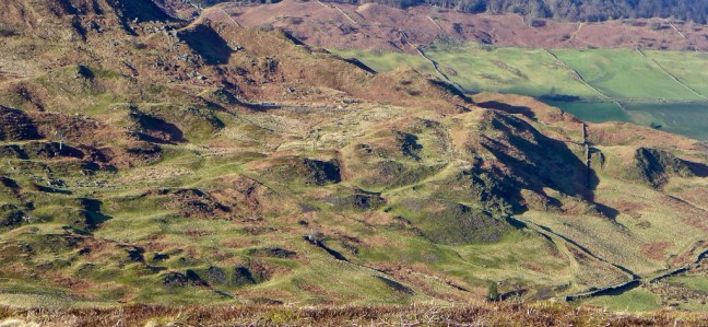
 At this point Sid the Yorkshireman was powering on along the clear track, but suddenly ‘turned off’ it and seemed to fall quickly. He didn’t appear for some time and I assumed he had suffered a bad fall. Indeed he had!
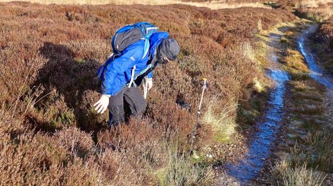 Joseph says in his book: During recent years the late Lord Downe has done a great deal to lessen these dangers (of bogs) by cutting trenches to drain away the water which feeds the bogs, but there are some of such vast dimensions that they defy ordinary measures, and George Gap Spa is one of them.
 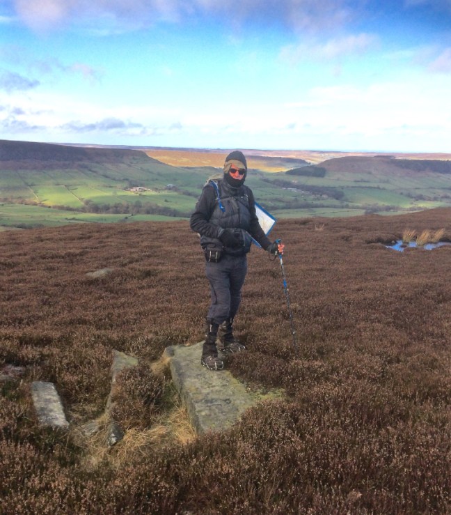 All that remained now was to progress another mile or two over more boggy land and then follow the lane for a mile or so back to the car.
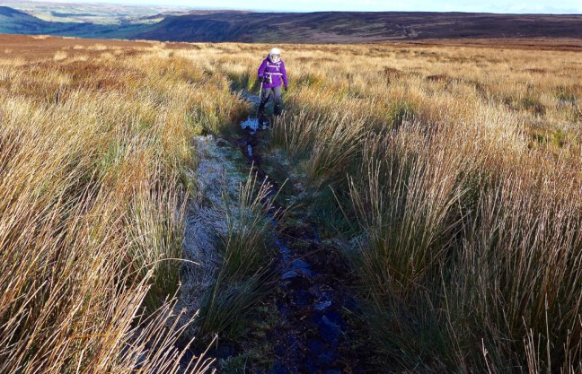 Rosedale Topping can just be spotted in the far distance to the left of the Millennium Stone. The snow clouds were gathering and it was time to head off home
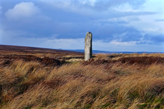 A challenging, fabulous walk and possibly the hardest circular section of The Inn Way completed, although we had only actually walked about 3 miles of The Inn Way!


 With the sun coming up behind the hill, we passed the former Glaisdale ironstone mine powder store, which would have been in use from 1862 to 1876 when the mine was in operation.
 Passing through Miller’s Wood we reached the old corn mill with its waterwheel.
 Following the River Esk we arrived at Rake Farm,
 and the Paddy Waddell Railway, the railway to nowhere. This was known as the Cleveland Mineral Extension Railway, which was intended to take a branch line from the Esk Valley Railway over the moors to connect with railway lines near Lingdale over ten miles to the north.
 In 1872 John Waddell, a famous Victorian Engineer began work on the line.
 The project ceased in 1889 but a flooded cutting and bridge remain. John was nicknamed Paddy due the many Irish navvies he employed.
 After passing The Board Inn,
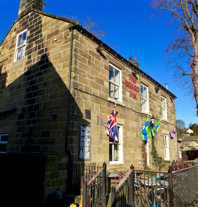 the real climbing on iced roads towards the open moors of Glaisdale Moor and Low Moor began.
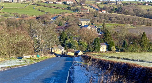 We followed The Inn Way sign, but there is no inn until Rosedale is reached many miles ahead.
  Having got someway behind my walking friends due to taking photographs, I had what I can only call a Sublime Moment, which climbers and walkers in remote areas experience as described in Robert McFarlane’s book Mountains of the Mind, which I have just finished reading. I think the moment was related to the sudden sense of changing nature, the icy sparse vegetation, the lone tree, the far distance views, the increased biting cold wind, all which overwhelmed my senses. It crossed my mind that if you had to spend a long time out here you would struggle to survive. It is essential to carry emergency bags and have good clothing. You go suddenly from a cosseted secure world to one of fragility.
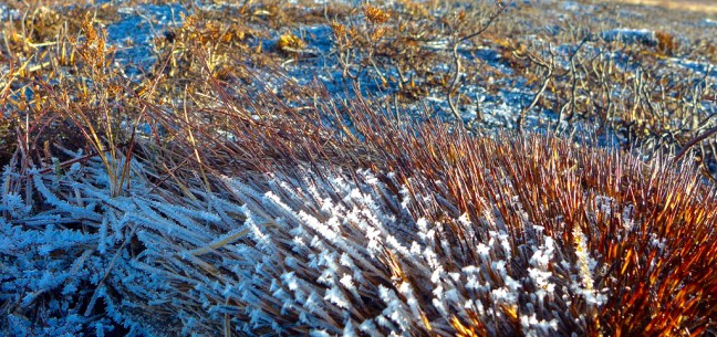

 Catching up with my friends at Glaisdale Rigg, I then did a small diversion to see wonderful vistas in the next valley of Glaisdale, where the frost lingered well into the day.

 There was no time for us to linger as we continued along the icy track towards Hart Leap.
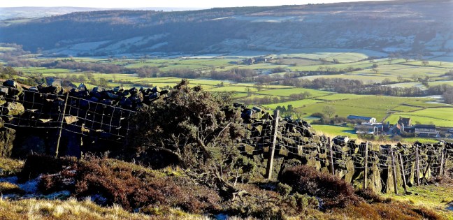
 Great Fryup Dale looked remote and beautiful below us to the north-west.
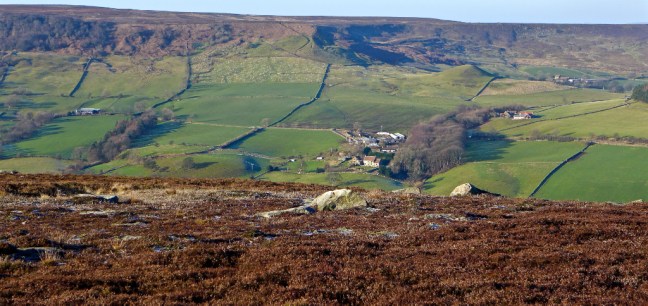 Finally, we arrived at Hart Leap where it is said that a large stag made its last leap in a vain attempt to escape the huntsman and their hounds; one stone marks where the stag took off and the other where it landed, the distance being 40ft 6 inches. The men’s world record long jump is 29 feet 4inches.
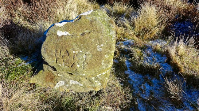
 This was our location to drop off the Rigg and leave The Inn Way to find a route back to the car and find a lunch spot out of the cold wind. There followed a few obstacles, a steep descent and a near fall for Sid the Yorkshireman (note without spikes!).


 We found a sheltered spot between walls with a view to savour. With homemade bread rolls, jam and fruit cake it was better than any restaurant lunch in York – well sort of!

 There was even a sculptured stone in the wall, which could be removed to let the sheep through! Not surprisingly it is known as a sheep hole.
 After lunch we followed the road to Glaisdale Mehodist Chapel near Postgate Farm. Built in 1821 it is very small and intimate and the graveyard has far reaching views up the valley of Glaisdale. A fine place for a final resting place.


 We crossed over Eller Beck, which becomes Murk Esk at the confluence with West Beck. Are you confused already?

 With an interesting sign on the door and with a dog barking at us from inside the window to prove the point!
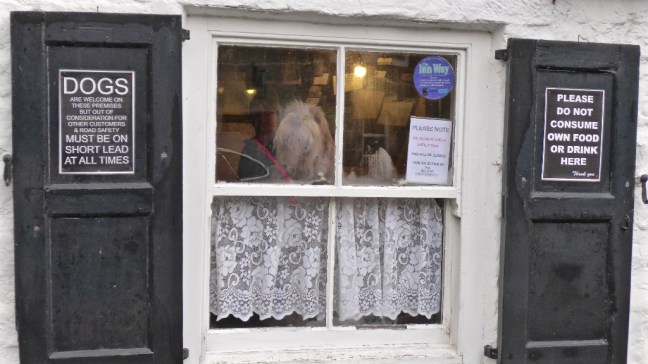
 After a diversion along a signed Grosmont Rail Trail, we then left the old line to ascend steeply from where there we fine and extensive views, including in the distance Egton Manor.
 Descending to Egton Bridge, Sid the Yorkshireman decided to do some community work (he does litter collection in his home village) encouraging branches blocking the path on their way. At this rate he will be expecting us to put him forward for an MBE. Not that we could use the path due to the flooded river!
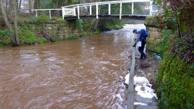 Always keen to cross rivers on stepping stones, Sid the Yorkshireman looked forlornly towards the stepping stones under water beyond the private bridge. .
 Another steep muddy ascent led to some rocks which made a a great coffee and banana break spot with extensive views. I remarked that it was much better than Costa or Starbucks or the multitude of other coffee shops in York. Although Alf wasn’t too pleased when he found his mat was not waterproof and he had a damp bottom!
 There was some tricky navigating on new paths for us. One of the reasons we like doing long distance walking projects is that we find paths we haven’t done before.
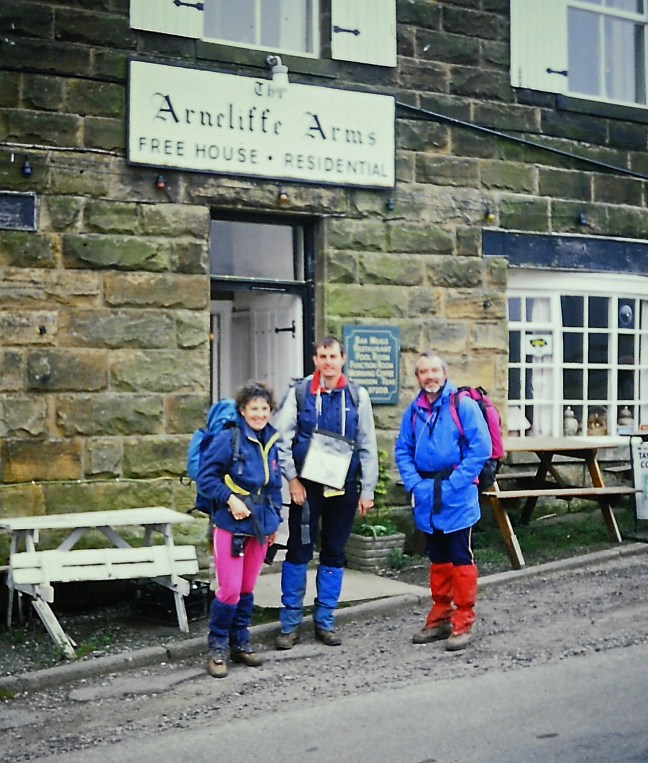
 We reached Arncliffe Woods, which is on the route of Alfred Wainwright’s Coast to Coast Walk. We then descended to the delightful River Esk.
 After passing the Arncliff Arms , which I stopped at when completing AW’s Coast to Coast route in 1991, we descended to Glaisdale Railway Station, which had been salted for ice (hmm..?) and had an automatic announcement which advised repeatedly of the forthcoming rail strike.
 Wainwright’s route continues to attract walkers and indeed in May I will be picking some friends’ luggage up at Glaisdale and picking them up at Robin Hood’s Bay the end of the walk.
 Another tiring ascent followed, but there were lovely views back.
 A steep descent led to the old miner’s cottages at Esk Valley.
 Following the dismantled railway line back to Beck Hole we found some more signs! A day of signs.