COT COMBO -Day 10 – 53rd Long-distance Walk Completed, Still Pot-holed, No Spare, Kate Humble.

Post 215: 14 November 2017, The COT COMBO WALK, Scalby to Scarborough

As we only had 5 miles to walk today we decided to leave home late at 9.30am with the aim of finishing my 53rd long-distance walk at around lunch time for celebratory fish and chips at the Plough in Scalby. It had excellent reports on trip advisor.

I looked out of the window at about 7.30am to see that the tyre on my car, which had hit a pot-hole on Sunday, had gone down again despite the garage checking it the day before and unable to find any fault. I suspect it could be wheel damage that is causing a slow leak. Expensive if it is! A quick phone call to the garage and it is booked in for tomorrow again and Volvo Assistance will pick it up. It was much easier when car manufacturers provided a spare wheel with the car! Whoever thought up it was alright to not have a spare wheel needs their head examining. It is not uncommon for us to be parked on the Moors with no telephone reception. What happens in the middle of winter if we have a flat then?

When Sid the Yorkshireman picked me up he was non too happy to have picked up a speeding fine for doing 35 in a 30mph area a few days earlier, which was not in a built up or particularly residential area. The little white police vans pop up all over the place around York in the most unexpected and quiet places imaginable. The locations seem to be identified more as likely places where drivers will err over the speed limit, rather than based on safety considerations. Certainly major cash injection for the Police.

We parked outside the Plough in Scalby and walked the couple or so miles to the coast and Scarborough Castle soon came into view near Scalby Beck.

P1090192

A rainbow appeared over the sea as though welcoming us to the end of the walk.

P1090193P1090195

There was a final descent to the promenade past the Sea Life Centre.

P1090196

P1090197P1090198

At the end of the promenade we had a coffee and banana break and recalled completion of another long-distance walk from Helmsley in 10 circular walks, combining The North of England Walk, The Tabular Hills Walk and the Missing Link. 

It had been a fine walk with lots of interest and some new discoveries. Mostly the weather had been kind.

All that remained was to walk back to the Plough, eat our fish and chips and be surprised to see Kate Humble there! She was filming lobsters in the area for Springwatch.

You never know who or what you might come across on a long-distance walk……

Now where will be my 54th long-distance walk?

Miles Walked 5.5. 

Calories Burnt 620

Steps Taken 10,900

Average Pace 17.58 Minutes per Mile 

Maximum Pace 13.52 Minutes per Mile

Elevation Gain 257 Feet 

Minimum Elevation 9.7 Feet

Maximum Elevation 167 Feet 


A Walk from Rievaulx Abbey to Helmsley. Pot-holed! The First and only Briton to climb the World’s Highest Mountains.

Post 214: 12 November 2017

On the second day our visitors were with us from the Lake District, the ladies again decided on a shopping morning, this time in Helmsley. I decided to take John on a short walk near Rievaulx Abbey and then to Helmsley to then meet the ladies for lunch.

We were greeted at the Abbey by a somewhat aggressive pheasant, which pursued us for food.

P1090169P1090170P1090172

We eventually escaped from the persistent bird to pass Rievaulx Abbey.

The Cistercian Abbey was founded by Walter L’Espec in 1132. Its importance can be judged by the fact that thirty-five years after it was founded there were 140 monks, 249 lay brothers and 260 hired laymen, a large community. The Abbey nestles in a tree-covered valley whose narrowness accounts for the fact that the church is aligned from north to south instead of from the usual east to west. The monks created great wealth, from sheep farming (at one time they owned 14,000 sheep), iron working, fishing and salt production on the coast. Canals were used for floating blocks of stone on rafts from the River Rye to the Abbey for carving. Around the time of the Dissolution, however, the abbey declined and fell into debt and by 1536 only twenty-two monks remained. After 400 years of life, the site was eventually stripped for building stone and, in due course passed to the Duncombe family. It was acquired by the state in 1918, and is now superbly looked after by English Heritage.

P1090176

We crossed the River Rye at a bridge and then ascended the hillside on the opposite side of the river from the Abbey.  There were delightful views in bright sunshine.

P1090177

A temple on Rievaulx Terrace high above peeped out through the trees.

P1090179

P1090180P1090181

We eventually reached the quiet lane leading over Rievaulx Bridge to join The North of England Way and Cleveland Way leading to Helmsley.

We then reached a ‘traffic jam’ of horses.

P1090183

Before a final look back towards Rievaulx Abbey.

P1090184

Afte passing through Blackdale Howl Wood we made the final descent to Helmsley with a fine view of the castle.

Helmsley lies under the southern edge of the North York Moors and is a typical small market town, with a large market place surrounded by old inns and interesting shops. Its ruined castle stands high on a mound overlooking the town. It was built in about 1200 and was later besieged by Parliamentary forces after the battle of Marston Moor and The fall of York during the Civil War. The castle was finally surrendered on 22 November 1644 after a three-month siege. Between 1646 and 1647 the castle was made unfit for war with parts of the keep and the walls being destroyed. It is now in the hands of English Heritage.

We went to Mannion’s for lunch and I had the best pork belly I had ever had in a sandwich.

P1090187

We then drove to the Robert Fuller Gallery in Thixendale (www.RobertEFuller.com) but on the way the heavens opened and on a very narrow lane we hit, with an big bump, an enormous pothole which was hidden by the rain. The next day a tyre was deflated but after air was pumped into it the garage checked it but couldn’t find a leak. A bit of a mystery.

The next morning a new DVD, which I had pre-ordered, arrived. It is well worth purchasing from wwstridingedge.com as it relates the life of Alan Hinkes who remains the first and only Briton to climb the 14 highest mountains in the World over 8,000 metres. An incredible feat.

IMG_2708

Miles Walked 5


Shopping versus a Walk around Castle Howard.

Post 213: 12 November 2017 A Walk around Castle Howard

Having completed the Country Walking Magazine 1000 Mile 2017 Challenge and my first fit-bit challenge it felt a bit strange not having to think about mileage to be achieved. I could just go for a walk.

With some visitors from the Lake District, I decided the first walk should be around Castle Howard which John hadn’t done before. Meanwhile Christine and Celia would go shopping – no change there! The latter is an opportunity for them to encourage each other to shop without husbands acting as a restraint. Invariably they return with more bags of shopping than normal. When asked why this is they say they value the opinion of the other particularly when choosing clothes, which has much more validity than the husbands opinion which invariably just wants them to spend the minimum. They have a point.

So we drove up the ‘drive’ of Castle Howard. This would have impressed visitors in days gone by when they arrived by horse and cart.

P1090147

We stopped to admire the view back across the lake to Castle Howard. Rather annoyingly the owners of what used to be a car park have closed it off so it is no longer possible  to park for long and look at the view. Just a quick photograph then it is time to move on.

Castle Howard was designed by playwright Sir John Vanbrugh and it was the first building he ever planned. Construction began in 1700 but when he died in 1726 the building was still not finished and the later West Wing was the design of Thomas Robinson. It was the first private house in England to have a large dome. Also it faces north to south instead of facing the more normal then east to west, so getting more sunlight.

P1090149

We started walking at Coneysthorpe and entered the grounds of Castle Howard to pass Ray Wood. The latter has existed since before 1563 and now has over 500 species of rhododendrons and 300 hybrids. We then reached The Temple of Four Winds.

P1090150
The Temple of Four Winds

P1090151

We crossed the bridge with distant views to Castle Howard on the right.

P1090155P1090152

And the Mausoleum on our left.

P1090156

After The Temple of Four Faces in Pretty Wood we passed a huge ancient tree.

P1090158

The paths hereabouts were very muddy but in the November sunlight the views were a delight

P1090159

We stopped for lunch near a Holy Well, which took some finding amongst the trees and overgrowth.

P1090161

We ascended to the Howardian Ridge from where there were extensive views towards the North York Moors in the far distance.

P1090162

We made the final descent towards Coneysthorpe.

P1090164

A track then led to a dilapidated barn and the village.

P1090165P1090168

A lovely days walking and n the sunlight surprisingly warm.

Miles Walked 10. 


THE COT COMBO – Day 9 – The Black Death returns to Yorkshire, Paw Patrol, The Kiss of Life, The Sea Cut, Where are all the Other Walkers?

Post 212: 6 November 2017, The COT COMBO WALK, Langdale End to Scalby. 

I awoke at 6.00am to a distinct chill in the air. After breakfast I went to load the car with my walking gear and found the first hard frost of the winter had arrived.

IMG_2690

Feeling happy with myself for escaping the Black Death, Norovirus or whatever it was that had made my son in law, two grandsons, mother and wife sick, on Sunday I had popped down to the village newsagent to get a newspaper only to find that the newsagent had the sickness. I mentioned this to Sid the Yorkshireman who had escaped to Cumbria to avoid catching anything. Despite this he returned to Yorkshire and when I went to pick him up he had his anti-bacterial hand gel ready at the door. Clearly he had been on a Fred Olsen cruise, who give excellent training on how to avoid Norovirus!

So arriving at Langdale End at about 8.30am we found the car park covered in iced pools. We made a steep ascent on The North of England Way towards Broxa and looked back to fine views.

P1090068

P1090070

We descended towards Hackness and got the first glimpse of the attractive Church of St Peter, which is thought to be the oldest church in Scarborough Deanery. Much of the church is 12th Century. There is an outstanding font, with a tall oak cover carved in 1480. Of particular interest are the carved stalls with misericords.

P1090071

We decided it was an ideal stop for our banana and coffee break, except Sid the Yorkshireman had run out of bananas. We found a bench, only to discover Paw Patrol had already been there.

P1090072

Not only cats were attracted to the bench area. Spiders were too.

P1090077P1090078

We left the church to pass a walled garden.

P1090079

Then Hackness Hall

Despite the sun, in the valley bottom the frost persisted.

P1090082

We soon got our first view of Scarborough in far distance, the end of the COT COMBO WALK.

P1090085

We were surprised to find the National Union of Miners still had buildings in the vicinity of Scalby.

P1090086

We went into the grounds of the Church of St Lawrence and on leaving came across  a memorial to a very brave lady Jane Harrison.

P1090088P1090089

After lunch in Scalby, we then followed a sea cut on The Tabular Hills Walk to Mowthorpe Farm. Fooding used to be a serious problem in the Vale of Pickering as the River Derwent flowed from the Moors into the meadows below. In wet weather the River Derwent had to carry as much as 50 times more water than during the dry periods. Sir George Cayley organised the building of a cutting between 1800 and 1810, the work being done by hand. The Sea Cut takes surplus water from the Derwent across to Scalby Beck which flows into the North Sea and so reduces the flooding on the Vale. An amazing structure.

On the opposite side of the cut we saw a deer and at the bridge we saw a heron take off.

There was about a mile of road walking before we ascended steeply into the forests. At this point I checked my fitbit to see what my pulse rate was. However, there was no reading so I said I must be dead. At which point Carol offered the kiss of life. However, I had to point point out I could be the carrier of the Black Death or whatever the bug was and that wouldn’t be a good idea. Eventually the reading appeared and my pulse had gone from 58 resting to 109 – a big ascent.

P1090097

A descent along Moor Road followed.

P1090101

Here Sid the Yorkshireman, also known as Kia King and formerly known as Skoda King, thought about replacing his current car at a bargain price.

P1090099P1090100

But in the end this one wouldn’t start for some reason.

There were some very big trees in this area.

P1090102

There was one final ascent and descent back to the car.

P1090105

P1090106P1090107

We had missed a viewpoint (looking over a fence/wall) at Broxa so drove back to see it. A fine end to a great days walking.

P1090109

Miles Walked 14 

Steps 31,000

Calories burnt 3,300

We saw no other walkers all day! 


1,000 Miles Completed, First Fit-Bit Challenge Completed. The Magnificent 7? Billy No-Mates.

Post 211: 3 November 2017, Whitby to Robin Hood’s Bay and Back. 

I had seven miles to walk to complete my boots only Country Walking Magazine 1,000 Mile 2017 Challenge and one more day of my first ever 5 day fit-bit challenge.

So what to do? I initially thought it would be good to finish the 1,000 mile challenge at Scarborough, the end of my coast to coast.

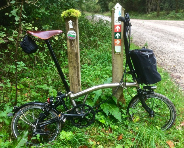
However, a friend had just lent me his book The Times Britain’s Best Walks – 200 classic walks from The Times, by Christopher Somerville. A few months ago I had bought a ticket for one of his talks in the village but had to miss it due to some family illness. I noticed that the walk was 7 miles. Perfect, I could finish my walk at Robin Hood’s Bay a delightful place. I could return on the dismantled railway line called the cinder track, which I had cycled along about a month ago. Then I could finish with fish and chips and a well earned knickerbocker glory!!

Christopher has a very good writing style and described admirably a walk I know.

P1090051

It was an early start following on from the previous 4 days of energetic walking on the fit bit challenge. I managed to get one of the last free parking spots in Whitby near the harbour. I have been well schooled by Sid the Yorkshireman, who knows where every free space is! He had of course skipped the county to go to Cumbria as he was worried the Black Death Plague had returned to Yorkshire and he was keeping me in quarantine (see previous blogs), even though I hadn’t even caught any of the sickness bugs and viruses flying about everywhere. Now I was Billy No-Mates.

I had driven through mist over the Moors and it was still a bit claggy as I walked along Whitby harbour at 9.15am

IMG_2646

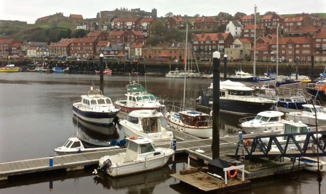
There is always plenty of interest around Whitby harbour with boats coming and going and in for repair.

P1080993P1080991

P1080994

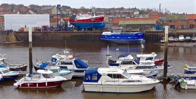
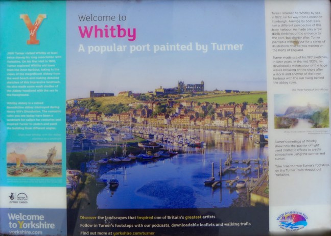
If Whitby was good enough for Turner to paint it’s good enough for me. However, it is certainly a lot busier than it was then, now with hordes of tourists and day visitors coming even in weekdays and even in winter.

P1080995

I crossed the swing bridge built in 1909.

P1080996

With an early start I was able to photograph the 199 steps with no one else on them – a rare occurrence. Those steps would add to my fit-bit challenge!

P1080997P1080998

I then passed the 12th Century Church of St Mary, which was designated a world heritage site on 23 February 1954.

P1090003

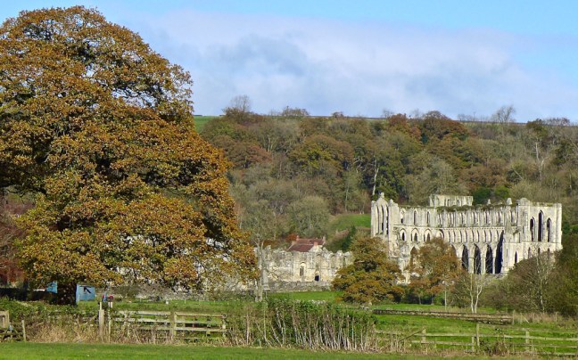
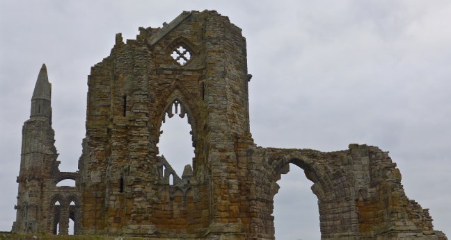
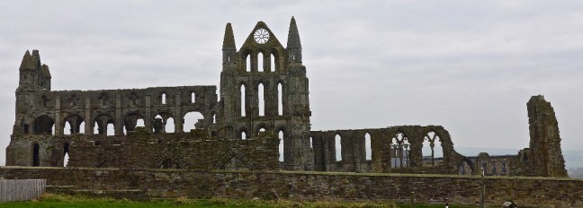
Followed by Whitby Abbey, a 7th Century Christian monastery that later became a Benedictine Abbey.  It was made famous in fiction by Bram Stoker’s 1897 novel Dracula, as Dracula came ashore as a creature resembling a large dog and proceeded to climb the 199 steps which lead up to the ruins. The area is now popular for Goth weekends and dog walkers!

P1090004P1090006

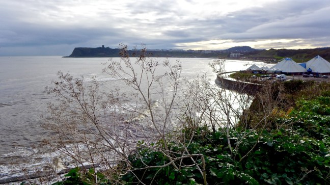
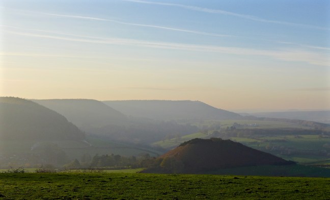
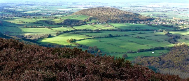
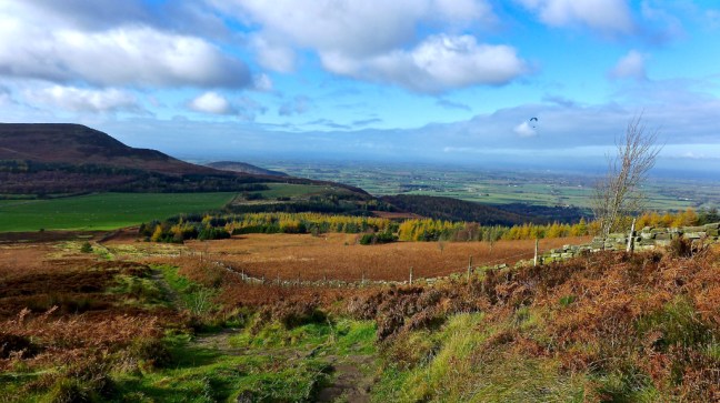
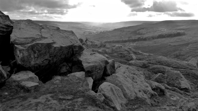
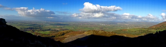
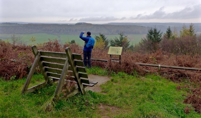
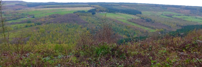
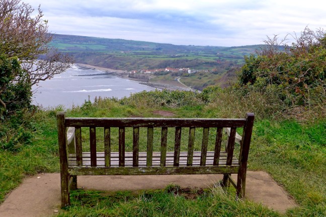
It is always good to reach the coastal footpath above the cliffs, with a fresh breeze. A recent walking German visitor made me appreciate how fortunate I am to have the coast within just over an hours drive as she lives 4 hours from the nearest coastline. She desperately wanted to go to the coast in England.

P1090007

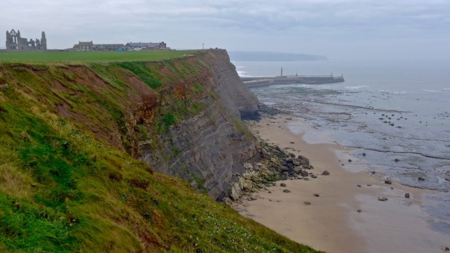
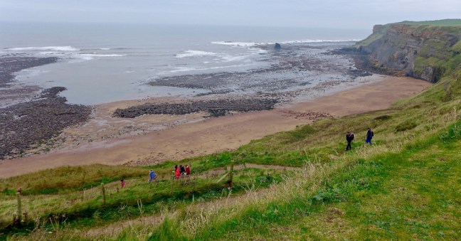
Saltwick Bay was passed and school parties were descending to explore the beach and probably look for fossils.

P1090008P1090009

I then spotted the ‘submarine‘ and the wreck of the Rohilla. Launched on 6 September 1906 the Rohilla became a hospital ship on 6th August 1914. At 4am on 29th October 1914 she struck rocks at Saltwick Nab with 229 people on board. A rescue attempt lasted for several days, but due to bad weather over 80 people perished.

P1090010P1090012

After a coffee and banana break in the shelter of some rocks, I continued to Whitby Lighthouse, which opened in 1858 having cost £8,000. It is possible to book holiday accommodation there in the adjoining Whitby Fog Signal.

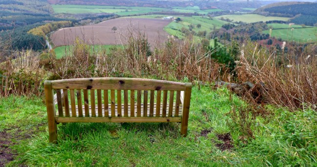
I was enjoying the coastal views

P1090018

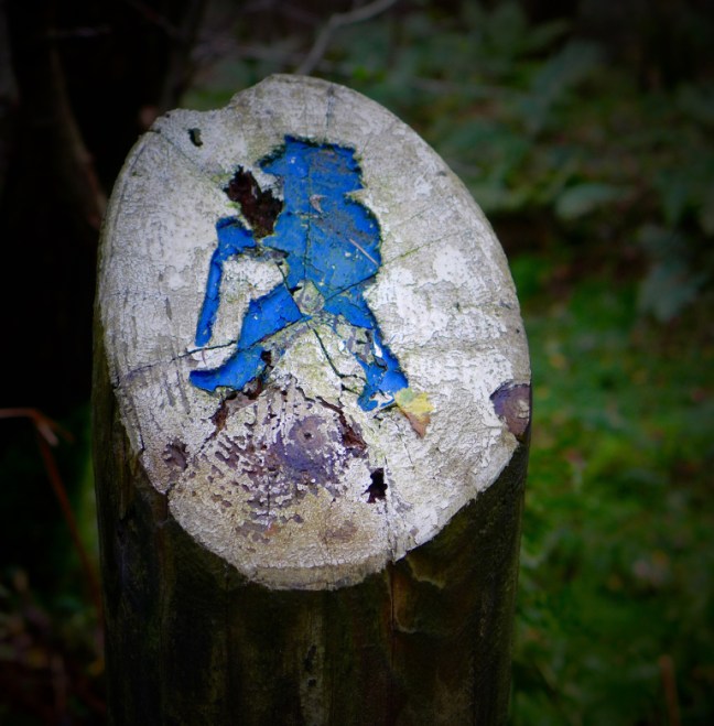
I arrived at the point where Wainwright’s Coast to Coast joins the coast and the Cleveland Way.

P1090019

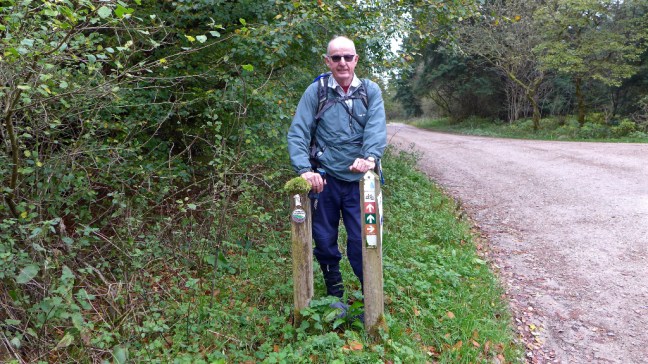
Arriving at a patch of mud my mapmywalk app told me I had walked 7 miles and therefore I had reached my 1,000 miles (boots only) for the year, two months ahead to meet the challenge. I could only think it was due to the walk from where the car was parked that had added to the mileage. P1090020
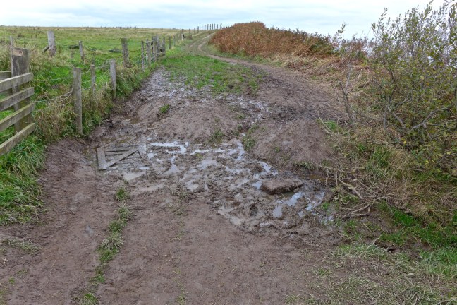
I did wonder if my German walking friend had a premonition a month or so ago?! Hardly the spot I had envisaged!!P1080116
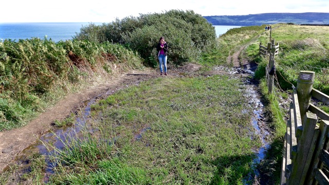
Not to worry I would hold the ‘formal’ completion ceremony in Robin Hood’s Bay a little further on.

P1090021P1090022
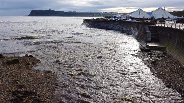
This was delayed as the tide was in and I had to walk extra up and down stairs to get to the beach – my legs groaned.

P1090024P1090023

However, I eventually reached the beach.

P1090025P1090026P1090028P1090029
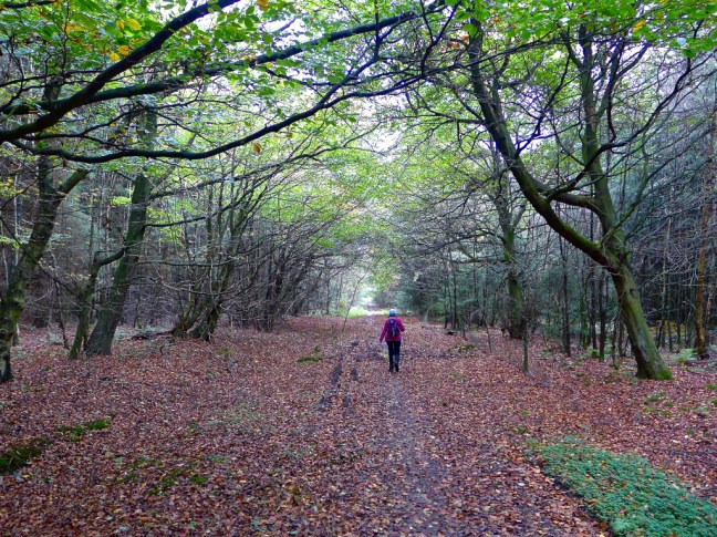
It was time for a quick lunch stop, an ice-cream and then the steep climb out of the village. It was then a bit of a route march along the cinder track back to Whitby well above the coastal path.

P1090032P1090034At this point five days of walking started to catch up on me and my legs started to feel tired. However, at just after 3pm Whitby came into view and the end of the walk was in sight.

P1090035P1090036
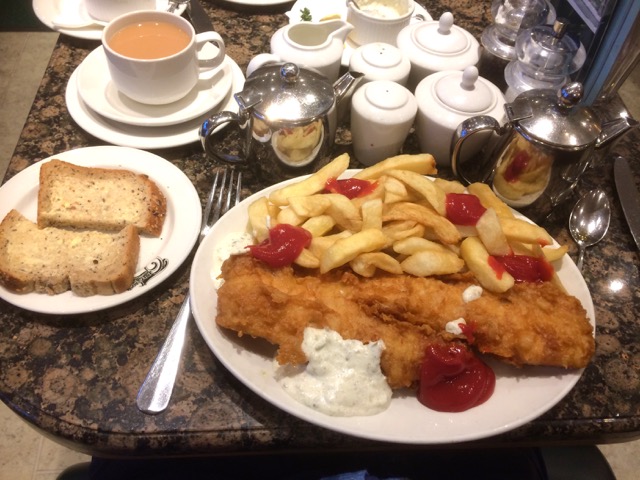
A quick change of my very muddy boots at the car and then it was off to Trenchers. Who cares if I was Billy No-Mates today?  Look what I had to myself!  A well earned reward as two challenges completed.

IMG_2659

IMG_1726

However, I hadn’t quite finished walking as I decided to have a slow walk along to the pier to add to my steps and walk some of the huge meal off. It was dark at just before 5pm!!!!

P1090039P1090042P1090043P1090044P1090047P1090049

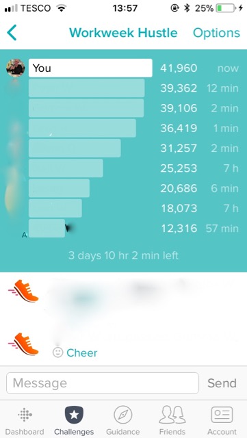
With regard to the fit-bit challenge the tortoise seems to have kept ahead of the hares.

IMG_2674

I recorded the most steps I had ever done in a day 36,447 (fit-bit), beating my previous best of 35,000, so am pleased. Celia my wife thinks I am mad, but did buy me a cake to celebrate the 1,000 miles.

P1090050

It was a Magnificent 7 plus Miles. 

Mapmywalk (Boots only) 

Miles Walked 15.25

Steps 31,400

Calories Burnt 1,700

Average Pace 18.48 Minute per Mile

Maximum Pace 9.4 Minutes per Mile

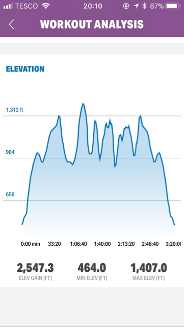
Elevation Gain 1,157 Feet. 

Minimum Elevation 7.9 Feet!!!!!!

Maximum Elevation 434 Feet. 


We were all Flying today! Up and Down. Back on Top. 993 Miles Completed

Post 210: 2 November 2017, Huthwaite Green to the bottom of Hasty Bank and back.  

I decided to do my ‘training’ walk today, which I have traditionally used to get fit for my 3 coast to coast walks and other long distance walks. It is always a good measure of how fit I feel and is probably one of the toughest sections on the North York Moors with lots of accents and descents. Alan Hinkes from Northallerton, the only Briton to climb all 14 of the world’s highest mountains over 8,000 metres, also used the area for his training. Except he often ran it at night!

It was quite eerie with mist just after 9am when we started walking from Huthwaite Green.

P1080950

The walk starts with an immediate ascent up Roundhill – no time to warm up.  However, there were also fairly immediate superb views.

P1080951

P1080952

We were surprised to find we had company on the path, which is part of the Cleveland Way and Wainwright’s Coast to Coast. .

P1080959

We took the opportunity to have a breather after our ascent and watch the para-gliders. On this section they said it was too windy and kept getting blown back onto the escarpment.

P1080963

Further on the wind dropped and some got properly airborne.

P1080965

Afte a banana and coffee break just after Carlton Bank we began another ascent, this time up Cringle Moor. There were fine views back.

P1080966

We reached the Alec Falconer viewpoint from where Roseberry Topping, the Yorkshire Matterhorn could be just be seen in the far distance.

P1080967

After a further descent and ascent we reached the Wainstones. 

P1080968

P1080969

Before descending to a sheltered bench for lunch. Within 5 minutes three sets of walkers all appeared hoping to sit on the same bench. We had timed it perfectly! We made the decision not to carry on to the highest point of the Moors as we felt we would run out of light. We would save that for the spring.

Returning back along the lower route we had fine views still.

P1080970P1080971P1080972P1080973

The para-gliders started to appear again

IMG_2639

P1080976

The weather, views and light had become very pleasant indeed.

P1080979

We passed a bronze age burial mound.

We were relieved to reach the top of our final ascent and enjoy the fresh cooling air and descending sun.

P1080984P1080988P1080989

The final descent was through a line of trees.

P1080990

A great days walking.

Position on Workweek Hustle Challenge – back on top – for now! 

IMG_2644

Mapmywalk 

Miles Walked 13

Calories Burnt 1,500

Steps 24,900

Average Pace 16.26 Minutes per Mile 

Maximum Pace 12.42. 

Elevation Gain – up and down, up and down over 14 times there and back  

IMG_2645

TOTAL MILES ON THE 1,000 MILE 2017 CHALLENGE –

                                         993.

                                        7 TO GO 

Fish and Chips and Knickerbocker Glory at Trenchers in Whitby beckons tomorrow! 


Back to Wacky Races and the Workweek Hustle.

Post 209: 1 November 2017.

Having had my lead as the ‘tortoise’ taken back by the ‘hares’, probably at the gym in the evening, it was time this morning to get out today and do a few more steps. It really is Wacky Races as you have to be a bit Wacky to do these fit-bit challenges.  It is the first time for me that walking has become competitive.  However, going with the flow I thought I might as well give it a go.

The plus is that I got some nice views today around my local woods.

IMG_2624 

IMG_2625

IMG_2629

As the light began to fade it was a lovely evening and sunset. Perhaps challenges aren’t so bad after all. The light and colours changed as time moved on. It was just after 4.30 when the last photograph was taken. The nights really are drawing in! Now where is my head torch?

IMG_2630IMG_2633IMG_2634

Still I did enough to set the hares running again tonight so my objective was reached.

IMG_2636

What will tomorrow bring? Definitely a proper walk on the North York Moors with lots of ascents and descents.  Sanity will return.

Mapmywalk (boots only) 

Miles walked 11

Calories 1248

Steps 22,000

Average Pace 17.50 Minutes per Mile 

Max Pace 7.58 Minutes per Mile

Total Boots Only Mileage 1,000 Mile 2017 Challenge 980


The Workweek Hustle, The Black Death Comes to Yorkshire. The End of the 1,000 Mile Challenge?

Post 208: 31  October 2017

This has been a rather strange few days. I attended my mother-in-laws 95th birthday party in the Midlands at the weekend. The cake even tasted as good as it looks. Superb.

IMG_2601

I also attended to my 94 year old mother for a couple of days as she suffered from the dreaded sickness bug. My two grandsons and son-in-law also had it.  There were also six other residents in my Mom’s supported accommodation who had it and one had been taken to hospital.

So arriving home on Sunday night it was not good to find that Celia had got the bug. However, Celia went the extra mile over the others and also fainted.

As I write tonight everyone is on the mend. I am hoping I will have escaped its clutches? It is a nasty bug.

The response of Sid the Yorkshireman was to put me into quarantine, not just for a few days, but for the whole week – no walks! He is even leaving Yorkshire at the end of the week. Now does he think the Black Death has returned to Yorkshire?

The Black Death was one of the most devastating pandemics in human history, resulting in the death of an estimated 75 to 200 million people in Eurasia and peaking in Europe in the years 1346-1353. It consisted of several forms of plague, including bubonic plague.

Having been quarantined I felt as though I might be thought to have the plague by Sid the Yorkshireman and others.

Sunday night I then got a Workweek Hustle Challenge from some fit-bit group members.  For some crazy reason I accepted the invite having not done one before. I soon realised what this entailed when people on the list had suddenly completed up to about 30,000 steps.

So it was matter of getting the boots on and going for local walks, even if it was raining.

IMG_2621

Now most of my challengers are a lot younger and were booking into gyms in the evening. However, it’s a bit like the hare and the tortoise and being retired I can play the tortoise and set the hares running. So over 2 days I managed to crawl to the top of the table.

IMG_2623

This has set the hares running tonight – literally I think on the running machines at the gym so I have now dropped down to third place. However, there are still 3 days left and I have one to two things I can try yet – watch this space.

So no ‘proper’ walks and blogs this week but I should be back to normal next week and on the COT COMBO WALK with only two more sections to do. It would be great if  I could finish my 1,000 mile 2017 challenge at the end at Scarborough, but I am not sure it will all work out. I am up to 970 miles and only have 30 to go.

Mapmywalk (Boots only walks):

Miles Walked last two days 19.3.

Calories Burnt 2555

Steps 32,600


THE COT COMBO – Day 8 – The Forecasters get it wrong again, Raptor’s View, The COT COMBO team replace the A-Team, Coptic Christianity, Heavy Breathing

Post 207: 30 October 2017, the COT COMBO WALK. Croscliff viewpoint to Langdale End. 

Earlier in the week BBC Look North weather forecaster Paul Hudson got the forecast wrong and now it was the turn of  Owain Wyn Evans who forecast good weather and it rained most of the day. Bring back Keeley Donovan I say. We suspect the rain is why Alf cried off through illness and we are still waiting for the medical note to arrive to explain his absence.

Afte parking at the remote Highwood Brow Viewpoint and walking along the Tabular Hills route westwards we had a diversion to the Raptor Viewpoint. We half expected dinosaur birds to come swooping down, but were disappointed on this occasion.

P1080897

Sid the Yorkshireman on the look out for raptors.

P1080901

We continued along the Tabular Hills walk and were repeatedly passed by a mountain biker covered in mud. There must be stunning views on a clear day!

P1080903

It continued to rain and it was rather dreary most of the time.

P1080905

Near Cockmoor Plantation we descended to Keeper’s Cottage to find a carpet delivery van stuck after taking a wrong turning (sat nav problems?).

P1080906

The COT COMBO team of Sid the Yorkshireman and myself then leapt into action (we have replaced both the AA and the A-Team). We managed to push it out with superhuman strength and, as can be seen, they were very pleased.

P1080907

Heading up from there we came across Broad Head Farm, which sells beef and lamb.

P1080946P1080947

Further on along New Road we came across some fungi.

For the second time this week we stopped at Crosscliff Viewpoint for lunch and some cyclists again passed us. We were now back on my North of England Way. 

Just a little further along heading eastwards we had fine views where the trees had been cleared, including of Red House, which used to be a youth hostel.

P1080912


P1080920

We passed some slugs in the slow lane of life.

P1080924

After passing a bridleway it became apparent, when we reached a bench on a sharp bend, that the Forestry Commission have closed a path that was previously used by the North of England Way and the Cleveland Way Missing Link. Therefore, it was necessary to backtrack to the very muddy bridleway and use that to descend to Noodle Farm.

P1080925

On the bridleway we passed a blue man sign which marks a 16 mile walk developed by the Forestry Commission  from Broxa to Allerston.

P1080926

After Noodle Farm we passed Blackwood Bungalow and headed to Bickley Rigg Farm.  I was glad these rather boisterous cows were on the other side of the fence.

P1080927P1080929

At Bickley Rigg Farm we passed some unusual accommodation

There were fine views towards Langdale End and Hackness.

P1080934

P1080935

We passed a building still under construction. It is the Uk’s first Coptic Monastery. It is a Worldwide Christian Church, whose heartland is Egypt.

The monks follow a strict life of fasting and prayer, which begins at 5am. It is an austere and celibate life of prayer, contemplation and self sufficiency.  I can’t really see Steve the Yorkshireman and myself signing up. We have too much walking to do. Also I think we would have trouble with the other abstinences.

P1080936

We arrived at the Moorcock Inn, Langdale End  to find two fine cars parked up.

P1080937

The delightful church was passed.

P1080938

We left the North of England Way at Bridge Farm and ascended steeply.

On arrival at a gate I pulled on the handle sharply to find it was faulty and the metal top banged sharply into my head, just above my eye. I let out a few expletives before digging in my rucksack for the first aid kit to put a plaster on a bleeding wound.

P1080939

Plastered!

P1080943

We then reached a cycle path called the Moor Road, which ascends steeply from a height of 70 metres (230 feet) to 208 metres (682 feet). There was soon some heavy breathing as we had decided to attack our last hill (see video in Facebook comments).

P1080944

After Sid the Yorkshireman had issued the immortal words:

‘It’s almost as if they have had cars down here’

I said:

‘Into the dark’

We came across this!

P1080945

If that wasn’t bad enough I then thought i had lost my fit-bit before remembering by mistake I had left it at home on charge. That’s 30,300 steps not recorded on it!

My Mapmywalk recorded the following:

Miles Walked 14.90

Calories Burnt 1,700

Steps 30,300

Average Pace 18.22 Minutes per mile 

Maximum Pace 7.02 mInutes per Mile 

Elevation Gain 1267.9 Feet 

Minimum Elevation 193.9 Feet

Maximum Elevation 839.9 Feet 


THE COT COMBO – Day 7 – Weather Forecasts, The Wetwang Forecaster, Hobbit Land, A Flasher, The Red Light District, Badger Meets, 900 miles passed, Three Times Around the World, Trump and North Korea, A High Court Injunction, Dykes.

Post 206: 28 October 2017, the COT COMBO WALK. Cockmoor plantation to Crosscliff Viewpoint 

After the recent storms related to the after effects of hurricane Ophelia, it was a bit strange to be leaving York at dawn in relative calm. P1080873

We arrived at the remote car park at Cockmoor Plantation. There were some alternative car parks which were less remote, but that would have cost us £8 on the Dalby Forest toll road. Sid the Yorkshireman  and myself think that’s a bit steep for a day out walking. The price does go down to £4 from November, which seems a bit more reasonable.

We started walking at about 8.30am with some concern that our local BBC Look North Paul Hudson had forecast rain all morning. Now Paul does come in for quite a bit of stick from his TV colleagues Harry Gration and Keeley Donovan, in particular about some of his forecasts. I have to question the credentials and authority of any forecaster who is I believe ‘the Mayor’ of a village called Wetwang. On a previous walk through Wetwang we had one of the wettest, and most miserable packed lunches ever on a bench in Wetwang. 

Now surely any reliable weather forecaster would  called Wetwang? The clue is in the name. Surely a good forecaster is more likely to be the Mayor Scarborough, which is usually called Scarbados by the locals, where the sun always shines?

We followed the Tabular Hills Walk to Givendale Head Farm, first along a muddy path and then a quiet lane . With a name like that it sounds like somewhere out of the Hobbit.

P1080872

Our next hamlet was Jingleby Thorn. With a name like that we were definitely in Hobbit Land.

P1080874

However, we didn’t see any hobbits but we did see a large deer flash across in front of us on a road section. There was no time to get my camera out. I had been cycling in this area not so long ago and had seen three deer on that occasion.

There are many cycling trails in this area with names such as the Ellerburn multi-user, Jubilee blue, Newclose Rigg, Adderstone, Jerry Noodle, Riggs and Dale, Red Route (does this take you to the red light district?) and the World Cup Route so that if you don’t see deer you will almost certainly see cyclists covered head to foot in mud. It must give the same enjoyment as going back to childhood in the outdoors where you could go out and get covered in mud and you just had to hope your Mom had seen the Daz advert on TV and she could get your clothes back to ‘Whiter than White’.

The forecasted rain had still not appeared and we were able to stop at Stain Dale lake with the sun creeping up behind the trees.

P1080875

We then came across a place that we thought must be for badger meets.


Now when I talk about badger meets I am referring to the Country Walking Magazine 1,000 mile 2017 Walk Challenge. Many of the participants refer to themselves as badgers and meet up at ‘badger meets’. Yes I agree a bit strange. Have I missed something? No doubt when they read this the 17,000 or more ‘badger’ participants will write to me and let me know.

Participating in the challenge, which aims to get you to do more walking, I have now passed 900 ‘boots only’ miles for the year and have to complete 1,000 miles by the end of the year. Watch this space. Having walked the equivalent of more than three times (over 45,000 miles) round the world in my lifetime, you would think at my bus pass age I could be given some time off?

On further inspection the building turned out to be the toilets so maybe is not for badger meets.

Continuing past the National Trust Bridestones Nature Reserve we reached Crosscliff Brow and joined my North of England Way coast to coast walk.   The Fylingdales early warning  building in a sandcastle shape could just be seen in the distance beyond Blakey Topping. Now if Trump and North Korea start firing missiles at each other this place would probably be the first to know. That is a sobering thought.

Legend has it that the hill Blakey Topping was formed when Giant Wade picked up some soil to throw at his wife, Bell, missed and so created the Hole of Horcum and Blakey Topping. Things were so much simpler before nuclear weapons as if Trump and North Korea lose their tempers the world will be destroyed, not just a hollow and hill created.

P1080880

Walking a bit further on we did wonder if the missiles had already gone off and no one had told us. This looks a bit like how the world might look.

P1080881

We eventually arrived at Crosscliff Viewpoint for lunch. Still no rain!

P1080883


The forecast had been for rain in the morning and then clearing late afternoon. However, with no rain we began to hope that if we ‘yomped’ to the end of the walk we might just escape it. We rejoined the Tabular Hills walk along New Road and kept up a fast pace.

I suddenly had a ‘deja view’ moment having realised that, having not been in this area for years, within the space of a couple of weeks or so, I had passed this spot twice now, once walking and once on my bike.

P1080891

IMG_2493

Somewhat further on and, after being overtaken by quite a few cyclists, we reached a path and were suddenly faced by a high court injunction, not something you come across often in the countryside. We think this relates to likely fracking in the area. It doesn’t actually say that, but reading between the lines that is how we interpreted it.

P1080894

We continued walking, but maybe next time we pass this way there will be a big drilling hole with fracking protesters chained to trees and anything else they can attach themselves to?

P1080896

One thing we had noticed was the large number of dykes (or dikes) and earthworks in the area, for example Red Dyke, Givendale Dike, Westmoor Dyke, Snainton Dyke and Dargate Dykes. We were a little unsure as to why? I decided to google it and discovered that dyke is a slang word for describing things associated with lesbianism. It’s amazing what you learn on walks! I searched again. Up came:

  1. An embankment of earth or rock built to prevent floods
  2. Chiefly British, a low wall, often sod, dividing or enclosing lands
  3. A barrier blocking a passage, especially for protection
  4. A ditch; a channel
  5. To protect, enclose, or provide with dyke
  6.  To drain with dikes or ditches.

It still doesn’t explain why this particular area has so many or when they were put there, so further research is needed…………………….

We finished walking at about 2pm and still there was no rain. Mr Wetwang had got it wrong!

Miles Walked 12

Steps 23,900

Calories burnt 1,400

Average Pace 17.4 Minutes Per Mile

Elevation Gain 644 Feet 

Minimum Elevation 476 Feet

Maximum Elevation 828 Feet.