Post 287: 9 August 2018, Kangerlussuaq
Having left Sisimiut at 18.00 hours and reached our most northerly point, including being above the Arctic Circle, we were now heading south and were due to arrive in Kangerlussuaq at 7am.  Kangerlussuaq is the only inland town in Greenland and is located at the end of the 106 mile (170km) Kangerlussuaq fjord, which is the longest in western Greenland. We crossed back below the Arctic Circle halfway along the fjord. There is only a population of 499 in Kangerlussuaq.
It would be necessary to tender from the ship. Due to mud flats and a low tide only 25 passengers could go in each tender as opposed to the normal 70. However, most Britains are good at queuing, even at temperatures that turned out to be up to 22 degrees.
The big landing platform was a wreck from the military occupation of the area in the Second World War.  The ship Ocean Diamond (Quark Expeditions) was also in the fjord. It only has a tonnage of 8,282 and 207 passengers and is for discovery-minded participants who enjoy a comfortable travel environment.
  As we approached the land in tender boats it occurred to me that these World War II landing craft might have been useful to increase the number of passengers that could be landed!
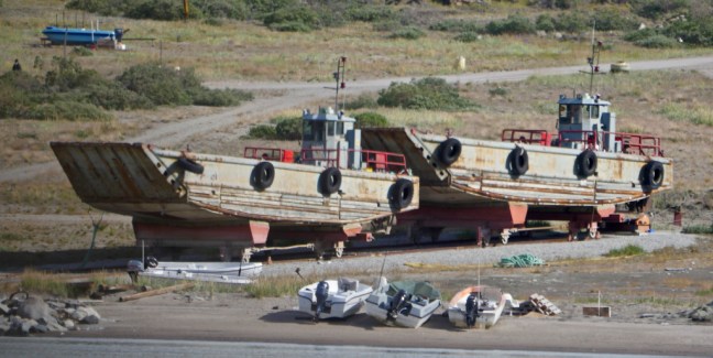 It also reflected how Kangerlussuaq came into being due to the war. The town was founded in 1941 when it was opened as a US Air Force Base. The Americans remained here until 1992.
There is a lot of writing on the rocks at the small dock. The earliest I could identify was 1959.


The air base briefly came under Danish control in 1950 but, following mounting concerns about the Cold War threat, a new agreement saw the U.S. re-open Bluie-West-8 under the name of Sondrestrom Air Base in 1951.

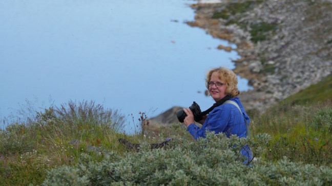
 After lunch we had an excursion booked to the Russell Glacier on partially off-road 4 wheel drive adapted vehicles.
  The bus was an interesting adaptation! Larger tyres? They were needed because it was a 16 mile (25km) drive along a track that in many parts was just sand.
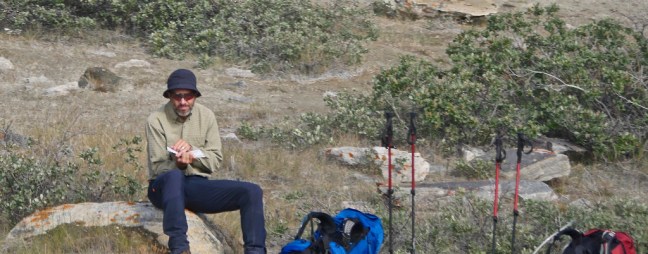
  On the way out we passed a few ‘hikers’

 We passed some unusual rock art and trees.
 The area is home to Greenland’s most diverse fauna including muskoxen, caribou, arctic hare and gyrfalcons. From the coach we saw the first two but from a moving bumpy coach at distance they were almost impossible to photograph. The muskoxen were very large – we had earlier seen knitting yarn made from gathered muskoxen fleece for sale at £60 a ball!
  We also saw the site where a Lochheed T-33 Shooting Star and two other planes had crashed in a blizzard in 1968. All pilots are believed to have ejected safely.


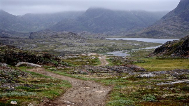
We followed the dusty track along the river Qinnguata Kuussua alluvial valley.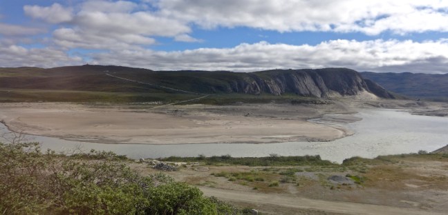
 Before reaching the glacier we stopped at an incredible UNESCO World Heritage viewpoint .
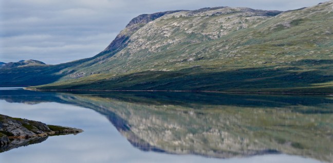


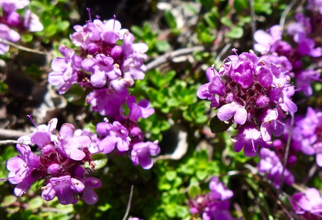
 Flora was all around us.
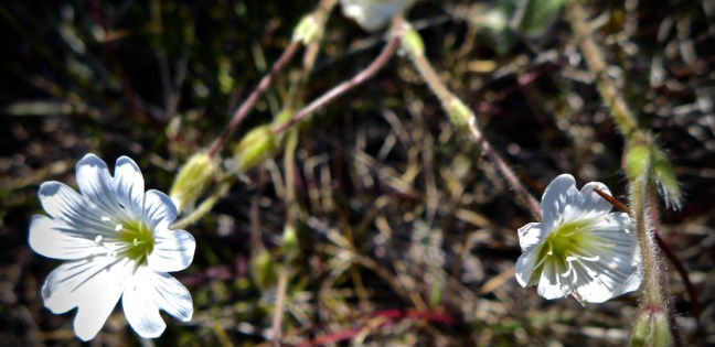


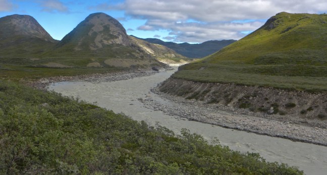
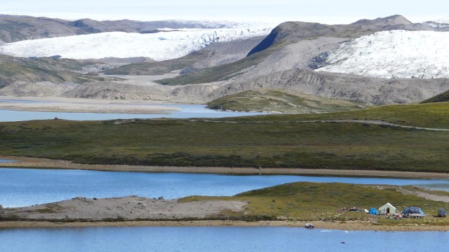
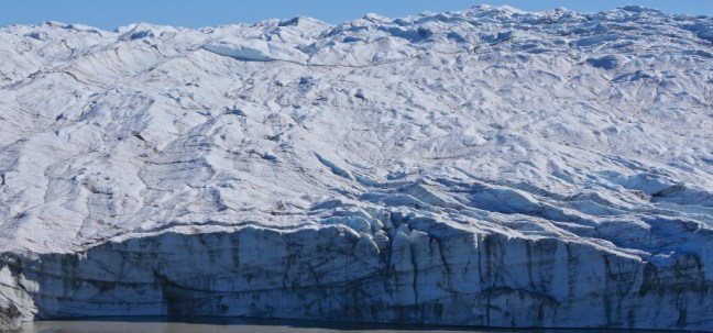
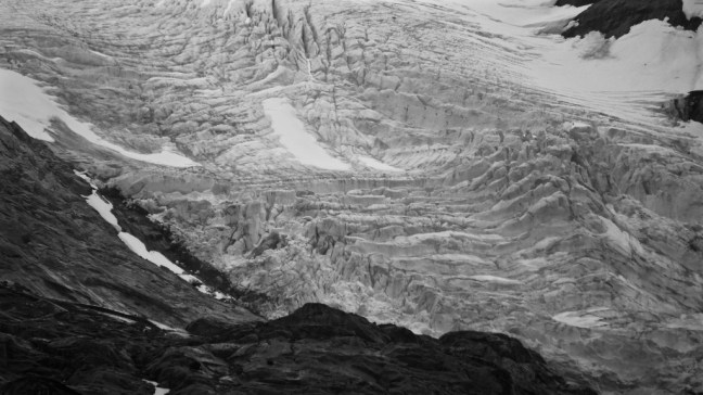
We then drove past some locals who are not allowed to hunt in this UNESCO World Heritage area, but do go further afield to hunt muskoxen and caribou.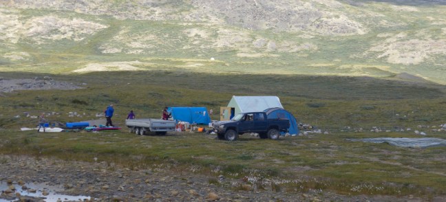 The glacier, which descends from the ice-cap, came into view
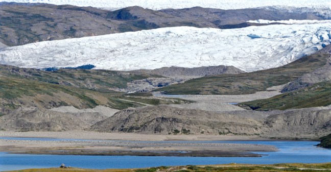 Finally, we reached it.
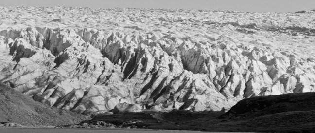
 It was very impressive.

 The vertical walls reach as high as 131 feet (40metres)

 There has been a biological darkening of glaciers due to cryoconite build-up. This is powdery windblown dust made of a combination of small rock particles, soot and bacteria. It is spread by wind and rain. It absorbs heat more quickly than white snow and ice and speeds up the melting of glaciers. Human influences such as emissions from cars, coal fired power stations and soot from fires play a part in its production as does rock particles from volcanic eruptions and mineral dust from warmer regions.
 A dramatic end to a stunning day. Again the weather had been kind to us when it mattered and we felt very blessed.
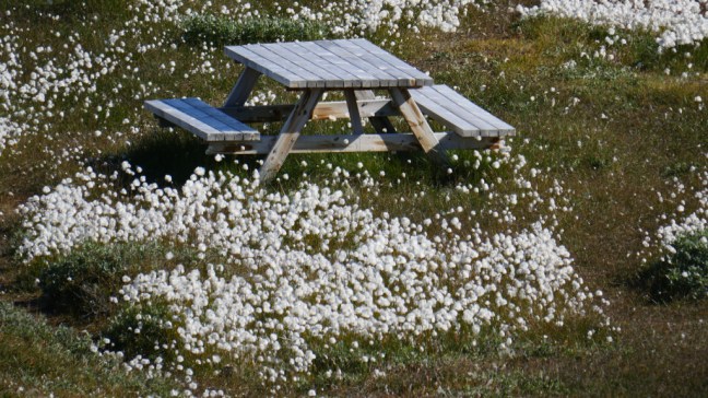 It is easy to forget that the locals, who are not wealthy, have to go and hunt for their food. As we arrived back at the tender dock, a father and his son were just going hunting.
 There was about an hours delay in getting some passengers back onto the tender boats and one or two passengers did complain. However, if you wish to go to these remote stunning places you must be prepared to adjust to the local conditions, tides and weather. Otherwise don’t bother!
The ship was due to depart at 16.00 hours but actually departed at 18.30pm. No problem. We were able to sunbathe on deck in Greenland – in shorts. Unbelievable! Global warming is here and now with all the implications of melting ice-caps and glaciers.

 I did buy this T-shirt in Sisimiut as I couldn’t resist the ‘mistake’ in the shirt:
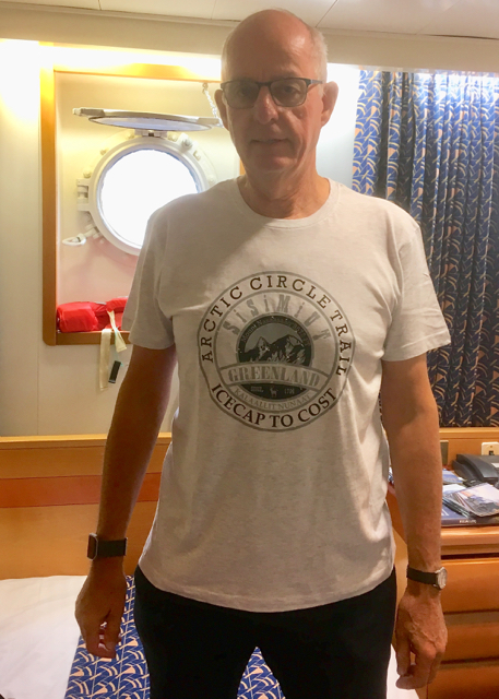

 I then had to decide what to do, given that the ship would depart again at 17.30. Of course I would have done the Arctic Circle Trail if I had been there for 12 days but, given I only had just under 12 hours (that’s my excuse!), a more leisurely hike seemed appropriate leaving the ladies to explore the town. There was a hike organised by the ship to Tele Island where Sisimuit started some 4,000 years ago. The Inuit used it as a hunting ground for many years. This would have included turf hut ruins and a burial ground. From the hike it is possible to see the mountain of Nasaasaq at 2,750 feet (785 metres), which dominates the town.
 However, Cumbria Man and myself decided to work our own route out to the nearby lakes. We left the port area.
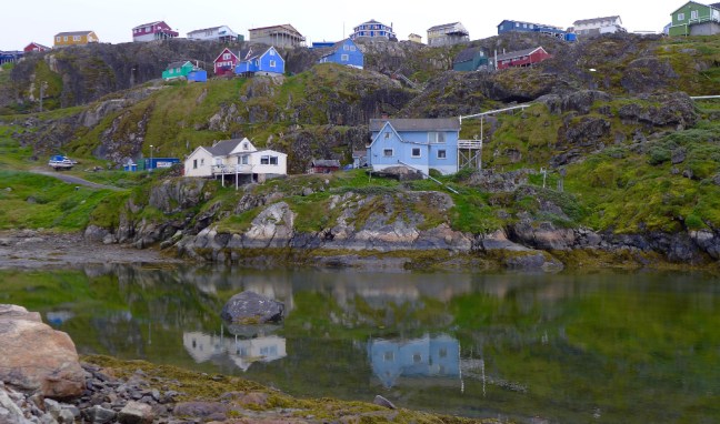 A good place to get one’s bearings on a walk (some would also say in life) is at the church, which is quite prominent in Sisimiut.
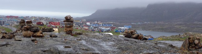
  Sisimiut is the second largest city (!) in Greenland with a population of 5,524 (2018) and has some unusual exposed waste disposal due to presumably cost, perma frost and the hard rock hereabouts. There is a small airport.
 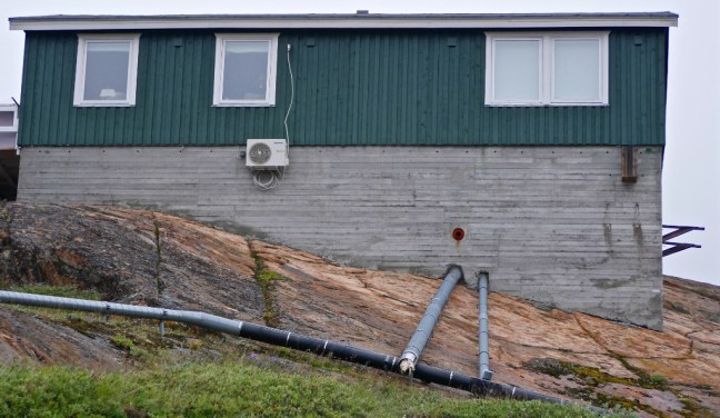 It also has some poorer quality housing with unique bicycle storage facilities.
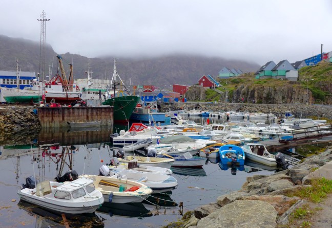
 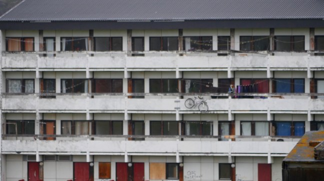 Boats are everywhere, here in front of the museum which specialises in Greenlandic trade, industry and shipping.
 The local cable car is also unique.
  Probably due to expansion of the town, the cemeteries with their characteristic wooden crosses are very close to the houses.
 Dogs, boats and arctic cats are ‘parked’ outside houses.
 We assumed these stone and turf units were not used for human habitation.
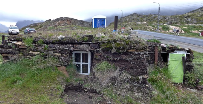
 Fishing and fish processing is the prominent industry in Sisimiut.
 Hunting is also important to some of the local livelihoods, mainly seals, walrus, beluga whale, narwhale, reindeer and muskoxen. Indeed on our walk we heard a number of gunshots.
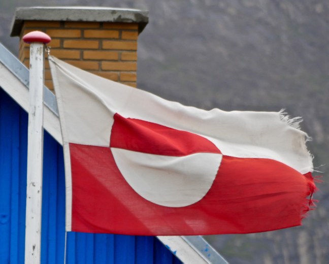 Leaving town we passed the first lake.


 We then met a young Danish couple walking from the mountains who had been on a 12 day hike to the ice-cap, being totally self-sufficient, even to the extent of having solar panels on their rucksacks! Maybe they were just finishing the Arctic Circle Trail.


 The puppies were very friendly and are allowed to roam free for up to 4 months.
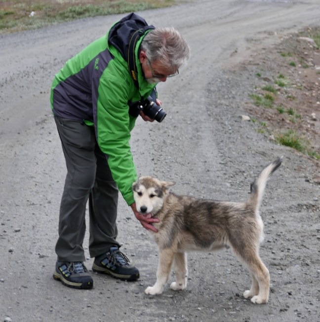 I think this may be a young snow bunting which we saw in the area. We also saw white adults.
 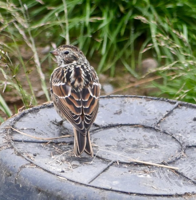 Also rooks are quite common.
 It is hard to believe that, despite all the ice and cold, there are 500 plant species within Greenland, 22 species of trees in the Sisimiut area and 63 species of herbs in central Greenland.
 Photographing sunrises and sunsets is one of my favourite subjects. I love this time of day when many others are asleep and I seem to have the world to myself, quiet and serene.
 But sunsets, especially at sea, look good on a broader view too as they change colour, tone and shape over time.

 And if you have a mountain peak and/or an iceberg in as well you have hit the jackpot!
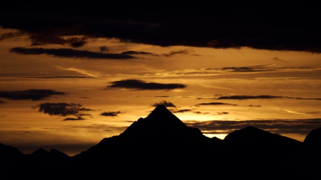

 After such a good start to the morning I then retired to the Marco Polo Bistro for tea and pastries, where I had a very enjoyable chat with Lawrence Robinson who was the excellent opera singer on the ship. He has even sung with Katherine Jenkins so must be good!


 We arrived in Sisimiut next day at 8am in the morning. The second largest city in Greenland, situated 25 miles (40km) north of the Arctic Circle.
  We passed Qassiarsuk where, according to Icelandic sagas, Greenland was discovered in 982 AD by Eirikr Porvaldsson (Eric the Red). He had been exiled from first Norway and then Iceland. According to legend Erik’s father was also exiled from Norway in 960 AD as a result of ‘a number of killings’, and Erik’s entire family thus settled in Iceland. Here Erik the Red married Tjodhilde, but history repeated itself and his father’s fate also befell Erik. In 982 he was sentenced to exile from Iceland for three years for murder. He came to and named Greenland. The settlement at Qassiarsuk has been reconstructed.
 This saga had particular interest for me as on 21st January 2017, as a birthday present consisting of a DNA test, I discovered, whilst on a ship to Norway, that I was 32% Viking.
 Our route took us past the small airport.


 Adjoining is a museum recording the period of the USA and Danish development and use of the airport since the Second World War
 The bus service and petrol station are interesting! The bus takes people from the airport to a nearby hotel. My bus-pass wouldn’t get me far in Greenland! I think the petrol station was self-service, with only two choices!


 Suprisingly there is also an arboretum and unique ‘botanical garden of the Arctic‘. The aim is to establish a live collection of trees and bushes heralding from both the arctic and alpine tree-lines of the entire Northern Hemisphere. There are 110 plant species and over 50,000 trees of various provinces.
  We decided to press onto the glacier on an increasingly hot day and with an increasingly higher number of mosquitos. We passed an interesting structure, which looked like a fireplace. Behind it was a dam for hydro-electric power.
  We enjoyed seeing the plant life in the area.
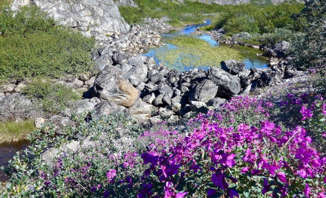


 Fed by water from the glacier.
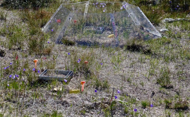
 A cairn indicated the variety of rocks in the area.
 We then passed an interesting snow fence experiment.
 Before climbing to a viewpoint.
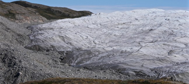
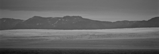
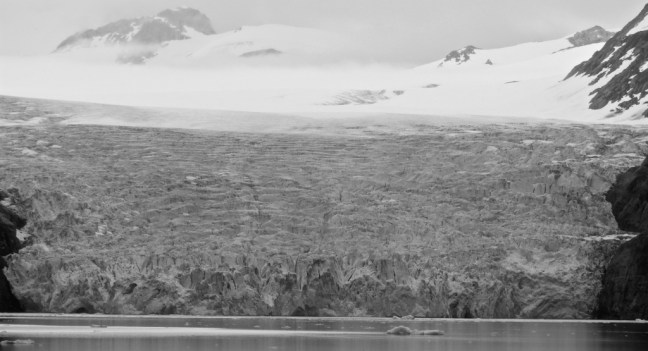
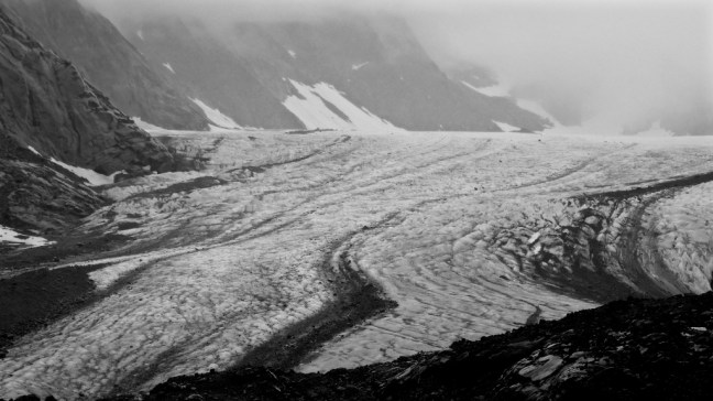
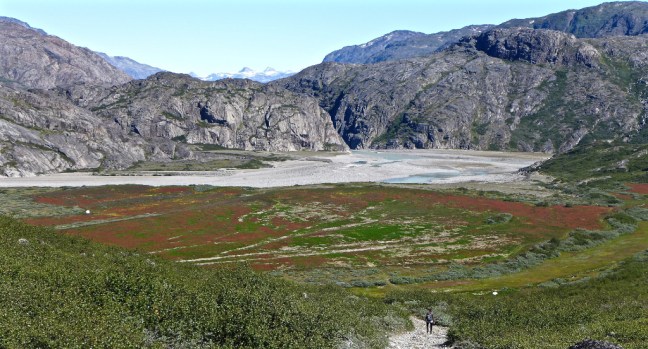 However, the glacier had retreated and we had insuffient time to reach it. I later got a peep of it and a photograph from the ship.
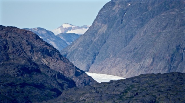 In a day that had begun at 3.15am with the ship colliding with an iceberg, followed by a stunning trip to icebergs/ice flows in the morning (see previous blog) and then a 12.6 mile walk towards a glacier, I thought it only fitting to finish with icebergs and mountains photographed from the ship after we departed the port at 18.00 hours.


 And in these remote and poor areas man can only struggle to dispose of his waste and rubbish by burning it. Or just leaving it to ‘soil’ the earth. In the wealthier countries with re-cycling facilities he often does worse, throwing it out of the car or throwing it on the floor or leaving it in a plastic bag to ‘stain’ the countryside for years to come.
 The next day our Captain announced that the ship would be checked in port followed by another more major check with specialist divers at the next bigger port. He did say we had hit a growler (a small ice-float). There was some doubt in some passengers minds that it was a growler, especially from those who saw it.
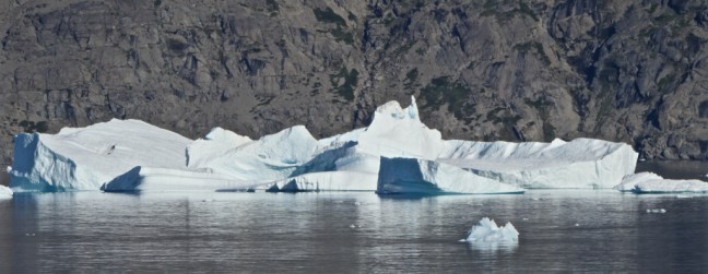
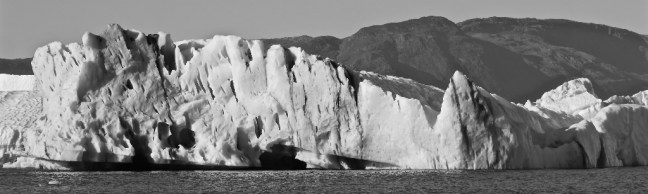
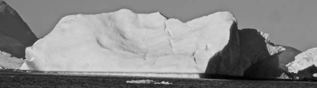
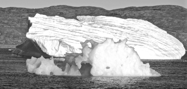
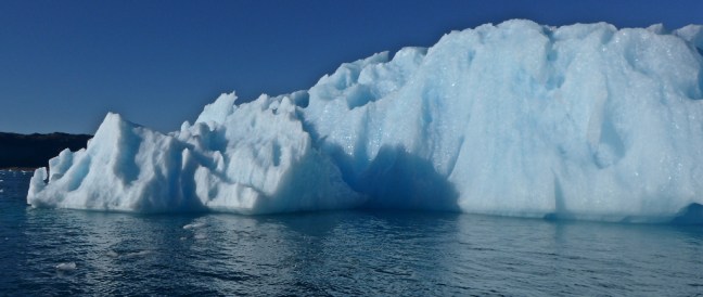
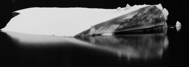
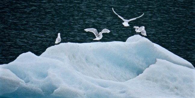
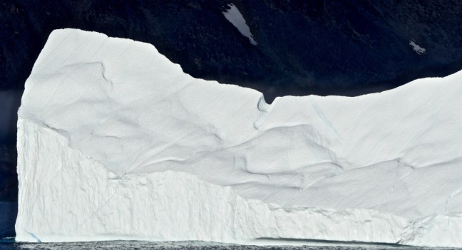
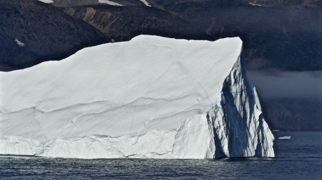
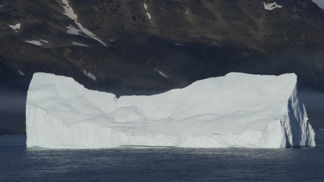
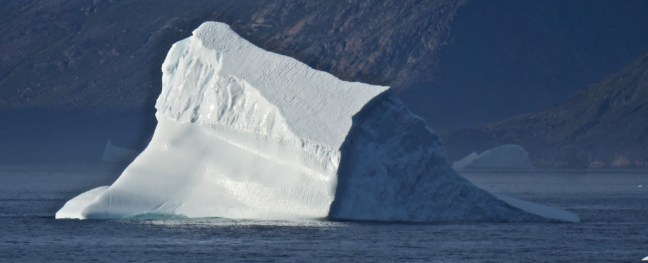
 To get amongst the ice in small boats is quite magical and humbling. Each iceberg/flow is different and unique. Nature is a wonderful sculptor. Here are some black and white photographs I took.


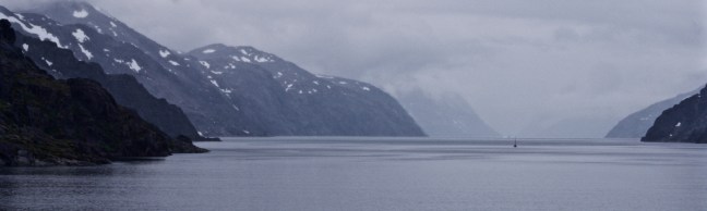
 We then went further up the fjord to see the source of these icebergs/flows. Our local ‘captain’ switched the engines off and we listened to the silence – it was so unlike anything else I had ever done. The scale of it was overwhelming.

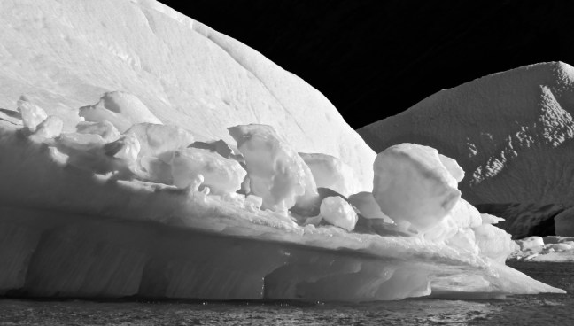
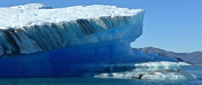
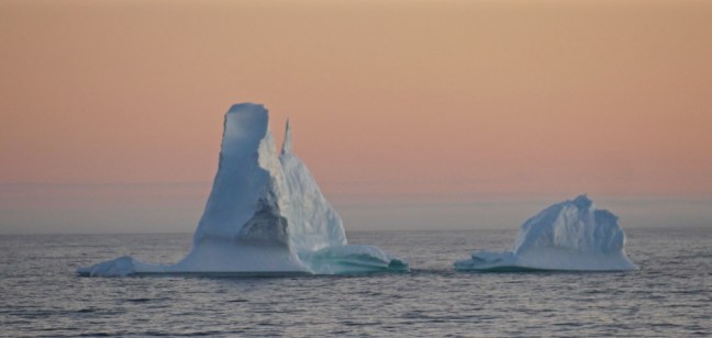
 The icebergs and glaciers are magical in colour too!! I will not apologise for the number of photographs as each ice flow is unique and carefully created by nature. To be amongst them overwhelms the senses and results in the mind constantly turning over to take in all the shapes, sizes and colours not normally seen. Many hues of blue and white, some intense, some transparent and some dense and snow packed.
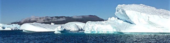

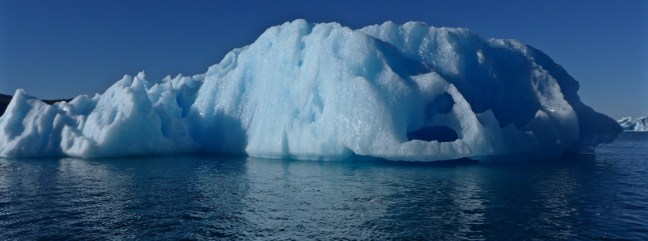
 The imagination wanders – a snowplough?
 A strange pointed eared animal?
 A monster from the deep with an eye, small mouth and flippers.
  At times we sped between the ice
  and then stopped suddenly close enough to touch it.


 Then it was time to get close again, at times almost underneath them.


 Before approaching the really big ones
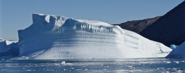

 Before scurrying back to our ship with our tails between our legs as nature showed us its power and supremacy.
 Such moments are etched on the mind and soul, never to be forgotten.


 It was time to get dressed up for the passageway, which was likely to be cold and out of the sun. Also to get cameras and binoculars ready. The order of the day was lots and lots of layers, including goose down body warmers and fancy warm hats. I was now grateful for my new thin gloves for photography, which I had bought in Akureyri, Iceland earlier in the voyage.


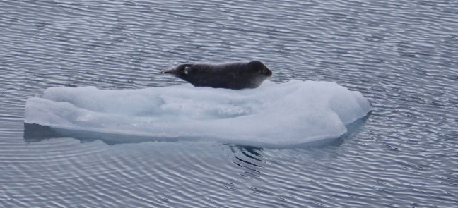
 Baby seal hitching a lift
 A growler
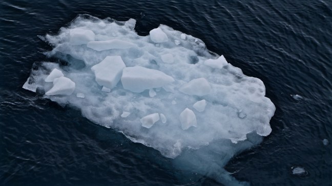


 Aappilattoq with a population of approximately 150, 132 in 2010 and 200 in 1991. The average age is 31.5. Only accessible by boat or in an emergency by helicopter. It again suffers from the difficulties of disposing of more modern rubbish.
 Not a good idea to meet one of these in a narrow passage as we were soon to find out next day at 3.15am!


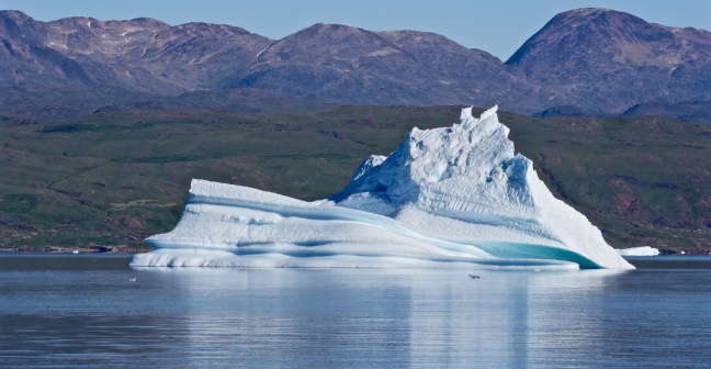
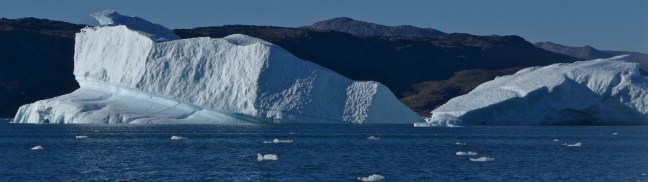
 Leaving the passageway of Prince Christian Sound, we entered open sea, where the icebergs just got bigger.


 We were due to arrive at Narsarsuag at 7am next morning, but were to have a startling awakening in the night…
 My wife Celia came dashing out of the shower naked and dripping wet. It was the nearest I would get to the ‘Titanic moment’ when Leonardo DiCaprio drew Kate Winslet completely nude, except for a necklace. Celia didn’t even have a necklace on.
 4 August 2018, Tasiilaq (formerly Ammassalik until 1997)
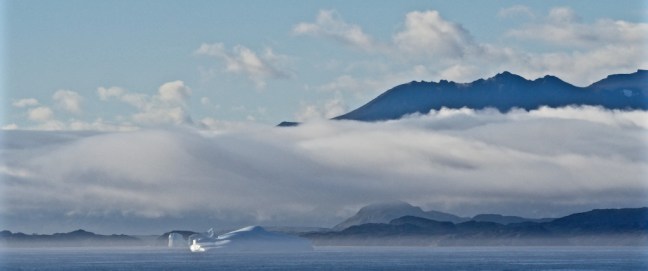
 Tasiilaq only has a population of approximately 2,062 people, but is the largest town on the eastern coast of what is the world’s largest island! It is the seventh largest place in Greenland. It is 65.9 miles (106 km) south of the Arctic Circle. It is one of the most isolated settlements in the world, where to the west the ice sheet rises up to 8202 feet (2,500m).
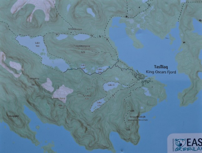
 The local children were first to greet us with interest on our landing.
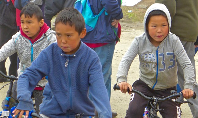 The Saqqaq culture was the first to reach Eastern Greenland arriving from the north. Thule migrations passed through the area through what is known as Peary Land and Independence in the 15th century, finding the south-eastern coast uninhabited. Due to back migrations to the more densely populated western coast, the south-eastern coast was deserted for another two hundred years. The region wasn’t settled until the late 18th century, with the village surviving as the only permanent settlement in the 19th century. This was founded in 1894 as a Danish trading station.
 We soon reached a new football pitch shrouded in sea fret. Will Greenland qualify for the next World Cup?!
 One of the sad and surprising things we found in Tasiilaq was an abundance of litter. One can speculate on the reasons but it is to be hoped that something can be done about it. It is clearly a poor area and pride in what must be an incredibly tough environment to live in appears to have disappeared. It may be the change from a subsistence culture of hunting and fishing to a culture mixed with a modern culture is a factor. Alcohol and drugs are now more readily available and hunting and fishing is becoming more difficult with climate change. Greenland is unable at present to provide recycling facilities and so has to burn rubbish. Modern products such as tin cans, metals and bottles can’t be burnt and they tend to pile up near the ports.


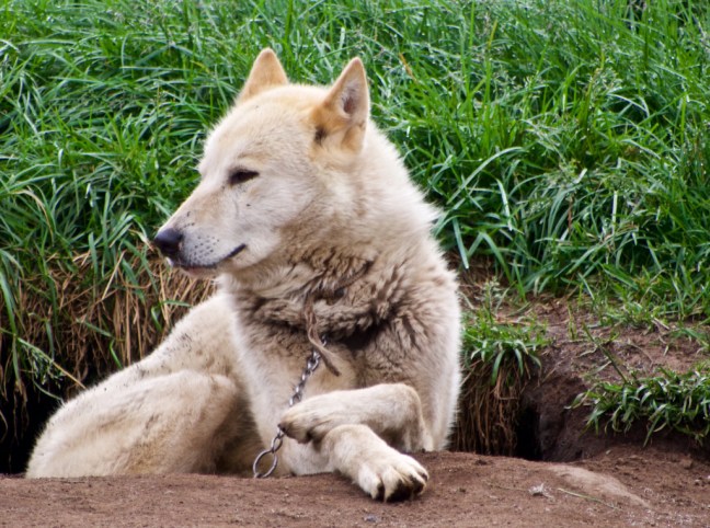
 Following the river valley we passed the husky dog area. These, pulling sledges, are used for getting about in winter in the snow as there are no roads out of Tasiilaq.

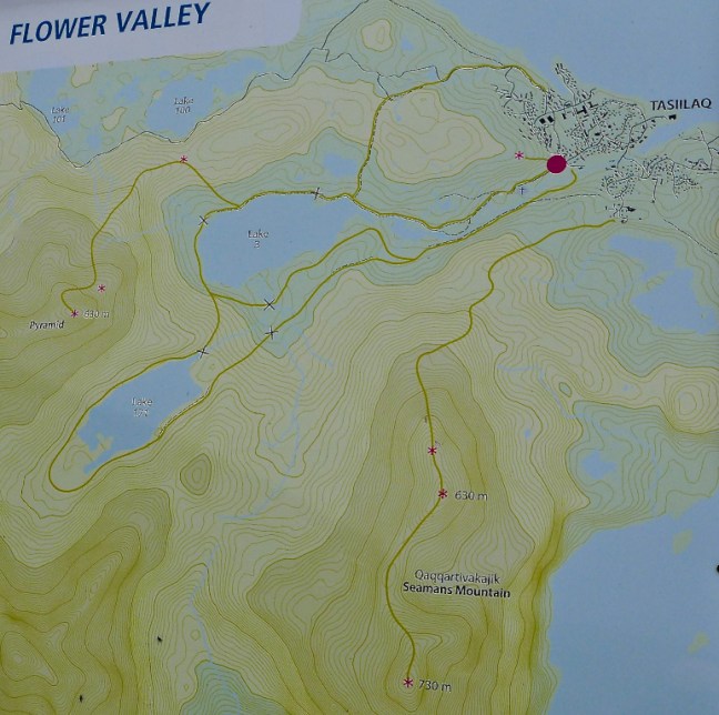
 Known as the the flower valley there are indeed a number of flowers to be found.


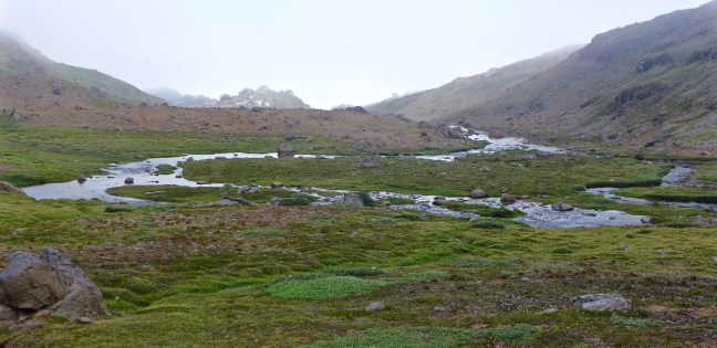 We decided to head up higher.
 Before descending to a waterfall and the lakeside area.


 Where our ship could be seen with passing icebergs and ice-flows.


 After an early cup of tea in the Marco Polo’s Bistro (there tended to be a few regulars there on opening at 6.00am each day!), I was rewarded with a good sunrise at 6.35am.
 Followed by some dolphins and possibly a whale.
 \
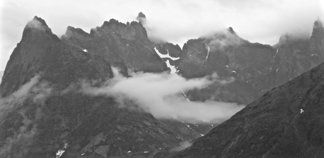
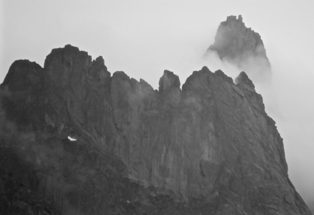
\ The impressive surrounding sheer granite mountains are tipped with snow all year round.
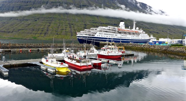
 Akureyri has a population of about 18,000 and on this day the population was to have an increase of 4,500 people due to the MSC Meraviglia being docked there.
  I have already expressed my view that these huge ships are inappropriate for docking at small ports as they tend to detract from the characteristics of the place you are visiting. Even a passenger I met from the MSC ship said it was just too big. New cruise ships are being built that are even bigger. In contrast the 848 on our ship (to the left behind the big one in the first photograph) can easily be absorbed by small towns and villages and not detract from the experience of the visit.


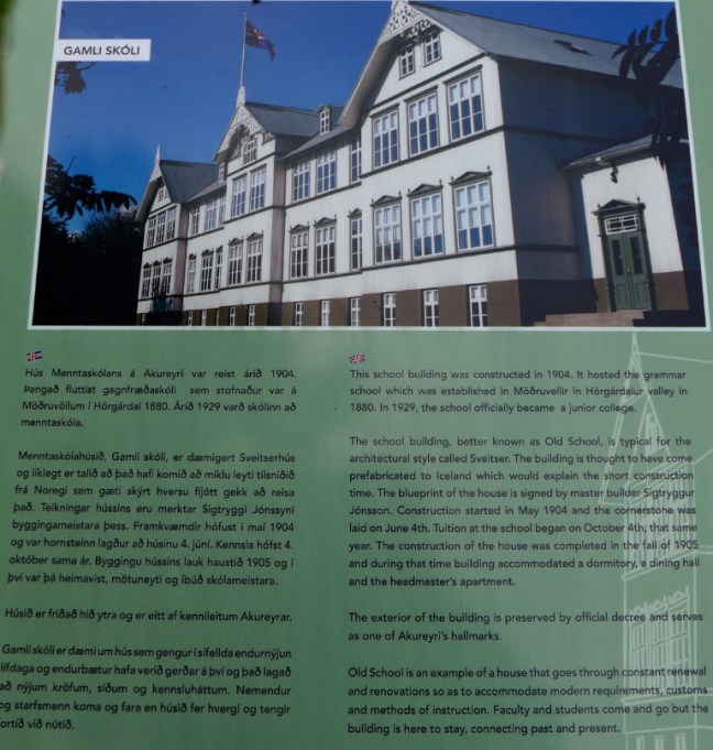
 A quick walk along the dockside and through the town’s main pedestrianised shopping street of Hafnarstraeti (I bought some thin gloves suitable for photography, but didn’t dwell there unlike the ladies who I left there) quickly brought me to the church and the ‘must do’ 100 steps, from which there are good views.

 I soon discovered that Akureyri has a microclimate and it was much warmer than anticipated, hence the surplus of clothes!
  The Lutheran Church was designed by the architect Gudjon Samuellson. The centre window in the chancel was donated by England’s Coventry Cathedral – it was one of only a few parts that survived the bombing during the second world war.
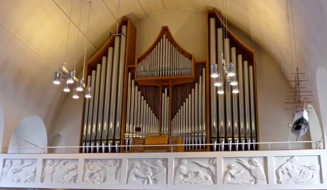 The gardeners near the top of the church had distinctive hairstyles and nice smiles and beat Alan Titchmarsh anyday!
 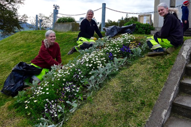 I then walked uphill past the church,
 to pass some rather nice houses built in the 1920s.


 A little further on I came to the college and the ‘road to destruction’.
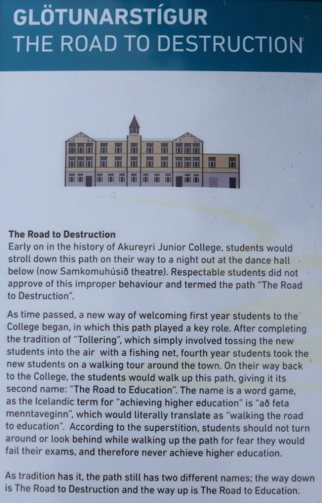

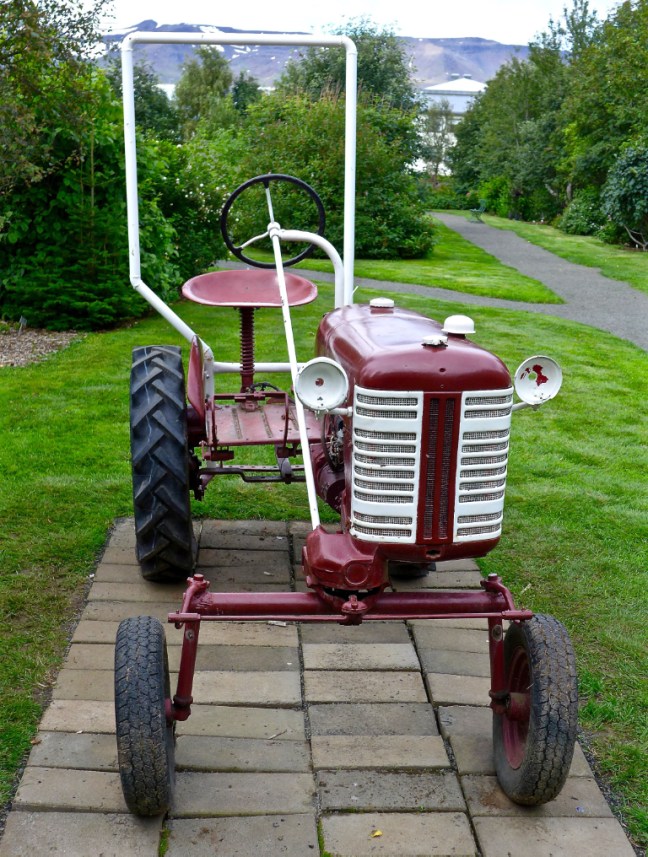
 Near an old tractor I found the entrance to Botanical Gardens famed for its 7,000 species of local and foreign flowers, which bloom outside in Akureyri’s warm microclimate. There were certainly a lot of plants to see.


 A new rock garden was under development
 All that remained was to walk back to the ship for lunch, encountering some trolls en route.


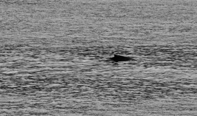
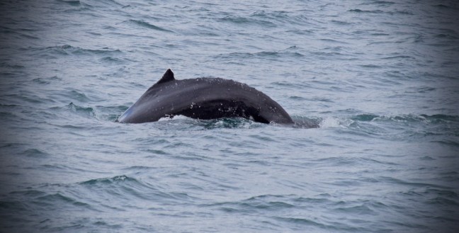
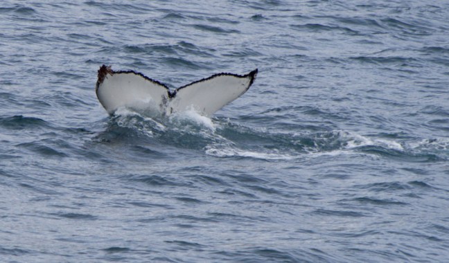
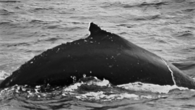
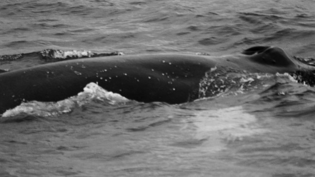
 We were then fortunate to have good sightings of the two humpback whales and their flukes (the two tail lobes that go up as they dive).


 We descended to look at the church. On both the ascent and descent there were fine views towards our ship.
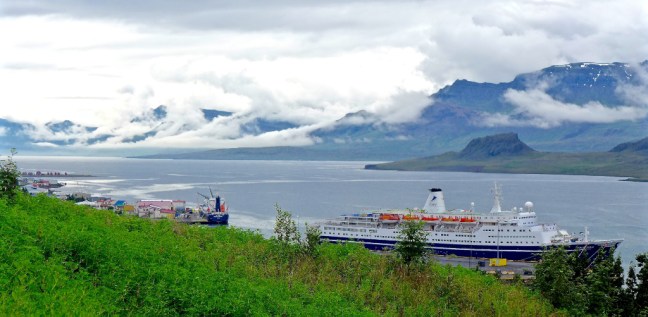
 There was a lot of light in the church and a fine painting of the fjord.
 Leaving the church and community centre, we visited the cemetery further up the valley. There were some interesting gravestones.


 It had been a relaxing morning walk.
 Torshavn has a population of 13,089 (2017) and the greater urban area 21,000. It has over a third of the Faroes population. It named after the Norse God Thor, the God of Thunder.
 We only had until 2.30pm on the island and so the opportunity to walk was minimal. Even more so as we were booked on a coastal villages tour to the village of Saksun.
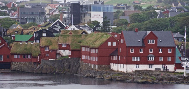 There was also the car ferry MS Smyril in dock, the largest ship in the Faroes transport company fleet at 12,650 tons and which can carry 200 cars.
  Our tour coach climbed rapidly and inevitably conversations turned to the controversial killing of whales in the Faroes. Figures of 60 and 160 were mentioned of whales killed recently, apparently for ‘free meat’. Not everyone was convinced that this was justified. It seems a bit different in Greenland where the Inuit had (and still have in some places) little alternative but to hunt for whales to survive as there is little else to live off.
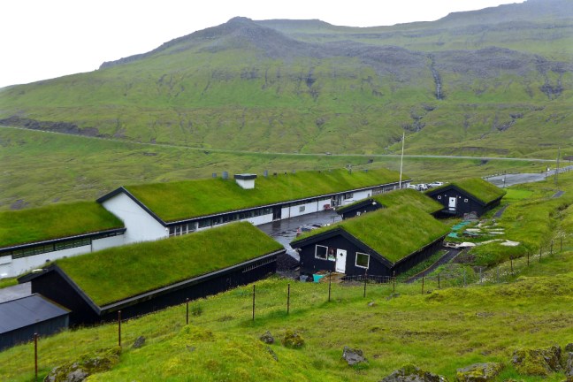
 We stopped briefly at a viewpoint over a sea inlet, with a first sighting of green grass roofs!
 We also went to the village of Kollafjorour, which lies along a broad fjord and is home to many salmon farms. The old Lutheran Church was built in 1837 and was constructed with black-tarred wooden sides and a turf roof and white bell tower. Like most churches in these northern areas a ship hangs from the roof inside.
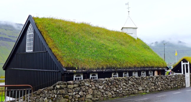


 After a journey of 48 kilometres (30 miles) from Torshavn we arrived at Saksun one of the most idyllic villages in the Faroes, with a well preserved folk museum.
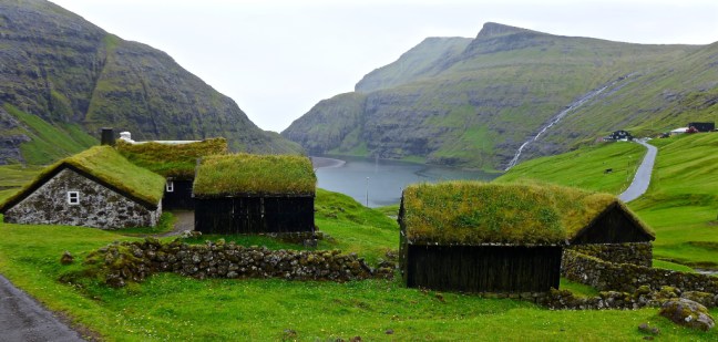


 The old turf-roofed farm house of Duvugarder is now a museum. It is a well preserved Faroese farmhouse of any period from medieval times to the end of the 19th century. There are many domestic items on display.


 We arrived back at our ship for a late lunch.