Post 244: 29th March 2018, The Inn Way – Yorkshire Dales, Arncliffe to Buckden.
The alarm clock went off at 3.45am! My gear was already packed in the boot of the car, apart from my rucksack with food and flasks still to be done. The forecast was for good weather and I planned to resume The Inn Way again for the second time without Sid the Yorkshireman, Carol and Alf, all of whom were still unavailable.
But first my wife Celia was off on an adventure, going on a Mystery Cruise, and so I was dropping her off at Leeds Coach Station for a 6.30am depart to Dover. I would be ‘Home Alone’ over Easter.
Celia had been invited to join me on a walking holiday in the Bavarian Alps later in the year with a German walking friend but, not being a walker, preferred to cruise. I have been surprised by how many people when told she is going on a Mystery Cruise have asked me where is she sailing to?! That’s the point you don’t know. Today I have heard that she docked in Ghent but, because you don’t know which port until you dock, she lost an hours sleep as the time zone is different! We are cruising together to Greenland and Russia (Baltic) later in the year!
The ‘drop off’ in Leeds went well but I had a bit of trouble getting out of Leeds, despite the sat nav. Give me driving in the countryside every time over cities.
As I got towards Grassington the fog came down for the second time this week, but I still prefer that to driving in cities. It cleared and I parked in Arncliffe near the Falcon Inn.
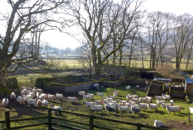
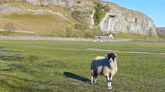
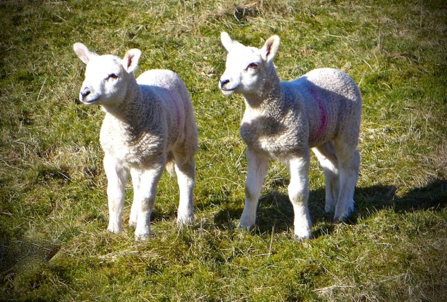
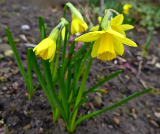
At about 9.00am I left the village along a road that was closed – at least it said it was until a landrover came hurtling along and I briskly stepped out of the way. It screetched to a halt and this bubbly, cheerful, young lady jumped out and headed for the lambs and starting feeding them. She then asked me if I wanted to hold them. Having never held a lamb in my life, how could I say no? They are surprisingly light, not surprisingly – very warm and certainly not nearly as cuddly as I am! However, they are a lot cuter than me.


I said goodbye to the welcoming lady (my friends later said asked whether she had been to Specsavers recently as they were worried about her eyesight) and headed off the road to the not too promising path. There had been heavy overnight rain and I hoped the paths weren’t flooded like this all the way.
 My fears were soon allayed as the final mist lifted and wonderful green velvety grass paths welcomed me.
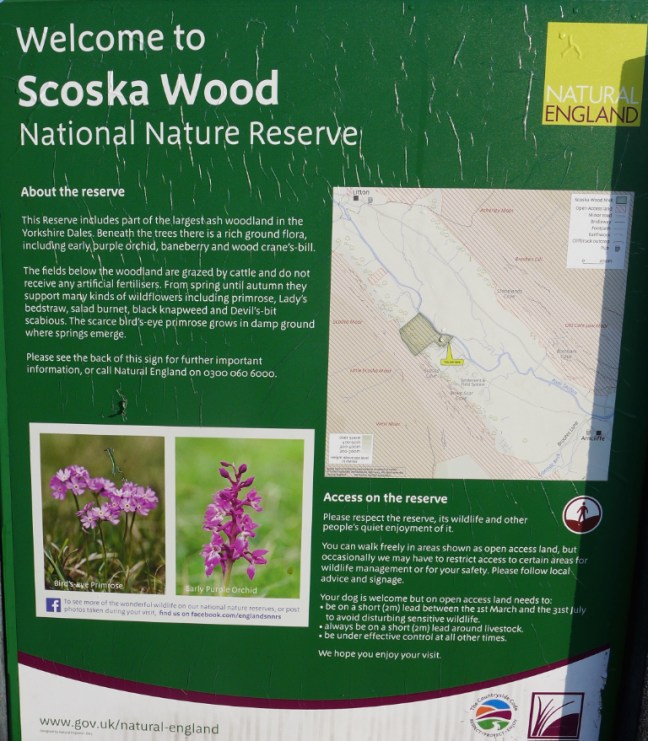
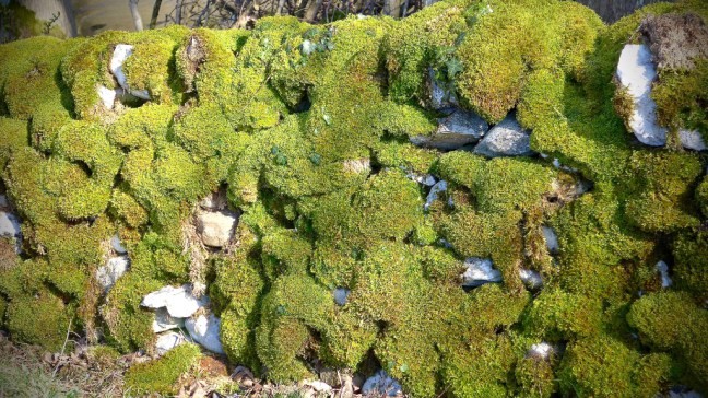
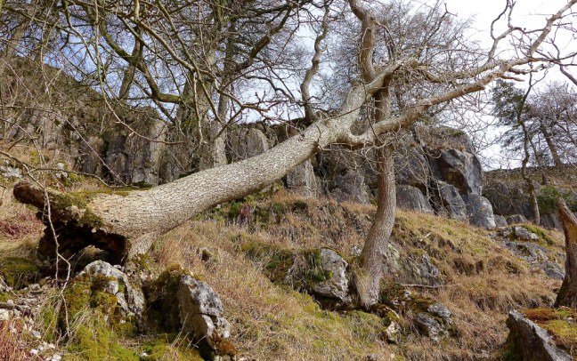
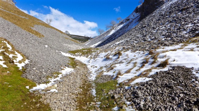
  I had entered ‘Arcadia’ (as opposed to arcades in Leeds) with wonderful soft paths, stone barns and the ancient Skoska Wood, which is the largest ash and rowan wood left in the Yorkshire Dales, now protected as a nature reserve. The valley of Littondale was carved by glaciers and the meltwater thousands of years ago with its Yoredale rocks lining both sides of the flat valley floor. It has changed little since then and it felt like I stepping back in time to a less hurried world where nature predominated.

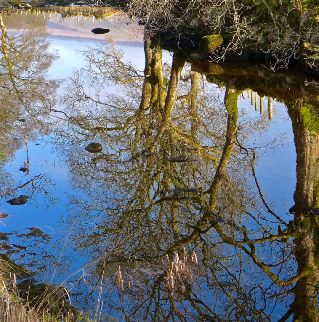
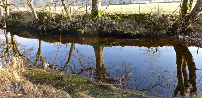
 The water in the River Skirfare was crystal clear and the low sun was casting ethereal reflections of the trees onto the river.
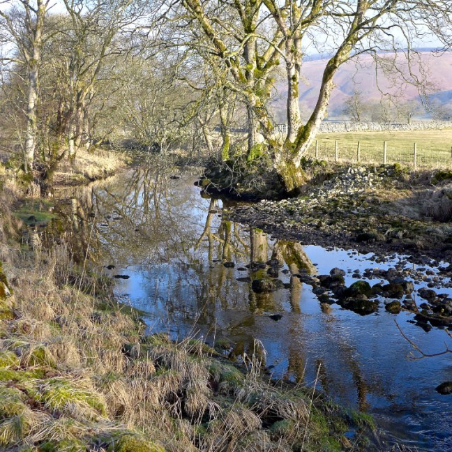

 The sudden contrast from Leeds or for that matter any city was stark.
Despite the rain overnight, the river had largely dried up in parts through the permeable limestone, only to emerge further downstream where there were less permeable rocks. A very strange phenomena.

 Certainly the sheep and lambs were enjoying the warming sun, peace and tranquility of the day as they sunbathed. No other walkers were about. Many birds were singing their hearts out.


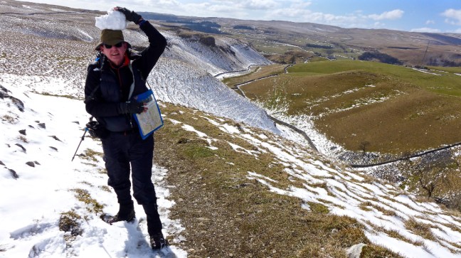
 I then began the ascent of Birks Fell to Buckden in Wharfedale. This is now a designated mountain (a hill above two thousand feet at 610 metres or 2,001 feet). On old imperial maps the highest point was shown as 2001-feet, but this was revised to 608 metres (the trig pillar is currently shown at 607 metres on maps) upon metric conversion. In 2006 the Ordnance Survey agreed with walkers that it was indeed over 2,000 feet just north-west of Birks Tarn.
In Alfred’s Wainwright’s book ‘A Pennine Journey – The Story of a Long Walk in 1938’ he says:
“There is only one way to know a hill, and that is to put your feet on it and walk. Wander about leisurely if you wish, but better still, make the summit your objective and struggle up it. Plunge into the bracken and heather, and wrestle with the thousands of tentacles that would hold you back; splash through the streams that silver the hillside; scramble up the rocks and know the thrill that enslaves the mountaineer; sweat and pant, slip and tumble, and curse if you are so minded, and rest often. But get to the top………..
Either you will never want to see a hill again, in which case you may safely assume that the rot has settled in your soul so deeply that nothing will remove it; or you will hunger for the next opportunity, do it again and again and keep young forever.”
He also mentions about running down on the descent, but this is unwise for a so called 55 year old + 16% like myself as I am likely to trip up and be stuck on the fell. Given my wife was away I could be there for a while until someone found me ‘dead or alive’. I only met one other person on the climb I was about to start.
I soon passed an unnamed farm (on the map) and clearly the sheep were desperate to join me on the mountain.
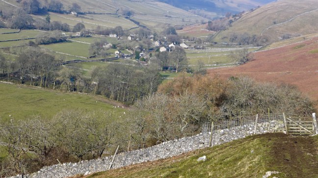
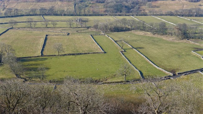
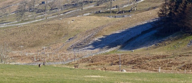
 As I ascended I kept looking back to the stupendous views. Who decided the shape of each field with its drystone walls and what was the rationale behind the shapes and sizes of the fields?
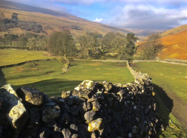


 The ascent looked long!
  And looking back was long.
 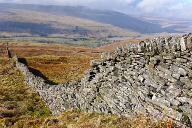 Nearing the top a little snow was clinging on.
 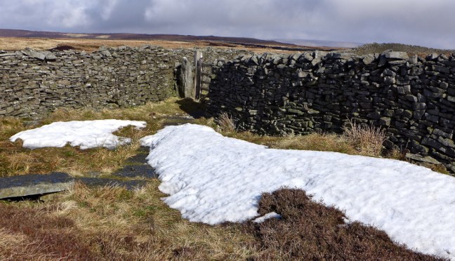 After the gate the trig pillar came into view and the descent, sometimes slippy and boggy, began.

 I was surprised to see frog spawn on the path.
 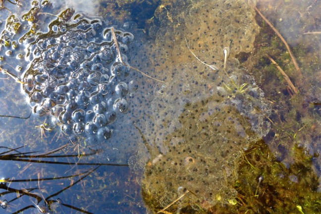 I passed a young man who was walking the route from Starbottom in reverse to me.
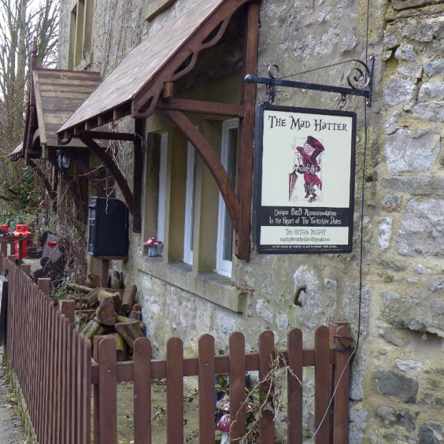
After a long tiring descent I reached Bucken to find both the Buck Inn and cafe closed. I had hoped to get a Dales ice-cream having missed out on one on my previous walk. This contrasted with when I did the Dales Way in 1990 and On Foot from Settle to Hadrian’s Wall in 1997 (see earlier blogs) when the cafe and pub were thriving. However, the cafe is for sale and it is planned that the inn will re-open.


There was a bed and breakfast for ‘Mad Hatters’.
 It was time to leave The Inn Way and find a route back to the car at Arncliffe.
I then joined The Dales Way towards Starbottom and it’s velvety level grass paths were a delight to the feet and the mind, as the sun came out again in the sheltered valley.


I was somewhat surprised to see a propeller aeroplane come hurtling low down the valley.  There are some delightful colourful enclosed ways on The Dales Way, which offer shelter from any breeze.
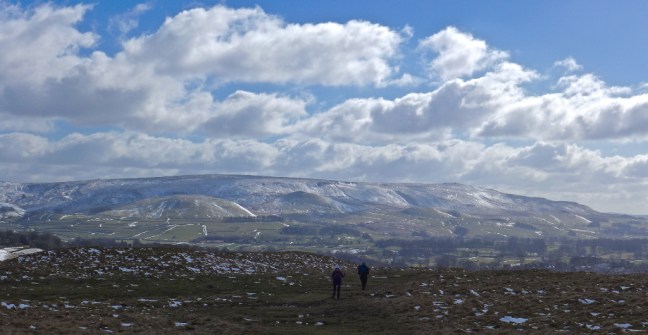
  Opposite the bridleway to Starbottom I took the ascending bridleway in the opposite direction, leading towards Old Cote Moor. This climb was particularly noticeable coming at the end of the day’s walk and there seemed to be many false summits where I got to what I thought was the top, only to find there was another one ahead. However, the views below of the meandering River Skirfare, slowly finding it’s route like a large snake, made the effort well worthwhile. Also, given my car was over the hill, there was no choice – I had to keep going. My bus pass was no use.
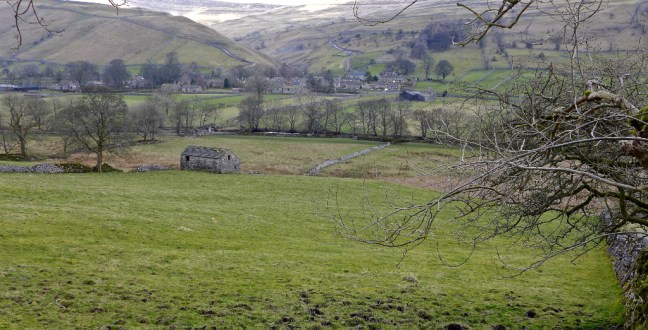


 Before the top and the heather line, I passed the young lad again. It was about 2pm and he said the Falcon Inn was due to close at 3pm. I hoped to make it for a cup of tea and icecream or cake as all my provisions had now gone.
 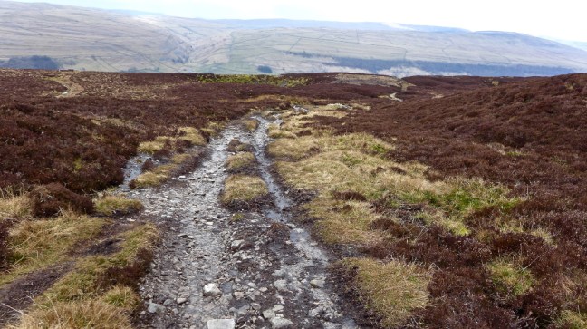 The descent followed with some relief. This is when most accidents happen and so it was important to keep concentrating on where I was putting my feet. It was clouding over, getting cooler and felt as though rain would arrive soon.

 Just before the village it was only appropriate the walk would end with lambs just as it had started.
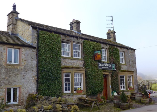
 I arrived at the Falcon Inn at 2.40pm and fortunately the landlord was welcoming and provided a pot of tea and a warm delicious scone by a warming fire. A proper Dales Inn. A great end to a great and challenging walk


Miles Walked 13.2
Steps 30,000
Calories Burnt 3,200
PS: When I came out of the Inn it was raining!
On the way home I found a delightful cafe at the bottom of the main street of Pateley Bridge, which had loads of varieties of Dales home-made ice-creams, pancakes and cakes, all reasonably priced. A well earned reward.
It could become a regular stopping point. There is 50p parking for an hour just off the road a little further up on the right.  I hit bad holiday and works traffic just after Knaresborough and so had a 30 minutes sleep in the car until it died down.
It had been a long day for a 55 year old!
 Leaving Pateley Bridge on the B6265 there were few cars, but some lovely views.
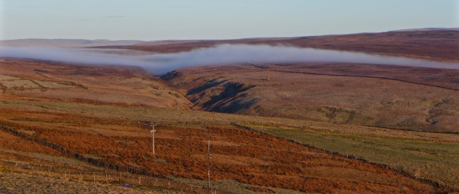
 However, approaching Grassington the views turned to thick fog, which lasted until I arrived at Conistone. Very strange as I didn’t remember fog being forecast. There was more of a hard frost in the Conistone area than fog. I started walking at just after 8.30am with clear blue skies. Conistone is a good example of an Anglian settlement that goes back to the 8th century with ploughing terraces on the hillside. The first thing that strikes you is how quiet it is.
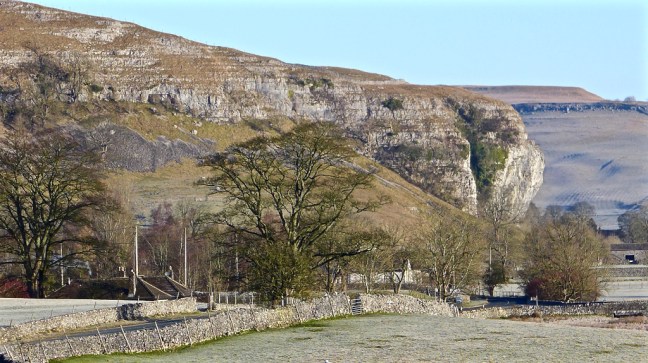
 Following the road and then a field path, Kilnsey Crag came into view.
 The River Wharfe was passed.
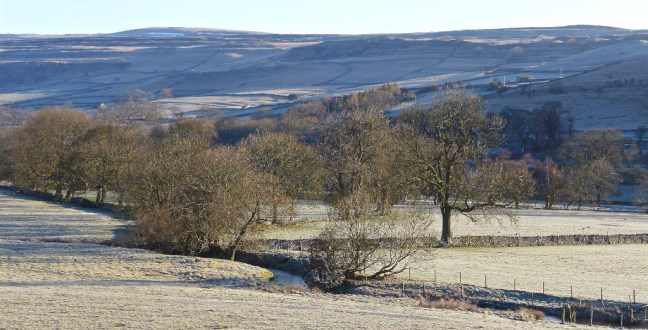
 I crossed the frosty fields towards the Crag and The Tennant Arms pub.
 Kilnsey Crag was formed when water from Vauclusian Springs had worn subterranean ramifications, to finally emerge from the limestone near its base. Here the series of springs burst out where the basement of Silurian slates is not far below. Glacial meltwater would have supplied the springs. Close up to the limestone crag is an impressive site and it is a favourite haunt of rock climbers. It is 170-feet high with an overhang of 40-feet.


 A couple of accommodation units for groups were passed.


 The frost created interesting patterns.
  Whilst mist was still lurking behind me back towards Grassington.
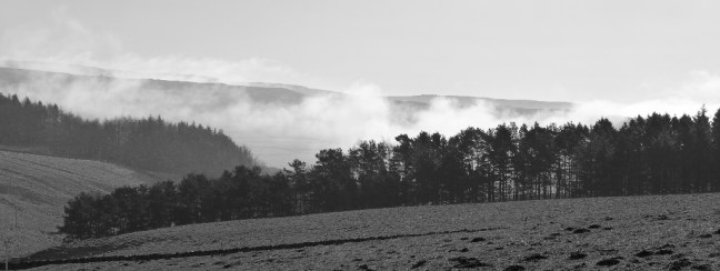
 I arrived at Hawkswick Bridge and the route crosses the bridge to the hamlet of Hawkswick, only to cross back shortly afterwards. Hawkswick was named after the birds of prey that once flew in the area.
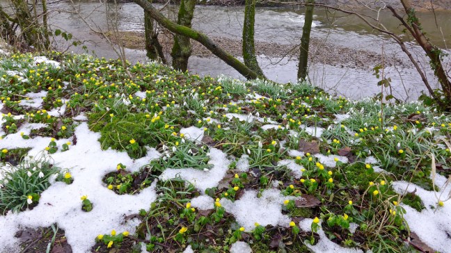
 There were lapwings ‘dancing’ in pairs. I could also hear curlew. The countryside was coming alive after our long and cold winter. Later I saw a dipper and heard skylarks and a woodpecker.
  There were some vibrant colours in the walls.
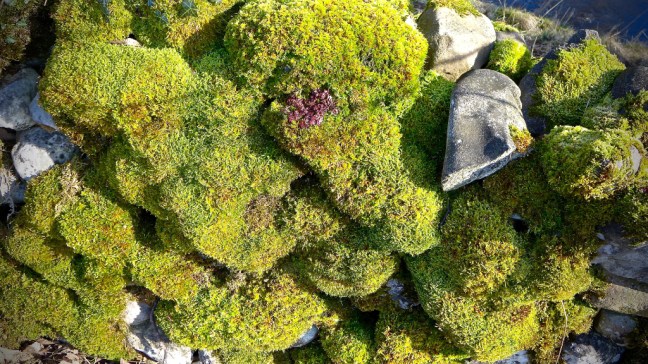
 A farmer then pulled up with his buggy and trailer and took new born lambs out of the trailer. Marvellous to see as the lambs had found a new exciting world to explore.
 ‘Mom’ was keeping a close eye on them.


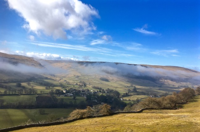
 Suddenly and rather strangely the mist came ‘enveloping’ up the valley. It went much cooler and I felt very disappointed fearing this could be in for the day.
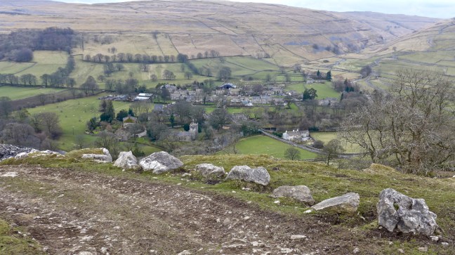
  Arriving at the Anglian settlement of Arncliffe, meaning ‘eagle cliff’, there was still some colour to be found.
 The present church, dedicated to St Oswald, dates mainly from 1796 and 1841. The church tower dates back to the late 15th century and there is a memorial to the local men who died at the Battle of Floden in 1513, when the Scots and English were still fighting each other. The bell is from 1350 and one of the oldest in the country and is believed to have come from Fountains Abbey.
 Trouble makers in the area were put in stocks.
  It was coffee and banana break time but surprisingly, despite its spacious Anglian village green, there are no benches. I think this gives the wrong message for the village. The only benches are for the use of patrons of the Falcon pub. I had no choice but to perch on an ancient drinking monument.
 It was now time to leave The Inn Way and find a route back to my car. This was to be a circuitous route over Middlesmoor Pasture to Kettlewell and then back along the Dales Way. I was still disappointed with the mist as I climbed the steep path through Park Scar Wood, whilst trying to avoid trees falling on my ‘crop of hair’.
 At the top of the pasture and with perfect timing the mist started to move further along the valley and at the same time disperse. I sat and watched it, quite mesmerised. I had gone to ‘heaven’ as I hadn’t seen the like of it in over 30 years of walking in the Dales. See separate video on Facebook. Here are the later stages of the mist rising, along with the emerging views below of Littondale and Arncliffe and with the sun now radiating a comforting warmth.

 A couple passed me in the opposite direction and I watched as for some strange reason they veered right and missed the gate to descend to the wood I had just come up. They walked and pondered as to where to go for a long time and in the end seemed to find an alternative but incorrect way down.
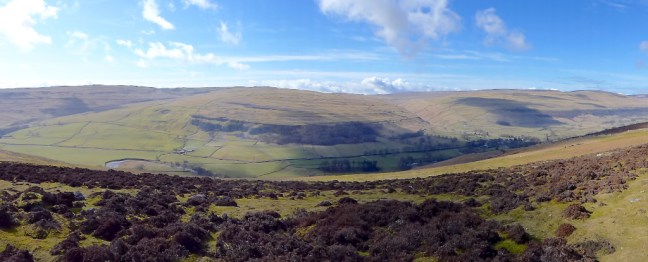
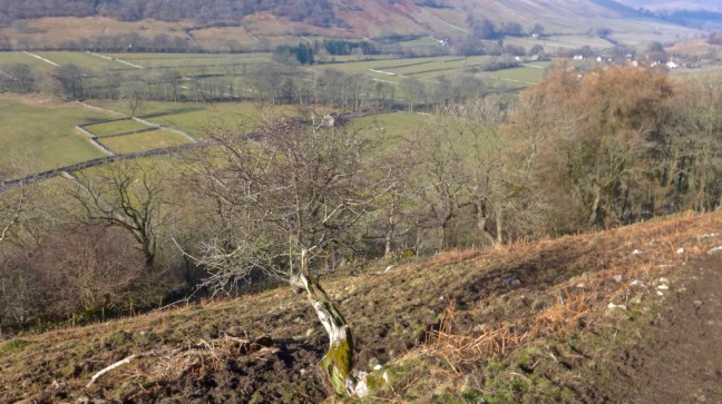
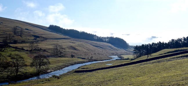
 Littondale disappeared from view and I then started to descend into Wharfedale towards Kettlewell.
 Buckden Pike could be viewed to the left.
  The villages of Starbottom and Buckden were in view nestled below Buckden Pike, all in warming sunshine. It was time to apply some more suncream.
  If I was going to finish the walk I had to get going again, but could have quite happily have sun-bathed for an hour or two. There were breathtaking views as I descended to Kettlewell and an intended Dales icecream – my first of the year. I had earned it.


 I found a couple of pubs but, despite trying two cafes (one was closed and the other sold the wrong sort of ice-cream) and a shop there was nowhere to buy a Dales ice-cream. The ice-cream parlour had the supply tied up but I was too early in season or had arrived on the wrong day.

 There was also the youth hostel (now also a Post Office) which I had stayed in on my 1990 Dales Way walk – my first long-distance walk. Hard to forecast then that I would now be on my 55th!
 I left Kettlewell with a sad heart having been denied an ice-cream, but was pleased to be back on the Dales Way 28 years later than when first on it.
  It soon brought back the need to go through and over many stiles on the Dales Way, some which have springs on the gates that can make you airborne if you are not careful.
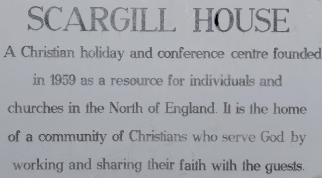
  I soon passed Scargill House in its wonderful peaceful setting.
 I then passed a lady walking the Dales Way solo. Only the fifth walker I had seen all day!
  Kilnsey Crag came into view on the other side of the valley and Conistone Pie on my side of the valley. I climbed to the top of the Pie but found out that I am not good at taking photographs of myself and gave up. I am not of the ‘selfie’ generation.


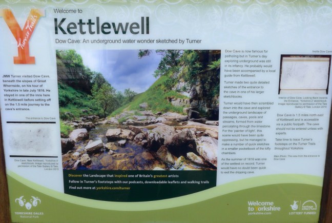
 A visit to the 8th century St Mary’s Church finished the day perfectly. It is the oldest church in the Southern Dales. It has a poor box and Norman font. In the graveyard is a sad memorial to a group of six young men who were killed by rising floodwater whilst they were exploring nearby Mossdale Caverns on 24th June 1967, in what was England’s worst caving accident.
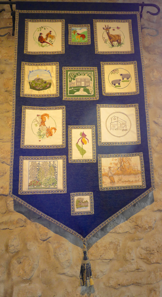
 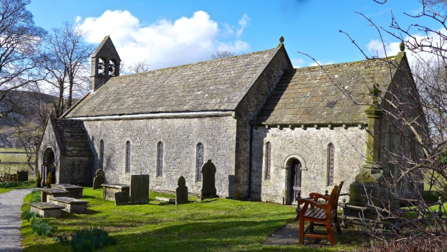 There are some beautiful Dales craft works – such detail!
 On the way home I called in for an ice-cream at Birchfield Farm ice cream parlour just after Pateley Bridge – but that was closed too!! Some things in life are not meant to be.
 This is an impressive cross standing some 10 feet high.
 We decided it was too windy for our coffee break and continued to a bench at the top of Rosedale Chimney. Sid the Yorkshireman and Alf decided it was still too windy on the bench so dropped down off the ridge, so I had the bench to myself.


 There was no one else about apart from the three of us – almost perfect solitude.
 Arriving at Hutton-le-hole we had the luxury of a bench each for lunch. This would be much busier in summer and even this coming Easter school holidays.
 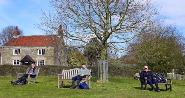 There were just a few sheep to keep us company.
 Carol, who often walks with us, was at work for her last week before retirement. Clearly when she retires she will be joining us for walks a lot more, judging by the cake she was given by her colleagues.
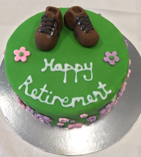


 Passing through the quiet village of Spaunton, where little seems to happen, we noticed the recycling bins for alcoholic bottles and cans were well stocked with empties!
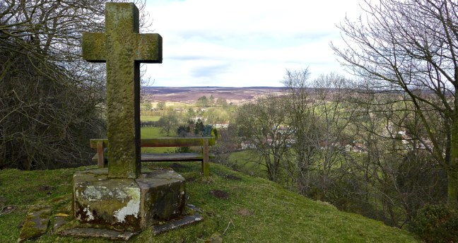
 A final descent with views of the church took us back to Lastingham


 By this time I needed a comfort break and we followed a sign for toilets to I think Dacre Banks. It took a while to find the toilets as they were not very well signed – more delays.
  They served my purpose, but Carol and Steve thought they were some of the worst toilets they had come across. However, they looked okay from the outside once you had found them!


 Fortunately, I had my infamous ‘1991’ hat on which will go down well when the Americans come to rescue us. This has been lost and found more times than I have had hot dinners, such is life when you are of bus pass age.
  The great thing about walking in winter in the Dales is that it is very quiet. In summer the main street would be packed.
 The buds on the trees were still being held back by first The Beast from the East and then the Mini Beast. Now it is not for me to put forward conspiracy theories, but I have read that it is possible to control climates and is it a coincidence that the bad weather comes from the East? Now Russia just happens to also be in the East. Hmm….
 Near Town End Farm there was some confusion as, since the guide book has been published, the farm has expanded and the path redirected. However, our route was quite picturesque being snow lined.

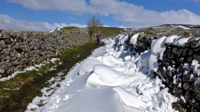 We joined the correct path along the edge of Grass Wood.


 Before being confined again as we joined The Dales Way


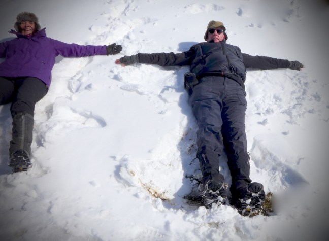
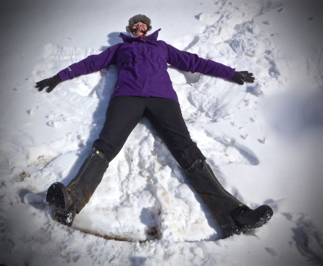
 This was proved when we went into ‘snow play’ and became snow angels.


 The RAF had received reports of strange folks in the area and buzzed us.
 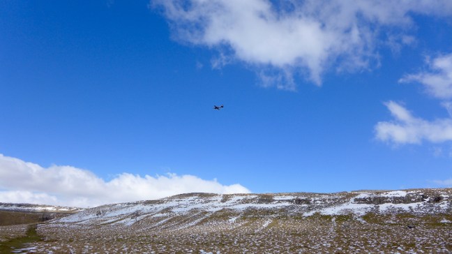 Some of the stiles were interesting.
  And there were some stunning expansive views.
 We arrived back in Grassington, which even if you are not religious had a poignant message in God’s own County of Yorkshire.


 It took only an hour and 15 minutes to get back home and Sid the Yorkshireman was a lot happier and you never know, on this walk, he may come to love the Dales as I do, not just the North York Moors?
 What was worrying is that the wire in the boot was in case the exhaust came even more loose than it was already. The rubbish (milk bottle and Sainsbury’s bag) in the back were what we collected at the end of the walk. The ‘other bits’ are another story.
 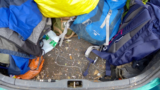 However, we had nothing to worry about as there was a decent first aid kit, especially if there were lots of insects about.
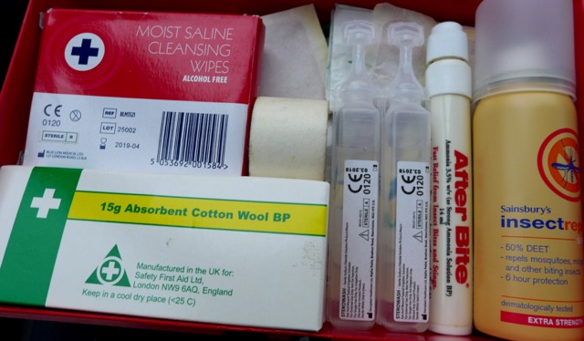


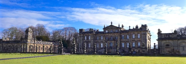
 Sir Charles Duncombe, a wealthy London banker and Lord Mayor of London, bought Helmsley Castle and its estate in 1689 on the death of the Duke of Buckingham.
 We passed the Ionic Temple.
 Ascending there were good views back towards Helmsley and the walled gardens of the castle, which are well worth a visit.
 Carol had her first tree hug of the day.
 After passing a tree felling area we reached Griff Lodge and The Cleveland Way and The North of England Way.
  A helicopter flew over us just as in the Tour de France! Were they filming us?!
  Rievualx Abbey could then be seen in its magnificent valley sitting. The monks were not stupid in picking this sheltered, picturesque location.
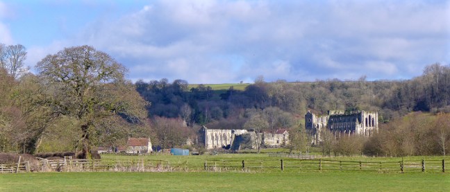 We then reached Rievaulx Bridge, which was where we needed to resume The Inn Way. Repairs were being carried out to presumably where cars and lorries had skidded into it during the bad weather.
 We carried on past Ashberry Farm to have our coffee and banana break at a bench with wonderful views in energising spring like weather.


 All that remained was to walk back three miles along The Cleveland Way and The North of England Way to Helmsley for our celebratory lunch at Mannions.
  Carol and Sid the Yorkshireman were very happy with the delicious food.
  Helmsley is a delightful market town to visit out of season, but in the summer can suffer from its popularity with many people visiting.
 All that remained was to have a final photo call in the market place to finish a fine challenging walk.

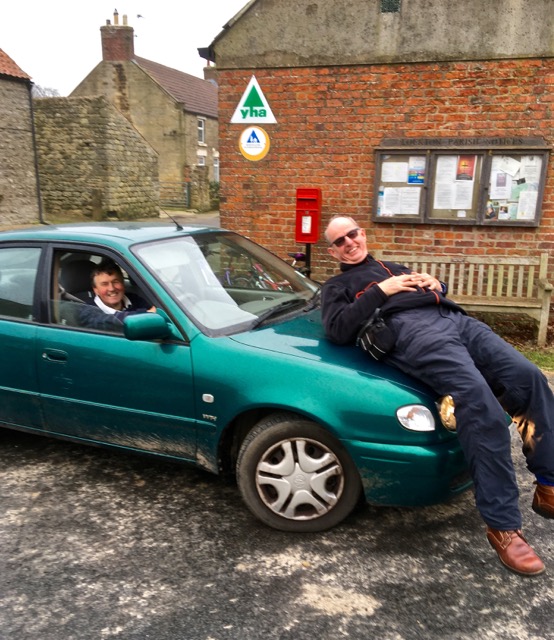
 We arrived at Cold Kirby to have an impromptu ‘Kia Meet’
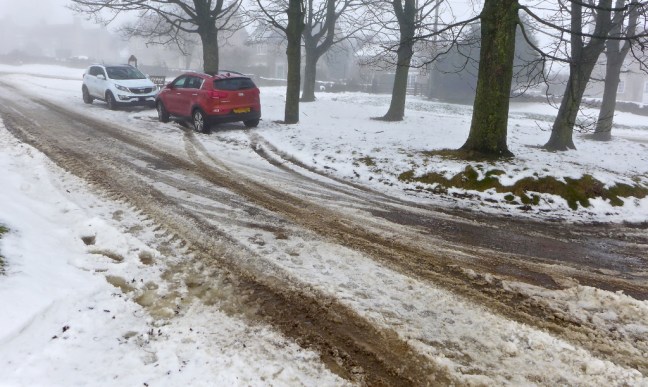 After slipping and sliding a few weeks ago on the Moors, Sid the Yorkshireman had decided to splash out on winter tyres and wheels to add to his 4 wheel drive Kia. He did this just before The Beast from the East arrived and so there is no doubt that he is to blame for the bad weather.

 We had an interesting start to our walk and thought that if the next 9 miles were going to be like this it could be a really tough day!

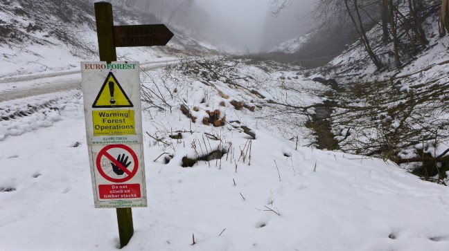
 We then had a tricky steep descent into Flassen Dale at which point Carol decided to put her spikes on. I already had mine on and Sid the Yorkshireman didn’t.
 Here we encountered some forest workers who, incredibly, informed us they had worked through all the bad weather the previous week!!! Snow Heroes.

 We ascended the other side of the valley. Much of the tree clearing was related to pheasant shooting, which is widespread in this area and brings a lot of income to it.
 We arrived at Pond Farm, Scawton where the sheep were very ‘friendly’ or more likely very hungry.
  After a coffee and banana break we visited the unique Norman Church of St Mary which is little changed since it was built by the monks of Byland Abbey in 1146.
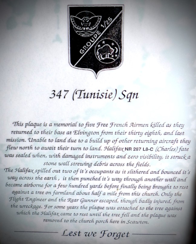
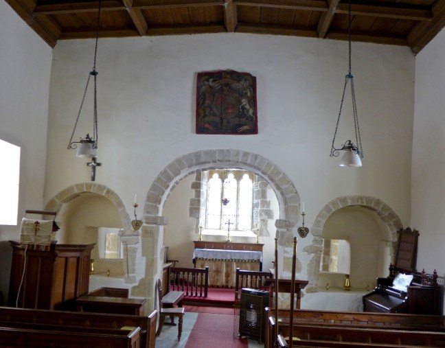 In the porch there is a memorial to five crew members of a Halifax bomber that crashed nearby in 1945.
 There are also the remains of a carving.
 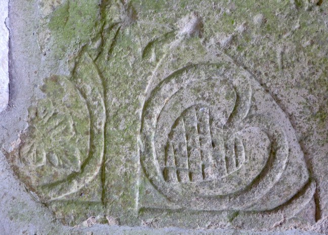 The font cover is unusual.
 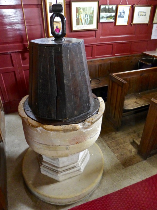 We descended to Nettle Dale where The Cleveland Way crossed our path. It is the spaghetti junction of a number of paths.


 There are some rare ducks.
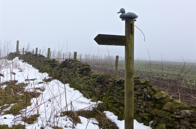 And delightful trees
 Shortly afterwards we reached Reins Farm where there were free range children
 We descended to Bow Bridge over the River Rye, which leads to Rievaulx Abbey.
 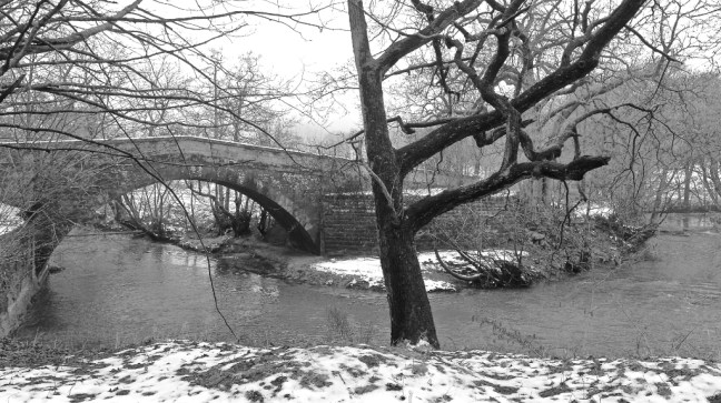 In the mist it was very atmospheric as we walked towards the Abbey for a lunch stop.
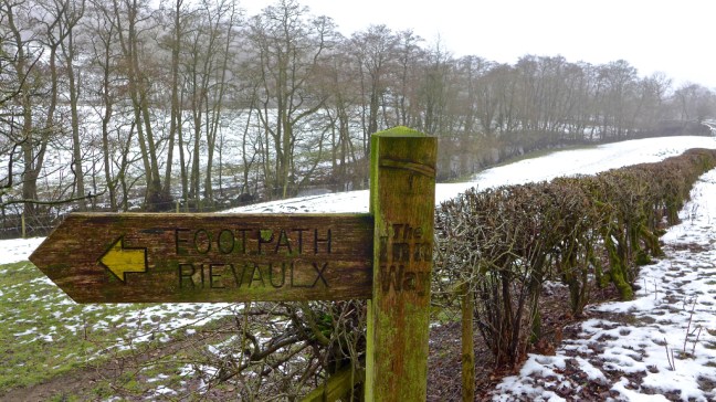

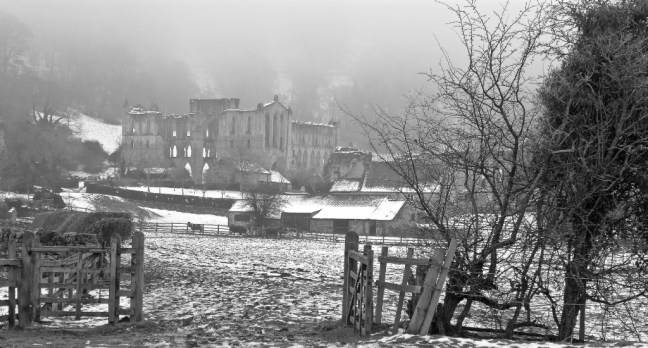

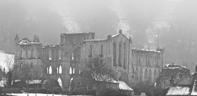
 This imposing Cistercian abbey was established in 1132 by twelve French monks and named after the valley Rievaulx, meaning valley of the Rye. St Aelred, the third Abbot, developed the abbey into being largest monastic establishment in England, with over 500 lay brothers and 140 choir boys.


 At Rievaulx Bridge we left The Inn Way to follow The Cleveland Way and The North of England Way back towards the car. The nearby house was built in 1885.
  We then entered Nettle Dale again as, at long last, the sun appeared.

 We then had a long and gradual, but tiring ascent along the secluded and snowy Blind Side and Tanker Dales, with springs appearing.


 The snow created some delightful effects.
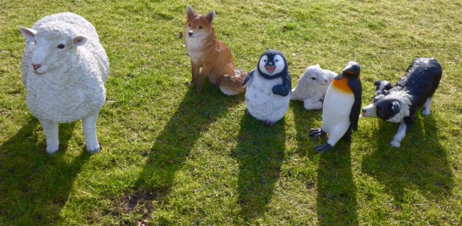
 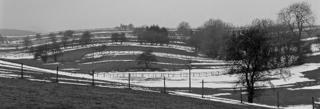 Arriving at Cold Kirby there some unusual sights. Whatever is a Penny Farthing doing there? Also the cow is not real.

 Finally, after the walk, I couldn’t resist stopping off at Sutton Bank to admire the views.
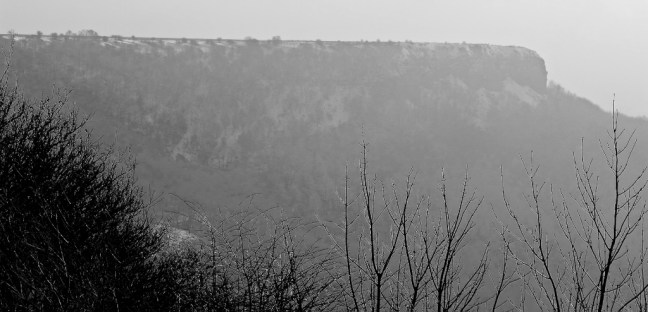

 A fine end to the day.