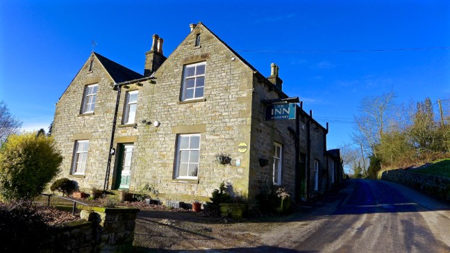
Post 237: 22 February 2018, The Inn Way, Hamilton Drove Road to Cold Kirby.
It was some relief that one of my blog readers, who makes home-made jam, was able to re-supply me. It is made to a ‘strict specification’ that it is not too runny and does not ‘soak’ into my home-made roll. Gloopy jam is ideal.
Now you may wonder what is so important about jam. Well when you get to my ‘bus pass age’ you need all the help you can get on these walks and jam is great at providing fairly immediate energy after lunch. Cheese, bacon, ham, chicken etc etc tend to take too long to digest and do not give energy when it is most needed.
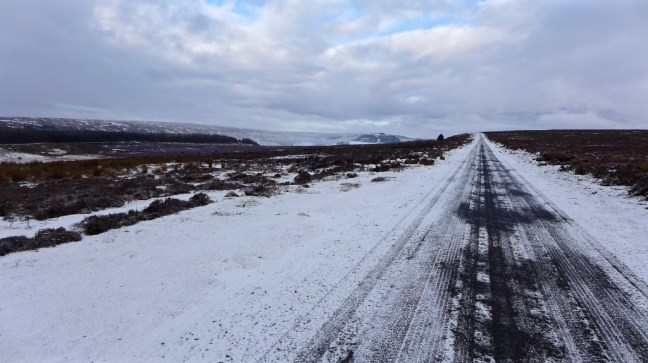
 We arrived at Cold Kirby at about 9.00am and it was a balmy 1 degrees. Cold Kirby is often much colder, hence the name, due its exposed location.
St Michael’s Church dates from the twelve century and was rebuilt in 1841. it was originally ministered by the Order of the Knights Templars, a religious group that supported pilgrims and knights during the Holy Land Crusades in the 12th-14th centuries.
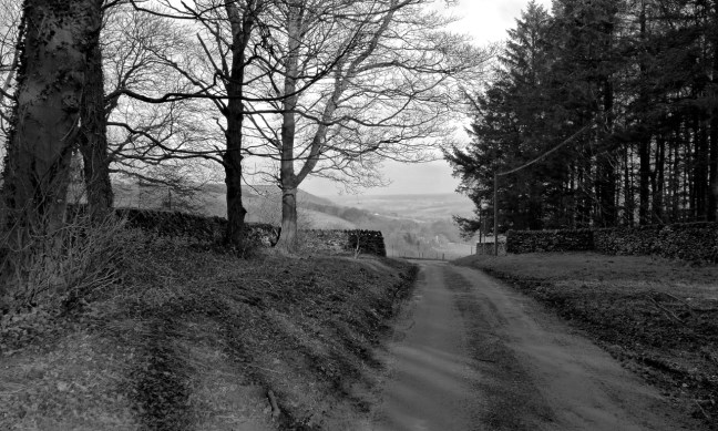
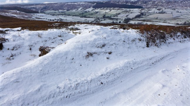
Leaving Cold Kirby we soon came across some majestic restored stone walls.
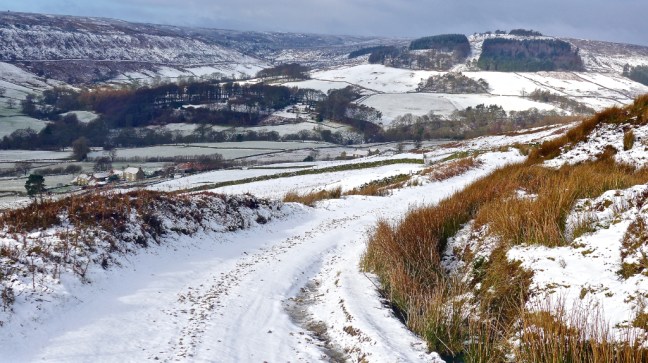
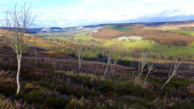
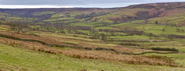
 After passing Murton Heights fine views emerged

 The Easterside Hills near Hawnby and beyond, from where we had walked in previous weeks, could be seen.
 After a coffee and banana break below Noodle East we ascended to what remains of it, with great views back.


Noodle East

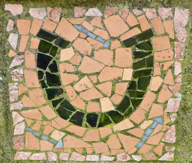
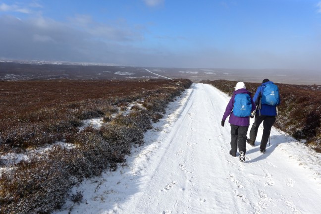
 We reached the Hamilton Drove Road to rejoin The Inn Way. We then joined the Cleveland Way to follow it to High Paradise Farm (see previous blog for opening times for refreshments etc). We were now on the Mosaic Walk where one of the many mosaics along the 36 miles route was in evidence. This is a circular route from Sutton Bank.
 Just beyond a special gate Sid the Yorkshireman and Alf posed where James Herriot was photographed for the front of his biography. With no dog, Alf just made dog noises.

 Near High Barn lunch was beckoning, but due to a cold easterly which was being sucked over and down the ridge we carried onto the nearby quarry for some shelter.

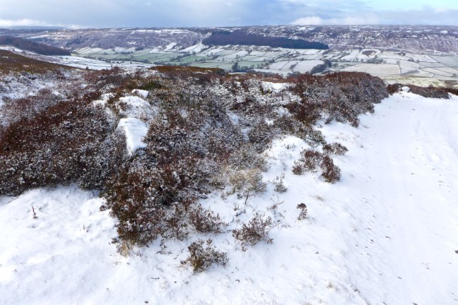
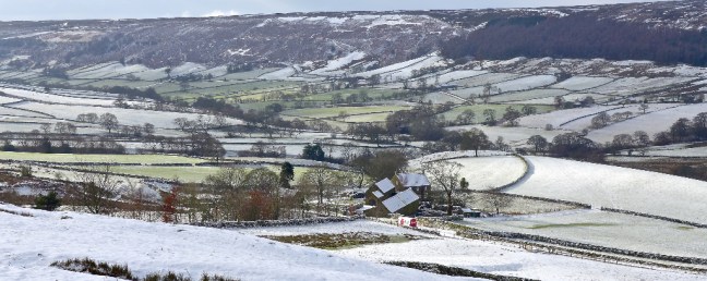
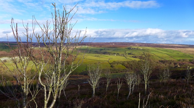
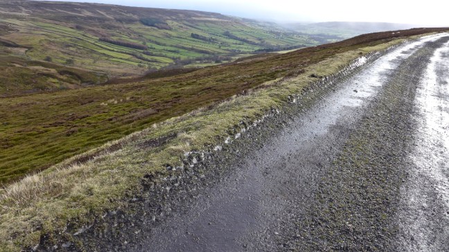
 Rejoining the Cleveland Way along the escarpment the expansive views were stunning.

 It was a bit further along from here at Sutton Bank where Alf Wight (James Herriot) said ‘The Finest View in England’ was. On a foggy day you have to make do with me as a German walking friend once found out. Not quite the same!
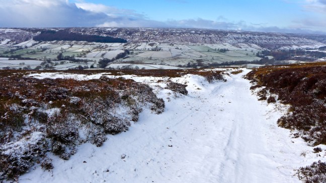
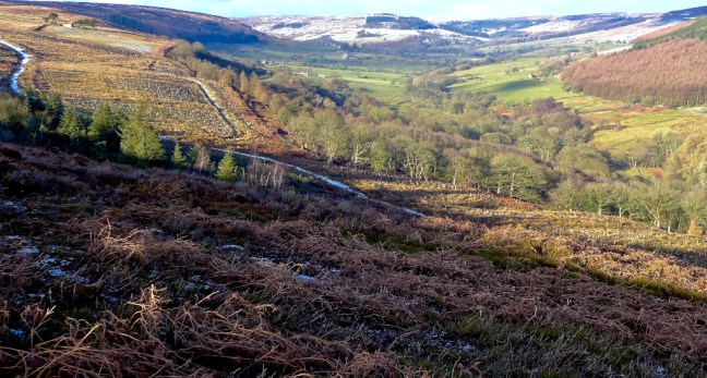
 We reached Whitestone Cliff and with rays of light the views were pretty impressive.
William Wordsworth and his new wife Mary Hutchinson watched the sunset from the escarpment on their wedding night.
“Every day is different up here and often the far hills are dreamlike with distance, but there are other times, on the frosty mornings or after a night’s wind, when you can almost reach out and touch the flat top of Penhill, when you can look down Wensleydale and peep into the entrance of Coverdale with the long summit of Great Whernside rearing above its neighbours. On those days the mighty plain seems like a narrow valley between the two ranges of hills. (J. Herriot ‘James Herriot’s Yorkshire 1979).
I converted todays view to black and white.
 Gormire Lake was far below us.
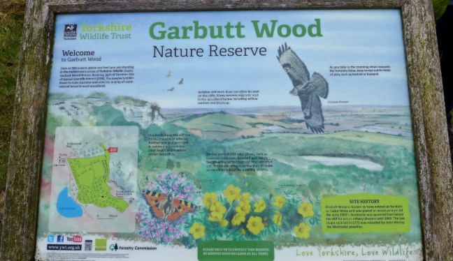
 Alf below was rightly proud to announce that he, with a colleague, had carried the oak bench from Sutton Bank (nearly a mile) and fixed it in position (as below) above Garbutt Wood. We decided to give Alf an honorary hero award.
 There is a tiny memorial plaque on the bench.
  It is said that from here, when steam trains were in use, you could follow a train all the way from York to Darlington.
 The Inn Way leaves the escarpment at this point to head towards Dialstone Farm. Sid the Yorkshireman got quite pedantic as to which gate we should go through even though they were only about 100 yards apart. By the time he had finished pontificating on the matter we were ready to throw him off Whitestone Cliff, just where a knight on horseback was reputedly lured over the cliff on his white horse, by the Devil dressed as the Abbott of Rievaulx.
We passed Dialstone Farm, which was once an inn on the drover’s road. From the 17th century The Hambleton Races used to take place here and were bigger than York or Newmarket races. It is still a training area for horses.
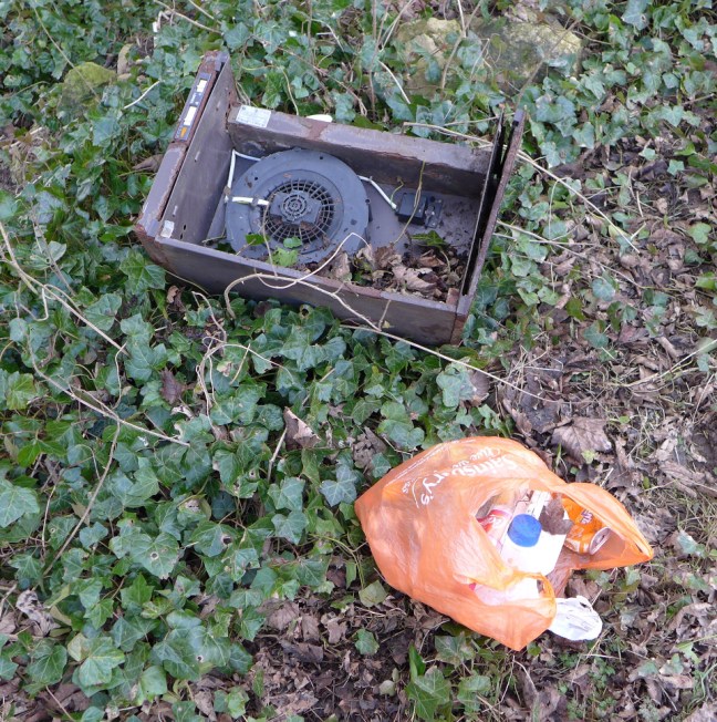
If we didn’t find the Devil today on the escarpment, we did find he or his friends work on the final mile road section back to Cold Kirby. We managed to fill a bag of rubbish to take for recycling that had been thrown mainly out of cars, as well as an abandoned road sign and kitchen fan. Unbelievable.


A sign in the village summed it all up!
 Apart from the last mile it was a fine walk. Somewhat flatter and easier than many of our previous winter walks on The Inn Way
Miles Walked 10.2
Steps 23,000
Calories Burnt 3,300


 There was much woodland clearing taking place.


 At this point I came across what would make a fine emblem for the North York Moors Winter Olympics. You can see the ‘Yorkshire Olympian’ if you look closely. The ‘sport’ would be Winter Cross Country Walking.
 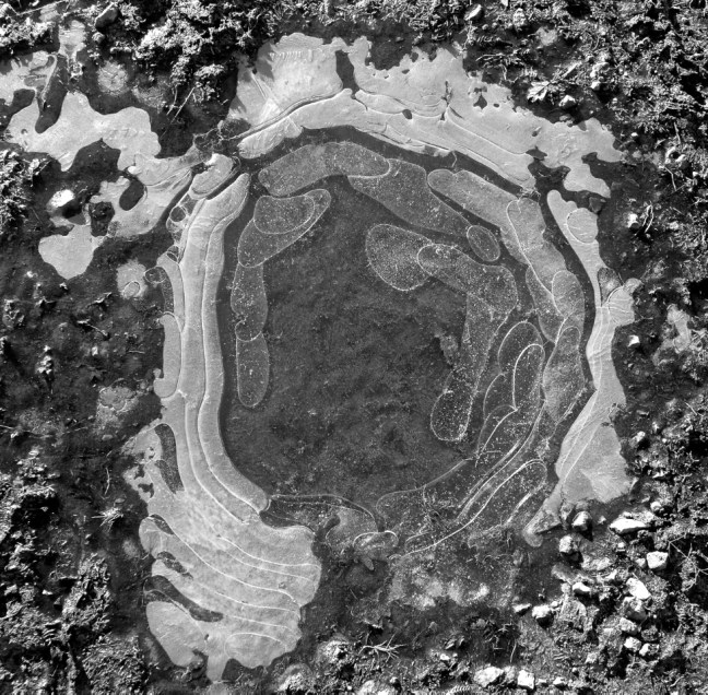 Our winter walking on The Inn Way has at times felt like a Winter Olympics and we had encountered much ice, snow, mud and winds on our walks. Indeed J.S Fletcher in his book The Enchanting North 1908 said about this area:
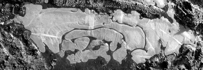 Back to reality we had some lane walking back to Hawnby.
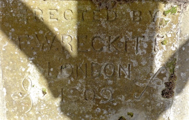
 Where we stopped in what was probably the best coffee and banana stop of the whole Inn Way walk. Built in 1909, presumably as a horse stop, it was very sheltered, warm and sunny.
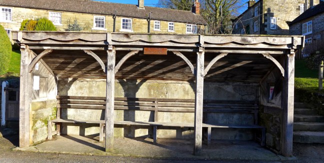
 Leaving the village we soon crossed Hawnby Bridge over the River Rye.
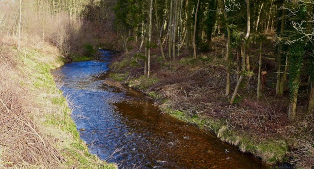 We then climbed around Coombe Hill with fabulous retrospective views.
 Before descending towards Arden Hall, situated in the beautiful Thorodale wooded valley. The building dates from the 17th century although it sits on a Benedictine nunnery which dates from the 12th century. Some remnants remain in the hall including a medieval fireplace. A pond known as Nun’s Well can sometimes be spotted through the trees.

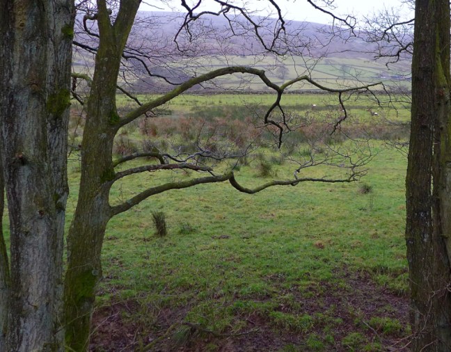
 A steep long ascent followed to join the Dale Town Common bridleway, with superb views back towards Hawnby and the moors beyond.
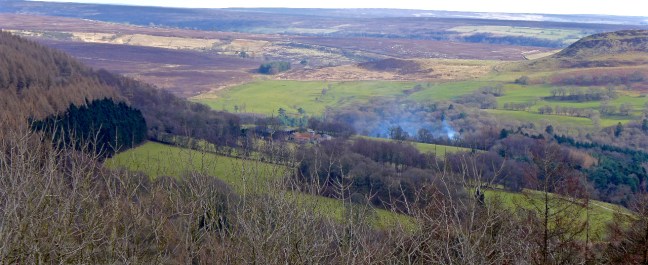 A little snow remained
 It was cooler and breezier on the tops and the sheep huddled together near their food. We started looking for a sheltered lunch spot.
  After nearly missing our bridleway at a fork we reached the Hamilton Drove Road and as Paradise was closed we settled for lunch in the shelter of a wall.
 We saw a few casual walkers without rucksacks who had just walked from the nearby car park for a breath of fresh air.
 At least the adders would be hibernating.
 The Bilsdale mast could be seen in the far distance and the views were 360 degrees.
  We descended to Sunny Bank Farm where our destination Hawnby could be seen in the distance, below Hawnby Hill and Easterside Hill.
  A little further on there was a fine view of Hawnby Bridge and its surrounds. It was designed by the famous architect John Carr.
 We crossed over the River Rye again at Dalicar Bridge where, whilst I was taking this photograph, Sid the Yorkshireman saw a kingfisher.
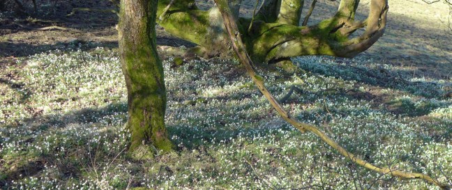
 We made a small diversion to the 12th Century All Saints Church decorated all around with snowdrops.


 The present Sun Inn next door was opened in 1914.
 To the right of the pub is the gravestone of Bobbie Dowson, a famous local huntsman as well as cricketer of the Scout House team, who died in 1902. The local vicar refused to have the headstone in the graveyard because of the hunting motifs carved into it.
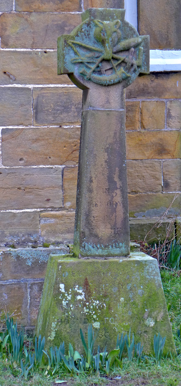
 We soon started following a route to grouse butt 3 and 7, which is where we finished on The Inn Way on Sunday. We passed by Hollin Bower Farm and above Low Crosset Farm, it getting cooler and more misty as we ascended.
  An ascent onto the open moorland followed where the route finding got very tricky to say the least. The bridleway we were following soon disappeared and Sid the Yorkshireman headed off across the heather after leaving a track which was not on my older map.
 Confusing or what?
 We headed along the line of the grouse butts and found 3 and 7 and the faint path nearby on which Carol had fallen (see previous post 234). It was time to regroup for the second time in this butt and have a banana and coffee break.
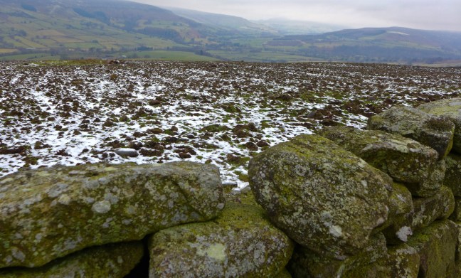
 After a long muddy descent and ascent and lunch, we reached Low Ewe Cote farm which, instead of ewes, had a herd of cows in the yard.

 We continued to High Banniscue Farm where we turned off The Inn Way to find a route back to my car. We passed Easterside Hill.
 Eventually we reached Crow Nest surrounded by snowdrops.
 Then a descent and ascent along a B.O.A.T, with Bumper Castle below us, led to a grouse deciding which route to follow at the junction of the B.O.A.T and bridleway!
  The B.O.A.T descended to Malkin Bower.
 With fine views along Bilsdale
 We then entered Hambleton, which is a place to grow! Being over 6 foot 2 inches do I really want to grow any more?
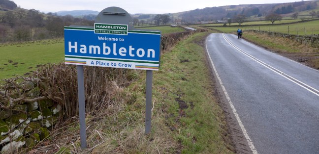 Does the sun shine in Bilsdale – well there are two Sun Inns. But no the sun didn’t shine today. It was claggy all day.
  Just as we were about to get our gear on a snow storm arrived.
  It was so bad and went on so long we thought we would have to abandon the walk and take a few photographs and go for a coffee somewhere. There are not many cafes in this wilderness! The roads deteriorated quickly but we decided to leave the car park.

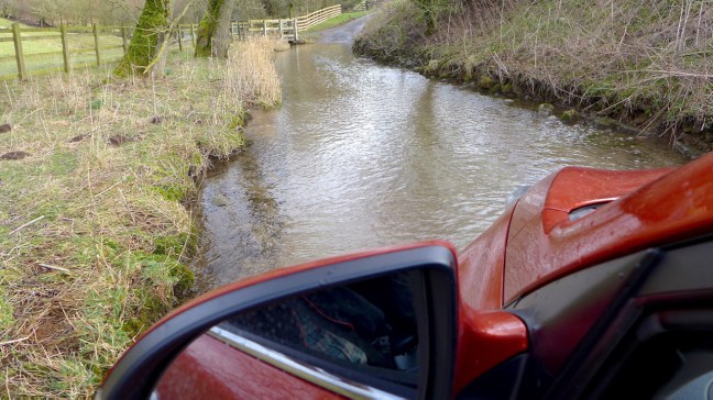
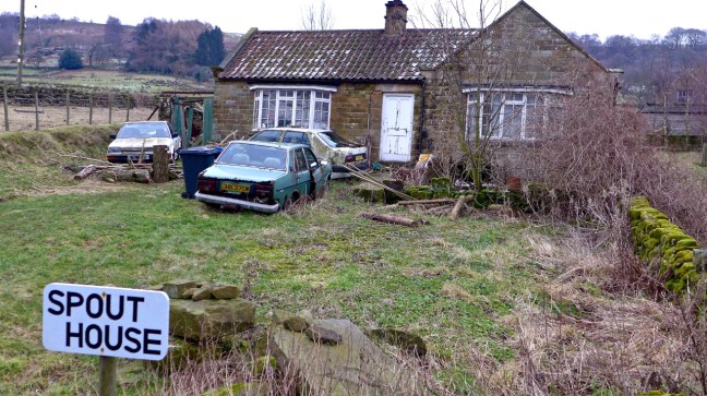
 When we reached a hill Sid the Yorkshireman drove very slowly and we thought with 4 wheel drive we would be okay. That was until the car started slipping and sliding down the hill towards Spout House. We were about to be spouted into a wall! I grabbed a car handle and braced myself for a crash as the car’s speed increased out of control and I could see some pretty hard stone walls directly ahead.
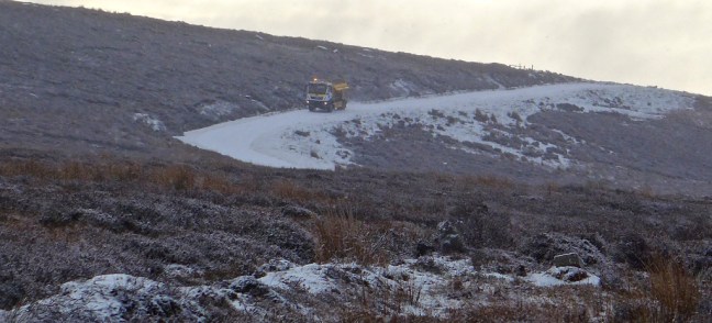
 Some locals then appeared in their cars so they must know what time the gritter comes round the North York Moors remotest valley on a Sunday!
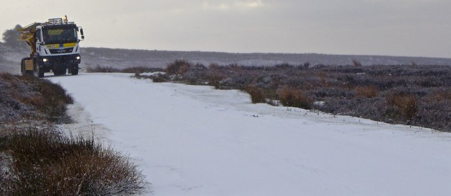
 Normal business resumed and we headed off walking along improving roads. Spikes were compulsory even for Sid the Yorkshireman.
 We soon turned off the road to begin climbing to Rudland Rigg where we would rejoin The Inn Way from earlier in the week. There were fine views towards Bransdale

 We then walked into low mist and all became grey again as we arrived at Rudland Rigg


 Bransdale Mill came into view. This and much of the land hereabouts is owned and managed by the National Trust.
  This was to be an early lunch stop at just after 11.30am as there was a bench and shelter from the slight wind. The old water wheel and other artefacts are still there. The mill is one of the oldest in the North York Moors dating back to the 13th century. It was used to ground corn and oatmeal. William Strickland restored the mill in 1842. Whilst sitting having our lunch we could imagine the activities that must have gone on there. It is like stepping back in time and full of interest.


 Bransdale was named after the Viking settler Brand and is the most remote valley on the North York Moors. Perhaps some of my relatives lived here?! With narrow lanes and few car parks and tourist attractions, such as cafes and information centres, it has a uniqueness and remoteness of its own. On the whole of the walk we only saw one other person on foot, and that was a runner from a remote farm. My sort of place!
 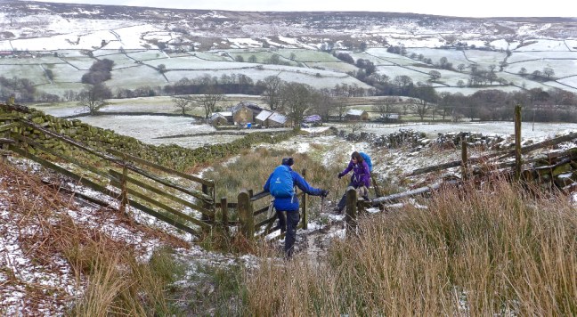 There was now a long undulating ascent towards our next destination Black Holes. The name is enough to put you off!


 There was suddenly a scream and I looked back and Carol had taken a tumble. Not the best place as if she was seriously injured it would have been a helicopter air ambulance job!
 At nearby Black Holes it was now important to find our bridleway/track back towards the car.


 We then continued to the ruins of Stork House with expansive views of Bransdale.


 It was with some sadness that we viewed the ruins. There is an inscription on a stone nearby dated 1815!


 Sid the Yorkshireman felt in need of a boot and spikes clean.
 And I felt in a need of a pheasant.
 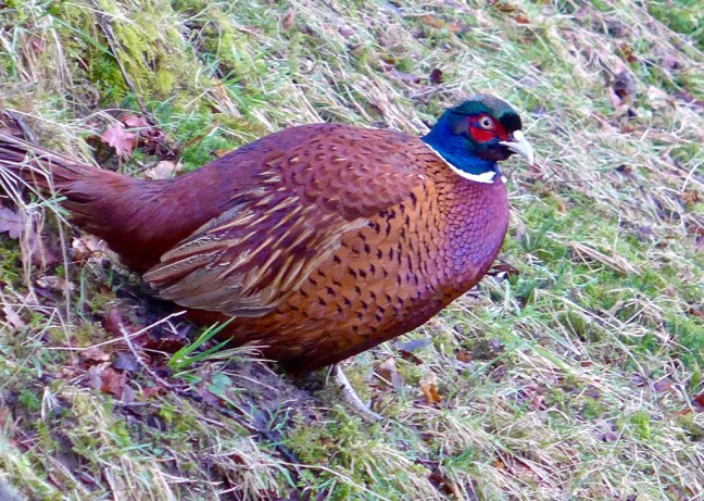 We just needed to find the transport home now. This seemed suitable.
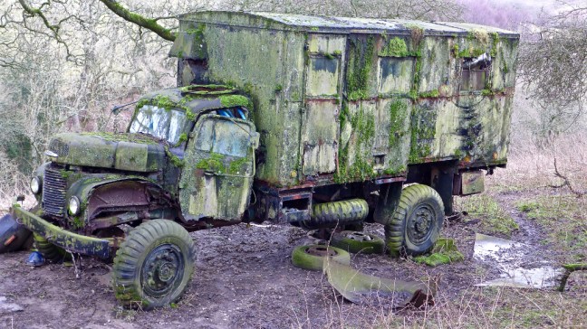


 After some tricky route finding through overgrown heather, we resumed descending into Farndale with fine views.
 Then light snow started and we thought that wasn’t forecast by Paul Hudson our weatherman. We hurried onto Church Houses for our coffee and banana break, alongside the closed Feversham Arms.
 We ascended steeply towards Rudland Rigg, with fine retrospective views back to Farndale.

 It was a bleak area in low cloud, not the bright sunshine forecast.
 We then left the Rigg and The Inn Way on a quickly disappearing path to descend back towards Farndale.
 It was very tiring through overgrown heather. Eventually we picked up a path and stopped for lunch in a sheltered spot out of the wind. There were great views along Farndale. Until………


 We kept saying that this wasn’t forecast. It was only when I watched Look North News that Paul Hudson admitted that things didn’t go according to plan and it was the first time since 2003! Not sure we would agree with that.
 We then had to cross the River Dove, which fortunately had a new bridge.

 At Esk House we came across a lovely Shire Horse, looking miserable with the poor weather.
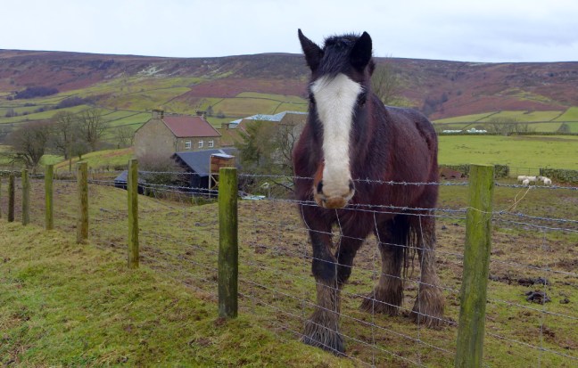 We then climbed the final hill of the day only for Sid the Yorkshireman to realise that he had dropped a glove about half a mile back. You can just see him (blue spot!) heading back down the hill to retrieve it!
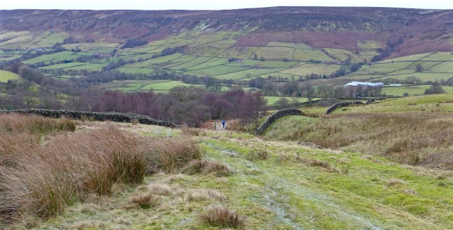
 After some delay we arrived at the dismantled railway, which is a section of Wainwright’s Coast to Coast Walk. The Rosedale Ironstone Railway was constructed in 1861, a considerable engineering achievement.


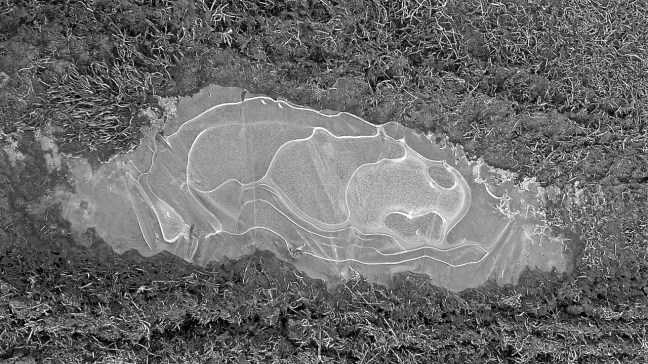
 I then started looking at the ice patches and the varying patterns they formed. Nature up here can be so creative.


